
|
Geological Survey Bulletin 1309
The Geologic Story of Isle Royale National Park |
A LOOK AT THE LANDSCAPE
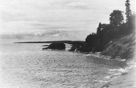
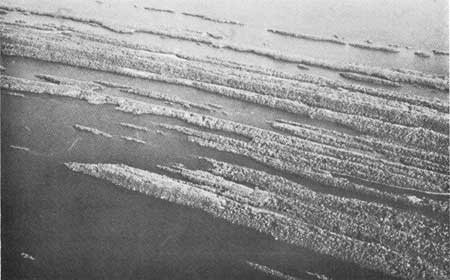
One's first impression of Isle Royale, when approaching by boat, is of an inhospitable rocky shoreline behind which a verdant mantle of vegetation softens what appears to be an irregular, hilly landscape. From this lake-level view, no topographic pattern is readily apparent (fig. 3). But if one approaches by air, a rather striking pattern becomes apparent, and one sees the island as a series of long parallel ridges and valleys, which give it a washboard aspect. This pattern is most conspicuous at the northeast end of the island where the ridges project into Lake Superior as so many rocky fingers and the drowned valleys between them have a distinct fiordlike appearance (fig. 4). The pattern is also dramatically displayed by the chains of elongate islands that fringe the main island—no more than the protruding tops of almost completely submerged ridges.
|
| ROCKY SHORELINE on Isle Royale. (Fig. 3) |
|
| FINGERLIKE PROMONTORIES on northeast end of Isle Royale. Photograph by Alan Eliason, National Park Service. (Fig. 4) |
To the hiker traveling across the grain of the country, the series of ridges seems never ending; seldom walking level, he is monotonously going up and down. He also quickly becomes aware of another aspect of the topography—the southeast-facing slopes are relatively gentle compared with the northwest-facing slopes, which are often precipitous; the ridge-and-valley structure is decidedly unsymmetrical. And to his discomfort, the hiker finds that even when traveling with the grain of the island, he is still spending an inordinate amount of time going up and down, for the linear ridges are interrupted at frequent intervals by crosscutting ravines or depressions.
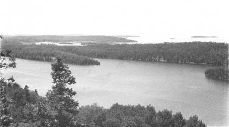
Another aspect of the topography that is readily apparent to the hiker is the generally poor drainage on the island. Every valley seems to be at least partly occupied by swamps and bogs, as well as numerous lakes, all adding to the difficulty of traversing across the grain of the island. For those willing to expend the effort, however, hiking on Isle Royale can be an enormously rewarding experience for the very topographic factors that make hiking arduous also provide numerous vantage points for some of the most scenic vistas in the Lake Superior region (fig. 5).
|
| VISTA FROM LOOKOUT LOUISE looking across Duncan Bay. (Fig. 5) |
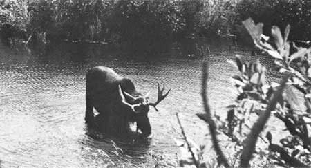
And the sight of a bog mat tinged magenta with miniature orchids or a bull moose feeding in a beaver pond is not soon to be forgotten (fig. 6).
|
| BULL MOOSE feeding in beaver pond. (Fig. 6) |
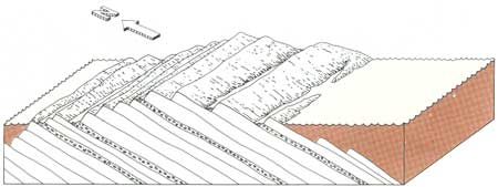
The landforms of Isle Royale, like landforms everywhere, are the result of geologic processes and are dependent upon the type of underlying rocks, the structure of the rocks, and their erosional history. The bedrock sequence on Isle Royale consists of a thick pile of lava flows and sedimentary rocks that has been tilted toward the southeast, and the linear ridges of the island are the eroded edges of individual layers of the pile (fig. 7). Many geologic processes in combination worked together to create Isle Royale as we see it today, not only its landforms, but the rocks and minerals themselves. These processes and their consequences are discussed at some length on the pages that follow in an attempt to unravel the geologic story involved at Isle Royale National Park.
|
| RIDGE-AND-VALLEY TOPOGRAPHY related to tilted rock structure. Circled areas indicate sedimentary rocks; blank areas indicate lava flows. (Fig. 7) |
| <<< Previous | <<< Contents >>> | Next >>> |
bul/1309/sec2.htm
Last Updated: 28-Mar-2006