
|
Geological Survey Bulletin 1327
The Geologic Story of Canyonlands National Park |
A NEW PARK IS BORN
On September 12, 1964, President Lyndon B. Johnson signed an act of Congress establishing Canyonlands as our thirty second national park, the first addition to the park system since 1956.
The birth of Canyonlands National Park was not without labor pains. In the 1930's virtually all the vast canyon country between Moab, Utah, and Grand Canyon, Ariz., was studied for a projected Escalante National Park. But Escalante failed to get off the ground, even when a second attempt was made in the 1950's. Not until another proposal had been made and legislative compromises had been worked out did the park materialize, this time under a new name—Canyonlands. Among the many dignitaries who witnessed the signature on September 12 was one of the men most responsible for the park's creation, park superintendent Bates E. Wilson, who did the pioneer spade work in the field.

|
| LOOKING NORTH FROM EAST WALL OF DEVILS LANE, just south of the Silver Stairs. Needles are Cedar Mesa Sandstone. Junction Butte and Grand View Point lie across Colorado River in background. (Frontispiece) |
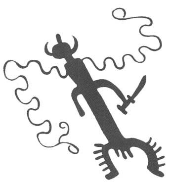
The newborn park covered 400 square miles1 at the junction of the Green and Colorado Rivers in Utah. It included such magnificent features as Island in the Sky, The Needles, Upheaval Dome, and the two great stone formations, Angel Arch and Druid Arch. On November 16, 1971, President Richard M. Nixon signed an act of Congress enlarging the park by 125 square miles in four separate parcels of land, so the area now totals 525 square miles, all in southeastern Utah, as shown on the map (fig. 1). The northern boundary was extended to include parts of Taylor and Shafer Canyons. The addition at the southeast corner takes in the headwaters of Salt and Lavender Canyons and part of Davis Canyon. The largest addition, at the southwest corner, includes grotesquely carved areas bearing such colorful names as The Maze, Land of Standing Rocks, The Fins, The Doll House (fig. 36), and Ernies Country (named after Ernie Larson, an early-day sheepman). The fourth parcel lies about 8 miles west of the northwest corner and encompasses much of Horseshoe Canyon, whose walls are adorned by striking pictographs (fig. 2).
1For the benefit of visitors from countries using the metric system, the following conversion factors may be helpful: 1 square mile = 2.590 square kilometers, 1 acre = 0.4047 hectare, 1 inch = 2.54 centimeters, 1 foot = 0.305 meter, 1 mile = 1.609 kilometers, 1 U.S. gallon = 0.00379 cubic meter.

|
| CANYONLANDS NATIONAL PARK, showing location in Utah, Lake Powell, Dead Horse Point State Park, boundaries, streams, roads, trails, landforms, and principal named features. There was insufficient room to show all named features; some not shown are related in text by distance and direction to named ones, and some additional names are given in figures 7, 51, and 59. Hans Flat Ranger Station near left border is in Glen Canyon National Recreation Area. The reader is referred to road maps issued by the State or by oil companies for the location of U.S. Highway 163 (shown as 160 on old maps) and other nearby roads and for the locations of the towns of Green River, Crescent Junction, Moab, La Sal Junction, and Monticello. Visitors also can obtain pamphlets at the entrance stations to the Needles and Island in the Sky districts of the park or at the National Park Service office in Moab; these contain up-to-date maps of the park and the latest available information on roads, trails, campsites, and picnic sites. (click on image for an enlargement in a new window) (Fig. 1) |
At this writing (1973) the park is still in its infancy, with most of the planned developments and improvements awaiting time and money, but a good start has been made. In 1960 my family and I first traversed Island in the Sky to Grand View Point over a rough jeep trail; now it is reached with ease over a good graded road which eventually will be paved. A temporary trailer-housed entrance station near The Neck will be replaced by permanent headquarters for the Island in the Sky district after water is piped up from wells drilled near the mouth of Taylor Canyon.
In August 1965, when the Park was but 11 months old, we drove the family car over a two-track dirt "road" from Dugout Ranch to Cave Spring—temporary headquarters for the Needles district of the park, whose personnel were housed partly in trailers and partly in the cave. Now a modern paved highway, built by the State (Utah Highway 11) for 19 miles to Dugout Ranch and by San Juan County, the State of Utah, and the National Park Service for the next 18 miles, extends a total of 38 miles from U.S. Highway 163 to a new modern campground at Squaw Flat (fig. 39). The entrance station and housing for park personnel are now in trailers about 2 miles west of Cave Spring, but the trailers will be replaced by permanent structures. A shallow well near temporary headquarters supplies the only water available to the campground 1.5 miles to the west, but a new supply is to be developed for the campground and permanent headquarters. Groceries, gasoline, trailer hookups, and charter flights are available at Canyonlands Resort, just outside the eastern park boundary. The old cowboy line camp at Cave Spring has been restored so that visitors can see this phase of colorful Canyonlands history (fig. 6). Except for 2-1/2 miles of partly graded road west from Squaw Flat, all travel to the west and south is by four-wheel-drive vehicle or on foot. In order to reach the confluence of the Green and Colorado Rivers, The Grabens, and Chesler and Virginia Parks, drivers must conquer formidable Elephant Hill, with its 40 percent grades and backup switchbacks. SOB Hill and the Silver Stairs also tax the skill and patience of jeepsters. Parts of this area will eventually be reached by graded roads, possibly by about 1977, but many hope that much of it will be kept accessible only by jeep or foot trails.
Bates Wilson, recently retired superintendent not only of Canyonlands National Park but also of nearby Arches National Park and of Natural Bridges National Monument about 80 miles to the south, is one of the few men in the park service who has guided a national park through all phases—location, promotion, establishment, and initial development. He retired in June 1972 to a ranch along the Colorado River north of Moab.
Unless credited to others, for which grateful acknowledgment is made, the color photographs were taken by me. Most of these were taken on 4- by 5-inch film in a tripod-mounted press camera using lenses of several focal lengths, but a few were taken on 35-millimeter film. Unless credited to others, the black and white photographs were kindly loaned from the Moab and Arches files of the National Park Service. The points from which most of the photographs were taken are shown in figure 19.
| <<< Previous | <<< Contents >>> | Next >>> |
bul/1327/sec1.htm
Last Updated: 28-Dec-2006