|
Geological Survey Professional Paper 387-A
Botanical Evidence of the Modern History of Nisqually Glacier Washington |
MODERN HISTORY OF NISQUALLY GLACIER
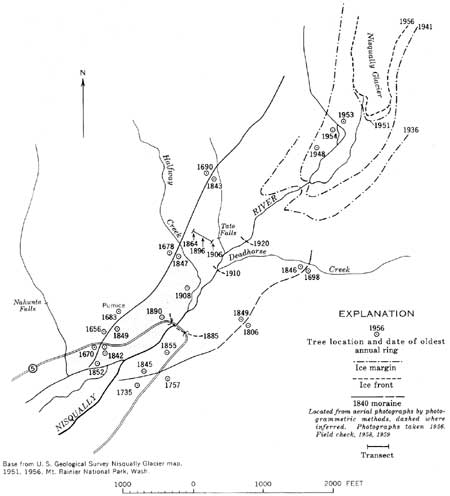
Conspicuous remnants of a terminal moraine are located approximately 1 mile downvalley from the terminus of Nisqually Glacier (fig. 6) or about 800 feet downvalley from the bridge under construction in 1958—60 on the highway between Longmire and Paradise. Lateral moraines extend upstream from the terminal moraine on both valley walls. These moraines mark the maximum advance of Nisqually Glacier during perhaps the last thousand years.
Field study was concentrated in the valley reach shown in figure 6. Thirty-two groups of trees in the entire study area were sampled. A total of 179 trees were cored, and annual rings were counted on 74 stumps, cut in the winter of 1957—58 as a part of the new road construction. Annual rings on cores were counted in the field and recounted later in the laboratory. The location of the area and the location of some of the key trees are shown on figure 6.
| <<< Previous | <<< Contents >>> | Next >>> |
pp/387a/sec3.htm
Last Updated: 01-Mar-2005
