
|
Geological Survey Professional Paper 669
The Colorado River Region and John Wesley Powell |
ABSTRACT
THE COLORADO RIVER REGION AND JOHN WESLEY POWELL
STRATIFIED ROCKS OF THE GRAND CANYON
By EDWIN D. MCKEE
The record of the earth's history in the walls of the Grand canyon has been deciphered through hard work by many people during the past 100 years. Much still remains unsolved. John Wesley Powell's contributions were of a pioneering type, though he was not the first to discuss the rocks of the Grand Canyon. Far more important than his own observations and deductions in the field of stratigraphic geology was his tremendous influence upon the work of his associates and his successors. This chapter traces the evolution of thought concerning the stratified rocks of the Grand Canyon and summarizes present concepts of stratigraphic history as recorded in the walls of the canyon. A brief summary of available data and conclusions on each of the principal sedimentary units is presented.
INTRODUCTION
On the centennial of the epic boat trip down the Colorado River by Maj. John Wesley Powell and his party in 1869, it is appropriate that recognition be given to various phases of Powell's many scientific accomplishments, especially those related to his journey through the Grand Canyon. Accordingly, this chapter reviews one feature of the geology—the record of the stratified rocks—that was of great interest to Major Powell.
Our knowledge of the earth's history recorded in the walls of Grand Canyon is the result of hard work by many people during the past 100 years, yet much remains unsolved. Powell's contributions were of a pioneering type, though he was not the first to discuss the rocks of Grand Canyon. Far more important than his own observations and deductions in the field of stratigraphic geology was his tremendous influence upon the work of his associates and his successors. The objective of this chapter is to trace the evolution of thought concerning the stratified rocks of Grand Canyon and to show how our knowledge has increased since the time of Powell's epic journey.
This chapter also summarizes present concepts of stratigraphic history as recorded in the walls of Grand Canyon and thereby indicates the status of investigations at present. To accomplish this objective, a brief summary of available data and conclusions on each of the principal sedimentary units in Grand Canyon is presented.
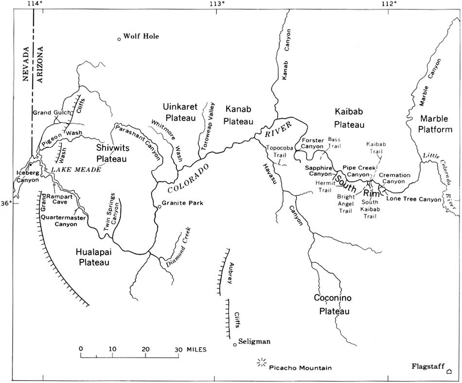
The region discussed in this chapter is largely restricted to the area that includes Marble Canyon and Grand Canyon (fig. 1), though Powell's explorations of the Colorado River took him through a much larger area. These canyons are in the southwest corner of the Colorado Plateau and are entirely within the northern part of Arizona. As was recognized by Powell (1875, fig. 73), the Colorado Plateau is divided in this region by major faults and monoclines into a series of flat-lying blocks or steps. These blocks consist (north of the Colorado River, from east to west) of the Marble Platform and the Kaibab, Kanab, Uinkaret, and Shivwits Plateaus and (south of the river) the Coconino and Hualapai Plateaus.
|
| FIGURE 1.—Grand Canyon and environs, showing localities cited in text. (click on image for an enlargement in a new window) |
Grand Canyon National Park, the area seen by most visitors to the region, includes only the eastern half of Grand Canyon or the part within the Kaibab Plateau and the eastern part of the Coconino Plateau (fig. 1). The Grand Canyon National Monument, less frequently visited but equally scenic, is mostly on the north side of the Colorado River within the Uinkaret and Kanab Plateaus.
ACKNOWLEDGMENTS
Appreciative thanks are extended to L. C. Craig, Eleanor J. Crosby, P. T. Hayes, and R. B. O'Sullivan, of the U.S. Geonlogical Survey, and to William Breed of the Museum of Northern Arizona, for many helpful suggestions and for constructive criticism during preparation of the manuscript.
| <<< Previous | <<< Contents >>> | Next >>> |
pp/669/secb1.htm
Last Updated: 22-Jun-2006