
|
Geological Survey Water-Supply Paper 1766
The Water Supply of El Morro National Monument |
WHERE THE WATER IS STORED: THE GEOLOGY OF EL MORRO
(continued)
Precambrian Rocks
The oldest rocks in the El Morro region are igneous and metamorphic rocks of the Precambrian Era. (See fig. 7.) These Precambrian rocks could be 600 million to 3 billion years old. They have had a turbulent history. They were squeezed, contorted, and torn, and great masses of magma and narrow bands of quartz from the interior of the earth were injected into them. Some of the magma spewed out on the surface as lava flows. The intense heat and pressure subsequently converted the sediments and lava into metamorphic rocks. Lofty mountains were built and then eroded away. No traces of primitive life are evident in these rocks, but that does not necessarily mean no life was ever present. Such traces may have been destroyed by the intense heat and pressure to which the rocks were subjected.
The bands of quartz are more resistant to erosion than the granitic rocks that enclose them, and several can be seen in low ridges along the road across the Zuni Mountains between Ice Cave and Grants. (See fig. 5.) They are easily discerned because of the large amount of white quartz fragments strewn over the ridges.
Rocks of Paleozoic Age
The Paleozoic Era of geologic time began about 510 million years ago and lasted about 330 million years. However, only a small part of this time is recorded by the rocks in the vicinity of El Morro. If rocks were deposited in the region during the first 300 million years of the Paleozoic Era, they must have been later completely removed by erosion, as there is no evidence of them now. However, rocks of one of the later subdivisions of the Paleozoic Era, the Pennsylvanian age, lie over the Precambrian rocks. (See fig. 7.)
The Pennsylvanian rocks range in age from about 235 to about 205 million years. The central interior of the United States was a vast lowland at the beginning of Pennsylvanian time, and part of the continent was submerged intermittently below the seas. During much of this time, El Morro region was a highland surrounded by seas, but the sea advanced temporarily into the area of the Zuni Mountains. We know this because marine fossils have been found in sedimentary beds of limestone and shale.
The brown and gray Pennsylvanian rocks are in areas of low relief bordering the central part of the Zuni Mountains on the southeast. The secondary road between Ice Cave and Grants (fig. 5) crosses some of these rocks about 10 miles north of Ice Cave. Pennsylvanian rocks do not exist beneath El Morro itself.
The latest subdivision of the Paleozoic Era is the Permian, which began about 205 million years ago and lasted roughly 25 million years (fig. 7). The central interior of the United States was a vast basin during Permian time. El Morro region remained above the seas during all of Early Permian time, but eventually it too was drowned by an advancing sea.
Rocks of Permian age in this region have been divided into four major sedimentary units, based on differences in the rocks that were deposited in the changing environment. These four units have been named, from bottom to top, the Abo Formation, the Yeso Formation, the Glorieta Sandstone, and the San Andres Limestone.
The Abo Formation consists of thin beds of brown to brownish- red sandstone, shale, and conglomerate. Fossils are sparse, except for a few species of small plants. These features indicate that the formation was deposited on the flood plains of streams on a nearly flat surface.
The formation is soft to very hard, and it forms alternating slopes and cliffs where it has been eroded. The best exposures of these rocks are in the lower parts of high escarpments and in areas of low relief bordering the central part of the Zuni Mountains. A few outcrops can be seen along the secondary road between Ice Cave and Grants, N. Mex. (fig. 5); better exposures can be seen along the road between Ice Cave and McGaffey.
The lower part of the Yeso Formation consists of pale-red sandstone. It is soft to hard and forms low rounded ridges or steep cliffs where it has been eroded. The physical character of the sandstone indicates that it was deposited by the wind as massive sand dunes in a wide expanse of desert.
The upper part of the Yeso Formation consists of red sandstone and shale and gray limestone. Gypsum, a soft white rock that formed on the bottom of shallow seas as the water evaporated, is also present as thin beds and a dispersed material in the sandstone and shale. Where eroded, the Yeso consists of nearly vertical cliffs. The beds of limestone contain the remains of marine shells, which show that the region was submerged below the sea during part of the time when the Yeso Formation was being deposited. The beds of shale record intervals during which the region was still submerged below the sea or was a little above the sea, and deposition was on broad mudflats or deltas.
The Yeso Formation is best exposed in the walls of deep canyons on the slopes of the Zuni Mountains and in high cliffs around the central part of the mountains. The lower part of the formation is best exposed in areas of low relief circling the central part of the mountains. The formation is well displayed along the roads between Ice Cave and Grants and McGaffey (fig. 5), and the striking red color of these rocks adds much to the scenic beauty of the Zuni Mountains.
The Glorieta Sandstone is light-gray to buff, and in some places it is red. The grains of sand are uniform in size, and they have been firmly cemented with minerals that make the rock very hard. This sandstone was deposited along the coast or in shallow water as the seas again covered the region.
The Glorieta is best exposed as the caprock on high cliffs and on timbered slopes in the Zuni Mountains. It can be seen in the canyon walls along the mountain road between Ice Cave and Grants. (See fig. 5.)
The San Andres Limestone is medium to dark-gray limestone and limy sandstone. Remains of seashells are common in the limestone. This marine limestone attests to the complete submergence of the region beneath the Permian seas.
The limestone is best exposed on broad slopes on the north, east, and south sides of the Zuni Mountains. The steep, south west-facing mountain front that can be seen from El Morro is capped with the San Andres. The formation can be seen also along the road between Ice Cave and El Morro and in canyon walls between Ice Cave and Grants. (See fig. 5.)
The San Andres Limestone furnishes large supplies of water to irrigation, municipal, and industrial wells near Grants.
Rocks of Mesozoic Age
The Mesozoic Era is sometimes referred to as the age of reptiles, for it was during this time that the great dinosaurs roamed the earth. The era began about 180 million years ago and lasted about 120 million years. An incomplete record of its three geologic periods—Triassic, Jurassic, and Cretaceous—has been found near El Morro.
The Triassic Period began about 180 million years ago and lasted about 30 million years. (See fig. 7.) The Triassic rocks have been divided into two formations of sedimentary rocks in the vicinity of El Morro—the Chinle Formation (shale, sandstone, and limestone), and the Wingate Sandstone. These rocks were formed during a long interval in which the land rose above the seas again, and rivers and streams deposited material in the valleys and on broad plains.
The Chinle Formation consists of a colorful sequence of red, gray, and purple shale, pebbly sandstone, and, in the uppermost part, impure limestone. Gypsum is dispersed throughout the formation. The beds of sandstone are firmly cemented, and they form low cliffs and even slopes. Because most of the Chinle is easily eroded, it commonly is exposed in areas of low relief in broad valleys. Perhaps the most widely known of the Chinle exposures are those at the Painted Desert and Petrified Forest National Monuments in Arizona. Equally impressive exposures can be seen on the flanks of the Zuni Mountains.
Petrified wood (wood that has turned to stone) is common in the Chinle Formation. At the Petrified Forest National Monument, Ariz., the wood is brilliantly colored. However, at El Morro it is mostly drab in color. The grain of the wood can be distinctly seen in the rock.
The Wingate Sandstone on the north flank of the Zuni Mountains was deposited as dune sand in a desert. The Wingate south of the mountains, in contrast, was deposited as sand, clay, and pebbles on flood plains, and in lakes or inland basins. It consists of pale-red, very fine grained sandstone. The best exposures of the formation are in the lower parts of cliffs on the slopes of the Zuni Mountains and south of State Highway 53 from 5 to 10 miles east of Zuni. (See fig. 5.) The bright-red cliffs of Wingate Sandstone east of Zuni contrast sharply with the green of juniper and pinon trees. Many of the houses in Zuni are made of stone quarried from the Wingate Sandstone.
The Jurassic Period began roughly 150 million years ago and spanned 25 million years. (See fig. 7.) Rocks of the Jurassic age (also sedimentary) on the north flank of the Zuni Mountains have been divided into several units as follows (in ascending order): Entrada Sandstone, Todilto Limestone, Summerville Formation, Bluff Sandstone, Zuni Sandstone, and Morrison Formation.
A short distance south of U.S. Highway 66, the units lose their distinctive characteristics, and near El Morro they are all called simply Zuni Sandstone. This Jurassic-age unit is the sandstone on which the inscriptions are carved at El Morro.
The Zuni Sandstone consists of white, light-gray, and buff to pale-red very fine to fine-grained sandstone, containing some intermixed clay and silt. It also contains some coarse sand and fine gravel in the uppermost part, but in general the particles are uniform in size. This rock was formed from massive sand dunes and stream deposits in a broad expanse of desert. The Zuni is soft to hard and it stands in cliffs. The high red cliffs extending eastward from Gallup, N. Mex., for many miles just north of U.S. Highway 66 are Entrada Sandstone.
The Morrison Formation, another unit of the Jurassic rocks north of U.S. Highway 66 (fig. 5), contains about 65 percent of the uranium ore that is known to exist in the United States. Most of the ore is found north of Laguna and in the vicinity of Ambrosia Lake. Other important deposits are a few miles east and northeast of Gallup.
The Cretaceous Period began about 125 million years ago and spanned a time interval of 55 million years. (See fig. 7.) Only a part of the Cretaceous rocks are represented in the region. In the vicinity of El Morro, these rocks have been divided into three sedimentary units—the Dakota Sandstone, the Mancos Shale, and the Mesaverde Group (shale and sandstone), from bottom to top. These units reflect a marked change in the environment of the region from that of the Triassic and Jurassic Periods. Once again the seas gradually rose over the land and then receded. The Dakota Sandstone was deposited in streams, lagoons, and in the margin of an advancing sea. The Mancos Shale was deposited in a sea that covered the entire region, and the Mesaverde Group was deposited along the coast and in low swamplands as the land once again emerged from the sea.
As shown in figure 7, the Jurassic unit is the Morrison Formation, and the Cretaceous unit is the Dakota Sandstone. The change from one kind of rock to another was accompanied by a change in the environment, during which time the sea covered the land. In many places, the contact between the two formations is marked by the presence of kaolin, a white clay. In some areas the kaolin appears by itself; in others it is mixed with the sandstone as a cement. This whitened zone is very distinctive at Inscription Rock. The kaolinized cementing material probably came from weathering of other minerals during the long interval of time between the deposition of the Morrison and Dakota sediments. Where it appears almost pure, it may have been "formed by local concentration of the fine, white clay in small, shallow lakes on the old surface." [10] It indicates that a moist climate prevailed during a part, at least, of the time between Jurassic and Cretaceous deposits in this area. It is from clues like these that geologists put together the puzzle of the earth's history.
The Dakota Sandstone consists of uniform grains that have been firmly cemented into very hard rock. It is relatively resistant to erosion, and it forms the caprock on Inscription Rock and on other mesas near El Morro.
At places the Dakota Sandstone contains medium- to dark-gray shale and coal that were deposited in swamps ahead of the advancing sea. The Dakota Sandstone is the reservoir rock for much oil and gas in San Juan and Rio Arriba Counties, N. Mex.
The Mancos Shale consists of thin beds of medium- to dark-gray shale and fine-grained sandstone, containing marine fossils. Because the beds of soft shale in the Mancos are easily eroded, it commonly is exposed in areas of low relief in broad valleys.
The Mesaverde consists of light- to dark-gray shale and light gray to reddish-brown sandstone. It also contains several beds of coal, where great amounts of vegetation accumulated in the swamps.
Coal has been mined from the Mesaverde Group at many places in western New Mexico. Notable were the mines near Gallup, which were operated for many years during the early part of the century. Farther north and northeast, the Mesaverde Group yields great amounts of oil and gas.
Rocks of Cenozoic Age
Our landscape as we see it today was sculptured during the Cenozoic Era, which began about 70 million years ago. During this era, all the seas were drained from the continents, and many mountain ranges of the world rose to their present, or greater, heights. We say "greater" heights because mountains are constantly being worn down by the process of erosion. The geologic history of the last few thousand years can be read in the traces left by man, as well as in those left in rocks by other forms of life.
The Cenozoic Era has been divided into two periods: the Tertiary and the Quaternary. Rocks of the Tertiary Period have not been identified in the vicinity of El Morro. Either they have been completely eroded or were not deposited at all. The Quaternary Period began about a million years ago. In many ways it is the most difficult period to interpret near El Morro, although it is the youngest of the geologic periods and extends into present time. This period is difficult to interpret because most of the Quaternary rocks consist of igneous rock and fine to coarse sediments that were deposited in small lakes and stream valleys. Neither of these types of rock is favorable for the preservation of fossils, and the geologist needs fossils to help him make age determinations.
The Quaternary rocks in the vicinity of El Morro have been divided into two units: basalt (an igneous rock) and alluvium (unconsolidated very fine to coarse sand, clay, silt, and gravel). Basalt and alluvium cover all but the western part of El Morro National Monument. The thickness of these units has not been determined except at a few places. At least 200 feet of Cenozoic rocks have been penetrated by wells near El Morro.
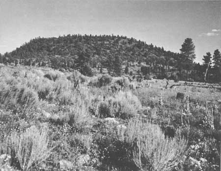
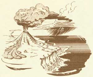
The igneous rock came from several volcanic cinder cones 12 to 15 miles east of El Morro. Most people assume that volcanoes have only one opening—the crater—but actually they generally also have smaller vents around the sides. Piles of volcanic ash form around these vents; these are called cinder cones (fig. 9).
|
| Figure 9. Volcanic cinder cone 14 miles east of El Morro. |
In the vicinity of El Morro, lava flowed through the vents down the valleys and solidified. The fronts of the flows are commonly marked by large masses of broken black rock. North of El Morro, the lava formed a plain 2 to 3 miles wide and about 10 miles long. Similar lava flows followed other valleys south of El Morro and spread across a few hundred square miles of plains to the south and west.
| <<< Previous | <<< Contents >>> | Next >>> |
wsp/1766/sec2a.htm
Last Updated: 01-Mar-2005