|
NATIONAL PARK SERVICE
The Lewis and Clark Trail A Proposal for Development |

|
RECOMMENDED PROGRAM
Implementation of an overall program for the enhancement of the historic and recreation resources along the route of the Lewis and Clark Expedition will be the continuing responsibility of the individual States and Federal agencies concerned. The following recommendations are designed to establish a general framework for the coordination of more detailed planning and implementation actions:
ACTIONS TO BE TAKEN
1. A convenient and attractive highway Trail should be provided for the public to use in retracing the route of the Lewis and Clark Expedition. Initially, the Trail can be established by carefully selecting and marking a continuous system of the best existing roads that parallel the Expedition route and that provide frequent access to the resources associated with the historic route itself. Where the original route was a river, the Trail may include highways on both sides. Suggestions for such routing are shown on the sectional maps accompanying this report.
Ultimately, it will be desirable to improve both the scenic quality and, in some cases, the location of the Trail. Existing sections of the Trail now classed as "secondary" roads should be improved first. As other sections need repair or other improvements, new locations should be considered to provide more driving pleasure or to take better advantage of nearby scenic opportunities.
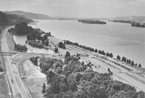
Large parts of the scenic and historic river sections of the Expedition route are beyond the view of the traveler by highway. Where traffic, volume, and engineering considerations warrant, it will be desirable to build new sections more closely paralleling the scenic waterways. Where the present Trail routing through riverfront cities and towns is directed away from the river because of waterfront congestion, redevelopment of the waterfront might well be considered, not only to obtain the best and most interesting location for the Trail, but also for the attendant benefits to the city or town involved.
The Trail also should be tied to existing and proposed historic, wildlife, and other recreation resources at a reasonable distance from the route. Where existing spur roads to these resources exist, they should be appropriately marked with the direction and distance to the site involved. Where no direct connections exist between the Trail and the resource, such access should be provided and appropriately marked.
Since most of the highways to be designated as part of the Lewis and Clark Trail network are already in existence, it is imperative that future roadside development be controlled. All Trail improvements should be accompanied by acquisition of scenic easements or the establishment of zoning regulations to deter undesirable roadside development in both rural and urban areas. In addition, provisions should be made for the establishment of frequent and attractive wayside parks and rest areas along the Trail and its spur connections.
Such a program can be carried out over a period of years according to a comprehensive plan adopted by the several States and by affected Federal agencies.
2. The Lewis and Clark Trail should be identified at appropriate intervals by a uniform official symbol in the form of highway signs. Besides serving as guideposts to the traveler, the symbol can enable participants to associate themselves with the overall program.
Second only to the actual development, protection, or enhancement of historic and recreation resources along the Trail is the guidance of the interested public to the areas. People must be informed as to what there is to see and do and the best way to get there. Of foremost importance, then, is the directing of traffic from high-volume highways to local access routes. Directional signs containing maps of the immediate locale should be located at all convenient rest and wayside areas. These signs would graphically locate for the recreationist all camping and recreation areas and points of historic interest in the vicinity. The proper freeway exits should be shown along with appropriate local access roads.
The Lewis and Clark Trail Commission should recommend a uniform symbol to the States and suggest the manner in which the symbol is to be employed to insure continuity and uniformity of marking the Trail throughout the interstate area. An appropriate technique would be the issuance of a sign and marker manual similar to the Great River Road Manual prepared by the Bureau of Public Roads and the National Park Service.
3. The water route should be developed for the use of boaters. Most of the Lewis and Clark Expedition route was on the Missouri and Columbia Rivers and their tributaries and can still be followed by boat. The increasing number of boaters could make extensive use of such a route. Boat trips could begin at any point on the river and last for a few hours to several weeks.
At dams where navigation locks are lacking, special facilities such as boat ramps and access roads should be constructed, and boat trailers and other equipment should be provided to transport the boats around the dams. At points where historic sites are adjacent to the water route, interpretive markers should be erected. Facilities for boaters should be provided at all parks, campgrounds, and other recreation areas with frontage on the rivers. The same symbol used to mark areas along the highway Trail should be used along the water route.
4. A hiking and horseback trail should supplement the highway trail. It can be patterned after the Appalachian Trail and, like it, serve as a major trunk trail to which local and regional loop trails can tie. Such a major trunk trail could connect with other major trails being considered along the Continental Divide and the Pacific Coast as part of a Nationwide System of Trails.
A hiking and horseback trail, like the highway Trail, would follow as closely as possible the Expedition's water and overland route. Except as topography and other factors may dictate, however, the hiking and horseback trail would not be in close proximity to the highway Trail. The trail, where feasible, should be constructed to permit use of bicycles, and overnight shelters should be provided at appropriate intervals.

5. Public agencies should acquire and develop major segments of the water and overland routes of the Lewis and Clark Expedition route that possess important historic, wildlife, scenic, and other resources. The Lewis and Clark Expedition had such a significant impact on the exploration and development of the United States and the 10 States since established along its route that representative sections of this route should be protected and made available for permanent public use and enjoyment. Although priority should be placed on sites associated with the Expedition, other important sites associated with the subsequent advancement of the frontier, the Civil War, and other phases of State and national history also should receive appropriate attention.
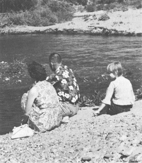
In addition to those areas noteworthy for their historic or scenic values, certain areas —particularly near population centers—should be acquired by State or city authorities and developed to meet recreation needs of the local citizens as well as the traveling public.
Because of the importance of the Missouri River and its tributaries to migratory waterfowl and other birds, habitat suitable for the propagation and management of wildlife also should have high priority for Federal or State acquisition or control. The tremendous number of geese moving north and south through these States has provided an attraction for thousands of persons who make special trips just to see these birds. The area is also the center of interest for the hunting of ducks and geese in the fall.
As natural areas gradually disappear from the scene, examples of the several different biotic communities representative of the Great Plains, the Rocky Mountains, and the Pacific Northwest become more valuable as grounds for scientific study. Unique examples remaining today should be preserved by the use of scenic easements, zoning regulations, or land acquisition.
Proposals for recreation areas along the Trail should give consideration to: (1) the planning of hiking and nature trails, (2) the zoning of water areas to provide optimum opportunities for recreation; and, (3) incorporating archeologic features and preserving, for public recreation purposes, representative examples of the major historic eras that are a part of the Nation's rich heritage.
In view of its possible national significance as the only major segment of the Lewis and Clark route that still remains essentially as it was in 1805, consideration should be given to establishing in Wild River status the proposed Lewis and Clark National Wilderness Waterway in accordance with Plan No. 6 of the joint Army-Interior study of the Upper Missouri River between Fort Peck Reservoir and Fort Benton, Montana. This plan would retain the entire 180-mile stretch of the Missouri between Fort Benton and the Fort Peck Reservoir in its natural condition.
An acceptable alternative to protect the wilderness character of a portion of the Missouri is Plan No. 8, which includes a dam at Virgelle, provided that recreation is not used to justify the construction of Virgelle Reservoir. Although Plan No. 8 would back water 40 miles upstream to Fort Benton, it would improve the quality of the river downstream by trapping the considerable silt load of the Marias River. Adoption of either Plan No. 6 or Plan No. 8 would preserve 140 miles of the natural values extending downstream from Virgelle which contain most of the unique blend of remoteness, scenic grandeur, and vital history.

6. A Lewis and Clark Trail Committee should be established in each State along the Trail. Such committees would coordinate the activities of private, quasi-public, local, State, and Federal agencies and organizations within the State that are related to the Lewis and Clark Trail in order to avoid duplication of effort and overlapping of developments and responsibilities. The membership should include interested and knowledgeable lay members as well as representatives of local, State, and Federal agencies. The State Committees should work closely with the Lewis and Clark Trail Commission.
7. Each State Committee should develop a State educational program for the Lewis and Clark Trail. Such a program would inform the public of the historic, wildlife, and other recreation resources available along the route of the Expedition and could be carried out as part of the existing promotion efforts of State travel, tourism, recreation, park, or economic development departments. Development of such a program should be a cooperative effort among the States involved and should coincide with any promotional plans by the Lewis and Clark Trail Commission.
8. Interpretation and information centers should be developed at appropriate points along the Trail. Such centers could serve to tell the story of the region through which the Expedition passed—its geology, its biology, its history, and most important, the Lewis and Clark story. Interpretation of this nature can enhance public understanding of the Expedition's contribution and importance to American history.
9. Adequate State legislation should be enacted and enforced to control sewage and industrial waste disposal in the Missouri and Columbia River Basins. Pollution of water proves a major obstacle to realization of the wildlife and other recreation potential of these waters.
10. Private enterprise should be encouraged to provide services of good quality at moderate rates and at carefully planned intervals. The pleasure of travel is closely bound to the strictly physical aspects of the trip, to wholesome food, clean lodging and rest rooms, and courteous and complete automobile service. Provisions should be made to improve and enlarge the facilities that now exist along the route. New developments should be established in new locations as increased visitation warrants. Certain controls over the quality and location of such development are desirable and should be maintained wherever public support is extended.
Steps should be taken to provide technical and financial assistance to private businessmen and landowners willing to provide public outdoor recreation opportunities. For example, many commercial marinas and unimproved private boat-launching sites are located along the Missouri River. The use of these facilities to meet public recreation demands could be greatly improved upon by well-conceived assistance programs.

RELATIVE ROLE OF PARTICIPANTS
1. Lewis and Clark Trail Commission. As specified in Public Law 88-630, this Commission shall provide the overall leadership in coordinating and furthering the purposes of the Lewis and Clark Trail and the implementation of State and Federal programs to enhance it. The Commission also can assume the leadership in advertising and promoting the use of the Trail.
2. State Lewis and Clark Trail Committees. These State Committees should act as a tie between the Lewis and Clark Trail Commission, the State agencies, and Federal agencies at the local or field level. Membership should include the representatives of the State agencies responsible for the protection, development, and management of the States' natural resources.
These Committees could assist in conducting or supervising additional studies to locate accurately all historic sites along the Trail, and should consult with Federal agencies having administrative responsibilities along the Trail in order to coordinate developments and avoid overlapping or duplication of facilities.
3. Federal agencies. All Federal agencies with land management responsibilities along the Trail should keep in mind the relationship of the Trail to lands under their control, should identify historic sites on these lands, and should provide needed recreation areas and access related to the Trail.
The Bureau of Outdoor Recreation, through its review of Federal agency recreation budgets and the preparation of a Nationwide Outdoor Recreation Plan, should insure that recreation developments along the Lewis and Clark Trail receive reasonable priority in the individual Federal agency recreation programs. The Bureau also should review State recreation plans submitted in relation to the Land and Water Conservation Fund with this same objective in mind. In connection with the above responsibilities, the Bureau should also provide staff assistance to the Commission by keeping it informed of progress on all fronts.
The Bureau of Indian Affairs should encourage the various Indian tribes located along the Trail to participate in the program through development of recreation areas, historic sites and pageants where such projects will benefit the Indians as well as the general public.
4. Participating States. The 10 States along the Trail should carry a large share of the responsibility for the designation, marking, and improving of the highway portions of the Trail and the acquisition and development of the historic, wildlife, and recreation resources related to the Trail.
5. Counties, cities and towns. The counties and municipalities along the Lewis and Clark Trail should participate in the program where possible and should coordinate their participation with the State Lewis and Clark Trail Committees.
6. Private enterprise. Establishment of the Lewis and Clark Trail will provide ample opportunities for private enterprise to furnish the travelers with food and overnight accommodations—from campsites to luxury inns—which now are conspicuously scarce along the route. Diversified and extensive possibilities also exist for development of outdoor recreation opportunities such as for hunting and resort areas on private lands.
FINANCING POSSIBILITIES
1. Highway improvements. Much of the Lewis and Clark Trail is or could be designated as a part of the Federal Aid Highway System and thus be made eligible for Federal Aid Highway funds provided regularly to aid the States on a matching basis. Where sections of the Interstate Highways are involved, the proportion of Federal participation will be higher. Such funds, according to existing laws, can be applied to planning, survey, purchase of normal rights-of-way, and to construction of all necessary features of a highway. Landscaping, wayside rest areas, and scenic easements can be financed by Federal funds, under Title 23, Section 319, U. S. Federal Code Regulations.
2. Land acquisition and development. The recently established Land and Water Conservation Fund can provide a fair share of the costs of acquiring and developing historic, wildlife, and other recreation resources associated with the Trail. Before such funds can be made available to the States and their political subdivisions, though, such projects must be included in individual Statewide plans approved by the Secretary of the Interior.
3. Assistance to private enterprise. Loans for appropriate and feasible tourism and other recreation development projects are available from the Small Business Administration and other sources. A rather complete analysis of such sources is provided in the publication Federal Assistance in Outdoor Recreation—Available to: States, Their Subdivisions, Organizations, and Individuals, published by the Department of the Interior, Bureau of Outdoor Recreation, Washington, D.C. 20240.
| <<< Previous | <<< Contents>>> | Next >>> |
lecl/proposal-for-development/recommendations.htm
Last Updated: 11-Jun-2012