|
NATIONAL PARK SERVICE
The Lewis and Clark Trail A Proposal for Development |

|
STATES
ILLINOIS
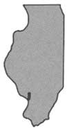
Illinois played a significant role in the Lewis and Clark Expedition because of the state of communications technology in 1803.
Originally, Lewis had planned to assemble the Expedition at St. Louis. The Louisiana Purchase agreement had been signed with Napoleon in May 1803 (antedated to April 30), and the treaty ratified by the Senate in October. Actual transfer of control, however, had to await the passing of word through channels from the French Emperor to the Spanish commandant at St. Louis, who still was responsible for the city.
In December 1803 Lewis requested permission for the Expedition to establish winter quarters on the west bank of the Mississippi. Despite the pending transfer the Spanish commandant at St. Louis refused for he had no official notice of the Treaty. Being unwilling to force the issue, Lewis crossed to the American side of the Mississippi and established camp near the mouth of the Wood River.
A 55-foot keelboat had been made to order in Pittsburgh, floated down the Ohio to its confluence with the Mississippi, and propelled up to St. Louis. It was then moved to the Wood River site.
Once established at Wood River Lewis and Clark set about completing their preparations for the journey in the spring. Lewis recruited men in the surrounding area to bring the size of the party up to 43 men, each suited to the rugged life he would lead during the venture, and each with useful skills. Military discipline was established. Two additional boats were constructed—pirogues, or dugout canoes, each made from a single log 40-50 feet long and equipped with 6-7 oars. The extensive supplies required to sustain the men and to be used in dealing with the Indians were received, sorted, and stored.

Information was sought about the country and tribes they would encounter. The first five months of travel would take the Expedition to the villages of the Mandan Indians; this area was known, since other explorers as well as traders had traversed it. But from there on the Expedition would push into country that was only legendary and whose vastness was unknown.
The party left its Wood River camp on May 14, 1804.
Nothing marks the Wood River Camp area today but a Lewis and Clark historic marker in a small State park nearby. The original campsite has been washed away with the shifting of the rivers during the elapsed 160 years. Plans now are under way to enlarge the State park.
Illinois maintains another site with a bearing on the Lewis and Clark Expedition—Cahokia Mounds State Park, east of East St. Louis. Lewis made trips during the winter of 1803 to Cahokia and also to Kaskaskia and was able to recruit soldiers there for his Expedition.
MISSOURI

SUMMARY

It was near St. Louis that the Expedition members spent the winter of 1803-04, making the necessary preparations for their journey which began on May 14, 1804. It lasted a little over two years, and they returned to St. Louis on September 23, 1806. Both explorers remained there after their trip, and Clark's descendants still reside there.
Some of the sites associated with the Lewis and Clark Expedition, such as St. Charles and the Lewis and Clark State Park, can be visited today. Although many of the campsites have been located, most are in need of interpretive signs and markers.
The Jefferson National Expansion Memorial in St. Louis will feature Lewis and Clark, along with other great explorers, in memorializing the Nation's westward expansion. The Memorial will focus attention not only on the historic aspects of our westward expansion but also on the economic, social, and cultural effects brought about by this migration westward.
Along the Lewis and Clark Trail the variety and quality of Missouri's outdoor recreation potential are outstanding. The abundant opportunities for water-based recreation, the favorable climate and long vacation season, the picturesque landscape, the profusion of historic sites, and the strategic location for westbound travelers constitute a prime setting for the development of Missouri's Lewis and Clark Trail program.
There are 56 existing and 30 proposed points of recreation interest along the Lewis and Clark Trail in Missouri. Twenty-three areas provide water-based recreation and all of the areas proposed for development by State and Federal agencies on the Missouri River will provide water-based recreation areas.
Public recreation areas providing access to the Missouri River are generally lacking along the entire course through Missouri. This is partly due to insufficient funds which hamper recreation development in both the private and public sectors.
The recommended routing of a Lewis and Clark Trail Highway in Missouri is indicated on maps 1-4. Future development of recreation areas along the Trail should follow the existing plans of the Missouri Conservation Commission and the Corps of Engineers with modifications as indicated in this report.
 Meriwether Lewis (left) and William Clark as portrayed by Charles Willson Peale. |
BACKGROUND
It was near St. Louis, on the banks of the Wood (Du Bois) River in Illinois, opposite the mouth of the Missouri, that the captains prepared for their journey. During the winter of 1803-04 the two leaders purchased supplies, disciplined their men and readied their equipment.
The party left their Wood River Camp on Monday, May 14, 1804. Two days later, they arrived at St. Charles and there waited for Captain Lewis, who had been detained in St. Louis. The members of the Expedition were well treated by the French inhabitants of St. Charles and a ball was held in their honor. Some of the members enjoyed themselves too much and on May 17 Clark selected a detail for court martial. Three men were found guilty and the first of several floggings was administered. Lewis arrived on May 19. The Expedition left St. Charles on May 21, continuing up the Missouri River. The next day they came to a camp of Kickapoo Indians who traded four deer for two quarts of whiskey.
 St. Charles, Missouri, where the Lewis and Clark Expedition was for the first time fully assembled. The expedition left May 21 after awaiting arrival of Meriwether Lewis from St. Louis. |
On May 25 the Expedition camped near La Charrette, a village of seven houses. Two nights later they camped at the mouth of the Gasconade River in a violent thunderstorm. The next day was spent in drying out their equipment.
The Expedition camped on Moreau Creek near Jefferson City on June 3. The following day Sergeant Ordway steered the keel boat too near the shore. The mast caught in a sycamore tree and snapped off. It "Broke verry Easy" said Ordway. Two Frenchmen came down the river on June 5, their fur-laden pirogues lashed together to make one boat. On June 7, the Expedition halted at a curious limestone rock. The place was alive with rattlesnakes and they killed several before investigating the rock which was embedded with red, white, and blue flint. The Indians had covered the rock with paintings of animals and inscriptions. On June 9 the Expedition reached a cliff of rocks called the Arrow Rock.
The Expedition met a party of Frenchmen coming down the river on two rafts loaded with furs on June 12. Among the party was a Mr. Dorion, who spoke several Indian languages. The captains persuaded him to join the Expedition and go with them to the Sioux nation. The boatmen began having difficulties with sunken snags and shifting sand bars. Heavy morning fogs often delayed the Expedition and violent winds forced them ashore at times. The muddy drinking water gave them boils and dysentery. On June 26 they reached the mouth of the Kansas River, and the future site of Kansas City.
On July 7 the Expedition passed the future site of St. Joseph and the next day camped near the mouth of Nodaway River. By this time there had been several cases of sunstroke. On July 12 one member of the Expedition was sentenced to 100 lashes for sleeping on post. On July 27 they passed the present Missouri-Iowa State line.
On the return trip in the fall of 1806 the journals do not give an accurate accounting of each overnight camp, but it is known that the Expedition did stop at some of the 1804 camp sites. The journey lasted for two years, four months, and nine days, and the Expedition arrived in St. Louis at 12:00 p.m. on Tuesday, September 23, 1806.
FINDINGS
RECREATION RESOURCES
Beginning at St. Louis, where both Lewis and Clark remained after their return, there are several points of interest along the Trail for the present-day traveler to visit. At the corner of Walnut and Main, Lewis participated in the Louisiana Purchase ceremony, whereby the United States took over 1,172,000 square miles of territory. After the Expedition, Clark lived and died here in a house where the Chamber of Commerce building now stands, and he is buried in the huge Bellefontaine Cemetery.
The new Jefferson National Expansion Memorial at St. Louis will honor the Lewis and Clark Expedition and other epic explorations and achievements contributing to the westward expansion of the Nation. The Memorial is located here because much of the Nation's westward surge was channeled through St. Louis. Its strategic location, near the Ohio, Missouri, and Mississippi Rivers, made it the hub of mid-continental commerce and truly the "Gateway to the West." In addition to the 630-foot stainless steel gateway arch now under construction, there are plans for a visitor center and a large museum. The Memorial and Fort Clatsop in Oregon are the only Federally-owned areas associated with the Lewis and Clark Trail that are presently administered by the National Park Service.
Just west of St. Louis and across the Missouri River, the present-day traveler can visit the town of St. Charles, the only large town on the Missouri River in existence when the explorers went west. Many of the buildings were constructed about the time of the Louisiana Purchase. A few miles west of Babler State Park, the tavern visited by Lewis and Clark and lost for decades behind a river-built bank was rediscovered not too long ago. The town of Marthasville is very near the former site of La Charrette, which consisted of seven houses when the Expedition passed.
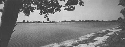
Few sites associated with the Expedition have been identified across the remainder of the State. One important site is the Lewis and Clark State Park, located near Winthrop across the river from Atchison, Kansas. Sugar Lake, located in the Park, was visited by Lewis and Clark and named "Goslin Lake" because of the large number of goslings feeding there.
These sites and others like them will be sought after by numerous Americans retracing the steps of Lewis and Clark. Some, such as St. Charles, are easy to locate—others such as the Wood River campsite—are not. Improvement of access and interpretation is needed to make them available to the public.
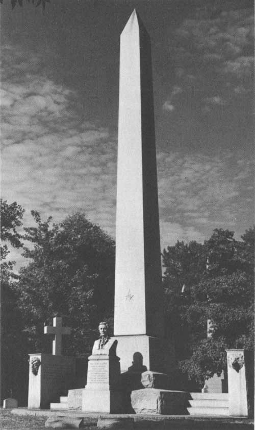 Monument at grave of William Clark in Bellefontaine Cemetery, St. Louis, Missouri. |
Missouri has other sites and attractions which would supplement those associated with the Lewis and Clark Expedition. Interesting stops along the river route include Daniel Boone's home, original grave site, and monument; William Ashley's grave; and Lexington, the famous Civil War battlefield. The Lewis and Clark Trail in Missouri roughly parallels the historic Santa Fe Trail from Arrow Rock to Independence. Routes taken by the Pony Express, the forty-niners, and the Oregon pioneers begin at the famous Missouri River jumping-off points—St. Joseph, Independence, and Westport (Kansas City).
Some historic sites along the Expedition route that have been approved for Registered National Historic Landmark status are: Arrow Rock State Park near Marshall (Santa Fe Trail); the Patee House at St. Joseph (Pony Express); the Utz site near Marshall (prehistoric Indian remains); and Fort Osage near Independence. The latter site, built in 1808, was selected by Captain Clark originally. These sites have been registered by the Department of the Interior because of their exceptional value and national significance in commemorating and illustrating the history of the Nation. They are not administered, however, by the Department.
An inventory of historic, wildlife, and other recreation areas including some of those already mentioned shows 56 existing and 30 proposed areas totaling 70,878 acres within about 25 miles of the Lewis and Clark Trail in Missouri. Twenty-three of the existing areas and all of the proposed areas will provide water-based recreation. In addition, facilities existing and to be developed include camping, picnicking, hunting, hiking, horseback riding, sightseeing, and nature study. A detailed list of existing and proposed points of recreation and historic interest along the Trail, with pertinent information concerning each, is found in the tables on pages 122 to 128.
Missouri has long been one of the Midwest's outstanding vacation States. Its climate permits a long vacation and camping season, extending from early spring until late fall. Superb fall colors attract thousands of tourists. Its many rivers afford float trips that can last for hours or weeks; in fact, Missouri's portion of the Expedition route can be floated throughout its entirety because there are no dams to obstruct navigation. Good fishing and hunting can be found on the streams, lakes, and refuges in the vicinity of the Trail.
 Jefferson National Expansion Memorial stainless steel arch now under construction on the St. Louis waterfront. |
RECREATION TRENDS
Outdoor recreation in Missouri is big business. Tourist expenditures have jumped from $218,600,000 in 1951 to $560,200,000 in 1964.
Population increase, higher incomes, and more leisure time will intensify the demand for outdoor recreation. The Interstate Highway System is producing a revolution in the use of outdoor recreation facilities. More and more people are traveling greater distances to enjoy the out-of-doors.
The 1964 population of Missouri was about 4,475,000. By 1976, it is estimated that the population will be 5,003,000, with 80 percent residing in urban areas. By the year 2000, the population is expected to reach 7,015,000.
Recreation demands are reflected to some extent by traffic volume. Outside the St. Louis metropolitan area, and west of the Missouri River, Interstate 70's average 24-hour volume is 17,301 vehicles; it continues to carry 5,000-6,000 across the State to Kansas City. This highway crosses the river (affording access to the Trail) twice, at St. Charles and at a point just west of Columbia (Rocheport).
U.S. Highway 50, south of the river, carries a flow of approximately 2,000-5,000 vehicles per 24-hour period. U.S. Highway 24, paralleling the river in western Missouri, averages between 2,000-3,000.
RECREATION PLANS
In 1964 the Corps of Engineers in an intensive recreation study of the Missouri River from Rulo, Nebraska, to St. Louis reported that there is only one developed public picnic area along the Missouri River in the State of Missouri. No developed camping areas exist along the river, although camping is permitted on certain adjacent properties owned by the State Conservation Commission.
Despite the lack of facilities, 154,000 visitors use this portion of the river annually. With development of facilities, the Corps estimated that use would double.
Accordingly, the Corps proposed construction of 32 small public use areas along the banks of the Missouri River. Twenty-seven areas would be located in Missouri. Wherever possible, the sites of Lewis and Clark Expedition encampments would be used. However, it has been impossible to locate some of the original campsites and others are not suitable for recreation development. Each of the proposed public use areas would have an improved access road, parking and camping space, and water and sanitary facilities. In most instances, boat ramps and group shelters would also be constructed.
The Corps recreation plans have been endorsed enthusiastically by most municipal, county, and State agencies concerned. Many of these agencies intend to expand the facilities originally suggested by the Corps.
RECOMMENDED
The basic development program for the historic, wildlife, and recreation resources along the Lewis and Clark Trail is outlined in the Recommended Program, page 20. The recommended routing of a Lewis and Clark Trail Highway in Missouri is indicated on maps 1-4. Specific recommendations relating only to Missouri follow:
1. Marking of the Lewis and Clark Trail should be closely coordinated with marking of the proposed Ozark Frontier Trail. The Ozark Trail will parallel the Missouri River on the east-west route across the State and thus follow the same roads as the Lewis and Clark Trail for part of its length. Since the two trails are intended to open different historic resources to public enjoyment, their marking should be coordinated to avoid any conflict or confusion.
2. Twenty-seven small public use areas should be constructed along the banks of the Missouri River, in accordance with the plans of the Corps of Engineers. Wherever feasible, they should be located in the vicinity of camp sites used by the Lewis and Clark Expedition in 1804 and appropriate signs or other interpretation should be provided for public appreciation of the sites.
  Fort Osage, restored, near Buckner, Missouri. The site chosen for the fort was originally recommended by Clark in 1804. |
KANSAS

SUMMARY

The Lewis and Clark Expedition, travelling from St. Louis up the Missouri River toward its unknown headwaters, arrived at the point where the Kansas spills into the Missouri on June 26, 1804. For the next 11 days they camped on what is now the northeast border of the State of Kansas. Some of the sites associated with the Expedition can still be visited today.
This section of the State is picturesque. Rolling wooded hills are interrupted by flat cultivated plains with steep bluffs here and there along the river bank. The river bottoms are covered with willows and other trees which provide shady and attractive settings for recreation.
The potential here for recreation development is great. Although water-based recreation is particularly popular because of the hot winds and high temperatures of Kansas summers, only one public area provides access to the Missouri River. Seven water-based recreation areas are proposed for development by State and Federal agencies on the river. Present recreation uses, through limited private access to the river, include fishing, boating, water skiing, hunting, and fishing. The long vacation season extends from early summer to late fall, and thus recreation areas established along the river would be well justified.
The Lewis and Clark Trail in Kansas passes very near the cities of Kansas City, Leavenworth, and Atchison. All of these urban areas possess outstanding historic sites, associated not only with the Lewis and Clark Expedition route but also with the Indian-military frontier, the Pony Express, the Oregon and Santa Fe Trails, and the Civil War.
Only a short stretch of the Missouri River is followed by a major highway in Kansas. Although secondary roads parallel much of the river, they often lie far from it and by no means constitute a "river drive" route. The road network following the Expedition route does not form a major traffic artery between any two large urban areas. Despite this condition, considerable traffic flow occurs in extreme northeast Kansas, and most recreation points along the Trail can be reached in a matter of a few hours' drive from the greater Kansas City area; from St. Joseph, Missouri; or from the smaller cities of Atchison, Leavenworth, and Topeka, in Kansas. Future water-based recreation areas within a few hours' drive of all of these urban centers will be in great demand.
The stability of the Missouri River for recreation development has been greatly improved by the construction of numerous high-dam reservoirs on its upper reaches. Sediment content of the water also has been reduced, but pollution from other sources remains a real threat to water-based recreation activities.
Insufficient funds have impeded recreation development in Kansas but the establishment of the Land and Water Conservation Fund should help to alleviate this problem in the future.
To assist in meeting Kansas' future recreation requirements and to develop a coordinated program to memorialize what many historians have found to be "the most consequential and romantic peace-time achievement in American history," the State should follow the recommended program as outlined in this report. It is also recommended that the plan of the Corps of Engineers to develop public-use recreation areas along the river be implemented as soon as possible.
The recommended routing of a Lewis and Clark Highway in Kansas is indicated on maps 3-4.

BACKGROUND
On its trip west, the Lewis and Clark Expedition camped on the Kansas side of the Missouri River for 11 days. The first camp was made "at the upper point of the mouth of the River Kanzas" on June 26, 1804. Its last camp was in Doniphan County on July 9.
Despite the short time the Expedition followed the northeast border of Kansas, the journals record many interesting events.
The men stayed on the "upper point" of Kansas River for three days — June 26, 27, and 28 — and left at 4:30 p.m. on June 29. The Missouri River was reported to be 500 yards wide at this point and the water of "the River Kanzas had a very disagreeable taste." This spot is now surrounded by the industrial development of Kansas City.
The first of the two courts martial which took place during the journey was at the Kansas River camp, when privates John Collins and Hugh Hall were tried and convicted. Hall was given 50 lashes for stealing whiskey and Collins 100 lashes for being drunk on post and for permitting the theft.
"On the banks of the Kanzas reside the Indians of the same name, consisting of two villages, one at about twenty, the other forty leagues from its mouth, and amounting to about three hundred men." Buffalo and beaver were observed for the first time by the explorers in this area.
 Road at Fort Leavenworth, Kansas which led to the Oregon and Santa Fe Trails. |
On June 30 the party camped on the Kansas side. On July 1, they camped on an island opposite the present city of Leavenworth and on July 2, they camped on the Missouri side, opposite the site of Fort Cavagnolle, a French post of the 1740's and 1750's built to protect French fur traders. This was in present northeast Leavenworth County. Their camp July 3 was on the Kansas side above an old trading house where they "found a varry fat horse, which appears to have been lost a long time." This site is above present Oak Mills, Atchison County.
On July 4, they "ussered in the day by a discharge of one shot from our Bow piece . . ." About four miles upstream they again landed on the Kansas side "to refresh our selves S. Jos. Fields got bit by a Snake, which was quickly doctored with Bark by Cap. Lewis (The poltice was of bark and gunpowder) . . ."
Ten miles farther upstream they named a Kansas creek "4th of July 1804 Creek . . . Capt. Lewis walked on Shore above this Creek and discovered a high Mound from the top of which he had an extensive View, 3 paths Concentering at the moun . . ." This was at the present city of Atchison, Kansas.
Lewis and Clark gave the impression that they camped on the Kansas side on July 4, although Sgt. Patrick Gass states that they camped on the north, or Missouri, side. The captains indicated they camped above Independence Creek, near an old Kansas Indian village. "We closed the (day) by a Descharge from our bow piece, an extra Gill of whiskey." This was near present Doniphan, Kansas.
On July 5, the Expedition camped on the Kansas side. Deer were not so abundant, but the tracks of elk were numerous. On July 6, they again made their camp on the Kansas side and the bird called whip-poor-will sat on the boat for some time. Their camp of July 7 was on the Missouri side, at the mouth of Nodaway River. Swans were seen in this locale, and a wolf was killed. On July 8, their camp was on the Missouri side at the head of Nodaway Island where five of the party were ill with violent headaches.
On July 9 the men camped on the Kansas side above Wolf River, Doniphan County, and on July 10 the camp was on the Missouri side. The next day they left the Kansas area.
On the return trip the Expedition passed through the Kansas area, probably between September 13 and September 15, 1806.

FINDINGS
RECREATION RESOURCES
The Missouri River serves as the boundary between the States of Kansas and Missouri for a distance of 112 miles. As a result, the Expedition spent very little time in what is now Kansas compared to the other States along the route. However, considering the recreation facilities, both existing and proposed, Kansas holds a significant position in the development of a "recreation ribbon" along the Lewis and Clark Trail.
Some sites associated with the Expedition may be visited by the modern-day explorer who is interested in following the route taken by Lewis and Clark. Many of the campsites used by the Expedition have been located along the river. Kaw Point, in the heart of Kansas City, where Lewis and Clark camped for three days, can be visited. A monument has been erected in Atchison to Lewis and Clark, who camped nearby on July 4, 1804.
The Trail, in Kansas, passed through or very near the urban areas of Kansas City, Leavenworth, and Atchison. All of these cities possess outstanding historic sites associated not only with the Lewis and Clark Expedition but also with the Indian-military frontier, the Pony Express, the Oregon and Santa Fe Trails, and the Civil War. The Wyandotte County Historical Museum (second floor of the Memorial Building) in Kansas City contains a rare collection of historical artifacts.
Twenty-three miles upstream from Kansas City is Leavenworth, the oldest city in Kansas. Fort Leavenworth, the oldest continuously operated military post west of the Missouri, was established in 1827 by Colonel Henry Leavenworth for protection against Indians and as a starting point for wagon trains. The Command and General Staff College, famous as the Nation's most important post-graduate military institution, is located here. The post also maintains a museum. Fort Leavenworth has been designated by the Secretary of the Interior as a Registered National Historic Landmark. At Leavenworth are Santa Fe and Oregon Trail markers, and the old wagon path up the steep river bank still can be traced between the trees.
A half-hour's drive upstream from Leavenworth brings one to Atchison. The 120-acre Jackson Park at Atchison, overlooking the Missouri River, is one of the most beautiful in the State. In Atchison's courthouse square is a plaque marking the spot where Lincoln in 1859 delivered his Cooper-Union speech and the hall where the Santa Fe Railroad was organized in 1860 can be visited.
A short distance west of the Missouri River, tourists may visit three Indian reservations—the Kickapoo Indian Reservation, just west of Horton, and the Iowa and the Sac and Fox Indian Reservations, northeast of Hiawatha.
The extreme northeast section of Kansas, bordering the Missouri River, is an area of rolling wooded hills, interrupted by flat cultivated plains with some steep bluffs along the river bank. Portions of the undisturbed oak-hickory woodlands and the Missouri River bluffs offer top recreation potential.
The summers in Kansas can become quite hot and the winters very cold, but the Sunflower State's vacation season is long, extending from early spring until late fall. Hot winds and high temperatures of the summer make water-based recreation very popular. The contiguous areas along the river are covered with willows and other trees which would provide shade and an attractive setting for recreation areas.
The State is well endowed with water for recreation. The numerous State and Federal flood control projects and local impoundments create nearly 90,000 surface acres of water, held by 36 State lakes, four State waterfowl refuges, eight Federal reservoirs, 42 city and county lakes, and numerous farm ponds. Lake areas have quadrupled during the past 20 years. Some 23 additional Federal reservoirs are scheduled for completion by 1975.
There is only one existing public recreation area affording access to the Missouri River in Kansas. This is a public boat ramp at the city of Atchison. Some private marinas and improvised boat docks along the bank provide limited access to the river.
There are four roadside parks beside the highways along the river from Kansas City to the Kansas-Nebraska line. Overnight camping, however, is permitted only at those roadside parks with sanitary facilities.
Within about 25 miles of the Lewis and Clark Trail in Kansas there are 29 existing and 8 proposed points of recreation interest. Seven areas provide water-based recreation; seven additional water-based recreation areas are proposed for development by State and Federal agencies on the Missouri River. The total area of land and water included within the 37 existing and proposed recreation sites is over 10,500 acres. Of this amount, approximately 7,500 acres of land and water are included within two of the eight proposed sites. Facilities existing and to be developed provide opportunities for most forms of water-oriented recreation, and also for camping, picnicking, hunting, hiking, horseback riding, sightseeing, and nature study.
A detailed list of existing and proposed points of recreation and historic interest along the Trail, and pertinent information concerning each, are found in the tables on pages 126 to 128.
 Atchison, Topeka and Santa Fe Railroad engine placed on spot where Lewis and Clark camped in Atchison, Kansas, in July, 1804. |
RECREATION TRENDS
The entire Nation has witnessed an increasing demand for all types of outdoor recreation opportunities. Kansas is no exception. As an example, visits to existing Federal reservoirs have steadily increased from 700,000 in 1950 to 8,300,000 in 1963. Specific data necessary to make accurate projections of demands for facilities along the Lewis and Clark Trail are not available. To a great extent, the demand for areas along such a trail would depend on the interest aroused in the Trail and on the quality of the effort made to identify, mark, and develop areas along the route. In order to provide some indication of the demand for recreation facilities in Kansas, we must rely on population projections and travel trends for the State as a whole.
The 1964 population of Kansas was about 2,200,000 as reported by the Kansas Industrial Development Commission. It has been estimated that by 1976 the population will increase to 2,502,000, with 80 percent living in the urban areas. The Outdoor Recreation Resources Review Commission forecast a population of 3,727,000 by the year 2000.
 The Hollenberg Ranch Pony Express Station represents a phase of the historical heritage of Kansas |
In addition to resident contributions, the out-of-State vacationing motorist spent $81 million in Kansas during 1952. In 1962 this figure had more than tripled to $252 million, and in 1964, although the final figures are not yet available, it is expected to be well over $300 million.
Kansans are rapidly recognizing the potential of the tourist industry as a new source of economic wealth. The first State travel conference in the State's history was recently called by Governor John Anderson, Jr. Some 400 key civic and business leaders pledged their full cooperation to develop more travel and recreation attractions. The State's tourist promotion slogan is "Midway USA." Kansas truly lies at the crossroads of the Nation, with major east-west transcontinental highways benefiting its travel and tourism industry. Recreation demand considerations must involve an analysis of this and other road systems as they relate to the Trail.
In Kansas, only about one-fifth of the Missouri River is followed by a primary highway (U.S. 73). Secondary roads (State 5 and 7) parallel the river, but they often lie far from it and by no means constitute a "river drive" route. As a result, this lateral road network, following the Trail in Kansas, does not form a major traffic artery between any two heavily populated areas.
The principal cities lying immediately north of Kansas City on the Missouri River are St. Joseph, Missouri; Omaha, Nebraska; and Council Bluffs, Iowa. Northbound traffic to these large cities could leave Kansas City, Kansas, via State Highway 5 and continue north to Atchison on U.S. Highway 73. Most traffic then would either turn west, leaving the Trail, to follow U.S. Highway 73 north, or turn east to cross the river and follow U.S. 59 to St. Joseph.
U.S. Highway 36, traversing St. Joseph, Missouri, is the primary east-west through highway in northern Kansas and Missouri. This highway lies perpendicular to the Missouri River and crosses it at only one point—Elwood, Kansas.
Recreation pressures are shown to some extent by traffic flow statistics. Although pleasure and commercial traffic volumes are combined, making it impossible to isolate the volume of recreation traffic alone, total traffic loads cited for major highways in the section of Kansas adjacent to the Trail (and the Missouri River) and north of Leavenworth are revealing.
From Leavenworth to Atchison the present traffic flow is 1,000 to over 2,000 vehicles per day. U.S. Highway 73, continuing west and north from Atchison, supports a daily flow of from just under 1,000 to nearly 1,500 vehicles per 24-hour period. Little use occurs (traffic flow 500 to 600 vehicles) on State Highway 7, between Atchison and Troy. U.S. Highway 36 from St. Joseph, Missouri, carries a traffic flow across the river and westward in Kansas averaging nearly 3,000, thus making it the heaviest traveled highway near the Lewis and Clark Expedition route north of Kansas City, Kansas.
Although the existing road system along the river is not conducive to high-volume travel, considerable traffic flow exists in extreme northeast Kansas. In addition, any point along the Trail could be reached (if access were available) in a matter of a few hours' drive from the greater Kansas City area, St. Joseph, Missouri, and the lesser urban areas of Atchison, Leavenworth, and Topeka, Kansas.
Future water-based outdoor recreation areas within a short driving distance from all of these urban centers will be in great demand. The recreation development of the Missouri River logically could assist in meeting this need. Specifically, traffic flow data indicate the need for recreation developments along U.S. Highway 73 and State Highway 5, between Atchison and Kansas City, Kansas. Additional scenic enhancement of the roads is needed north of Kansas City paralleling the Missouri River.
The advanced development of highway systems and travel modes will continue to make traffic volume soar. The completion of the Federal Interstate Highway System in the Midwest will play a vital role in determining the effective supply of, and demand for, outdoor recreation facilities in Kansas.
The expected upward trend of Kansas population, with its corollary of greater spending, mobility, and leisure time, will cause increased use of the State's natural resources. Much of this demand from outdoor-minded citizens, particularly in northeast Kansas, will be focused on the Missouri River.

RECREATION PLANS
Prior to the Trail proposal, the Kansas State Park and Resources Authority conducted studies to establish two parks for day and overnight use on the Missouri River in Doniphan County. These parks, still in their original primitive state and under private ownership, would receive heavy use from travelers on U.S. Highway 36 and would fill a definite recreation void in this section of the State. One of the proposed parks is near a Lewis and Clark camp at the junction of Wolf Creek and the Missouri River. The Kansas Park Authority has invited the cooperation of county and city governments in the vicinity of the Trail to participate in future development and management of these proposed parks. No other recreation sites along the shoreline of the river are proposed at this time.
With the present dearth of facilities, a definite need exists to provide picnic and overnight camping areas in conjunction with boat-launching ramps and access to the river shoreline. A program to meet this need has been proposed by the Corps of Engineers, Kansas City District, in its "Preliminary Master Plan for Recreation Development of the Missouri River, Rulo, Nebraska, to the Mouth." This plan calls for the creation of 32 small public-use recreation areas along the banks of the Missouri River near Lewis and Clark's 1804 campsites. In addition to the two proposed areas by the State Park and Resource Authority, five such areas are planned by the Corps along the river shoreline from Leavenworth to the Kansas-Nebraska line. Each area would be provided with an improved access road and parking and camping areas, including water and sanitary facilities. Boat ramps and group shelters would also be constructed in most instances.
There are many recreation attractions in this area. Much has been done by local, State, and Federal agencies to provide adequate recreation facilities along the Missouri River, but looking beyond the existing and presently proposed recreation areas, a need for even more facilities clearly can be seen.
SPECIAL PROBLEMS
The planning, development, and operation of an expanded State program to meet outdoor recreation demands in Kansas have been hampered by insufficient funds, in spite of the State's having spent $20 million since 1951 for outdoor recreation facilities and improvements, an average of $1.7 million a year. This represents less than one cent of every dollar spent for all purposes, and is not enough to satisfy the need. A 10-year (1965-75) $6 million recreation development program by the State Park and Resource Authority is planned at 29 sites throughout the State.
A basic development program for the historic, wildlife, and recreation resources along the Lewis and Clark Trail has been outlined on page 20 in the Recommended Program. The recommended routing of a Lewis and Clark Trail Highway in Kansas is indicated on maps 3-4. Specific recommendations relating only to Kansas follow:
RECOMMENDATIONS
1. The main through highways which carry the bulk of traffic into and out of the State, should display adequate exit directions for those desiring to follow the Lewis and Clark Trail Highway.
2. The plan proposed by the Corps of Engineers to develop five public-use recreation areas along the river shoreline from Leavenworth to the Kansas-Nebraska line should be pursued and implemented by the public agencies concerned as soon as practical.
3. Further investigations should be made to provide public-use recreation facilities in close proximity to the Kansas City area.
4. Consideration should be given to future expansion of scenic roads along the river from Atchison north to the Nebraska border.
 Jackson State Park at Atchison, Kansas. |
IOWA
SUMMARY

The Corps of Discovery, as the Lewis and Clark Expedition frequently is called, entered what is now the Iowa and Nebraska portion of the Missouri River Valley on July 18, 1804, outward bound, and spent nearly a month in the area. On the return trip in 1806 they spent only six days there. During July and August of 1804, Lewis and Clark named many of Iowa's streams, counselled with the Indians, and found a wide variety of wildlife inhabiting the bottom lands and adjoining plains. Council Bluffs takes its name from their historic conference with the Oto and Missouri Indians on August 3, 1804, although the meeting with the Indians took place a considerable distance upstream and on the Nebraska side. The only fatality of the Expedition was that of Sergeant Charles Floyd, who was buried on what is now Iowa soil.
The sandbar-studded Missouri courses past the western border of Iowa for some 192 miles. The terrain is mostly flat, with a rare outcropping of bluffs. There are numerous wooded areas, islands, and marsh lands along the Iowa shore, most of which are in private ownership.
For centuries the river has moved about freely, hunting new channels, abandoning old, sometimes adding to the shoreline and sometimes subtracting from it. In recent years channelization and construction of reservoirs by the Corps of Engineers have resulted in better control of water levels and have reduced the threat of floods. Most of the channelization work is complete.
The Missouri River provides recreation for the hunter, the fisherman, and the casual boatman. Since the river constitutes an important branch of the central flyway, large flocks of ducks and geese follow the Iowa border each spring and fall. The adjacent bottomlands offer good small and upland game hunting and fine habitat for white-tailed deer. Sport fishing is minor on the river but is enjoyed on the many natural oxbow lakes formed by the river. The enthusiasm of Iowans for lake boating has placed it among the top boating States and this pastime is now becoming popular on the Missouri River as well.
There are 27 existing and 30 proposed points of recreation interest within about 25 miles of the Lewis and Clark Trail in Iowa. Fifteen areas provide water-based recreation and 25 additional water-based recreation areas are proposed for development by State and Federal agencies on the Missouri River.
Two recreation development plans for the Missouri River have been prepared. The Iowa State Conservation Commission's plan proposes development of 25 recreation areas including four on the Nebraska side of the river. The other plan, developed by the Corps of Engineers, calls for the creation of numerous small public-use recreation areas located along both sides of the Missouri River.
The recommended routing of a Lewis and Clark Trail Highway in Iowa is indicated on maps 4-6.
Future development of recreation areas along the Missouri River should follow the plans of the Iowa State Conservation Commission and those of the Corps of Engineers. The State boundary problem between Iowa and Nebraska and the problem of land ownership laws should be resolved.
BACKGROUND
The Expedition reached the southwest corner of what is now Iowa on July 18, 1804. As they travelled through the area, they camped on sand bars and alternate banks of the river.
During their 33-day journey upstream along this stretch of the river the Expedition had a number of interesting experiences. On July 20 a large yellow wolf was killed and a large water snake tried to feast on a deer the party had killed and placed on the river bank. Tracks of bear were observed and dens of rattlesnakes seen. "Musquitors" were everywhere. The meat diet of the men was a virtual wild-game chef's dream—turkey, geese, catfish, deer, elk, and beaver.
On July 21, 69 days after leaving Camp Wood, the party reached the mouth of the Platte River, which was considered the dividing point between the Lower and Upper Missouri. Clark recorded a distance of 600 miles from their starting point; the distance between the same two points now is given as 611 miles. The captains decided to hold a council with the Indians and sent couriers to bring them in while the Expedition continued up the river about 50 miles to select a place for the meeting. This they called Council Bluff. The location was approximately 13 miles north of present-day Council Bluffs, Iowa, on the Nebraska side of the river. On August 3, 1804, they held council with the Oto and Missouri Indians. Both Lewis and Clark made speeches telling the Indians about the change in government from Spain to the United States, promising them protection, and giving them advice on how they should conduct themselves.
 Sergeant Floyd's Grave Site and Monument near Sioux City, Iowa. |
The next day, two members of the party—Reed and La Liberte—deserted. Drouillard and three men were sent out to find the deserters, which they did, but La Liberte escaped on the way back. After leaving council with the Indians and before Drouillard and the deserter rejoined the Expedition, Lewis and Clark passed an island, two miles above the Little Sioux River, which they named Pelican Island because of the number of pelicans feeding on it. On August 18, Reed, the captured deserter, was sentenced to "run the gauntlet four times through the party, each man to have nine switches, and for him not to be considered one of the party in the future." On the same day, Captain Lewis celebrated his birthday and the men were given "an extra gill of whiskey" and allowed to dance until 11 o'clock.
On August 20 the only fatality of the entire Expedition occurred when Sergeant Charles Floyd died of what is believed to have been a ruptured appendix. He was the first United States soldier to die west of the Mississippi River. Lewis and Clark buried Floyd with military honors on the top of a bluff. A half mile below the bluff is a small river which the Expedition named for Sergeant Floyd. The site is now a park in the southern part of present Sioux City, Iowa. His grave, marked by an obelisk monument, has been designated a Registered National Historic Landmark.
The Expedition's progress up the Missouri is shown by the men's records of the dates on which they passed the mouths of streams draining present-day Iowa. Boyer was passed on July 29, 1804; Soldier, August 6; Little Sioux, August 12; Floyd, August 20; Big Sioux, August 21. On that day the Expedition left the Iowa area.
On the return trip in 1806, they passed through this section between September 4 and 10. They paid a visit to the grave of Sergeant Floyd and camped at or opposite several of their old camp sites.
FINDINGS
RECREATION RESOURCES
A number of sites in Iowa directly related to the Lewis and Clark Expedition can be visited today. One of these is the 286-acre Lewis and Clark State Park, located 59 miles north of Council Bluffs and two miles west of Onawa, near the point where the Expedition camped on August 8, 1804, on their westward trek. The park offers swimming, boating, fishing, camping, picnicking, and hiking trails.
A monument marking the grave of Sergeant Floyd—the only member of the Expedition to lose his life—is just south of Sioux City. A half century after his burial, his grave was disturbed by the eastward movement of the river current, necessitating the reburial of his bones somewhat higher on the same bluff. The obelisk of white sandstone rises 100 feet above the bluff and can be seen at a distance as Sioux City is approached from the south on U.S. Highway 75.
Just four miles north of the business district in Council Bluffs is a monument erected in 1935 to commemorate Lewis and Clark's council with the Oto and Missouri Indians in 1804. Sculpturing on the south panel shows the Indians bringing melons and fruits to exchange with Lewis and Clark for medals and flags, while the north panel depicts the meeting of Lewis and Clark with the Indian chiefs in full ceremonial regalia. Also in Council Bluffs is the Mormon Trail Memorial commemorating the passing of the Mormans through the city on their trek westward.
The Lewis and Clark Trail in Iowa is well endowed with other historic sites and recreation areas. The first important recreation area along the Expedition route found upstream from Missouri is the 1,100-acre Waubonsie State Park with its many trails for hiking and with excellent camping grounds where Indians once headquartered. The park, located about nine miles northwest of the town of Hamburg, has much of historic value to recommend it. A few miles east of the park is the 940-acre Riverton Game Management Area. Lake Manawa State Park, created by a change in the course of the Missouri River, lies a mile south of Council Bluffs and includes 919 acres on Lake Manawa. Facilities for camping, swimming, boating, fishing, hunting, and picnicking are offered there. There are also several wildlife areas along the river, and other recreation areas are proposed for development by the State and the Corps of Engineers.
Within about 25 miles of the Lewis and Clark Trail in Iowa there are 27 existing and 30 proposed points of recreation interest. Fifteen areas provide water-based recreation and 25 additional water-based recreation areas are proposed for development by State and Federal agencies on the Missouri River. Combined, the recreation sites total about 27,500 acres. Facilities existing and to be developed provide opportunities for most forms of water-oriented recreation and also for camping, picnicking, hunting, hiking, horseback riding, sightseeing, and nature study.
A detailed list of existing and proposed points of recreation and historic interest along the Trail, and pertinent information concerning each, are found in the tables on pages 128 to 132.
In past years the uncontrolled Missouri River, stretching some 192 miles along the western border of Iowa, was fast-running and moved about freely, cutting new channels, abandoning old, and always adding or subtracting from the shoreline. Channelization and construction of upstream reservoirs by the Corps of Engineers have improved the control of water levels and reduced the threat of floods. Channelization work is complete from De Soto Bend on the Harrison-Pottawattomie County line down to the Iowa-Missouri State line. Some work remains to be done up-river to Sioux City.
The Missouri River Valley, a major branch of the central flyway, is one of the most important routes for waterfowl in the United States. Many of the natural oxbow lakes are used as resting areas for migrating waterfowl. Although much of the original habitat for ducks and geese has been eliminated through farming practices, the ravages of floods, and the filling of shallow ponds by bulldozers, hundreds of thousands of ducks and geese follow the Missouri River each spring and fall and provide a major recreation resource. Probably the world's largest concentration of snow and blue geese congregate in the bottom lands below Council Bluffs each spring. Nationwide publicity has attracted thousands of people to view the great natural spectacle which these birds provide.
 Monument near Council Bluffs commemorating Lewis and Clark's council with the Oto and Missouri Indians in 1804. |
In this portion of the river valley thousands of acres of marsh, water, islands, and shoreline hold great potential for outdoor recreation development. Many of these areas are in private ownership. The sand dunes and many of the islands would lend themselves well to public-use recreation development if the State boundary problem were resolved.
Sport fishing on the Missouri River is confined largely to natural oxbow lakes, although there is increased interest in river angling. The principal species caught are bullheads, catfish, and carp in the river and bluegills, crappies, large-mouth bass, and sauger in the oxbow lakes.
The bottom lands along the Missouri provide good habitat for white-tailed deer and numerous small game species. On the State-owned islands, which are primarily covered with stands of softwood trees, an opportunity exists for multiple-use management of timber, recreation, and wildlife.
RECREATION TRENDS
Iowa's outdoor recreation facilities are receiving increasing use from residents and tourists alike. Visits to Iowa State Parks in the vicinity of the Lewis and Clark Trail between Sioux City and the Iowa Missouri State line have increased from 1,070,694 in 1958 to 1,182,657 in 1963. The parks surveyed include Waubonsie, Lake Manawa, Preparation Canyon, Lewis and Clark, Brown's Lake, and Stone.
The number of registered boats places Iowa near the top among the States in their use. Boating has been done mostly on lakes but it is being enjoyed increasingly on the Missouri River. Boating itself is the most popular way in which the river is used for pleasure; picnicking is second and water skiing is third. Sport fishing, too, is important.
People today are willing to travel a considerable distance to find recreation. For instance, a 1961 study revealed that 24 percent of Iowa hunters and fishermen drive as much as 100 miles in their activities. Another 18 percent drove between 100 and 250 miles.
The 1964 population of Iowa was approximately 2,750,000. By 1976, it is estimated that the population will be 3,266,000 with 80 percent living in the urban areas. By the year 2000, a population of 4,514,000 is forecast by the Outdoor Recreation Resources Review Commission.
All of the existing recreation facilities along the Missouri River are receiving heavy use. With the potential of an increasing population, future recreation demands will be enormous.
Approximately 13 percent of Iowa's population lives within 50 miles of the Missouri River and 23 percent within l00 miles. On the Nebraska side, approximately 35 percent of the State population lives within the counties along the Missouri River. Therefore, development on the Iowa side may receive heavier use by Nebraska residents than from Iowa residents.
Two of Iowa's largest cities, Council Bluffs and Sioux City, are located on the Missouri River. At the time of the 1960 census, 674,656 people lived within a 50-mile radius of Council Bluffs and the total population within 50 miles of Sioux City was 292,127. In the near future, these cities will be connected by Interstate 29, which will generally parallel the river.
In June 1963 a completed section of Interstate 29 between Council Bluffs and U.S. 30 in Pottawattamie and Harrison counties carried a daily traffic flow of both pleasure and commercial traffic which averaged 4,650 vehicles. By 1975 this section is expected to carry an average of 15,352 vehicles per day—more than three times the 1963 figure. Use of the section of Interstate 29 between Onawa and Sioux City also is expected to triple from 2,946 vehicles in 1963 to 9,504 per day by 1975. Eventually this highway will carry the greater portion of north-and south-bound traffic between the heavily populated areas of Kansas City, Kansas, and Kansas City, Missouri, to the south and Sioux Falls, South Dakota, to the north. This highway may become the major north-south traffic route for the upper Midwest.
With the completion of Interstate 80, a direct connection between the large urban centers of the Great Lakes region and the Lewis and Clark Trail will be established. Most west-bound motorists from the Chicago area will pass through Des Moines and cross the Trail in the vicinity of Council Bluffs. Highway travelers will be able to turn north or south at this point to follow the Trail.
Use of recreation areas along this route will, accordingly, grow rapidly if proper markers and directional information are provided the motorist. Properly developed water-based recreation areas within a few minutes' drive of Interstate 29 should receive especially heavy visitation.
The improving highway facilities and the increased use of modern camping vehicles and equipment will continue to boost the interstate travel volume. The completion of the Interstate Highway System in the Midwest will play a vital role in determining the effective supply of and demand for recreation facilities in Iowa. The demand for more campgrounds and facilities of all kinds can be expected. Development of the Missouri River Valley's recreation potential logically could meet this demand.

RECREATION PLANS
A plan for extending the recreation use of the Missouri River has been developed by the Iowa State Conservation Commission. A report on this plan, entitled "Part 1 of the Missouri River Planning Report," was published in January 1961. This comprehensive report presents the existing (1961) situation on channel development, problems of land and water ownership and State boundary disputes, and proposed development of 25 recreation areas. Four of the areas would be on the Nebraska side of the new channel and 21 on the Iowa side. These areas are shown on the accompanying maps as proposed recreation sites. Four additional areas were thought possible at the completion of channelization by the Corps of Engineers. One fish and wildlife area, the 7,800-acre De Soto National Wildlife Refuge, is already being developed by the Bureau of Sport Fisheries and Wildlife.
A second report is under preparation by the Omaha District Office of the Corps of Engineers. Entitled "A Preliminary Recreation Master Plan for the Missouri River, Rulo, Nebraska, to Sioux City, Iowa," it is due for completion in the near future. It will be a companion to a similar report for the Missouri River from Rulo, Nebraska, to St. Louis, Missouri. The latter report was published March 1964 and has been approved by the Corps of Engineers.
The Corps plan will call for the creation of numerous small public-use recreation areas along alternate banks of the Missouri River. The first report had proposed developing public-use recreation areas close to Lewis and Clark campsites of 1804. However, locating and marking the actual campsites has proved impossible in many cases. Consequently, the plan will suggest that markers be placed in the public-use areas to explain the Expedition and to indicate the probable location of the nearest campsite. Each area would have an improved access road, parking, campsites, water, and sanitary facilities. Boat ramps and group shelters also would be provided in most instances.
SPECIAL PROBLEMS
1. The State Boundary
A boundary dispute between Iowa and Nebraska is the principal problem hindering the development of the Missouri River's recreation potential in both States. Failure to agree on a new State boundary, based upon the new stabilized channel of the river, has left a legal and physical tangle that has severely retarded recreation expansion.
Since Iowa became a State, the boundary between Iowa and Nebraska has been the center of the channel of the Missouri River. Because of the natural changes in the channel since 1877 and further alterations caused by channel stabilization by the Corps of Engineers, the river in many places has left the old historic river bed. Redefinition of the State's boundary therefore has been necessary. In 1943 Iowa and Nebraska compromised on a new boundary and defined it as the center of the channel. The agreement subsequently was incorporated in the Code of Iowa in 1958.
 Lincoln Memorial overlooking the Missouri River Valley where on August 19, 1859, Abraham Lincoln decided that Council Bluffs would become the eastern terminus of the Union Pacific Railroad. |
Additional channel work has been undertaken between the two States in recent years. As a result, for some 40 miles the river now passes wholly within the State of Nebraska because the State boundary still follows the maps adopted in the 1943 compromise. Consequently, several thousand acres of land and water within the State of Nebraska now lie east of the new channel. Some Iowa lands and waters now lie west of the channel.
Many oxbows, cut off by the channel work, are east of the new channel and are made up of both Iowa and Nebraska lands. If Iowa were to develop these oxbows for recreation, the State would be expending funds for development that would be of benefit mainly to citizens of Nebraska. Without some form of cooperative program with Nebraska, Iowa may well be unwilling to spend State funds for access to island areas within Nebraska. Nebraska, however, has no law allowing a reciprocal agreement with Iowa on boundary waters. Moreover, the State of Nebraska has not authorized use of the power of eminent domain to acquire any of these areas through condemnation. As a result, even Iowa's cooperation in a Nebraska development project could be defeated by the refusal of one Nebraska landowner to sell.
The boundary issue also creates problems of wildlife law enforcement. A Nebraska resident wishing to hunt in an oxbow cut off from the river would have to enter the area over Iowa ground. Reciprocal fishing regulations have been established, however, that are satisfactory to both Iowa and Nebraska.
 Home of General Grenville M. Dodge, chief construction engineer of the Union Pacific Railroad, in Council Bluffs. This National Historical Monument is one of many historical sites along the Lewis and Clark route in Iowa. |
Members of the Iowa legislature have been appointed to a committee to meet with a similar committee in Nebraska to work out a mutually acceptable solution to the boundary dispute. A number of such committees have existed over the years, and have made recommendations which have not been approved by either legislature. The committees have recommended to their respective legislatures 1) that the boundary between the States be established at the median line, or middle of the Missouri River, as it is now stabilized by the Corps of Engineers; and 2) that the boundary would remain the middle of the stabilized channel, as determined by any future changes through channelization work. The Governors of both Nebraska and Iowa have concurred in the committee's recommendations and have asked their legislatures for affirmative action.
If such action is taken by the State legislatures, Carter Lake legally would become a part of Nebraska. At the present time the entire economy of Carter Lake is dependent upon Omaha. From an economic standpoint, Iowa will receive two and one-half acres under this agreement for every acre that the State of Nebraska acquires. Iowa also will receive approximately two and a half dollars to three dollars greater value for every one dollar that Nebraska will get in reciprocity from Iowa, because of the land values involved in the interchange.
2. Land Ownership Laws
A difference in land-ownership laws in Iowa and Nebraska poses complex problems concerning public acquisition and recreation improvements on certain areas along the Missouri. Project development is further hampered by the cloudy title to lands on the Iowa side of the river believed to be owned by the State. Lack of knowledge on exact ownership boundaries prevents both Iowa and Nebraska from acquiring lands needed for access to water or for shoreline development. There is a difference in State law in Iowa and Nebraska affecting public ownership, and in Iowa there is the matter of "quieting title" to lands believed to be State owned.
In Nebraska the law provides that riparian owners have title to the bed of the river to the center of the channel or to the described boundary line, whichever the case may be. Thus all lands in a proposed project area lying west of the Iowa boundary but east of the new channel are in Nebraska and privately owned. Such lands, of course, must be purchased for project improvements. This brings forth the unique question, "Can the State of Iowa own lands in another State?"
In Iowa the law states that all lands below the mean high-water mark and the center of the channel, or a described boundary line, are property of the State of Iowa. Thus it is conceivable that Iowa could sell lands to Nebraska owners that lie west of the new channel. Islands in meandered streams are held to be the property of the State. The jurisdiction to establish and mark boundary lines between State property and privately-owned property in meandered streams is vested with the Iowa State Conservation Commission. Private individuals have contested the right of the State to own bottom lands under this law, and have brought them to court test. In at least one decision the courts have declared islands to be State owned. Quieting title to such lands involves the slow but necessary actions of the courts.
RECOMMENDATIONS
A basic development program for the historic, wildlife, and recreation resources along the Lewis and Clark Trail was outlined in the Recommended Program, page 20. Recommended routing of a Lewis and Clark Trail Highway in Iowa is indicated on maps 4-6. Specific recommendations relating only to Iowa follow:
1. Public-use areas should be developed as recommended in the Iowa State Conservation Commission plan published in 1961 as "Part 1 of the Missouri River Planning Report."
2. Completion of the recreation development plans of the Corps of Engineers for the Missouri River from Rulo, Nebraska, to Sioux City, Iowa, should be expedited. Lewis and Clark Expedition campsites should be chosen for protection, interpretation, and development for public use and enjoyment, whenever possible. State and local agencies should participate in the development program and give prompt attention to the proposals.
3. Because future channel work will cut off many oxbows possessing high potential as public recreation areas, efforts should be made to protect these oxbows from sand-carrying river flows by strategic placement of impervious levees at their upper or lower ends, or both.
4. Until legal complications are resolved, the numerous islands in the Missouri River flood plain which possess possibilities for recreation development should be preserved and protected in their primeval state. Their permanent management in the public interest should be planned as soon as possible.
5. The long-time boundary dispute between Iowa and Nebraska should be resolved through the joint acceptance of the interstate committee's recommendations by the Iowa and Nebraska legislatures.
6. The Iowa and Nebraska interstate boundary committee should study the problems arising from the differences in state land ownership laws and present recommendations for legislative action to make the respective legal changes necessary to resolve these problems.
NEBRASKA
SUMMARY

The Lewis and Clark Expedition on its outward journey spent nearly two months on the section of the Missouri River forming the northeastern border of present-day Nebraska. Using the river as its highway, the Expedition passed along the shore of what is now Nebraska, on the one side, and on the other saw lands which were to become Missouri, Iowa, and South Dakota. Campsites were selected on either shore as conditions warranted. Ascending the river, the Expedition continued with its assigned task; exploring along the shore, counseling with the local Indians and observing their ways, and making copious notes on the geography of the area and its flora and fauna. Many of Lewis and Clark's campsites and council locations still can be found and visited.
Nebraska was the scene of many of the activities connected with the opening up of the West. Major historic themes could be developed along the Lewis and Clark Trail, including the early exploration and fur trade, the overland migrations, the Indian wars, and the homestead movement. Many of the forts, fur posts, and other landmarks of the early days are still intact. Both the Oregon and Mormon Trails cross the Lewis and Clark Trail in Nebraska. Four Indian reservations—Winnebago, Omaha, Ponca, and Santee—lie along the Trail.
An acute need for recreation facilities is evident in Nebraska, especially in the southeast, where 68 percent of the State's population lives. Because of the hot, humid summers, water-based recreation is particularly desirable, and the Missouri River, with its scenic bluffs, numerous islands, and wooded shorelines, could provide for such activities.
Many of the oxbow lakes formed by the river are in recreation use; excellent warm water fishing and waterfowl hunting can be had here. At Lewis and Clark Lake outdoor enthusiasts can enjoy fishing, boating, swimming, water skiing, picnicking, and overnight camping. Year-round fishing along the Missouri, good game bird hunting in the uplands, plus rodeos and Indian pageants, are also to be found.
Nebraska's two largest cities—Omaha with a 1960 population of 301,598 and Lincoln, 128,521—are within an hour's drive of the Trail. These urban centers have increased 26 percent in population during a 10-year period, and there is no reason to expect this trend to change. With the completion of the Federal Interstate Highway System in the Midwest, a substantial increase in tourist traffic is inevitable. The magnitude of future recreation demands will be considerable along the nearly 400 miles of the Trail in Nebraska.
There are 66 existing and proposed points of recreation interest within about 25 miles of the Lewis and Clark Trail in Nebraska. Nineteen areas provide water-based recreation and 24 additional water-based recreation areas are proposed for development by State and Federal agencies on the Missouri River.
The State boundary problem between Iowa and Nebraska has been a deterrent to the development of the Missouri River's recreation potential in this area. A difference in land ownership laws between these States also poses complex problems concerning public acquisition and recreation improvements in certain areas. When these issues are resolved, there will be numerous islands, sand dunes, and shoreline areas that can be developed to complement existing recreation sites.
Recommended routing of a Lewis and Clark Trail Highway in Nebraska is indicated on maps 4-7.

BACKGROUND
On July 11, 1804, the Lewis and Clark Expedition entered the portion of the Missouri River lying between the present States of Nebraska and Missouri. That night they camped on a large island, immediately opposite the Big Nemaha River, and remained camped there all the next day. Captain Clark ascended the river about two miles in a pirogue and reported finding several artificial mounds or graves. About one-fourth mile below the mouth of the river, a cliff of free stone was observed, with various inscriptions and marks made by Indians. The Expedition ran into a sudden and severe squall on July 14, and later made camp about the Nishnabotna River on the Missouri side. On July 15, the group camped on the Nebraska side, progressing approximately nine and three-fourths miles upstream. They passed a large island (probably Sonora Bend) on July 16 and a few miles further upstream they reported a cliff of sandstone that extended for two miles along the river and was frequented by birds. Some 20 miles past Bald Island the captains came to a large prairie and named it Baldpated Prairie. Camp was made on the Missouri side and the party remained there the next day. On July 18 they camped on the south, opposite the lower point of the Oven Islands, a little below present-day Nebraska City. This day's journey carried the expedition past the boundary between Missouri and Iowa, entering the section of the river separating Nebraska from Iowa.
On July 19 the expedition passed high cliffs of yellow earth on the south, near two "beautiful runs of water." The sand bars were becoming more numerous and troublesome. Camp was made on the western extremity of an island in the middle of the river, near the present boundary between Cass and Otoe Counties. Having traveled some 18 miles, on July 20 the group again camped on the Nebraska shore. A party walking along the shore found the plains rich but very parched from frequent fires and with practically no timber. On July 21, after covering some 14 miles in the rain, the party reached the Platte River which they estimated to be 600 yards wide at its mouth. Both captains ascended the Platte for about a mile, and reported the current very rapid and the river divided into a number of channels, none of which was deeper than five or six feet.
On July 22 the Expedition set sail from the mouth of the Platte, passed Papillion and Mosquito Creeks, and camped on the Iowa side near the present-day town of Bellevue, Nebraska. The party remained at this camp until July 27. During these five days they sent two of their party to the Oto or Pawnee villages with a present of tobacco and an invitation for the chiefs to visit their camp. The messenger returned unsuccessfully after two days, reporting that the Indian villages were deserted.
From July 27 to July 30 the party moved upstream, camping first on one side of the river and then on the other. The captains decided to hold a council with the Oto and Missouri Indians and on July 29 sent couriers to bring them in. On July 30 they camped near Fort Calhoun, Nebraska, in a grove at the edge of a ridge which stood some 70 feet above a plain covered with grass five to eight feet high.
At sunset, August 2, about 14 Oto and Missouri Indians and a Frenchman named Fairfong arrived. The council was held the following morning and the captains announced the change in government from Spain to the United States, promised protection, and gave advice on how the Indians should conduct themselves in the future. Numerous presents—medals, flags, paint—were given to the Indians.
It was at this site that the name Council Bluffs was mentioned. Both captains thought the location was an exceedingly favorable spot for a fort and trading post, as the soil was well "calculated" for bricks and there was an abundance of wood in the neighborhood. The location was also central to the Oto, Pawnee, and Omaha, and within range of some of the Sioux Indians. Here is the origin of the name Council Bluffs, although the city of that name is much below the exact spot where these incidents took place, and is on the other side of the river.
From August 4 to 8 the Expedition continued northward, reaching an island where a number of pelicans were feeding. They named it Pelican Island and out of curiosity shot one of the birds and poured five gallons of water into its bag.
The burial place of Blackbird, one of the great chiefs of the Omahas, who had died several years before from smallpox was visited on August 11. On August 13, camp was made at Omadi, Dakota County, Nebraska. At this camp the captains sent a party of men up the Omadi River to an Omaha Indian camp. The village at one time consisted of 300 cabins, but was burned several years before, after having been ravaged by smallpox. Still waiting for the Indians on August 16, the men made a seine of willows and bark, and their first drag in the river brought up 318 fish.

On the afternoon of August 18, a party of Oto Indians arrived at the camp, along with the French interpreter and one of the deserters, Reed. A trial was held for the deserter and he was sentenced to run the gauntlet four times.
On August 19, a council was held with the chiefs and warriors and presents were distributed and the same speech and advice given at Council Bluffs was repeated. The next day the party set sail and landed about 13 miles north at the present site of Sioux City, Iowa. It was near here that Sergeant Charles Floyd died of what is believed to have been a ruptured appendix. Sergeant Floyd was the only fatality of the Expedition.
The Expedition passed the mouth of the Great Sioux River on August 21, and on August 22, Captain Lewis became ill after inhaling cobalt fumes from a cliff he was examining. On August 23, Captain Clark and one of the men killed their first buffalo near the camp which was in present-day Dixon County, Nebraska.
From August 28 to 31, they made camp at Calumet Bluff on the Nebraska shore near what is now the south edge of Gavins Point Dam. It was here that a lengthy and important council was held with a delegation of Sioux Indians comprising five chiefs and 70 men and boys. On September 1 the Expedition camped at the lower point of Bon Homme Island, between Bon Homme County, South Dakota, and Knox County, Nebraska. September 3, camp was made near Plumb Creek on the Nebraska side. Beaver lodges were observed in great numbers on the river at this point. On September 4 the party camped just above the Niobrara River on the south side and on September 7 the Expedition entered what is now South Dakota.

FINDINGS
RECREATION RESOURCES
Some of the Lewis and Clark Expedition's camp and council sites located along the Missouri River in Nebraska can be visited today. One of the most important sites—the Council with the Oto and Missouri Indians—is located approximately 13 miles north of present-day Council Bluffs, Iowa, near the town of Fort Calhoun, Nebraska. The military post of Fort Atkinson, 1819-1827, which later occupied the site of the original "Council Bluffs," is now a Nebraska State Park project. The burial place of the great Omaha chief, Blackbird, visited by Lewis and Clark in 1804, can be visited near the town of Macy.
Present-day explorers can also visit several fur trading posts and military forts in Nebraska along the route taken by the Expedition. The Lewis and Clark Trail is intersected by the Mormon Trail at Omaha and branches of the Platte River route to California and Colorado began at Plattsmouth and Nebraska City, also on the Missouri.
Much has been done to preserve some of the historic sites in Nebraska and much remains to be done. The Fontenelle Forest, a 1,300-acre virgin forest south of Omaha, has been designated a Natural History Registered Landmark. The Leary Site near Rulo and Walker Gilmore Site near Murray (both prehistoric Indian remains) have been approved for Registered National Historic Landmark status.
In addition to historic sites, Nebraska has much to offer the fisherman and the hunter. The terrain along the Missouri River shore in Nebraska is mostly flat with some bluffs and numerous islands and marsh lands and wooded areas. Many of the natural oxbow lakes, such as Carter Lake, are being used now as recreation areas and provide excellent warm-water fishing. This area also provides good habitat for white-tailed deer and some upland game bird hunting. Thousands of ducks and geese follow the Missouri River each spring and fall and provide a major recreation resource for Nebraskans. One fish and wildlife area, the 7,800-acre De Soto National Wildlife Refuge, is being developed by the Bureau of Sport Fisheries and Wildlife. New recreation regulations, designed to permit wider use of National refuges, have been promulgated by the Department of the Interior. The regulations permit increased public recreation use where it is compatible with the primary conservation purpose of an area.

Nebraska's hot, humid summers make water-based recreation especially desirable. Winters are usually too variable to provide for extensive winter sports, but the State has beautiful and enjoyable spring and autumn seasons. At this time of the year visitors to such areas as Lewis and Clark Lake make good use of the reservoir for fishing, boating, swimming, and water-skiing, and picnicking and overnight camping are enjoyed along the shore.
Although typically a plains State, Nebraska boasts two National forests. It has beautiful State Parks, two National monuments, a National historic site (Chimney Rock), year-round fishing, excellent upland game bird hunting, and a host of rodeos, frontier forts, Indian pageants, and four Indian tribes. The Winnebago, Omaha, Ponca, and Santee reservations are located along the Lewis and Clark Trail.
Within 25 miles of the Trail there are 39 existing and 27 proposed points of recreation interest with a total of 18,659 acres. These include prehistoric Indian village sites, trading posts, State parks and recreation areas, a number of historic sites and a Federal dam and reservoir. Nineteen areas provide water-based recreation and 24 additional water-based recreation areas are proposed for development by State and Federal agencies. Existing facilities provide opportunities for camping, picnicking, hunting, hiking, horseback riding, sightseeing, and nature study.
A detailed list of existing and proposed points of recreation and historic interest along the Trail and pertinent information concerning each are found in the tables on pages 128 to 134 Maps accompanying the tables show the location of all the areas.
RECREATION TRENDS
The rising demand for outdoor recreation in Nebraska is closely associated with the trend toward urbanization. Although the State's total population increased only 6.5 per cent between 1950 and 1960, both the cities of Omaha and Lincoln grew by more than 26 per cent.
The state's population is expected to continue to grow at about the same rate. In 1960 Nebraska's population was 1,411,330. By 1976 it is expected to rise to 1,719,000 and by the year 2000 to reach 2,368,000. Approximately 35 per cent of the people live in the counties bordering the Missouri River and the cities of Omaha, population 301,598, and Lincoln, population 128,521, are less than an hour's drive from the Trail. Thus the Missouri river is a major recreation resource close at hand for two thirds of the State's people.
Virtually all of the existing recreation facilities along the Missouri River are receiving heavy use. From 1958 to 1963 the total annual recreation visitor-days on reclamation projects in the state increased 50 per cent, from 479,914 to 719,000. Over the same period, visitor-days on Corps of Engineers projects increased 127 per cent, from 280,000 to 637,000.
Highway construction plans and average daily highway traffic flows also indicate that demand for outdoor recreation will continue to rise. Interstate 80, one of the major east-west highways, bisects Nebraska and will carry a great portion of the east-west traffic through the Midwest. Its completion will directly connect the large urban centers of the Great Lakes region and the Nebraska portion of the Lewis and Clark Trail. Interstate 29, although in Iowa, will follow the Iowa-Nebraska border and will channel considerable traffic from the large urban centers to the south into the Omaha-Council Bluffs area. In 1963 U.S. Highway 73, which parallels the Missouri River through Nebraska for nearly three-fourths of the river's length, had a 24-hour traffic flow averaging in excess of 2,000 vehicles between Omaha and the Nebraska-Kansas border. North of Omaha, U.S. Highway 73 carried a traffic load of between 1,500 and 2,000 vehicles per day. East-west Interstate 80, leaving Omaha, had a recorded traffic flow of between 5,000 and 7,000 vehicles.
Recreation development planning along the river in Nebraska must therefore consider a great deal of transient, nonresident users. The completion of the Federal Interstate Highway System will be an important factor in determining the effective supply of, and demand for, recreation facilities in Nebraska. Moreover, the completion of the Lewis and Clark Trail program and the adequate promotion of the Trail will, in itself, increase recreation demands along the Missouri River. How much of this recreation demand will occur at historic, wildlife, and other recreation sites along the Lewis and Clark Trail will depend largely on the interest aroused in the Trail and on the quality of the effort made to identify, mark, and develop areas along the route.
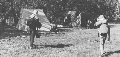
RECREATION PLANS
The Omaha Indian Reservation offers an especially attractive opportunity to provide outdoor recreation for regional needs which can also improve the tribal economy. The Omaha Tribe played an important role in the Lewis and Clark Expedition and a major role in the history of the region which can be presented to the public in interpretative displays and programs.
The Omaha Reservation is ideally suited and situated for outdoor recreation use. It lies in one of the few areas along the Missouri River that contains rolling, wooded, scenic terrain close to the river which is untouched by man-made developments. Fishing, water sports, and historic and archeologic interpretation would be made available without impairing the natural beauty, of the setting. With proper financing, planning, and management, the contribution of the reservation to the recreation resources of the Lewis and Clark Trail could be invaluable.
A Development Plan for the Omaha Reservation has been prepared with the assistance of the Aberdeen Regional Office of the Bureau of Indian Affairs. Portions of the plan have been initiated.
The Aberdeen office also has undertaken an ambitious long-range plan to guide the development of non-commercial and commercial recreation on several other reservations under its jurisdiction. Three reservations in Nebraska, the Winnebago, Ponca, and Santee, are included in the program. The plan is designed to establish policies, principles, and procedures which will develop sound recreation planning to meet the needs of the various tribes and the recreation demands of non-Indians.
In establishing the regional recreation plan, the Bureau of Indian Affairs is stressing the advantages of tying the recreation aspects of the reservations to a collective regional recreation unit. Such a collective arrangement would increase purchasing power and permit adequate advertisement, merchandising, promotion, and overall professional management of the various recreational complexes.
A recreation development plan for additional areas along the Missouri River is being prepared by the Omaha District Office of the Corps of Engineers. This report, to be entitled "A Preliminary Recreation Master Plan for the Missouri River, Rulo, Nebraska, to Sioux City, Iowa," is due for completion in the near future. It will be a companion to a similar report for the Missouri River from Rulo, Nebraska, to St. Louis, Missouri, published in March 1964 by the Corps of Engineers.
The Corps' plan will call for the creation of numerous small public-use recreation areas along alternate banks of the Missouri River. In the first report, these public-use recreation areas were selected in the vicinity of the Lewis and Clark campsites of 1804. In many cases in Nebraska, locating or marking actual campsites is impossible. In such instances, the plan calls for erecting appropriate markers in nearby public use areas. Each area would be provided with an access road, parking, camping spaces, water, and sanitary facilities. Boat ramps and group shelters also would be provided in most instances.
The city of Omaha has initiated a program to acquire and develop a 1,000-acre park which would include five to six miles of Missouri River frontage just east of the present levee surrounding Eppley Airfield. In the vicinity of the park is the Expedition campsite of July 27, 1804. The proposal is set forth by the Omaha Chamber of Commerce, Park and Recreation Committee, in a publication entitled "A Proposed River Park for Metropolitan Omaha."
SPECIAL PROBLEMS
1. The State Boundary
A long-standing boundary dispute between Nebraska and Iowa has been a serious handicap to the development of the Missouri River's recreation potential in both States. Failure to compromise on a new State boundary based upon the new stabilized channel of the river has resulted in a legal problem that has severely retarded recreation expansion.
Historically, the boundary between Nebraska and Iowa has been the center of the channel of the Missouri River. Because of the natural changes in the channel and further alterations occurring from channel stabilization by the Corps of Engineers, the river no longer follows the old river bed. Thus a redefinition of the States' boundary became necessary.
In 1943, Nebraska and Iowa compromised on a new boundary and defined it to be the center of the channel as shown on certain alluvial plain maps of the Missouri River. Since the second World War, additional channel work has been required. As a result, some 40 miles of the river now lie wholly within the State of Nebraska because the State boundary did not change with the location of the new channel and the new channel does not follow the maps adopted in the 1943 compromise. Moreover, several thousand acres of land and water thus legally within the State of Nebraska lie east of the channel, while certain Iowa lands and waters lie west of the new channel.
Much of the affected land has high recreation potential. Some areas are oxbows, cut off by the channel work. Including both Iowa and Nebraska lands, they generally lie east of the channel. If Iowa were to develop these oxbows for recreation, the State's funds would be expended for development that mainly would benefit citizens of Nebraska. The Nebraska legislature, however, has not authorized use of the power of eminent domain to acquire any of these areas through condemnation. Moreover, where an oxbow is cut off from the river, a Nebraska resident would have to enter the area over Iowa ground, creating problems in wildlife law enforcement. Reciprocal fishing regulations have been established, however, that are satisfactory to both Nebraska and Iowa. To resolve the boundary dispute members of the Nebraska legislature have been appointed to a committee to meet with a similar committee in Iowa to work out mutually acceptable solutions. Both committees have recommended to their respective legislatures that the boundary between the States be established at the median line, or middle of the Missouri River, as it is now stabilized by the Corps of Engineers, and that the boundary remain the middle of the stabilized channel, as determined by any future changes through channelization work.
The Governors of Nebraska and Iowa have concurred in the above recommendations and have asked their respective legislatures for affirmative action. Neither legislature has accepted the recommendations.
2. Land Ownership Laws
A difference in land ownership laws in Iowa and Nebraska poses complex problems concerning public acquisition and recreation improvements in certain areas. Lack of information on exact ownership boundaries prevents both Iowa and Nebraska from acquiring lands needed for access to water or for shoreline development.
In Nebraska the law provides that riparian owners have title to the bed of the river to the center of the channel, or to the described boundary line, whichever the case may be. Thus, all lands in a proposed project area lying west of the Iowa boundary but east of the new channel are in Nebraska and owned privately. If the State of Iowa were to purchase such land for project improvements, it would mean that Iowa would own lands in another State.
In Iowa all lands below the mean high-water mark and the center of the channel, or described boundary line, are State property. Thus it is conceivable that Iowa could sell lands to Nebraska owners that lie west of the new channel. Islands and meandered streams also are held to be the property of the State of Iowa. Private individuals, however, have contested the right of the State to own bottom lands under this law and have brought the State of Iowa to court tests. In at least one decision, the courts have declared islands to be State owned. Settlement of title to such lands involves the slow, but necessary, actions of the courts.
3. Pollution of the Missouri River
Pollution, an historic problem of the Missouri River, remains an important barrier to recreation use of this great waterway. The dumping of sewage wastes, especially paunch manure from the Omaha packing industry, continues, although Federal and State laws are attempting to curtail such actions.

RECOMMENDATIONS
A basic development program for the historic, wildlife, and recreation resources along the Lewis and Clark has been outlined on page 20 in the Recommended Program. The recommended routing of a Lewis and Clark Trail Highway in Nebraska is indicated on maps 4-7. Specific recommendations relating only to Nebraska follow:
1. The more important sites along the Missouri River associated with the Lewis and Clark Expedition should be protected and interpreted for public use; appropriate sites should be accorded National Historic Landmark status.
2. Recreation features of the Omaha Reservation Development Plan should be completed as promptly as possible.
3. The regional recreation plan for the Indian reservations should include appropriate recreation, historic, and archeologic sites which can be identified with the Lewis and Clark Trail.
4. Completion of the recreation development plans of the Corps of Engineers for the Missouri River from Rulo, Nebraska, to Sioux City, Iowa, should be expedited. Insofar as possible, Lewis and Clark Expedition campsites should be chosen for protection, interpretation, and development for public use and enjoyment. State and local agencies able to participate in the development program should be prepared to give prompt attention to the proposals.
5. The long-time boundary dispute between Nebraska and Iowa should be resolved through the joint acceptance of the inter state commissions' recommendations by the Iowa and Nebraska legislatures.
6. The Nebraska and Iowa Interstate Boundary Commissions should study the problems arising from the differences in state land ownership laws and present recommendations for legislative action to make the respective legal changes necessary to resolve these problems.

7. Pending the resolution of legal complications, the numerous islands in the Missouri River flood plain which possess possibilities for recreation development should be preserved and protected in their primeval state. Their permanent management in the public interest should be planned as soon as possible.
8. Because future channel work will cut off many oxbows that possess high potential as public recreation areas; efforts should be made to protect these oxbows from sand-carrying river flows by the strategic placement of impervious levees at their upper or lower ends, or both.
9. The proposed river park for metropolitan Omaha should be given early and serious consideration.
10. Consideration should be given to the development of Dodge Park, along the Trail in Omaha.
SOUTH DAKOTA

SUMMARY
The route of Lewis and Clark through South Dakota has been dramatically transformed into a string of giant reservoirs referred to as the Great Lakes of South Dakota. These huge impoundments have harnessed the river, eliminating the unpredictable floods that were long a menace to this section of the river valley. Water backed up by this series of dams already has inundated most of the Missouri River bottomlands of South Dakota, covering many historical locales and thousands of acres of prime wildlife habitat.
The Lewis and Clark Expedition travelled through the South Dakota area on its outward journey and on its return. Going west, the Expedition spent 53 days here. Exactly two years later, and home-ward-bound the Expedition reentered the area. Only fourteen days were spent here as they hurried past the troublesome Teton Sioux on their way to St. Louis. The visitor to South Dakota can still visit some of the sites described in the Lewis and Clark journals.
Total visitors to the Great Lakes of South Dakota number nearly 2.5 million annually; completion of the road system is expected to raise the annual visitation figures to 10 million. The number of tourists in South Dakota now is estimated at approximately four million. By 1970 the tourists volume is expected to be between five and six million people annually and tourists expenditures are expected to reach $700 million.
South Dakota has a great deal to offer the vacationing tourist as well as the State resident. The most attractive area naturally is the Great Lakes of South Dakota and intervening stretches of the Missouri, for water-based recreation is always appealing. Facilities now available are patronized well at present and the trend is toward even greater use. Along the Lewis and Clark Expedition route in South Dakota are 135 recreation sites totaling 22,809 acres. Of this number 90 sites are now available for use. The rest are proposed for development by various State and Federal Agencies.
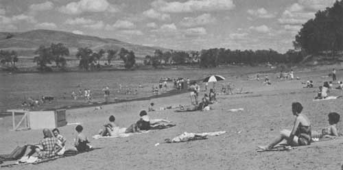
A 10-year program to provide road access to the Missouri River reservoir shoreline has been developed and construction has begun. This program will include scenic routes down both sides of the reservoirs, as well as access routes to the recreation areas. With the completion of this road network and the continued development of recreation facilities, the Great Lakes of South Dakota easily will constitute the most extensive water-based recreation portion of the entire Lewis and Clark Trail.
Although South Dakota has much to offer the visitor interested in historic and archeologic sites and other recreation attractions, more facilities are needed. Implementation of the plans prepared by several State and Federal agencies for the development of recreation areas along the reservoirs should go a long way toward meeting these needs.

BACKGROUND
The Lewis and Clark Expedition had been on the river exactly three months when they entered the South Dakota area. The first camp on August 21, 1804, was approximately four miles above the Big Sioux River but on the Nebraska side.
The next day, Captain Lewis became ill after closely examining the minerals in Nicollet's Dixon Bluffs. He "was near being poisoned" when he smelled the fumes of the minerals. He identified them as alum, copperas (ferrous sulfate), cobalt, pyrite. From this experience came the theory that these minerals might have caused the men's stomach disorders suffered since the party had passed the Big Sioux River.
The next day the Expedition camped at Elkpoint, so named because of the elk found there. On August 23 the first buffalo was killed near camp and two barrels of meat were salted. The following day the discovery of a bluff "too hot for a man to bury his hand in the earth at any depth," and buffaloberries, which made "delightful tarts," was noted in the journals.
Lewis and Clark made a side trip, while in this vicinity, to see for themselves a mound which was regarded with awe by all the nearby Indian tribes. It is known as "Spirit Mound," located in present-day Clay County. The Indians believed the mound to be inhabited by little devils in human form about 18 inches high, with large heads, and armed with sharp arrows. After a tortuous walk in excessive heat, the exploring party reached the mound and climbed it. On it they found only a "multitude" of birds, to which they ascribed the Indians' superstition. Heat and thirst forced them from the hill about 1:00 p.m. The next day, August 26, they obtained several elk and deer, "jurked" the meat, and wove a new tow rope from the hides. Camp was made at Audubon's Point and the prairie set on fire as a signal for the Sioux to come to the river.
Upon passing the James River, the Expedition made its first contact with the Sioux. Sergeant Pryor went up the James to the Yankton Sioux village and returned with five chiefs and 70 men and boys. On August 28, they started a four-day stay at Calumet Bluff, where they erected a flag pole. The next day, under a large oak tree near the flag, a council was held at which Captain Lewis delivered a speech and gave presents to the Indians.
The chief received a richly laced uniform coat of the United States Artillery, with a cocked hat and red feather. The peace pipe was smoked and the chiefs retired to divide their presents. The following day, the grand Chief Shakehand spoke at some length, approving what Captain Lewis had said and promising to make peace with the Oto-Missouri Indians. The chief remarked that white men so far had given him only medals and very little clothing, and he desired something for his women and children, who had no clothing.
Many of the lesser chiefs also spoke, describing the distress of the Nation and begging for pity and for traders to be sent them. They wanted powder and ball and a supply of their great father's "milk," later to be called "firewater" by the red man. The journals for the days spent at Calumet Bluff (very possibly a part of Gavins Point Dam) contain many interesting comments. The Indians were described as "stout, bold-looking people. The young men hansom and well made—verry much deckerated with paints, porcupine quills and feathers, large leagins and mockersons, all with buffalo roabes of different colours; squars ware peticoats and a white buffalo roabe."
By September 1 the Expedition had arrived at Bon Homme Island. There they discovered and mapped some ancient works known today to be water-made sand dikes.
"The Tower," a famous landmark, was reached on September 7, and the day was spent in carrying water from the river to drown out a prairie dog for a "specimen."
On September 8 the Expedition passed the Trudeau or Pawnee House, built in 1795, and Fort Randall site, camping on Big Cedar Island. The next day, on a hill to the south, the 45-foot backbone of a fish was found in a perfect state of petrification. These petrified bones later were determined to be the tail of a plesiosaurus; the relic eventually was placed in the Smithsonian Institution in Washington, D.C.
On September 11 George Shannon rejoined the party after having been missing since August 28. He had been sent out in search of two horses, and had been following the bank of the river ahead of the party for 16 days.
On September 14 the southern shore was searched all day, in vain, to find an ancient volcano which the captains had heard at St. Charles was somewhere in the neighborhood. This "volcano" was in reality a burning bluff; it is located near Wheeler Bridge.
The mouth of the White River was reached on September 15. Here Captain Clark saw and shot his first antelope. On September 16 and 17 the Expedition paused in Pleasant Camp near American Crow Creek, to rest and recuperate.
On September 19 favorable winds carried the group past the "Three Rivers of the Sioux"—Crow, Elm, and Campbell Creeks—and on to the gorge at Big Bend. The following night a near disaster occurred for the Expedition when the bank beneath which the men were sleeping caved in and nearly swamped the boats. On September 21 the Expedition passed the trading post of Registre Loisel, the only white man for hundreds of miles around, and camped at Chapelle Creek.
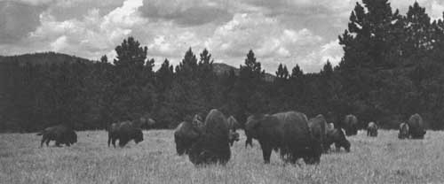
On September 23 three boys of the Teton Sioux Nation swam the river and informed the party that two groups of Sioux were camped on the next river. The following day, camp was made on an island in the river, 70 yards out from the mouth of Bad River near the present site of Pierre. At noon the next day the party met on shore with the Indians. The captains gave the Indians one-fourth of a glass of whiskey apiece. They grew very insolent. The chief, Black Buffalo, ordered his men to hold the pirogue and one leaped on board and hugged the mast. The Indians jostled Clark and he drew his sword and signaled the larger boat to ready its small cannon. At this show of force, Black Buffalo called off his men. Clark then rejoined Lewis and the Expedition continued up the river. On succeeding days council was held with the Indians not far below the present Oahe Dam.
On October 8 the Expedition passed the Grand River and reached the Arikara villages, located about eight miles due east of present Wakpala. Here some time was spent with the Indians in council and gifts and food were exchanged. On October 13 a small creek on the south was named Tocasse (now Kunktapa) in honor of the chief of the second Arikara village.
John Newman was tried in October 14, found guilty of "mutinous expression," and sentenced to 75 lashes. A nine-man court of privates pronounced the sentence. The party halted on a sand bar and after dinner the sentence was executed. Newman was discharged as a member of the permanent party and sent back to St. Louis in the spring of 1805. This was the first judicial punishment carried out in what is now the State of South Dakota and perhaps the first and last legal flogging. The next day, October 15, the Expedition entered what is now the State of North Dakota.
On August 21, 1806, just two years after Lewis and Clark first entered South Dakota at the Big Sioux River, they again entered the State on their return journey. Two days were spent at the Arikara villages; food supplies were down, so corn was bought there. The men now depended almost entirely on hunting for their food.
Proceeding down river, the Expedition camped on sand bars and hurried by the troublesome Tetons. The captains found the flag pole at Calumet Bluff still up. They passed a trading post on the James River that a Robert McClellan had erected and abandoned in the time they had been in the West.
At 11:00 a.m. on September 4, 1806, the Expedition left what is now South Dakota. Fifty-four days had been spent there, outward bound, and 14 days on the return trip.
The Expedition had crossed South Dakota by the most obvious and practical route, the Missouri River, which meanders down the center of the State through rolling prairie land.
Long before Lewis and Clark, the Verendrye brothers, first known white men to visit South Dakota (1743), had envisioned that the river would lead them across the vast unknown to a western sea. After Lewis and Clark disproved this myth, the beaver trappers came by the hundreds in keel boats, pirogues, and dugout canoes and established trading posts along the river banks. South Dakota was much involved in the fur trade on the upper Missouri. The trade in wild furs, especially beaver and buffalo, lasted some 40 years.
Later came the steamboats that carried thousands of emigrants to the newly opened Northwest Territory. The "canoes that walked on the water" navigated the river as far as Fort Benton, Montana. Later the Missouri River became the highway for thousands of gold seekers headed for the gold fields of Montana, Idaho, and the Black Hills. Today the fabled route of Lewis and Clark in South Dakota has been transformed into the Nation's longest chain of lakes, formed by four giant dams across the Missouri River.
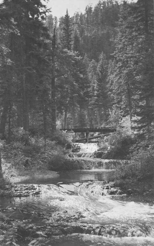
FINDINGS
RECREATION RESOURCES
The route of Lewis and Clark through South Dakota via the Missouri River abounds with a rich array of historic sites and affords an outstanding potential for outdoor recreation. The visitor will find that several of the sites described by Lewis and Clark can still be observed. Nicollet's Dixon Bluffs, where Captain Lewis became ill, are just across the Nebraska-South Dakota border. Spirit Mound, mentioned in detail in the journals, is located in Clay County.
Other sites which can be visited have been altered considerably since 1804-06. Calumet Bluff, the scene of a four-day council with the Indians, is now a part of Gavins Point Dam. The city of Pierre now stands where a near fatal clash with the Teton Sioux almost caused the loss of the entire Expedition.
Although the famous Indian-woman guide of the Expedition, Sacagawea (also spelled Sacajawea and Sakakawea), did not join the explorers until they reached North Dakota, a suitable marker to the bird-woman has been erected on U.S. Highway 12, on a hilltop west of the Missouri River near Mobridge, South Dakota.
Just three miles west of Mobridge is the grave of Sitting Bull. The famous Sioux leader was killed near there in 1890. An appropriate marker interprets the burial site.
Tourists following the Lewis and Clark Expedition route through South Dakota may visit six Indian reservations—Yankton, Rosebud, Lower Brule, and Crow Creek, all lying south of Pierre; and Cheyenne River and Standing Rock, north of Pierre. Ancestors of the present Indians held councils with Lewis and Clark. The South Dakota Historical Society, with the assistance of private contributions, has erected many historic markers throughout the State in a graphic and appealing manner. Although a few historic and archeologic sites along the Missouri have been marked and developed, the Historical Society, lacking sufficient funds and authority, has been unable to develop many of the sites which have not been inundated by the reservoirs.
Some prehistoric Indian sites have been approved for Registered National Historic Landmark status by the Department of the Interior. These include: The Arzberger site, near Pierre; Fort Thompson Mounds, near Fort Thompson; Crow Creek site, on Fort Randall Reservoir; Langdeau site, near Big Bend; and Malstad Village near Mobridge.
Recreation opportunities are many and varied. Tourists and residents alike are drawn to the many excellent natural fishing lakes, the Great Lakes created by impoundment of the Missouri River, the National Monuments, and National and State parks and forests throughout the State. South Dakota is internationally famous as the pheasant capital of the Nation. Hunters from distant States and Canada harvest some three million ringnecks annually. Excellent upland game hunting is found in many counties along the river valley; deer are hunted along the river bottom and pronghorn antelope are harvested through restrictive management procedures along the plains adjacent to the river. Waterfowl hunting is a major fall outdoor pursuit.
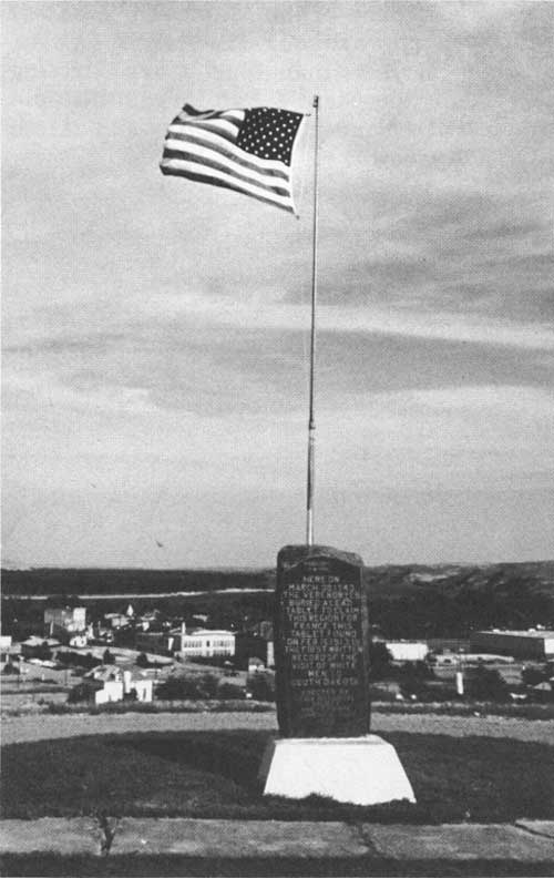 The Missouri River shows as a slim thread in the background when viewed from the Verendrye Monument situated on a hill overlooking Pierre, S. D. |
There are two National Wildlife Refuges along the Trail in South Dakota. The Lake Andes Refuge is located at Lake Andes, six miles north of the Fort Randall Dam. Pocasse National Wildlife Refuge is located near Pollock, a few miles south of the North Dakota State line. These refuges provide opportunities for wildlife observation, photography, sightseeing, interpretive programs, fishing and hunting, picnicking, swimming, and boating. New recreation regulations have been promulgated by the Department of the Interior permitting wider use of National refuges and other Federal wildlife conservation areas where it is compatible with the primary conservation purpose of an area.
The "Great Lakes of South Dakota" form an important asset to this plains State. They provide water for electrical power, irrigation, and downstream navigation, and are creating one of the Midwest's greatest water sports areas. The lakes can be reached in less than four hours' driving time from the State's two largest cities—Sioux Falls and Rapid City—and from Sioux City, Iowa.
Beginning at the Nebraska-South Dakota State line is Gavins Point Dam at Yankton, completed in 1957, impounding a lake 37 miles long and appropriately called Lewis and Clark Lake. Just upstream is Fort Randall Dam at Pickstown, completed in 1956 and forming a 140-mile-long reservoir. At the upper extremity of this reservoir, Big Bend Dam is under construction at Fort Thompson; it is scheduled for completion in 1966. Big Bend will make a lake 80 miles long, reaching almost to Pierre. Just upstream from Pierre is Oahe Reservoir, completed in 1963, which creates a reservoir 250 miles long. These lakes provide a shoreline almost as long as our Pacific coast, and impound some 1,000 square miles of water.
Recreation use of these reservoirs includes motorboating, sailing, swimming, water skiing, skin diving, and excursion-boat tours to what remains of the historic sites. Thirty-three varieties of fish are caught in their waters, providing some of the finest lake fishing in America. Motels, campsites, and other recreation areas are within easy access of the lakes.
An inventory of historic, wildlife, and other recreation sites revealed a total of 135 sites within about 25 miles of the Lewis and Clark Trail in South Dakota. Ninety are existing and 45 are proposed. Forty-six existing areas provide water-based recreation and 29 additional water-based recreation areas are proposed for development by State and Federal agencies on the Missouri River. The total amount of land and water included within the recreation sites is 22,809 acres. All forms of water-oriented recreation, and camping, picnicking, hunting, hiking, horseback riding, sightseeing, and nature study are provided. A detailed list of existing and proposed points of recreation and historic interest along the Trail and pertinent information concerning each are found in the tables on pages 132 to 138.

RECREATION TRENDS
Tourism is important in South Dakota. The State's tourist volume rose from 1.2 million in 1946 to 2.3 million in 1955, with tourist expenditures rising during this same period from $66 to $90 million. The number of tourists now is estimated at approximately four million. Each stays within the State an average of just over four days and they spend an estimated $150 million annually. By 1970 the South Dakota Industrial Development Expansion Agency predicts a tourist volume of 5-6 million people annually, with an average stay of 6-8 days and an expenditure of $700 million.
Recreation use of Bureau of Reclamation projects increased from 644,732 visitor days in 1958 to 1,031,000 visitor days in 1963. On Corps of Engineers projects, visitor days increased from 2,017,000 in 1958 to 2,417,000 in 1963. Visitor days for the State recreation areas from 1958 to 1962 has steadily climbed from 3,806 to 5,235.
Transient users are playing a prominent role in South Dakota's outdoor recreation, far overshadowing the local users. In 1962 the Bureau of Reclamation reported that 79 percent of the recreation utilization on its projects in South Dakota came from other than local users.
The increasing population of South Dakota will place a greater demand on recreation facilities. The 1964 population of South Dakota was approximately 682,000. The projected population is 796,000 for 1976 and 1,083,000 for the year 2000.
South Dakota is traversed by considerable traffic bound for the Northwestern section of the United States and such population centers as Minneapolis, St. Paul, and Chicago. The State will shortly be crossed by two Interstate highways. Northbound traffic from Kansas City, Omaha, Council Bluffs, and Sioux City will enter the State on Interstate 29, and westbound traffic will enter near Sioux Falls on Interstate 90.
The annual average 24-hour daily traffic flows give some indication of the potential recreation demand. A major tourist traffic route spanning the State is the east-west U.S. 16, which will later be replaced by Interstate 90. From Sioux Falls to Rapid City, this highway carries an annual 24-hour average traffic flow of approximately 1,800-2,500 vehicles. Approximately 250-300 of these vehicles constitute commercial traffic. The next most heavily traveled east-west through highway is U.S. 14, with a total traffic volume between 1,300 and 1,400 and a commercial volume of less than 200. U.S. 12, which crosses the Missouri River near Mobridge, carries a total traffic flow between 1,000 and 1,100 vehicles.
An important north-south through highway, in the vicinity of the Missouri River, is U.S. 83, which carries a traffic volume averaging between 500 and 800 vehicles. State Highway 50 follows the Missouri River from Vermillion to Yankton and finally to Chamberlain. Its volume is quite heavy to Fort Randall Dam, where it drops off sharply, with the traffic flow continuing east on U.S. 18. Interstate 29, between Sioux City, Iowa, and Sioux Falls, South Dakota, carries a total traffic flow in excess of 2,000 vehicles per 24-hour period.

RECREATION PLANS
Important to the historic and recreation enhancement of the Trail are the six Indian reservations which lie along the route of the Expedition through South Dakota. These reservations and the various tribes have played a vital role in the history of this region and the Expedition itself. The Yankton Indian Reservation in Charles Mix County, for example, has many historic sites associated with the Lewis and Clark Expedition. The Expedition camped on what is now the Yankton Reservation on September 5, 6, and 10, 1804, and on August 30, 1806. Plans for development of recreation facilities on Indian lands bordering the Trail are under way.
The Aberdeen Regional Office of the Bureau of Indian Affairs has undertaken a long-range plan to guide noncommercial and commercial recreation development on the reservations under its jurisdiction. The objective of this plan is to establish policy, principles, and procedures that will develop sound recreation planning to meet both the needs of the various tribes and the recreation demands of the non-Indian. The plan will stress the advantages of tying the recreation aspects of the reservations to a collective regional recreation unit. Such collective arrangement has the advantage of added purchasing power, advertisement, merchandising, promotion, and overall professional management of the various recreation complexes.
The National Park Service, at the request of the Cheyenne River Sioux tribe, has developed a general recreation development plan for an area adjacent to the western termination of the bridge carrying U.S. Highway 212 across Oahe Reservoir. Detailed plans for the financing, development, and construction will be undertaken shortly. The area is already a popular fishing spot, despite a lack of basic recreation facilities.

A large recreation complex is proposed near Big Bend Dam. The plan, prepared by Harland and Bartholomew and Associates, proposes an investment of over $2 million in the Councilor Creek Bay Area. A motel, marina, restaurant, home sites, and several hunting areas on the Lower Brule and Crow Creek Reservations are included. Consideration was also given to preservation and development of historic and archeologic sites and an interpretive program for tourists within the reservations. Plans call for the two tribes to form a joint corporation or enterprise to carry out this project. This development could well become one of the major recreation attractions along the Lewis and Clark Trail in this area.
To meet the pressing problem of dwindling unspoiled recreation resources and the mounting need of residents and tourists alike, the State Game, Fish, and Parks Department has undertaken a 20-year land-acquisition program.
The whole composition and complexion of recreation use on the "Great Lakes" will be intensified by the completion of a perimeter road system. A 10-year, 1,000-mile road program to open the extensive shoreline of the lakes is now under construction. The system will include scenic routes down both sides of the reservoirs, plus access roads to all recreation areas. These perimeter highways and access roads will open up vast areas to recreation and business development and greatly increase the State's tourist volume.
The Corps of Engineers has developed extensive plans for public-use recreation areas along the reservoirs in their recreation master plans. Data concerning proposed and existing sites are included in the inventory and the locations are shown on the maps accompanying this report.
RECOMMENDATIONS
A development program for the historic, wildlife, and recreation resources along the Lewis and Clark Trail appears in the Recommended Program, page 20. The recommended routing of a Lewis and Clark Trail Highway in South Dakota is indicated on maps 6-9. Recommendations relating specifically to South Dakota follow:
1. Additional camping, boating, fishing, and swimming facilities should be developed below the Fort Randall Dam.
2. The regional recreation plan for the Indian reservations prepared by the Bureau of Indian Affairs should include recreation, historic, and archeologic sites which can be identified with the Lewis and Clark Expedition route.
3. Preparation of detailed plans for the financing, development, and construction of a recreation area on the Cheyenne River Reservation should be completed as soon as possible.
4. Plans for a recreation complex near Big Bend Dam on the Lower Brule and Crow Creek Reservations should include historic, and archeologic sites which can be identified with the Lewis and Clark Expedition route.

5. The State Game, Fish, and Parks Department should make a concerted effort to develop recreation sites along the Lewis and Clark Trail.
6. The 10-year, 1,000-mile perimeter road system on the "Great Lakes"should be completed as promptly as possible.
7. Roadside parks and overnight facilities should be developed along the "Great Lakes" perimeter road system by the agencies involved.
8. Plans of the Corps of Engineers for public-use recreation areas around the reservoirs should be implemented as soon as possible, giving priority to those sites associated with the Lewis and Clark Expedition.
9. The already existing Bureau of Outdoor Recreation Technical Coordination Committee should form the nucleus of the State Lewis and Clark Trail Committee and should undertake the development of an educational program for the Lewis and Clark Trail in South Dakota.
NORTH DAKOTA

SUMMARY
North Dakota's history teems with events connected with the opening of the Northwest. Here Lewis and Clark spent the winter of 1804-05, their longest sojourn in any of the future States, and built Fort Mandan north of present-day Bismarck. Here Sacagawea and her husband, Charbonneau, joined the Expedition. Military forts later were set up along this section of the Missouri. The fur-trade flourished here for over 40 years. Mandan Indian villages were located along this reach of river and its tributaries, providing Lewis and Clark with abundant opportunity to study the way of life of the American Indian, one of the specific tasks assigned to the Expedition.
Traces of North Dakota's historic past may still be discerned along the Missouri. Although the waters of Oahe Reservoir and of 200-mile-long Garrison Reservoir have destroyed many historic sites, interested people still may visit the site of Fort Mandan where the Expedition wintered and the ruins or sites of numerous Indian villages described by Lewis and Clark in their journals. Military forts, and fur trading posts are also found along the Trail. The Indian tribes which played such a prominent role in the history of this area are represented by their descendants, now mostly on reservations in the State. Two of these—Standing Rock and Fort Berthold—lie along the Trail.
A study of North Dakota's recreation potential shows that it is great, but far from being fully developed. Water-based recreation particularly shows promise: Garrison Reservoir alone offers some 1,500 miles of shoreline. The section of the Missouri extending south of the reservoir as far as Bismarck presents the longest single section of Missouri River bottom land in the Dakotas which is still in its original natural state.
Many types of water-based recreation can be enjoyed in this State. Waterfowl hunting is second to none in the Nation, for North Dakota leads in waterfowl production. Fishing, too, is outstanding here. Boating and related activities on Garrison Reservoir are excellent. These possibilities, combined with the historic, geologic, and archeologic points of interest, make the recreation picture an attractive one.

Within about 25 miles of the Lewis and Clark Trail in North Dakota 77 recreation sites exist and 22 more are proposed. Many provide water-based recreation. Several of the sites proposed for development by State and Federal agencies are on the Missouri River and its reservoirs. The total area of land and water within the 99 sites is over 72,000 acres.
Existing recreation facilities in North Dakota are well used. Attendance at North Dakota's State parks has nearly doubled during the past decade, and all attendance records for State and Federal recreation areas show a steady and continual increase.
Even more use of the State's recreation facilities is expected when the new highways begin to function. Interstate Highway 94 will channel considerable out-of-State traffic to the vicinity of the Trail from the east (the Minneapolis-St. Paul region) and from the west (Billings and other urban areas of Montana). This new highway undoubtedly will receive heavy use both from the Fargo area and from traffic diverted westward from Interstate 29, funnelling it toward the Lewis and Clark area. Perimeter road networks at Garrison and Oahe Reservoirs will help to guide people to recreation areas along the Trail if proper markers and directional information are provided.
Considerable efforts are being made to establish additional recreation areas and to meet the increased future use of areas along the Missouri River. Spearheading these efforts are the North Dakota State Historical Society, North Dakota Game and Fish Department, Corps of Engineers, and Bureau of Indian Affairs.
The recommended routing of a Lewis and Clark Highway in North Dakota is indicated on maps 9-12. Future development of recreation areas should include the Corps of Engineers' comprehensive plans for the Garrison and Oahe Reservoirs, and the Bureau of Indian Affairs' regional recreation plan for the Indian reservations.
 Minnaterree Village. formerly located northwest of present-day Bismarck, N.D., as portrayed by George Catlin. |
BACKGROUND
The Lewis and Clark Expedition spent more time in North Dakota than in any other State through which it passed. Going west it entered the State on October 14, 1804, and departed on April 27, 1805. Homeward bound in August 1806, the Expedition spent only 10 days there.
The outward bound Expedition encountered great numbers of antelope along the banks of the river on its second day in the area. On October 18 the group reached the mouth of Cannonball River. The next day, in what is now Burleigh County, some 52 herds of buffalo and three herds of elk were counted in a single view. The captains also met several traders, mostly Frenchmen, along the upper stretches of the river.
The men continued upstream, observing deserted Mandan villages and making increasingly frequent contacts with the Indians. On October 29 Clark wrote, "After brackfust, we were visited by the old cheaf of the Big Bellies—this man was old and had transfired his power to his sun." On the same day members of the crew narrowly escaped a prairie fire which killed and burned several Indians.
On October 30 Lewis and Clark began to search for a wintering site near the villages of the Mandans, who agreed to provide the Expedition with corn as long as the supply held out. The site was found on November 2; it was four miles below the villages and six miles below Knife River, and was well supplied with wood for building houses and the fort. The location was "situated in a point of low ground, on the north side of the Missouri, covered with tall and heavy cottonwood." The next day the building began.
During the winter at Fort Mandan the captains frequently counselled with the Indians to obtain information about the country before them. Although the mercury occasionally dropped to minus 40°, adding frost bite to the men's problems, the crew prepared equipment and bargained for corn and foodstuffs for their trip up the river in the spring. During late winter the Expedition members made several dugout canoes from the large cottonwoods along the river bottom.
Several interpreters were hired. Among them was a half-breed named Charbonneau who requested that Sacagawea, one of his young wives, accompany him. Since she was a Shoshone Indian, the captains felt she would be valuable as an interpreter and agreed to the proposal.
During the latter part of March, the ice began to break up on the river. On April 5 the party began loading the boats and preparing to continue their journey to the coast.
While preparations were being made to continue upstream, the keelboat was loaded with plant and animal specimens, skins, skeletons, articles of Indian apparel, tobacco seed, and several cages of live animals. On April 7 the keelboat with 10 men left Fort Mandan and headed downstream for St. Louis. Only the best men were retained for the remainder of the journey. The unreliable had been weeded out and returned with the keelboat.
That same day the 33-person Expedition set out upstream from Fort Mandan aboard six canoes and two pirogues. On the morning of April 8 the Expedition passed the Knife River and on April 26 it reached the junction of the Missouri and Yellowstone Rivers. The next day it left what is now North Dakota.
The Expedition's return trip through North Dakota in August 1806 was a hurried one. The two captains who had separated west of the Continental Divide, joined forces at a point not far from Sanish (near New Town), now under the Garrison Reservoir. A stop was made at the Mandan villages north of Bismarck. Here the Mandan chief, Big White, joined the party to make a visit to the Great Father in the United States.
 Slant Village, once home of the Mandan Indians near Mandan, N.D., now restored as a historical attraction along the Lewis and Clark Trail. |
FINDINGS
RECREATION RESOURCES
North Dakota possesses extensive natural resources which have great recreation potential but which are only partly developed. Contrasts in terrain abound. Bordering the State on the east is the Red River and the rich, rolling flatlands of its valley. The Missouri valley dominates the western half of the State. There the land has been deeply eroded to form the canyons and buttes of the Badlands.
Lewis and Clark followed the meandering Missouri River all the way across what is now the State of North Dakota, a distance of about 320 miles. Although much of the river has changed since 1804-06, the visitor to North Dakota may still view sites described by Lewis and Clark. The site of Fort Mandan where the Expedition spent the winter of 1804-05 is located about 60 miles north of Bismarck, and 14 miles west of Washburn. Fort Mandan was abandoned when the Expedition left for the west coast and the buildings were destroyed by the Sioux in 1805. The fort site itself has been washed away; however there is a marker on a 30 acre site showing the former location of the fort. The area is maintained by the State Historical Society. Indian village sites, such as Double Ditch, Big Hidatsa, and Big White and Black Cat, may also be visited.
Near the mouth of Knife River, north of Stanton, are the remains of several large Hidatsa villages associated with Lewis and Clark's Expedition. The so-called Big Hidatsa village has been declared eligible for Registered National Historic Landmark status by the Secretary of the Interior. It is believed that it was at this village that Sacagawea and her husband, Charbonneau, resided before joining the Expedition. Sketches of this village were made by the famous artists, Catlin and Bodmer, in 1832-1833. The Minoken Indian village site near Minoken has also been declared eligible for Registered Historic Landmark Status.
On the extreme western edge of the State, near the confluence of the Yellowstone and Missouri Rivers, lies Fort Union, one of the major historic sites in North Dakota. An important hub of the American fur trade from 1828 to 1866, the fort also was associated with Indian affairs, steamboat navigation, and military activity of that period. Fort Union Trading Post was approved by the Advisory Board on National Parks, Historic Sites, Buildings, and Monuments in October 1962 as having National significance and status as a National Historic Site. Development of this Post as a National Historic Site has been proposed by the National Park Service. Another nearby historic site, Fort Buford, already has been developed by the State Historical Society and is now a park.
Although one of North Dakota's nicknames is the "Sioux State," the first Indian tribes in the State were the Mandans, who have left clear evidences of their gradual retreat up the Missouri River for modern-day explorers to observe. Other Indian tribes in the State at the time of the Expedition were the Hidatsa, Absaroka, Cheyenne, Assiniboin, Sioux, Arikara, Amahami, Cree, Ojibwa, and Chippewa. The State was carved from the territory occupied by these tribes through a series of Indian wars and military expeditions. No less than 10 military posts were established in North Dakota.
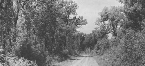
Today, four Indian reservations remain in the State. Two reservations—Standing Rock and Fort Berthold—are found along the Lewis and Clark Trail.
Many Expedition campsites and significant historical locales are within the reservations. With proper financing, planning, and management, the contribution of these reservations to the development of the Lewis and Clark Trail could be invaluable.
For many years the Missouri was the main thoroughfare in this area. From time immemorial the Indians' canoes floated on it. For over 40 years after the Louisiana Purchase in 1803 the fur traders carried on a flourishing business along its waters, taking advantage of the seemingly endless herds of buffalo and the abundant beaver. Now the river has been widened by dams which have backed up its waters to form Garrison Reservoir and the northern portion of Oahe Reservoir.
Although many historic and archeologic sites have been inundated by the two reservoirs, a considerable number can still be found along the river, some of which pertain to the Lewis and Clark Expedition. The 60-mile stretch of river from just below Bismarck north to Garrison Dam is especially valuable because it will remain much as it was when the Expedition passed through the area in 1804 and 1806.
Other areas are drastically changed. Fort Berthold Indian Agency was relocated and three towns—Sanish, Van Hook, and Elbowoods—were destroyed by the construction of Garrison Dam. Archeologists and historians of the Smithsonian Institution, National Park Service, and the State Historical Society accelerated their program of excavating Indian villages, army forts, trading posts, and other historic sites before inundation was complete.
In their place Garrison Reservoir has provided all forms of water-based recreation activities—fishing, swimming, water skiing, boating, camping—in a region which had been almost devoid of such facilities. With 1,500 miles of shoreline and 390,000 acres of water surface Garrison Dam and Reservoir attracted 340,800 visitors in 1960. Total annual attendance in 1963 topped a half million visitors.

North Dakota still produces an abundance of wild game and fish. It is the Nation's largest and most important waterfowl producing area, and duck and goose hunting is a popular fall sport. Excellent upland game-bird hunting, including pheasants, wild turkeys, and sharp-tailed grouse, is found along the rolling hills and plains of the Missouri River. White-tailed and mule deer also offer considerable sport in the river bottoms and the rough western portion of the State. Garrison Reservoir, the State's largest body of water, offers a wide variety of game fish, including northern pike, walleyes, sauger, rainbow trout, channel catfish, ling, perch, and crappies.
Both Federal and State agencies have active fish and wildlife programs along the Trail. The Federal Bureau of Sport Fisheries and Wildlife operates the 13,500 acre Snake Creek National Wildlife Refuge on an eastern arm of Garrison Reservoir and the Garrison Dam National Fish Hatchery. New regulations by the Department of Interior will increase the recreation value of National wildlife areas. The regulations permit more public recreation use of wildlife refuges, fish hatcheries, and other Federal wildlife conservation areas when it is compatible with the primary purpose of the area. The extent to which various types of outdoor recreation can be enjoyed is defined in the new regulations, as well as limitations for the collection of scientific specimens and artifacts.
The North Dakota Game and Fish Department has conducted a continuous program of wildlife management and habitat development on numerous selected areas within the Garrison Reservoir takeline. Most of this work has been concentrated on the lower end of the reservoir. Additional wildlife management areas have been continually added in recent years, and are providing good habitat protection to increasing wildlife populations. These State wildlife management areas are helping to replace, in part, the tremendous wildlife habitat losses that occurred with inundation of the river bottom lands. The wildlife production areas serve as public hunting and fishing areas and their annual use, despite the early stage of development in most cases, continues to increase. The areas all are owned by the Corps of Engineers and are leased for wildlife management purposes to the Game and Fish Department.
The public lands along the Trail, under the administration of the Bureau of Land Management, are remnant parcels—small in size, (approximately 40 acres) and are isolated from the major travel routes. The highest recreation use will be that of wildlife habitat and management. The Bureau's policy is to transfer to other land-managing agencies, such as the Game and Fish Department, those tracts having high public values. North Dakota is especially interested in the acquisition of the wetland tracts and transfers are presently being made to the State under the provisions of the Recreation and Public Purposes Act.
Other recreation opportunities are expanding. Picnicking, swimming, and horseback riding are favorites, and with the completion of Garrison Reservoir and other water development programs, water-based sports and camping increasingly are being enjoyed. Gem and mineral rock collectors can explore a wide variety of rock formations and deposits millions of years old.
The recreation facilities of the State are becoming a prime factor in the development of a healthy economy. More than 60 State parks and historic sites and numerous roadside parks offer day and overnight camping facilities.
An inventory of recreation, historic, and wildlife areas within about 25 miles of the Lewis and Clark Trail in North Dakota revealed some 77 existing and 22 proposed recreation sites. Forty sites provide water-based recreation and five additional water-based recreation areas are proposed for development by State and Federal agencies. The total area of land and water included within the 99 sites is over 72,000 acres. Facilities existing and to be developed provide opportunities for most forms of water-oriented recreation, and also for camping, picnicking, hunting, horseback riding, hiking, sightseeing, and nature study.
A detailed list of existing and proposed points of recreation and historic interest along the Trail, and pertinent information concerning each, are found in the tables on pages 140 to 144.

RECREATION TRENDS
Use of outdoor recreation facilities has been expanding rapidly in North Dakota. Out-of-State tourist expenditures already a prime factor in North Dakota's economy—have paralleled recreation visitation. From $34,800,000 in 1951 they increased to $40,000,000 in 1955 according to a report by the National Association of Travel Organizations. The 1964 estimate is $659,000,000.
The 1960 census showed 632,446 people living in North Dakota of which 409,738 were in rural areas. From 1950 to 1960, however, urbanized areas grew 35 percent. The 1964 population was estimated at 638,200. By 1976 the population is expected to reach 695,000 and by the year 2000, 890,000.
Attendance at North Dakota's State parks has increased from 405,000 in 1958 to 597,150 in 1963. From 1958 to 1963 the annual days of recreation use on Bureau of Reclamation projects in the State increased from 118,700 to 553,000 and on Corps of Engineers projects from 382,000 to 920,000. The National Park Service estimates that North Dakota's recreation areas will receive a minimum of 2,100,000 recreation days of use by 1980. Although the attendance figures for recreation sites along the Lewis and Clark Trail have not been separately identified in available reports, use at sites along the Missouri River is increasing even more rapidly than for the State as a whole because of the reservoirs. Future demand for recreation areas along the Lewis and Clark Trail will depend on the interest aroused in the Trail and on the quality of the effort made to identify, mark, and develop areas along the route.
The major east-west traffic route intersecting the Lewis and Clark Trail at Bismarck is U.S. Highway 10, later to become Interstate 94. Traffic flow at present is greatest on this highway, with a daily volume of approximately 2,500 vehicles. U.S. 83, entering North Dakota from Pierre, South Dakota, is the primary existing highway north and south along the Missouri River between the United States border and Garrison Reservoir. The daily traffic volume along this highway averages about 1,100-1,300 vehicles per 24-hour period. U.S. 85, bisecting the Trail in the far western section of the State, carries a traffic volume of less than 1,000 vehicles per day.
With the completion of Interstate 94, a direct connection will be established between two of North Dakota's largest cities, Bismarck, population 30,600, and Fargo, population 46,662. Interstate 94 will also channel west-bound traffic from the Minneapolis-St. Paul area and east-bound traffic from Billings and other cities in Montana to the Trail. Interstate 29, the main north-south highway in the Upper Midwest, will carry traffic between southern population centers and from Fargo and Grand Forks to the border, where it will tie in with a Canadian route to Winnipeg. Considerable traffic is expected to turn west off of Interstate 29 onto Interstate 94, and follow it to Bismarck and the Lewis and Clark Trail area. In addition, consideration is being given to a possible Prairie-lands Parkway from Oklahoma to North Dakota where it would tie in with the Lewis and Clark Trail.
Traffic volume will increase materially with the completion of Interstate 94 and the Garrison and Oahe Reservoir perimeter road networks. Recreation areas along this route will, in turn, receive greater use if proper markers and directional information are provided the motorists. Properly developed water-based recreation areas near Interstate 94 and U.S. Highways 83 and 85 will be increasingly in demand in the future. Development of the recreation potential of the Missouri River Valley and Garrison Reservoir logically could meet this demand.
Reports published by the Outdoor Recreation Resources Review Commission reveal that water is a prime factor in most outdoor recreation activities, and that 44 per cent of the population prefers water-based recreation. In addition, water also enhances recreation on land. Choice camping sites and picnicking areas are usually those adjacent to or within sight of water and the touch of variety added by water enriches the pleasures of hiking or nature study. During the past 15 years, boating and water skiing have skyrocketed in popularity all over the country.
A 1961 study by the North Dakota Economic Development Commission reporting on recreation opportunities for small businesses in the State's vacation and recreation industry pointed out a universal lack of boating, swimming, and camping facilities for vacation travelers. Many recreation facilities did not provide for the State's internal demands, let alone the tourist industry.
Considering North Dakota's newly developed opportunities for water-based recreation, the improving highway facilities, and other trends augmented by an increasing population with higher mobility, income, and leisure time, outdoor recreation demands can be expected to grow significantly.
 Archeologic diggings at the former site of Fort Berthold, N. D. Site was flooded in 1954 under the waters of Garrison Reservoir. |
RECREATION PLANS
Much has been accomplished in North Dakota in the fields of historic and archeologic investigation and preservation along the Trail, but considerable emphasis now should be placed upon the development of natural and historic recreation areas to satisfy existing and future needs. North Dakota's most outstanding recreation resources are not yet despoiled and the opportunity for their care and improvement still exists. Preparation of these resources for public enjoyment will give a significant boost to the entire State's economy. Plans are underway in several areas.
Facilities at Garrison State Park at Riverdale soon will be expanded to include a modern motel. The area already has a boat dock concession, swimming beach, and numerous well-developed picnic, day, and weekend recreation facilities maintained by a permanent caretaker. The North Dakota Park Service also is undertaking planning and development along the Missouri River between Bismarck and Garrison Reservoir. On the shore of Oahe Reservoir in the Fort Rice area a sizable park is being planned to include the Huff Mandan Indian Village, a natural swimming beach, and the revamping of a railroad trestle to form a walking bridge.
Fort Abraham Lincoln, from which General Custer commenced his expeditions to the Black Hills and to the Battle of the Little Big Horn, is to be rebuilt and the fort gradually reconstructed. A luxury motel will be built there by private business. The North Dakota Park Service is also negotiating to lease a big island about three miles below the fort. Development here will provide a very extensive recreation area just south of Bismarck and Mandan. Long-range plans have been made for a large park north of Stanton which would embrace the sites of three Hidatsa villages.
A large potential recreation site, on the east side of Oahe Reservoir, is the Beaver Creek area. No attempt has yet been made to develop this area because road expansion is needed on the east side of Oahe Reservoir to provide adequate access for recreation.
The Aberdeen Regional Office of the Bureau of Indian Affairs has undertaken an ambitious long-range plan to guide the development of non-commercial and commercial recreation on the various reservations under its jurisdiction. The objective of this plan is to establish policy, principles, and procedures that will develop sound recreation planning to meet the needs of the various tribes and the recreation demands of the non-Indian. In establishing the regional recreation plan, the Bureau of Indian Affairs is stressing the advantages of tying the recreation aspects of the reservations to a collective regional recreation unit. The advantages of such a collective arrangement involve added purchasing power, advertisement, merchandising, promotion, and overall professional management of the various recreation complexes.
The Four Bears Park Development, on the Fort Berthold Indian Reservation, is well on its way to becoming an important recreation development on Garrison Reservoir. Several years ago the three affiliated tribes of the Fort Berthold Reservation obtained a license from the Corps of Engineers to operate Four Bears Park. In the spring of 1964 a private firm, under contract with the Bureau of Indian Affairs, completed an intensive survey of the Four Bears area and recommended a plan for the development of commercial and associated outdoor commercial recreation facilities. The report clearly indicated that the recreation market for the park was largely potential and that facilities must precede development of a market. Further, it will be many years before such facilities can become self-sustaining.
Development of Four Bears Park has accordingly been very slow. In the past 18 months a museum has been completed. Accelerated Public Works Projects also have assisted in certain physical improvements and the recent Dakota Cup hydroplane races have focused attention on the park. The park now offers tourists a marina, boat and motor rentals, fishing equipment, complete overnight camping facilities, summer rodeos, three major Indian celebrations, and reconstructed Indian lodges. However, financial assistance will be needed for capital improvements and operating costs at what ever scale the park is operated.
 Monument to Sacagawea, on the State Capitol ground in Bismarck, N. D. |
RECOMMENDATIONS
The basic development program for the historic, wildlife, and recreation resources along the Lewis and Clark Expedition route is in the Recommended Program, page 20. Recommended routing of a Lewis and Clark Highway in North Dakota is indicated on maps 9-12. Specific recommendations relating only to North Dakota follow:
1. Plans of the Corps of Engineering for public-use recreation areas around the Oahe and Garrison Reservoirs should be implemented as soon as possible, with priority given to those sites associated with the Lewis and Clark Expedition.
2. The regional recreation plan for the Standing Rock and Fort Berthold Indian Reservations prepared by the Bureau of Indian Affairs should include recreation, historic, and archeologic sites which can be identified with the Lewis and Clark Expedition route.
3. The State of North Dakota should implement the recommendations contained in the report on the vacation and recreation industry prepared by the North Dakota State University.
4. The Four Bears Park development should be continued and maintained.
5. The already existing Lewis and Clark Trail Advisory Committee should form the nucleus of the State Lewis and Clark Trail Committee and should undertake the development of an educational program for the Lewis and Clark Trail in North Dakota.
MONTANA

SUMMARY

The Lewis and Clark Expedition explored more of what is now the State of Montana than of any other State along the route. Consequently, Montana has the most trail routes, campsites, and other sites of historic significance related to the Expedition. Including both water and overland travel, the Expedition explorations covered approximately 1,940 miles within the State.
Visitors to Montana can see a number of sites directly associated with the Lewis and Clark Expedition. These include the Great Falls of the Missouri River, Gates of the Mountains, Three Forks of the Missouri, Beaverhead Rock, Rattlesnake Rock, Fortunate Camp, Lemhi Pass, Lost Trail Pass, Travellers Rest, Lolo Hot Springs, Lolo Pass, and Pompeys Pillar.
Montana is already well known as a vacation State. In addition to the major attractions of Glacier and Yellowstone National Parks, there are an excellent State Park system and many national forests, Indian reservations, historic sites, ghost mining camps, large reservoirs on the Missouri River, and good hunting and fishing, all of which provide recreation opportunities.
The Lewis and Clark Trail in Montana passes through or very near the cities of Great Falls, Helena, Missoula, Bozeman, and Billings. However, because of the rugged nature of the terrain along the various routes used by the Expedition in this State, portions of these routes are well removed from today's major highways.
A considerable section of the Expedition route along the Missouri River has been flooded by Federal and private power company water control developments. Most of the existing and many of the proposed recreation areas associated with the Trail are found along the shorelines of these reservoirs.
The Federal and State agencies with administrative responsibilities for land along the Trail have developed some recreation areas, but much remains to be done, especially at the local level, in order to prepare for the demand which is expected to develop along the Lewis and Clark Trail.

There are 66 existing and 87 proposed points of recreation interest within about 25 miles of the Lewis and Clark Trail in Montana. Some 39 areas provide water based recreation and 66 additional water based recreation areas are proposed for development by State and Federal agencies along the river. The total area of land and water included within the 153 sites is over 554,000 acres. Facilities presently existing and proposed provide all forms of water-oriented recreation as well as camping, picnicking, hunting, hiking, horseback riding, sightseeing, nature study, winter sports, and other activities.
One of the most promising possibilities along the Trail is the Lewis and Clark National Wilderness Waterway as proposed by the National Park Service. The area to be included would extend approximately 180 miles from Fort Benton downstream along the Missouri River to the upper end of the Fort Peck Reservoir. This part of the Missouri is the only large section which remains much the same as it was when the Lewis and Clark Expedition passed through.
The National Park Service proposal was included in a joint study by the Department of the Interior and the Corps of Engineers of the reach of the Missouri River between Fort Peck Reservoir and Morony Dam, located about 30 miles upstream from Fort Benton. The joint study produced 11 alternative plans for use or development of the river. Only three of these plans include the Wilderness Waterway proposal in whole or in part.
To memorialize the Lewis and Clark Trail and to aid in meeting Montana's future recreation requirements the State should follow the basic development program as outlined in the Recommended Program. In addition, every effort should be made to establish the Lewis and Clark Wilderness Waterway as proposed by the National Park Service.
The recommended routing of a Lewis and Clark Highway in Montana is indicated on maps 12-19 and 24-25.
BACKGROUND
Montana was the scene of many of the most significant incidents concerned with the Lewis and Clark Expedition's eventual success as well as the setting for many of its more interesting adventures. It was in Montana that tragedy threatened more often than anywhere else along the Trail. This State was the real beginning of the great unknown as far as white man was concerned. The Expedition explored unknown routes of travel and discovered strange new plants and animals. The experiences and hardships endured were a constant challenge to the ingenuity and resourcefulness of the two leaders and to the courage and hardiness of all members.
It was April 27, 1805, when the Expedition left the junction of the Yellowstone and Missouri Rivers to cross into present-day Montana. Near the Judith River Captain Lewis climbed a bluff and had the first view of the Rocky Mountains. They also had a narrow escape from a buffalo bull stampeding through their camp. When they reached the mouth of the Marias River the party camped for a week while deciding which river was the Missouri.
Above the Marias River the Expedition encountered the Great Falls of the Missouri River which caused the longest, most arduous, and time consuming portage of the entire journey. It was near the Great Falls that Clark, York, Charbonneau, Sacagawea, and the baby "Pomp" were almost drowned in a small ravine by a sudden flash flood.
Late in July the party reached the area where the three forks of the Missouri unite to form the main stem. They named these forks the Jefferson, Madison, and Gallatin Rivers after the President and the Secretaries of State and the Treasury.
They followed first the Jefferson and then its tributary, today's Beaverhead River, upstream to where the latter river forks. Here, at what is now Clark Canyon Dam, they remained for a week while trading with the Shoshone Indians for the horses needed to haul their equipment across the mountains.
Leaving the boats cached at this camp, the Expedition struck out for the first time on land. The main party, under Captain Lewis, left Montana behind as they crossed the Continental Divide at Lemhi Pass on August 26. Meanwhile, Captain Clark, who had gone ahead to explore a route down the Salmon River, discovered that the Salmon was a river of no return, just as it is today.
Since a water route to the Columbia River was not practical from this point the leaders decided to continue traveling overland by following a route used by the Indians. Hiring an Indian for a guide, the Expedition turned north, back into Montana again, as they headed for Lolo Pass and the Lolo Trail.
The Expedition reentered Montana on September 4 near Lost Trail Pass. That day they met and camped with a band of Flathead Indians at an area now known as Ross' Hole. They traded some horses with these Indians who were heading for the buffalo country along the Missouri. This meeting with the Flatheads is the subject of the largest painting by Charles M. Russell, which hangs in the State Capitol in Helena.
The Expedition traveled down the Bitterroot Valley to a camp that they called Travellers Rest, located at the confluence of the Bitterroot River and Lolo Creek. Here they turned west up Lolo Creek and crossed Lolo Pass into Idaho on September 13, 1805. The Expedition's Indian guide led them through this area without too much trouble, although he missed the route for a while near Lolo Hot Springs.
On the return trip the following year, the Expedition crossed Lolo Pass and entered Montana again on June 29, 1806. At Lolo the party split into two groups. The purpose was to permit exploration of two different routes used by the Indians to cross the Continental Divide. They hoped to find a more direct route between the Missouri and Columbia River drainages than the one they had followed going west.
Captain Lewis led a small party down the Bitterroot River to its confluence with the Clark Fork River. Turning upstream, he followed first Clark Fork and then the Blackfoot River to a pass, now called Lewis and Clark Pass, on the Continental Divide. From here the route led north to the Sun River and then down that river to the upper end of the Great Falls of the Missouri. At this point Lewis left six men to wait for Clark's river party and help them haul the Expedition's boats across the portage at the falls. This group would then proceed down the Missouri as far as the mouth of the Marias River where they were to wait for Lewis.

Taking three men, Lewis explored the upper reaches of the Marias River nearly to present-day Browning. The reason for this side trip, as stated by Lewis in his journal, was to "ascertain whether any branch of that river (Marias) lies as far north as latitude 50." Actually, Lewis was trying to determine if the upper reaches of the Marias River approached closely enough to the south branch of the Saskatchewan River to permit an easy portage between the Saskatchewan and Missouri River drainages. An encounter with a wandering party of eight Blackfeet Indians, which almost ended disastrously for Lewis, caused him to return hastily to the Missouri. There he met the men bringing the boats down the Missouri toward the Marias River mouth. As the reunited parties traveled on down the Missouri River to a rendezvous with Clark and the remainder of the Expedition, they left Montana on August 7, 1806.
Captain Clark, meanwhile, had gone south, up the Bitterroot Valley, along the same general route followed the year before on the trip west. At Sula he turned off the outbound route to follow an Indian trail across the Continental Divide at Gibbons Pass. After crossing the pass, Clark's party entered the Big Hole River valley and then turned south again to the upper end of the valley. From there it was only a short distance across to Fortunate Camp where the Expedition's boats were cached.
Clark accompanied the boats downstream from Fortunate Camp as far as the Three Forks of the Missouri. There he divided his party, sending some of the men with the boats down the Missouri under the command of Sergeant John Ordway, while he took eight men, the Charbonneau family, and all the horses and went up the Gallatin Valley and across to the Yellowstone River. From here their route followed the river downstream toward the scheduled rendezvous with the remainder of the Expedition at the confluence of the Yellowstone and Missouri Rivers.
Clark's party traveled overland along the Yellowstone on horseback for several days before finding trees large enough to make dugout canoes. It then required four days to construct two canoes. During this period Indians stole half of their horses. When the canoes were finished, Clark divided his group once more, detailing Sergeant Pryor and three men to take the remaining horses on to the Mandan Indian Village on the Missouri, while he and the other members of the party proceeded down the Yellowstone in the new boats. Clark and his group stopped to explore a large rock near the river east of present-day Billings. Clark carved his name on the rock and named it Pompeys Tower (now Pompeys Pillar) after Sacagawea's son, whom he called Pomp. His name on the rock is still visible today.
Traveling effortlessly down the Yellowstone, Clark's small group left Montana on August 2, 1806, the day before they reached the Missouri River once again. Meanwhile, Sergeant Pryor and his three horse wranglers were having trouble. The second night out the Indians stole the remainder of the horses. Not wanting to walk all the way, the four men built two boats out of buffalo hides like the ones the Mandan Indians used. With these impromptu craft they caught up with Clark after he reached the Missouri. Finally, on August 12, the entire Expedition was reunited. Their travels through what is now Montana had consumed almost six months of westbound and eastbound explorations.
The Expedition came closest to disaster and failure in Montana. On the outward trip a sudden squall on the Missouri River tipped their large boat on its side. This occurred in the area now inundated by Fort Peck Reservoir. Had it not been quickly righted, the boat would have been lost, together with most of the Expedition's important instruments and equipment. Both leaders were safely on shore, but Charbonneau and Sacagawea were on board. The loss of the boat, instruments, and interpreters could have been a disaster great enough to turn back the Expedition.
 Unusual rock formations above Ryan Dam at the Great Falls of the Missouri |
There were narrow escapes from grizzly bears, rattlesnakes, flash floods, falling trees, hail storms, and a stampeding buffalo. It was soon after entering Montana, downriver from the present Fort Peck Dam, that the party met its first grizzly bear. These ferocious animals became a constant threat from which the leaders and their men had many narrow escapes.
The Missouri up to this time had been easy to follow. However, in Montana there were at least two places—one at the Marias River and the other at the Three Forks of the Missouri—where an incorrect decision as to which river to follow could have resulted in failure for the Expedition. At Three Forks the party was confronted with the problem of determining which river—Jefferson, Madison, or Gallatin—would lead them to the divide separating the Columbia and Missouri drainages. The leaders made the proper decision, selecting the southwest fork which was the Jefferson.
The contributions of the Expedition to the State of Montana were many and varied. Rivers and major streams that they passed, as well as other features of the terrain, often were named after members of the Expedition. Some of these names still survive. Judith River and Marias River, named by Clark and Lewis respectively for girls they had left behind, and the three forks of the Missouri, named for President Jefferson, James Madison, and Albert Gallatin, are still called by the same names.
But the Expedition's effect on the State went far beyond the naming of topographic features. The publicity given to this area by the Expedition was responsible for some of the early migration to the State. Montana's first industry, fur trapping, was encouraged by the report brought back by the Expedition. In fact, one member of the group, Colter, turned back to go trapping before the main group returned to St. Louis.
FINDINGS
RECREATION RESOURCES
Because the parties separated on the return trip to explore the Marias and Yellowstone Rivers, the Expedition explored more of what is now the State of Montana than any of the other States along the route. Including both water and overland travel, the Expedition covered approximately 1,940 miles within the State.
Because of the Trail mileage involved, there are more existing and proposed recreation areas than in any of the other nine States—153 sites, 66 existing and 87 proposed. Some 39 areas provide water-based recreation and 66 additional water-based recreation areas are proposed for development by State and Federal agencies near the Trail. The total area of land and water included within the 153 sites is over 554,000 acres. The facilities, existing and to be developed, are to provide opportunities for all forms of water-oriented recreation, as well as for camping, picnicking, hunting, hiking, horseback riding, sightseeing, nature study, winter sports, and many other activities. The tables on pages 144 to 158 and 168 to 170 list all the above sites and pertinent data concerning each area.
It is possible to visit several sites in Montana which relate directly to the Lewis and Clark Expedition. These include the Great Falls of the Missouri River, Gates of the Mountains, Three Forks of the Missouri, Beaverhead Rock, Rattlesnake Rock, Fortunate Camp, Lemhi Pass, Lost Trail Pass, Travellers Rest, Lolo Hot Springs, Lolo Pass, and Pompeys Pillar. Some of these sites, such as the Great Falls of the Missouri, Gates of the Mountains, Rattlesnake Rock, and Fortunate Camp, have been altered by the construction of dams and reservoirs. However, all are still easily recognized and signs or monuments mark the location of most of them. The Three Forks of the Missouri are now commemorated by being included in a State Park area. Others, such as the spring at Lemhi Pass, which are located on National Forest lands have been set aside by the Forest Service and suitable signs erected. Two of the sites, Travellers Rest and Pompeys Pillar, should be acquired and dedicated to recreation and historic use while another, Beaverhead Rock, which is on public domain land, should be established or marked in a suitable manner.
The Federal agencies having control of lands over which the Expedition traveled include the Bureau of Land Management, Bureau of Indian Affairs, Bureau of Reclamation, Bureau of Sport Fisheries and Wildlife, Corps of Engineers, and the Forest Service. In addition, the National Park Service has proposed the establishment of the Missouri River between Fort Peck and Fort Benton as the Lewis and Clark National Wilderness Waterway. The Waterway would preserve 180 miles of the river which remain much as they were when first explored by Lewis and Clark.
The Secretary of the Interior has significantly honored the Lewis and Clark Expedition in Montana by certifying four associated historic features as Registered National Historic Landmarks. These are Lolo Trail and Lemhi Pass (U.S. Forest Service), Travellers Rest (privately owned), and Three Forks of the Missouri State Park. In addition, Pompeys Pillar (privately owned), has been declared eligible for Registered National Historic Landmark status.
Montana's State Park Division and Fish and Game Department administer several areas along the Trail. The State Highway Commission has erected signs at important historic sites all across the State, some of which relate to the Lewis and Clark Expedition.
There is only one county park area along the Trail in Montana. Two cities report parks along the Expedition route and, near another city, service clubs have cooperated in the development of two roadside parks. The Montana Power Company has developed recreation areas on its reservoirs on the Missouri River.
The Smithsonian Institution conducted an archeologic appraisal of the Missouri Breaks region of Montana in 1962, including a strip extending 160 miles downstream from Fort Benton to Armell Creek. This appraisal indicated the need for more detailed studies of the several sites that were discovered to increase the knowledge of prehistoric inhabitants of the area. Although archeologic investigations of the Fort Peck Reservoir area were not made before it was flooded, an archeologic shoreline survey by Montana State University recently was completed, as well as surveys at other sites along the Missouri River.
Although the Trail passes through or very near the present cities of Great Falls, Helena, Missoula, Bozeman, and Billings, through much of the State the Expedition route itself is well removed from existing major highways and large urban areas.
To facilitate the discussion of recreation resources and needs along the Lewis and Clark Trail, with particular emphasis on existing and proposed recreation sites, the westward Trail across Montana is treated in 11 sections, which follow:
NORTH DAKOTA BORDER TO FORT PECK DAM
From the North Dakota border to Fort Peck dam the Missouri river is paralleled by U.S. Highway 2. Access to and across the river is provided in this 125-mile stretch at five places, one by ferry, three by bridges, and the other by Fort Peck Dam.
The area along the north side of the Missouri River between Big Muddy River and Milk River, a distance of about 75 miles, is within the Fort Peck Indian Reservation. Land south of the river is administered by the Bureau of Land Management. The Bureau has identified one potential recreation site north of the river and east of the reservation.
One city park, the Lewis and Clark Memorial Park, is located on the north side of the river near Wolf Point. A recreation area administered by the Corps of Engineers is just below Fort Peck Dam. No Lewis and Clark campsites or areas of historic interest in connection with the Expedition have been marked.
FORT PECK DAM TO UPPER END OF FORT PECK RESERVOIR
The Expedition route from Fort Peck Dam to the upper end of Fort Peck Reservoir is now under the waters of that Corps of Engineers project. Fort Peck Dam, completed in 1940, forms a 245,000-acre reservoir 189 miles long with 1,600 miles of shore line. The total project area, which includes the shore lands acquired for the project as well as the reservoir, is 590,084 acres; nearly all of which is located within the 951,000-acre Charles M. Russell National Wildlife Range, administered by the Bureau of Sport Fisheries and Wildlife.
This section includes three State parks, four Corps of Engineers recreation areas, seven potential Corps recreation areas, and four potential Bureau of Sport Fisheries and Wildlife recreation areas, all located on the reservoir. In addition, there are five existing and proposed wildlife areas and range conservation areas.
Road access to the reservoir is not adequate at the present time. State Highway 24 crosses the dam and U.S. Highway 191 crosses on Robinson Bridge at the upper end of the reservoir. In between, for about 190 miles, there are no crossings. A few roads provide access to the reservoir on both sides and a few more are planned. However, there is no road closely paralleling the reservoir on either side. U.S. Highway 2 is far to the north.
UPPER END OF FORT PECK RESERVOIR TO FORT BENTON
Much of this 140-mile stretch of the Missouri from the upper end of the Fort Peck Reservoir to Fort Benton is still accessible only by boat. In the 100-mile stretch of river between the Charles M. Russell National Wildlife Range and Virgelle, there are no bridges and only three ferries. A few unimproved roads give access to the river or to the river bluffs. From Virgelle upstream to Fort Benton, a distance of 40 miles, U.S. Highway 87 passes some distance to the northwest. Ferries at Virgelle and Loma and a bridge at Fort Benton provide access to and across the river.
There are extensive tracts of public domain lands along this section of the Expedition route, especially in the 50-mile stretch from the Judith River downstream to the wildlife range. No recreation areas exist near the river in this section.
A major potential recreation development is the National Park Service's proposed Lewis and Clark National Wilderness Waterway. The heart of the Waterway would extend downstream about 100 miles from the vicinity of Virgelle to the Charles M. Russell National Wildlife Range. Also proposed for inclusion in the Waterway, but remaining under present ownership and administration, would be a 39-mile river section of the wildlife range extending from its western boundary downstream to the upper end of the Fort Peck Reservoir, and a 42-mile stretch of river extending upstream from Virgelle to Fort Benton. The lands bordering this latter section are almost entirely privately owned.
The proposed Wilderness Waterway not only remains much the same as it was when Lewis and Clark were there, but is the most scenic section of the river and contains many important historic, archeologic, and geologic sites and areas as well.
The proposal was included in a joint study by the Department of the Interior and the Corps of Engineers of the reach of the Missouri River between the upper end of Fort Peck Reservoir and Morony Dam, located about 30 miles upstream from Fort Benton. The study produced 11 alternative plans for use or development of the river. Plan No. 6 would include the Wilderness Waterway proposal, a public land management program proposed by the Bureau of Land Management, the fish and wildlife program proposed by the Bureau of Sport Fisheries and Wildlife, and the Fort Benton Dam and Reservoir proposed by the Corps of Engineers.
Between U.S. Highway 2 and the Missouri River there are three areas, including Chief Joseph Battleground State Monument; Bearpaw Lake Fishing Access Site, administered by the State Fish and Game Department; and Beaver Creek County Park, administered by Hill County.
FORT BENTON TO HOLTER DAM
The Great Falls of the Missouri River that cost the Expedition so much time and effort are the central feature of the Trail between Fort Benton and Holter Dam. The river is paralleled by 41 miles of U.S. Highway 87 from Fort Benton to Great Falls, and by 58 miles of U.S. Highway 91 from Great Falls to Holter Dam. U.S. Highway 87 stays well to the northwest of the river until it crosses at Great Falls. Access to the river in this stretch is quite limited. A ferry crosses about 15 miles up the river from Fort Benton and a few unimproved roads exist down to the river, but the first bridge is at Great Falls. In the 12-mile stretch of river below the city of Great Falls there are now four power dams operated by the Montana Power Company.
From Great Falls to Holter Dam, U.S. Highway 91 diverges from the river until it reaches the town of Ulm, 11 miles upstream. From there, it follows the river and the Trail quite closely as far as Holter Dam.
The Montana Power Company has established a popular recreation area on an island below Ryan Dam on the Missouri. The city of Great Falls has developed a picnic area at Giant Springs, along the river downstream from the city. The State Fish and Game Department administers a fish hatchery also located at Giant Springs.
Upstream from Great Falls, near Craig, the Bureau of Land Management has identified a small piece of public domain land as a potential recreation area.
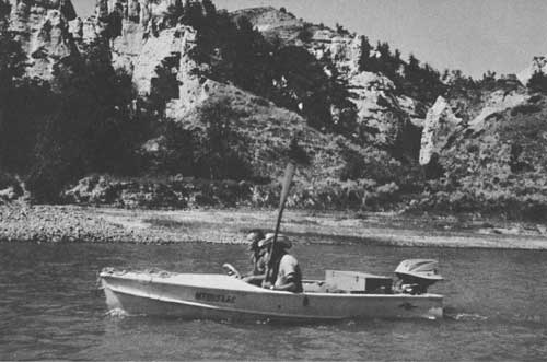
HOLTER DAM TO THREE FORKS
The lower two-thirds of the river from Holter Dam to Three Forks has been inundated by Holter, Hauser, and Canyon Ferry reservoirs. Of these, Holter and Hauser were constructed by the Montana Power Company, while Canyon Ferry, the one farthest upstream, is a Bureau of Reclamation facility.
Holter Dam backs water 26-1/2 miles up the Missouri to Hauser Dam, forming a reservoir with 4,800 surface acres. Hauser Dam backs water up the Missouri 16-1/2 miles to Canyon Ferry Dam and also forms Lake Helena in Helena Valley. Hauser Reservoir and Lake Helena together have a surface area of 6,000 acres. The 35,200-acre Canyon Ferry Reservoir stretches 25 miles to Townsend.
Helena, the capital of the State, is about 18 miles west by road from Canyon Ferry Dam. U.S. Highway 91 (Interstate 15) crosses the river below Holter Dam, then stays well to the west of the river as it continues south 34 miles to Helena. U.S. Highway 12 and State Highway 287 go 32 miles east and south from Helena to cross the Missouri just above the upper end of Canyon Ferry Reservoir. At Townsend, U.S. 12 heads east while State Highway 287 goes south along the east side of the Missouri for 11 miles, crossing at Toston; State Highway 287 then continues south, staying well west of the river, for 21 miles to a junction with U.S. 10 (Interstate 90) near Three Forks. Except for the short stretch between Townsend and Toston, the major highways in this section are distant from the Expedition route; however, there is access to and across Hauser Lake and Canyon Ferry Dam.
The Montana State Park Department administers the Missouri River Headwaters State Monument at Three Forks, and the Canyon Ferry Recreation Area, comprised of the water surface and shorelands of Canyon Ferry Reservoir. Six recreation sites have been developed by the State along the reservoir.
The Bureau of Land Management administers scattered tracts of public domain lands along the river and around the reservoirs. The Bureau identified one potential recreation site on Holter Lake, four on Canyon Ferry Reservoir, and 10 along the river between Townsend and Three Forks.
The Montana Power Company has developed a picnic area on the shore of Holter Reservoir near the dam. The Forest Service has developed Meriwether Picnic area on this reservoir at Gates of the Mountains.
A portion of Helena National Forest borders the east shore of Holter Reservoir from Gates of the Mountains upstream to Hauser Dam. The National Forest also borders two small stretches of the east shoreline of Hauser Reservoir, one near Hauser Dam and the other just below Canyon Ferry Dam. Gates of the Mountain Wilderness is located in Helena National Forest not far from the Expedition route.
THREE FORKS TO LEMHI PASS
The route from Three Forks to Lemhi Pass includes the location of Fortunate Camp and the Montana side of Lemhi Pass. Major highways parallel the water route along this section of the Trail. From Clark Canyon Dam the Expedition route is paralleled by State Secondary Highway 324 to the top of Lemhi Pass.
From Three Forks to Whitehall, a distance of 30 miles, U.S. Highway 10 (Interstate 90) is never far from the Jefferson River. Near Whitehall, the river comes in from the southwest, and U.S. 10 is left behind. State Highway 287 next follows the river upstream for 12 miles to a junction with State Highway 41. State 41 takes over for 14 miles along the Jefferson, then 28 miles along the Beaverhead River to a junction with U.S. Highway 91 (Interstate 15) at Dillon. U.S. 91 then follows the Beaverhead River as far up as the Bureau of Reclamation's new Clark Canyon Dam.
The Bureau of Land Management has identified seven potential recreation areas along the lower 40 miles of the Jefferson, a potential historic site on Beaverhead Rock, and a potential recreation area along the county road leading to Lemhi Pass.
Lewis and Clark Caverns State Park, 10 miles from Three Forks, takes its name from the Expedition's leaders, even though the cave was discovered about 100 years later. A new State park has been established on the shores of the recently completed Clark Canyon Reservoir. Just before the Expedition route reaches Lemhi Pass, at an elevation of 8,000 feet, it enters Beaverhead National Forest. The Forest Service has developed the Sacagawea Memorial Area on the Montana side of the pass, including the spring that Lewis and Clark believed to be the source of the Missouri River. A small picnic area and a wildflower trail are to be found there.

LOST TRAIL PASS TO LOLO PASS
Paved highways now follow the route of the Expedition's reentry into Montana near Lost Creek Pass, its travel down the Bitterroot Valley to Lolo, and its route up Lolo Creek to Lolo Pass. U.S. Highway 93 crosses Lost Trail Pass into Montana, and then follows the Bitterroot Valley downstream to Missoula, crossing Lolo Creek near Lolo. At Lolo, U.S. Highway 12 leads west to Lolo Pass.
The first portion of the Trail from Lost Trail Pass down to the East Fork of the Bitterroot River crosses Bitterroot National Forest lands. The Forest Service has built a new visitor center at Lost Trail Pass and has plans for a campground near there. There is a Forest Service ski area at Lost Trail Pass; another is planned for the area. There are five campgrounds along or near the Expedition route within the forest boundary. One of these campgrounds is located on Lake Como, a Bureau of Reclamation reservoir situated in the foothills of the Bitterroot Mountains south and west of Hamilton.
From the East Fork of the Bitterroot River down the valley to Lolo, the route is on private land. There are no nearby public domain lands in the Bitterroot Valley. Going west from Lolo, the Expedition route crossed what is now a piece of public domain land about four miles up Lolo Creek. Here the Bureau of Land Management has identified a potential recreation area.
Continuing west, the Expedition route lies in Lolo National Forest to the top of the pass. Lolo National Forest has developed two campgrounds near Lolo Hot Springs, and has plans for another near the Expedition route.
Fort Owen State Monument, near Stevensville, is the only State park facility along this section of the Trail. It commemorates a trading post and fort, built in 1850.
The Lions Club of Hamilton has created a small roadside park, Durland Park, about 10 miles south of the town. The Lions Club and the Chamber of Commerce in Hamilton cooperated in the development of a similar area, Blodgett Park, which is about four miles north of town.
LOLO TO GREAT FALLS
The first portion of Lewis' separate return route from Lolo to Great Falls has been opened by a good system of Federal, State, and county roads except for the portion across Lewis and Clark Pass. The pass, located about five miles north of the point at which State Highway 20 crosses the Continental Divide at Rogers Pass, can be reached by 10 miles of dirt road and two miles of jeep trail.
At the junction of the Bitterroot and Clark Fork Rivers, the return route passes through Missoula, the third largest city in Montana. The eastern end of this section of the route is near Great Falls, the State's largest city.
The Trail through this section goes for the most part through private land. Along the Blackfoot River west of the Continental Divide, however, the Trail crosses several tracts of public domain lands and some small parcels of Helena National Forest lands. As the Trail approaches Lewis and Clark Pass it crosses about five or six miles of Helena National Forest lands just before reaching the summit. East of the Divide the Trail does not cross public domain or national forest lands.
Of the 16 existing or potential recreation, historic, or wildlife areas located along or near the Trail between Lolo and Great Falls, only five are east of the Divide. These include the Sun River Game Range, the Freezeout Lake Area, and the Bean Lake Fishing Access Area, all administered by the State Fish and Game Department, and the Bureau of Sport Fisheries and Wildlife's Pishkun and Willow Creek National Wildlife Refuges.
The Forest Service has earmarked a potential historic site at Lewis and Clark Pass. At the present time, there is nothing at this historic spot but a rustic sign identifying the pass. West of the pass, near Lincoln, there are two Forest Service campgrounds and a State park. In this same general vicinity, five potential recreation sites have been recognized by the Bureau of Land Management on lands under its jurisdiction. A few miles farther west are two areas administered by the State Fish and Game Department. One of these is the 52,000-acre Blackfoot-Clearwater Game Range while the other is a small site providing fishing access to Upsata Lake.
MARIAS RIVER LOOP
Lewis' side trip to explore the upper reaches of the Marias River is a relatively undeveloped section of the Trail. No major highways parallel the Expedition route. Between Great Falls and the Marias it is possible to follow its general direction by using county roads, but none closely follows the route upstream along the Marias and Cut Bank Rivers.
Access has been provided to the Bureau of Reclamation's Tiber Dam and Reservoir located on the Marias River. Above the reservoir the route cuts across Interstate Highway 15 and U.S. Highway 2; the return portion of the route also intersects these highways. The principal towns along or near the route are Shelby, Cut Bank, and Browning.
The majority of the lands along this section of the Trail are in private ownership. The only Federal lands involved are those which border Tiber Reservoir and a scattering of public domain lands along the Marias River upstream from the reservoir.
There is only one recreation area in this section—the Tiber Reservoir Recreation Area, administered by the State Park Department. On public domain lands along the Marias upstream from the reservoir, the Bureau of Land Management has identified 28 small sites to give access to the river for fishing, boating, and camping. These sites have been shown on the map as one area. Farther upstream are two other Bureau of Land Management potential recreation sites.
West of Cut Bank the Great Northern Railroad has erected a monument marking the farthest point north reached by members of the Expedition.
SULA TO CLARK CANYON DAM
Clark's separate return route from the time he turned off of the outbound route at Sula until he returned to it at Fortunate Camp can be followed on State and county roads, varying in type from paved to gravel to dirt. Most of the lands along this section of the Trail are in private ownership. On both sides of the Continental Divide, however, the Expedition route is on lands of the Bitterroot and Beaverhead National Forests, and on the Divide between Grasshopper and Horse Prairie Creeks it crosses a large tract of public domain land.
The State Park Department has developed Bannack State Monument to commemorate the site of the first major gold discovery in Montana and the establishment, in 1862, of Bannack as the first capital of the Montana Territory. The Big Hole National Battlefield, administered by the National Park Service, is located 12 miles west of the town of Wisdom. There are no other parks or recreation areas along this section of the Trail. The Forest Service has located two potential campground areas along Trail Creek on the east side of the Divide in Beaverhead National Forest.
YELLOWSTONE RIVER
A major portion of Clark's separate return route where he turned off the outbound route to explore the Yellowstone River is paralleled by Interstate Highways. From Three Forks east to Billings, a distance of about 175 miles, Interstate 90 follows the Expedition route. Interstate 94 parallels the 220-mile portion from Billings east to Glendive. Along the remaining 65 miles between Glendive and the North Dakota border, State Highway 16 and then State Highway 20 follow the river route.
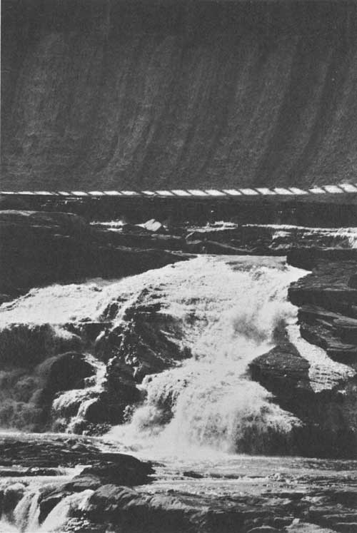 Great Falls of the Missouri with Ryan Dam in the background at Great Falls, Montana |
Several of Montana's larger cities are located along this section of the Trail. They include Billings, the State's second largest city, with a population in 1960 of 52,851; and Bozeman, Miles City, Livingston, and Glendive, which were in the 7,000-9,000 population range that same year.
Except for a sprinkling of public domain lands along some stretches of the Yellowstone River, almost all of the lands in this section of the Trail are privately owned. However, the Bureau of Land Management has identified 14 potential recreation sites on the public domain lands under its administration. Forest Service lands border the Trail quite closely near Bozeman and Livingston. Bridger Bowl Ski Area, located in the Gallatin National Forest north of Bozeman, is a popular winter sports area.
At Bozeman, the Bureau of Sport Fisheries and Wildlife administers a national fish hatchery. Southwest of Billings within the Crow Indian Reservation the National Park Service administers the Custer Battlefield National Monument.
Makoshika State Park near Glendive is the only State park in this section. The Montana Fish and Game Department administers four small areas along the Trail which provide opportunities for fishing and picnicking.
RECREATION TRENDS
Specific data necessary to make accurate projections of demands for facilities along the Lewis and Clark Trail are not yet available. Demand for areas along such a trail can be expected to reflect the interest aroused in the project and the quality of effort made to identify, mark, and develop visitor use areas.
Some indication of potential demand can be derived from population and travel trends. The 1960 census listed 674,767 inhabitants for the State of Montana, representing an increase of 14.2 percent over the 1950 census. Population projections indicate that by the year 2000, the population of Montana will increase to 1,397,000, or a little more than twice the present number. Undoubtedly such an increase will more than double the present demand for recreation areas and facilities in the State. To this should be added the pressure of the expected increased out-of State travel.
Montana is justly famous as a vacation State. Glacier and Yellowstone National Parks are prime vacation targets. The many national forests with their extensive recreation developments, the excellent State Park system, and the major reservoirs such as Fort Peck and Canyon Ferry on the Missouri River, all combine to attract tourists to the State.
Many of these people will travel highways which now parallel portions of Lewis and Clark's Expedition route. If the route is marked in a suitable manner, and if a Lewis and Clark Trail is established by using existing highways and later adding new roads where needed, there is no question that such a highway would be a popular route in Montana. This would result in a greatly increased demand for recreation sites along the route.
The proposed Lewis and Clark Trail in Montana would be made up of a combination of several Federal, State, county, and Forest Service roads. In most instances, these roads follow the Lewis and Clark Expedition route quite closely. However, there is a 300-mile section of the Expedition route in eastern and central Montana, from Fort Peck Dam upstream to Virgelle, where the proposed Lewis and Clark Trail route is 75-90 miles north of the Expedition route along the river. One State highway and a few county roads provide access south to the river.
Interstate Highway System plans for Montana involve two east-west routes and one north-south route. Interstate 90 and 94 from the east join at Billings. Interstate 94 ends there but Interstate 90 continues on west, through Bozeman and Missoula, to Spokane and Seattle. Interstate 94 parallels most of Clark's return route on the Yellowstone downstream from Billings. Interstate 90 parallels Clark's route between Billings and Three Forks, a short stretch of the main Expedition route west of Three Forks, and a small portion of Lewis's return route near Missoula. Interstate 15, a north-south route from southern California to Canada, follows sections of the Trail along the Beaverhead and Missouri Rivers.
When these routes are completed, Interstate Highway traffic to and through Montana undoubtedly would be increased to a marked degree. The Montana State Highway Commission, for highway planning purposes, estimates that traffic flow on its primary highways will double in the next 20 years and that on the Interstate Highways it will triple.
RECREATION PLANS
On April 20, 1965 the Montana Fish and Game Commission declared the Yellowstone River from the Yellowstone National Park boundary to Pompeys Pillar as the Yellowstone State Waterway. Special emphasis will be given to the recreational development of this reach of the river.
The National Park Service has proposed the establishment of the Lewis and Clark National Wilderness Waterway under its administration along the Missouri River. The area relates directly to the Lewis and Clark Expedition and would extend from the upper end of the Fort Peck Reservoir to Fort Benton. This is not only one of the most scenic sections of the Missouri River but the only sizable portion which remains much the same as it was when the Lewis and Clark Expedition passed through. Alternate Plan No. 6, of the joint Army-Interior Study of the upper Missouri, provides for river access points, campgrounds, overlooks, interpretive points, and for the development of part of the hydroelectric resources available in this region by construction of the Fort Benton Dam and Reservoir.

RECOMMENDATIONS
The basic development program for the historic, wildlife, and recreation resources along the Lewis and Clark Trail is outlined in the Recommended Program, page 20. The suggested highways to be designated and marked as the Lewis and Clark Trail are shown on maps 12-19 and 24-25. Specific recommendations relating only to Montana follow:
1. Alternate Plan No. 6 of the joint Army Interior study of the upper Missouri, which provides for the establishment of the Lewis and Clark National Wilderness Waterway, should be implemented.
2 The Corps of Engineers and the Bureau of Sport Fisheries and Wildlife should develop the proposed recreation areas and wildlife conservation areas along the shoreline of Fort Peck Reservoir and within the boundaries of the Charles M. Russell National Wildlife Range. Access to existing areas on Fort Peck Reservoir should be improved.
3. The Bureau of Land Management should continue its program of identifying potential recreation and wildlife conservation areas on public domain land along the Expedition route and should arrange for the development and administration of the more important ones, either by the Bureau itself or by other public agencies, particularly at the State and local level.
4. The Forest Service should continue its program of identifying potential recreation areas on National Forest lands with particular emphasis on developing existing areas along the routes of the Expedition.
5. The Forest Service should improve its road across Lemhi Pass to the extent possible without destroying the natural setting of that important historic site.
6. The State of Montana should take the initiative in identifying and marking the Lewis and Clark campsites and other sites of historic importance in connection with the Expedition along the several routes followed in the State.
7. The Montana State Parks Division should develop a program for the acquisition, development, and administration of additional State park areas along the route and should work closely with the Bureau of Land Management, Corps of Engineers, Bureau of Reclamation, and the Bureau of Sport Fisheries and Wildlife in such a program in order to take advantage of opportunities for acquiring potential sites available from these Federal agencies.
8. The Montana Power Company should continue its reservoir recreation program and develop additional recreation areas on its existing reservoirs along the Lewis and Clark Trail.
IDAHO

SUMMARY

The Lewis and Clark Expedition's route in Idaho was primarily overland. Most of the route is on Federal land within the National Forests and is still much the same today as when the Expedition passed through. Several sites which relate directly to the Lewis and Clark Expedition can be visited. These include Lolo Trail, Canoe Camp, Wieppe Prairie, Long Campsite, Lolo Pass, Lost Trail Pass, and Lemhi Pass.
U.S. Highway 12, which parallels the route of the Expedition from Lewiston east to the Montana border at Lolo Pass, has been designated by the State as the Lewis and Clark Highway.
Along the 210 miles of Expedition route in Idaho there are 21 existing and 30 proposed points of recreation interest. The total area of land and water included within these 51 sites is about 1,242,000 acres. Nearly 1,240,000 acres are included within the Selway-Bitterroot Wilderness.
A bill passed by the 88th Congress authorizes the Secretary of the Interior to designate certain lands in Idaho as the Nez Perce National Historical Park. This park will include several sites related to the Lewis and Clark Expedition.

In contrast to the situation which exists elsewhere along the Expedition route, only a very small section of the route has been flooded by a reservoir formed by a small Washington Water Power Company dam on the Clearwater River near Lewiston. The Corps of Engineers has begun the construction of a large dam and reservoir on the North Fork Clearwater River near the Expedition route.
The State of Idaho has developed two State parks along the route, one of which commemorates the site of the Expedition's Canoe Camp. An opportunity exists for the local agencies to develop recreation sites along the Lewis and Clark Trail, since there are no county or municipal recreation sites. The State of Idaho, however, should take the responsibility for identifying and marking the location of the route, campsites, and other historic sites outside the National Forest boundaries.
To assist in meeting Idaho's future recreation requirements and to develop a coordinated program to memorialize the route of the Lewis and Clark Expedition, the State should follow the recommended program as outlined in this report.
The recommended routing of a Lewis and Clark Trail Highway in Idaho is indicated on maps 18-20. This routing includes the highway from Lewiston to Lolo Pass.
State and Federal agencies in Idaho responsible for the development of recreation resources must continue to expand existing recreation facilities. One of the more important developments is the proposal to give National Wild River status to the Middle Fork Clearwater River and its tributaries, the Lochsa and the Selway, and to the Salmon River including the Middle Fork Salmon River.

BACKGROUND
The Expedition's overland trek through Idaho represented a connecting link between the Missouri and Columbia Rivers. The means of transporting supplies changed here from boats to horses. In no other State did they travel such a great proportion of the route on land as in Idaho. And perhaps in no other State did they encounter such a combination of difficult travel and lack of food as they did here. What appeared at first to be just a simple matter of dropping over the Divide and floating down a tributary to the Columbia turned into a long and arduous detour across two additional mountain passes and the Lolo Trail in order to reach a navigable stream. The information available to them concerning the route to follow was meager. Without the qualities of leadership, perseverance, and endurance demonstrated by Captains Lewis and Clark, the Expedition would not have been able to accomplish their objective under such difficult conditions.
The first members of the Expedition to enter what is now Idaho were Captain Lewis and three men who, on August 12, 1805, crossed the Continental Divide at Lemhi Pass. They were looking for the Shoshone Indians from whom they hoped to obtain the horses so essential to their plans. They found the Indians on the following day near the Lemhi River. Lewis was able to pursuade them to accompany him back across the Divide into Montana to meet the rest of the party. There they bargained successfully for the horses with which to cross the mountains.

The rest of the Expedition entered Idaho on August 26, preceded by Clark and 11 men who went ahead in order to determine if the Salmon River were navigable. Clark soon found out that the Salmon River Canyon was an impassable route. This meant that the Expedition would have to detour by way of the Lolo Trail, a route which they had heard about previously from the Indians. After hiring an old Indian and his son as guides, the entire party headed north into Montana, crossing near Lost Trail Pass on September 4.
Lewis and Clark travelled down the Bitterroot Valley and then up Lolo Creek to Lolo Pass where they entered what is now Idaho for the second time on September 13. For the next week they struggled along the Lolo Trail. This, undoubtedly, was the most strenuous part of the whole trip. Snow and freezing temperatures added to their misery. They had difficulty finding their way, and their food supplies were exhausted, except for some "portable soup" and a little bear grease. Because the game on which they depended for food had moved down to lower elevations, they were forced to kill some of their horses in order to survive.
Upon reaching the Clearwater Valley, they established friendly relations with the Nez Perce Indians living there. A camp, which they named Canoe Camp, was established on the Clearwater River across from the mouth of the North Fork Clearwater. There they recuperated from their arduous trip while building canoes for the run down to the Pacific Ocean. Arrangements were made to leave their horses, saddles, and other equipment with the Nez Perce Indians until their return.
 View from Lemhi Pass, where Lewis and Clark first crossed into the Salmon River drainage. |
Glad to be on water once more, they resumed their journey in the new canoes on October 7. They reached the junction of the Clearwater and Snake Rivers in three days and on the following day, October 11, 1805, they left the present State of Idaho as they floated down the Snake toward the Columbia River.
When the Expedition returned the following spring, they were on horseback again, having abandoned their canoes in favor of horses while still on the Columbia River. They crossed the Snake River to its north bank a few miles downstream from the mouth of the Clearwater. On the following day, May 5, 1806, they entered Idaho land once more as they approached the confluence of the Snake and Clearwater Rivers. From there the route followed the Clearwater Valley upstream to where the Expedition's horses and equipment had been left with the Indians the preceding fall.
While preparing for the trip up the Lolo Trail and waiting at Camp Chopunnish near present day Kamiah for the snow in the hills to melt, the Expedition's leaders made a lasting impression on the local Indians with their medical skill. Using part of their dwindling stock of medicine, they treated the sick and lame Indians who came from miles around as the reputation of the two "practicing doctors" spread.
 Rock cairns at Indian Post Office, Lolo Trail. These cairns were used by the Indians to mark the location and direction to reach good hunting and fishing grounds |
Anxious to be on their way home, they started out too early and were turned back by deep snow on the ridges in the middle of June. After a short wait they started again on June 24 and this time made a successful, though still difficult, crossing. Five days later they left Idaho behind as they crossed over Lolo Pass into Montana.
The Expedition was in Idaho a total of 96 days; only about a third of this time was used for travel. The remainder was spent in building canoes on the westward trip, and in waiting for the snow to melt on the Lolo Trail the following spring.
For much of its length, the Lewis and Clark Trail in Idaho remains almost the same today as when the Expedition passed by. This is especially true along the Lolo Trail and across the three mountain passes. Even the Clearwater River, where they took to the water again, has changed but little. A small dam operated by the Washington Water Power Company on the Clearwater near Lewiston is the only existing water control facility along the Trail in Idaho. The Dworshak Dam, being constructed by the Corps of Engineers, will be located on the North Fork, a few miles off the actual Expedition route.
The Lolo Trail, scene of so much suffering and hardship on both the outbound and return trips, is one of the most history-laden sites along the Expedition's route in Idaho. Known to the Indians for countless years before the Expedition's arrival, the Lolo Trail also was used by Chief Joseph, leader of the Nez Perce Indians, during the Nez Perce Indian War of 1877. He led his tribe across the trail into Montana in an attempt to escape pursuing army troops. A Forest Service road, passable only during the summer months, follows the Lolo Trail quite closely. Other historic events that took place here after the Expedition passed include the establishment in 1812 of Mackenzie Post, a fur trading post at the mouth of the Clearwater River which was abandoned the following year; and the establishment of Spalding Mission in 1836 by an associate of missionary Marcus Whitman.
The Lolo Trail has been approved for Registered National Historic Landmark status.
The Salmon River, which Clark found to be impassable, is best known today as the "River of No Return." A road goes down the river a few miles past the spot where Clark turned back. Beyond the end of this road expert rivermen run boats down the rapids, carrying passengers through a Forest Service wilderness area.
The routes into Idaho pioneered by Lewis and Clark never proved popular with the road builders that followed. Lemhi Pass has changed the least. It is crossed by an unimproved Forest Service road but otherwise remains much the same. There has been a highway across Lolo Pass for many years but until very recently it did not penetrate far into Idaho. The highway has now been extended down the Lochsa River to meet the road coming from the west. The dedication of this completed highway between Missoula, Montana, and Lewiston, Idaho, was held at Packer's Meadow near Lolo Pass in August 1962. The Expedition had camped in this same meadow 157 years earlier after crossing Lolo Pass on the way west.
Most of the names given by the explorers to the streams, rivers, and other terrain features have disappeared. Lewis' River and the North Fork of Lewis River became the Snake and Salmon Rivers respectively. Colter's River is now the Potlatch River and Colt-Killed Creek has become White Sand Creek. But the explorers are remembered in other ways. Lewiston, Idaho, and Clarkston, Washington, are on opposite banks of the Snake at the mouth of the Clearwater.
The contributions of the Expedition to the State of Idaho are difficult to assess. Perhaps the greatest contribution was the establishment of a claim by the United States to the land now Idaho as a result of the Expedition's passing through.
The explorers established friendly relations with the Nez Perce Indians which smoothed the way for trappers and settlers who came later. Legends about Lewis and Clark persisted for many generations with these Indians, whose descendants still live in the Clearwater Valley.
FINDINGS
RECREATION RESOURCES
In Idaho, it is possible to visit several sites which relate directly to the Lewis and Clark Expedition. These sites include Lolo Trail, Canoe Camp, Wieppe Prairie, Long Campsite, Lolo Pass, Lost Trail Pass, and Lemhi Pass. Three of these—Lolo Trail on the Clearwater National Forest; Canoe Camp, a State Park facility; and Lolo Pass—are presently marked with interpretive signs. Lost Trail Pass and Lemhi Pass can be easily reached but interpretive signs are lacking. The two remaining sites, Wieppe Prairie and Long Campsite, are scheduled for development as part of the Nez Perce National Historical Park. Through a joint effort of the State Highway Department, Historical Society, and Department of Commerce and Development, an excellent historical sign program has been established in Idaho. Signs have been installed at Canoe Camp, Lolo Pass, and on the Salmon River where Clark made his exploration of the canyon.
The Forest Service, Bureau of Land Management, Bureau of Indian Affairs, and Corps of Engineers are Federal agencies that presently have administrative responsibility for lands on or near the route. When the recently authorized Nez Perce National Historical Park has been established, the National Park Service also will have administrative responsibility along the Trail.
The State Department of Parks and the State Department of Fish and Game administer recreation and conservation areas along the Expedition route. There are no county, city, or private recreation areas along the Lewis and Clark Trail in Idaho.
Within about 25 miles of the Lewis and Clark Trail in Idaho there are 21 existing and 30 proposed points of recreation interest. Ten areas provide water-based recreation and five additional water-based recreation areas are proposed for development by Federal agencies.
The total area of land and water included within the 51 existing and proposed recreation sites is about 1,242,000 acres. Of this amount, nearly 1,240,000 acres of land and water are included within the Selway-Bitterroot Wilderness. The facilities existing and to be developed provide opportunities for camping, picnicking, hunting, hiking, horseback riding, sightseeing, and nature study. With the exception of two areas where swimming is permitted, water-based recreation at existing sites is limited to fishing.
The tables on pages 156 to 160 list data pertaining to the existing and potential recreation areas, historic sites, and conservation areas along the route of the Lewis and Clark Expedition through Idaho.
To discuss in more detail the recreation resources and attractions along the route taken by the Expedition in Idaho, the Trail has been treated in two sections, which follow:
LEMHI PASS TO LOST TRAIL PASS
Access is good from Lemhi Pass to Lost Trail Pass along the Expedition route. A Forest Service road good only for summer travel leads west from the summit of Lemhi Pass two miles to the Boundary of the Salmon National Forest. From there it is about nine miles by county road to the town of Tendoy on the Lemhi River. At Tendoy, State Highway 28 runs northwest for 21 miles down the Lemhi Valley to Salmon, situated at the confluence of the Lemhi and Salmon Rivers. There U.S. Highway 93 comes in from the south along the Salmon, and continues 21 miles north to where the Salmon meets the North Fork Salmon River. Here the main river turns due west. The Salmon River, including the Middle Fork Salmon, has been proposed by the Administration for National Wild River status. An improved road follows the north bank of the Salmon River downstream for a few miles past the point where Clark turned back. U.S. 93, however, continues north up the North Fork 26 miles to Lost Trail Pass.
The actual route used by the Lewis and Clark Expedition is difficult to determine in this section because they travelled overland. According to most authorities who have studied the route, it closely follows the road system. After leaving the Salmon National Forest just west of Lemhi Pass, the route crosses a sizable area of public domain land between the forest and the Lemhi Valley. Down this valley and the Salmon River Valley beyond, most of the lands are privately owned. At Tower Creek, a few miles short of the North Fork, the route turns northeast up the creek and then cuts across to the North Fork about three or four miles above its mouth. The Expedition route reenters Salmon National Forest a few miles up Tower Creek and remains in the forest all the way to the pass. Approximately two-thirds of this entire section is on public land.
This section of the route is significant because white men first entered Idaho and the first U.S. citizens crossed the Continental Divide at Lemhi Pass. Captain Lewis finally established contact with the Shoshone Indians on the Idaho side of Lemhi Pass, and Captain Clark's exploration of the Salmon River established the fact that the route they had just discovered across the divide was not a suitable connection between the Missouri and Columbia Rivers.
One historic site, three recreation sites, and several potential historic and recreation sites are located in Salmon National Forest. The Bureau of Land Management has identified four potential recreation areas on lands under its control. There are no State, county, or private recreation areas in this section.
The existing Forest Service historic and recreation sites are not sufficient to provide for the anticipated demand. However, if the potential sites identified by that agency and those sites identified by the Bureau of Land Management are developed, either by the Bureau or by State or local authorities, much of the anticipated demand will be accommodated.
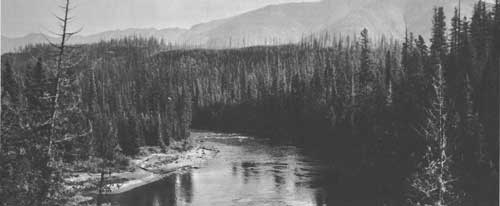
LOLO PASS TO THE SNAKE RIVER
There also is good access to the Expedition route from Lolo Pass to the Snake River. U.S. Highway 12, Idaho's Lewis and Clark Highway, enters the State from the east at Lolo Pass. The highway descends for nine miles to the Lochsa River, and then follows the right bank of that river downstream for 69 miles in a southwesterly direction to the junction with the Selway River. These two rivers combine there to form the Middle Fork Clearwater River. This river and its two tributaries, the Lochsa and the Selway, have been proposed by the Administration for National Wild River status.
From this point U.S. 12 goes west 23 miles down the right bank of the Middle Fork to Kooskia. There the Middle Fork meets the South Fork Clearwater to form the main Clearwater River. The highway turns north at Kooskia, follows the right bank of the Clearwater downstream for eight miles, then crosses over to Kamiah on the left bank. From Kamiah the highway runs northwest, then west, for 55 miles along the river to Spalding State Park. There the road crosses back to the right bank and goes west nine miles to Lewiston. In Lewiston, U.S. 12 crosses the Clearwater again and then, at the west edge of town, goes across the Snake River Bridge to Clarkston, Washington.
The Expedition's route was similar to the route of the highway from Lolo Pass down to the Lochsa River and for a few miles down the river. However, Lewis and Clark soon discovered that they had missed the Lolo Trail. Climbing out of the Lochsa Valley, they found the trail along the ridge which parallels the river on the north. A Forest Service road, passable only during the summer months, follows the Lolo Trail almost all the way to the Clearwater Valley. From Canoe Camp, just west of present-day Orofino, downstream to Lewiston, the highway and the Expedition route down the river are very close to each other.
From Lolo Pass west to the edge of the Clearwater Valley the route is on lands of the Clearwater National Forest. The location of the Expedition route across this forest has been determined very accurately by Forest Service personnel. Between the National Forest boundary and Lewiston the route crosses an area composed of intermingled Nez Perce Indian tribal lands and public domain and private lands. Since the location of the route outside the forest has not been determined with the same detailed study and analysis as that used within the forest, the relationship of the route to these lands is not certain.
The Forest Service administers 12 existing recreation sites and has identified two potential ones along or near this section of the Trail. In addition, the Service has marked 10 historic sites related to the Expedition, identified nine other sites, and proposed the establishment of its road along the Lolo Trail as the Lewis and Clark Scenic Highway.
The Lochsa River forms the northern boundary of the Selway-Bitterroot Wilderness, administered by the Forest Service. There are several places along U.S. 12 where foot bridges provide access across the Lochsa River to the trails which penetrate the wilderness area.
The Bureau of Land Management has located four potential recreation areas on lands under its administration in this section. All of these sites are along the main Clearwater River.
The Corps of Engineers has started construction of the Dworshak Dam and Reservoir on the North Fork Clearwater River. The dam site is about two miles upstream from the mouth of the North Fork. When completed, the reservoir will have recreation areas along its shoreline.
It is along this section of the Trail that the Nez Perce National Historical Park will be established. A bill passed by the 88th Congress authorizes the Secretary of the Interior to designate certain lands in Idaho as the Nez Perce National Historical Park. The purpose of such a park will be to facilitate protection and provide interpretation of sites in the Nez Perce country of Idaho that have historic value. The park will include three main interpretive centers on lands to be acquired and administered by the National Park Service and 19 other historic sites owned and administered by various Federal, State, and local agencies, the Nez Perce Tribe, and various private individuals and corporations. These 19 sites will be marked and interpreted under cooperative agreements with the National Park Service to form an integrated series of sites illustrating the entire Nez Perce country story. Five sites pertaining to the Lewis and Clark Expedition will be included in the proposal. These are Lolo Pass, Lolo Trail, Canoe Camp, Wieppe Prairie, and the Long Campsite. Wieppe Prairie is where the Expedition first met the Nez Perce Indians, while Long Camp site is another name for Camp Chopunnish, the site near Kamiah, where they camped for about a month in the spring of 1806.
The State Park Department administers the developed park areas along the Expedition route in this section, one of which relates directly to the Expedition. This is the Lewis and Clark Canoe Camp State Monument, located at the site of the original camp. It is a small park, crowded between the highway and the river. Development consists of a replica of a canoe and a sign explaining the significance of the site. The other park is Spalding State Park, on the south bank of the Clearwater River near the old Spalding Mission site. Although intended primarily for picnicking and swimming, overnight camping is permitted.

RECREATION TRENDS
It is difficult to determine the demand for recreation areas along the Lewis and Clark Trail in Idaho. To some extent it will depend on the publicity given to the Lewis and Clark Trail Study and to the interest generated by the study in following the Trail or portions of it. Other measures of demand are the growth of population and the anticipated increase in travel along the highways.
The 1960 Bureau of Census report lists 667,191 inhabitants for the State of Idaho. This represented an increase of 13.4 per cent over 1950. Population forecasts indicate that by the year 2000 there will be 1,254,000 inhabitants. The route taken by Lewis and Clark across Idaho passes through two very sparsely settled sections of the State. Lewiston, located at the western end of the Trail across Idaho, had a population in 1960 of 12,691. It is the largest city along the route in this State. Salmon near Lemhi Pass at the eastern end of the Idaho section, listed only 2,944 inhabitants that same year.
No Interstate Highways are proposed along the Lewis and Clark Trail in Idaho. There are Federal, State, county, and Forest Service highways and roads, however, which follow the Expedition route quite closely.
U.S. Highway 12, dedicated as the Lewis and Clark Highway, runs from Lolo Pass down the Lochsa River to Lewiston. It carried an average of 700 cars per day in 1963. The State Highway Department estimates that in 20 years this travel will have increased to an average of 1,400 vehicles per day.
If the Lewis and Clark Trail is developed along the lines recommended in this report, then travel for recreation and historic purposes along U.S. 12 in Idaho can be expected to increase considerably more than that now anticipated. Similar increases can be expected for U.S. Highway 93 and State Highway 28 which follow the Trail closely down the Lemhi and Salmon Rivers and up the North Fork Salmon River to Lost Trail Pass.
RECOMMENDATIONS
The basic development program for the historic, wildlife, and recreation resources along the Lewis and Clark Expedition route was outlined in the Recommended Program, page 20. The recommended routing of a Lewis and Clark Trail Highway in Idaho is indicated on maps 18-20. Specific recommendations relating only to Idaho follow:
1. The Wild Rivers bill, which names the Middle Fork Clearwater River, including its Lochsa and Selway Tributaries, and the Salmon River, including the Middle Fork Salmon, as initial units in a National Wild Rivers System, should be enacted.
2. The Forest Service should develop recreation sites along the Lolo Trail within the National Forest for the use of individuals following the Lewis and Clark Trail.
3. The Forest Service should improve its road along the Lolo Trail and across Lemhi Pass to the extent possible without destroying the natural setting of those historic sites.
4. The Bureau of Land Management should continue its program of identifying potential recreation and wildlife conservation areas on public domain lands along the Trail, and should either develop these areas or arrange for their development by State or local agencies.

5. The Corps of Engineers should develop recreation facilities on the reservoir to be formed by Dworshak Dam on the North Fork Clearwater River which will help to fulfill the need for recreation areas along this section of the Trail.
6. The State of Idaho should expand its historic sign program to include identification and marking of the Lewis and Clark campsites and other sites of historic importance where they have not otherwise been identified and marked.
7. The exact route of the westward Trail between the National Forest boundary and Canoe Camp and of the return Trail from Lewiston to the National Forest should be accurately located on the ground. The sites of other historic events that took place along this section of the Expedition route should be located and marked.
8. The planning of hiking, nature, and horseback trails should receive particular emphasis by all agencies since most of the route in Idaho was overland. Development of trails following the route over Lemhi, Lost Trail, and Lolo Passes, and where needed along the Lolo Trail, would provide the opportunity to most closely appreciate and relive the Expedition's experiences.
WASHINGTON

SUMMARY

The Lewis and Clark Expedition's outbound route in Washington led by canoe down the Snake and Columbia Rivers 465 miles to their destination, the Pacific Ocean at the mouth of the Columbia. They reached the Pacific Ocean near Cape Disappointment on the Washington coast. On the return trip Lewis and Clark retraced this route, except for an overland short cut between the mouth of the Walla Walla River and the confluence of the Clearwater and Snake Rivers. Several sites associated with the Lewis and Clark Expedition can still be visited today. These include Beacon Rock, Chinook Point, Cape Disappointment, and the campsite at the mouth of the Snake River.
A large percentage of the original river route soon will be beneath the waters of a continuous series of reservoirs extending for 320 miles from Bonneville Dam upstream to Clarkston, Washington. Most of the recreation opportunities along this section of the Trail will be on these reservoirs. The problem of public access to the river route in Washington is complicated by existing transportation developments and by difficult terrain situations. Moreover, the lands bordering the 145-mile stretch of the Columbia River from Bonneville Dam downstream to the river's mouth and along the overland portion of the return route are almost entirely privately owned.

State and local agencies have developed some recreation areas along the Trail in Washington but much remains to be done to meet the anticipated demand. The facilities existing and to be developed provide opportunities for most forms of water-oriented recreation, and also for camping, picnicking, hunting, hiking, horseback riding, sightseeing, and nature study.
The Washington State Legislature has designated the highway system between Vancouver and Clarkston via Kennewick and Walla Walla as the Lewis and Clark Highway. Lewis and Clark Highway markers have been erected by the State Highway Department. This highway designation should be extended to include the highway system from Vancouver to the mouth of the river.
The State of Washington should continue its program of identifying and marking the Lewis and Clark route, campsites, and sites of related historic events.
There are 42 existing and 27 proposed points of recreation interest within a few miles of the Lewis and Clark Trail in Washington. The total area of land and water included within the 69 recreation sites is almost 63,000 acres.
BACKGROUND
After the adventures and hardships encountered in Montana and Idaho, the Expedition's travels through the State of Washington must have seemed tame in comparison. There were rapids to contend with and the scarcity of food remained a problem, but they were certain now of their route and they knew that the Pacific Ocean could not be too far away.
On October 11, 1805, soon after leaving their camp on the north bank of the Snake River just below the mouth of the Clearwater River, the Expedition entered what is now the State of Washington. Passing swiftly down the Snake in their newly constructed canoes, in only five days they reached the Columbia River, one of the major objectives of the Expedition. Here they camped for two days in order to trade with the Indians, explore the Columbia for a few miles upstream, and make observations and measurements for mapping purposes. Captain Clark explored upstream on the Columbia to within sight of the mouth of the Yakima River near the present city of Richland.
On October 18 the Expedition left their camp at the mouth of the Snake and started down the Columbia. After passing the mouth of the Walla Walla River they camped on the left bank, not far from the Oregon-Washington border. From here to the mouth of the Columbia the Expedition camped part of the time on the south or Oregon side of the river, but most of the campsites were on the north or Washington side.
A series of three rapids or cascades, which in later years were known as Celilo Falls, the Dalles Rapids, and Cascade Rapids, required difficult and time-consuming portages. Finally, in mid-November, they approached the mouth of the Columbia and accomplished their principal objective—to reach the Pacific Ocean. The Expedition probably first saw the ocean on November 10, 1805, from the vicinity of Point Ellice, on the Washington shore about five miles from the mouth of the river. Captain Lewis and five men were the first actually to reach the ocean when they explored Cape Disappointment and the coast north of there on November 14, 15, 16, and 17.
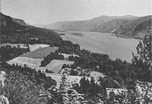
The Expedition camped for about two weeks on the Washington shore, near Point Ellice and Chinook Point while exploring the surrounding countryside. These explorations and the advice received from the local Indians convinced the leaders that the best location for a winter encampment would be south of the river. Consequently, on November 26, 1805, the party crossed the river to the Oregon shore.
After spending a miserable winter at Fort Clatsop, the Expedition started for home on March 23, 1806. Traveling by canoe up the Columbia, they retraced their route of the previous fall, stopping frequently to hunt and to barter with the Indians for food. They camped for nearly a week on the Washington shore, across from the mouth of Sandy River, while the hunters scoured the surrounding countryside for game and Clark explored the lower reaches of the Willamette River.
Upstream from this camp they encountered the first of the many rapids and falls which meant difficult and time consuming portages. They decided to obtain horses from the Indians to use instead of canoes for hauling equipment and supplies. It required several days of shrewd bargaining before they had enough horses. Finally, on April 24, they disposed of the last of their canoes and the route once again became overland.
Traveling along the Washington side of the river, they soon reached an Indian camp across from the mouth of the Walla Walla River. Here the party crossed the Columbia with the help of Indian canoes and then, with horses to haul their equipment and an Indian for a guide, headed cross-country on April 30, 1806, in an easterly direction. Their guide led them across the hills and down to the Snake just a few miles downstream from the mouth of the Clearwater. The Expedition crossed the Snake to the right bank and on the following day, May 5, approaching the mouth of the Clearwater, they crossed the present-day border between Washington and Idaho.
The Expedition's travels across the southeast corner of Washington and along its southern border and return took over three months. Except for the cross-country portion of the return route, the explorers did not penetrate very far into the State of Washington. What little information they obtained about the land north of the Columbia and Snake Rivers came from their contacts with the Indians.
Their water route down the Snake, and down the Columbia as far as the last series of rapids, has changed considerably in the intervening years. A group of eight dams and reservoirs constructed, or under construction, by the Corps of Engineers is turning that turbulent river route into a series of long, narrow, quiet pools. The bordering canyons and hills have changed very little, but the sites of the Expedition's camps, and those of the many Indian villages and fishing areas, as well as the numerous islands, rapids, falls, and cascades that the Expedition knew in this section, are fast disappearing under the reservoir waters.
The river route downstream from the series of dams has changed very little, except for the towns, cities, and industries which are scattered along the river bank. The lands bordering the Expedition's overland route from the mouth of the Walla Walla River across to the confluence of the Snake and Clearwater Rivers are now devoted principally to farming and grazing.

The names bestowed by Lewis and Clark on rivers, streams, and other terrain features did not fare any better here than elsewhere along the trail. The Columbia River, of course, was already known and named, as was Cape Disappointment. The Snake River, however, was named Lewis' River by the Expedition. The present-day Lewis River in Washington, a tributary to the Columbia near Woodland, was not named by the Expedition; they used the Indian name, Chawahnahiooks.
The Expedition has been memorialized by the State and other agencies in Washington in several ways. Clarkston, Washington, and Lewiston, Idaho, located on opposite banks of the Snake at its junction with the Clearwater, are named for the explorers. The Corps of Engineers reservoir formed by Ice Harbor Dam on the Snake, and a State park located at the confluence of the Snake and Columbia Rivers both are named after Sacajawea (Sacagawea), the Indian woman who accompanied the Expedition. The Lewis and Clark Trail State Park is located between Dayton and Waitsburg along the Expedition's return route.
The experiences and events concerned with the Expedition's travels in Washington were, perhaps, less significant than those that occurred elsewhere in their journey through the Pacific Northwest.
The contributions of the Expedition to the State also were less than in Oregon, Idaho, and Montana. Ships had been trading with the Indians at the mouth of the Columbia for years and better claims to the adjacent lands had been established by other countries long before Lewis and Clark appeared on the scene. Their explorations of the lower Snake River country and the upper Columbia River area were significant, however, and the friendly relationships that were established with the Indians in that region made it much easier for the trappers and fur traders who followed.
FINDINGS
RECREATION RESOURCES
There are several sites in Washington related directly to the Lewis and Clark Expedition which still may be recognized and visited today. These include Beacon Rock, Chinook Point, Cape Disappointment, and the campsite at the mouth of the Snake River. One of these sites, the camp at the mouth of the Snake River, has been flooded by the backwaters of a reservoir. However, Sacajawea State Park, located on the shore of the reservoir, overlooks the campsite. The other three sites are included, at least in part, within the boundaries of Beacon Rock, Fort Columbia, and Fort Canby State Parks.
The Federal agencies which have administrative responsibilities for lands along the Trail in this State include the Corps of Engineers, Bureau of Land Management, Bureau of Sport Fisheries and Wildlife, Forest Service, National Park Service, and Bureau of Reclamation.
The State Parks and Recreation Commission administers several park and recreation areas along the Trail route, some of which relate directly to the Lewis and Clark Expedition. The State Department of Game supervises areas along the route which include three game ranges and three trout and steelhead hatcheries. The State Department of Fisheries administers five salmon hatcheries, a fishway, and a shell fish laboratory on or near the Trail along the lower part of the Columbia River.
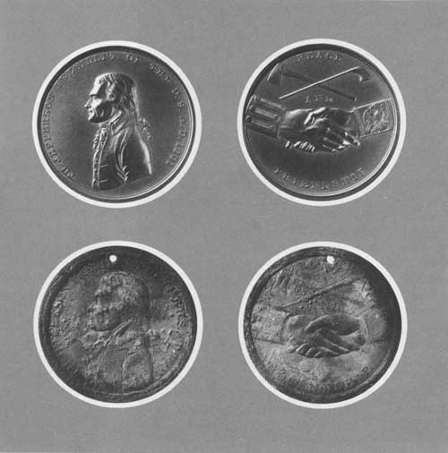 1801 Jefferson Presidential Medal found by Washington State Archeologists in July, 1964 when relocating an old Indian graveyard at the mouth of the Palouse River. |
By an act of the 1955 Washington State Legislature, the highway network along the Columbia from Vancouver via Kennewick, to the mouth of the Walla Walla River, and from there via Walla Walla and Pomeroy to the Idaho border at Clarkston, Washington, was established as a Lewis and Clark Highway. The State Highway Department has erected Lewis and Clark Highway markers along this officially designated route.
Four counties—Benton, Clark, Franklin, and Walla Walla—have developed recreation areas along the Expedition route. Many of the cities, towns, and villages along the route have parks and some of these municipalities have erected signs or monuments concerning the Expedition. The Pacific Power and Light Company has developed recreation facilities on its three reservoirs on the Lewis River east of Woodland, Washington. The Columbia Historical Pageant, an annual event sponsored by the city of Richland, includes scenes relating to the Lewis and Clark Expedition. It takes place in mid-summer at Columbia Park, a Benton County facility located on the bank of the Columbia east of Richland.
As a result of the dam and reservoir construction activities of the Corps of Engineers on the Columbia and Snake Rivers in Washington, extensive archeological salvage surveys have been accomplished within the reservoir areas prior to flooding. These surveys financed by the Corps were made by teams from the University of Washington and Washington State University. Many of the excavated sites had been occupied by Indians at the time the Expedition was in this region. Archeologic investigations along the lower Columbia River have been less extensive.
In July 1964 archeologists from Washington State University, while relocating an old Indian graveyard at the mouth of the Palouse River, opened a casket made from a dugout canoe. Inside the casket, in a leather pouch buried with the remains, they found an 1801 Jefferson Presidential Medal like those given by Lewis and Clark to important Indian chiefs. On one side is a likeness of President Jefferson with the words, "TH JEFFERSON, PRESIDENT OF THE U. S., AD 1801," around the edge. On the other side are two clasped hands, a peace pipe and a hatchet crossed, and the words "PEACE AND FRIENDSHIP."
There are 69 recreation sites in the general area, with 42 existing and 27 proposed. Some 26 areas provide water-based recreation and 26 additional water-based recreation areas are proposed for development by State and Federal agencies near the Trail. The total area of land and water included within the 69 sites is about 62,765 acres. Of this amount approximately 56,000 acres of land and water are included within the existing sites; 6,500 acres will be within the proposed sites. The facilities existing and to be developed provide opportunities for all forms of water-oriented recreation, and for camping, picnicking, hunting, hiking, horseback riding, sightseeing, nature study, winter sports, and many other attractions.
The tables found on pages 160 to 166 list pertinent data relating to existing and potential recreation areas, historic sites, and conservation areas along or near the route of the Lewis and Clark Expedition in Washington.
For the purpose of discussing recreation resources and needs with particular emphasis on the existing and proposed recreation sites, the route followed by the Lewis and Clark Expedition in Washington is treated in four sections, which follow:
CLARKSTON TO ICE HARBOR DAM
The Expedition route from Clarkston to Ice Harbor Dam includes all but the lower 10 miles of the Snake River portion of the route in Washington.
Four dams have been authorized and are in various stages of construction by the Corps of Engineers along this stretch of of the Snake. Ice Harbor Dam, completed in 1962, is located 10 miles upstream from the mouth of the river. The reservoir formed by this dam has been named for Sacajawea, the Indian woman who accompanied the Expedition. Sacajawea Lake, which has a surface area of 9,200 acres, extends upstream 32 miles to Lower Monumental Dam site. This dam, scheduled for completion by 1967, will back water up to Little Goose Dam site, creating a reservoir nearly 30 miles long. Little Goose Dam site, when completed in 1968, will form a 37 mile long reservoir ending at Lower Granite Dam site. Lower Granite Dam, now in the preliminary construction phase, is expected to impound water by early 1971. This last dam of the series will back water a few miles up the Snake River past Clarkston, which is 32 miles upstream from the dam site.
The Corps of Engineers has developed four recreation areas on Sacajawea Lake, one of which has been named Charbonneau Park after the Indian woman's husband. The Corps has selected 12 potential recreation sites for development on the other three reservoirs in this section. When all of the reservoirs have been filled on this stretch of the river, the adjoining shore-lands will be under the administrative jurisdiction of the Corps of Engineers. It is the Corps policy to lease lands to State and local agencies for recreation and fish and wildlife purposes. Locks at each of the four dams will permit the passage of pleasure craft and commercial boats.
At the present time, the nearest State park is Palouse Falls State Park, located about five miles north of the Snake River on the Palouse River, a tributary to the Snake. The Kamiak Butte State Park is also north of the Snake near Pullman. No existing county or local parks are along this section of the Trail except those in the cities of Clearwater, Colfax, Dayton, and Pullman. Columbia County has identified a potential park on the Snake River at the mouth of the Tucannon River.
No highways or roads closely parallel the Snake in this section for any great distance, but railroads follow both banks of the river upstream for about 65 miles and then along the north or right bank as far as Lewiston, Idaho, across from Clarkston, Washington. U.S. Highway 410 follows the river west of Clarkston for about seven miles to where the river turns sharply to flow north. U.S. Highway 295 crosses the river about 55 miles downstream from Clarkston on the only bridge between the one at Clarkston and the road across Ice Harbor Dam at the lower end of this stretch of river. Lyons Ferry, crossing near the mouth of the Palouse, will be replaced with a highway bridge upon completion of Lower Monumental Dam. County roads provide access to the river at several points on both banks of the river. When the other dams are completed and recreation areas have been developed on the new reservoirs, the access situation undoubtedly will be much improved along this section of the Trail.
 Archeologic site at the mouth of the Palouse River where the Jefferson Presidential Medal was unearthed. |
The existing and planned Corps of Engineer recreation developments on Sacajawea Lake and its plans for development on the other three reservoirs should provide sufficient opportunities for access and recreation use of this section of the Lewis and Clark Trail for the foreseeable future.
ICE HARBOR DAM TO BONNEVILLE DAM
The Expedition route from Ice Harbor Dam to Bonneville Dam includes the lower ten miles of the Snake River and a 175-mile portion of the Columbia River extending down to the upper limit of tidewater on the river.
At the time the Expedition passed by, this part of the Columbia contained falls, cascades, and rapids. Now John Day Dam, the last in a series of four dams being constructed by the Corps of Engineers on this stretch of the Columbia, is nearing completion. The first dam in this series, completed in 1943, is Bonneville, located at the site of the rapids or cascades farthest downstream on the Columbia. The 20,600-acre reservoir formed by this dam backs water 47 miles up the river to The Dalles Dam, completed in 1957. The Dalles Dam, in turn, forms an 11,000 acre reservoir which extends 24 miles upstream to the site of John Day Dam. When this dam is completed in 1968, it will inundate the 75-mile stretch of river between John Day and McNary Dams. The reservoir created by McNary Dam in 1953 is 61 miles long and has a surface area of 38,800 acres. It extends up the Columbia almost 30 miles past the mouth of the Snake and also backs up the Snake 10 miles to Ice Harbor Dam.
Except for a view point and visitors' building at the dam, the Corps of Engineers has developed no recreation areas on the Washington shore of Bonneville Reservoir. The Corps has developed and administers recreation sites on both The Dalles and McNary reservoirs, however, and has authorized such developments by State and local agencies. The Corps also has located three potential recreation areas on McNary Reservoir, two of which will be administered by Benton County. The Corps identified eight sites that will have potential for recreation development when the new John Day Dam reservoir is filled. Locks in all four of the dams along this section will permit passage of recreation boaters as well as commercial boat traffic.
The Bureau of Land Management has identified several tracts of public domain lands with recreation potential along this section of the Expedition route. There is a small segment of Gifford Pinchot National Forest bordering the Trail along the north shore of Bonneville Reservoir. Its potential for recreation development is limited because of problems of terrain and access; however, one potential recreation development site has been identified. The Forest Service's Cascade Crest Trail, which follows the Cascade Range across Washington and Oregon, crosses the Columbia River at this point.
The Bureau of Sport Fisheries and Wildlife administers McNary National Wildlife Refuge, located east of McNary Reservoir and south of the Snake River. This refuge includes about 2,000 acres of land and water. The Bureau has plans for a wildlife refuge on the John Day Reservoir when it is completed; to be called the John Day Waterfowl Management Area. It would include about 7,500 acres of land on the Washington shore of the reservoir.
The State and local recreation areas located on McNary reservoir include Sacajawea State Park, at the mouth of the Snake River; Columbia Park (Benton County); Chiawana Park (Franklin County); Hood Park (Walla Walla County); and Riverside Park (City of Richland). Benton County has expressed interest in developing two potential park areas on McNary Reservoir. The Corps of Engineers administers Wallula Park at the mouth of the Walla Walla River on McNary Reservoir.
The State Game Department administers the 8,945-acre McNary Game Range, located along the east shore of McNary Reservoir and south of the mouth of the Snake River. This area provides opportunities for waterfowl and upland bird hunting, fishing, and boating.
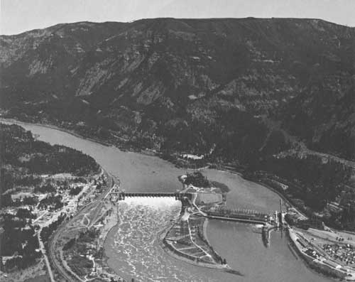 Bonneville Dam is located at the upper end of tidal water on the Columbia, 145 miles from the Pacific Ocean. Captain Clark noted the effect of the tide here in his journal entry for Nov. 2, 1805. |
At The Dalles Reservoir, the Corps of Engineers has developed three recreation areas on the Washington shore. Two of these, Maryhill Park and Avery Area, also are administered by the Corps. The other area, Horsethief Lake Park, has been turned over to the Washington State Parks and Recreation Commission for administration. The Corps has plans for development of one other recreation area at this reservoir. North of the reservoir about 16 miles is another State park area, Brooks Memorial State Park, located along U. S. 97.
The road across the top of Ice Harbor Dam connects with roads along both sides of the Snake River from the dam down to the mouth of the river. U.S. Highway 395 follows the left bank of the Columbia from Pasco to the Oregon border. U.S. Highway 410, which begins at Clarkston, comes down the Walla Walla River and then turns north along the Columbia to Pasco. Here it crosses the Columbia to Kennewick, and then follows the right bank of that river upstream to the mouth of the Yakima River State Highway 12 starts at Kennewick, heads overland, south, to McNary Dam, and then turns west to follow the right bank of the Columbia downstream as far as Maryhill. There U.S. Highway 830 takes over and continues along the river almost to its mouth. These last two highways, together with the portion of U.S. 410 from Kennewick to the mouth of the Walla Walla River, are a part of the State's Lewis and Clark Highway.
In the 10-mile stretch of the Snake included in this section, there is a bridge at the mouth of the river and a road across the top of Ice Harbor Dam. On the Columbia, between the mouth of the Snake and Bonneville Dam, there are five toll bridges and one ferry crossing.
Railroads parallel the entire route through here, running close to the water between the highway and the river on both sides of the Columbia and along the north bank of the Snake. This complicates the problem of access, and interferes with the development of otherwise suitable recreation sites.
A large sign, erected by the Kennewick Women's Club, marks the farthest point upstream on the Columbia River reached by members of the Expedition. A State Highway Department sign near Sacajawea State Park pays tribute to Sacajawea, the only female member of the Expedition.
The existing and planned recreation areas along this section are not sufficient to meet the demand. Access is especially inadequate along the Washington side of Bonneville Reservoir where there are no public recreation areas. Improvement of access is impeded by the shortage of suitable development sites and the railroads which lie between the highway and the water.
 Horsethief Lake Park looking west from Washington down The Columbia River. |
BONNEVILLE DAM TO THE PACIFIC OCEAN
The Expedition route from Bonneville Dam to the Pacific Ocean includes the final portion of the Expedition's westward route down the Columbia River to its destination. Except for the cities, towns, and industries located on the river banks, this section of the Expedition route remains much the same today as when the explorers passed this way.
The Corps of Engineers has improved the Columbia River channel to a depth of 35 feet as far upstream as the mouth of the Willamette River, and to 30 feet as far as Vancouver. From Vancouver to Bonneville Dam the channel depth has been improved to 27 feet. Bonneville Dam, the farthest downstream of all the dams on the Columbia, is at the upper end of tidal water on the river, 145 miles from the Pacific Ocean. Captain Clark noted the effect of the tide here in his journal entry for November 2, 1805.
A good system of highways follows the Columbia along this section, but access from these highways to the river needs to be improved. U.S. Highway 830 runs west along the river from Bonneville Dam to Vancouver. This section of the highway is a part of the State's Lewis and Clark Highway which begins at Vancouver and goes east. At Vancouver, U.S. 830 joins Interstate Highway 5 and U.S. Highway 99, then, still following the river, turns north to Kelso. At Kelso, Interstate 5 and U.S. 99 continue north, but U.S. 830 turns west with the river as far as Skamokawa, 30 miles from the river's mouth, before turning away. Near the ocean, State Highway 401 and U.S. Highway 101 follow the lower 15 miles of the river to Ilwaco. State and county highways provide access from Ilwaco to Cape Disappointment and the ocean beaches.
 Beacon Rock State Park west of North Bonneville, Washington, on the Columbia River |
There is a bridge across the river at Vancouver, and another near Longview, Washington. At Cathlamet a bridge, island, and ferry combination cross the river, while at the mouth of the river a ferry, soon to be replaced by a bridge, provides the fourth crossing in this section. The new bridge will be named the Lewis and Clark Bridge.
A railroad follows the river downstream as far as Longview. Because the railroad is between the river and the highway for most of this distance, public access to the river is impeded.
The concentration of population in the metropolitan Portland, Oregon, area has created a demand for recreation which exceeds available supply. The only Federal area providing recreation opportunities along this section of the Trail is Fort Vancouver National Historic Site, administered by the National Park Service at Vancouver. This 90 acre historical area commemorates the establishment in 1824 of Fort Vancouver, a Hudson's Bay fur trading post. It includes the site of a new fort, built in 1829 about a mile west of the original fort, and occupied by the Hudson's Bay Company until 1860.
Of the five State parks along the Trail in this section, four include or adjoin areas related to the Lewis and Clark Expedition. Beacon Rock, a huge monolith located just a few miles below Bonneville Dam, was first noted and named by Lewis and Clark; it is now the principal feature of Beacon Rock State Park. Fort Canby State Park is on Cape Disappointment, a headland named by the explorer John Meares in 1788. Lewis and Clark knew of the cape's location and they recognized and explored it in 1805. Ft. Columbia State Park and museum on Chinook Point overlooks the site where the Expedition camped for two weeks while exploring that region. The campsite itself is marked by a sign at Lewis and Clark Campsite State Park. The other State park in this section is Paradise Point State Park, about five miles off the Expedition route where Interstate 5 and U.S. Highways 830 and 99 cross the east fork of Lewis River. Located farther upstream on the east fork of the Lewis River is Clark County's Lewisville Park, the only county park along the Trail in this section.
The State Department of Game administers three trout and steelhead hatcheries along this section of the Trail and the Department of Fisheries has five salmon hatcheries and a fishway. There are two small-boat basins on the Washington side of the Columbia which contribute to the recreation picture. These are the Ilwaco Small-Boat Basin, administered by the Port of Ilwaco, and the Chinook Small-Boat Basin, administered by the Port of Chinook. A similar facility has been proposed for development at Cathlamet by the Wahkiakum County Port District No. 1.
The Pacific Power and Light Company has developed five recreation areas on its three reservoirs located on the Lewis River east of the Expedition route. Only the two areas on Lake Merwin, the reservoir nearest the Trail, are included in this study.
There are several markers and monuments related to the Expedition's experiences along this section of the route. A sign near Chinook identifies the general location of their campsite west of Chinook Point. A rock monument and sign at Long Beach mark the approximate spot where a tree once stood upon which Captain Clark carved his initials on November 19, 1805.
WALLA WALLA RIVER TO CLARKSTON
This section includes the portion of the Expedition's return route from the mouth of the Walla Walla River overland to where it crossed the Snake River, just a few miles downstream from Clarkston. The exact location of the Expedition route is difficult to determine because the party followed old Indian trails which have long since disappeared.
Most of the land bordering the Expedition's route is privately owned and devoted to farming and grazing use. U.S. Highway 410, which follows the route quite closely, has been designated as the Lewis and Clark Highway by the State legislature. Beginning at the mouth of the Walla Walla River, U.S. Highway 410 heads east along that river to the Walla Walla, then turns northeast through Waitsburg, Dayton, and Pomeroy to Clarkston, on the Snake River.
The Corps of Engineers administers Wallula Park, located at the mouth of the Walla Walla on the shore of a bay formed by the backwaters of McNary Dam. The Bureau of Reclamation has proposed the construction of three irrigation reservoirs along this section of the Expedition's route. The only one of these three projects with recreation potential is Dayton Dam.
Whitman Mission National Historic Site, located just west of Walla Walla and administered by the National Park Service, commemorates the establishment of a mission among the Cayuse Indians by Dr. Marcus Whitman in 1836. The 98 acre site includes the area where the mission stood, and the grave of Dr. and Mrs. Whitman and 11 others, all of whom were killed by Indians who attacked and destroyed the mission in 1847.
Lewis and Clark Trail State Park, located on the Lewis and Clark Highway between Waitsburg and Dayton, is the only State park facility along this section of the Expedition route. W. T. Wooten Game Range, administered by the Washington Game Department, is located a few miles south of the Expedition's route near Dayton. Its 11,235 acres are dedicated to wildlife management, providing opportunities for upland bird and big game hunting, trout fishing, and camping. In addition, lands and buildings within the game range have been made available to the Washington State Parks and Recreation Commission for organized group camping purposes. This facility is known as Camp Wooten. Asotin Game Range, comprising 6,357 acres, is located several miles south of the Expedition route in the edge of the Blue Mountains, south and west of Clarkston.
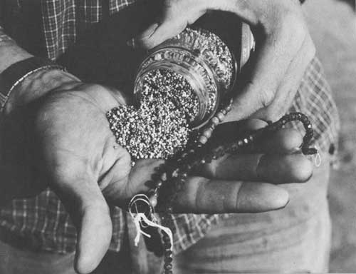 Trade beads found at a Nez Perce burial site. |
The city of Walla Walla, though not on the route of the Expedition, is situated on the Lewis and Clark Highway. It has a city park which provides facilities for overnight camping.
There are no county parks located along this section, but, some of the counties have erected signs and markers related to the Expedition. Both Garfield and Asotin Counties have put up informational signs where the Lewis and Clark Highway crosses the county line. A monument on the lawn of the Columbia County Court House in Dayton marks the Lewis and Clark Trail.
The city of Waitsburg has erected a sign at the edge of town proclaiming its location on the Lewis and Clark Trail, and another sign at the local high school commemorates the Expedition and some of its members.
If the Bureau of Reclamation's proposed Dayton Dam is constructed and if recreation facilities are installed on the reservoir, it would help meet the demand for recreation opportunities along this section of the Expedition route. A need exists for a recreation area in the vicinity of Pomeroy, and for another along the Snake River below Clarkston.
The Corps of Engineers' potential areas along the Snake near Clarkston, which might be suitable for development when Lower Granite Dam and Reservoir are completed, would help provide for the needs in this section.
The State-designated Lewis and Clark Highway in this section needs to be relocated in some places, using existing State Highways, in order to follow more closely the Expedition's return route.
RECREATION TRENDS
Demand for recreation areas along the Lewis and Clark Trail in Washington will depend largely on the interest aroused in the project and on the quality of the effort made to identify, mark, and develop areas along the route. Some indication of demand can be found in population projections for the State as a whole and to trends in travel on the highways which parallel the route.
The 1960 Bureau of Census report for Washington lists 2,853,214 inhabitants, an increase of almost half a million, or 19.9 percent, over the 1950 census. Population projections indicate that by the year 2000 the number of inhabitants will have increased to 6,378,000. The largest city along the Trail in Washington is Vancouver, with 32,464 inhabitants in 1960. Clarkston, at the eastern end of the route across the State, had 6,209 inhabitants that same year. Other principal cities along the route in Washington and their 1960 census totals are Pasco, 14,522; Kennewick, 14,244; Richland, 23,548; Longview, 23,349; and Kelso, 8,379.
Washington is a popular target for vacationists. Mount Rainier and Olympic National Parks, the five National Forests along the Cascade Mountains with their wilderness areas, the waters of Puget Sound, a system of more than 100 State parks, and the Pacific Ocean beaches are a combination that attracts recreationists from all over the country. A very high percentage of these tourists will use highways that parallel or intersect the Lewis and Clark Trail. If additional facilities are provided along the Trail and if the route is publicized and promoted properly, it could become a popular tourist attraction. This would increase considerably the demand for recreation sites along the Trail.
The Interstate Highway System plan for Washington involves three highways, two of which cross the Lewis and Clark Trail. Interstate Highway 5, which runs from Mexico to Canada, crosses the Columbia River between Portland, Oregon, and Vancouver, Washington and then parallels the Trail downstream (north) on the Washington shore for 40 miles until the river turns west again. Highway 82, which takes off from Interstate 80N at Pendleton, Oregon, will cross the Columbia near McNary Dam and then continue on to Seattle. This Interstate Highway route has its beginning as Interstate 80 on the east coast.
Without doubt, these Interstate Highways when completed will prove popular with recreationists as a means of getting quickly to their vacation destination. Such highways will not be good "recreation roads," however, because of high speed traffic and inability to leave the highway except at certain designated access points. As a result, demand may increase for recreation areas on the Washington side of the Columbia River across from Interstate Highway 80N, which runs along the Oregon side of the river for about 165 miles upstream from Portland. Recreationists may prefer the more leisurely pace along the Washington side of the river, especially if additional recreation facilities are provided at suitable intervals.
 Access problem in Washington, showing the railroad running between a highway and the Columbia River. |
SPECIAL PROBLEMS
The principal problems affecting the recreation use of the Lewis and Clark Trail in the State of Washington are related to topography. The route used by the Expedition on its westward journey followed the narrow confines of the canyons of the Snake and Columbia Rivers. These natural avenues of travel were used later by the railroads and highways. Still later, because of the hydroelectric power potential in the river and the need to improve water transportation, dams were built. Consequently, most of the readily accessible lands which would be best suited to recreation purposes have been used for highways, railroads, or reservoirs. The problem now is to find suitable or adaptable recreation sites, and to obtain access, since often either a railroad runs between the highway and the river, or a precipitous cliff lies in the way. The access problem can best be solved by cooperative efforts of the Federal, State, local, and private agencies involved. Washington is now preparing a State Recreation Plan which will consider similar problems throughout the State and could provide the needed impetus for a solution.
RECOMMENDATIONS
A basic development program for the historic, wildlife, and recreation resources along the Lewis and Clark Expedition route appears in the Recommended program, page 20. The recommended routing of a Lewis and Clark Trail Highway in Washington is indicated on maps 20-23. Specific recommendations relating only to Washington follow:
1. The Corps of Engineers should work with the State and local agencies to provide recreation sites and improved access along the north shore of Bonneville Reservoir.
2. The Corps of Engineers should continue its program of identifying and developing recreation areas on its new reservoirs on the Columbia and Snake Rivers.
3. The Bureau of Sport Fisheries and Wildlife should proceed with its plans to develop the proposed John Day Waterfowl Management Area, including the acquisition of needed additional lands, in order to provide waterfowl benefits and improve waterfowl hunting opportunities along the Lewis and Clark Trail.
4. The Bureau of Land Management and the Forest Service should continue to study the recreation potential of lands under their respective jurisdictions along the route of the Lewis and Clark Expedition in the State, and develop those sites suitable for recreation.
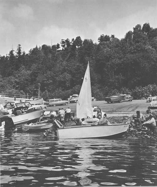
5. The Bureau of Reclamation should develop recreation sites on the reservoir behind Dayton Dam in the event that this project is constructed.
6. The State and local agencies should provide additional recreation areas, signs and markers, and improve access along the Columbia River between Bonneville Dam and the mouth of the river.
7. The local agencies should provide additional recreation opportunities and markers along the return route of the Expedition between the mouth of the Walla Walla River and Clarkston, Washington.
8. Some galleries in existing museums along the Trail should be oriented toward the Lewis and Clark exploration.
OREGON

SUMMARY
The Lewis and Clark Expedition traveled by canoe down the Columbia River in the fall of 1805 enroute to the mouth of the river and their destination, the Pacific Ocean. They spent the winter at a site they named Fort Clatsop, close to the ocean and the mouth of the river. On the return trip in the spring of 1806, their mode of transportation was again canoe until they reached the vicinity of present-day The Dalles, Oregon. Here they abandoned canoes in favor of horses, crossed to the Washington shore, and continued their journey eastward along the north bank of the Columbia River. Many of the sites directly associated with the Lewis and Clark Expedition can be visited today. These include Hat Rock, Fort Clatsop, the Salt Cairn and Tillamook Head.
The upper 120 miles of the Expedition's Columbia River route soon will be entirely flooded by reservoirs when the John Day Dam, now under construction, joins Bonneville, The Dalles, and McNary Dams to complete the series. The shorelands of these four reservoirs offer opportunities for needed recreation areas and facilities to provide for water-oriented recreation activities. However, problems of access and shortage of suitable terrain complicate the picture.

The Columbia Gorge section of the Columbia River is not only the most scenic portion of the Expedition's route in Oregon but is also the most highly developed from the standpoint of recreation areas and facilities. These include developments by the Forest Service on lands of the Mt. Hood National Forest and a concentration of State parks and recreation areas.
Demands by recreationists from nearby metropolitan areas who are attracted by the scenic qualities of the Gorge, however, have generated an even greater need for development.
The lands bordering the 145 mile section of the Expedition's river route downstream from Bonneville Dam are almost entirely privately owned. This section is much more heavily populated than the area upstream and there are only a few recreation areas at present.
The area around Fort Clatsop and south along the ocean to Cannon Beach, Oregon, (which was as far south as members of the Expedition traveled) receives heavy recreation use at the present time. This recreation demand will be even greater when the bridge replacing the auto ferry is completed across the mouth of the river. Additional recreation areas will be needed here as well as improved access to the ocean beaches.
There are 65 existing and 26 proposed recreation sites along the Lewis and Clark Trail in Oregon. Together these sites provide over 97,000 acres of land and water, making possible all forms of water- and land-oriented recreation.

BACKGROUND
The Lewis and Clark Expedition entered the last state of their epic westward explorations when, on the second day of floating down the Columbia River, they touched the shores of what was to become the State of Oregon. During that day they observed and named Hat Rock, a peculiar basaltic outcropping on the south side of the river, according to Captain Clark's field notes. The campsite that night is believed to have been on the south bank of the river a few miles downstream from the mouth of the Umatilla River.
During the next three weeks, as the Expedition continued by canoe down the river to its mouth, they camped at four other sites on the Oregon shore. They were the first white men to see the John Day and Deschutes Rivers. They named the former river Lepage after one of the men and used the Indian name, Towornehiooks, for the latter. The Willamette River was missed entirely.
 Indian petroglyph carved on rock which can now be observed in the Museum at The Dalles. |
The many rapids and falls encountered along the upper part of the Columbia River slowed their progress considerably. The portages around Celilo Falls and present-day The Dalles were difficult but did not cause too much trouble. Finally, on November 2, 1805, they passed the last series of rapids on the Columbia. A week of travel brought them from here to the mouth of the river, a distance of about 145 miles.
After reaching the vicinity of the ocean, the Expedition camped for two weeks on the Washington shore while looking for a suitable winter campsite. They decided that the south side of the river offered better opportunities for a camp, and on November 26, 1805, they crossed to the Oregon shore. A good site was found on the left bank of a river now called the Lewis and Clark River which empties into Young's Bay, south and west of present-day Astoria, Oregon.
Construction was started immediately on a fort consisting of seven cabins and a stockade, and called Fort Clatsop after a local Indian tribe. They moved in just before Christmas, even though the buildings were not completed.
The winter at Fort Clatsop was spent in preparation for the long trip home. A salt works was set up on the coast and a good quantity of salt was obtained by boiling sea water. The hunters brought in elk which provided food as well as material for making clothes. A trip across Tillamook Head to obtain oil and blubber from a stranded whale was not too successful. The Indians already had salvaged everything of value and the explorers had to give part of their fast dwindling supply of trade goods in exchange for a small quantity of whale oil.
The long winter was hard on the health and morale of the men, so when spring came they were anxious to get started on the long trip home. On March 23, 1806, traveling by canoe, the party headed up the Columbia River.

For the first part of the return trip the group stayed close to the Oregon shore. Not knowing that the mouth of the Willamette was concealed behind a group of islands, they again passed it by. However, while camped further upstream for a week to replenish their food supply by hunting, they learned from local Indians of the Willamette's existence and location. Captain Clark returned with a small group and explored the lower reaches of the Willamette River about as far upstream as the city limits of present-day Portland, Oregon. He sighted and named Mt. Jefferson while near the mouth of the Willamette.
When the Expedition resumed its journey, the rapids on the Columbia proved even more troublesome than they had been the previous fall because of the higher spring water level. To avoid the difficult portages and to make better time, they decided to trade with the Indians for pack horses to haul their supplies and equipment. The Expedition camped for three days near present-day The Dalles, Oregon, at a place they called Rock Fort, while Captain Clark crossed the river to engage in horse-trading activities with the Indians. Then, on April 18, 1806, the main group crossed to the Washington shore where, traveling overland along the north bank of the river, they continued their upstream journey.
The Expedition spent nearly four and half months in Oregon altogether. Of this time, nearly four months were at or near Fort Clatsop while the remaining two weeks were spent at camps on the Oregon shore during the outbound and return journey on the Columbia River. Except for the hunting excursions near Fort Clatsop, the trip to see the whale, and the exploration of the lower Willamette River, the Expedition did not see much of the State of Oregon.
The first part of the Expedition's river route along a portion of Oregon's northern boundary has changed considerably during the intervening years, due principally to the construction of dams along this stretch of the Columbia River. What was formerly a series of turbulent rapids and falls when the Expedition passed this way will become four consecutive quiet pools when the last of four power dams is completed in the near future. Hat Rock, though, was not flooded by the backwaters of McNary Dam. It remains an easily recognized landmark and the principal feature of Hat Rock Park on the shore of McNary Reservoir.
The lower section of the river route is still much the same except for the cities, towns, industries, highways, and railroads which occupy much of the river bank. The immediate area around the site of Fort Clatsop is being restored to a natural state. The site of the salt cairn and the beach where the whale was stranded are now within the city limits of Seaside and Cannon Beach, respectively. Tillamook Head, or Clark's Point of View, probably has changed the least of all. Still wild and rugged, it is much the same as the day Captain Clark stood on top of the bluff and marvelled at the view of the Pacific Ocean.

Most of the names given by the explorers to the Oregon landmarks have disappeared. Clark's Point of View became Tillamook Head, and Ecola or Whale Creek has been changed to Elk Creek. Likewise, the large bay near the fort which they named Meriwether Bay is now called Young's Bay, while Point William, on the Columbia, is now Tongue Point. But some of their names have remained: Hat Rock, Mount Jefferson, Fort Clatsop.
All visible traces of Fort Clatsop have long since vanished. When the Expedition started for home in March of 1806 they presented the fort and its furnishings to a local Clatsop Indian chief. Traces of the fort persisted for many years after the Indians were gone; many of the early settlers mentioned seeing it. The present replica of the fort is located as close to the original site as studies of the journals and maps could determine.
The State of Oregon has remembered the leaders of the Expedition in several ways. The river flowing past the fort site, which the Expedition called by its Indian name, Netul, has been renamed Lewis and Clark River. The bridge which is being constructed across the mouth of the Columbia River will be called Lewis and Clark Bridge. Farther upstream on the Columbia, on the east side of the Sandy River, is Lewis and Clark State Park. Lewis and Clark College, located in Portland, Oregon, also commemorates the Expedition's leaders. Camp Meriwether, a Boy Scout camp, is located on the Oregon coast south of Tillamook, Oregon. The camp contains a replica of a Mandan Indian earth lodge and the pageant put on by the Scouts each week during the summer for the benefit of new arrivals includes appropriate references to the Expedition.
The Expedition's contributions to the State were considerable. Their experiences and discoveries, which were well publicized after the Expedition's return to civilization, led John Jacob Astor to establish a fur trading post, Fort Astoria, at the mouth of the Columbia. This American establishment, which was constructed in 1811 just five years after Lewis and Clark left Fort Clatsop, undoubtedly strengthened claims of the United States to the Oregon Territory.

FINDINGS
RECREATION RESOURCES
The Lewis and Clark Expedition traversed about 310 miles of the Columbia River which now forms the boundary between Oregon and Washington. It is possible to visit several sites in Oregon which relate directly to the Lewis and Clark Expedition. These include Hat Rock, Fort Clatsop, the Salt Cairn and Tillamook Head. Three of these sites, Hat Rock, Tillamook Head, and Fort Clatsop, are within the boundaries of established State or Federal park areas. The site of the Salt Cairn is marked by a monument erected by local civic groups.
Because of the outstanding attractiveness of the river, a "recreation ribbon" of parks and other recreation sites paralleling the river has been developed, particularly in the area of the Gorge between Sandy River and The Dalles.
There are 65 existing and 26 proposed recreation sites along the river. Thirty provide some form of water-based recreation; 18 additional water-based recreation areas are planned by State and Federal agencies near the Trail. Over 97,000 acres of land and water are included in the 91 sites. All forms of water-and land-oriented recreation opportunities are offered.
A detailed list of existing and proposed points of recreation and historic interest along the Trail, and pertinent information concerning each, are found in the tables on pages 162 to 166.
The State Parks and Recreation Division of the State Highway Department administers 30 State parks and waysides along the route of the Lewis and Clark Expedition in Oregon. These areas, most of which are located along the Columbia River, enable recreation uses such as picnicking, camping, swimming, and boating. Some of the parks and waysides contain excellent scenic viewpoints and natural features. The total attendance at these parks in 1963 was 2,467,333 day-use visitors. Two of the State parks are located on sites related to the Expedition. Ecola State Park, on the Oregon Coast, includes Tillamook Head, or Clark's Point of View. The other park is Lewis and Clark State Park, on Sandy River not far from its confluence with the Columbia. While not located on the site of an Expedition camp, this park is related to their explorations of the lower reaches of Sandy River, which they called Quicksand River.
Oregon has an excellent historical sign program under the direction of the State Highway Commission, working in cooperation with the Oregon Historical Society. Seven signs along the Lewis and Clark Trail in the State point out sites or describe events related to the Expedition's travels. The State Parks and Recreation Division has plans for expanding its interpretive program at Ecola, Lewis and Clark, and Fort Stevens State Parks to commemorate experiences of the Expedition in or near those areas.
The State Game Commission and the State Fish Commission administer numerous areas along the Expedition's route in Oregon. These areas provide recreation opportunities, public access, and fish and game protection, as well as contributing to sport fish and game production and to the commercial fish harvest. At each of the dams on the Columbia River along Oregon's northern boundary, fish ladders have been constructed by the Corps of Engineers to permit the passage of anadromous fish. Facilities also include opportunities for the public to observe the fish using these ladders. The reservoirs behind the dams and the 145-mile stretch of river below the first dam on the river form important Sport and Commercial fisheries as well as good waterfowl habitat.
The State Game Commission administers three game management areas along the Lewis and Clark Trail. Two of these, Government Island and Sauvie Island, are islands in the Columbia River which the explorers mentioned in their journals. They camped overnight on Government Island, which they called Diamond Island, in November 1805. Public hunting and fishing are permitted on the islands and, in the case of Government Island, opportunities are provided for boating, water skiing, and picnicking. The other game management area is Fort Stevens, on the Oregon Coast not far from Fort Clatsop.
The State Fish Commission operates four salmon hatcheries along the Trail, all located on tributaries to the Columbia River. These facilities supply salmon to assist in maintaining the Columbia River runs, and also provide an opportunity for the public to view hatchery operations. In addition to the State Fish Commission hatcheries, there are two hatcheries operated by the State Game Commission located along the Trail.
The Columbia Gorge Commission, a three-member State Commission, was created by the Oregon Legislature in 1953. It is charged with ". . . preserving, developing and protecting the recreation, scenic, and historic areas of the Columbia River Gorge..." This commission has been active in acquiring lands for public use and in coordinating other agency programs in the area lying between the Sandy River on the west and Celilo on the east. Because the Gorge is closely associated with events and experiences of the Lewis and Clark Expedition, the Commission's activities and programs contribute immeasurably to the goals of the Lewis and Clark Trail Study.
Several of the counties and municipalities along the route of the Expedition in Oregon have developed parks, recreation areas, and historic sites.
Archeologic salvage surveys were conducted at the several Corps of Engineers reservoirs along the Columbia River in Oregon prior to their construction. Similar investigations along the Columbia between the mouth of the river and Bonneville Dam have not been as extensive.
The National Park Service, Forest Service, Corps of Engineers, Bureau of Sport Fisheries and Wildlife, Bureau of Land Management, and Bureau of Reclamation have administrative responsibilities along the Expedition route in Oregon. The area administered by the National Park Service is Fort Clatsop National Memorial, the Expedition's campsite during the winter of 1805-1806 and one of the most significant sites along the Lewis and Clark Trail.
To facilitate the discussion of the recreation resources and needs along the Lewis and Clark Trail with particular emphasis on existing and proposed recreation sites, the westward Trail across Oregon is treated in four sections, which follow:
 McNary Dam and Lock |
OREGON-WASHINGTON BORDER TO THE DALLES, OREGON
A series of three Corps of Engineers dams and reservoirs are involved in this 120 mile section of the Expedition's route down the Columbia River. One of these, the John Day Dam, is still under construction. Beginning at the downstream end of the section, the first dam is The Dalles Dam, completed in 1957. This 9,400 acre reservoir extends 24 miles up the Columbia to the John Day Dam, located just below the mouth of the river from which it takes its name. When the John Day Dam is completed in 1968, it will form a reservoir 75 miles long, extending upstream to McNary Dam. The reservoir formed by the backwaters of McNary Dam, completed in 1953, extends 20 miles upstream to the Washington-Oregon boundary and 40 miles beyond.
Lake Celilo, the reservoir formed by the Dalles Dam, flooded Celilo Falls, the historic Indian fishing site on the Columbia River. The opportunity to view the Indians fishing from their precarious platforms extending out over the falls was a popular tourist attraction. This ancient practice still survives on the Deschutes River.
Two parks are located on the Oregon shore of Lake Celilo. One of these is Celilo Park, developed by the Corps of Engineers in cooperation with Wasco County and administered by the county under a lease agreement with the Corps. It is near the site of Celilo Falls and offers day-use recreation facilities for picnicking, swimming, boating, fishing, and water skiing. The other is Deschutes River State Park, on the Deschutes River arm of the reservoir. It has limited use at present as there are no facilities; these are planned, however, and will provide for day-use recreation activities such as picnicking, boating, swimming, and fishing. The Corps of Engineers has identified two potential recreation areas on the south shore of Lake Celilo—the Rufus Area and the Biggs Area, both located near the upper end of the reservoir.
Three recreation areas are located below The Dalles Dam. One of these is Seufert Park, administered by Wasco County under a lease agreement with the Corps of Engineers. The park has a half mile of shoreline on the river but the shoreline is hazardous and not considered suitable for public access. An abandoned cannery building is utilized for a museum of local archeologic and historic exhibits, and for other civic functions. The county proposes to develop picnic facilities, playgrounds, and additional roads and parking. Another recreation area is The Dalles Small Boat Basin, administered by the Port of The Dalles in cooperation with the Corps of Engineers. Recreation facilities here include a boat ramp, protected boat moorage, and marine supplies. The third area is The Dalles Viewpoint and Memorial, administered by the Corps of Engineers. The viewpoint provides a panoramic view of The Dalles Dam and Lake Celilo. The memorial marks entombed Indian remains removed from the reservoir area prior to flooding.
Preliminary planning for the reservoir to be formed by John Day Dam has included the identification of seven potential recreation areas and three potential wildlife management areas on the Oregon shore. One of the latter, the proposed John Day Waterfowl Management Area, would be administered by the Bureau of Sport Fisheries and Wildlife. It would include lands on both the Oregon and Washington shores of the reservoirs as well as the waters lying between.
The 20 mile stretch of McNary Reservoir shoreline between the dams and the Oregon-Washington border contains two recreation areas. One is McNary Beach, administered by the Corps of Engineers, which provides facilities for picnicking, boating, and swimming. The other area is Hat Rock State Park, named for the interesting rock formation first discovered and named by Captain Clark. This park provides opportunities for day-use recreation activities such as picnicking, swimming, boating, water skiing, and fishing.
The Bureau of Reclamation has constructed Cold Springs Reservoir, located about four miles south of the Columbia River near Hermiston, Oregon. The 1,500 acre reservoir and surrounding shorelands are administered by the Bureau of Sport Fisheries and Wildlife as the Cold Springs National Wildlife Refuge. Recreation activities at the reservoir include picnicking, fishing, and nature study.
Toll bridges cross the river just below The Dalles and McNary Dams. A new toll bridge was recently completed a few miles below the John Day Dam site. These three bridges and one ferry are the only crossings in this 120-mile section of the river.
There are no public campgrounds along this section of the Trail and the day-use facilities on McNary and The Dalles reservoirs are not sufficient to provide for present needs. Fulfillment of future needs along this section requires extensive recreation development at all three reservoirs.

THE DALLES TO SANDY RIVER
This section of the Trail takes in about 70 miles of the Expedition's route down the Columbia River and return. Sandy River marks the western edge of the Columbia River Gorge area, which is the channel cut by the Columbia through the Cascade Mountains. The Dalles is located near the Gorge's eastern boundary. This stretch of the Columbia is considered by many to be one of the most outstanding scenic attractions in the Pacific Northwest. The many waterfalls which are found along the precipitous, timber-clad cliffs of the Gorge add to its beauty and are an additional tourist attraction. Multnomah Falls, 620 feet high, is the largest and most famous of these falls.
The upper two-thirds of the section has been inundated by the waters backed up by Bonneville Dam, completed by the Corps of Engineers in 1943. The dam is located at the site of the first series of rapids encountered on the river when proceeding upstream, and is at the extreme upper end of tidal water on the Columbia, some 145 miles from the Pacific Ocean.
The 20,600-acre reservoir formed by Bonneville Dam extends 47 miles upstream to The Dalles Dam. Recreation development opportunities on this reservoir have been limited by such factors as unfavorable terrain and lack of access. Here again U.S. Highway 30 and the railroad between the highway and the reservoir complicate the access problem. Consequently, recreation use of the reservoir is not as great as normally would be expected.
The 24-mile stretch of river downstream from Bonneville Dam to the mouth of Sandy River receives heavy recreation use. This can be attributed to easy access, to terrain that is more suitable for recreation developments along the river, and to the area's proximity to the Portland metropolitan area.
The Columbia River Scenic Highway, which runs through the Columbia Gorge from the Sandy River almost to Bonneville Dam, also affects the recreation use in this area. This highway is the remaining section of the first highway constructed through the Gorge between Portland and Hood River. An engineering wonder of its day, the old road climbs high on the sides of the Gorge and affords good scenic vistas of the Columbia River. Many of the State parks and Forest Service recreation developments in this area are located along the scenic highway.
The Corps of Engineers has developed facilities at Bonneville Dam for visitors who wish to view operations of the dam and its fish ladders. Just below the dam at the Bonneville Salmon Hatchery, operated by the State Fish Commission, there are picnic facilities as well as opportunities for viewing hatchery operations. On the reservoir, the Corps has cooperated with the Port of Hood River in the development of a small boat basin at Hood River. Recreation developments at the basin include a boat ramp, protected moorage, and marine supply and repair facilities. The Corps presently is conducting a study to determine the feasibility of constructing a small boat basin at Cascade Locks in cooperation with the Port of Cascade Locks.
Mt. Hood National Forest borders the river and reservoir for nearly 30 miles in this section. These National Forest lands, in what is defined by the Forest Service as the Landscape Management Area (the area between the Columbia River and the Columbia Gorge breaks) are managed primarily for their recreation values. These include scenic, historic, archeologic, geologic, and botanic values, as well as recreation activities such as camping, picnicking, hunting, fishing, travel, and general sightseeing. A Secretary of Agriculture land classification order of 1915 designated that the lands adjacent to the Columbia River be known as the Columbia Park Division, to be managed for recreation purposes and coordinated with the purposes for which the National Forest was created.
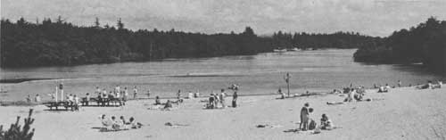
The Forest Service modifies development sites at such recreation attractions as waterfalls and campgrounds if needed to accommodate large numbers of people. National Forest lands immediately adjacent to these occupancy sites, to bodies of water, and to routes of travel are managed so as to provide a pleasing forest environment or recreation zone for the forest traveler and visitor. The background scenery or primary foreground behind the recreation zones is managed so as to present an undisturbed and natural appearance. The Forest Service is preparing a comprehensive plan of management of the recreation resources in the whole Columbia Gorge, to be known as the Columbia Gorge Recreation Area Plan, which will spell out the details of management to achieve the recreation objectives.
The Forest Service has established five recreation development sites in this section, including two campgrounds, two picnic areas, and one concessioner operated lodge. There were no Lewis and Clark camp sites on these National Forest lands. The one historic area that has been established by the Service relates to an early wagon road in this area.
Seven potential recreation development sites have been identified on National Forest lands. Other types of potential areas identified include those which are particularly wild or scenic, or especially suited to mountain climbing, or to archeologic study. The Service also is studying the possibility of a scenic road which would run along the top of the bluff through the Gorge and would afford good vistas of the river and the route used by the Expedition.
The Bureau of Land Management administers some public domain lands in this section which might have potential for recreation. Except for a small tract which is proposed for addition to an existing State park, however, the recreation potential of these lands has not been fully evaluated.
In addition to the previously described hatchery below Bonneville Dam, there are two other State Fish Commission salmon hatcheries located in this section. Both the Oxbow and Cascade Hatcheries are located near Cascade Locks on tributaries to the Columbia. Visitors can observe hatchery operations but there are no other recreation facilities similar to those at the Bonneville Hatchery. Nearby Forest Service picnic areas, however, provide such facilities.
The State Game Commission operates the White River Game Management Area, located near Tygh Valley, south of The Dalles. The Game Commission also operates a fish hatchery in this section, located at Dee, south of Hood River.
The Columbia River below Bonneville Dam is a popular area for steelhead, salmon, and sturgeon sport fishermen. Sandy River has been well known for years because of its smelt fishery, but for some unknown reason smelt have not entered Sandy River for the past seven years even though they were in the Columbia.
The Oregon State Parks and Recreation Division has developed an excellent group of State parks in this section. Lewis and Clark State Park, located on the east bank of Sandy River near the U.S. Highway 30 (Interstate 80N) bridge, contains a historical marker relating to the Expedition. Although the Expedition did not camp here, they did explore the Sandy River area. Rooster Rock State Park, located on the Columbia about 10 miles upstream from the mouth of the Sandy, is a very popular day-use recreation area because of its swimming beach. Lewis and Clark camped at Rooster Rock on November 2, 1805. A historical marker near the park commemorates this event.
There are 22 other existing and two potential State parks in this section. Although some of the existing parks are not developed, they all offer outdoor recreation opportunities and most have facilities for a wide variety of activities, including camping, picnicking, hiking, swimming, boating, fishing, sightseeing, and nature study. Seven of the State parks are along the scenic highway in the Gorge. Six of the parks have frontage on the Columbia River or Bonneville Reservoir but in three of these areas access from the developed portion of the park to the water is cut off by a highway or railroad or both.
The only county park in this section is Oxbow County Park, administered by Multnomah County and located on the Sandy River a few miles above its mouth.
The section of the Trail from The Dalles to Sandy River coincides closely with the area of responsibility of the Columbia Gorge Commission, a three-member State Commission created by the Oregon Legislature in 1953. This Commission has been very successful in its program of bringing into public ownership those Gorge lands which have outstanding recreation, scenic, and historic values. A sum of $100,000 has been made available by the State Highway Commission for purchase by the State of lands in the Gorge which are recommended by the Gorge Commission and approved by the Highway Commission; approximately $80,000 has been spent. Since interest was first aroused in a "Save the Gorge" movement in 1951, some 3,170 acres have been acquired by public agencies through purchase, donation, and exchange.
Subsequent to the establishment of the Columbia Gorge Commission, two events took place in which the Commission's efforts were significant. One was the zoning of that part of the Gorge within Multnomah County against indiscriminate commercial and industrial developments. The other was the establishment of the Columbia River Highway, from Celilo west to Sandy River, as a Scenic Area by the State Scenic Area Commission. Along this highway, except at certain exempted locations, no new billboards may be constructed, and existing ones must be removed by July 19, 1969.
There are only two bridges across the Columbia River in this 70 mile section. One is at Hood River and the other at Cascade Locks. The latter is named Bridge of the Gods because it is located at the site where local Indian legends say a land bridge across the Columbia once existed.
The existing and planned recreation areas are not sufficient to provide for future needs even though this section now is highly developed. This situation is caused by the heavy demand resulting from the scenic attractions on the area, the nearby population pressures, and the highways, which add tourist use to local pressure. Additional areas are needed, especially those with usable frontage on the river or reservoir.
Better access to the Expedition's river route is needed. This problem is complicated by the limited access features of the Interstate Highway being constructed through here and by the difficulties connected with developing crossing sites over the railroad which usually lies between the highway and the water.

SANDY RIVER TO FORT CLATSOP
The section from Sandy River to Fort Clatsop includes the final 120-mile portion of the Expedition's travels on the Columbia River, site of the winter camp at Fort Clatsop, and the area of exploration along the Oregon coast south to the vicinity of present-day Cannon Beach.
There are no dams or reservoirs along this heavily populated stretch of the Columbia River. In contrast to the Trail section immediately upstream, only a small percentage of the land bordering the river is under State or Federal administration.
The National Park Service administers Fort Clatsop National Memorial, located at the site of the Expedition's camp during the winter of 1805-1806. This 125-acre area, which was authorized by Congress in 1958, contains a replica of the fort. The replica, which was constructed in 1955 through the community-wide efforts of individuals, organizations, and commercial firms in Clatsop County, was a feature of the celebration of the sesquicentennial of the Lewis and Clark Expedition. It was based on floor plan dimensions and other descriptions recorded in the Expedition's journals. At that time, the fort site was owned and administered by the Oregon Historical Society which had purchased the area in 1899 and administered it until its establishment as a national memorial. A new visitor center contains a museum with exhibits that tell the story of the Expedition and describe the adventures and experiences that occurred near the fort.
The Corps of Engineers has cooperated in the development of three facilities which contribute to recreation boating use of the Columbia. One is the Oregon Slough Entrance Channel near Portland, which is administered by the Portland Yacht Club. The other two are both small boat basins, one at Astoria and the other at Warrenton, administered by the City of Warrenton.
The State Parks and Recreation Division administers five park areas and has identified one potential area in this section. One of the existing areas, Ecola State Park, includes Tillamook Head, across which Captain Clark led a small party, including Sacagawea, on the trip to see a whale stranded on the beach south of there near present-day Cannon Beach. Gearhart Ocean Wayside is located on the ocean beach between Seaside and Gearhart, not far from the site of the salt cairn. Fort Stevens is situated near the ocean west of Fort Clatsop and Branley Wayside is alongside U.S. Highway 30 on a high bluff overlooking the Columbia River. Saddle Mountain State Park includes Saddle Mountain, a local landmark clearly visible from the site of Fort Clatsop.
The State Game Commission administers three game management areas along this section of the Trail. Two of the areas are on Columbia River islands which were related directly to experiences of the Expedition. Government Island, about three miles downstream from the mouth of the Sandy River, was the site of an overnight camp on November 3, 1805; almost all of this island is now owned by the Oregon Game Commission. This island, and two smaller ones nearby that are also owned by the Commission, are used for waterfowl management purposes. Public hunting and fishing are permitted on these islands, accessible only by boat. They serve also as popular bases for boaters, water skiers, picnickers, and campers.
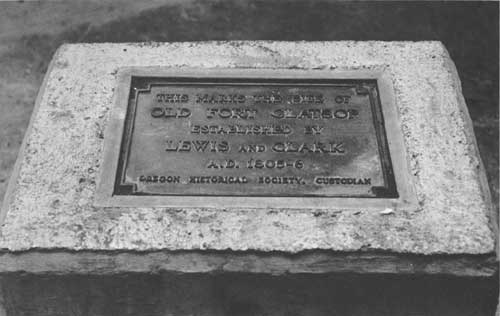
Sauvie Island Game Management Area occupies a major portion of Sauvie Island, located at the confluence of the Willamette and Columbia Rivers. The Expedition made a lunch stop on the north side of the island on November 4, 1805, and Clark walked along the island for about three miles, but no one in the group realized the existence of the mouth of the Willamette River, hidden by this and other nearby islands. The Oregon Game Commission owns much of this large island and administers its holdings as a waterfowl management area and as public fishing grounds. Other recreation activities include boating and picnicking. The island is readily accessible from U.S. Highway 30 by a bridge across Willamette Slough.
The Fort Stevens Game Management Area, which adjoins Fort Stevens State Park, is used primarily for habitat development for game production. Recreation uses include public hunting, hiking, and picnicking. Its 1,466 acres of sand dunes along the ocean just south of the mouth of the Columbia also provide an access route through which fishermen may reach the river's south jetty.
There are two fish hatcheries close to the Trail in this section, both in Clatsop County. One is the State Game Commission's Gnat Creek Hatchery located near Westport where salmon and steelhead are produced to stock lower Columbia tributaries. The other is the State Fish Commission's Big Creek Salmon Hatchery near Knappa, producing salmon to assist in maintaining Columbia River runs.
There are three county park areas in varying stages of development along this Trail section. Blue Lake County Park, administered by Multnomah County, is a few miles east of Portland, between U.S. Highway 30 and the river. The highly developed park, close to Portland, receives very heavy recreation use, primarily because of its swimming area. Other recreation activities include picnicking, fishing, and boating.
The other two county parks are located in Clatsop County, one at the mouth of the John Day River with access to the Columbia River, and the other at Cullaby Lake, one mile off of U.S. Highway 101 between Astoria and Seaside. Both parks, in the process of being developed by the Clatsop County Park Department, will offer opportunities for picnicking, boating, fishing, and swimming. In addition, Cullaby Lake will provide for camping use.
There are several historical markers, monuments, and museums along this section of the Trail. In Astoria, Oregon, settled in 1811 by the American Fur Company, there are two museums, the Clatsop County Historical Museum, and the Columbia River Maritime Museum. The former contains pictures, references, and some material relating to the Expedition. Also located in Astoria, on a hill overlooking the city and the mouth of the Columbia River, is the Astoria Column. This 125-foot high column, with a viewpoint at the top reached by an inside stairway, features a frieze around the outside on which are depicted lower Columbia River historic events, including scenes of the Lewis and Clark Expedition. In the same park with the Column is a replica of an Indian canoe which is a memorial to a local Indian, Chief Comcomly, who was known to Lewis and Clark. The site of Fort Astoria, established in 1811, is within the city of Astoria. One of the bastions of the Fort has been rebuilt on the site and the area has been designated a National Historic Landmark.
In Seaside, at a location owned and administered by the Oregon Historical Society, local civic groups have erected a monument and constructed a replica showing how the salt cairn might have been operated by the Expedition. In Portland, a statue of Sacagawea and her infant son stands in Washington Park.
The State has erected four historic signs relating to the Expedition along highways in this section. One sign, on U.S. Highway 101 south of Astoria, describes Fort Clatsop, located less than a mile from that point. Another, on U.S. 101 near Cannon Beach, describes the trip across Tillamook Head by Clark and others to see the whale. The other two signs are located along U.S. Highway 30 west of Portland. One relates to Sauvie Island and the other to Deer Island, an Expedition campsite in March 1806. At Fort Stevens State Park, the State has erected a large sign which calls attention to nearby Fort Clatsop and refers to the Lewis and Clark Expedition.
The road access situation in this section is similar to the other two sections in Oregon except that Interstate Highways will have less effect. Interstate 80N from the east presently ends at Portland, and Interstate 5 from the south will cross the river at Portland on its way to Seattle. From Portland to Astoria, U.S. Highway 30 runs along the river. U.S. Highway 101, the coast highway, follows the route of the Expedition's explorations south along the coast as far as Cannon Beach, passing close to Fort Clatsop and to the salt cairn at Seattle. A railroad follows the Columbia in this section, too, running between the highway and the river.
There are four crossings of the Columbia River in this 120-mile section. Two are toll bridges—one across the river between Portland, Oregon, and Vancouver, Washington, and the other between Rainier, Oregon, and Longview, Washington. A toll ferry bridge connects Westport, Oregon, and Cathlamet, Washington, and a toll ferry plies between Astoria, Oregon, and Medler, Washington. When the bridge now under construction replaces the ferry at the mouth of the river, it is expected to result in a considerable increase in recreation travel along the coast.
Additional recreation areas are needed in this section, especially along the river between Portland and Astoria. The bridge at the mouth of the river will result in a greatly increased demand for recreation areas in that region, particularly along the coast. Access to the river and to the ocean beaches needs improvement. The Trail across Tillamook Head should be improved to permit greater use of this historic route. Similarly, the Trail from Fort Clatsop to the salt cairn at Seaside needs to be established so as to permit the following historic route.
RECREATION TRENDS
Specific data necessary to make accurate projections of demands for recreation facilities along the Lewis and Clark Trail are not yet available. To a great extent, the demand for areas would depend on the interest aroused in the Trail and on the quality of effort made to identify, mark, and develop areas along the route. Since it is almost impossible to forecast such a demand, reliance must be placed on generalities and on population projections and travel trends for the State as a whole.
In 1960 the Bureau of the Census reported 1,768,687 inhabitants in the State of Oregon, an increase of nearly a quarter of a million, or 16.3 percent, over the 1950 census. Population projections indicate that the number of inhabitants will have risen to 4,013,000 by the year 2000.
Portland, with a population in 1960 of 372,676, is the largest city along the Trail in the Pacific Northwest. Other principal cities along the Expedition's route in Oregon, together with their 1960 population figures, are The Dalles, 10,493; Hood River, 3,657; St. Helens, 5,022; and Astoria 11,239.
Oregon has a great variety of scenic attractions ranging from ocean beaches to mountain peaks. The annual influx of tourists from the eastern states and from California to the south is sizable and is growing steadily each succeeding year. A very high percentage of the tourists from the east travel along the Columbia River, a natural route through the Cascades in use long before Lewis and Clark discovered its practicality. Tourists from the south primarily use two routes when passing through Oregon—either down the Willamette Valley to Portland and across the Columbia River bridge to Vancouver, or else along the coast to Astoria and across by ferry to the Washington shore. It is evident that the majority of tourists coming to or through Oregon will follow or cross the Lewis and Clark Trail. Consequently, the demand for recreation facilities along the Trail will increase each year as highway traffic increases.
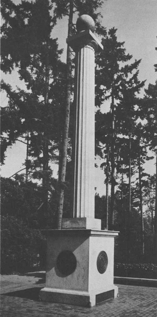 Lewis and Clark Memorial located above the entrance to Washington Park in Portland, Oregon. |
One of Oregon's Interstate Highways, 80N, follows the route of the Expedition down the Columbia River from Boardman west to Portland, a distance of about 165 miles. Interstate 5, which comes north from California to Portland, crosses the Columbia River and the route of the Expedition, on the bridge between Portland, Oregon, and Vancouver, Washington. Several sections of both of these Interstate Highway routes have been constructed. The third highway, Interstate 82, will begin at junction with 80N in Pendleton, Oregon, and then head northwest for Seattle, Washington, crossing the Columbia River, and the Expedition route, just downstream from McNary Dam. These Interstate Highways will carry a high percentage of the tourist traffic to and through Oregon. Because of the highspeed traffic and limited access features of these highways, however, they can not be considered as recreation roads.
In addition to the Interstate Highways, several Federal highways follow or intersect the Lewis and Clark Trail. U.S. 101 follows the Oregon coast from the California border north to Astoria. A bridge now under construction will replace the ferry which now carries U.S. 101 traffic across the mouth of the Columbia River. This new bridge, which is to be named in honor of the leaders of the Expedition, undoubtedly will increase highway tourist traffic in this locality and thus will also increase demand for recreation areas and facilities along the Trail near the mouth of the Columbia.
U.S. 101 goes through Cannon Beach, near the site of the whale incident, and through Seaside, where the salt cairn was located. It also passes within a half mile of the site of Fort Clatsop.
When Interstate 80N is completed, it will replace U.S. Highway 30 along the Columbia River between Boardman and Portland, but U.S. 30 will continue its present route downstream from Portland to Astoria, a distance of over 100 miles. Upstream from Boardman, U.S. Highway 730 follows the river for nearly 40 miles to the Washington-Oregon border.
The highways along the Columbia River in Oregon share with a railroad the limited space near the river. For most of this distance the railroad lies between the highway and the river, further complicating the problem of access to the river, or reservoirs, for recreation purposes.
East of Portland in the Columbia Gorge is a section of the first highway constructed along the Columbia River in Oregon between Portland and Hood River. The stretch between Troutdale and Dodson is a State scenic highway, affording a welcome change from the high speed, limited access highway which replaced it.
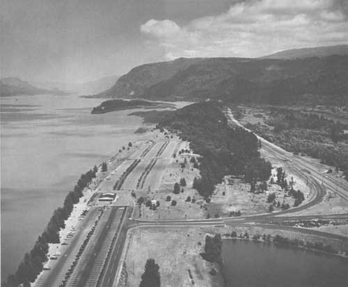
SPECIAL PROBLEMS
The principal problems affecting the recreation use of the Lewis and Clark Trail in Oregon are related to access. Although highways follow the Expedition route down the Columbia River to its mouth, access from these highways to the river is complicated by two factors. One is the existence of a railroad, usually between the highway and the river, which not only makes access a problem but also occupies much of the limited area suitable for recreation development along the river.
The other factor is the limited access features of these highways. This is a particular problem in the case of Interstate Highway 80N, which follows the river route from Boardman to Portland, a distance of approximately 165 miles. Because of the highspeed traffic on the Interstate Highways and the safety features required, access to and from these highways is especially restricted.
The problem of access is difficult to solve in this instance since it involves more than merely acquiring land. For example, it is not always practical to cross over a railroad to reach to a recreation area because of factors, such as safety and construction costs, that are involved. In some cases it might be more practical to enlarge existing areas that have access by acquiring adjoining land rather than attempt to obtain a new access point. In other instances the development of an area with frontage on the river or reservoir may be accomplished through provision of boat rather than road access.
Access to and from the Interstate and other limited access highways cannot always be obtained where it is needed because of safety factors and the high construction costs of overpasses, and acceleration and deceleration lanes. Consequently, full utilization must be made of existing access points by expanding existing areas where possible, and by the construction of service roads from a single access point to several nearby recreation sites when terrain conditions permit.

RECOMMENDATIONS
A basic development program for the historic, wildlife, and recreation resources along the Lewis and Clark Expedition route appears in the recommended program, page 20. The recommended routing of a Lewis and Clark Trail Highway in Oregon is indicated on maps 21-23. Specific recommendations relating only to Oregon follow:
1. The Corps of Engineers should work with State and local agencies to improve access to the three existing reservoirs on the Columbia River in Oregon and to provide additional recreation facilities. The planning for recreation developments and access on the John Day Dam and reservoir, now under construction, should take into account the increased demand for recreation facilities that may be expected as a result of the interest aroused in following and exploring the Lewis and Clark Trail.
2. The Bureau of Sport Fisheries and Wildlife should proceed with its planning for the proposed John Day Waterfowl Management Area, including the acquisition of needed additional lands, in order to provide waterfowl benefits and improve waterfowl hunting and other recreation opportunities.
3. The Bureau of Land Management should analyze the public domain lands along or near the Lewis and Clark Trail in order to determine the recreation potential of such lands and to provide for appropriate and timely development of recreation facilities on those lands that are suitable.
4. The Forest Service should continue its recreation planning, development, and administration program on Mt. Hood National Forest lands along the Lewis and Clark Trail, and when practicable, give priority to additional developments to help meet the present and anticipated demands on the Trail. It is further recommended that the Service give emphasis to its planning on the proposed scenic road along the top edge of the Columbia Gorge between Larch Mountain and Hood River, Oregon. This road would provide a scenic alternate to the Interstate Highway now being constructed along the floor of the Columbia River Gorge.

5. The State Parks and Recreation Division should proceed with its plans for an interpretive program related to the Lewis and Clark Trail at Ecola, Lewis and Clark, and Fort Stevens State Parks. It is further recommended that the Division improve and expand existing State recreation facilities, and acquire and develop additional recreation areas and access to the river and ocean along the trail in Oregon.
6. The Columbia River Gorge Commission should continue its program of preserving, developing, and protecting the recreation, scenic, and historic areas of the Columbia River Gorge with special emphasis on acquiring areas that provide access to the river or expand existing areas along the river.
7. The Oregon State Historical Society should provide the leadership in identifying and marking the Lewis and Clark Expedition campsites and other historic sites related to the Expedition in Oregon that have not yet been properly identified and marked.
8. The already existing Lewis and Clark Trail Advisory Committee should form the nucleus of the State Lewis and Clark Trail Committee and should undertake the development of an educational program for the Lewis and Clark Trail in Oregon.
| <<< Previous | <<< Contents>>> | Next >>> |
lecl/proposal-for-development/states.htm
Last Updated: 11-Jun-2012