|
Research Catalog
A comprehensive manual of natural and cultural study opportunities within Mount Rainier, North Cascades, and Olympic National Parks |

|
 |
 |
 |
 |
Research in the Parks
This catalog describes some of the applied research needs of Mount Rainier National Park, North Cascades National Park Service Complex, and Olympic National Park. This first edition is a work-in-progress; the list it provides is not intended to be all-inclusive. It is intended to encourage research, stimulate discussion, and facilitate new partnerships in science. In addition, the catalog describes how to apply for a research permit, who to contact, and the support available to scientists in each park.
The catalog is arranged by broad subject areas such as aquatic ecology, fire ecology, plant ecology, and wilderness management. Each subject area is divided into smaller resource issues that are summarized in a background statement. Following each background statement is the Park Focus identifying which parks are interested in research on this issue. Parks are indicated by a four letter code: Mount Rainier National Park (MORA), North Cascades National Park Service Complex (NOCA), and Olympic National Park (OLYM). Finally, a series of research questions or topics is presented for the resource issue. If park data is available on the resource issue, we summarize these resources after the research questions.
Application Procedures Any scientific activity conducted within a park that involves field work, specimen collection, and/or may potentially disturb resources of visitors (Appendix I) requires a research permit from the appropriate park. This requirement is true for research in all fields including natural resources, cultural resources, or social science studies.
To apply for a research permit, you must complete a written application (Appendix II) and submit it with a research study proposal (Appendix III) to the park in which you plan to conduct the research. The proposal should explain the who, what, when, where, why, and how of the proposed research; the guidelines outline the information needed by the park. They also contain a list of common criteria for making a permitting decision. Applications for studies in several parks can be submitted to the Science Advisor at North Cascades National Park (Dr. Regina M. Rochefort) who will then coordinate permit review among the parks.
A contact for each park is listed on the overview for each park (following). We encourage you to call the designated park contact and discuss your research proposal before you submit your application. The park contact will likely direct you to a technical expert in the park who can help you complete the permit or who can provide information about the park that may help refine your proposal.
Research proposals are reviewed by technical experts in the park. Depending on the proposed activities, additional review may be required. If your research includes collecting specimens, curation will be necessary. Each park has a curator who will provide instructions on National Park Service standards for documenting, labeling, and cataloging the specimens (Appendix IV). All specimens are property of the National Park Service and may be stored in NPS facilities or loaned to another institution.
Final approval of all permits is the purview of the park superintendent. Permits may be issued for one year or for multiple years. In either case, an Investigators Annual Report is required of all permittees (Appendix V) each year. We also request copies of publications that result from your research.
General Setting and Resources
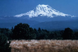
Mount Rainier National Park encompasses 235,625 acres on the west-side
of the Cascade Range, and is located about 100 kilometers (50 miles)
southeast of the Seattle-Tacoma metropolitan area.
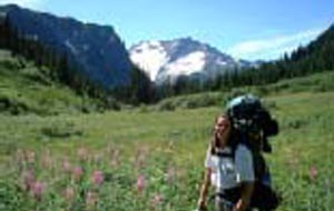
The park was established in 1899 to "provide for the preservation from injury or spoliation of all timber, mineral deposits, natural curiosities, or wonders within said park, and their retention in their natural condition . . . for the benefit and enjoyment of the people. . ." (Mount Rainier National Park Act 1899). As directed by the NPS Organic Act, the Redwood Act for Expansion and its enabling legislation, the major activities conducted by Mount Rainier National Park are the protection and preservation of natural and cultural resources and the provision for use of the park by visitors. Mount Rainier National Park is approximately 97 percent wilderness and 3 percent National Historic Landmark District and receives approximately 2 million visitors per year.
At 14,411 feet, Mount Rainier is the most prominent peak in the Cascade Range. It dominates the landscape of a large part of western Washington State. The mountain stands nearly three miles higher than the lowlands to the west and one and one-half miles higher than the adjacent mountains. It is an active volcano that last erupted approximately 150 years ago.
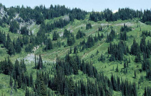
The park is part of a complex ecosystem. Vegetation is diverse, reflecting the varied climatic and environmental conditions encountered across the park's 12,800-feet elevation gradient. Approximately 58 percent of the park is forested, 23 percent is subalpine parkland, and the remainder is alpine, half of which is vegetated and the other half consists of permanent snow and ice. Forest ages range from less than 100 years old on burned areas and moraines left by receding glaciers to old-growth stands 1,000 or more years. Some alpine heather communities have persisted in the park for up to 10,000 years.
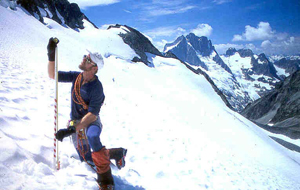
Species recorded in the park include more than 800 vascular plants, 162 birds, 55 mammals, 12 amphibians, 5 reptiles, and 8 native fishes. The park contains 26 named glaciers across 9 major watersheds, with 382 lakes and 470 rivers and streams and over 3,000 acres of other wetland types.
Administrative Support for Approved Research
Bunkhouse space is available at the Nisqually entrance for seven people,
at a minimal fee. Use of wet lab and office space may be scheduled
during the summer field and is available more frequently during the
fall. Winter, and spring. Reserved campsites and fee waivers are also
available for approved research.
Research Application Procedures
Inquiries and research permit applications should be directed to: Dr.
Gary Ahlstrand, Mount Rainier National Park, Tahoma Woods, Star Route,
Ashford, WA 98304, (360) 569-2211 x 3380, gary_ahlstrand@nps.gov.
Rev. 9/2000
General Setting and Resources
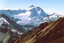
North Cascades NPS Complex (North Cascades National Park, Ross Lake
National Recreation Area, and Lake Chelan National Recreation Area)
covers 684,238 acres of the Cascade Range from the Canadian border south
approximately 80 miles to the head of Lake Chelan. The Stephen Mather
Wilderness encompasses approximately 93% of the Complex.
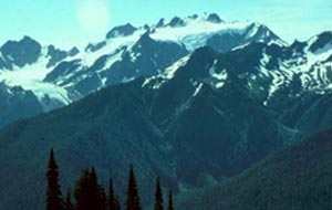
The topography, geology, and hydrology of the Complex are extremely varied. Local relief is approximately 8,800 feet, with the lowest point at 400 feet along the Skagit River at the Complex's west boundary and several peaks over 9,000 feet. There are approximately 320 active glaciers in the Complex. The major watersheds are the Skagit River and the Stehekin River. The Skagit River is the largest watershed in Puget Sound and is impounded by three Seattle City Light hydroelectric dams. The Stehekin is one of the largest undisturbed watersheds on the east side of the Cascades. The bedrock geology and geologic history is complex because of the location along the tectonically active western edge of the North American lithospheric plate. The accretion, metamorphism, and movement of exotic terrains and the intrusion of igneous and associated extrusive rocks have punctuated the area's geologic history.
The great variety of plant species is a result of the extreme variation in elevations combined with the presence of ecosystems representing both the east and west side of the Cascades Range. Over 1,627 vascular plant species had been identified within the park ecosystem, however only 880 have been verified through voucher collections.
The variety of habitats in the park and recreation area supports over 320 vertebrate species. There are approximately 75 mammal species in 20 families and approximately 17 species of reptiles and amphibians representing at least five orders. The avian fauna of the Complex is comprised of roughly 200 species in 38 families. At least 28 species of fish are known to be present. Recent surveys have documented over 500 terrestrial invertebrate taxa and approximately 250 aquatic invertebrate taxa.
The rugged landscape of the North Cascades has been occupied and modified by human populations for thousands of years. Four Native American groups occupied the region: the Upper Skagit who utilized resources along the Skagit River and its tributaries up to the gorge at Newhalem; the Chilliwack who used the upper reach of the Chilliwack River; the Nlakapamux who occupied the upper reaches of the Skagit River in the area now covered by Ross Lake; and the Chelan in the southeast.
Early explorers and the Hudson Bay Company were among the first Europeans to visit the area. Settlement patterns focused on the Skagit River on the west and the Stehekin River on the east. Development included settlement by homesteaders in the valley bottoms and miners.
Administrative Support for Approved
Research
The North Cascades Research Station (NRCS) is located in the town of
Newhalem, approximately 11 miles east of Marblemount on State Route 20.
The facility combines living quarters for eight people with a laboratory
and meeting room. This facility was funded by Seattle City Light as
part of the relicensing process for the Skagit project and space is
available for a minimal fee. Reserved campsites and fee waivers are
also available for approved research.
Research Application Procedures
Inquiries and research permit applications should be directed to: Dr.
Regina Rochefort, North Cascades National Park Service Complex, 2105
State Route 20, Sedro-Woolley, WA 98284, (360) 856-5700 x 254, regina_rochefort@nps.gov.
Rev. 9/2000
General Setting and Resources
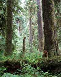
Olympic National Park was established in 1938 to "preserve for the
benefit, use and enjoyment of the people, the finest sample of primeval
forests of Sitka spruce, western hemlock, Douglas fir, and western red
cedar in the entire United States; to provide suitable winter range and
permanent protection for the herds of native Roosevelt elk and other
wildlife indigenous to the area; to conserve and render available to the
people, for recreational use, this outstanding mountainous country,
containing numerous glaciers and perpetual snow fields, and a portion of
the surrounding verdant forests together with a narrow strip along the
beautiful Washington coast."
Primary park objectives are to: (1) protect the park's natural and cultural resources and ensure professional management of these resources, (2) provide public access in a manner compatible with preserving park resources, (3) enhance visitor and community understanding and conservation of park resources, (4) work closely with other agencies and the community to effectively solve resource management problems, (5) establish a sound, scholarly basis for resource management decisions, (6) create and maintain a highly professional organization and workforce.
Olympic National Park encompasses 922,651 acres (over 1,400 square miles) in the center of Washington's Olympic Peninsula and along a 60 mile strip of wilderness coastline on the Pacific Ocean. The park is located less than 116 kilometers (72 miles) west/northwest of the Seattle-Tacoma area (36 miles as the crow flies). The park receives over 5 million visits per year, most from the state of Washington. Over 96% of the park is designated as wilderness.
From sea level, the park rises to almost 8000 feet at Mount Olympus in less than 40 miles. The Olympic Mountains intercept moisture-laden Pacific winds, resulting in a rainshadow effect more pronounced than any other in North America. Olympic National Park is the wettest spot in the conterminous United States. The west slopes of Mount Olympus receive about 200 inches of precipitation per year, while less than 34 miles to the east, precipitation is under 20 inches per year.
The park's biotic diversity mirrors its climatic diversity. Park ecosystems range from the rich intertidal zone, to rainforests, montane forests, alpine meadows, and glaciers. Temperate rainforests blanket the western slopes of the mountains, while alpine tundra conditions prevail in the dry, northeast section of the park. Along this gradient, Sitka spruce, Western red cedar, and Western hemlock yield to subalpine fir, white pine, and lodgepole pine.
Although they occur as a separate, higher and more rugged mountain massif, geologically, the Olympic Mountains are closely related to the Coast Range of Oregon. The predominant rock types of the Olympics are sandstone, shale, and basalt. Most rocks of the Olympic Mountains were formed on the bed of the Pacific Ocean, and later uplifted to form a "disorganized, circular array of jagged peaks." These mountains formed during a separate uplift event, rather than as part of the long coastal mountain chain.
Eleven major rivers radiate from the mountainous core of the park. Within these watersheds lie over 260 glaciers and over 400 lakes and wetlands.
During glacial periods of the Pleistocene, the Olympic Mountains were cut off from the continent. This island-like isolation fostered high levels of endemism among plant and animal communities of the Peninsula. There are thirty five (35) endemic forms of plants and animals currently recognized on the Olympic Peninsula, including 15 endemic plants, 1 amphibian, 3 fish, and 5 mammals. Largely due to habitat alterations (or harvest activities) outside park boundaries, there are also 10 federally listed threatened or endangered species within the park, including 5 birds, 4 fish, and 1 insect species. At least one species, the gray wolf, is known to be extirpated. Another species, the fisher, is also suspected to be extinct within the park.
The park is recognized as both a World Heritage Site, and an International Biosphere Reserve. In its review of the park's nomination as a world heritage site, the International Union for the Conservation of Nature concluded that: "Olympic National Park is the best natural area in the entire Pacific Northwest, with a spectacular coastline, scenic lakes, majestic mountains and glaciers, and magnificent temperate rain forests; these are outstanding examples of on-going evolution and superlative natural phenomena. It is unmatched in the world."
Administrative Support for Approved
Research
For a nominal fee, during the fall, winter, and early spring months,
bunkhouse or apartment space is available in park facilities at Port
Angeles, Elwha, Kalaloch, or Mora. Entrance, backcountry camping, and
parking fee waivers are also available for approved research.
Frontcounrty camping fees may be waived for approved research projects
on a case-by case basis. Year round, researchers may also reserve
dormitory, apartment, and lab space in Forks on the campus at the
University of Washington Olympic Natural Resources Center (see
http://www.onrc.washington.edu).
Research Application Procedures
Inquiries and research permit applications should be directed to: Cat
Hawkins Hoffman, Olympic National Park, 600 East Park Avenue, Port
Angeles, WA 98362. Phone: (360) 452-0314. E-mail: cat_hoffman@nps.gov.
Tabor, R. 1987. Geology of Olympic National Park. Pacific Northwest National Parks and Forests Association. p. 11.
Rev. 9/2000
| <<< Previous | <<< Contents>>> | Next >>> |
research-catalog/research.htm
Last Updated: 05-Sep-2000