|
OREGON'S HIGHWAY PARK SYSTEM: 1921-1989 An Administrative History |

|
APPENDIX
ORGANIZATION CHARTS
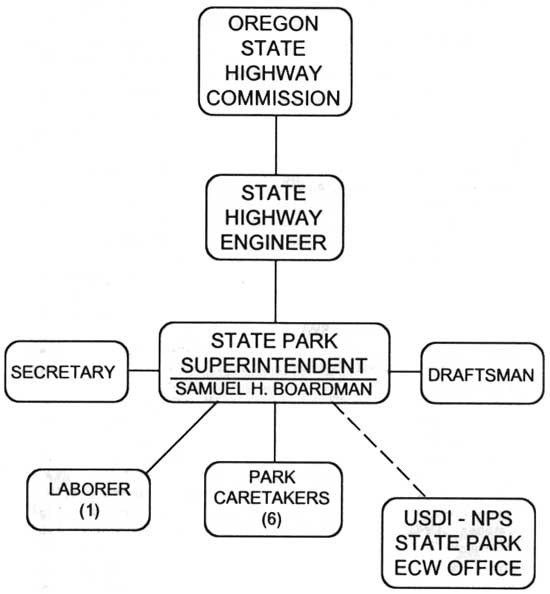
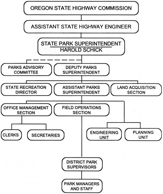
OREGON STATE PARKS
ORGANIZATION CHART 1936
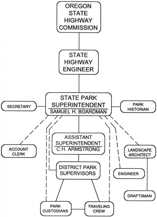
OREGON STATE PARKS
ORGANIZATION CHART 1949
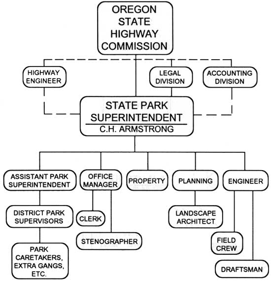
OREGON STATE PARKS
ORGANIZATION CHART 1954
OREGON STATE PARKS & RECREATION
ORGANIZATION CHART 1961
OREGON STATE PARKS & RECREATION
ORGANIZATION CHART 1963
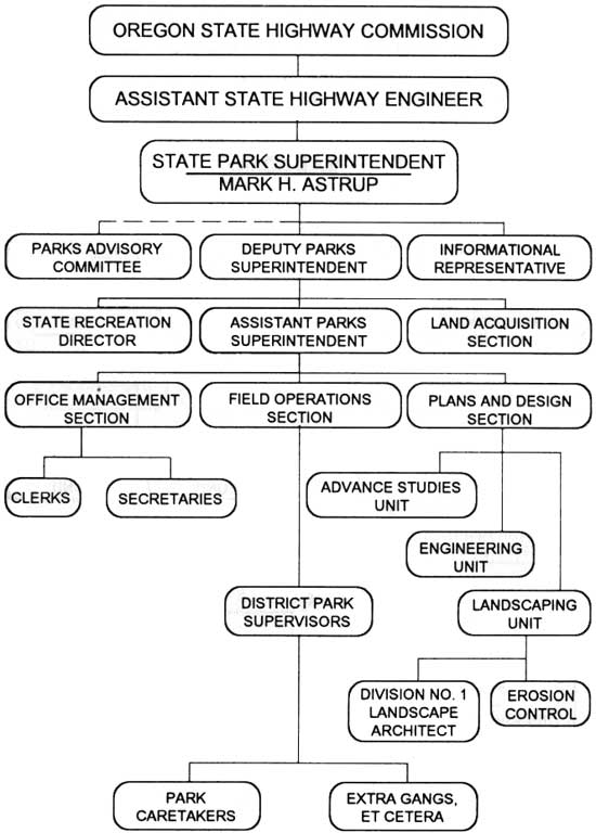
OREGON STATE PARKS & RECREATION
ORGANIZATION CHART 1989

|
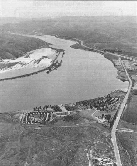
| Fig. 52. Central Snake River basin, State Parks Region V. Aerial perspective view of the Snake River, facing south, overlooking Farewell Bend State Park. The Snake, north-flowing in this section, is tributary to the Columbia and forms much of the Oregon-Idaho border. Overnight camping and boat-launching facilities are in the foreground. Interstate Highway 84 curves along the west shore in the distance. In this vicinity, Oregon Trail immigrants had their last view of the river that defined their westward course across Idaho. 1981. Oregon Department of Transportation Photo #A785-139. |
| <<< Previous | <<< Contents>>> | Next >>> |
appendix5.htm
Last Updated: 06-Aug-2008