.gif)
Parks for America
MENU
![]() Findings and Recommendations
Findings and Recommendations
|
Parks for America
|

|
|
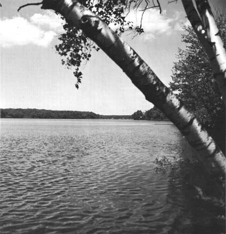
| South Pond in Connecticut's potential Taconic Tri-State park area. |
CONNECTICUT
CONNECTICUT'S centers of population and industry enjoy many opportunities for close-in shore and upland recreation.
In the last decade the population increased 26 percent, to reach 2,535,234 in 1960; this rate of growth is expected to continue, with a population of 3,141,000 expected by 1976. Urban dwellers account for 78.3 percent of the State's population. They are concentrated in the southern part of the State near Long Island Sound and in the Connecticut River Valley. Population density averages 517 per square mile. The State has nine standard metropolitan statistical areas.
Manufacturing is the chief industry; agriculture ranks second in importance. Both are concentrated in the central lowland area of the State. Tourist and vacation expenditures in 1960 were estimated at $105 million.
Rail and bus transportation are important in serving recreation areas, but are secondary to automobile travel. Traffic flow into and through the State is mainly in a southwest-to-northeast direction. Access to the recreation areas is good, but will be further improved by the new interstate routes.
The 245-mile shoreline of Long Island Sound is an outstanding asset worthy of preservation. The forested eastern and western upland regions contain several rivers and numerous streams, lakes, and ponds. The uplands present varied landscapes and have high recreation potential. Major rivers and streams can provide additional opportunities for recreation. Al most 63 percent of the State is forested.
Many and varied historic sites illustrate colonial beginnings, relations with local Indian tribes, events of the American Revolution, the evolution of modern industrial techniques, and the economic and cultural development of the State. The Old State House at Hartford, Stanley-Whitman House in Farmington and Webb House in Wethersfield possess exceptional value in commemorating the history of the United States.
The coastal areas along the Atlantic Flyway are significant for migration and wintering of waterfowl. Fresh- and salt-water fishing are popular. Connecticut has completed a fishery survey of lakes and ponds and has developed a statewide public fishing access plan.
The climate is excellent for recreation. Summers are warm to moderately hot without excessive humidity. Fall and spring are very pleasant, but spring months are variable. Winters are cold, with some snow, but cold spells are not prolonged. Winter sports are popular, but the climate limits them.
Urban development is preempting open countryside that has been providing recreation opportunities for city dwellers. Pollution impairs recreation use of the State's rivers and beaches and harbors along the sound.
EXISTING PUBLIC AREAS
NATIONAL: The Corps of Engineers administers one reservoir of 879 acres. The 1960 attendance was 22,500.
STATE: The State Park and Forest Commission administers 83 parks, monuments, and recreation areas, amounting to 22,237 acres. Together they had a 1960 attendance of 4,497,058. The Commission also administers 27 State Forests containing 123,626 acres, 13 foot trails with a total length of 280 miles, and 1 horse trail of 7 miles. The Highway Department has 120 waysides well distributed throughout the State, and additional areas are being developed. The Board of Fisheries and Game has 29 State owned or leased shooting areas totaling 59,930 acres and 9,080 acres in 61 pond and lake areas accessible to the public
LOCAL: Three major nonurban areas total 1,042 acres.
QUASI-PUBLIC AND PRIVATE: Eight nature preserves total 8,817 acres; 56 miles of the Appalachian Trail traverse the northwestern corner of the State. There are four historic monuments available to the public.
PRIVATE ENTERPRISE: The many resort, motel, and tourist accommodations play an important role in serving vacationers. A large percentage of these facilities operate on a year-round basis.
PARK AND RELATED NEEDS
Preservation of open space for esthetic, recreation, and other conservation purposes is imperative. The State park system is well established and distributed; however, several of the areas are too small and some are relatively undeveloped. Foot and canoe trails should be developed to supplement basic park facilities. Day and weekend recreation facilities should be expanded to serve highly urbanized areas. Natural areas for nature study are too few in number.
Acquisition and protection of seashore areas is most urgent. Important river and stream valleys should be retained in a natural state. Recreation use of water-supply reservoirs should be studied Marina and boating facilities are in need of expansion. The State highway program should provide for control of roadside developments. Additional wayside areas are needed. Emphasis should be given to incorporating esthetic considerations into the design of the Interstate Highway System.
Private and local agencies have been active in preserving many of Connecticut's historical treasures, and some areas have been placed under the care of the State, but much more needs to be done to realize more fully the rich historical heritage.
Existing State park and related areas provide approximately 22,980 acres for the 2,535,000 residents.
Potential areas identified in this plan total 17,880 acres. Considerably more acreage will be needed to meet the demands of the population of the State as well as of the adjoining New York metropolitan region. Although recreation facilities may be lacking, the State forests and fish and game lands, with a combined total of 191,900 acres, are used for recreation and offer additional opportunities.
RECOMMENDATIONS
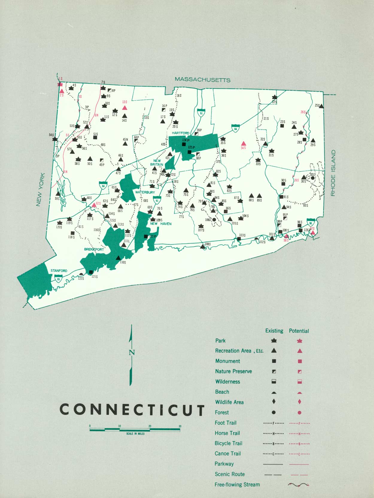
Existing recreation resources and many potential areas are shown on the accompanying tabulation and map. If the following recommendations are implemented by vigorous action on the part of the agencies concerned, they can help provide needed outdoor recreation opportunities.
NATIONAL: A cooperative study of the feasibility of an Appalachian National Parkway, a portion of which would traverse the western part of Connecticut.
Acquisition of permanent easements for the Appalachian Trail.
Development of existing and proposed water-control projects to their fullest recreation potential.
STATE: A long-range program for land acquisition and development for State parks and recreation areas, with shorelands on Long Island Sound being given immediate attention, as indicated in the State's 1961 budget authorization of $3.1 million. Expansion of existing State park facilities where appropriate. One park and five recreation areas are recommended, and one additional area is suggested.
A study to determine ways of incorporating esthetic and recreation considerations into the primary and secondary highway systems, with particular attention given to the new Interstate System.
Retention of portions of the Housatonic River and other selected streams in a free-flowing state. Study of possible recreation use of water-supply reservoirs. A portion of the Connecticut River offers potential as a water parkway. River and stream courses should be protected from encroachments and pollution. Flood plains on rivers and streams should be zoned to provide additional open space for recreation, as well as for other conservation benefits.
A comprehensive survey of archeological and historic sites to provide a basis for the preservation and development of those possessing outstanding educational and inspirational values.
Supporting recommendations include:
1. Development or expansion of marina and boating facilities.
2. Utilization of the recreation potential of existing reservoirs.
3. Further development of canoe routes and foot trails to supplement other recreation uses.
4. Preservation of nature preserves and similar areas possessing outstanding natural values.
5. Intensified efforts are needed to control water pollution on streams, rivers, and harbors.
(Table omitted from online edition)
|
| (click on image for an enlargement in a new window) |
NEXT >>>
 Top
Top
|
|
Last Modified: Mon, Sep 6 2004 10:00:00 pm PDT
parks_america/connecticut.htm