.gif)
Parks for America
MENU
![]() Findings and Recommendations
Findings and Recommendations
|
Parks for America
|

|
|
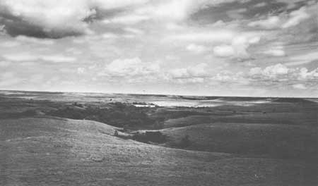
| The tall grass prairie is one of the most significant features of America, both ecologically and historically. The proposed Prairie National Park in Kansas would preserve an important remnant of this once vast grasslands environment. |
KANSAS
KANSAS lies in the geographic center of the 48 contiguous States.
From 1950 to 1960 the population increased 14.3 percent, to reach 2,178,611. Projections indicate a population of 2,592,000 by 1976. Density averages 26 persons per square mile, ranging from 3 in the western portion to over 100 in the metropolitan areas of Kansas City, Topeka, and Wichita. Sixty-one percent of the population live in urbanized areas.
The State is actively promoting the tourist industry, which accounted for estimated expenditures of $130 million in 1960. Tourist potential lies in increased facilities and services at reservoirs and in getting travelers to stop an extra day or so.
In addition to its well-known prairies, the State has a variety of other attractive features. The glaciated region of the northeast has steep, rolling hills, while the southeastern section resembles the Ozarks. There are also the "Flint Hills" prairie area in east-central Kansas, the "Red Hills" section with mesas and buttes along the southern border, and the chalk bluffs in the high western plains. Existing Federal reservoirs provide opportunities for water-oriented activities, and those under construction or authorized will add to these opportunities. Fortunately many of these are located in the eastern part of the State where they will better serve population needs.
Kansas has many historic sites associated with westward expansion and military and Indian affairs. Wagon Bed Springs, Fort Larned, Fort Leavenworth, Hollenberg Ranch Pony Express Station, and Haskell Institute possess exceptional value in commemorating the history of the United States and are eligible for Registered National Historic Landmark status.
|
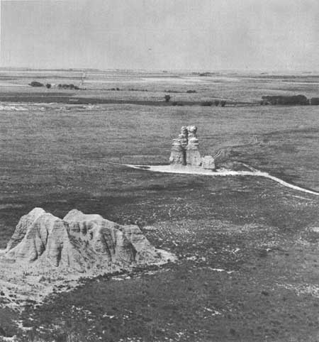
| Castle Rock, famous chalk erosional remnant in Gove County, Kansas, deserves protection as a scientific monument. |
EXISTING PUBLIC AREAS
NATIONAL: The Bureau of Sport Fisheries and Wildlife administers two wildlife refuges of 19,304 acres. The Forest Service administers 300,000 acres in land utilization projects.
STATE: The State Park and Resources Authority administers 5 parks of 15,095 acres that had a 1960 attendance of 522,146. The Forestry, Fish and Game Commission operates 41 State parks and lakes totaling 40,798 acres, and 45,450 acres in 7 wildlife refuges; total attendance in 1960 was 1,445,266. The State Historical Society administers five historic sites. Six other historical sites are owned by the State but administered by local agencies. The Highway Department has 143 roadside parks.
LOCAL: There are 65 local nonurban parks and recreation areas totaling 14,533 acres. Sixteen of the major areas are included in the tabulation.
PRIVATE ENTERPRISE: Most private recreation enterprises are geared to services for through travelers. A potential exists for development of facilities and services at existing and proposed reservoirs.
|
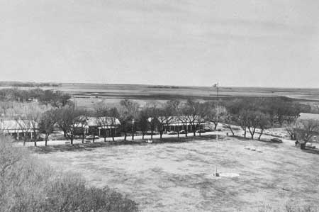
| The parade ground at Fort Larned, Kans., guardian of the Santa Fe Trail and base for frontier protection. The fort, with is quadrangle of stone buildings, is an outstanding example of a military post of the 1860's. |
PARK AND RELATED NEEDS
Major emphasis needs to be placed on acquisition of natural and cultural areas to preserve portions of the State's heritage. There is need and opportunity to enlarge some of the major existing State parks. The park system needs expansion to assure proper balance and to provide more recreation opportunities, especially near large population centers. There is a need for additional recreation facilities at existing Forestry, Fish and Game Commission areas where this would be compatible with the primary use of the area.
For the more than 2 million residents, the State now provides 56,000 acres of parks and recreation areas, and an additional 10,824 acres are provided locally. Potential areas identified in this plan total 59,500 acres of lands with State significance and 16,800 acres of local significance. Acquisition and development of these areas would meet most of the recreation needs of the people. Additional areas of various types must be found to meet the needs of the expanded population of 1976.
|
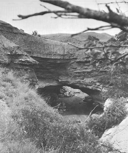
| A picnicking family explores the unusual rock formation of Natural Bridges, in Barber County, Kansas. |
RECOMMENDATIONS
Existing recreation resources and many potential areas are shown on the accompanying tabulation and map. The following recommendations are made to help provide needed outdoor recreation opportunities for public enjoyment and use. Prompt and vigorous action by the agencies concerned will be needed to realize these opportunities.
NATIONAL: Establishment of Prairie National Park and Fort Larned National Historic Site.
STATE: Establishment of eight parks, one nature preserve, nine monuments, three recreation areas, and major additions to nine existing areas. Suggested for additional study are 4 parks, 11 monuments, and 1 recreation area.
Designation and control of a system of scenic roads. Two routes are suggested for initial study.
LOCAL: Establishment of areas of local significance to protect resources and provide recreation opportunities. One park and seven recreation areas are recommended, and seven additional parks and recreation areas are suggested for further study.
Supporting recommendations include—
1. Provision for adequate lands and facilities at existing and proposed Federal reservoirs.
2. Provision for additional recreation facilities on Forestry, Fish and Game Commission areas where compatible with the primary purpose of areas.
3. Recognition of important historic trails, the Santa Fe, Overland, Oregon, and Lewis and Clark, by various means such as markers, interpretation, or public ownership where necessary.
4. Continuation of the excellent program of providing convenient wayside rest areas and facilities and historical markers.
(Table omitted from online edition)
|
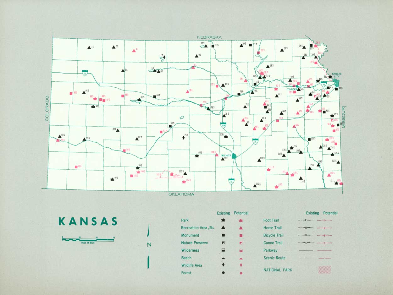
| (click on image for an enlargement in a new window) |
NEXT >>>
 Top
Top
|
|
Last Modified: Mon, Sep 6 2004 10:00:00 pm PDT
parks_america/kansas.htm