.gif)
Parks for America
MENU
![]() Findings and Recommendations
Findings and Recommendations
|
Parks for America
|

|
|
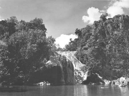
| Turner Falls, highest in Oklahoma, is one of the most outstanding features in the Arbuckle Mountain region, suggested for addition to Platt National Park. |
OKLAHOMA
OKLAHOMA extends from the forest-covered mountains of Arkansas to the high, arid plains of New Mexico. It is a land of timbered mountains, treeless plains, and large reservoirs.
In 1960 the State had a population of 2,328,284, an increase of 4 percent since 1950. Projections indicate a population of 2,341,000 by 1976. The population is 62.9 percent urban. The density averages 34 per square mile, ranging from 2.5 in the Panhandle to over 600 in Oklahoma and Tulsa Counties.
Tourism has not yet established itself as a significant economic factor; however, reservoir developments have caused a boating and recreation boom.
The principal recreation resources lie in the forested uplands of the Ozark region in the northeastern portion and the Ouachita Mountains in the southeastern portion. West of the uplands the prairie region extends to the high, arid plains of the Panhandle. The Red, Arkansas, and Canadian Rivers drain the entire State.
Lakes and reservoirs together total 1,200 square miles, the largest at present being Lake Texoma. Three reservoirs under construction—the Markham Ferry, Oolagah, and Eufaula—will be major recreation resources for the future. Climatic conditions are varied with a long outdoor season in the southern portion. Lakes and mountains of the eastern area offer relief from prolonged heat spells. Indian and military affairs and frontier living are historical themes of importance. The Cherokee National Capitol, Creek National Capitol, Fort Gibson, and Fort Sill possess exceptional value in commemorating the history of the United States. There is a diversified wildlife population, and fishing and hunting are of statewide interest.
|
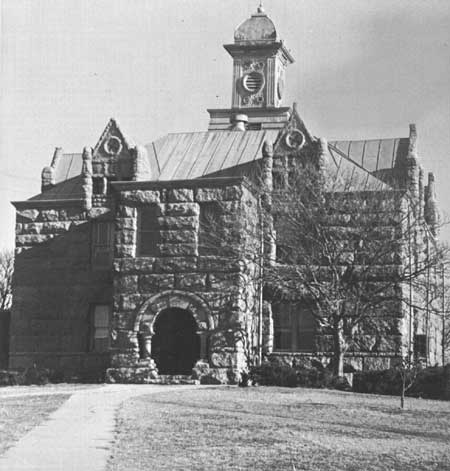
| Tishomingo, a seat of tribal government when Oklahoma was Indian Territory. |
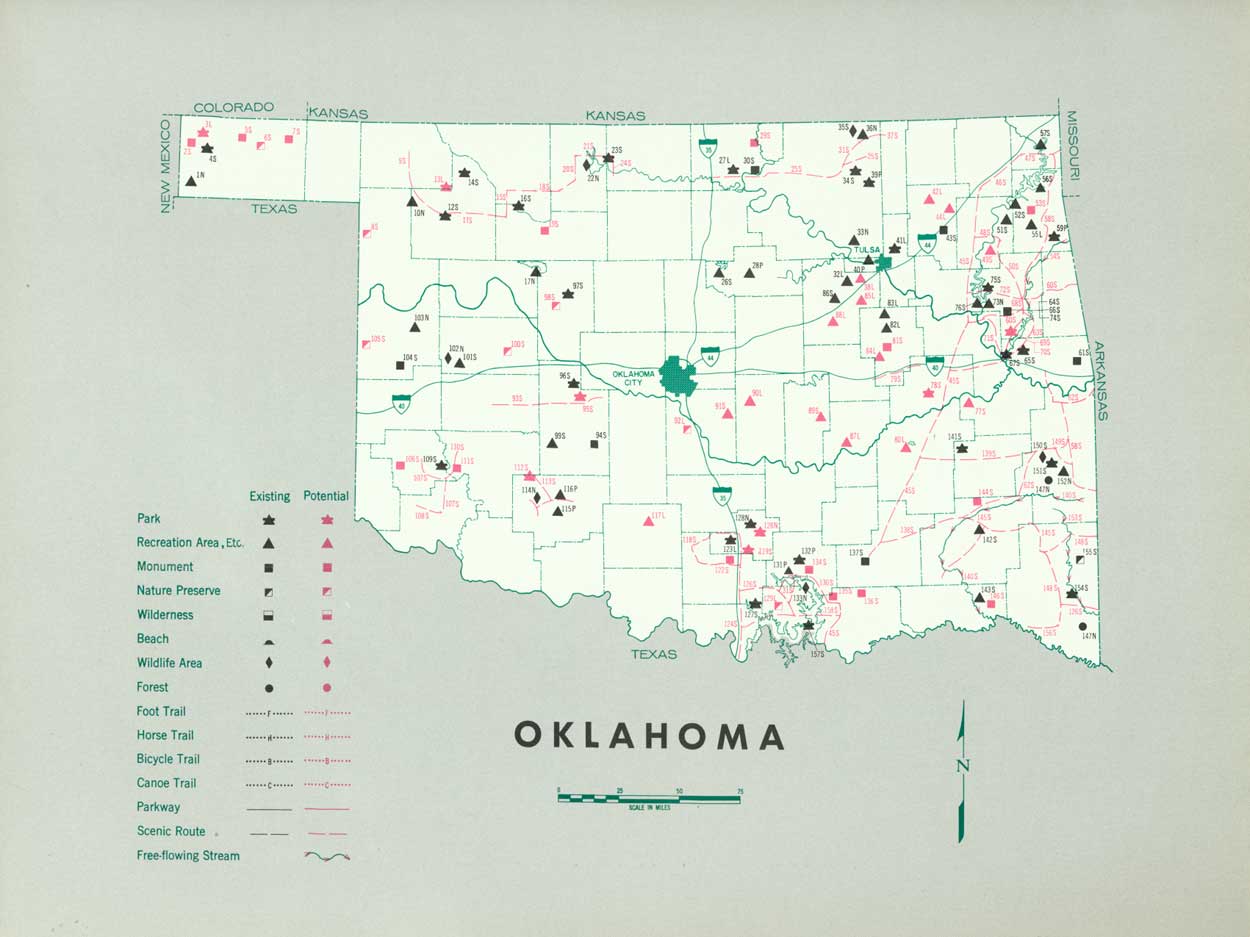
EXISTING PUBLIC AREAS
NATIONAL: One national park of 912 acres is administered by the National Park Service. The 1960 attendance was 1,150,500. The Bureau of Sport Fisheries and Wildlife manages four national wildlife refuges totaling 116,269 acres. One national forest with 180,977 acres and two land-use areas are administered by the Forest Service.
STATE: The Division of Recreation and State Parks administers 310,430 acres in 17 parks, 8 monuments, and 11 recreation areas. The 1960 attendance was 8,995,308. The Will Rogers Memorial Commission administers a memorial park of 26 acres. The Highway Department provides 45 roadside parks and areas and 60 rest stop areas.
LOCAL: Three major nonurban parks and four major recreation areas are identified in this plan.
QUASI-PUBLIC AND PRIVATE: Three parks, one of 4,000 acres, and five recreation areas, one of 2,500 acres, are provided by quasi-public and private interests.
PRIVATE ENTERPRISE: This sector plays a major role in providing facilities and services at water impoundments.
PARK AND RELATED NEEDS
The protection of natural areas including free flowing streams, the further preservation and development of historic, prehistoric, and geologic sites, and additional scenic routes are primary statewide needs. There also is a need to provide additional park and recreation areas near Oklahoma City, Tulsa, and Lawton.
|
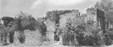
| Fort Washita, built in 1844, was, at the time, westernmost of the frontier military posts in the Southwest. Its ruins stand near Lake Texoma. |
RECOMMENDATIONS
Existing recreation resources and many potential areas are shown on the accompanying tabulation and map. The following recommendations are made to help provide needed outdoor recreation opportunities for public enjoyment and use.
NATIONAL: Further study of the suitability of adding a segment of the Arbuckle Mountains to Platt National Park.
STATE: Enlargement of the State park system to preserve valuable resources by addition of 5 parks, 4 recreation areas, 11 monuments, and 5 nature preserves. Enlargement of 19 existing State park and recreation areas. Further consideration of one potential park and four monuments.
Designation and protection of 41 sections of 3 existing roads as scenic roads and portions of the Kiamichi, Mountain Fork, and Illinois Rivers as free-flowing streams. Further study suggested for designating portions of the Canadian, Cimarron and Wachita Rivers as free-flowing streams.
LOCAL: Establishment of 2 parks, 10 recreation areas, and 2 nature preserves to meet local needs.
Supporting recommendations include—
1. Establishment of an Ozark Hiking and Riding Trail extending through the mountains and by the lakes of eastern Oklahoma.
2. Study of the feasibility and suitability of a riverside trail along the Cimarron, Canadian, Arkansas, and Red Rivers to connect with park areas in the State, the Ozark Trail, and recommended trails in New Mexico.
3. Provision for additional waysides and expansion of existing waysides.
(Table omitted from online edition)
|
| (click on image for an enlargement in a new window) |
NEXT >>>
 Top
Top
|
|
Last Modified: Mon, Sep 6 2004 10:00:00 pm PDT
parks_america/oklahoma.htm