.gif)
Parks for America
MENU
![]() Findings and Recommendations
Findings and Recommendations
|
Parks for America
|

|
|
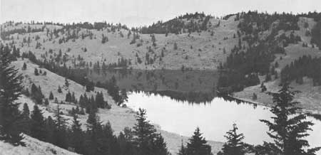
| Chopaka Lake, a proposed Washington State park. |
WASHINGTON
WASHINGTON has a variety of recreation resources including the Olympic and Cascade Mountains, the Columbia River, and 2,846 miles of tidal shoreline along the Pacific Ocean, Strait of Juan de Fuca, and Puget Sound.
Population projections to 1976 indicate the growth of the 1950-60 decade (2,378,963 to 2,853,214) will continue so that by 1976 the population may be 3,844,000. The State population was 68.1 percent urban in 1960. The density averages 42.8 persons per square mile, ranging from 1.8 persons per square mile in northeastern Washington to 438.2 per square mile in King County (Seattle).
Manufacturing, agriculture, forest products, and recreation are the State's most important industries, in that order. In 1960 recreation activities contributed an estimated $428 million to the economy of the State. There is a great potential for expanding the importance of recreation to the State economy.
The ocean beaches provide clamming, fishing, and swimming; Puget Sound, the Strait of Juan de Fuca, and several other salt-river bays and waterways provide boating, swimming, fishing, camping, and picnicking opportunities. There are 21 million acres of forest lands, hundreds of mountain lakes and streams with excellent camping, fishing, hiking, and picnicking. The two principal mountain ranges, the Cascades and the Olympics, offer hiking, camping, fishing, and hunting activities. Five snow-capped volcanic peaks ranging in elevation from 9,671 to 14,410 feet, together with many lesser peaks, provide outstanding scenery, winter sports, and mountaineering. Many salt- and fresh-water marshes, cultivated fields, and wheatlands furnish waterfowl and upland-bird hunting. Chinook Point and San Juan Island possess exceptional value in commemorating the history of the United States.
EXISTING PUBLIC AREAS
NATIONAL: The National Park Service administers two national parks, two national historic sites, and one national recreation area with a total of 1,228,750 acres. The 1960 attendance was 3,424,500.
Under the administration of the Forest Service are 9,688,591 acres in 9 national forests in which there are 369 recreation areas totaling 1,900 acres; 10 winter sports areas using 1,400 acres; and 1 wilderness, 2 wild areas, and 1 primitive area totaling 1,384,196 acres. The 1960 attendance for the national forests was 3,464,250. The Washington section of the Pacific Crest Trail is in the national forests.
The Corps of Engineers administers 20,113 acres on three reservoirs. The Bureau of Sport Fisheries and Wildlife administers 101,444 acres in 13 wildlife refuges that had an attendance of 92,594 in 1960.
STATE: The State Parks and Recreation Commission has 103 parks and recreation areas with 75,638 acres. There are 274 public-fishing access areas and 19 game-management areas of 297,636 acres administered by the State Department of Game. The Department of Highways maintains 108 roadside rest and picnic areas.
LOCAL: There are 37 local nonurban parks totaling 1,958 acres. Ten of the major areas are included in the listing.
PRIVATE ENTERPRISE: Several lumber and private utility companies maintain camping and picnic areas that are open to the public. Twenty-two sites, 360 acres, have been developed on private timber holdings, and six sites on four reservoirs having a water surface of 12,722 acres are operated by power companies.
PARK AND RELATED NEEDS
Many existing areas are not suitable for intensive development for day and overnight use. The State park system needs expansion by additions to existing areas and acquisition of new areas to provide more areas near the Seattle, Tacoma, Spokane, and Yakima metropolitan areas; improvement of public access to suitable portions of the Pacific shoreline; and preservation of several free-flowing streams. In addition, canoe and boat trails should be established and increased protection given archeoloical sites.
Existing State parks, recreation areas, beaches, and related areas provide 75,638 acres for the present resident population. Potential State recreation lands identified total 8,155 acres. The combined acreage is short of 1976 needs, though to an extent this is compensated for by the presence of Federal recreation lands near the population centers. A similar situation exists in the local picture, where existing and potential acreages of 4,012 acres are short of 1976 needs. Further study is required to determine the location, type, and acreage for State and local areas to meet 1976 needs.
|
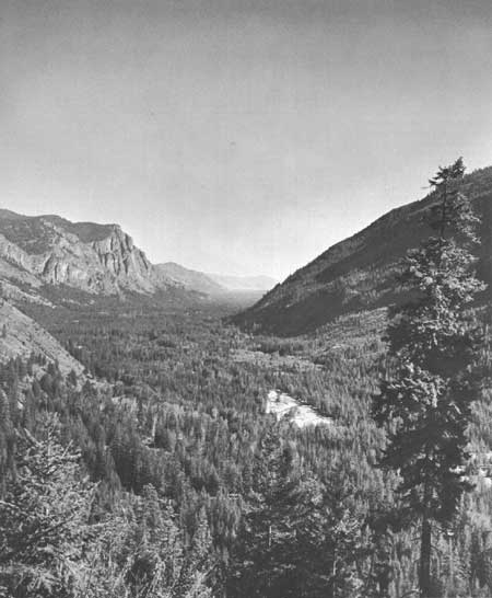
| The Methow River, flowing freely through its beautiful valley in Washington, merits designation as a canoe trail. |
RECOMMENDATIONS
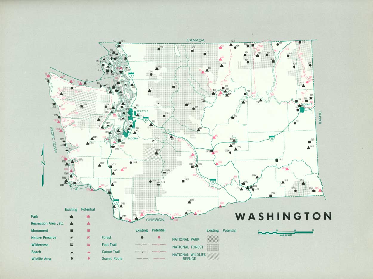
Existing recreation resources and many potential areas are shown on the accompanying tabulation and map. The following recommendations are made to help provide needed outdoor recreation opportunities for public enjoyment and use.
STATE: Enlargement of the State park system to preserve significant resources by the addition of 3 State parks, 12 recreation areas, and 2 beaches, with major additions to 18 existing areas.
LOCAL: Establishment of three recreation areas and two beaches, with further study of eight recreation areas and one beach.
Supporting recommendations include—
1. Study the feasibility of land acquisition and construction of a Pacific coast scenic road.
2. Bring U.S. 830, on the north side of the Columbia River Gorge, up to parkway standards.
3. Designation and development of 13 potential canoe and boat trails including facilities for stopover sites.
4. Assistance to counties by providing technical aid for their recreation programs.
(Table omitted from online edition)
|
| (click on image for an enlargement in a new window) |
NEXT >>>
 Top
Top
|
|
Last Modified: Mon, Sep 6 2004 10:00:00 pm PDT
parks_america/washington.htm