|
ROCKY MOUNTAIN
Mountaineering in the Rocky Mountain National Park |

|
PART 2.—THE PEAKS AND HOW TO REACH THEM—METHODS OF APPROACH, TRAILS AND REPORTS OF CLIMBS, GIVING STARTING POINT, ROUTE FOLLOWED, TIME REQUIRED, AND OTHER DATA.
ARRANGEMENTS OF REPORTS.
The mountain area under consideration in this book may be approached from several directions. The data on how to reach the peaks and the reports of trips to the principal peaks are grouped according to the starting point that one may select. Reference to a peak may be found in two or more places, but all trips from the same starting point are grouped together, and it is believed that this is the most useful and convenient arrangement.
The data regarding peaks on the eastern side of the range are placed first and grouped under locality headings, such as Estes Park (including Longs Peak, the Mummy Range, etc.), Wild Basin, Middle St. Vrain Creek, Ward, and North Boulder Creek.
The data regarding peaks on the western side are also grouped under locality headings such as the Medicine Bow Range, Grand Lake, and Monarch Lake.
The data and reports on peaks are grouped according to the following outline:
Peaks accessible from the eastern or Atlantic slope:
Peaks accessible from Estes Park.
Longs Peak.
Other peaks accessible from Longs Peak post office.
Peaks of the Mummy Range.
Other peaks of the Continental Divide and east side accessible from Estes Park.
Peaks accessible from Wild Basin.
Peaks accessible from Middle St. Vrain Creek.
Peaks accessible from Ward.
Peaks accessible from North Boulder Creek.
Peaks accessible from the western or Pacific slope:
Peaks of the Medicine Bow Range, etc., accessible from the North Fork of the Grand River.
Peaks accessible from Grand Lake.
Peaks accessible from Monarch Lake.
LONGS PEAK.
[Altitude, 14,255 feet.]
Longs Peak is the king of the Rocky Mountain National Park. It is more than a hundred feet higher than Pikes Peak. Mount Meeker, Mount Lady Washington, and Longs Peak form an encircling ring of granite cliffs that nearly surround Chasm Lake and produce one of the wildest and most impressive spots in the Colorado mountains. It stands well out from the Continental Divide, with which it is connected by a short spur of bristling peaks. The alcove of deep canyons north of it is called the Wild Gardens; the similar alcove south of it is called the Wild Basin.
Among Colorado peaks, Longs Peak ranks thirteenth in order of height. It is the highest peak in the northern part of the State, Grays and Torreys Peaks being its nearest rivals. It dominates the Rocky Mountain National Park and can be seen from a great distance in every direction—for example, from Pikes Peak, 103 miles distant. Longs Peak is on the eastern slope, 2 miles east of the Continental Divide. By reason of its accessibility it is probably climbed more frequently than any other 14,000-foot peak in the State, with the possible exception of Pikes Peak. It is an unusually interesting climb by reason of the wide variety of views, its rugged character, and the different points of interest along the trail. The climb is not a dangerous one, but there is no very easy route to the top, as is the case with so many peaks.
The first ascent was made on August 23, 1868, by a party consisting of Wm. N. Byers, Maj. W. J. Powell, and five other men. They climbed the peak from the south side.
Approach.—There is an automobile road from Estes Park village (elevation 7,547 feet) to the settlement known as Longs Peak (elevation 9,000 feet). The distance is 9 miles. An auto stage is run in connection with the hotels. The hotels located nearest to the peak are Long Peak Inn, the Columbines Hotel, and Hewes-Kirkwood Inn. These hotels are on the east side of the peak at an elevation of from 8,900 to 9,100 feet. They are within 5 miles of the top of the peak, in an air-line or about 7 miles by trail. A road recently built runs up from the Hewes-Kirkwood Inn for half a mile or so toward the peak, and if one takes an auto to the upper end of this road (elevation about 9,300 feet), which is the nearest approach to the peak by road, it will shorten the climb to the peak in time, distance, and elevation.
Sprague's Hotel, in Bartholf Park, is on the north side of the peak at an elevation of about 8,600 feet. The peak can be climbed from this point, but the trail is not as much traveled.
The trail on the east side of the peak is clearly marked. It is very desirable to have a guide on one's first ascent of the peak, as the trail beyond the Keyhole is difficult to follow. Guides can be obtained at Longs Peak Inn, Hewes-Kirkwood Inn and from The Columbines.
The climb may be made in one day or in a day and a half. For those who are not sure of their endurance the easiest way is to take horses at one of the hotels and ride to the edge of the Boulder Field, at an elevation of about 12,300 feet, and about 5 or 5-1/2 miles from the hotels. Horses may be tied here (though there is no fodder), and the remainder of the trip taken on foot. This reduces the elevation to be climbed to about 2,000 feet. The distance to the top is about 2 miles. Horses may be obtained at Estes Park or at either Longs Peak Inn or Hewes-Kirkwood Inn.
The climb is frequently made from the hotels on foot in one day, but the elevation to be climbed is about 5,200 feet, which is a long, hard day's work, and one is apt to be tired when the most interesting part of the climb is reached. Therefore, the one-day trip on foot is not recommended for one's first trip up the peak, unless the climber knows that his energy is equal to the task.
A very good way to make the climb on foot is to allow a day and a half. The start can be made in the afternoon from one of the hotels above mentioned and the night spent at Timberline Cabin. This is a mountain shelter under the same management as Longs Peak Inn, and is located at an elevation of about 11,050 feet. It contains a kitchen and two sleeping rooms with bunks, in tiers, and in midsummer tents furnish additional accommodations. The shelter is kept open through the summer months and is closed some time in September, depending upon the season. A cook is in attendance to care for the wants of travelers.
As the accommodations are limited, reservations should be made in advance. There is a telephone connection between Timberline Cabin and Longs Peak Inn. Owing to the location of this shelter and the fact that all supplies must be taken up by pack horse, one should not expect anything but the simplest accommodations; however, a roof, a stove, and warm food are as welcome as they are infrequent at timber line.
The trip from one of the hotels to Timberline Cabin may easily be made in two or three hours. Fast climbers may require only an hour and a half. The trail goes up the well timbered mountain side and for a short distance runs along Alpine Brook, a picturesque, as well as refreshing, stream. Firewood is abundant all the way along the trail, as far as timber line.
From Timberline Cabin the trail winds upward, crossing the ridge, known as the Wall of China, at Granite Pass, between Battle Mountain and Mount Lady Washington, and reaches the edge of the Boulder Field. Drinking water is found at the lower edge of the Boulder Field. In midsummer this is the last water that will be found on the peak, but either early or late in the season, if snow is present and the weather is warm enough for it to melt, small streams will be found trickling across the trail at the Ledge or on the Narrows. From the edge of the Boulder Field to the Keyhole the route lies across a tumbled mass of bowlders, large and small.
|
|
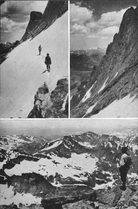
PLATE XI. LONGS PEAK TRAIL. Upper left: On the Shelf Trail. Upper right: The west side of Longs Peak from the Trough. Photographs by G. H. Harvey, jr. Lower: Glacier Gorge from the Top. Photograph by Clark Blickensderfer. |
The Keyhole is an irregular gap in the ridge leading from Longs Peak to Storm Peak, an overhanging mass of rocks on one side of the gap entitles it to the descriptive name. The trail presents no difficulties whatever as far as the Keyhole and makes an enjoyable trip to this point, even if one goes no farther. From the climber's standpoint, however, the most interesting part of the trip begins here. The view from the Keyhole, looking down into Glacier Gorge, is very fine. If the day is at all breezy, there is apt to be a strong wind at the Keyhole.
From the Keyhole the trail leads in a fairly horizontal line across the Ledge or Shelf. Above, the rock face of the peak rises toward the summit with increasing steepness, and below it slopes quite steeply into Glacier Gorge. The trail from the Keyhole to the foot of the Trough is partly over solid rock, which gives but little sign of the route to be followed; particularly on the return trip one must be careful not to get either above or below the trail, for to do so might lead one into difficulty. For this, reason a guide can be of great help in following the route, and even on one's second or third trip, careful observations should be made on the way up, in order to locate the trail upon the return trip.
The Trough is a steep ravine filled with loose rock. Climbers should be careful not to dislodge any rocks which might be disastrous to those on the trail below. Early or late in the season the Trough will probably be partly filled with snow and ice and one should watch his footing to avoid a fall. At the top of the Trough there is a steep scramble to get up a rocky wall some 10 or 15 feet high. One is usually so much occupied in this portion of the climb that the view down into Wild Basin comes with an abruptness that is startling. One is now on a sharp ridge, with Glacier Gorge, temporarily forgotten, in the rear, while ahead the cliffs fall abruptly and then merge into the vast valley of Wild Basin.
The next 200 or 300 feet of the trail is called the Narrows. It is a shelf 3 or 4 feet wide at the narrowest point. Above, the cliff rises steeply toward the top of the peak, and below it falls abruptly for 100 or 200 feet and then slopes steeply into the rocky gorge below. Looking at the Narrows from the head of the Trough often gives one a dizzy feeling, but this sensation does not last long. The footing is firm and there is no danger. This part of the trail is on the south side of the peak and is usually free from snow and ice. If not accompanied by a guide, one should watch the trail carefully at the end of the Narrows so as to be able to find the best path on the return, for the rocks leave little trace of the trail, and on either side one might get into trouble.
The Home Stretch starts at the end of the Narrows. Here the trail leads up the sloping slabs of rock to the top of the peak. One uses both hands and feet in this last scramble, but the rock face is seamed by cracks and the footing is good, so that it is not difficult under ordinary weather conditions.
The top of the peak is practically level, and has an area of 10 or 15 acres. It is covered with rocks of all sizes, similar to those on the Boulder Field. The cairn is at the northeast corner of the flat top of the peak, and from it a splendid view is obtained over a vast area. To the south the mountains are crowded one behind another; several ranges are visible. Pikes Peak, 103 miles away, is one of the more distant visible peaks; all the prominent intervening peaks can be distinguished. To the west, the Continental Divide is near, and its peaks are prominent, while further away is Medicine Bow Range. Fifteen miles to the north is the Mummy Range, beyond which the mountains decrease in size and fade away toward the Wyoming horizon. To the east lie the plains, dotted with innumerable reservoirs and blending with the sky in the distant horizon. One can see into Wyoming, 52 miles distant. Other States are not visible, as Nebraska and Kansas are 188 miles distant, and Utah is 181 miles away.
The Colorado Mountain Club has placed a bronze weatherproof cylinder on top of Longs Peak containing a small register book. Here several hundred visitors record their names each year.
Upon starting down, the Home Stretch appears more steep and difficult than it did on the way up, for a slope usually looks steeper when viewed from the top than from the bottom. However, it is not dangerous, and a little care is all that is needed.
The return trip need not be described, for the same route is followed. It is important to carefully watch the trail down the Home Stretch and to the Narrows, and again watch for the right place to leave the Trough, and stay close to the trail across the Ledge. The Keyhole is not visible from either the Trough or the Ledge, and it frequently happens that on the return trip parties mistake a notch higher up on the ridge known as the False Keyhole for the genuine one.
Most parties continue their descent to their hotel in the valley, but if the climb has proved to be exhausting, one can spend the night at Timberline Cabin, and complete the return trip on the following day.
Time.—The time required from Longs Peak Inn, Hewes-Kirkwood Inn, or The Columbines is practically the same, though the latter two are a fraction of a mile closer to the peak. The usual time may be put at 1-1/2 to 2 hours to Timberline Cabin, 1 to 2 hours more to the end of the horse trail at the Boulder Field, 45 minutes to 1-1/4 hours more to the Keyhole, 1 to 2 hours more to the Narrows at the head of the Trough, and three-fourths to 1-1/2 hours from there to the top. At least half an hour and preferably 1 hour should be allowed for the stay on top in order to rest and enjoy the magnificent view. The return to Timberline Cabin will take from 2 to 4-1/2 hours and from there to any of the three hotels will take from 1 to 2 hours. The total trip from Longs Peak Inn or either of the other hotels, to the top of the peak and return, takes from 8 hours, for a fast trip, to 18 hours, for a slow trip, depending upon the party. Twelve hours may be considered average time. If one starts from Timberline Cabin in the morning, and returns to one of the hotels at night, the trip will be reduced by 2 or 3 hours. Nine or 10 hours may be considered average time for this trip.
The shortest time for climbing the peak, of which record is available, is Willard T. Day's trip, via the north face. He reached the top in 3 hours and 15 minutes after leaving Longs Peak Inn. The total climb of 5,255 feet was accomplished at a rate of 1,617 feet per hour, which is unusually fast climbing. Shep N. Husted has made the round trip, via the usual trail, in a little less than 6 hours from Longs Peak Inn. Shep Husted has climbed Longs Peak more than 200 times.
The following reports of various trips by large parties and small ones, and under various weather conditions, and at different rates of speed, will be of interest for purposes of comparison.
|
|
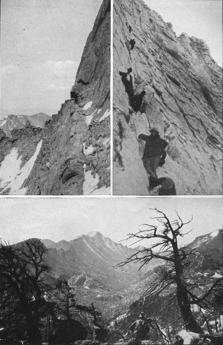
PLATE XII. LONGS PEAK TRAIL Upper left: The Narrows. Photograph by Gen. C. Barnard. Upper right: The Home Stretch. Photograph by W. F. Erwin. LONGS PEAK AND GLACIER GORGE. Lower Photograph by G. H. Harvey, jr. |
CLIMBING LONGS PEAK BY MOONLIGHT.
[Report furnished by Robert Collier, jr. (Aug. 17 and 18, 1916).]
Number in party, 27; 15 women, 12 men, and a dog.
After supper near Timberline Cabin at 6.30, we slept in the open, as best we could until the moon came up at 10 o'clock. The moon was in the last quarter and consequently not very bright, but it was enough to make climbing practicable. The pace was very slow, just enough to keep the party moving and warm. The usual trail was followed. Reached Boulder Field at 1 a. m. and Keyhole at 2.30 a. m. The Trough was in good condition for climbing. The views obtained on the way were very fine. The lights of Denver, Estes Park, and many small towns in the valley were seen. We arrived at the Narrows at 3.30 a. m. and the summit was reached at 4.30 a. m., just as the sky was beginning to be tinted by the coming sun. Soon a high wind came up, that, coupled with the freezing temperature of the night, chilled us through, in spite of all that we could do to keep warm.
After watching the sunrise and signing the register book the party started down at 6.30 a. m., arriving at Keyhole at 8.30 a. m. Here some ate breakfast, and then all drifted along, reaching camp at timber line at 9.30 a. m., where hot coffee and chocolate helped make out more of a breakfast.
This party of 27 is unusually large for a moonlight trip, and it is worthy of note that no one gave out, though some were not experienced climbers.
Our advice is: In order to keep warm on a moonlight climb on Longs Peak always take five times too much clothing, and then take some more.
A FAST CLIMB UP LONGS PEAK.
[Report furnished by George C. Barnard.]
In the middle of July, 1915, three of us made the ascent of Longs Peak in the actual going time of 8 hours and 10 minutes from Denver. Of course conditions of road and weather were favorable, and we were in the pink of condition, or we could not have made that record. However, we did not start with the idea of making an unusually fast trip, and spent a little time in taking pictures on the way to the summit.
For pure enjoyment I should never advise a fast trip up any mountain, for the greatest pleasure lies in drinking in the marvelous views that greet one in every direction, stopping to enjoy the flowers and to watch the birds, photographing the cloud effects, the waterfalls, and the distant ranges, and in a general way becoming familiar not only with the immediate surroundings, but the geography and topography of the region.
Where one's time is limited the best way to make the trip up Longs Peak is to leave Denver in the early afternoon by automobile, and go direct to Longs Peak Inn. Here the machine must be left, and the 4-mile trail to Timberline Cabin covered either on foot or on horseback. Spend the night there, and after a good breakfast at 5 in the morning start for the summit not later than 6 o'clock. From three to five hours under ordinary conditions is ample time for the average climber to reach the summit
In good weather it is always worth while to spend at least an hour on top and a busy hour it may be if one tries to study the topography of the surrounding ranges. The return trip to timberline will be made in about half the time required for the ascent, and from timberline another hour on the trail brings one back to the Inn and the automobile.
I have climbed Longs Peak a number of times, under widely varying weather conditions. I shall never forget the first trip. We had gone to Longs Peak Inn, planning to go to timber line on the following day and climb the peak on the third day. All the second day it rained in the valleys and snowed on the peak, so we remained at the Inn.
The following morning (July 3) looked threatening. We parleyed as to whether we should start. The sun tried to come out and shine about 8 o'clock and we decided to attempt the trip and chance the weather. We were not in good condition and the walk to timber line seemed like a good day's work. Again the weather threatened and there were flurries of snow and rain. We hated to turn back, so pushed on across the Boulder Field to the Keyhole.
When we reached the Trough we found it nearly full of snow and our progress was slow indeed. However, I shall never forget the wonderful cloud effects below us in Glacier Gorge and out across the Continental Divide as the scurrying rain clouds were whipped by the wind around Pagoda, Chiefs Head, McHenrys Peak and Taylor Peak. At the top of the Trough we paused in awe to gaze Into the cloud-filled depths of Wild Basin. The sun came out, to the south we could discern the Arapaho Peaks and the jagged pinnacles of the Arikaree group.
We passed on across the Narrows and in a few minutes found ourselves at the foot of the Home Stretch. Here was a graver situation. The big broken seams in the granite, that give such excellent toeholds and handholds when one climbs this steep incline (slanting in two directions) in dry weather, were filled with snow and ice and I began to feel that our judgment had been faulty in attempting the ascent on such a day.
However, a little care and perseverance brought us safely to the summit a few minutes before 5 o'clock in the afternoon. It was cold and the clouds were beginning to drift in about us again, so we only tarried long enough to leave our names in a tin can which we found in the cairn on top, and then began the downward journey.
The trip down was in many ways more spectacular than the ascent. While passing along the Narrows our faces were cut by sharp sleet and snow, while clouds filled the depths below, giving a feeling of insecurity hard to describe, and before we had finished the descent of the Trough we were thoroughly soaked. Just as we reached the Keyhole the storm ceased and the clouds lifted in the west, treating us to one of the grandest sunsets I have ever seen. Heavy mist filled Glacier Gorge, partly obscuring the lakes in its depths, while through a rift in the clouds the peaks along the Continental Divide were seen and away in the distance the Medicine Bow Mountains stood out sharply in the sunset glow.
It was getting cold and we lost no time in crossing the Boulder Field and descending to Timberline Cabin, where we arrived wet, tired, and cold, with the thermometer just 32° above zero.
Longs Peak appeals to the average mountaineer because of the absolute lack of any uninteresting climbing. The trail to timberline on either the north or east sides of the peak lies through beautiful timber and the distant views are fine enough to keep one's mind from dwelling on the difficulties of the ascent. Once Boulder Field is reached the view broadens until it comprises distant ranges, wild cirques, and numberless lakes, so that here, too, there is little time to dwell on the difficulties of the ascent.
Shelf Trail, along the west side of the peak, is not difficult in dry weather and gives an opportunity for a more extended study of Glacier Gorge and the peaks that surround it—Pagoda, Chiefs Head, McHenrys Peak, Taylor Peak, and Thatchtop Mountain. Once across the Shelf Trail, the most arduous task of the trip confronts us in climbing the Trough. But here again the scenery is superb. As one climbs higher in the Trough the almost perpendicular cliffs, seamed and broken, that form the west face of the peak stand out to the left in sharp outline against the northern sky, and each hundred feet of ascent rewards the climber with more distant views across the Continental Divide to the Medicine Bow Range, Middle Park, and the Gore Range.
At last the top of the Trough is attained. As suddenly as the view of Glacier Gorge bursts on the eye at Keyhole the indescribable view across Wild Basin to the summits of Mount Copeland, Mount Audubon, Arikaree and Arapaho Peaks greets you at the top of the Trough. No matter how enthusiastic an admirer of mountain scenery you may be, the spirit of "get to the top" is now in your veins and you push along the Narrows for 150 yards to the face of the Home Stretch. Here again is a steep climb that offers, however, no difficulties in dry weather, but where greatest caution must be exercised when the steep granite surface is covered with ice or snow. In July, 1915, we found it necessary to cut steps across the field of ice and snow on the Home Stretch for 150 yards. and when one considers that the granite face slants on an angle about equal to the average house roof, it is easy to understand that care and deliberation and a level head are necessary.
Perhaps the most impressive sight that I have ever seen from Longs Peak was on a trip in 1914, when clouds at an elevation of approximately 10,500 feet covered the plains from Wyoming to Colorado Springs, and as far east as the eye could reach. An east wind had driven the mist up into the valleys of the foothills, and, indeed, clear into the cirques that line the Continental Divide. Peaks and high ridges stood out like islands in the sea, and below us Twin Sisters Peak bore a striking resemblance to a huge battleship plowing through the surf; its two summits were like gun turrets, and mist, driven by the wind, whirled upward at the southern end of the peak like spray thrown into the air from the bow of a ship. We were amazed at the uniform height of the cloud mass, which for several hours was almost unbroken and quite level, save where the surface was ruffled here and there by rolling waves of mist.
If you never have climbed a mountain of 14,000 feet, start by making the ascent of Longs Peak, where every half hour will change the view and every hour will change the character of your climbing.
LONGS PEAK BY VARIOUS ROUTES.
(Report furnished by Enos A. Mills.]
About June, 1903, I made a trip down the east side of the peak to Chasm Lake. I went from the very summit to the Little Notch in the top and then descended almost vertically about 200 feet. I do not think anyone had ever been down this way before, but I believe that Rev. E. J. Lamb many years earlier went down from the bottom of the Big Notch some distance farther to the south. A more complete account of this trip is to be found in Outing for July, 1904.
One of the most striking climbs that I ever made to the top, I made on an extremely windy day in winter.
The easiest trip that I have made to the top of the peak was made during January. I reached the summit without touching any snow. The loose rocks in the Trough were frozen solid. The day was warm and windless. I made the round trip from the inn in nine hours and did it easily.
An interesting climb was made the first week in May one year immediately following a heavy fall of snow on the summit. This snow had slipped or blown from the rocks from Keyhole to the bottom of the Trough, but all the way up the Trough it was 2 feet deep. However, I waded up through it with out starting a slide and on the way down the Trough I simply sat down in the soft snow and slid from the top of the Trough to the bottom in about a minute.
A good climber will find it interesting at the top of the Trough to climb onto the summit on the southwest corner of the peak without going around on the Narrows or the Home Stretch.
In July, 1896, I was climbing Longs Peak with an adventurous young man from Pittsburgh. Just after we passed through the Keyhole I told him of the possibility of getting to the summit by a shorter though more difficult route than that of the regular trail. This appealed to him. After we passed the high point on the trail, about midway between the Keyhole and the Trough, we turned to the left, east, and climbed up a gully. In the upper end of it for about 200 feet we had interesting ledge work, but by helping each other we reached the summit without great difficulty and did not use either ropes or Alpine stocks. But some one had been over this route before. This way is one which I would commend to all who are looking for an interesting climb and one not too dangerous nor difficult.
Two or three years earlier than this I had traveled from the summit of Mount Meeker through the Notch, scaling the peak from that quarter. This is an interesting climb, but one not to be commended to the average climber because of the danger element, nor to anyone who is short on time.
I twice made the summit of the peak from Boulder Field. Once, from a point about 200 feet east of Keyhole and with much zigzag climbing I at last reached the summit. The other time I climbed up quite close to the northeast corner and not far from the precipice. I did a little zigzagging but conditions were favorable and I made this climb all alone and without rope or Alpine stock.
Both these are excellent rock climbs, but the danger is a little too great for the inexperienced climber. I have not yet climbed down this north side. Once I attempted to do so but after spending 2 hours and getting caught in a high wind I deemed it wise to return to the summit and come down the regular way.
LONGS PEAK FROM THE NORTH SIDE.
[Report furnished by Willard T. Day, July 1, 1916.]
The party of nine left the Young Men's Christian Association in a car at 6.00 a. m., arriving at Longs Peak Inn at 6.35, and leaving for the peak immediately. Our party split up into three groups, three others and myself being in the lead. We reached Boulder Field without incident at 8.50 a. m., and a little later I decided to leave the party and attempt to scale the north side of the peak. The others went on through the Keyhole. My route lay along the east side of the snow patch to the edge of the chasm, which I reached at 9.00 a. m., thence up the shortest stretch of cliff, directly above the end of the big cliff (9.15 a. m.). Ice was melting and made the rocks and moss very slippery. In many places there were handholes only. I worked my way up the rock by aid of a 4-inch crack in the rocks, running upward for several hundred feet, and then reached loose bowlders about 150 yards above the chasm edge. From there on the trip was fairly easy. Arrived on summit about 9.50 a. m. Three of my party arrived by way of the usual trail about an hour later and the rest of the party strung out, the last reaching the top four hours after my arrival.
This route is hard and perilous. One hundred yards is very hard climbing over smooth rock. Would not recommend it for anyone who gets dizzy when looking over a cliff. It is strenuous and should not be attempted unless one is in good condition, physically and mentally, and willing to take a chance.
ANOTHER TRIP UP LONGS PEAK FROM THE NORTH SIDE.
[Report furnished by Roger W. Toll, Sept. 23, 1917.]
The regular trail is well known. There are a few other possible routes by which the peak may be climbed, but they are seldom used because they are either indirect or difficult. The north side of the peak would make the most direct route and the object of our trip was to see if this side of the peak could be made suitable for parties by placing ropes in the most difficult places. The decision was not favorable.
Three of us left Longs Peak Inn at 9.30 in the evening, reaching Timberline Cabin at 11.25 p. m., and climbed into our bunks about midnight. We got up at 4.30 in the morning and started at 5.30 a. m. We did not follow the usual trail, but went to the ridge overlooking Roaring Fork, the outlet of Chasm Lake. We followed this ridge, reaching the top of Mount Lady Washington at 8.10 a. m., and continued along the ridge at the edge of the chasm, descending about 300 feet, reaching the low point of the saddle at 9 a. m. and the last notch (at the end of the large snow bank) at 9.55 a. m. Up to this point we had made about average time, as the route was all easy. The next 300 or 400 feet is the most difficult.
We had hoped to find the north side of the peak free from ice, but a few early snows had melted and left a glaze of ice over the rocks, while the last powdering of snow still remained and made things bad.
We crossed a small steep snow patch, cutting good steps in the ice with an ice axe, and then started up an angle of the rock face. The handholds were filled with ice and it was difficult to secure footholds even by cutting, as the ice coating was thin and shell-like. We used our rope once. The footing kept getting more precarious and handholes were lacking, but, with the aid of the axe and using the pick point to wedge in the crevice, I worked up the angle, intending to use the rope as soon as I got to a safe footing or a knob of rock about which to wrap the rope. When I got to a fairly good place, it was beyond the reach of our rope. Without the axe it was impossible for the other two men to get up, though they are excellent climbers, and it was also impossible for me to go back over the steep ice-coated rock face, so they reluctantly turned back, carefully retraced their steps and went around to the Keyhole, while I had to go on alone. We had spent two hours and a half on this stretch which was only about 200 feet long, but each step had to be carefully selected.
I had discarded my pack sack on this stretch and it lay below out of reach. It was dislodged by throwing a rock at it and then it rolled and fell some 300 feet below to a point where it was later recovered.
From this point on I found the footing better and went up, intending to avoid the part of the slope directly above the chasm, but the rocks became smooth again, and I had to work to the left for better footing. This steep slope terminates at the lower end in a sheer cliff varying from 1,000 to 1,500 feet or more in height. The flat top of the peak was reached some 200 feet from the cairn. The upper slope of the peak was less easy than I had expected. It was something like the Home Stretch. There were many possible routes hut the footing had to be carefully chosen on any of them, and the ice axe was very useful at two or three ice runs. Reached the top at 1.35 p. m. and rested 10 minutes. Went down the regular trail to the Keyhole, where the other men were waiting. There was very little snow or ice on the south side of the peak or in the Trough. Reached the Keyhole at 3 p. m., going slowly, as I was tired. Crossed the Boulder Field and went down Wind River, reaching Sprague's in Bartholf Park, at 7.20 p. m.
We decided, that the north side of the peak is too steep and too frequently icy to make a safe or practical route. This route would be less dangerous in July and August, but it should never be attempted when there is ice on the rocks, and it is always unsafe.
The sheer cliff on the north side of Longs Peak has few, if any, equals in the State. On a trip up the peak some 16 years ago, I worked down the slope from the summit to the edge of the cliff. Lying full length and braced with one hand, I dropped several rocks over the edge, and they fell straight down for 10 or 12 seconds before striking at the base of the cliff. The edge of this cliff is a good place to stay away from. It is 2,400 feet from the top of the peak to Chasm Lake, and most of the distance is perpendicular cliff.
OTHER PEAKS ACCESSIBLE FROM LONGS PEAK POST
OFFICE.
Mount Meeker (13,911 feet) is about one mile southeast of Longs Peak and is the second highest peak in the Rocky Mountain National Park. The ridge between the two peaks can not be followed because the Notch is practically impassable, but Mount Meeker can be reached from the top of Longs Peak by following a somewhat indirect route. To make this trip, descend to the foot of the Home Stretch, almost to the point where the Narrows begin, then turn to the left and descend to the draw that slopes down from the Big Notch. One should be careful not to try to leave the Home Stretch trail too soon, as the route above described will be found to be easier. Follow the main draw down until you find a practicable route along the base of the cliffs and this will lead you up to the saddle between Mount Meeker and Longs Peak.
If one descends the main draw, going down further toward Wild Basin, an easier route will be found, but the climb to gain the saddle will be increased several hundred feet.
After reaching the saddle northwest of Mount Meeker, there are no difficulties. When seen from the south or east, Mount Meeker appears so smoothly rounded that one is surprised to find that the summit is a sharp ridge several hundred feet long, and that much of the north slope is steep and precipitous. Two points on the ridge are of nearly equal elevation.
Mount Meeker may be reached from Longs Peak post office without difficulty, by following the ridge to the peak leading up from the northeast side. It may also be reached from Chasm Lake, though less easily, as the route must be carefully selected.
Battle Mountain (11,930 feet) may be reached from the usual Longs Peak trail, by leaving the trail shortly before it reaches the Boulder Field and following the ridge northerly for about a mile. It may easily be reached from Timberline Cabin in about one hour. It is more of a ridge than a mountain, but looks quite like an isolated peak when seen from Bartholf Park or other points to the north.
Estes Cone (11,017 feet) is easily reached from Longs Peak post office. The time required is two or three hours from the post office to the top.
There is a trail from Longs Peak post office to Bartholf Park, going over Storm Pass (10,300 to 10,400 feet elevation).
The Twin Sisters (11,436 feet and 11,384 feet, respectively) may be reached by a good trail starting at Longs Peak post office and leading to the North peak, which is the higher of the two. The United States Forest Service maintains a fire-lookout station on the top of the peak, with facilities for observation and communication. The view is unusually good for a peak of this elevation, because it is comparatively isolated from the main range and presents a wide panorama of peaks to the west, plains to the east, Estes Park to the north and Allens Park to the south.
MOUNT MEEKER (13,911 FEET).
(Report furnished by Dean Babcock.]
Mount Meeker has the general form of a three-sided pyramid. One side, the southeast, is a long, even slope covered with fine rocky débris. The other two faces are more precipitous and irregular. The apex consists of two very sharp peaks of equal altitude, about 600 feet apart, connected by a thin, broken arrete which narrows in places to a mere knife-edge with a precipice on one hand and on the other a slope impassably steep. This unusual summit formation is one of the features of special interest; another feature is the north precipice, with its grandly sculptured buttresses, which form one wall of the double glacial cirque at the head of the East Gorge; and still another, the peculiar Loft, described later. In fact, the peak is remarkable, even unique, in many ways, and would long ago have become more popular with mountain climbers were it not somewhat overshadowed by its slightly higher and far more famous companion, Longs Peak.
Mount Meeker is in some way accessible from every side. Until recently, the occasional parties who gained the summit usually made the entire ascent either by the long, gradual south ridge, or by the east ridge. But either of these routes is long and indirect, and demand hours of tedious climbing over fallen timber and monotonous débris slopes. Undoubtedly the most direct and interesting routes are by way of the East Gorge and the small glacial meadow just below Chasm Lake, both of which approach the peak on the side which appears the most difficult, namely the north or northeast.
To reach the little meadow, one may take the regular Longs Peak trail to timberline, and there, at a point near the Timberline Cabin, branch off on the rough foot trail, well marked with cairns, that leads to Chasm Lake. Traveling this for about a mile and a half, over the moraine, along the south base of Mount Lady Washington and past the top of Columbine Falls, one arrives at the meadow. Just beyond, towers the end of that great bastion which thrusts down into the head of the East Gorge, dividing the Meeker cirque from the Longs Peak chasm. Here leaving the trail and ascending to the left of the bastion, a climb of perhaps a quarter mile brings one well up into the Meeker amphitheater. High on the rim to the westward may be seen that large pocket of permanent snow, shaped like an inverted apron and called by this name, which appears so conspicuously in the saddle between Longs and Meeker as the peaks are viewed from the northeast. One should now ascend directly toward the Apron for perhaps 1,000 feet over smooth rock slopes which, though steep, offer ample foothold, coming at length into a trough in the mountain wall. This trough is ordinarily filled with snow, which may require step-cutting; but at some seasons it is entirely bare and easy of access up to a point about 100 feet below the edge of the Apron, where it narrows up and ends in a vertical and apparently inaccessible chimney. Here, however, one may leave the trough by a ledge or shelf which will be seen leading up and out to the left around the face of the cliff. This ledge, which is several hundred feet long, is steep, uneven and rather narrow in places, but unless covered with ice is not dangerous. It ends in an easy rock slope, over which, turning again up to the right or westward, one soon emerges in the saddle, at the upper edge of the Apron.
Here one finds instead of a rounded ridge a perfectly level platform called the Loft, a name strongly suggested both by the form and location of the place and by the mode of access to it. Here a short and interesting side trip, with no climbing, may be made by going to the northeast edge of the Loft to a point from which there is an impressive view of the Longs Peak precipice and chasm. Returning then to the south, a short climb over an easy débris slope brings one to the summit—that is, the western apex of Mount Meeker.
This route is by no means easy, and may be a little dangerous. In bad weather or at any time of year when there is much snow. Safer and more practical, regardless of season or weather, and hardly less interesting is the second route. For this one should go as before to the little meadow and up about a quarter mile into the Meeker cirque. Now, instead of continuing toward the Apron turn to the left, and high up against the south rim of the cirque will be seen two rounded rock buttresses, appearing from below like detached pillars with a steep passage, a sort of chimney, between them. Climbing now to the base of these buttresses, by any route that seems easiest over the slide rock and ascending the chimney which is filled with broken rock and offers no difficulties, one comes out suddenly on the sharp eastern ridge of the peak at a point about half a mile from the summit, which from here is in sight most of the time. The course is now obviously up along the ridge, keeping as near the crest as possible, but a little on the south side, for the north side is here a sheer precipice. This route leads to the eastern apex of the mountain.
Starting from the Longs Peak Inn or vicinity the round trip to Mount Meeker by either route will require a full day or at least seven or eight hours.
For a trip which is second to none for interest and variety one may ascend the peak by the first route and descend by the second. Evidently, to do this it will be necessary to cross the acute summit ridge from one apex to the other; and, therefore, this trip, as well as the trip by route first described, is recommended only for experienced mountaineers well equipped with ropes and climbing sticks. The other route is suitable at any time for ordinary parties and requires no special equipment.
PEAKS OF THE MUMMY RANGE.
The Mummy Range takes its name from a fancied resemblance to an Egyptian mummy. As seen from Longs Peak or other points to the south, the profile of Mummy Mountain forms the head, Hagues Peak forms the foot, and the rest is left to the imagination.
On some of the early maps the name of Hagues Peak was applied to the point now called Mummy Mountain, but the naming shown on the Geological Survey map will doubtless be followed in the future, and is used here. Hallett Glacier (elevation, 13,200 feet) is frequently made the objective of a trip. It is north of and close to the summit of Hagues Peak (13,562 feet). The present snow and ice field vividly suggest the mighty glacier that in bygone ages helped to carve the peaks of the Mummy Range. Hagues Peak is the highest point of the range.
An automobile road starts from Estes Park village (7,550 feet) near the Elkhorn Lodge, passes up the valley of Fall River, through Horseshoe Park (8,600 feet), and thence to the present terminus of the road to Grand Lake. The four following trails approach the Mummy Range, and may be used by saddle horses:
1. Fall River trail.—This extends beyond the present end of the road and leads to Grand Lake. To reach the Mummy Range the route follows the road as far as the ranger station (elevation, 10,500 feet), from which point Mount Chapin (12,458 feet), Mount Chiquita (13,052 feet), Ypsilon Mountain (13,507 feet), and Mount Fairchild (13,502 feet) may be climbed. Any, or even all, of these peaks may be climbed in one day by this route.
. 2. Ypsilon Lake trail.—This trail branches off from the Fall River road at the upper end of Horseshoe Park, and reaches an elevation of 10,800 feet. The end of this trail is within 2 miles, in an air-line, of the top of Mount Chiquita and Ypsilon Mountain. The east side of these peaks is steep and in places precipitous, but one may pick out a route to the top.
3. Roaring River trail.—This trail is the one most frequently used. It branches from the Fall River road at the same point as the Ypsilon Lake trail and follows up the valley of the Roaring River to Lawn Lake (10,900 feet). There is a cabin at Lawn Lake that is maintained by one of the hotels in Horseshoe Park, and one can ascertain before starting just what accommodation is available. The horse trail ends a short distance beyond Lawn Lake. Mount Fairchild, (13,502 feet), Hagues Peak (13,562 feet), or Mummy Mountain (13,413 feet) may be climbed in one day from Estes Park, but it facilitates the trip to camp at Lawn Lake and climb one or more of the peaks the following day. Hallett Glacier may be easily reached from Hagues Peak.
Bighorn Mountain (11,473 feet) may be climbed from Horseshoe Park or from a higher point on the Roaring River trail, and Mount Tileston (11,244 feet) is of easy access from the upper portion of the trail.
4. Trail up North Fork of Thompson River.—Hallett Glacier and the north portion of the Mummy Range may be reached via road through Devils Gulch (not on map) thence up the north fork of the Thompson River and by trail to Lost Lake (10,500 feet). Horses may be taken beyond Lost Lake and to within about a mile (half-hour walk) of Hallett Glacier.
Mount Dunraven (12,548 feet) and Mount Dickinson (11,874 feet) may be reached either from the trail up the north fork of the Thompson or from the trail that follows the divide between Fox Creek and West Creek. This trail is overgrown and seldom used.
The trail shown on the map up Black Canyon has been closed to protect the water supply of Estes Park village.
|
|
PLATE XIII. THE MUMMY RANGE. Photograph by G. H. Harvey, jr. The peaks from left to right are Mount Chapin, Mount Chiquita, Ypsilon Mountain, and Mount Fairchild. HALLETT GLACIER ON HAGUES PEAK, MUMMY RANGE. Photograph by W. T. Lee. |
MUMMY MOUNTAIN (13,413 FEET).
[Report furnished by Arnold Emch.]
By automobile in 30 minutes from Estes Park to Fall River Lodge. Walk on to the point where the trail to Lawn Lake branches off from the road. Some distance up, the trail to Ypsilon Lake branches off to the left. The distance from Fall River Lodge to Lawn Lake is something like 5-1/2 miles, and the altitude to be overcome in this distance is about 2,400 feet. The time required is from two to three hours. There is a lodge at Lawn Lake (10,900 feet). Accommodations and cooking facilities there are primitive. Visitors may, if they wish, pay for lodging only and provide their own food.
Although the summit of Mummy Mountain is almost directly north of Lawn Lake Lodge, a direct ascent from here is advisable only for experienced rock climbers. The ordinary and easy route is along the trail which continues from the cabin up to the grass-covered ridge opposite Crystal Lake. From here it is advisable to ascend the rock-covered slopes on the right side of the creek which, on the map, is shown to come from figure 2 of 13,562. In this manner the ledges of the southeastern wall of Mummy Mountain are avoided. After these have been passed, it is not difficult to reach the saddle between Hagues Peak and Mummy Mountain. The time from the Lodge to the saddle may be set at about two and a half hours. From here the top of Mummy Mountain can be reached without difficulty in half an hour.
Instead of going down to Lawn Lake by way of the saddle, Hagues Peak may easily be made on the same day. Starting from the saddle, and following the ridge, Hagues Peak may be reached in about one and a half hours. Conversely, Hagues Peak first and Mummy Mountain afterwards is a very good combination for a one-day trip, starting from Lawn Lake and ending at Estes Park.
HAGUES PEAK (13,562 FEET).
[Report furnished by Arnold Emch.]
Follow the trail from Lawn Lake up the ridge opposite Crystal Lake. Instead of going over to the saddle between Hagues Peak and Mummy Mountain, climb the ridge at about the point marked by the letter a in the word Hagues on the map. From here follow the ridge to the top of the mountain, which from Lawn Lake may easily be accomplished in about three hours. From the top it is possible to descend to the glacier without difficulty. This will require from one to two hours (including return to the ridge), according to the time spent in visiting and exploring various parts of the glacier.
The crevasses in the ice are not well developed in the early summer, and do not show up clearly until the beginning of September. This glacier and all others of this region are mere rudiments of former huge ice streams. Hagues Peak is the highest point in the Mummy Range, and affords interesting but easy rock climbing near the top of the peak.
HALLETT GLACIER AND HAGUES PEAK (13,562 FEET).
HORSEBACK TRIP VIA LOST LAKE. AUGUST, 1915.
(Report furnished by Robert Collier, jr.]
Party, 7 women, 7 men, 15 horses.
From Estes Park the party rode east to Devils Gulch. At a point near Glen Haven we went west and north, following an old log road along the north fork of the Big Thompson River for about 2 miles. Then the trail led over to the North Fork Road. About 2.30 p. m. the party came to the beautiful waterfalls of the North Fork. This well-forested canyon is one of the most beautiful in the park, and one that is very seldom visited. Several bad bogs were encountered, making it difficult for the horses. Some grouse were seen, but no other animals of note. The trail at times would emerge from the dense forest into little Alpine meadows.
The night was spent at Lost Lake. At the next morning all were up. Frost was heavy, and the creek showed signs of ice. After breakfast a couple of horses that knew enough not to be caught delayed matters for some time, but finally at 7.30 a. m. we started for the glacier.
We started south and climbed onto the moraine, which we followed as far as possible with the horses. A beautiful view of Lake Rusted, Lake Louise, and Lost Lake was obtained from the moraine. We left the horses at 9 a. m., and walked to the glacier, about a mile distant, arriving there in half an hour. On the way up a fine view of the Sherman Hills of Wyoming was obtained. The lake at the foot of the glacier (elevation 13,200 feet) was frozen, and the ice made a wonderful sight, being colored in many places by beautiful red and blue tints. After a stop at the lake the party went on to the glacier in search of a crevasse. At first sight none were to be seen, but one was finally found that proved to be very beautiful. A small opening led into an immense grotto. It was at least 50 feet high, 100 feet long, and 40 feet wide. From the walls and ceiling hung the most beautiful ice formations. The walls were coated with a heavy white frost that glistened wonderfully when the sun was reflected into this cavern. The ice on the roof had been tilted at various angles and the floor was built up in curious shapes.
From here some of the party returned direct to the horses, while seven of us went to the top of the glacier. Here a most wonderful view was obtained of the Poudre Valley, Clarkes Peak, the Medicine Bow Range, Sherman Hills, North Park, and as far south as Grays and Torreys Peaks. George Barnard and Clyde Smedley climbed Hagues Peak (elevation 13,562 feet) from this point, while the rest of the party returned to the glacier, sliding down most of the way on the snow slope. The horses were reached at noon and we stopped for lunch.
The return start was made at 1 p. m. The divide between Lost Lake and Fox Creek was followed. Here, to avoid a big bowlder field, we descended too low, thus forcing a partial return and a loss of one hour. Finally the old Divide Trail between Fox Creek and West Creek was picked up at 4.10 p. m. We had been traveling three hours above timber line. The trail led down a beautiful timbered slope for a long way. As the trail got down, it gradually became blind. Evidently few people ever use this trail and all of the blazes are overgrown, making it difficult to follow. At last, at 7.30 in the evening, we reached the wagon road about 1-1/2 miles from Glen Haven. From here on we traveled in the dark, reaching Estes Park at 9.30 p. m.
MOUNT FAIRCHILD (13,502 FEET).
[Report furnished by Arnold Emch.]
From Lawn Lake follow the trail in the direction of Hagues Peak. Cross the creek directly east of the ridge of the rock wall north of Crystal Lake; then follow the ridge up to Mount Fairchild, crossing the place marked by letter A in the word Lake on the map, and reach the top over the northern face without difficulty in about two and a half hours. The direct ascent through the gorge of Crystal Lake is possible, though probably difficult. The descent can be made over the same route as the ascent, or down to the saddle between Mount Fairchild and Ypsilon Mountain.
YPSILON MOUNTAIN (13,507 FEET).
[Report furnished by Arnold Emch.]
It is possible to climb down from Mount Fairchild to the saddle between that peak and Ypsilon Mountain in about 45 minutes. Likewise, from the saddle, the top of Ypsilon Mountain may be gained in 45 minutes. On this interesting traverse the rugged ridge between the two mountains must, in the main, be followed. The route to be followed is something like a semicircle, and it requires some steep, although not difficult, rock climbing. The elevation of the saddle is about 500 feet lower than the summits. The last portion of the ascent, over the northern ridge, is over a relatively smooth rock field. The east wall of Ypsilon Mountain is precipitous and is cut by two steep and narrow gulches, filled with snow and ice, which, below, converge to a common branch. These snow-filled gulches resemble the Greek letter Ypsilon in shape and give the mountain its name.
MOUNT CHIQUITA (13,052 FEET).
[Report furnished by Arnold Emch.]
From Ypsilon Mountain Mount Chiquita is, of course, in full view and is reached by following the crest of the watershed that connects the two mountains. From Ypsilon Mountain one has to descend about 600 feet to the saddle, and from here rise again 150 feet or so to the summit of Mount Chiquita. The whole traverse is an easy walk and requires about 45 minutes' time. Those who do not care to continue in the direction of the less important Mount Chapin, but desire additional variety are recommended to descend over the picturesque southeast ridge of Mount Chiquita. This ridge crosses the letter M in the word Mountain on the map and is left just about midway between the letters M and O. From here go toward the small lake directly south of Ypsilon Lake (on the map) and after crossing a bowlder field above the small lake the Ypsilon Lake trail appears. The time from Mount Chiquita to this trail is about one hour.
On our traverse from Mount Fairchild to Mount Chiquita and down to Ypsilon Lake trail, the time was as follows: Lawn Lake, 6 a. m.; Mount Fairchild, 8.30; saddle, 9.45; Ypsilon Mountain, 10.45; Mount Chiquita, 12 (noon); Ypsilon Lake trail, 1; Fall River, 2.30; Estes Park, 5.30 p. m. This traverse is one of the finest one-day climbing tours in the Estes Park region and can be highly recommended to energetic climbers.
MOUNT CHAPIN (12,458 FEET),
[Report furnished by Arnold Emch.]
Mount Chapin may be reached from Mount Chiquita in about half or three-quarters of an hour. Descent to the shelter cabin will take about one hour. The shelter cabin is a good starting point for the climb of Mount Chapin, Mount Chiquita, and Ypsilon Mountain. The entire traverse, including the climbing, in one day, of all peaks from Hagues Peak to Mount Chapin, or conversely, is not at all impossible, for energetic mountaineers.
MUMMY MOUNTAIN (13,413 FEET), MOUNT FAIRCHILD (13,502 FEET), AND YPSILON MOUNTAIN (13,507 FEET).
(Report furnished by Roger W. Toll (Sept. 19, 1915).]
Started from Estes Park village at midnight intending to climb Mummy Mountain and return early enough to get back to Denver the same day. Had hoped to get one or more companions but, being unable to do so, went alone rather than give it up altogether. Certainly do not recommend traveling alone. Followed the line of the water main from the village to the Black Canyon road and thence the trail, which has since been closed, to the head of the canyon, south of Mummy Mountain. This took five hours. The moon set about 1.30, and after that Black Canyon lived up to its name until dawn shortly before 5 o'clock.
The ascent of Mummy Mountain from the southeast side offers no difficulties; in fact, the south or southwest side is the only precipitous part of the mountain. but these cliffs are not a continuous barrier and I understand that the mountain has been climbed from that side.
From the top, the other peaks looked so close that I decided to visit them and so went to the saddle between Mummy Mountain and Hagues Peak and then (not wanting to revisit Hagues Peak) crossed the south slope of the peak, not descending until after passing above a small rock face about due south of the peak.
The north side of Mount Fairchild presents no difficulties. The northeast side of the peak is precipitous and the whole west slope, from Hagues Peak to Ypsilon Mountain, is steep and rugged.
The ridge from Mount Fairchild to Ypsilon Mountain is rough and sharp in places, but the east slope of the ridge offers an easy way around all difficult places. The northeast and east sides of Ypsilon Mountain are precipitous.
The route was above timber line for 9 miles. There was no difficult or dangerous climbing on any part of the route. It was a long, fatiguing, 15-hour trip, and the going over broken rock of assorted sizes for hour after hour became monotonous.
The following is a tabulation of time, distance, and elevation to be climbed, which, for purposes of comparison, might be useful to anyone planning a trip in this vicinity:
| Point. | Time. | Scaled distance from preceding point. |
Elevation. | Climb from preceding point. |
| a. m. | Miles. | Feet. | Feet. | |
| Estes Park village | 12.10 | 7,700 | ||
| Mummy Mountain | 7.40 | 7.5 | 13,413 | 5,713 |
| Saddle between Mummy and Hagues | 8.00 | .5 | 12,800 | |
| Saddle between Hagues and Fairchild | 9.20 | 1.8 | 12,300 | |
| Mount Fairchild | 10.30 | 1.0 | 13,502 | 1,202 |
| Saddle between Fairchild and Ypsilon | 11.25 | .7 | 12,600 | |
| p. m. | ||||
| Ypsilon Mountain | 12.45 | .9 | 13,507 | 907 |
| Chapin Creek Pass | 2.20 | 2.8 | 11,400 | |
| Shelter cabin on Fall River trail | 2.45 | .5 | 10,500 | |
| Temporary end of Fall River road | 4.45 | 2.0 | 9,400 | |
| Total | 115.35 | 9.8 | 7,822 | |
1Hours. | ||||
It would have been better to start from Lawn Lake and then all six peaks could be made in one day, or one could shorten the trip as much as desired. Another good way to reach these peaks would be to start from Chapin Creek pass, which will be very accessible after the extension of the Fall River road, and then go over Mount Chapin, Mount Chiquita and Ypsilon Mountain. The return to Horseshoe Park, via Roaring River, can be made without any difficulty from the saddle north of Ypsilon Mountain or from the saddle north of Fairchild. Other routes of descent on this east side would have to be carefully chosen as there are many cliffs.
|
| PLATE XIV. ON TRAIL RIDGE LOOKING DOWN INTO FOREST CANYON. Photograph by Wiswall Brothers. ICEBERG LAKE. Photograph by National Park Service. |
OTHER PEAKS OF THE CONTINENTAL DIVIDE AND EAST SIDE
ACCESSIBLE FROM ESTES PARK.
All of the peaks of the Continental Divide from Specimen Mountain south to Chiefs Head, a distance of 16 miles in an air line (or more if the twistings of the divide are considered), are easily accessible from Estes Park. So also are numerous peaks in this region that lie east of the divide on the Atlantic slope.
A study of the map will indicate the best method of approach to any one of the various peaks. The following trails offer easy means of approach to different parts of this region:
The Fall River trail.—This trail, referred to in connection with the Mummy Range (page 59), continues up valley from the Fall River road, crosses the ridge separating the Thompson River watershed from that of the Cache La Poudre River at an elevation of 11,797 feet, and then descends a thousand feet to Milner Pass (elevation 10,759 feet). This descent to a pass in the Continental Divide is an unusual proceeding and the saddle at the head of Fall River has more of the characteristics that one expects of a continental pass than has Milner Pass.
There is a shelter cabin at Poudre Lakes (elevation 10,700 feet) just east of Milner Pass and one can find protection from the weather here, if necessary. The cabin has a stove and a few cooking utensils.
A trail leads off from here to Specimen Mountain (12,482 feet) and a visit to its so-called crater is of great interest and will repay the slight detour. The volcanic formations are varied and unusual. The distance one way is about 2 miles. After leaving Milner Pass the road descends to the North Fork of Grand River, and joins the river road close to Bob Wheeler's camp, generally known as Squeaky Bob's. The road may be followed to Grand Lake.
Ute trail.—This trail is less frequented than the Fall River trail but has a splendid scenic location. It starts from the Highline Drive or from Moraine Park and ascends westerly to the top of Trail Ridge. This ridge lies above timberline for about 7 miles and is nearly straight. The highest point on the ridge is at an elevation of 12,400 feet. The Ute trail joins the Fall River trail at an elevation of 11,524 feet at the point where it starts the descent to Poudre Lakes.
Fern Lake trail, via Moraine.—Moraine Park (elevation 8,000 feet) is on the Thompson River and about 5 miles from Estes Park village; it is reached by an automobile road. Several hotels are located in Moraine Park and give convenient access to the beautiful and well-timbered country to the west. The lateral moraine that gives the park its name is south of the park and is about 2 miles long.
The road is passable for automobiles for about half a mile beyond the Brinwood hotel, and at this point the Fern Lake trail begins, following the stream up to the Pool, 3 or 4 miles distant, near the junction of Forest Canyon and Spruce Canyon and at the foot of Stones Peak (12,928 feet). One may turn to the right up Forest Canyon and reach Terra Tomah Peak (12,686 feet), Mount Julian (12,928 feet), and Mount Ida (12,700 feet). Mount Ida is the only peak on the Continental Divide between Specimen Mountain and Flattop Mountain, a distance of 11 or 12 miles that at this writing bears a name on the map.
|
|
PLATE XV. ONE OF THE POUDRE LAKES IN MILNER
PASS. Photograph by Wiswall Brothers. SPECIMEN MOUNTAIN. Showing lava rock, which forms one of the porphyry pillars. Photograph by Wiswall Brothers. |
One may continue up the Fern Lake trail and secure welcome refreshment and lodging at Fern Lodge (9,600 feet). This rustic shelter, hidden up in the mountains remote from all highways and accessible only on foot or on horseback, is a good starting point for the climb to Stones Peak, Sprague Glacier, or Flattop Mountain (12,300 feet).
Flattop trail.—This is the most direct trail from Estes Park to Grand Lake. From Estes Park village, the road toward Moraine Park is followed for about 4 miles. Shortly after passing, on the left, the road to the Young Men's Christian Association grounds, the road crosses the Thompson River and follows up Mill Creek on the south side of the long moraine. The road ends at the Mill Creek Ranger Station and the trail begins. Bierstadt Lake and Bear Lake are reached by trails branching from this main route. The trail climbs up the ridge on the east side of Flattop Mountain and crosses over the top of the mountain (12,300 feet) and descends on the western slope to the North Inlet and thence to Grand Lake. This trail will be again referred to. It should be here noted that there is a good shelter cabin, built by the National Park Service, near the trail at timberline on the western slope, about 2 miles south of Flattop Mountain. This is a very important shelter in case of storm, and a good starting point from which to climb the peaks in this vicinity.
The top of Flattop Mountain (12,300 feet) is an area without any prominent peak and comparatively flat. It lies north of Tyndall Glacier, is crossed by the Continental Divide, and projects from the divide toward the east as a ridge, with a flattened top over which the trail to Grand Lake passes.
Flattop trail gives easy access to the head of Tyndall Glacier, Hallett Peak (12,725 feet), Otis Peak (12,478 feet), the top of Andrews Glacier, and the more distant Taylor Peak (13,150 feet).
Glacier Gorge trail.—From Estes Park village, take the Mill Creek road to the fork above Glacier Creek, and, turning to the left, follow the road as far as Sprague's Hotel, which is located on the south side of the creek. The road crosses Glacier Creek just below Sprague's and follows the north side of the creek for half a mile or more, and from the end of the road the trail continues to Loch Vale and the entrance to Glacier Gorge.
From this trail trips can be taken to Tyndall Glacier, Flattop Mountain (12,300 feet), Taylor Glacier, Thatchtop (12,600 feet), McHenrys Peak (13,300 feet), Chiefs Head (13,579 feet), Pagoda (13,491 feet), Longs Peak (14,255 feet), and Storm Peak (13,335 feet. There are 10 big peaks, all within a 3-mile radius of a centrally located camp. The mountain enthusiast can spend a week at one camp and not be able to exhaust the variety of trips that here present themselves. There are all degrees of climbing, easy routes and hard routes. If one is looking for dizzy rock climbing, it comes more than half way to meet him here. Longs Peak may be climbed without difficulty from Glacier Gorge by starting at the very foot of the Trough and joining the usual trail near the head of the Trough. One does not pass through the Keyhole on this route Glacier Gorge is remote and seldom visited but has, for that very reason, a charm that adds to its great natural beauty.
SPECIMEN MOUNTAIN (12,482 FEET).
[Report furnished by Roger W. Toll (Aug. 28, 1914).]
The principal interest of this mountain is the so-called crater and not the top of the peak. It is well worth a visit because of the unusual geological formation and specimens that are found there and also because of the mountain sheep frequently seen on its slopes. It is on the Continental Divide, 2 miles north of Milner Pass, and easily accessible from the main route between Estes Park and Grand Lake. One can ride a horse up the east side of the mountain to the saddle south of the peak, and within a short walk of the so-called crater, which lies on the west side of the peak. The basalts of various colors, the obsidian or volcanic glass, and the volcanic salve are interesting, as are also the nodules containing agatelike formations.
Our horseback party of four, with Shep Husted, left Estes Park one day after lunch and camped below timber line on the Fall River trail. The next day we reached the Poudre Lakes for lunch and spent the afternoon on Specimen Mountain. After going to the so-called crater I left the others, returned to the Divide, and went north over the three summits of Specimen Mountain and down on the west side of the last peak, returning by way of the crater. There is, however, no particular object in taking the trip that way. Returned to camp at Poudre Lakes for the night.
STONES PEAK (12,928 FEET).
(Report furnished by Arnold Emch.]
From Fern Lake take the trail in the direction of the letter C of the inscription Spruce Canyon on the map. Follow along the base of Castle Rock (between the words Spruce and Canyon on the map), over a blazed trail into Spruce Canyon. The creek will he crossed about at a place marked by the last letter R of the designation Sprague Glacier. After timberline is reached follow more or less the line of the creek to Hour Glass Lake, below the letter T of the word National on the map. This lake can be reached in two hours by good walkers. From its north shore. Stones Peak may be climbed without difficulty in a line of direct accent over its southern slope in about one and one-half hours. As a line of descent, the southwest ridge down to Sprague Glacier is suggested. From here a visit to Irene Lake, a little above and north of the glacier, should not be missed. From the glacier one may go down to Rainbow Lake, directly east, and then down to Hour Glass Lake in a northeasterly direction. From here the return trip is over the same trail back to Fern Lodge. The time for descending from Stones Peak to Sprague Glacier and down to Hour Glass Lake is about two hours, and depends, of course, upon the length of stops. Even for an easy-going party it should be possible to start from Fern Lodge at 7 a. m. and return by 6 p. m.
Another possibility for a return trip is to go from Sprague Glacier up over the Knife Blade to Flattop Mountain, and from here down through the romantic Tourmaline Gorge. The Knife Blade which is the steep rock ridge forming the wall on the southeast face of the glacier, requires climbing in the true sense of the word, and is therefore the essential feature of this trip. Time required for Knife Blade, three quarters hour; from top above Sprague Glacier to head of Tourmaline Gorge, one and one-half hours. This point is indicated by the letter A in the word Tourmaline on the map. Descent to Tourmaline Lake, going around its northern shore, and crossing a bowlder field, three-quarters hour. From here, there is a blazed trail to Lake Odessa, and by this trail Fern Lake may be reached in about an hour. These times include stops, and may, of course, be shortened or lengthened.
STONES PEAK FROM THE EAST.
[Report furnished by Gustave A. Gambs, accompanied by a guide and two other men, July 30, 1917.]
We started from Fern Lake at 7.30 a. m. Went down Fern Creek trail to altitude 9,000 feet, crossed Spruce Canyon and up north to Black Pool (as black as ink), located on the spur between Spruce and Forest Canyons; then down northwest into Forest Canyon. Followed this up two miles west. The first mile of this canyon was highly interesting botanically. At Raspberry Park (9,150 feet), where Lost Brook comes tumbling down from Stones Peak, we left Forest Canyon, following up on the west side of Lost Brook. Soon the whole Ute trail unfolds before the climber; open forest all the way up, steep but fascinating; at noon we reached an altitude of 11,000 feet, and had before us a good sized cirque, which is deepest to the northwest; the easiest climb to the peak from here is by going southwest, crossing the brook, where the underbrush ends and gaining the eastern crest line of East Stones Peak. We would have preferred the climb through the cirque but the weather was uncertain, and we had to hurry.
From Raspberry Park it took us three and one-half hours to make East Stones Peak. Then into the gap between East and Middle Stones Peaks and down to Hidden River, passing two small lakes and five steep snow fields, where the ice axes were useful. At about 9,800 feet we left tile Hidden River to gala the Spruce Trail or Sprague Glacier Trail and were back at Fern Lake at 7.30 p. m. The distance covered was 13 miles, according to the guide. Time required from Fern Lake to Black Pool about one and one-half hours; from Black Pool to Raspberry Park about two and one-half hours; from Raspberry Park to East Stones Peak about three and one-half hours; from East Stones Peak to Fern Lake about 4 hours, Total, 11-1/2 hours.
|
|
PLATE XVI.
FLATTOP MOUNTAIN AND HALLETT PEAK FROM BIERSTADT LAKE. Photograph by Clark Blickensderfer. HALLETT PEAK FROM FLATTOP MOUNTAIN. SHOWING TYNDALL GORGE. Photograph by National Park Service. |
FLATTOP MOUNTAIN (12,300 FEET), HALLETT PEAK (12,725 FEET), AND TAYLOR PEAK. (13,150 FEET).
[Report furnished by Arnold Emch (August, 1916).]
One of the best routes by which to climb these peaks is that from Bear Lake, or from the ranger station, over the trail to Flattop Mountain. From Bear Lake the summit of Flattop Mountain may be reached in about three hours. The same time is required for the climb from Fern Lake to Flattop Mountain. The trail from Fern Lake to Odessa Lake and Helene Lake, and from here to Flattop Mountain, leads through some of the finest scenery in the Rocky Mountain National Park. The upper portion of the crest north of Tyndall Glacier, not far from the trail, offers a magnificent view of Longs Peak. After leaving the trail to Grand Lake, and going around the upper edge of Tyndall Glacier, Hallett Peak which is always in full view may be climbed in an hour. If the starting point is The Loch climb to the Continental Divide above Andrews Glacier, and from there, following the Continental Divide, Hallett Peak may be reached in about one and a half hours.
To get an idea of the time required to cover various distances in this region data of an attempt on Lake Nanita will be given, which Clifford S. Higby and the author undertook in August 1916. Left Fern Lake Lodge 7.30 a. m.; Helene Lake, 9; Flattop Mountain, at head of Tyndall Gorge, 10.30; Hallett Peak, 11.15; and reached a point on the north ridge of Taylor Peak, 1.30 p. m. Our plan was to make Lake Nanita from here as nearly as possible along a direct line. Descending the western slope of Taylor Peak in a southwesterly direction we reached the sheer precipice directly opposite Lake Nanita at about 2.30 p. m. We tried in three different places to force a descent of the wall, but it proved absolutely impossible. Meanwhile heavy masses of fog began to envelop the surrounding rocks and crags, so that we decided to give up the attempt to go down to the North Inlet from this side. At 3.30 p. m. we started on our return trip. The fog was so dense that it was impossible to correctly locate directions.
We tried to retrace our route, and after climbing constantly for a seemingly unreasonable length of time we suddenly discovered by reaching a cairn that we were on the top of some peak. We had lost all sense of direction, and decided that it would be best to wait until there should be a break in the fog to get an orientation by studying the geography of neighboring peaks. Fortunately the masses of fog cleared enough for a moment so that we were able to recognize Hallett Peak in the distance and to make out that we were on top of Taylor Peak. This was at 5.25 p. m. The fog turned into snow and rain, and it was not long before our clothes stiffened with frost. We reached Flattop Mountain at 6.55 and Bear Lake at 9 p. m. We found pleasant night quarters in this comfortable camp. It rained all night and the next day. After a long wet tramp we returned to the village in the afternoon.
Dense fog on the heights comes quickly and sometimes makes it difficult to keep one's bearings. Carry a compass and keep constant watch of your location and the character of the surrounding country. Extra food and clothing should he kept at camp for emergency use or in case of prolonged bad weather.
|
|
PLATE XVII. LONGS PEAK FROM HALLETT PEAK. Photograph by G. H. Harvey, jr. GLACIER GORGE FROM LAKE MILLS. Photograph by Wiswall Brothers. |
OTIS PEAK (12,478 FEET).
[Report furnished by Reed A. Higby (July 15, 1916).]
Our party of 10 men and 3 women left Sprague's Hotel, followed the Loch Vale trail to its end, at The Loch and then went without a trail until we reached Bear Lake on the return trip. Our course was around the north side of The Loch, up the glacial basin to Glacier Lake; around its north shore and onto Andrews Glacier. Perhaps one-fifth of the way from The Loch to Glacier Lake was made on snow. The pull up the glacier was great sport, although a little strenuous and long for some who were wishing for lunch. It took us 30 minutes to climb and cross the glacier. We then went to the top of Otis Peak.
The descent from Otis Peak to Otis Gorge is thrilling. After skirting the north shore of Lake Haiyaha we cut across to Bear Lake, passing Grant Lake en route. Bear Lake Lodge gave us a glad welcome and a good send off to Sprague's Hotel, where we took the automobiles for Estes Park.
All who took the trip felt that it was one of great interest and beauty, varied in scenery and attractive because it was a circle trip and only 2 miles of trail were retraced on the return. A log of the trip follows:
| Place. | Time. | Elevation. | Scaled distance from preceding point. |
| a. m. | Feet. | Miles. | |
| Sprague's Hotel | 8 15 8 25 |
8,700 | |
| Miner's Cabin The Loch | 9 05 10 20 10 35 |
9,000 10,250 | 1.75 2.75 |
| p. m. | |||
| Glacier Lake | 12 10 12 15 |
11,350 | 2 |
| Top of glacier and Continental Divide | 12 50 1 10 |
12,000 | 1 |
| Otis Peak | 1 50 2 10 |
12,478 | .50 |
| Lake Haiyaha | 4 00 4 15 |
10,375 | 2.50 |
| Bear Lake | 5 45 6 05 |
9,550 | 2 |
| Sprague's Hotel | 6 55 7 00 |
8,700 | 2.50 |
| Estes Park (by auto) | 7 50 | 7,500 | 15 |
The walking portion of the trip, that is, from the time we left Sprague's Hotel until we returned, was 10 hours and 40 minutes.
OTIS PEAK FROM THE LOCH.
[Report furnished by Arnold Emch.]
This peak can he reached from The Loch by climbing to the Continental Divide above Andrews Glacier. From this point the top is easily reached in about half an hour.
There are different possibilities for interesting descents from this peak. One can follow the Continental Divide around Hallett Peak to Flattop Mountain, and from here take the trail to Bear Lake or the Government trail to the ranger station; or one can go down to Otis Gorge. For wildness and romantic scenery this gorge offers rare attractions. The descent from the peak to this gorge is made over the northern face, first over patches of snow which can be seen from the village, then through rock gulleys and slides down to Lake Haiyaha. The bottom of the valley in the vicinity of this lake is filled with an indescribable mass of huge bowlders. It takes about an hour from the top of Otis Peak to reach this lake. From here one can either follow Otis Gorge down to Glacier Creek, or cross the sharp-edged rock field, and the lower end of the ridge coming down, east from Hallett Peak, in order to reach Bear Lake. The trip from Lake Haiyaha to Bear Lake takes an hour and a half and is rather tedious on account of the network of fallen timber.
TAYLOR PEAK (13,150 FEET); AND M'HENRYS PEAK (13,300 FEET).
[Report furnished by Arnold Emch.]
From the heights north of Estes Park village, McHenrys Peak is easily recognized as the prominent peak 2-1/2 miles northwest of Longs Peak. The ridge to the left, connecting McHenrys Peak with Chiefs Head, is jagged and abrupt. Taylor Peak is to the right or 1-1/2 miles northwest of McHenrys Peak. A good way to climb these peaks is to take the Bartholf Park road, and then follow the Government trail along Glacier Creek to The Loch in the lower portion of Loch Yale. Here the shore is followed on the north side of the lake. The southern slope of Otis Peak is then traversed up to timberline until Andrews Glacier is reached. To get to the glacier one can go either to the left or right, immediately below it. On the right side one must climb a steep snow field, leading up to a rock ridge. Use care to avoid slipping on this field. On can pass around on the north side of the lake at the foot of the glacier. Some distance above the lake, the ridge that runs along the axis of the glacier, like a hogback, is reached and followed up to the saddle between Otis and Taylor Peaks.
Starting from the village, Sprague's Hotel in Bartholf Park is reached in an hour by automobile. From here one must allow from two to two and one-half hours to the saddle. From this point Taylor Peak is in full view, and may be climbed over the easy northern slope in one to one and one-half hours. Energetic climbers may reach both Taylor Peak and McHenrys Peak in one day. If one does not intend to climb Taylor Peak at the same time, the northern slope of Taylor should be climbed to about an altitude of 12,800 feet, that of the saddle between Taylor Peak and McHenrys Peak. Keeping at this altitude, the western and then the southern slope of Taylor Peak is followed to the head of Taylor Glacier. From this point McHenrys Peak can then be climbed over its northwestern ridge. The time consumed to climb from the head or top of Andrews Glacier to McHenrys Peak can be estimated at about three hours. This means that climbers who intend to return the same day should make a very early start from The Loch. Another way to the peak is up the whole length of the Loch Vale and over Taylor Glacier. This, however, makes greater demands on the climber.
PEAKS ACCESSIBLE FROM WILD BASIN.
This beautiful and seldom visited area incloses the head waters of the North St Vrain Creek. It is roughly circular in shape, 6 or 7 miles in diameter, and has an area of 30 or 40 square miles. It is uninhabited except for a few visitors during the summer.
Copeland Lake Lodge (8,300 feet) on North St. Vrain Creek and on the automobile road from Allens Park to Estes Park is located at the eastern portal of Wild Basin. It offers a good starting point for trips up the valley. One may also find hotel and cottage accommodations at Allens Park, some 2 miles farther south.
From a point a mile north of Copeland Lake Lodge, there is an old road that follows up the creek north of Copeland Moraine, crosses over the Moraine near its head, and leads to Sandbeach Lake, now a reservoir (elevation 10,300 feet). A trail runs from Copeland Lake Lodge up the south side of the Copeland Moraine and joins the wagon road, above referred to, at the head of the Moraine.
Longs Peak (14,255 feet) may be climbed from the south side, starting from Sandbeach Lake and going up Hunters Creek, and following the right-hand fork, finally going up the main trough that comes down from the Notch on Longs Peak. One should go about through the letter O in the word Pagoda on the map. From this trough one may reach the foot of the Home Stretch, which is the last section of the usual trail up Longs Peak. The route is not particularly difficult, but the best route must be carefully selected. The trip is a long one because of the absence of any horse-back trail up Hunters Creek to timberline.
One may climb Pagoda (13,491 feet) by taking the route above described, but, after reaching an elevation of about 11,500 feet, follow the line of the stream shown on the map, and pass about through the letter P in the word Pagoda on the map.
Mount Orton (11,682 feet) may be climbed from Sandbeach Lake in an hour and a half or two hours. Mount Orton is a ridge projecting into Wild Basin, from the crest of which a fine panorama is obtained of the surrounding country in Wild Basin, the row of peaks on the Continental Divide and the rugged south side of Longs Peak.
Chiefs Head may be reached by following the ridge from Mount Orton.
Mount Meeker (13,911 feet) may be climbed from Copeland Lake Lodge, though the trip is slightly longer than from Longs Peak post office.
Most of the trips to the peaks in Wild Basin are too long for one-day trips, if one starts from Copeland Lake Ledge, unless horses are taken as far as the end of the trails. Even then an early start should be made. If one is going on foot, it will be advisable to take a pack horse and make a two-day trip or longer if more than one peak is to be visited. Wild Basin is a splendid location for spending a week's outing.
A road leads from Copeland Lake Lodge about 2 miles up the creek and the lower part of this road is passable for automobiles. A horse-back trail, referred to as the North St. Vrain Creek trail, continues up the valley past some good camping sites, and then forks, one branch going to Ouzel Lake (9,900 feet) and another to Thunder Lake (10,500 feet).
The Thunder Lake trail gives access to several peaks. One may climb the Mount Orton ridge (11,682 feet) and then follow up the ridge and reach Chiefs Head (13,579 feet). The Continental Divide comes well up on the western slope of Chiefs Head, though the actual summit of the peak is a quarter or a half of a mile east of the divide. The watersheds of the Thompson River, the St. Vrain River, and the Grand River come together on the ridge west of Chiefs Head.
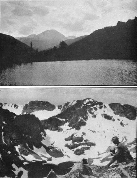
|
|
PLATE XVIII. MOUNT COPELAND FROM COPELAND
LAKE. Photograph by John King Sherman. OGALALLA FROM MOUNT COPELAND. Photograph by G. H. Harvey, jr. PEAKS OF THE WILD BASIN |
Mount Alice (13,310 feet) may be reached from Thunder Lake by following up the stream west of the lake, or by going north from the lake and following up the ridge to the Continental Divide and then southwesterly up the steep slope and above the dizzy cliff to the top of the peak.
Tanima Peak (12,417 feet) may be reached from Thunder Lake by following up the west inlet of the lake to the Continental Divide, and thence swinging back to the east along the ridge and to the summit. It may be reached more directly by following the west inlet for half or three-quarters of a mile, and then climbing directly to the top of Tanima Peak, but this route is steep and not recommended.
From Thunder Lake a trail runs around the eastern point of the Tanima Peak ridge to Eagle Lake (10,800 feet). Several of these small lakes, including Thunder Lake and Eagle Lake, are utilized as storage reservoirs for water to irrigate land east of Lyons.
From Eagle Lake one may reach Tanima Peak and Mahana Peak (12,629 feet). It is to be noted that the map shows an unnamed point over 13,000 feet in elevation a mile west of Mahana Peak. The trail to Ouzel Lake is marked by signs and easily followed. From Ouzel Lake one may visit the beautiful and interesting lakes named Bluebird, Pipit, and Junco, and may take trips to Mahana Peak, Ouzel Peak (12,600 feet), and Mount Copeland (13,176 feet).
Mount Copeland is probably the favorite climb in Wild Basin. This may be because it projects a mile or two east from the Continental Divide and when seen from the Valley below stands out prominently and appears to be even higher than it really is. Mount Alice, Chiefs Head, and Pagoda are all somewhat, higher than Mount Copeland, but are dwarfed by their proximity to Longs Peak and thereby lose some of the prestige that would otherwise be theirs. Mount Copeland is easily approached by the horseback trails to Ouzel Lake and Pear Reservoir. Because it projects east of the Continental Divide, the view of Wild Basin and its wall of peaks is unusually fine from the top of Mount Copeland. Prior to the publication of the United States Geological Survey map, Mount Copeland was known as Mount Clarence King, in honor of the eminent geologist who was the first director of the United States Geological Survey and the author of a classic entitled "Mountaineering in the Sierra Nevada." The change of name is regretted by most people who knew the peak as Mount Clarence King.
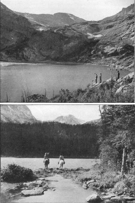
|
|
PLATE XIX. BLUEBIRD LAKE AT THE END OF
BLUEBIRD TRAIL. Photograph by Wiswall Brothers. A GLIMPSE OF OUSEL LAKE AND OUSEL PEAK, 10 MILES DISTANT ON THE CONTINENTAL DIVIDE. Photograph by Wiswall Brothers. LAKES OF THE WILD BASIN |
There is a trail from Allens Park to Pear Reservoir (10,500 feet), and from this point Mount Copeland is easily accessible. Ogalalla (13,147 feet) and the two unnamed peaks south of Mount Copeland, whose elevations are 12,381 and 11,546 feet, respectively, may also be reached from Pear Reservoir.
Meadow Mountain (11,634 feet) is easily climbed from Allens Park, or from the trail to Pear Reservoir, or from the North St. Vrain Creek trail. Finch Lake (9,900 feet) is not visible from the Pear Reservoir trail, though close to it. The trail at this point gives a close approach to Meadow Mountain or to Mount St. Vrain (12,162 feet). These two peaks can easily be included in one trip.
The southern boundary of the Rocky Mountain National Park is a straight township line, and includes within the park almost all of Wild Basin. The line runs just south of Meadow Mountain and just north of Ogalalla. Allens Park and Copeland Lake Lodge are not in the park, but a mile or so east of it.
PAGODA (13,491 FEET), LONGS PEAK (14,255 FEET), AND MOUNT MEEKER (13,911 FEET).
[Report furnished by Roger W. Toll, accompanied by Francis E. Bouck (Aug. 9 and 10, 1916).]
Started from the annual outing camp of the Colorado Mountain Club, located in Wild Basin on North St. Vrain Creek, about 4 miles above Copeland Lake Lodge. Left camp at 8.45 a. m. and walked to Copeland Lake Lodge, then started up the side of the Copeland Moraine back to the lodge, and soon struck a trail. Followed this trail to the upper end of the Copeland Moraine, where it ends on Meeker Ridge, and there met the disused road to Sandbeach Lake. Followed the road, which is now impassable for wagons, crossed the creek that comes down from the south slope of Mount Meeker, then Hunters Creek, and reached Sandbeach Lake at 1.20 p. m. The sand beaches, which give the name to the lake, are only visible when the reservoir is partially empty, as it was on this day. Walked around the reservoir and having some time to spare, started toward Mount Orton, reaching timber line at 2.30. Here I met the Mountain Club party, some 45 strong, returning from Mount Orton, and went with them back to Sandbeach Lake, where I met Francis E. Bouck by previous arrangement.
Leaving Sandbeach Lake at 4.30 p. m., we followed up the valley of Hunters Creek and camped at timberline, a couple of hundred yards north of the small lake (not shown on map) at the junction of the two branches of Hunters Creek. It had rained two or three times during the day, but we dried out at a good fire and crawled into our sleeping bags which we had carried up with us from the Mountain Club camp. A short sleet storm at 3 o'clock in the morning ended the unfavorable weather, and the following day was clear and warm.
Pagoda.—We left camp at 6 a. m., leaving behind us bedding and all unnecessary impediments, and went up the rugged, lonesome, and impressive glacial gorge above which towered the peaks of Pagoda, Longs and Meeker. Followed the rock slide between Pagoda and Longs Peak, reaching the saddle between the two peaks without any difficulty, and started up Pagoda, keeping fairly close to the ridge, and reaching the top at 8.30 a. m. This is the easiest approach to Pagoda, and, so far as I know, it can be reached only from this north ridge; the other sides are quite precipitous. Pagoda is seldom climbed, and there was no cairn on top, so we built a small one.
Longs Peak.—On the southwest side of Longs Peak, facing Pagoda, is a long cliff of black rock, 50 to 100 feet high, but broken by gullies near the center of the cliff like stretch. We looked the ground over carefully and picked out the most promising break in the cliff. Followed the saddle ridge to the base of the cliff, going around the sharp gendarmes or sentinel rocks on the ridge. This saddle, by the way, can also be reached from Glacier Gorge by following up one of the several long draws leading to the saddle from the west side. Going easterly from the ridge and ascending but slightly, we reached the break in the cliff and had no trouble in getting up on the rock-covered slope above. It would be somewhat more difficult to go from Longs Peak to Pagoda, than from Pagoda to Longs Peak, since the break in the cliff would be harder to find from above than from below, but anyone going in that direction should descend on the south slope of Longs Peak until the most prominent sentinel rock on the ridge is in line with the saddle north of McHenrys Peak, and then, by going toward the sentinel rock, the break in the cliff will be found. The ridge from Longs Peak toward Pagoda is very ragged and we stayed on the rock-covered slope below until nearly under the Narrows, then, turning west, reached the crest of the ridge not over 200 feet from the head of the Trough. From there we followed the ridge, which is rather dizzy, to the head of the Trough, and thence over the usual trail along the Narrows and Home Stretch, reaching the top of Longs. Peak at 10.50 a. m. We probably could have reached the Home Stretch more easily without going over the Narrows, but we wanted to take in that part of the trail which, to my mind, is the most spectacular part of the regular trail up Longs Peak.
We left the top of Longs Peak after signing in the register book, and descended the Home Stretch nearly to the Narrows, and then turned easterly, passing at the foot of some cliffs, and so reached the draw coming from the Notch. The only precaution to be taken on this part of the route is to follow the Home Stretch far enough, and not try to keep close to the foot of the cliffs all the way. I followed up the draw to the Notch and tried to look through, but the Notch is full of big broken rocks, and though I could see the more distant part of Estes Park, I could not squeeze through the last opening between the rocks far enough to look down into Chasm Lake. No doubt a fine view could be obtained from a point in the Notch a few feet westerly from where I was, but the whole pile of rock in the Notch gave such an impression of being loose and treacherous that I tried no more experiments.
We then descended the draw for a short distance, and I have no doubt at all that this main draw affords an easy way of descent into Wild Basin. In fact, the route up or down Longs Peak, by means of this draw, does not, I feel sure, offer any greater difficulties than the usual route through the Keyhole. A party would have to be careful not to start rocks rolling down the draw, but this is also true of the Trough, and the danger of rocks falling from the cliffs towering above is probably more imaginary than real.
Mount Meeker.—We soon left the main draw (the one leading to the Notch) and kept fairly close to the base of the cliffs, descending all the time, but working toward Mount Meeker. At 12.30 p. m. we turned up a small draw or gorge, and, after a little rock scrambling, reached the top of the draw and thence over open ground to the saddle between Mount Meeker and Longs Peak. We had intended to go farther down the slope of Longs Peak, and then up the rock slide leading to the Mount Meeker saddle, and I believe such a route would be easier going, though it would have a few hundred feet more rise and fall.
The top of Mount Meeker was reached without event at 1.35 p. m. For a mountain that gives such an appearance of smooth, even slopes and easy walking as Meeker does from the east, the top ridge is quite a surprise. For several hundred feet this ridge is a narrow rock crest with steep, almost precipitous slopes on either side. There are two points of practically equal elevation toward the westerly end of the ridge. At 2 p. m. we started down and followed the southwesterly ridge of Mount Meeker, going around several jagged knobs, and reached our camp at timberline at 4.15 p. m. Enjoyed a rest until 5 p. m.; then, carrying our sleeping bags, we started for the Mountain Club camp, going to Sandbeach Lake, thence down the outlet to the meadow below, thence across a saddle to the south and along a faint trail in a southwesterly direction to two small lakes not shown on the map, where we lost the trail and struck down hill to the Thunder Lake trail. Reached the camp at 8.15 p. m.
Pagoda is very rarely climbed, because of its inaccessibility from ordinary starting points. Few people go from Longs Peak to Mount Meeker, or vice versa, because either one alone is usually considered to be a full day's trip. The principal reason more people do not climb Longs Peak from the south is that there is as yet no horse trail near the peak on that side, Sandbeach Lake being the nearest point of approach by horseback in that direction. Also the route is not so well known as the usual Keyhole trail.
Log of trip to Pagoda, Longs Peak, and Mount Meeker.
| Place. | Time reached. | Time from last-mentioned place. | Length of stop. | Elevation shown by map. | Elevation climbed from last-mentioned place. | Distance from last-mentioned place scaled from map. |
| Aug. 9: | a. m. | h. m. | h. m. | Feet. | Feet. | Miles. |
| Left Colorado Mountain Club camp | 8.45 | 8,800 | ||||
| Copeland Lake Lodge | 10.10 | 1 25 | 45 | 8,300 | 3.2 | |
| p. m. | ||||||
| Creek | 12.10 | 1 15 | 15 | 9,400 | 1,100 | 2.2 |
| Hunters Creek | 12.50 | 25 | 9,500 | 100 | .7 | |
| Sandbeach Lake | 1.20 | 30 | 10,300 | 800 | 1.1 | |
| Around lake | 1.35 | 15 | 10,300 | .4 | ||
| Timberline on Mount Orton | 2.30 | 55 | 20 | 11,000 | 700 | .3 |
| Sandbeach Lake | 3.30 | 40 | 1 00 | 10,300 | .3 | |
| Timberline camp | 6.30 | 2 00 | 11,100 | 800 | 1.5 | |
| Total | 19 45 | 7 25 | 2 20 | 3,500 | 9.7 | |
| Aug. 10: | a. m. | |||||
| Left timberline | 6.00 | 11,100 | ||||
| Saddle between Pagoda and Longs Peak | 8.00 | 2 00 | 13,200 | 2,100 | 1.4 | |
| Pagoda Peak | 8.30 | 30 | 30 | 13,491 | 291 | .2 |
| Saddle between Pagoda and Longs | 9.20 | 20 | 13,200 | .2 | ||
| Top of Trough | 10.25 | 1 05 | 14,000 | 800 | .5 | |
| Top of Longs Peak | 10.50 | 25 | 20 | 14,255 | 255 | .2 |
| Below Notch | 11.35 | 25 | 13,500 | .4 | ||
| m. | ||||||
| Detour to Notch and return | 12.00 | 25 | 13,500 | 200 | .2 | |
| p. m. | ||||||
| Low point of route | 12.30 | 30 | 13,000 | .1 | ||
| Top of draw near Meeker | 12.40 | 10 | 13,200 | 200 | .1 | |
| Saddle between Longs and Meeker | 1.00 | 20 | 13,400 | 200 | .1 | |
| Top of Meeker | 1.35 | 35 | 25 | 13,911 | 511 | .3 |
| Timberline camp | 4.15 | 2 15 | 45 | 11,100 | 1.4 | |
| Sandbeach Lake | 6.00 | 1 00 | 10,300 | 1.5 | ||
| Lakes | 7.15 | 1 15 | 9,500 | 1.3 | ||
| Ouzel Lake trail junction | 7.45 | 30 | 9,300 | .3 | ||
| Colorado Mountain Club camp | 8.15 | 30 | 8,800 | 1.5 | ||
| Total | 114 15 | 12 15 | 2 00 | 4,557 | 9.7 | |
| Total for both days | 124 00 | 19 40 | 4 20 | 8,057 | 19.4 | |
1Hours and minutes. | ||||||
MOUNT ORTON (11,682 FEET) AND CHIEFS HEAD (13,579 FEET).
[Report furnished by Roger W. Toll, accompanied by Carle Whitehead (July 7, 1916).]
Chiefs Head is the third highest peak in that part of the Front Range lying north of Berthoud Pass; Longs Peak and Mount Meeker take first and second place. On account of its proximity to Longs Peak, Chiefs Head does not appear to be as high as some of the more isolated peaks farther south. It is at the junction of the ridge connecting Longs Peak with the Continental Divide. The top of the peak is probably a quarter of a mile to the east of the divide. Chiefs Head is on the ridge separating the watersheds of the Thompson and the St. Vrain Rivers, while the watershed of the Grand River comes well up on the side of the peak. The peak affords an extensive view of plains, parks, and peaks. It overlooks Glacier Gorge and Wild Basin and gives a good view of the steep southern sides of Longs Peak, 2 miles distant.
Mount Orton is the southeasterly point of a high ridge and this ridge affords an excellent panorama of the rugged peaks encircling Wild Basin.
The following is the report of a scouting trip, preliminary to the 1916 annual outing of the Colorado Mountain Club:
The preceding night had been spent in a temporary camp at Ouzel Lake (9,900 feet). We left camp at 7.30 in the morning and followed the trail across North St. Vrain Creek (9,400 feet) to the trail leading to Thunder Lake. Followed this trail to a point where there are small log bridges across four branches of the creek, all within 150 feet of each other. This is not far from the point on the map where the creek from Thunder Lake joins the main stream. Followed the main stream northerly from this point, passing beautiful cascades and waterfalls to a small lake on a high bench near timberline. Left the creek and climbed Orton ridge, reaching the crest of the ridge at a point half a mile northwest of Mount Orton. About a mile of the ridge is nearly level, having half a dozen small knobs of nearly the same elevation. We did not go to the Mount Orton end of the ridge, but northwest along the ridge and up the slope to the top of Chiefs Head. The day was warm and the air was mild, even on the summit.
We then went to the saddle southwest of Pagoda. At this point a long steep trough leads down into Glacier Gorge and forms a feasible method of getting into this gorge from Wild Basin. The ridge up Pagoda from this saddle is steep and ragged. The south side of Pagoda is flanked with precipitous cliffs. On the west side of Pagoda there are ledges that can be followed for some distance, but we did not go far enough to determine whether or not Pagoda can he reached from its west side.
Returning to the saddle, we went easterly, slid down a snow bank (avoiding a small projecting ledge) to a beautiful ice lake, and then followed Hunters Creek to its junction with the creek from Longs Peak. Half a mile farther climbed over the shoulder of Mount Orton and descended to Sandbeach Lake. This is in a typical moraine formation, with a tract of burned and fallen timber to the north of it. Wild Basin has large tracts of splendid timber and this is one of the few burned districts.
From the lake we followed the road, which is now only a fair horseback trail, to a point where the road crosses Meeker ridge, and went down from there to the scouting party's camp, about 1-1/2 miles west of Copeland Lake Lodge. There are a number of small lakes in addition to those shown on the map, particularly on the west side of Mount Orton.
Log of trip.
| Place. | Time reached. | Length of stop. | Elevation shown by map. | Distance from last mentioned place. |
| a. m. | h. m. | Feet. | Miles. | |
| Left Ouzel Lake | 7.30 | 9,900 | ||
| North St. Vrain Creek | 8.15 | 9,400 | 1.2 | |
| Thunder Lake trail | 10.10 | 10,300 | 1.9 | |
| Timberline | 11.00 | 10 | 11,000 | 1.0 |
| Top of Orton ridge | 11.55 | 50 | 11,600 | .2 |
| p. m. | ||||
| Chiefs Head Peak | 2.40 | 45 | 13,579 | 1.5 |
| Saddle between Chiefs Head and Pagoda | 4.05 | 12,800 | .5 | |
| North side of Pagoda and return to saddle | 4.30 | 12,800 | .4 | |
| Timberline at Hunters Creek | 6.00 | 11,000 | 1.5 | |
| Sandbeach Lake | 7.00 | 10,300 | 1.5 | |
| Camp near Copeland Lake | 8.30 | 8,300 | 3.3 | |
| Total | 113 | 1.45 | 13.0 | |
1Hours. Elevation climbed, 5,000 feet. | ||||
CHIEFS HEAD (13,579 FEET).
[Report furnished by Miss Agnes W. Vaille, accompanied by Miss Edna Smith (Sept. 4, 1915).]
We left camp at Thunder Lake about noon and climbed northwest to a long ridge which brought us on to the Continental Divide between Chiefs Head and Mount Alice, rather nearer Mount Alice. From there we went along the top of the Divide to the top of Chiefs Head and returned by the same route. It would have been easy to climb Mount Alice also from the point where we reached the Continental Divide, and both Mount Alice and Chiefs Head could easily be done in a day. We did not climb Mount Alice, however, because the rain and clouds would have shut off all the view, and we had rather too late a start. We reached Thunder Lake again about 6 o'clock.
MOUNT ALICE (13,310 FEET), LAKE NANITA, AND TANIMA PEAK (12,417 FEET).
[Report furnished by Roger W. Toll, accompanied by Thurlow Lacy and Thee. K. Bushnell* (Aug. 11 and 12, 1916).]
*Theo. K. Bushnell was mortally wounded, in action, and died in France, October 9, 1918.
After dinner, we left the Colorado Mountain Club camp, on North St. Vrain Creek, and with our sleeping bags, walked up the trail toward Thunder Lake for two hours or more, and then unrolled the bags and crawled in. The object of this night trip was to get an early start the next morning. We got down at dawn (4.30) and after caching our sleeping bags under a rock, passed Thunder Lake and struck northward up the timbered slope, brilliant with flowers of many varieties. The large yellow lily, known as the "dog-toothed violet," worthy companion of the columbine, grows in profusion in this region, and during the blossoming season (July and early August) would well repay a long trip. They are abundant in many parts of Wild Basin but nowhere more plentiful than here. The slope led to a timberline plateau, and from there we started up the ridge between Mount Alice and Chiefs Head. Came in sight of a lake on the north side of the ridge with a large snow field running into it and terminating in a snow cliff 20 or 30 feet high at the edge of the lake. We waited while Lacy went down to get some photographs, and then went on up the ridge to the Continental Divide.
The crest of the Divide north of Mount Alice is quite narrow in places, but presents no difficulties. The north side of Mount Alice, as seen from the ridge below, appears very steep and the loose rock on it looks as though it might, on the slightest provocation, go sliding over the cliff into the abyss below. This feeling gives one rather a nervous sensation while on the north side of the peak; but actually most of the rock is firmly lodged and gives good footing, though a large party would find the south side of the peak a better way of approach. After resting a few minutes, we started west, descending gradually on the south side of the ridge, hoping to get a view of Lake Nanita. One ridge after another hid our view, and we had gone a mile before we could see into the lake.
This lake, which since has been made accessible by trail, from the Flattop trail, is on a bench 1,000 feet above the North Inlet. There was a story that the lake had never been visited, so we decided to make its acquaintance and followed the ridge down to the saddle between the North Inlet and East Inlet Creeks and from there into the head of a valley that we termed Boulder Pit. This is located just south of the letter E of the word Andrews on the map. This pit suggests recent glacial action, as the moraine has only a few young spruce growing on it, and the stream, a fairly good-sized one, is completely buried for a couple of hundred yards under a large pile of bowlders that make a sort of pocket out of the head of the valley. We then went up a saddle to the northwest and saw Lake Nanita below us. Three mountain sheep, not welcoming our visit, clambered with considerable difficulty up the clifflike face of Andrews Peak and nearly to the top of the peak. After enjoying the exhibition and envying their climbing ability we went down to the lake and made a small cairn at the inlet. The gorge on the northwest side of Andrews Peak, tributary to Lake Nanita, is extremely rugged, wild, lonesome, and impressive.
It had begun to rain and we had no time to explore the lake more thoroughly, so started back to camp, which was 7-1/2 miles in an air-line, while Grand Lake was not over 5-1/2 miles in a direct line from the lake. We reached the Continental Divide at the saddle between Mount Alice and Tanima Peak. As Tanima Peak is only 400 or 500 feet above this saddle, we decided to visit it on the return route. There was no difficulty except that at a narrow point in the ridge, 100 feet or so west of the top, all the rocks including some large ones, seemed anxious to slide when we stepped on them. We got on top shortly before 6 o'clock and gave up the plan of following the Tanima Ridge down to Thunder Lake, as the rain and clouds hid any distant view and made difficult the selection of the best route. So we returned to the narrow part of the ridge, above referred to, and went down the steep draw to the north.
This was the most difficult climbing of the day. The loose rocks started easily and went bounding down ahead of us at a high speed. Several times we had to work around small cliffs and were much relieved to get out of the shifting clouds and into the valley below. Returned to Thunder Lake and later picked up our sleeping bags and followed the trail, in a white mist, to camp which we reached at 9.15 in the evening. From start to finish it was a 16-hour trip, and a long one, too long for one day.
From the top of the Tanima Peak we caught a glimpse of an ice lake on the north side of Mahana Peak, west of Eagle Lake. The elevation of this lake is 11,800 feet, and the following day, August 13, George C. Barnard, Clifford S. Higby, and I visited it. In July many of the lakes above timberline are partly covered with ice. By the middle of August most of these lakes have lost their ice floes, but the one on Mahana is an exception, and I believe has snow on its banks and floating ice in the lake all through the summer.
The only comment on the map (which is excellent) is that there are about a dozen small lakes in the timberline region, east of Mount Alice, that are not shown. It should also be noted that the local names of the lakes differ from the map names and are given below to avoid the confusion that might result:
Thunder Lake is locally known as Green Lake.
Eagle Lake is locally known as Long Lake.
A lake not shown on the map, lying northeast of Thunder Lake, is locally known as Thunder Lake.
A log of the trip follows:
Log of trip to Mount Alice, Lake Nanita, and Tanima Peak.
| Place. | Time reached. | Time from last mentioned place. | Length of stop. | Elevation shown by map. | Elevation from last-mentioned place. | Distance from last-mentioned place. |
| Aug. 11: | p. m. | h. m. | h. m. | Feet. | Feet. | Miles. |
| Left Colorado Mountain Club camp | 7.45 | 8,800 | ||||
| Temporary camp | 10.00 | 2 15 | 10,500 | 1,700 | 2.9 | |
| Total | 12 15 | 2 15 | 1,700 | 2.9 | ||
| Aug. 12: | a. m. | |||||
| Left temporary camp | 5.10 | 10,500 | ||||
| Breakfast stop | 5.25 | 15 | 1 20 | 10,700 | 200 | .5 |
| Four bridges | 6.50 | 05 | 10,600 | .2 | ||
| Thunder Lake | 7.00 | 10 | 05 | 10,600 | .3 | |
| Timberline plateau | 7.50 | 45 | 11,000 | 400 | .5 | |
| Near Snow Lake | 8.40 | 50 | 20 | 11,500 | 500 | .5 |
| Continental Divide | 10.00 | 1 00 | 12,500 | 1,000 | 1.0 | |
| Top of Mount Alice | 11.00 | 1 00 | 13,310 | 810 | .5 | |
| Boulder Pit | 10,700 | 2.0 | ||||
| p. m. | ||||||
| Saddle Southeast of Nanita | 1.45 | 2 45 | 10 | 11,400 | 700 | .5 |
| Lake Nanita | 2.35 | 40 | 10 | 10,700 | .5 | |
| Saddle Southeast of Lake Nanita | 3.25 | 40 | 11,400 | 700 | ||
| Boulder Pit | 3.45 | 20 | 10,700 | .7 | ||
| East Inlet Saddle | 4.25 | 40 | 11,400 | 700 | .6 | |
| Top of Tanima Peak | 5.55 | 1 30 | 12,417 | 1,017 | 2.2 | |
| Thunder Lake | 7.10 | 1 15 | 10,600 | 1.0 | ||
| Temporary camp | 7.40 | 30 | 10,500 | 1.0 | ||
| Colorado Mountain Club camp | 9.15 | 1 35 | 8,800 | 2.9 | ||
| Total | 116 05 | 14 00 | 2 05 | 6,027 | 15.6 | |
| Total for trip | 118 20 | 16 15 | 2 05 | 7,727 | 18.5 | |
1Hours and minutes. | ||||||
MOUNT COPELAND (13,176 FEET).
[Report furnished by Henry F. Brooks (Aug. 10, 1916).]
Number in party, 41—16 men and 25 women.
Our party started at 7.15 a. m. from camp (elevation about 8,700 feet) on the North St. Vrain Creek, below the mouth of Cony Creek. We reached the point where the Ouzel Lake trail forks to the left from the Thunder Lake trail, at 7.45 a. m. and reached Ouzel Lake (9,900 feet) at 9.15 a. m.
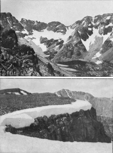
|
|
PLATE XX. PAIUTE PEAK (LEFT) AND RIDGE FROM
SHOULDER OF MOUNT AUDUBON. Photograph by G. H. Harvey, jr. SNOW CORNICE ON RIDGE BETWEEN THE ST. VRAIN GLACIERS. Photograph by G. H. Harvey, jr. |
On a preceding trip, one member of the party had complained that the pace was much too slow to suit him, so he was promised a faster trip up Mount Copeland. Accordingly, our party divided at Ouzel Lake, nine of the "fire eaters," led by Reed A. Higby, starting ahead and the rest of the party following more leisurely. The leader of the fast party reached the top at 11.17 a. m., having climbed the 3,200 feet from Ouzel Lake to the summit in two hours and two minutes. The member for whose benefit the trip was speeded up, arriving among the last of this first party. Most of the main party reached the top at 12.45 p. m., or three hours and a half after leaving Ouzel Lake, although some did not arrive until two hours later, having taken five and a half hours for the climb. The above shows the widely varying lengths of time that different people require on a climb, and the difficulty of stating standard time schedules that will suit all needs.
Mount Copeland is a fairly easy mountain to climb, as there is grass and soft footing most of the way up. The top is rocky.
MEADOW MOUNTAIN (11,634 FEET), AND MOUNT ST. VRAIN (12,162 FEET).
[Report furnished by Roger W. Toll (Aug. 11, 1916).]
Number in party, 13—6 men and 7 women.
The party left camp on North St. Vrain Creek at 8.20 a. m., and followed the new trail up Cony Creek to the beautiful falls of that stream. The trail was uncompleted beyond that point. Our route lay through the Engelmann spruce, lodgepole and limber-pine forest that covers such a large portion of Wild Basin. We ate part of our lunch on Meadow Mountain and the rest on Mount St. Vrain. Had a short slide on one of the two snow fields on Mount St. Vrain and made the most of the drinking water below the snow field. The one canteen in the party was welcome on the summit. The view of Longs Peak and the range south to Mount Audubon was first class. We could see the trail over Buchanan Pass; also the St. Vrain glaciers and all of Wild Basin. Found Finch Lake on the return without difficulty, although it is not visible from the Allens Park-Pear Reservoir trail. The map shows no inlet to Finch Lake, but there is a small one on the southeasterly side.
At Finch Lake the party separated into two sections, one reaching camp at 6.15 and the other at 6.40 p. m.
The log of the trip is as follows:
| Place. | Time reached. |
Length of stop. |
Elevation shown map. |
Distance from last- mentioned place. |
| a. m. | h. m. | Feet. | Miles. | |
| Left camp | 8.20 | 8,800 | ||
| Cony Creek | 8.45 | 9,300 | 0.7 | |
| p. m. | ||||
| Meadow Mountain | 12.15 | 40 | 11,634 | 2.0 |
| Saddle | 1.15 | 11,200 | .5 | |
| Mount St. Vrain | 2,15 | 35 | 12,162 | .9 |
| Finch Lake | 5.20 | 10 | 9,900 | 1.7 |
| Camp | 6.30 | 8,800 | 1.7 | |
| Total | 110 10 | 1 15 | 7.5 | |
1Hours and minutes. | ||||
Elevation climbed was 3,800 feet.
PEAKS ACCESSIBLE PROM MIDDLE ST. VRAIN CREEK.
The area forming the headwaters of the Middle St. Vrain Creek is reached through Ward or Allens Park. From the automobile road connecting these two places and about 4 miles north of Ward, a road turns off toward the west, bearing the sign Stapp Lake. This road is passable for automobiles. It crosses the dam of Beaver Reservoir, passes the forest ranger's station, and reaches Stapp Lake, where there is a hotel and outing resort. Visitors will be met at Ward, if such an arrangement has been previously made, and driven to Stapp's Hotel.
Mount Audubon (13,223 feet) is the principal peak in this region and lies a mile east of the Continental Divide. It can easily be climbed in a day from Stapp's Hotel.
The trail over Buchanan Pass (11,700 feet) runs from Stapp's Hotel to Monarch Lake, on the western slope. The distance is 16 miles and can be made in a day. This is the only horseback trail across the Continental Divide between Arapaho Pass on the south and the Flattop trail on the north, a distance of more than 25 miles, measured along the Divide.
Just south of Buchanan Pass is Sawtooth Mountain (12,304 feet), which gets its name from the profile of the peak, which has a perpendicular cliff on the south side and a rounded slope on the north side.
The other peaks whose slopes rise from the Middle St. Vrain Creek, and whose summits may be reached from this valley, are Mount St. Vrain (12,162 feet), Ogalalla (13,147 feet), and Paiute Peak (13,082 feet). There are several unnamed peaks on the Continental Divide between Mt. Audubon and Ogalalla.
MOUNT AUDUBON (13,223 FEET).
[Report furnished by George H. Harvey, jr. (July 2, 3, and 4, 1916).]
Number of persons on trip, 11; 8 men and 3 women.
We took the train to Ward. From there walked about 4 miles north on the regular Estes Park auto road, then turned off to the west and followed the road to within half a mile of Stapp's Hotel, where we made our camp (9,300 feet). Good camp site. Fine water, plenty of wood. To climb Mount Audubon, pass Stapp's Hotel and follow the stream to a sawmill half a mile beyond. Take the log road to the south, connecting with a well marked trail to the summit of Mount Audubon. The trail is good and there is plenty of water all the way. It is a pleasant climb, and the lower part of the trail leads through fine timber.
The approximate length of the round trip from Beaver Reservoir is 15 miles, and the elevation climbed is 4,000 feet. The actual walking time was about 9 hours, not including 2 hours spent on top of the peak.
PEAKS ACCESSIBLE FROM WARD.
The part of the Front Range from Arapaho Peaks, north to Mount Audubon, a distance of 6 miles, is called, collectively, The Arikarees. These peaks and pinnacles form one of the most rugged and forbidding parts of the mountains in this region, and it is difficult to find in the whole Front Range any stretch of country that can equal it in abrupt cliffs, sharp peaks, torn and ragged ridges and general wild and savage appearance.
Ward is a mining town with more past than present activity. It is located at an elevation of 9,253 feet, and most of the streets are steep and hilly. Practically all of the Arikaree country is within a radius of 8 miles from Ward, so that this town is a good starting point from which to reach the little known and seldom visited rampart of peaks bristling up only a few miles to the westward.
The road from Ward, past Redrock Lake to Brainard Lake, connects with the United States Forest Service trail up Mount Audubon (13,233 feet) and brings one within reach of Paiute Peak (13,082 feet) and Pawnee Peak (12,900 feet). If one continues on the trail above Brainard Lake, past Long Lake to Lake Isabelle, he is then within reach of Pawnee Peak and the steep north side of Navajo Peak (13,406 feet).
Bald Mountain (11,453 feet) is a point on the ridge leading from Navajo Peak, and seems of greater importance when seen from Ward than when looked down upon from any of the higher vantage points to the west.
PAIUTE PEAK, 13,082 FEET.
[Report furnished by Arnold Emch, accompanied by son, Walter Emch (Aug. 17, 1916).]
This peak may be ascended along the eastern face of Paiute Horn, thence to the top. It may also be reached from the top of Mount Audubon, which is the least troublesome route, and the one that we took. From Mount Audubon one has to go down about 300 feet to the lowest depression in the rugged but solid ridge connecting the two summits. The ascent of Paiute Peak from this saddle is an interesting, but not difficult, climb over a solid ridge formation. The top of Paiute Peak is much more interesting than that of Mount Audubon. We placed the Colorado Mountain Club register on Paiute Peak. The wind on the heights was ferocious. The descent over the southeastern face of the mountain requires careful going. Steep ledges and snow fields alternate clear down to the magnificent lake at the foot of both Paiute Peak and Paiute Horn. In a number of places steps had to be cut in order to pass down the snow slopes between the ledges. In the early season when great masses of snow are still embedded between the rocks, a direct descent as we made it is only advisable when aided by an ice pick. The time schedule for the trip was as follows:
Left Ward, 4.40 a. m.; Redrock Lake, 5.35; Brainard Lake, 6.05; end of United States Forest trail, 6.30; Mount Audubon, 8.50; left Mount Audubon at 9.30; saddle, 10; Paiute Peak, 10.30; left Paiute Peak, 11; down at lake at foot of peak, 12.30 p. m.; back in Ward at 5 p. m.
To have more time and leisure it would be advisable to stay over night at Brainard Lake and start early in the morning from this point.
PAIUTE HORN (12,900 FEET).
[Report furnished by Arnold Emch, accompanied by son (July 24 and 25, 1915).]
From Redrock Lake west of Ward, Paiute Horn appears as the most prominent and interesting elevation of the range; it is located between Pawnee Peak and Paiute Peak. Paiute Peak is not visible from Redrock Lake as it is hidden from view by Mount Audubon. I do not know of any previous ascents of Paiute Horn, which lies three-quarters of a mile south of Paiute Peak (13,082 feet) and half a mile north of Pawnee Peak. On account of its shape and proximity to the higher Paiute Peak, I named the mountain Paiute Horn.
We left Ward at 8.45 a. m., got to Redrock Lake at 9.45, and to Brainard Lake at 10.45; from here we followed the Mount Audubon trail, which was in course of construction by a United States Forest Service party. The trail starts directly north of Brainard Lake (elevation 10,300 feet). After proceeding approximately along the 11,000 contour line to a place on the south side of the creek, we stopped for lunch at 12.30 p. m. We then made a reconnoitering climb on the ridge leading from Brainard Lake up to Pawnee Peak. High up on this ridge we came to a number of crags and rock towers which seemed to make this route over Pawnee Peak to Paiute Horn impracticable. We returned and at 5 o'clock reached a convenient camping place just at timber line, where firewood was available.
The next morning we broke camp at 5 o'clock. Our plan was to climb Paiute Horn over the south ridge that connects it with Pawnee Peak, so we kept along the north face of this latter peak. A great number of snow fields and rock ledges had to be traversed before the highest lake directly east of Paiute Horn was reached. Great masses of ice were floating on this lake. A series of rocky barriers and snow fields have to be climbed before the saddle between Paiute Horn and a minor elevation south of the Horn can be reached. From this saddle a steep ridge formed of huge bowlders leads up to a big snow cornice which required the cutting of steps and careful going.
The summit was reached at 8 a. m. The western face consists of an immense precipice, and a sharp depression or notch, in the north ridge, interrupts the line over to Paiute Peak. We stayed an hour and a half on this magnificent mountain and then returned in two hours to our camp. At noon we left this bivouac and after spending some time at Brainard and Redrock Lakes, returned to Ward a little after 5 p. m.
PAWNEE PEAK (12,900 FEET).
[Report furnished by Arnold Emch.]
On the map this peak is marked by the angle in the boundary line between Grand and Boulder Counties, a little northeast of the letter K of Pawnee Peak. We left Ward in the forenoon in the direction of Redrock Lake, Brainard Lake, Long Lake, and Lake Isabelle, where we intended to camp out during the night. A very heavy thunder and rain storm compelled us to retire down to the unattractive cabin on Lake Isabelle, where we spent an uncomfortable night. The next morning was clear and we started at 5 a. m. from the cabin. The route was along the snow fields, rock ledges, and bowlder fields on the south side of the creek, and is not at all difficult. After reaching the top of Pawnee Peak we descended on the northeast face toward the beautiful lake.
From here we followed the creek down to Mitchell Lake (not named on the map, but south of the contour designation 11.000), went around it on the north side; going directly east we soon struck the newly built Government trail to the top of Mount Audubon, starting from the north shore of Brainard Lake. We got back to Ward at 5 o'clock in the afternoon.
This traverse of Pawnee Peak from Lake Isabelle to Mitchell Lake, although easy, is one of the most interesting trips in this region. It involves alternately the crossing of snow fields and rock walls with constantly changing situations. Above Mitchell Lake one must be careful in selecting a proper passage through the swampy high moors and the bothersome underbrush. Go right through it, and don't say much about it.
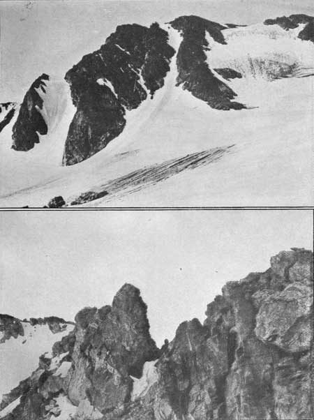
|
|
PLATE XXI. SOUTH ARAPAHO PEAK AND THE
GLACIER. Photograph by Clark Blickensderfer. THE RIDGE BETWEEN NORTH AND SOUTH ARAPAHO PEAKS. Photograph by G. H. Harvey, jr. |
PEAKS ACCESSIBLE FROM NORTH BOULDER CREEK.
The principal starting points for trips in this region are Silver Lake or (still higher in the string of lakes) Lake Albion or Goose Lake. Several of these lakes are now reservoirs. This area furnishes the excellent water supply for the city of Boulder and is under such regulations as will insure the purity of the supply. These regulations allow the use of certain cabins at Silver Lake, but discourage camping in the area above, unless special permission is obtained.
Silver Lake may be reached from Glacier Lake, Hill, Blue Bird Mine, or several other stations on the Eldora branch of the Denver, Boulder & Western Railroad. It may also be reached from Ward. Glacier Lake may be reached by automobile, without much difficulty, from Denver, via Nederland, or by one or two other routes, but there are several hills in this neighborhood that are too steep for automobiles. A few autos go all the way from Glacier Lake to Silver Lake, but the trip, like many of the trips over the steep mountain roads, is hard on tires and requires a good hill-climbing car and a careful driver.
Taking the north fork of the creek, from Silver Lake, we pass Lake Albion and the Green Lakes, from which Navajo Peak (13,406) feet, Arikaree Peak (13,147 feet), and Kiowa Peak (13,101 feet) are all accessible. Mount Albion (12,596 feet) is a promontory south of Kiowa Peak and can be climbed by a short detour from that point.
Taking the west fork of the creek, from Silver Lake, we pass Island Lake, Goose Lake, and Triple Lakes, and from here Mount Albion, Kiowa Peak, and Arikaree Peak are accessible, as well as the principal points of interest at the head of this valley, namely, Arapaho Glacier and Arapaho Peaks. The North Peak (13,506 feet) is the higher of the two Arapaho Peaks, more rugged and more difficult to reach. The South Peak (13,342 feet) is separated from the North Peak by a ridge half a mile or more in length. This ridge is sharp and precipitous on both sides, but is not dangerous if the rocks are dry and free from ice. In the glacial cirque east of the two peaks lies Arapaho Glacier. It is the largest and most perfect of the glaciers in this region, probably in the entire State. All of these glaciers, however, are but dwarfed remains of the mighty ice streams that once filled the valleys and played such an important part in the present topography of the country.
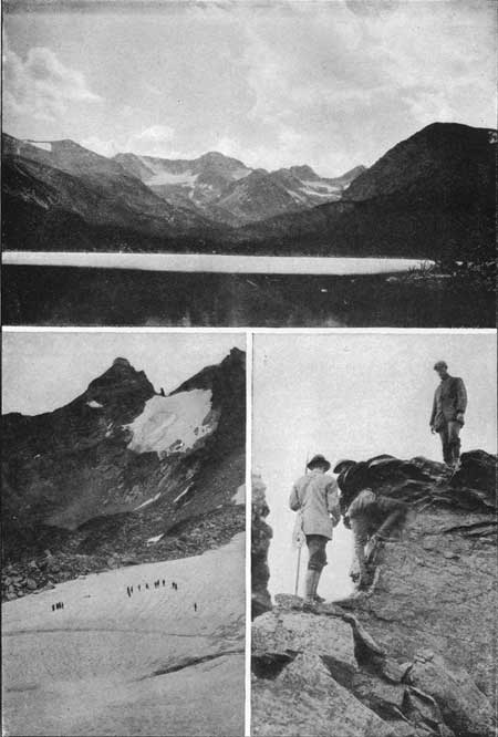
|
|
PLATE XXII. Upper: Arapaho Peaks from Silver Lake. Photograph by Clark Blickensderfer. Lower left: Isabelle Glacier, Navajo Peak. Photograph by G. H. Harvey, jr. Lower right: On the Arapaho Ridge. Photograph by Clark Blickensderfer. |
In a visit to the glacier one should take along an ice axe or something for cutting steps in the ice, and should not venture on the snow-covered portions of the glacier early in the summer; dangerous crevasses may be concealed beneath. The ascent of either the North Peak or the South Peak, direct from the glacier, is difficult and somewhat dangerous, and should not be attempted by anyone not familiar with rock climbing or steep snow slopes.
The South Peak, the ridge, and the North Peak are most easily reached from the Fourth of July Mines. One of the mine buildings is shown on the map. Others, where one may find shelter for the night, are located near the creek, south of the one shown on the map. The South Peak is an easy climb from the Fourth of July Mines, and one may then cross the rather dizzy ridge to the North Peak.
The Fourth of July Mines is reached from Eldora, the terminus of one branch of the Denver, Boulder & Western Railroad. One may walk, ride, or drive from Eldora to the mine.
Arapaho Pass (11,906 feet), or Boulder Pass, as it is sometimes called, is located about 1-1/2 miles beyond the Fourth of July Mines. It leads over the Continental Divide and down the western slope to the Fraser River or to Monarch Lake. A wagon road was started over this pass many years ago, but abandoned.
Mount Neva (12,800 feet), the most southerly peak on the map, may be reached from Arapaho Pass or from the Fourth of July Mines.
NAVAJO PEAK (13,406 FEET).
[Report furnished by Arnold Emch, accompanied by two of his sons and two other young men (Aug. 19 and 20, 1915).]
Next to North Arapaho Peak, this is one of the finest peaks of the whole region. We left Ward at 10 a. m., and followed the mountain road to Left-hand Park (old dilapidated reservoir). We crossed over Bald Mountain ridge and reached the upper Albion mining camp at half-past 1. We spent the afternoon here and passed a tolerably comfortable night, prepared breakfast and started on our climb at 5 a. m. We followed the route to the upper Green Lake, and from here along the eastern slope of the ridge from Arikaree Peak to Navajo Peak. Thus we reached the small lake under the letter K of Navajo Peak on the map. From here we enjoyed the magnificent view of the rugged ridges between Arikaree Peak, Navajo Peak and Arapaho Peak. On the first part of the climb there are no difficulties; the chimney and the final climb may be accomplished by any sure-footed climber.
The last portion of the ascent is the really interesting part of the whole climb. We stayed about 45 minutes on the summit and admired in particular the imposing view of North Arapaho Peak from this elevation. The northeast face of Navajo Peak is very abrupt and leads down to Lake Isabelle. A descent to this lake over a very steep snow field may be undertaken; it would seem advisable, however, to use ice picks and rope on either an ascent or descent over this route. The long Bald Mountain chain terminates in a ridge.
NAVAJO PEAK (13,406 FEET).
[Report furnished by W. F. Ervin (Sept. 1, 2, and 3, 1917).]
Number in party 12—9 men, 3 women.
The Colorado Mountain Club party left Denver on Saturday, September 1, 1917, with an even dozen members on the Colorado & Southern 8.15 train for Boulder, where we changed cars and went to Hill Station, on the Boulder & Western, where we left the train at 12.10 p. m. After loading our equipment on the wagon, we walked to the top of the first hill on the Silver Lake road and stopped there three-quarters of an hour for lunch and then Walked to University Camp, where we again met the wagon. We walked on to Silver Lake and then over to Camp Albion, where we pitched our camp for the night.
We left camp at 6.10 Sunday morning, walked up the train track to the Lake Albion dam, and then around the south side of the lake to where the trail meets the road and followed this to the camp at Green Lakes. This would be a good place to camp if one were packing, but it is impossible to get a wagon beyond Camp Albion. Here we took the trail which leads up the watercourse and followed it to the end and then kept on up the watercourse past Green Lakes until we came up on the shelf above Upper Green Lake, or the last lake of the Green Lakes chain. We did not go on up to the little lake at the foot of the snow bank, but turned north and climbed to the low point in the ridge running east from Navajo. Up to this point the climb presents very little difficulty. From here we took a diagonal course across the face of Navajo Peak to a point on the ridge about 200 feet south of the summit and then followed the ridge to the top. This last 200 feet of the climb is very interesting, but not dangerous. We arrived at the summit at 11.30 a. m. Distance traveled, 4 miles. The last 900 feet of the climb is over medium-sized loose rocks and is fairly hard climbing.
We left the summit at 12.30 p. m. and nine of us went back the way we had come to the camp at Green Lakes while the other three climbed Arikaree Peak from the north side. From the camp at Green Lakes we took the upper road, which keeps up on the hill north of the creek and the lakes and returned to camp. This part of the walk was very beautiful, as you can look across Lake Albion to Kiowa Peak and Arikaree Peak. We arrived at camp at 5.30 p. m. The weather was fine all through the trip.
Monday we broke camp and started down at 9.15 a. m. Walked to Silver Lake and then around for a mile or so on the Goose Lake road. We then walked down to Arapaho Falls where we cooked lunch, and went on down to Bluebird and took the train to Denver.
While there is some hard climbing on this Navajo trip, the distance is short. It is a very pleasant trip and gives a wonderful view of rugged peaks, close at hand.
Log of trip to Navajo Peak.
| Place. | Time reached. | Elevation. | Elevation climbed from last-mentioned place. | Distance from last-mentioned place. |
| Saturday: | p. m. | Feet. | Feet. | Miles. |
| Hill Station | 12.10 | 9,000 | ||
| University Camp | 2.20 | 9,600 | 600 | 3 |
| Silver Lake | ||||
| Camp Albion | 4.00 | 11,000 | 1,400 | 4 |
| Totals | 2,000 | 7 | ||
| Sunday: | a. m. | |||
| Camp | 6.30 | |||
| Green Lakes | 7.30 | 11,400 | 400 | 1 |
| Summit, Navajo Peak | 11.30 | 13,400 | 2,000 | 3 |
| p.m. | ||||
| Left summit | 12.30 | |||
| Camp | 5.30 | 5-1/2 | ||
| Totals | 2,400 | 9-1/2 | ||
ARIKAREE PEAK (13,147 FEET).
[Report furnished by Carl Blaurock, accompanied by F. H. Clark, Morton Hamon, and Charles H. Saunders (Sept. 2, 1917).]
Four of us left the Colorado Mountain Club party after having climbed Navajo Peak, and started about 1 p. m. to follow along the serrated ridge between Arikaree Peak and Navajo Peak, with the intention of climbing up the precipitous northern side of Arikaree Peak.
The going was fairly good over small bowlders until the large snow bank lying in the hollow of the cirque was reached, and here Clark was sorely tempted to leave the party and slide down the snow some 300 feet to an icy bath in the beautiful glacial lake below, but after several long looks decided to stay with the rest of us until a more favorable spot was reached. So we continued, keeping our elevation and paralleling the ridge around until the foot of the large cliff to the west of Arikaree was reached.
Here Clark temporarily left the party and slid down the glacier and worked his way around to the foot of Arikaree on the moraine. The rest of us continued along the edge of the snow bank for a short distance, when Hamon and Saunders decided to cut across the bank at a favorable-looking spot while I continued along the edge until the first large fissure extending up the cliff was reached. This I could not cross, as it was too steep and the ice gave me no foothold. Hamon and Saunders had meanwhile worked their way around to the ice chute extending up to the gash between Arikaree Peak and the cliff beside us. Here the ice got too steep for them to secure a foothold. Saunders then slid down the glacier and joined the main party, on their way to Green Lakes.
I next turned to the cliff and started to climb up. After going up about 50 feet I wanted to go down again, as footholds and handholds began to get scarce and the cliff smoother and steeper (estimated 75° to 85°), but going down was still more difficult, so I kept on ahead, occasionally resting on some small knob, poised in midair, while I noted the great amount of space around me, especially at my feet. At times there would be small patches of snow and ice which made the climbing more precarious, and in one or two places it was necessary to hang by my hands and swing myself, pendulum fashion, around a smooth piece of rock to a new foothold. Soon the top of the fissure was reached and the going was good up to the notch, into which I descended and could then see Clark on the other side and quite far below me, giving advice to Hamon, who was still sitting at the foot of the cliff.
Then ensued a three-sided powwow as to what to do next, after which Hamon got across the ice chute and joined Clark, and we all continued up Arikaree. The going was not so bad here, though still very steep and with much loose rock, so that footholds and handholds had to be carefully chosen to avoid dislodging these or other rocks. Being quite a bit above the others, I reached the top first, at 3.30 p. m., while they joined me in about 15 minutes. We sat there half sa hour or so, enjoying the scenery, then started for camp by way of the saddle between Mount Albion and Kiowa Peak, which is an easy route all the way down, except for a small stretch of rock and a snowbank, down which we slid, just above Lake Albion.
KIOWA PEAK (13,101 FEET).
[Report furnished by Arnold Emch (August, 1913).]
One gets a beautiful view of this mountain from the ridge that leads from Bald Mountain (11,453 feet), in a westward direction up to Navajo Peak. The uppermost Albion Mine, from which the ascent can be made, may be reached from Ward (by crossing over Bald Mountain) or from Silver Lake. We took the early morning train from Eldora to the Blue Bird Mine, walked to Silver Lake, and from here to the upper Albion Mine. We left this place at ll o'clock and, after a steady climb of three hours, reached the summit, which bears a triangulation station of the Boulder City survey. The mountains and the range were immersed in clouds. At times it was not possible to see farther than 20 feet in any direction. We waited over an hour on the summit, hoping that the clouds would disperse, but conditions, instead of getting better, grew steadily worse.
As it was then after 3 o'clock, we decided to descend on the south side toward the Arapaho Peaks. This side of Kiowa Peak is extremely interesting, much more so than the northern face, and keeps the climber constantly busy and on the alert. When we got down to Frozen Lake, the fog lifted for a moment and we saw the wonderful and romantic location of this beautiful lake. Farther down we had to contend again with rock barriers, and a number of times had to hunt for places where it was possible to get down. It was 6.30 p. m. when we came to a place above the northern shore of Triple Lakes. The clouds began to settle down on the lake and it got dark, so we were forced to camp here. During the greater part of the night the fog around us was so dense that our shadows were projected on it by the light of the camp fire. It was impossible to distinguish anything more than 10 feet away from the fire. The next day we returned by the usual route to Silver Lake and to Eldorn.
ARAPAHO PEAKS—SOUTH PEAK (13,342 FEET) AND NORTH PEAK (13,506 FEET).
[Report furnished by Arnold Emch (various trips, from 1900 to 1914).]
These peaks can easily be climbed in one day from Eldora, especially if the trip to and from the Fourth of July Mines is made by wagon. On the map only the upper mine and the dilapidated trail leading to it are shown. The lower mine, nearer the creek, where night quarters may sometimes be obtained, is not shown on the map. From here a trail leads to the upper mine.
South Arapaho Peak is located on the map just north of the letter A in the word Pass. It may be reached without difficulty from the Fourth of July Mines in three or four hours. There is a trail most of the way. The main portion of the ascent begins at the saddle, from which a magnificent view of the glacier below presents itself. The North Peak, shown as Arapaho Peak on the map, may be reached from the South Peak, over a very rugged rock ridge. This, however, takes more time and requires sure footing and a steady head. South Peak may also he climbed in the same easy manner over the ridge, coming from Caribou, which joins the other route at the saddle.
On the six excursions which I have made on this mountain, the descent was made twice upon the glacier. The last of these traverses, August, 1912, was the most interesting. In spite of the advanced season, great masses of snow still remained on the mountain. My oldest son, Walter, was with me and we were tied together by a rope. To get down at all, I had to cut steps for at least two hours in the very steep surface of hard snow leading down to the glacier. We finally struck the south wall of North Arapaho Peak. By sliding down the rest of the inclined snow plane, the glacier was reached in a few minutes. The crevasses in the upper part of the glacier were mostly packed with great masses of snow and, consequently, did not cause us any trouble, as they had done on a previous trip. Below the glacier extended several snow banks and below these were lakes in terrace formation. From the highest of the Triple Lakes, we followed the tedious route down the valley. A little below Silver Lake in a boarding house conducted by a Mrs. Parker, we found welcome quarters for the night. The next day, on our way down to the blue Bird Mine (a station on the Denver, Boulder & Western Railroad), we had an opportunity to admire the beautiful upper Boulder Falls. Shortly afternoon the train brought us back to Eldora. My brother-in-law and I made a somewhat easier descent upon the glacier in 1911.
On September 3, 1900, my brother and I made a complete ascent and traverse of the more difficult North Arapaho Peak. I do not know of any previous ascent of this North Peak and was told that it had not been climbed before. We started at 4.30 a. m. from a bivouac in the rocks southwest of and above the upper of the Triple Lakes. The night was cold; we were without a tent or sleeping bags.
After climbing for some time over a chaos of huge bowlders, cliffs, and rocky barriers, so characteristic of all high valleys in this section, we came to the glacier. Its lower portion was absolutely harmless, while the upper strata, leaning on the south wall of North Arapaho Peak, were very steep in places. The bergschrund, a crevasse in the ice, which is always found in the highest portions of a glacier, was very irregular and in places from 30 to 50 feet deep and 5 feet wide. It required very careful work to find a suitable bridge across the chasm. From here the rest of the climb was an exhilarating scramble with hands and feet up the rugged southern wall. It was a little after ll o'clock when we reached the summit of North Arapaho Peak, one of the most magnificent peaks of the Colorado Rockies. Surely there could stand no finer monument in memory of the valiant and noble Arapaho Indians than this imposing and dominant peak, which, like a guardian, watched for centuries the wild folk dwelling in his domain.
An hour of supreme enjoyment passed like an instant, surrounded as we were by the greatest and purest display of nature. As there was hard work ahead of us, we departed promptly at half past 12. Not expecting particular difficulties, we chose for our descent the rugged northeast ridge. The first part was steep and in some places precipitous, but the difficulties continued to increase. In one place a perpendicular precipice blocked our route, so that we had to retrace our steps and then go down a narrow, ice-filled gully. From here we were able to reach the notch below the precipice. The view from here toward the opposite east ridge was first rather discouraging, but close inspection showed that with sufficient care the descent could be accomplished from this lofty eyrie. To get to this notch, still high up, we had lost over two hours of valuable time. Thirty feet below, the almost perpendicular rocks, surrounding the gap in the crest, terminated in a steep snow field of very hard icy structure. Three hundred feet below, this field fell directly into a lake whose extremely dark blue water suggested gruesome and frigid depth. It took two hours more to perform the difficult and dangerous task of crossing this treacherous incline.
With this passage accomplished, all difficulties were over, and the traverse was a success. Climbing along the rugged eastern slope and down over a number of steep rock barriers, we finally reached the upper of the Triple Lakes. above which we bivouacked the night before. From here it was impossible to follow the irregular and clifflike shores of the string of lakes that extends to the east.
At the time of our first exploration in this region there was no trace of a trail like the one now in existence. The lakes had to be avoided by tediously climbing around over very rough ground, crossing alternately heavy, dead timber, bowlders, and shallow basins or moors filled with swamp grass. Above Goose Lake the falling night compelled us to camp in the open. Our provisions had run out, and in the morning, when we had to continue our journey, we were in a weakened condition. We managed to reach the cabin at Silver Lake at 5 o'clock in the morning. The forest guard prepared a breakfast for us which tasted better than any we could remember. After a cheerful tramp of about 7 miles down to the station of Sunset, a train took us back to Boulder.
The trail from Triple Lakes to Silver Lake lies north of the lakes. This is important, as two attempts to pass on the south side resulted in failure.
On long, hard trips the traveler should be well provisioned; in fact, he should have some reserves for cases of emergency. Prolonged lack of food in the higher regions may become positively dangerous, and continuous expenditure of energy without food is impossible.
An account of this ascent of North Arapaho was published in the Rocky Mountain News of September 16, 1900.
MOUNT NEVA (12,600 FEET).
[Report furnished by Arnold Emch, accompanied by son, Walter Emch (August, 1913)1.
The road to the lower Fourth of July Mine, where one can stay over night, and the mine itself, are not shown on the map. They are near the creek, directly south of the mine building indicated on the map. This magnificent pyramid, Mount Neva, the sentinel of Middle Park, is on the Continental Divide just south of Arapaho Pass.
We left the Fourth of July Mines at 5 in the morning, and followed more or less the rugged ground along the creek that crosses the word Neva on the map. Dense undergrowth and high moors above timberline had to be overcome by scouting through the wearisome labyrinth. At the end of the creek we circled around the southern shore of the frozen lakes, which are not completely shown on the map, and from here gained the south ridge of Mount Neva by climbing more or less in a northwesterly direction, After this ridge was reached the top was not far off and we arrived at 9 a. m. The frozen lakes which we passed were still covered with thousands of tons of floating ice in immense blocks. Mount Neva may also be scaled from the point (12,557 feet) west of Lake Dorothy (12,050 feet). Arapaho or Boulder Pass (B. M. 11,906) lies a short distance northeast of the mountain. From this north side a steep snow field must first be traversed before the crest leading up to the summit can be reached.
On our way down from Mount Neva, the first part of the route was identical with the line of ascent, and we then went south to the valley of the Jasper Lakes (Central City quadrangle map). We reached the Continental Divide between South and Middle Jasper Peaks and from here descended directly to the uppermost Jasper Lake, which was entirely covered with ice, The scramble from here down to the lower Jasper Lakes is very interesting and leads through landscapes of romantic ruggedness. Returned over the usual trail, down from Jasper Lakes, in the rain, and reached Eldora at 7 o'clock in the evening.
PEAKS ACCESSIBLE FROM THE WEST SLOPE.
The Denver & Salt Lake Railroad starts from Denver, crosses the Continental Divide at Corona, descends to Granby (8,000 feet elevation), and continues westerly. From Granby one may take a stage to Grand Lake (elevation 8,369 feet), which is a popular summer resort, with hotels, a number of attractive cottages, boating, yacht club, and other facilities that make it a good starting point for many splendid horseback or climbing trips. Grand Lake may be reached in a day (8 or 10 hours) from Denver by auto, over roads that are in constant use and are better than most mountain roads. The route from Denver is through Golden, over the Denver Mountain Parks boulevard system to Idaho Springs, thence over Berthoud Pass to Coulter, Granby, and Grand Lake. Berthoud Pass is a long, steep pull, but thousands of autos go over it every summer.
From Grand Lake a road leads up the North Fork of the Grand River to Squeaky Bob's (Bob Wheeler's camp) at the foot of Milner Pass, and not far from B. M. 9038 on the map. From here one may ride horseback or walk to Lulu Pass (11,300 feet), La Poudre Pass (10,192 feet), or Milner Pass (10,759 feet), all on the Continental Divide. Lulu Pass is a mile or two east of Mount Richthofen. The name Lulu Pass has sometimes been applied to La Poudre Pass, which is not surprising, as the town of Lulu, now completely abandoned, was located near the junction of the two trails.
The peaks in the north part of the Front Range that may be climbed from Squeaky Bob's or from any point near the head of the North Fork, are Specimen Mountain (12,482 feet), previously referred to; Shipler Mountain (11,400 feet); Mount Neota (11,700 feet), and most of the peaks of the Medicine Bow Range.
West of the North Fork the Continental Divide takes a turn to the south, and one must take a good look at the map and readjust his idea of the usual order of things in order to grasp the situation. Here we have the Pacific slope on the east side of the Divide, and the Atlantic slope on the west side. Here, too, we have a valley with the Continental Divide on both sides.
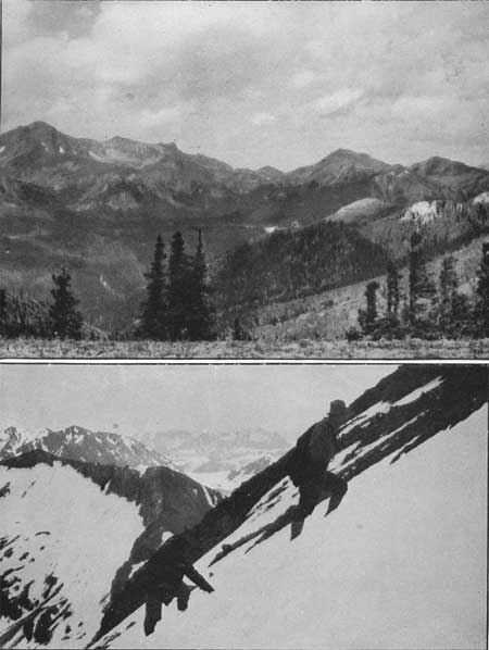
|
|
PLATE XXIII. MOUNT RICHTHOFEN ON LEFT, LULU
PASS AND LULU PEAK ON
RIGHT, FROM SPECIMEN MOUNTAIN. Photograph by Geo. C. Barnard. NEARLY UP MOUNT RICHTHOFEN. Photograph by G. H. Harvey, jr. Peaks of the Medicine Bow Range, the poetic Indian name of which is Never Summer Range. |
The United States Geological Survey map refers to this range as the Medicine Bow Mountains, and this name is followed in this book, although the main part of the Medicine Bow Range lies still farther north. The usual name for these mountains is Rabbit Ear Range, and the poetic Indian name should not be forgotten; to the Indian it was the Never-Summer Range.
The highest peak of this range is Mount Richthofen (12,953 feet), and the others, from north to south, are Nokhu Crags (12,400 feet), Seven Utes Mountain (11,438 feet), Lead Mountain (12,532 feet), Mount Cirrus (12,804 feet), Howard Mountain (12,814 feet), Mount Cumulus (12,724 feet), Red Mountain, (11,505 feet), Mount Nimbus (12,730 feet), Baker Mountain (12,406 feet), Parika Peak (12,400 feet), Bowen Mountain (12,541 feet), Cascade Mountain (12,320 feet), and the more distant group on the Atlantic slope, Bearpaws Peaks (11,735 feet).
Farther south, beyond the turn of the Continental Divide, but on an extension or spur of the range, are Blue Ridge (11,680 feet), Porphyry Peaks (11,355), and Mount Bennay (11,781 feet).
Most of these peaks of the Medicine Bow Range can be reached from any convenient starting point in the upper end of the North Fork Valley. Squeaky Bob's is about the only place where accommodations are available.
The peaks at the southern end of the range, near where the Continental Divide turns west, may be reached from points in the North Fork Valley or from Grand Lake.
MOUNT RICHTHOFEN (12,953 FEET).
[Report furnished by Roger W. Toll, accompanied by Shep Husted (Aug. 30, 1914).]
We went on horse back from "Squeaky Bob's" summer camp at the foot of Milner Pass, up the valley of the North Fork of the Grand River, to the ditch camp at an elevation of about 10,200 feet. The Continental Divide takes a loop to the north in this region and parallels the North Fork on both the east and the west sides. We climbed from the ditch camp to the top of Mount Richthofen in two or two and one-half hours. A snowstorm cut the view short and we returned to Bob's for the night.
HOWARD MOUNTAIN (12,814 FEET).
[Report furnished by Gustave A. Gambs (Aug. 5, 1917).]
I left Squeaky Bob's alone at 8.30 a. m., going north. Within half a mile a small trail to the right avoids a double crossing of the fork and after about 1-1/2 miles an abandoned camp is met at the entrance to the tall timber; from here a trail leads west, climbing to the irrigation ditch which takes its supply from the south flank of Howard Mountain and runs north at an altitude of 10,200 feet along the ridge for a distance of about 12 miles to the La Poudre Pass. At 10.15 a. m. I crossed this ditch near its beginning where it winds around the southeast spur of Howard Mountain and from here I followed the crest line in a northwesterly direction. At ll a. m. I came to a small gap at timberline and 11.15 a. m. to the end of the underbrush at an altitude of 11,200 feet. From here I saw at my feet the white tents of Bob's place, and beyond the mighty tower of Longs Peak. I left this spot at noon and followed the sharp crest line in a westerly direction. On my way I flanked five towers, some to the south, others to the north; three of these towers look like real giants. The rocks were brittle at times, and being alone I had to proceed rather carefully. Sheep trails abound in all directions. At my feet to the north I perceived the blue transparent lake of the cirque of Mount Cirrus and to the south a smaller lake under the eastern spur of Howard Mountain, that feeds the irrigation ditch. The snow fields in both basins and those hanging along the main ridge are very numerous.
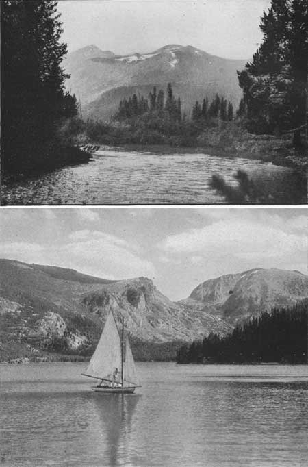
|
|
PLATE XXIV. MOUNT BAKER FROM GRAND RIVER, 8 MILES NORTH OF GRAND LAKE. Photograph by G. H. Harvey, jr. GRAND LAKE AT THE WESTERN GATEWAY. Photograph by Wiswall Brothers. |
At 3 p. m., after three hours of hard crest work, I reached finally Howard Mountain. The view is superb. No register, no cairn, no sign of tourists was found on top except that the rocks were grouped so as to form a round cavity, 1 foot deep and of 3 feet diameter. In its center I built a small cairn 2 feet high. I followed the divide line south into the first little gap, slid down the east slope over a steep snow field, then over gravel and over more snow fields, and within one hour I was at the lake, at an altitude of 11,200 feet. I followed its outflow until I came to the beginning of the irrigation ditch after an hour of traveling, and after another hour I entered Bob's kitchen.
Summary of time consumed.
| H.M. | |
| Bob's (9,050 feet) to irrigation ditch (10,200 feet) | 1 45 |
| Irrigation ditch to end of underbrush (11,200 feet) | 1 00 |
| End of underbrush to summit of Howard Mountain (12,814 feet) | 3 00 |
| Howard Mountain to unnamed lake south of Howard (11,200 feet) | 1 00 |
| Unnamed lake to beginning irrigation ditch (10,200 feet) | 1 00 |
| Beginning irrigation ditch to Bob's (9,050 feet) | 1 00 |
| Total | 8 45 |
| Rest | 0 45 |
| From 8.30 a. m. to 6 p. m. | 9 30 |
PEAKS ACCESSIBLE FROM GRAND LAKE.
Besides the Fall River trail, there are two other trails from Grand Lake to Estes Park, though they come together at Flattop Mountain and both use the Flattop trail on eastern side of the Divide.
One of these trails starts north from Grand Lake and follows up Tonahutu Creek, almost to the Divide, and then skirts along on the western slope side of the crest of the Divide, until Flattop Mountain is reached. Twenty years ago this was the shortest trail between Estes Park and Grand Lake and was the one most often used. Since the completion of the North Inlet trail most of the travel has gone over the newer and shorter trail. The Tonahutu Creek trail gives access to Mount Ida (12,700 feet), Nakai Peak (12,221 feet), Flattop Mountain (12,300 feet), Snowdrift Peak (12,280 feet), and Mount Patterson (11,400 feet).
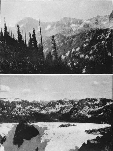
|
|
PLATE XXV. LAKE NANITA GORGE, ANDREWS PEAK IN
LEFT BACKGROUND. Photograph by John King Sherman. ARAPAHO AND NAVAJO RANGE FROM MOUNT CRAIG. Photograph by G. H. Harvey, jr. |
The North Inlet trail enables one to reach Flattop Mountain. Hallett Peak (12,725 feet), Otis Peak (12,478 feet), Taylor Peak (13,150 feet), McHenrys Peak (13,300 feet), Snowdrift Peak, and Mount Patterson. The Government shelter cabin, located just below timberline on this trail, gives a very useful starting point for several of these peaks.
During the year 1917 the national park authorities cleared a trail from the North Inlet trail, continuing on up the valley of the inlet and reaching Lake Nanita (10,700 feet). This trail opens up to the public a wild, beautiful, and rugged region, previously visited by but few persons. Andrews Peak (12,564 feet) towers above Lake Nanita, though its ascent from this north side may be difficult. This new trail also gives closer access to Chiefs Head (13,579 feet) and Mount Alice (13,310 feet).
If the East Inlet of Grand Lake is followed up to Lake Verna (10,100 feet) and the other lakes at the head of the valley, it leads within reaching distance of Mount Alice, Tanima Peak (12,417 feet), Mahana Peak (12,629 feet), the south slope of Andrews Peak, and Mount Craig (12,005 feet).
A fork south from the East Inlet leads toward Ouzel Peak (12,600 feet), Ogalalla (13,147 feet), Hiamovi Mountain (12,388 feet), Watanga Mountain (12,381 feet), Mount Adams (12,115 feet), and Mount Craig. Mount Bryant (11,000 feet) is easily reached direct from Grand Lake,
PEAKS ACCESSIBLE FROM MONARCH LAKE.
Monarch Lake (elevation 8,340 feet) is reached from Granby by road. A railroad was built from Granby to the lake for lumber purposes, but was discontinued. For a while auto stages were run on the track, but one can ascertain by inquiry the best method of reaching the lake. A fishing resort is located at the lake and one can obtain hotel accommodation there. The trail from Monarch Lake over Buchanan Pass (11,700 feet) and down to Stapp's Hotel on the Middle St. Vrain gives convenient access to Sawtooth Mountain (12,304 feet), to the steep western side of Paiute Peak (13,082 feet) and Thunderbolt Peak (11,943).
Cascade Creek, branching southeast from this trail, passes Thunderbolt Peak and leads to the western slope of Paiute Peak, Pawnee Peak (12,900 feet), Apache Peak (12,807 feet), which towers above Crater Lake (10,400 feet) and Mount Achonee (12,656 feet). Hell Canyon leads to Mount Irving Hale (11,747 feet), Hiamovi Mountain, and toward Ogalalla Peak.
A trail runs up Arapaho Creek to Arapaho Pass (11,906 feet) and gives access to Mount Neva (12,800 feet), Arapaho Peaks (13,506 feet), and Satanta Peak (11,885 feet). A stream to the east of Arapaho Creek leads into Hellhole, an abyss encircled by the steep and threatening walls of Apache Peak (12,807 feet), Navajo Peak (13,406 feet), Arikaree Peak (13,147 feet), and North Arapaho Peak; Mount Achonee is passed on the way up Arapaho Creek.
CIRCUIT TRIPS IN THE ROCKY MOUNTAIN NATIONAL
PARK.
Many splendid trips can be taken, starting on one side of the national park, crossing the Continental Divide by one route and returning by another route. Such trips are usually taken on horseback but the ascent of several peaks may be included as a part of these trips, if desired. The entire trip may be taken on foot, if preferred.
The following reports are suggestive of such extended trips and will be of help in planning similar excursions:
ESTES PARK TO GRAND LAKE, VIA FALL RIVER TRAIL AND RETURN VIA FLATTOP MOUNTAIN.
[Report furnished by Dr. Max Giesecke, Aug. 16, 17, and 18, 1912.]
Number in party, 5 men.
Our party left Estes Park on horse back at 8 a. m., and arrived at the shelter cabin on Fall River at noon, where we rested, fed our horses, and had lunch. We continued our trip at about 1.30 p. m., following the trail, which was very good, by Poudre Lakes and over Milner Pass to the North Fork of the Grand River and then to Squeaky Bob's (Camp Wheeler), one-quarter of a mile upstream, where we arrived about 4 p. m. Here we were very comfortably housed for the night and served with a well-cooked supper and breakfast by the proprietor, who is an entertaining host and an excellent cook. In the morning we left for Grand Lake, about 16 miles downstream, following the road.,
The lake is one of the most beautiful spots in Colorado. It is of glacier formation, 7 miles around, and the bottom had not yet been sounded. It is entirely surrounded by trees and many summer homes have been built near by. We spent the rest of the day enjoying a motor boat and taking pictures. Grand Lake is a veritable mecca for kodaks. On the third day, August 18, at 8 a. m., we started on our return, taking the trail up the North Inlet, which we found very boggy at first. Later we came to a more defined trail, which was easily followed to timberline, where we nooned. From there the trail was very steep with many loose rocks, so we dismounted and led our horses to the top. From Flattop Mountain we could look into Bartholf Park, see Bierstadt Lake, the Moraine, Bear Lake, Longs Peak, and on the other side of Flattop we could see Lake Helene and Lake Odessa in its setting of pines.
In descending on the Estes Park side, the trail was pretty well covered with snow, which gave us more or less trouble until timberline was reached; from there on the trail was in good condition and easily followed.
We arrived in Estes Park about 7 p. m.
GRAND LAKE, LULU PASS, SHIPLER MOUNTAIN, SPECIMEN MOUNTAIN, AND FALL RIVER TRAIL.
[Report furnished by Miss Alice White (Mrs. Walter H. Price) August, 1914, Colorado Club Outing,]
Words fall me in describing the exquisite beauty. of Grand Lake—two miles long by a mile wide—and in places so deep that I don't believe they have fathomed it. It is set like a gem in the hollow of the mountains. Beautiful evergreens shelter its shores, and almost conceal the log cottages, and the wonderful snow-capped mountains completely encircle it. The North and East Inlets empty into it with a rush and noise seldom attained by eastern rivers of like size, impelled by cataracts or beautiful little waterfalls which have, been formed by the waters cutting their way through the mountains. You can just imagine how lovely it was to motor around this beautiful little lake in the clear Colorado sunshine.
Tuesday, Wednesday, and Thursday were spent at Grand Lake, boating, fishing, and taking short walking trips.
Friday morning dawned bright and clear, and the walk of 16 to 18 miles to our Shipler Park camp, which was nearly 1,000 feet higher than Grand Lake, was one of the finest trips of the whole outing. A road led from Grand Lake to Shipler Park, and we followed it all the way, through seas of flowers of every hue imaginable. The fringed blue gentians grew so thick that one swoop of the hand would have secured a large bunch, and they formed pools of blue, first on one side and then on the other side of the road. At noon we came to one of those swift-running glorious little mountain brooks, took off our shoes and stockings and bathed our feet in the icy waters. After lunch we were quite ready to continue our jaunt, and by 3.30 p. m. we arrived at Squeaky Bob's camp, which he calls the "Hotel de Hard Scrabble." It is a pleasant looking log-cabin resort surrounded by tents and much frequented by trout-fishing enthusiasts, as the trout fishing in Grand River is very good. Squeaky Bob is quite a character, and claims to have been everything from a cow puncher, horse thief, and guide to a hotel proprietor. He got his name for his voice, which is high pitched and has a falsetto note in it. Some of the folks stopped here and had supper for the fun of it, and the rest of us pushed on to camp. It was really the most beautiful camp of the trip. This park was adorned by the finest grove of Englemann spruce and fir balsam trees and bounded on the one side by the Grand River and the other by a swift-running mountain brook. The only person up there was an old miner, Mr. Shipler, who had several mining claims in that region, and from whom the park as well as a mountain looking down upon it got its name.
Sunday was another glorious day and we were up and away before 7 o'clock, the objective point being Lulu Mountain and Lulu Pass. Crossing Grand River, we ascended a winding trail, blue with ripe blueberries, until we had climbed about 1,000 feet, then we reached an irrigating ditch, which to me was extremely interesting, as through it the waters on the western slope of the Rocky Mountains were turned back to the eastern slope through one of the low passes in the Continental Divide. Tail forests of Englemann spruce grew on either side of the ditch, and, as usual, masses of brilliant flowers; and the water was as clear as crystal and cold as ice.
Just where the snows were, we found two lovely little mountain lakes, and from there on it was only a short distance to the summit of the Pass, where we looked away over the eastern slope and back again to the western slope, with everywhere that the eye could reach, gorgeous snow-crowned mountains. Lulu Mountain was 500 feet higher, so we did not linger long at the Pass, as we were anxious to reach the summit of the mountain. Until you attempt to climb loose rock and struggle with shortness of breath and thin air, you can scarcely appreciate what it meant to reach the top of Lulu Mountain, which looked so near, and yet proved to be a goodly distance. It was a pretty big task for us beginners, and it was only by selecting some point a short distance ahead and setting my teeth firm in the determination not to stop till I had reached that point, that I was able finally to reach the top. The view was glorious and we rested quite a while, with sweaters buttoned clear to the necks, for though it was noon and the sun blazing away, it was cold up there with the winds piercing through you. We did not stop for lunch, preferring to descend to the pretty little lake. From there it was a continual descent till we reached camp about 4 p. m. and retired to our tents to wash and dress, as word had been passed around we were to have a chicken dinner, and we determined to dress for the occasion.
I decided to forego the trip to Mount Richthofen on Monday, so stayed in camp.
Tuesday morning we got up in a heavy mist, packed our bags and left them trustingly standing outside our respective tents. It was quite a sight to see the men catch the horses and saddle them with the peculiar packsaddle that is used when baggage must be carried. The saddle has four wooden prongs, and the bags are tied to these, four bags, I think being carried by each horse. By 7 o'clock, as the mists were rolling away and the sun beginning to shine down in the valley, we started off straight up Shipler Mountain over the fallen timber without even a trail to guide us. The way was direct, as we only had to gain the summit and then walk along the backbone of the ridge till we came to an extinct crater on the slope of Specimen Mountain. From here we could look down upon the two beautiful Poudre Lakes and Milner Pass. Some mountain sheep went into hiding on the approach of the first members of our party, and all we saw were their tracks. We climbed into the alleged crater and explored the interesting rocky caves; while here we were caught in a fierce thunder, lightning, and hail storm. The wind blew so hard we had to crawl up into the rocks and wait till the storm blew over, then we proceeded down a lovely trail to the Poudre Lakes, where we lunched and waited, hoping that the pack train would come into sight, before climbing 1,000 feet higher, above timberline, where we were to camp for the night without tents.
When we reached camp, however, word arrived that the pack train would not get across the Divide that night. After a hasty consultation it was announced that all who thought they could make it would be led by Mr. Collier, who knew the trail, over the ridge and down to our fourth and last permanent camp, on Fall River, where the balance of our food supply had been sent in through Estes Park, so that while we would not have shelter we would at least have food. That appealed to me, and with some 50 others we formed in line, and each grasping the knapsack of the person in front, proceeded slowly in the fast gathering darkness over the rough trail, marked only in spots by small white stones, up to the summit of the ridge and down about 3 miles on the other side. How we ever did it, in the utter darkness, without even a friendly moon, I shall never be able to explain, for we walked slowly from about 7 in the evening until 10.30 p. m., and when I walked that trail in the daylight and saw the huge stones and roots of trees, to say nothing of the marshes and mountain brooks we had crossed, the wonder grew.
However, we did finally reach the shelter cabin, and when great fires had been built, soup was produced, heated, and consumed with great dispatch. Then, when as many women as possible had been stowed away in the shelter cabin to keep out of the rain which had begun to fall again, the balance of us disposed ourselves as well as we could around the two fires and endeavored to get a little sleep. If any of the party got more than half an hour's sleep, all told, that night, I would like to meet them.
At 4.30 in the morning, having reposed on the root of a tree, I was glad to get up and stir around, and even bathe in the ice-cold brook. Breakfast was most welcome. It was almost 3 in the afternoon when the first, pack train hove into sight and we learned the cause for their nonappearance the day before. The storm which struck us in the "crater" of Specimen Mountain had appeared at Shipler Park about 10 in the morning and was so intense there that the hailstones were large as marbles. The hail and lightning caused the pack horses to stampede and run away down to Squeaky Bob's camp, scattering the dunnage bags to right and left. This meant that the horses had all to be caught and the bags picked up and repacked, so that it was late in the afternoon when they started on their journey. The rain had made the trail, bad in the first place, almost unsafe for travel, so they were compelled to halt for the night and leave us to our fate. We rested all that day as well as we could, and at night, our tents not having arrived, spread our sleeping bags out on the hillsides, pulled boughs of fir balsam to put under them, and went to sleep under the most glorious canopy of stars.
That day there were two trips, one to explore three mountains of the Mummy Range, which rose one higher than the other, and the second trip to Iceberg Lake, which lies above timberline, frozen the year around, guarded by cliffs 700 feet high which rise sheer from the lake.
Saturday morning we left Horseshoe Inn at 6.30 a. m., stowed in great automobile stages, and started off for a 35-mile auto ride through Estes Park to the station at Longmont, where we took the Colorado & Southern train back to Denver.
ESTES PARK TO GRAND LAKE VIA FALL RIVER TRAIL, AND RETURN VIA THE FLATTOP TRAIL, INCLUDING THE CLIMBING OF SEVERAL PEAKS.
[Report furnished by Erich S. Stern, accompanied by Clifford S. Higby and Arthur J. van Dyke (Aug. 25 to Sept. 1, 1917).]
August 23, left Elkhorn Lodge at 7.30 a. m., going by auto to the present terminus of the Fall River road (elevation, 10,500 feet), 16 miles from Estes Park. Proceeded on foot, following the trail to its highest point (elevation 11,797 feet). There we left the trail, going to the left up the peak (elevation 12,221 feet) at the beginning of Trail Ridge. Rejoined the trail, going down to Poudre Lakes, over Milner Pass (elevation 10,759 feet), and reached Squeaky Bob's (elevation 9,050 feet) at 6 p. m.
August 24, started at 9 a. m. and followed up the creek that comes down from the so-called crater of Specimen Mountain. Spent a long time watching 50 to 70 mountain sheep which are attracted by the alkali salts. Climbed the sharp ridge north of the "crater" and continued around to the opposite side of the "crater," then descended the steep slope, almost opposite Squeaky Bob's camp, reaching there at 6 p. m.
August 25, left camp at 9 a. m. and walked down the valley to Grand Lake, 13 miles, arriving there at 1.30 p. m. Dinner at Ische's Hotel. Rowed across the lake and walked up the East Inlet half a mile to Adams Falls.
August 26, left Grand Lake at 7.15 a. m. and went up the North Inlet on the Flattop trail. Left the trail between Otis and Taylor Peaks and slid down Andrews Glacier and went to the Loch. We left the Loch at 5.30 p. m. and went down the Glacier Gorge trail and up the Bear Lake trail to Mrs. A. E. Brown's lodge at Bear Lake, reaching there at 6.30 p. m. Length of walk, 17 miles.
August 27, stayed in camp all day, as the weather was unfavorable.
August 28, left camp at 8 a. m., going around the right of Bear Lake and up a sharp incline until we reached the Flattop trail. Followed the trail to the summit of Flattop Mountain. Climbed Hallettt Peak, reaching the top at 1 p. m. Left at 2 p. m. and proceeded northward,, along the eastern edge of Flattop Mountain, until we came opposite Tourmaline Gorge, into which we descended. Beautiful colored rock wails on our left. Went down to little Tourmaline Lake; along Fern Creek to Odessa Lake, then to Fern Lake, reaching Fern Lodge at 6 p. m.
August 29, across country to Longs Peak Inn, 15 miles of up and down trail. Left Fern Lake at 9 a. m., down to Forest Inn at Funstons Pool, 1,200 feet below Fern Lake; then along the trail above Cub Lake; about 800 feet up to Mill Creek ranger station, on the Flattop trail. Followed the trail a short distance, then turned to left and climbed about 500 feet to Bierstadt Lake. Approached the valley of Glacier Gorge; lunched; descended into the valley, crossed road in the valley between Sprague's and the Bear Lake trail; ascended Storm Pass (elevation 10,300 feet), 4 miles from the valley; descended to Longs Peak Inn (3 miles from Pass), reaching there at 5.30 p. m.
August 30, left Long's Peak Inn at 11.30 a. m. and walked to Timberline Cabin, reaching there at 1.30 p. m. After lunch walked to Columbine and Chasm Lakes, returning to Timberline Cabin at 5.45 p. m. for the night.
August 31, left Timberline Cabin at 6.15; Boulder Field at 8 a. m.; Keyhole at 8.45 a. m.; top of Trough at 10.15 a. m.; top of Longs Peak 11.40 a. m.; left summit at 12.15 p. m. and, instead of returning through the Keyhole, continued down the Trough, reaching the foot at 2 p. m.; came to Black Lake; Lake Mills; reached trail from Loch Vale and followed down it to the Bear Lake trail; reached Bear Lake Lodge at 7 p. m.
September 1, left camp at 9 a. m.; went around south shore of lake, passed the little Grant Lake; reached Dream Lake; Ursula Lake; continued up the chasm until well in sight of the glacier and then climbed to the base of the last flight of rock wall of Flattop Mountain. Climbed up a difficult chimney and reached the top at 3 p. m. Reached the Flattop trail at 3.30 p. m. and followed it back to Estes Park village, 12 miles, reaching there at 7.30 p. m.
| <<< Previous | <<< Contents>>> | Next >>> |
romo/toll/part2.htm
Last Updated: 5-Jan-2007