|
Payette National Forest |
|
In a High Mountain Country
THAT PART OF YOUR national heritage represented by the Payette National Forest, in Idaho, includes about 1-1/3 million acres, and most of it is high mountain country. From 3,300 feet in the Garden Valley area in the southwestern portion of the forest, elevations range to 9,722 feet atop Big Baldy Mountain, a landmark on the breaks of the Middle Fork of the Salmon River between Pistol and Indian Creeks. Scott Mountain, best known peak in the southern extremity of the forest, rises 8,268 feet and overlooks the South Fork of the Payette River. In general, elevations increase from southwest to northeast, and most of the forest is above 5,000 feet.
The West Mountain Ridge, directly west of Cascade and Long Valley, is the dividing line between two great geological formations—the Columbia lava flow west of the ridge and the giant Idaho batholith of granite rock to the east. These formations have a marked effect on soil texture and road conditions. In the lava country, roads are very slippery and muddy when wet, while in the granitic formation, they are, in general, more stable under all conditions.
Precipitation over the Payette is usually very light or almost entirely lacking from about July 1 to the middle of September. During the mid summer months, however, temperatures seldom exceed 90° F. except in the valleys. Winter temperatures as low as 40° F. below have been recorded in Cascade and 50° F. below in Pen Basin. Snow and freezing weather may occur in any month at elevations above 6,500 feet.
The earliest snows of any consequence usually occur about the middle of September, but are not likely to remain on the ground until after the middle of October. Snow depths vary from 2 to 3 feet in the lower valleys to 10 feet on Deadwood and other high summits. Through traffic over the high summits is not possible until sometime between May 1 and June 15.
|
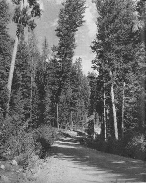
| THROUGH VIRGIN TIMBER IN THE PAYETTE NATIONAL FOREST, ROADS LEAD TO STRANGE PLACES AND OFFER PLEASANT ADVENTURES. F—369539 |
RICHES FROM FURS AND MINERALS
When the national forest was created from the public domain in June 1905, by proclamation of President Theodore Roosevelt, it was named for Payette, a French fur trader and a member of the Hudson's Bay Company at Fort Boise. The influence of this hardy trader on central Idaho is attested not only by the national forest which bears his name, but also by a river, a lake, and a town named in his honor.
Many of the colorful episodes connected with the "Baby Klondike" gold rush to the Thunder Mountain strikes at the turn of the century had their locale on or near the present Payette National Forest. During these feverish days adventurers from the four corners of the earth poured into the district.
Over the terrific grades of the wagon road from Thunder City, close to the spot where Cascade now stands, stamp mills and heavy machinery were hauled to equip the newly located mines. Mortar blocks and cam shafts are still strewn along the road, evidently dumped by disgusted freighters and never salvaged.
From the present ghost towns of Crawford, Van Wyck, and Thunder City pack trains supplied the famous gold camps in the Thunder Mountain country, immortalized by western writers in their tales of boom towns.
|
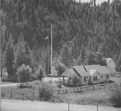
| GARDEN VALLEY RANGER STATION. FROM HERE THE DISTRICT RANGER ATTACKS THE COMPLICATED MANAGEMENT OP A QUARTER OF A MILLION ACRES OF NATIONAL-FOREST LAND. F—369489 |
| <<< Previous | <<< Contents>>> | Next >>> |
|
handbooks/payette/sec1.htm Last Updated: 19-Nov-2010 |