|
Routt National Forest |
|
RECREATIONAL ATTRACTIONS
Many and varied are the attractions open to the vacationist throughout the year on the Routt National Forest.
Picnicking and Camping.
Free camp and picnic grounds are maintained for the pleasure and con venience of the public at many places on the forest. All of the necessary facilities, such as fireplaces, tables, footbridges, and the usual sanitation improvements are provided. Deadwood is plentiful and handy at most of these sites and may be used freely but should not be wasted. Also, all users should protect the live trees and shrubs, and the campground improvements. The map in this booklet may be consulted for locations of individual grounds, descriptions of which follow:
BIG CREEK LAKES CAMPGROIJND.—Leave State Highway 125 at Cowdrey and follow State Highway 312 to the junction with the Big Creek Lake Road, about a half mile southeast of Pearl. This road extends in a general southwesterly direction for a distance of 5 miles, to the north side of Big Creek Lake, where the campground is located. The lake offers a pleasant outing on the shores of the largest body of water within the forest. Red Elephant Mountain and Mount Zirkel loom up spectacularly across the lake. Camping, picnicking, fishing, swimming, boating, and hiking are the attractions.
FISH CREEK FALLS PICNIC GROUND.—Turn east off U S 40, near the eastern limits of the town of Steamboat Springs, and follow the Fish Creek Falls road about 3 miles, to the picnic ground and falls, at the end of the road. This is a delightful short drive for a picnic outing. Fish Creek Falls are especially beautiful early in the summer when they carry the largest flow of water from melting snows in the high mountains above.
RABBIT EARS PICNIC GROUND.—On U S 40 at Rabbit Ears Pass. Picnicking and a good view of the Rabbit Ears.
WALTON CREEK CAMPGROIJND.—On southeast side of U S 40, about 4 miles west of Rabbit Ears Pass. Camping, picnicking, and fishing. The Walton Creek Campground is a very pleasant place for those who wish to stop a short time, to rest and refresh themselves from the weariness of travel.
COULTON CREEK CAMPGROIJND.—From State Highway 129, take State Highway 311 at Clark, and drive east up the Elk River drainage about 4 miles, to the campground. Camping facilities are located on the south side of the road, on the north bank of Elk River at the junction with Coulton Creek. Picnicking, camping, and fishing.
HINMAN PARK CAMPGROUND.—Near State Highway 311, approximately 5 miles east of Clark. The camping improvements are on the south side of the highway. Turn off at the Hinman Park campground sign and follow a short drive to the camp site. Camping, picnicking, and fishing.
SEEDHOUSE CAMPGROUND .—Follow east on State Highway 311 from Clark about 8 miles to the bridge across Elk River. The campground is on the south side of the highway one-quarter-mile east of the bridge. It is a spacious recreation area, favored by those who have some time to spend on the forest and wish to enjoy privacy. Camping, picnicking, fishing, and hiking are the main attractions. From this location one can drive a car to Slavonia and hike into the high country along the Continental Divide to the head of the Elk River and return in a day. Many spectacular mountain peaks and lakes await those who make this trip. The hike from Seedhouse Campground by trail to Three Island Lake is also a very nice 1-day trip.
|
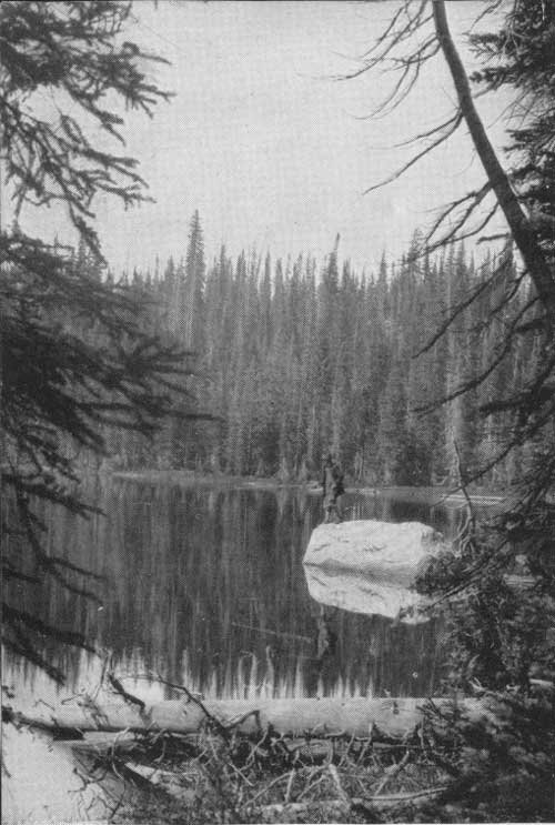
| LAKE FISHING ON THE ROUTT IS GOOD F—155891 |
Hunting and Fishing.
Trout fishing is very good in many of the crystal clear streams and lakes of the forest. With the exception of occasional temporary closures, all the streams and lakes are open to fishing. Young fish, varying in size from fry to legal size, are obtained from State and Federal hatcheries each year and placed in the more heavily fished waters to keep them well stocked.
There is an abundance of game animals on the Routt, and hunters are reasonably sure of success. Most of the elk range in the country west of the Continental Divide, between Elk River and Walton Creek watersheds, and deer are found generally over the forest. All hunting and fishing is under the jurisdiction of the State Fish and Game Commission, and State game laws apply on the forest, the same as on other lands.
Riding and Hiking.
Hundreds of miles of well marked trails afford rich opportunities to the nature lover for exploration of remote parts of the forest. A pack trip into the Mount Zirkel-Dome Peak wild area takes one into the most scenic part of the forest, where conditions are nearly as primitive as they were when Indians hunted in these beautiful mountains or camped beside the picturesque lakes. Red Elephant Mountain, Big Agnes, The Dome, Mount Zirkel, Flat Top Mountain, and Lost Ranger Peak are some of the more prominent points on this area. Under the present Forest Service plan, the area will be maintained in its original wild and primitive state except for the occasional trails that traverse it. Refer to the map for the location of this wild area.
Resorts and dude ranches within and adjacent to the forest have saddle horses to rent and will provide guides if this service is desired. Information regarding the locations of these places may be obtained from the commercial clubs or chambers of commerce in the local towns.
|
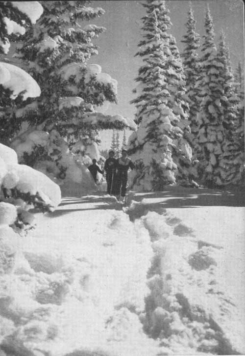
| SKIERS ON THE TRAIL TO RABBIT EARS PASS F—405397 |
Skiing.
The Rabbit Ears Pass area of the forest, with natural conditions of heavy snowfall, long winter season, and a great variety of favorable open and timbered slopes, attracts many ski enthusiasts.
There are practice hills for the beginner, natural slalom areas and ski runs for the more advanced, and longer routes for cross-country skiers. U S 40 passes through this winter wonderland and is maintained in good condition during the entire season. Adequate parking space is kept clear of snow.
The Valley View Ski Run is probably the most popular run of the area. It takes off on the north side of U S 40, about a half mile west of the Rabbit Ears Station, and comes back to U S 40 at Valley View Lodge. This route is approximately 3-1/2 miles in length. The first mile, starting at the top, is nearly level, then drops 2,000 feet in the remaining 2-1/2 miles. The lower mile provides the choice of a first-class run of considerable interest for experts or a slower and longer route for less-experienced skiers. This range of interest, combined with the many attractive views of the surrounding high timbered country and the broad Yampa River valley below, make it a very attractive run.
Skiers who prefer cross-country skiing over longer distances may take the trip from Rabbit Ears Pass to the Buffalo Pass Station, and thence west along the old Buffalo Pass Road to Steamboat Springs. However, a guide should be obtained for the trip, unless one is familiar with the country.
Ski tournaments are held at Howelsen Hill, in Steamboat Springs, each winter. The improvements, consisting of jumps, a tow, slalom, and downhill runs, are owned and maintained by the Steamboat Springs Winter Sports Club. Good food and lodging accommodations are available in Steamboat Springs, conveniently located to the Rabbit Ears Pass area.
|
FOREST HEALTH RULES 1. PURIFICATION.—Mountain streams will not purify themselves in a few hundred feet. Boil or chlorinate all suspected water. 2. GARBAGE.—Burn all paper, old clothing, or rubbish. Bury or place in pits or receptacles provided, all garbage, tin cans, bottles, and other refuse. 3. WASHING.—Do not wash soiled clothing or utensils or bathe in springs, streams, or lakes. Use a container and throw dirty water where it cannot get into the water supply without first filtering through the ground. 4. SANITARY PRECAUTIONS.—Use public toilets if they are available. Where not provided, bury 1 foot deep all human excrement, at least 200 feet from water. 5. OBEYING LAWS.—Observe the rules of sanitation and protect yourself and others. Report all insanitary conditions to the nearest health or forest officer. |
| <<< Previous | <<< Contents>>> | Next >>> |
|
handbooks/routt/sec2.htm Last Updated: 19-Nov-2010 |