|
Shoshone National Forest |
|
PLACES OF ESPECIAL INTEREST
Bliss Creek.—One of the favorite routes of rustlers in earlier days, leading to their favorite rendezvous in Jackson Hole, followed Clark Creek at the head of the South Fork of the Shoshone River. In 1892, a horse thief named Bliss, attempting to escape pursuers, was captured by a posse after a long and grueling chase. He was shot and buried at a point about a mile above Clark Creek, near where a small stream from the north empties into the South Fork. This stream was named Bliss Creek as a result of this episode. Bliss's grave was marked by a rude pile of stones along the trail until a very few years ago when it was destroyed by a mountain cloudburst. Bliss Creek can be reached only with a saddle horse and is 35 miles southwest of Valley.
|
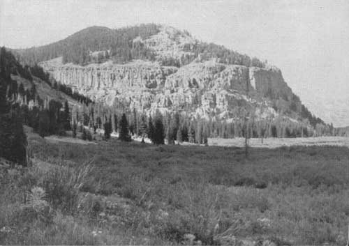
| Bliss Creek Meadows on Upper South Fork—within the South Absaroka Wilderness Area. F—385957 |
Beartooth Plateau.—After two military expeditions had previously failed, the first official crossing of Beartooth Plateau was accomplished during the last week of August 1882 by a scouting party headed by Lt. Gen. P. H. Sheridan. In his party were 71 officers, soldiers, and civilians, 36 packers, 1 hunter, and 5 Shoshone Indian scouts and 1 squaw. The party reached Cooke City, Mont., on August 24 from Mammoth Hot Springs, and Billings on August 31. The route selected and followed by General Sheridan was almost identical with that of the present Red Lodge-Cooke City Highway.
Dead Indian Hill.—A small war party of Bannocks was attacked by General Miles' troops just south of Clark, near the northeast corner of the forest, in 1878, shortly after the Nez Perce outbreak. The Indians retreated over what is now known as Dead Indian Hill, about 16 miles southwest of Clark, leaving one of their wounded behind. The following day the Bannock was found by some of the Crow Indian Army scouts, who promptly killed and scalped him. Until recent years a rude pile of stones halfway down the west side of the hill, north of the road and near the drift fence, marked the grave. From this episode the hill got its name. Captain Bennett, in charge of the cavalry troop which engaged the Bannocks, and one of his Crow scouts, Little Rock, lost their lives in the fight. Two streams running down the east face of Beartooth Plateau, just west of Clark, bear the names of these men.
Camp Monaco.—Located about 15 miles north of Pahaska Tepee, along the North Fork of the Shoshone River, is one of the old hunting camps of Colonel Cody, Camp Monaco. Here in September 1913, Colonel Cody took as his guests on a hunting trip, Albert I, Prince of Monaco, and his aide-de-camp, Count Beret. At the close of the successful hunt, the Prince had his artist paint on a large tree at the camp site, "Camp Monaco, 1913," and a bear's foot.
Frank Hammitt Grave.—Frank Hammitt was one of the first six forest rangers appointed in the United States. He met his death by plunging over the precipitous walls of Russell Creek Canyon near its mouth, on July 25, 1903. His grave is near the south base of Antelope Mountain, beside the Crandall Road. Hammitt was trained for the priesthood, but gave it up for the life of a cowboy. For 7 years he was chief of cowboys with Colonel Cody's Wild West Show before he became a forest ranger.

|
| A typical trappers' cabin on the South Fork. F—385979 |
Jack Crandall Grave.—On July 1, 1870, a prospector named Jack Crandall and his partner, T. Dougherty, were on their way to a rendezvous with some miner friends on the headwaters of the Clarks Fork River. The two men made camp on Crandall Creek and, as they prepared their evening meal, were killed by a marauding band of Indians. The miners' picks were driven into the ground and their severed heads were spitted on the ends protruding. The grave of these men is marked by a huge boulder on which is a large bronze plate giving a brief history of the incident. It is located on the north side of Crandall Creek, about three-fourths of a mile upstream from the Crandall Creek bridge, on the Sunlight-Clarks Fork Road.
Pahaska Tepee.—Pahaska Tepee, situated alongside the Cody-Yellowstone Highway, 51 miles west of Cody, is the original hunting lodge of Colonel Cody, which he built in 1901. Here he entertained such distinguished guests as Albert I, Prince of Monaco, statesmen, and the more famous members of his troup.
Sheepeaters' Tepees.—Ancient tepees of the "Sheepeaters" made entirely of poles are to be found in different parts of the forest. There is a group of three, well preserved, on Tepee Creek, a tributary of the North Fork of Crandall Creek, where the trail crosses. Another is located about 1 mile above the Timber Creek Ranger Station, along an old logging road. They can be reached only with saddle horses.
The Old Stockade.—In August of 1891, a cowboy discovered a log stockade on Beartooth Plateau, on the divide between Little Rock and Bennett Creeks, about 3 miles north of Deep Lake. The stockade, resembling a corral about 50 feet in diameter, had been made of huge logs laid up similarly to those in a log house. Here and there along the walls loopholes had been cut, obviously to permit shooting through them. The stockade was old when found. Who it was built by and why is not known. The logs had been cut with a sort of an ax or a hatchet, yet only a portion of the work appeared to be that of white men. Some of the chopping appeared to have been done by a man familiar with the use of an ax, while other logs were literally "gnawed off." The old stockade is still standing. It can be reached only afoot or with horses.
Wapiti Ranger Station.—The Wapiti Ranger Station, situated along the Cody-Yellowstone Highway, 30 miles west of Cody, is the oldest ranger station in the United States built with Government funds. It was erected in 1901.
The Firefighters Memorial.—On August 21, 1937, 15 men lost their lives in what is known as the Blackwater Fire. Along the Cody-Yellowstone Highway, 36 miles west of Cody, at the mouth of Blackwater Creek, a large cut stone monument has been constructed by the Forest Service and the Civilian Conservation Corps, to commemorate the memory of these men. The fire, which originated 4 miles south of the memorial, burned over 1,254 acres. The Memorial Trail, a splendid foot or horse trail, begins at the Firefighters Monument and leads to the burned-over area and to Clayton Gulch, located 6 miles south, where a stone marker with a huge bronze placque has been constructed to mark the site where Ranger Alfred G. Clayton, Foreman James T. Saban, Assistant to Technician Rex Hale, and four Civilian Conservation Corps enrollees—Rodgers, Gerdes, Griffith, and Mayabb—were burned to death. In addition, Junior Forester Paul E. Tyrrel, Billy Lea, a workman on a Bureau of Public Roads crew, and CCC enrollees Allen, Garaza, Bevens, Seelke, Sherry, and Whitlock died as a result of burns suffered on this fire.
Upon the recommendation of the Forest Service, the United States Board of Geographic Names has changed the name of Double Mountain, which is the highest point in the vicinity of the Blackwater area, to Clayton Mountain, in honor of Ranger Clayton. A lookout tower is being constructed on Clayton Mountain, which commands a view of a considerable area of the Shoshone National Forest.
| <<< Previous | <<< Contents>>> | Next >>> |
|
handbooks/shoshone/sec2.htm Last Updated: 19-Nov-2010 |