|
National Forests in the Southern Appalachians
|
|
Cherokee National Forest
LOCATION AND DESCRIPTION—This forest, except for 327 acres in North Carolina, lies entirely in Tennessee in a long narrow strip joining North Carolina, the Great Smoky Mountains National Park separating it into two divisions. Forest supervisor headquarters are at Cleveland, Tenn. Ranger headquarters are at Cleveland, Tellico Plains, Greeneville, and Bristol.
The southern division is separated from the agricultural lands of the Great Valley of Tennessee by a steep escarpment, behind which jumbled mountains rise to the mile-high Unicoi Range on the Tennessee-North Carolina line. Portions of the forest bear good merchantable timber, but large areas were logged over years ago and now support excellent young growth. The northern section of the forest is characterized by long paallel ranges between which lie agricultural valleys.
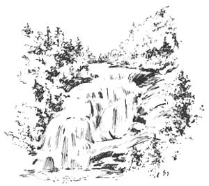
Noteworthy features of the forest include the Ducktown copper mining section, Parksville Lake on the Ocoee River, Bullet, Greasy Creek, Bald River, and Tel lico River Falls, the John Sevier house and Indian mounds near Tellico Plains, the area of virgin timber on Falls Branch near Hemlock lookout tower, and the ruins of old Fort Loudon just north of the forest boundary. Other special points of interest include Roan High Knob, elevation 6,300 feet, Beauty Spot, and the gorges of the Nolichucky, Doe, and Watauga Rivers.
The Cherokee National Forest has a gross area of 1,204,327 acres, of which 535,656 acres have so far been purchased or approved for purchase. It is estimated that there are on Government land some 600 million feet of merchantable timber composed of pine, hemlock, oaks, yellow poplar, and other hardwoods. There are also 300 million feet of blight-killed or damaged chestnut which is being salvaged as rapidly as economic conditions permit. The present annual growth is 15 million board feet.
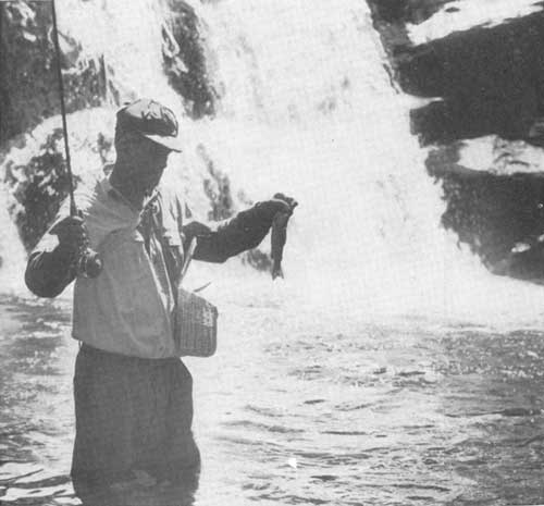
HUNTING AND FISHING.—Hunting and fishing are excellent on this forest, especially in the southern division. In the 10,096-acre Big Frog Federal Game Refuge, no hunting is permitted, but the refuge serves as a feeder for the 18,832-acre Ocoee Wildlife Management Area which surrounds it. Here, as in the 79,821-acre Tellico Fish and Game Management Area, deer, bear, turkey, and small game are increasing, and the fishing has greatly improved with the planting of thousands of rainbow trout. A unique feature of the Tellico area is hunting for Prussian wild boar. In three annual hunts 54 of these vicious fighters have been killed. A fish rearing station at Pheasant Fields supplies trout to stock the streams of this forest.
In the northern division, the Andrew Johnson State Game Refuge of 9,000 acres has been stocked with deer, its streams are well stocked with rainbow trout, and grouse, squirrels, and fur bearers are plentiful. The Laurel Fork area of 5,000 acres contains no deer as yet, but has been stocked with wild turkey and grouse. Other kinds of small game are plentiful.
|
| Tumbling water and fighting trout. Bald River Falls in the Cherokee National Forest. F—386651 |
RECREATION.—The Cherokee National Forest is a favored vacation land for people from the cities and towns to the west and north. The Forest Service has developed a number of recreation areas, including the following:
Lake Chilhowee.—On Beans Mountain near Benton. Bathing in a 7-acre lake, picnicking, camping.
Quinn Springs.—On Tennessee Route 40, 1 mile east of U S 411. Picnic grounds and camping area.
Kimsey Highway.—Near Sassafras lookout tower. Picnicking.
Bald River Falls.—On the scenic Tellico River Road 10 miles east of Tellico Plains. Bathing, picnicking, camping.
Dam Creek.—Eight miles up the river from Bald River Falls. Bathing, picnicking, camping
Sycamore Creek.—Eighteen miles up the river from Tellico Plains. Sites for summer homes.
Round Knob.—Sixteen miles from Greeneville. Picnicking.
Horse Creek.—Twelve miles from Greeneville. Swimming, picnicking, and camping.
The Laurels.—A very popular picnic area in a grove of white pines and hemlocks 8 miles from Johnson City.
Dennis Cove.—Twelve miles from Elizabethton. Picnicking, camping, and bathing.
Backbone Rock.—Three miles south of Damascus, Va., where the Beaverdam Road tunnels through a peculiar geologic dike. Popular for picnicking, swimming, and sightseeing.
Beaverdam.—One-third mile north of Backbone Rock, providing picnicking, camping, and bathing.
ROADS AND TRAILS.—Among the roads suggested for recreational motor travel are the following:
The road from Tellico Plains up Tellico River to Stratton Meadows on the crest of the Unicoi Range.
The Kimsey Highway from Reliance across Little Frog Mountain, with interesting views of the Ducktown Basin.
Tennessee Route 68 from Ducktown crossing the Hiwassee River and winding through the mountains to Tellico Plains.
U S 64 from Cleveland passing Parksville Lake and following up the gorge of the Ocoee River to Ducktown.
U S 25 and 70 from Newport following up the French Broad River via Hot Springs and Marshall to Asheville.
U S 421 from Bristol crossing the Holston and Iron Mountains to Mountain City.
U S 19—W from Erwin though wild mountains to Asheville.
Unaka Mountain Road loop from Erwin passing Rock Creek recreation area to Beauty Spot on the mountain top.
Tennessee Route 91 from Elizabethon up the valley between the Holston and Iron Mountains to Shady Valley.
Of the numerous foot trails the following are listed in addition to the Appalachian Trail:
Peavine Trail to the top of Big Frog Mountain.
Rock Creek Trail to the top of Beans Mountain.
Oswald Dome Trail from Quinn Springs to Oswald Dome lookout tower.
Bald River Trail following an old logging road up Bald River from Bald River Falls into one of the wildest areas in the forest.
| <<< Previous | <<< Contents>>> | Next >>> |
|
handbooks/southern_appalachians/sec5.htm Last Updated: 19-Nov-2010 |