|
The National Forests of the Northern Region Living Legacy— |
|
Chapter 4
Early Resource Management
The early Forest Service consisted of college-trained individuals from the East and practical "westerners" when the forest reserves were formed. Region 1's first "District" Forester, William B. Greeley, marveled at how these two diverse elements (easterners and westerners) became "integral parts of the whole," providing the base for the development of a truly unique organization. Greeley delivered three informal lectures at the University of Montana in 1908 and 1909—"The Development of Forestry in the United States," "The Administration of the National Forests," and "The Organization of the Forest Service, Its Requirements and Opportunities." [1] These lectures explained the philosophy on which the Forest Service was conceived and provided a portent of the role the agency was to play in the Northern Region.
Greeley, as did Chief Forester Gifford Pinchot, espoused a concern for the wise use of the national forest resources. He explicitly believed that the Forest Service should control timber resources as a mechanism to stabilize and protect the timber industry and to ensure a permanent timber supply. He also felt that promotion and salary within the Forest Service should rest entirely on merit rather than on seniority, as was traditional in most Government agencies. Greeley's administration set the style and tone of the Forest Service in the northern Rocky Mountains—to wisely manage the public's national forest resources. [2] Major programs of foresters in those early years involved inventorying the timber, organizing the forests for orderly use, reseeding or replanting timber already cut, managing the grazing resources, and protecting the forests from fire, insects, and disease. Although the mission has grown more diverse and the technology more sophisticated, the essential mission of the Forest Service in the Northern Region has remained consistent from that time to the present.
The Deteriorated Forests
The deteriorating condition of particular areas of the public forests and ranges in Montana and northern Idaho was clearly evident by the latter part of the 19th century. An 1888 report on forest conditions in the Rocky Mountains noted that the forests were being reduced by railroad use, lumbering, mining, and fire. An 1897 survey in northern Idaho indicated that on 4 million acres of public domain not yet in forest reserves, 85 billion board feet of timber remained, but an estimated 8 billion had been cut and 43 billion had been destroyed by fire. [3]
The 1907 Yearbook of Agriculture contains a graphic illustration of the destructive cutting that was occurring in Montana. The following statement is central to the perception of the mission of the Forest Service in the region at that time:
The consequences of destructive cuttings are to be seen everywhere through the National Forests, but especially in the lodgepole pine region of the middle Rocky Mountains, where the demand for timber was great. Thus around some of the mining centers near Butte, Mont., large areas were cut over under real or pretended compliance with the provisions of the act of June 3, 1878. Smelters were established in Butte in the early eighties, and as coal was not then available, wood was used for fuel. This, together with the immense quantities used for mining timber, has been a great drain on the forest resources of the region. Wood of all sizes was utilized, and in tall, dense stands of lodgepole pine on the rounded hills and slopes of this region, clear???cutting was the rule. On what is now the Helena National Forest it is estimated that 140,000 acres (218 square miles) were cut over and 3,000,000 cords taken out before the creation of the reserve. Most of this cutting was done before 1897, and in the vicinity of Butte a great deal was done before 1877. No limit except hauling distance was placed on the size of the areas to be cut clear. Along all the principal streams and creeks clear???cuttings extend back from one to three miles. In some places spurs were run out from the railroads. On Mike Renig Creek, for instance, a spur track was built up the creek seven miles and the slopes were stripped clear for from half a mile to two miles on each side. [4]
Thus, the mission of the Forest Service in the region was not only conservation and preservation, but replenishment of both the timber and wildlife resources.
Inventory: A Prelude to Management
The first step in effective management was the not-so-simple inventory of the renewable and nonrenewable resources within the region. It was bad enough that forest fires, timber cutting, overgrazing, and trapping had depleted timber and wildlife resources in the past. When the Forest Service assumed control of the Federal forest reserves in 1905, wildfire swept through much of the region, causing additional damage to millions of acres of timber, wildlife habitat, and drainage systems. Many of the older inventories had been sketchy at best; some forests had never been inventoried, and conditions on all the forests had changed over the decade preceding the creation of the Forest Service.
President Grover Cleveland's proclamations establishing the forest reserves predated management plans for those reserves. Many of the parcels of land recommended for the reserves were assumed to be worthy of inclusion, without any knowledge of their actual conditions. Gifford Pinchot and his young foresters wished to absorb as much of the public domain into the forest reserve system in as short a time as possible, but they often had extremely meager information. The potential the lands had for timber production and livestock grazing was one consideration for inclusion within the forest reserves. Other factors, such as watershed protection, also were in the inclusion criteria. However, making an informed decision based on the available inventory data was almost impossible.
The earliest survey efforts, beginning in July 1897, were led by the U.S. Geological Survey and organized by the chiefs of the Rocky Mountain and Pacific sections of the forest reserves under the direction of Henry Gannett. The surveys were actually conducted by foresters borrowed from the USDA Division of Forestry, and they were extensive (rather than intensive) in nature. The reports of these inventories (called forest surveys) were titled "Forest Conditions in the (name of reserve)" and included information on the distribution and character of forests and woodlands, the amount of forest fire damage and dead timber, where timber had been cut, and the effects of grazing on the forests. [5]
The first surveys in the northern Rocky Mountains were made on the Lewis and Clark, Flathead, Bitterroot, and Priest River Reserves in 1897-1898. These reserves were established by the proclamation of February 22, 1897, to be effective March 1, 1898. By July 1, 1890, the following reserves had been established in what was to become the Northern Region. [6]
| Reserve | Location | Acreage |
| Bitterroot | Idaho and Montana | 4,147,200 |
| Black Hills | South Dakota | 967,680 |
| Flathead | Montana | 1,382,400 |
| Gallatin | Montana | 40,320 |
| Lewis and Clark | Montana | 2,926,000 |
| Priest River | Idaho and Washington | 645,120 |
Reports on forest conditions of the Absaroka Division of the Yellowstone Forest Reserve (proclaimed on September 4, 1902, as the Absaroka Forest Reserve and transferred to the Yellowstone on January 29, 1903) and of the Little Belt Mountains Forest Reserve (proclaimed August 16, 1902) in Montana were published in 1904. Although the original survey appropriations for fiscal year 1897-98 had been $150,000, these later surveys were conducted on a total allotment of $25,000. They necessarily provided little hard data and a broadly conceived evaluation of the forest resources. [7]
By 1907, there were nearly 30 million acres on the national forests of the Northern District (later Region). During the next decade, many of these acquired lands were surveyed and reviewed for the first time, and some lands were subsequently excluded from the National Forest System. Some lands were dropped because they were missurveyed, others because they were submarginal in timber growth potential, and others because they were agricultural in nature and claimed for farming under the Homestead Acts of 1906 and 1912. More than 100 farmers in the Kootenai Valley, Montana, petitioned to keep their sections of land, which were within national forest boundaries. Thus the narrow valleys at the confluence of streams on the Kootenai River were zoned agricultural; on the Fortine Creek of the Blackfeet National Forest in northern Montana, a valley almost 3 miles in width was zoned agricultural. [8] By 1919, the total area of the Northern Region had been cut to approximately 22.5 million acres. Fire control and management problems were compounded by the private holdings within forest boundaries.
Only by the end of the 1920's had the general land designations been stabilized. Additions and deletions have occurred annually since that time, but the total area of the region has remained more or less constant. The total acreage of the region at key dates in its early history are as follows: [9]
| Date | Acreage |
| April 1, 1907 | 29,624,425 |
| June 30, 1909 | 28,840,384 |
| June 30, 1914 | 26,166,122 |
| June 30, 1919 | 22,480,180 |
| June 30, 1924 | 22,397,779 |
| June 30, 1929 | 22,281,881 |
| September 30, 1987 | 24,053,305* |
| (*Includes the national grasslands added in 1954.) | |
Even in the early days, many raised questions about the productivity of some of the land to be included in the Northern Region. In 1904, Forester R.E. Benedict prepared a comprehensive report for the Bureau of Forestry on a proposal to add large and often inaccessible tracts of land to the Bitterroot Forest Reserve. He alluded to the necessity of making below-cost timber sales in the tract, a matter of concern many decades later. His management analyses of the proposed 3-million-acre addition of lands on the watersheds of the Payette, Salmon, and Clearwater Rivers resulted in the proposal being withdrawn because the entire acreage would be too large to administer as a single unit. Instead, the addition of 452,357 acres north of the Salmon and adjoining the west boundary of the Bitterroot Reserve was recommended. [10]
Such decisions, however, required "hard" information about the acreage under consideration, and that information was most often lacking or deficient. The 1907 edition of "The Use Book" (The Use of the National Forests) addressed the need for better inventories:
At first a great many of the National Forests were made without knowing exactly where the boundary lines should run. This was unfortunate; because some agricultural lands which should have been excluded were taken in, and a good deal of timber land which should have been included was left out. This could have been avoided by making examinations on the ground, but there was no money for the work, and so the boundaries had to be drawn very roughly. Since 1900, however, men and money have been available for field examinations, and rough and inaccurate work has been done away with entirely. The old and carelessly made National Forests have been surveyed and mapped, and the President has put back into the public domain those lands which should not have been included. Now, before new forests or additions to the old ones are made, all the lands are examined on the ground. [11]
The Early Forest Surveys
Forester David T. Mason, who later gained fame as the standard bearer for the "sustained-yield" concept, provided much of the initial planning for the inventorying and early harvesting programs of the region. His first job, beginning July 1, 1907, brought him to the Montezuma National Forest in southwestern Colorado as a technical assistant in charge of timber surveys, timber appraisals, and the preparation of forest plans. He moved to Washington, D.C., the following May, but he transferred to Region 1, with headquarters at Missoula, Montana, when the Forest Service organized the Northern Region on December 1, 1908. In preparation for the transfer, Mason had inspected a timber sale on the Kaniksu National Forest and had examined fire-damaged timber on the Coeur d'Alene Indian Reservation. At the District (Regional) office, he served as assistant chief of silviculture, "responsible for all technical work relating to timber surveys, appraisals, and sales and for the supervision of cutting operations, forest management plans...(etc.)." [12]
In June 1910, Mason became supervisor of the Deerlodge National Forest, which then had the largest timber sales program of any national forest. He "began a working plan for the management of the Deerlodge" before being assigned as assistant district forester for District 1, which at the time made 40 percent of all timber sales in the Forest Service. He noted in his diary on October 18, 1913: "We figured out a fine way for the Service to start logging insect-infested timber—an operation paying costs." [13] The problem of harvesting insect-infested timber never abated, however, and solutions remained imperfect and timber reconnaissance an eternal necessity.
In July 1909, John S. Baird organized a reconnaissance crew on the Deerlodge National Forest. The timber there was being killed by smelter fumes. Everything affected had to be cruised and sold. Baird made a timber estimate by 40-acre sections and a topographic-and-forest-type map. Because most of the area was unsurveyed, a skeleton survey in each drainage had to be made by putting in temporary section corners. Thus, reconnaissance and survey, as Hartley A. Calkins commented, was a very inexact business. Base lines for timber reconnaissance and range surveys were conducted by transit survey. Route surveying for the construction of forest roads was necessary; it was usually conducted by compass and (abney) level. In June 1910, Baird moved to the Helena National Forest to begin similar surveys. [14]
The cursory timber inventories conducted before and after the forest reserves were proclaimed were becoming more formalized as the fledgling Forest Service began its operations in the northern Rocky Mountains. Beginning in 1908, the region issued instructions for reconnaissance and timber work and called for the examination of Northern Pacific Railroad lands. William B. Greeley, Ferdinand A. Silcox, and others developed these instructions. Adjustments and additions were made to the instructions each year until 1914, when the complete "Manual of Timber Reconnaissance, 1914" was issued. [15]
William W. Morris recalls the rough reconnaissance work he did during the summer of 1909 on the Coeur d'Alene National Forest. His first job was to prepare a map of the "watershed of timber" in colors to indicate areas timbered, burned, or bare and those that could be planted and restocked. From this map, a working plan for the national forest was developed. Morris explained, "a working plan is a detailed plan of running a forest. In the plan a certain amount of timber is allotted to be cut each year on a certain area, or during a certain period, so arranged that the forest will not be overcut. The plans also show the areas to be restocked, and the improvements to be made." [16]
Foresters made two types of reconnaissances in the region during the early years. An extensive reconnaissance (1- to 5-percent samples) helped select areas for logging units and roughly calculate growth. An intensive reconnaissance (5- to 10-percent samples) provided data for future timber sales and working plans. In 1926, the forest survey status of the national forests in the region showed that almost 40 percent of the land area still had not been inventoried (see Figure 4.1). [17]
Land classification, both intensive and extensive, supplemented the reconnaissance. Clarence B. Swim remembers being placed in charge of this activity in the District office in 1913. Intensive classification projects were scattered from the Kaniksu to the Custer National Forest. "Each forest," he said, "made a large bulky report on atlas-sized paper, that is, 18 by 22 inches, covering the entire forest, and dividing the total land acreage into two general classes—land entirely non-agricultural, and land agricultural or possibly agricultural in character." Forest classification was a huge job, sometimes requiring 7 years to complete. [18]
Early reconnaissance and classification foresters in the region included John F. Preston, David Mason, James Walter Girard, and Elers Koch. Preston was assigned to the region in 1908, but he spent much of his time working as a traveling representative in the Pryor Mountains of Montana. [19] While in Missoula, Mason's job was to supervise timber reconnaissance and mapping. He prepared the "Manual of Timber Reconnaissance, 1914," which was "considered the best of its kind at the time." Mason joined the faculty of the University of California in 1915, having gained some of his teaching experience through 3-month lecture courses on forestry at the University of Montana in 1911 and 1912. [20] Another pioneer in developing timber reconnaissance and appraisal techniques was Girard, who became legendary as a timber cruise (see discussion under "The Sale and Free Use of Timber" later in this chapter). [21]
Elers Koch spent much of his early career in the region on boundary work. He once said about such work, "There was no great amount of burdensome detail, the country was mapped by traverse and from high points, sketching in the various timber types, grass land, barren and brush. We figured on covering half a township to a township (36 square miles) a day, and that is a lot of country." In 1904, he made boundary surveys in Montana and Wyoming, and he covered his home area, the Gallatin Forest Reserve. Gifford Pinchot made Koch a forest inspector for Montana and Wyoming in 1905. [22]
In 1907, Koch became "supervisor" of the Montana division of the Bitterroot National Forest, the newly created Lolo National Forest, a portion of the new Hellgate National Forest, and the recently established Missoula National Forest. Much of the land in these forests was unmapped and largely unexplored. Koch assigned his foresters, such as John D. Jones, a graduate of the University of Montana, to the Lolo National Forest to "locate timber trespass, check on fraudulent claims, make some timber sales where needed, and generally find out what was going on." His assistant supervisor, Willard W. White, a graduate of Cornell University, was responsible for "timber work, cruising and looking after the sale of timber." [23]
Thus in the early days, a major effort of the Forest Service in the Northern Region was simply to find out what was there. Reconnaissance, inventory, and classification were essential to planning for effective management. In 1909, the resurvey of the national forest boundaries within the region was completed, and serious planning could begin. [24]
Planning for Management
Because inventories took so long to complete in the Northern Region, working plans, timber management plans, silvicultural plans, and other management plans were still being produced during the second and third decades of the region's existence. Samples taken from forest working plans, statements of policy, and management plans from the archives of the region include the following: [25]
| National Forest | Title of Plan | Date |
| Beaverhead | Outline of Forest Working Plan | Feb 20, 1913 |
| Bitterroot | Preliminary Statement of Policy | July 1, 1921 |
| Coeur d'Alene | Statement of Policy | April 19, 1924 |
| Deerlodge | Outline for Timber Management Working Plan | July 1, 1921 |
| Flathead | Preliminary Statement of Policy | March 2, 1921 |
| Jefferson | Preliminary Statement of Policy | May 12, 1922 |
| St. Joe | Preliminary Working Plan | April 10, 1923 |
| St. Joe | Management Plan and Policy | 1927 |
The working plans were relatively simple documents; they included general outlines of the forest's history, topography, climate, geology, soils, land classification, transportation, settlements, industries, ranching and grazing, and lumbering. The Bitterroot preliminary statement of policy was a brief 4-page statement containing information on "working circles," or areas of timber stands for future harvesting. The booklet covered estimates of timber volume, the limitation of the annual cut, the objective of management, the policy on selling timber, the probable demand, the working plans needed, and the sequence of cutting. [26]
The Deerlodge plan of 1921 was prepared in three parts with an appendix. Part I, the preface, included sections on the limitation of cut, working circles, rotation, cutting cycles, and sales; Part II contained the theory of regulation and listed technical and administrative needs to prepare schedules for harvest, silviculture, and regeneration; Part III included descriptions, recommendations, maps of the forest that displayed merchantable timber stands; overmature, overdense, diseased, and dead timber; and other sites, stands, cutting areas, and special work areas. The appendix contained reference sheets for the supervisor and district rangers, along with special records. [27]
To ensure that national forest timber would be perpetuating, the region devised timber marking rules to obtain another crop when the overstory timber was removed. One of the means for determining how to cut was to major forest type within the Northern District (Region). Methods-of-cutting studies were among the scenarios. Forest examiner C.K. McHarg, after studying how western white pine stands on the Coeur d'Alene National Forest had been cut for 2 years, concluded that the previous marking rules were too rigid. He proposed a revised marking standard, thus indicating that onsite study and observation had a place in developing the best way to manage the timber stands in the region. [28]
|
| Forest Service scalers, Kaniksu National Forest, 1923 (Idaho Panhandle National Forest) |
The Sale and Free Use of Timber
From the beginning, the young foresters in the Forest Service believed, as did Gifford Pinchot, that the forest resources were for use. Therefore, policies to sell timber to commercial interests and to furnish small amounts for "free use" (actually at the cost of making the sale) for local residents were quickly adopted. In a letter dated August 4, 1908, to E.A. Sherman, the Washington Office associate forester recommended that a general timber sale policy could not be promulgated for each national forest, but rather should apply to groups of forests. Region 1 announced its timber sale policy in a memorandum effective July 1, 1908, and each administrative unit (national forest) subsequently adopted its own general sale policy. On no national forest was the cut estimated to exceed 1 percent of the total amount of standing timber. [29]
The region, notwithstanding cutting constraints, was a leading provider of national forest timber. In the fiscal year starting July 1, 1905, the State of Montana ranked third in sales with 53 million board feet; Idaho sold more than 9 million board feet. Records for the fiscal year starting July 1, 1906, indicate that as high as 3.98 percent of the volume standing was cut on one national forest (Bitterroot) and less than 1 percent on the Coeur d'Alene. From 1914 through 1922, the timber sales volume for the region was erratic, with large volumes sold one year and smaller volumes the next (see Figure 4.2). The region ranked high in sales when compared with the National Forest System total during the early years, but sales declined as production in Districts (Regions) 5 and 6 increased. [30]
William Greeley, in charge of silviculture, prepared a comprehensive report in 1912 on the nature of timber sales to large and small operators on the Deerlodge National Forest. He stated that the forest supplied 119 timber operators, one of which was a large operator logging in the high country near the Continental Divide and investing large amounts in flumes, roads, and equipment. The smaller operators, with more limited capital, worked the lower, more accessible areas of the forest. Most of the timber, when converted into lumber products, was used in the copper mines near Butte, Montana. [31]
 The salvage of dead timber was an important element of the "wise use" concept |
The salvage of dead timber was an important element of the "wise use" concept. Following the devastating fires of 1910, the Senate Committee on Public Lands, in 1912, authorized the "Sale of Burnt Timber on Public Lands," through H.R. 9845. The report specifically cited the large areas of land in Minnesota, Idaho, Washington, and other Western States that had burned in 1910; it authorized the Government to cut and dispose of the burnt timber [32]
The opportunity to obtain timber for free use was especially welcome to local farmers and residents. Many national forests, especially in sparsely forested areas, served as community woodlots. The Sioux National Forest, located on the Dakota-Montana line, for example, served 1,200 to 1,500 farmers. Chief Forester Graves listed the following uses of national forest timber by farmers: cordwood, fence posts, derrick poles for stacking hay, corral poles, barn rafters, and lumber for buildings. [33]
Greeley cited several illustrations of national forest timber sale policies in the Northern Region in the 1912 Yearbook of Agriculture. He indicated that the primary consideration in setting annual timber harvest for a national forest is the needs of the local community; no sales were to be made to outside markets unless the growth on the national forest exceeded local demand. For example, the Sioux in South Dakota and the Madison in Montana were forests that sold all the allowable cut locally. Timber sales from the northern Idaho forests went to national markets because local needs were minimal. The Madison National Forest supplied timber for nine operators. Five small mills drew from the timber stands of the Helena National Forest.
In some regions, national forest timber supplied the Beartooth National Forest, for example, supplied more than 100,000 round mine props annually for mine operators. Montana forests also produced an average of 120,000 railroad ties annually. Large and small operators in Montana and northern Idaho found log markets at the downstream end of river log drives. These special conditions occurred on such forests as the Kootenai, Priest River, St. Joe, and Pend Oreille. [34]
Provisions for administering timber sales and free use on the Clearwater National Forest for the fiscal year ending June 30, 1913, included an allowable cut approximately equal to the annual yield. However, because the forest was inaccessible to the general market until rail or roads could be built administrators anticipated that this cut would not be reached. Although free use was set at 100,000 board feet, there was little demand even for that. Maximum stumpage prices were $4 and $2 per million board feet, respectively, for green and dead white pine and $2 and $1 per million board feet, respectively, for green and dead mixed sawtimber. [35]
Before national forest timber could be sold, an appraisal was needed. This policy predated the Forest Service, having been mandated by the Sundry Civil Appropriations Act, which was approved June 4, 1897. Timber sales with appraisals were conducted by the U.S. Geological Survey under this act, before any of the national forests were created. [36] The appraisal report prepared for a proposed timber sale on Four Mile Creek on the Lolo national Forest by Jim Girard and others and dated December 28, 1915, offers a good insight into the nature of such appraisals. The 13-page document, covering a 2,400-acre tract composed of 62 percent yellow pine, 24 percent Douglas-fir, 11 percent larch, and 3 percent mixed species provided detail estimates of logging and milling costs. At current stumpage prices in the area, according to the appraisal, the logging costs would not allow any appreciable margin for profit and risk. It was recommended that the cut be withheld until lumber or log prices increased.
Girard, who supervised this appraisal, was one of the most proficient timber cruisers of all time. He began his working career piling brush for the Burlington Railroad. He then worked for a small lumber company in Coeur d'Alene, Idaho, falling timber, bucking logs, and piling the inevitable brush. In the spring of 1907, he was employed by the Anaconda Copper Mining Company and joined the Forest Service on February 1, 1908, as a forest guard. Girard took correspondence courses in English, engineering, business administration, and cost accounting. From 1908 to 1910, he worked on a large timber sale to Anaconda and trained college graduates in cruising and log scaling. In 1909, he was placed in charge of the 50-million-board-foot Big Blackfoot Milling Company sale at Seeley Lake. He passed the scaler's examination in 1912 and the lumberman's examination in 1915, when he was appointed logging engineer for the Coeur d'Alene. He was a living legend by the mid-1920's. [37]
The need for sound timber marking rules for each forest type within the Northern Region affected how timber appraisals were prepared and whether a positive appraised price was justified. A timber appraisal study by Albert Wiener (1982) recited the example from Region 1 set by forest examiner Donald R. Brewster in 1915. Brewster recommended that white pine be clearcut in mature stands and shelterwood cut in immature stands. The average logging costs for this type in that year were $6.44 per thousand board feet. The larch/Douglas-fir type averaged $4.33 per thousand board feet. [38] Given an average stumpage price of $1.83 per thousand board feet in the region that year, the logger would have lost $2.11 per thousand on the harvest.
Elers Koch made his first timber sale on the Bitterroot to an Idaho outfit competing with the Anaconda Copper Mining Company, (but soon bought out by Anaconda). The timber was marked by the selection method; the mature ponderosa pines—the ones with the wide bark plates and the thinning crowns—were selected, and the thrifty growing trees (that is, those with the black bark and the thick crowns) were saved for a later harvest. Despite the purchasers' dislike for the practice, timber cuts required that slash be piled and burned. Koch visited the sale area 45 years later and the stand there indicated that the original timber marking was wisely done. [39] He said:
I always figured that if the Forest Service did a good job without fear or favor, opened up the country with trails, administered our timber sales and grazing permits fairly, kept down the forest fires, and made a good showing in efficiency and economy, the works would speak for themselves [40]
Other Tasks of Resource Management
In 1907 and 1908, the Milwaukee Railroad was being built through the Lolo National Forest, requiring rights-of-way, permits for building construction, timber sales, and other activities. The fires associated with the right-of-way clearing became a greater hazard in 1908 because of considerably reduced rainfall. Firefighting thus became a larger task for the Forest Service.
Reforestation by tree planting was always a minor activity, for most stands were reforested by natural seeding following selective cutting. Planting did become important, however. Koch established Savenac Nursery at Haugen, Montana, while he was supervisor of the Lolo National Forest. For a time, Savenac was the largest Forest Service nursery in operation. It produced from 2 to 7 million seedlings a year for more than 35 years. [41]
Artificial reforestation in the Northern Region was generally unsuccessful during this period. For example, on one district of the Gallatin National Forest, a ponderosa pine plantation, a Douglas-fir plantation, and a Douglas-fir/ponderosa pine mixed plantation were all seeded in 1913, but there were negative results because of poor seed stock, shallow soil, and inappropriate elevation. The Gallatin did not attempt seeding again until 1935, when it experienced only modest results. [42]
During the early days of Region 1, there were also negligible results in insect and disease control. Koch recalled an incident in which an infestation of bark beetles in central Montana was fought by removing and burning the dead trees. When Koch realized they were losing the battle against the beetle, the Forest Service withdrew from the field and let the infestation run its course.
Controlling Wildfire
The historical records of Montana and northern Idaho are replete with references to large and damaging fires. Lewis and Clark reported burned-over areas; they noted that the Native Americans sometimes set fire to tree crowns as "fireworks." Col. Edgar T. Ensign said, in his 1888 Report on the Forests of North America, that in the Montana Territory, "The destruction by forest fires is almost beyond computation...." [43]
Although the "Use Book" of 1907 advised that less that one-third of 1 percent of the total area of the national forests had been burned over, events in the Northern Region disproved that vital statistic. According to Koch, there are two parts of the year for a forester on the national forests of western Montana and northern Idaho—the forest fire season (early July until September rains) and the rest of the year. The "really bad fire years" in the Northern Region were 1910, 1914, 1917, 1925, 1926, 1929, 1931, and 1934, according to Koch. For sheer destructiveness, the fires of 1910 were the worst—a "complete defeat for the newly organized Forest Service force." John F. Preston remembered that, as late as February 1911, he found snags still smoking, sticking up through 5 feet of snow on the Stillwater burn. The economic loss in Region 1 was staggering—estimated at 6 billion board feet of timber with a value of $20 million. [44]
Although stories of forest firefighting in the early days indicate that the work was all done with saw, pick, and shovel, this was not the case. Gasoline-fueled water pumps and hose were available and were used in certain situations. Getting a firefighting crew together was difficult. Streets, saloons, and freight trains were the sources of most of the firefighters, and "we always expected most of them to be drunk," said Koch. John S. Baird recalled being pulled from timber reconnaissance in July 25, 1910, to head up a fire crew. He was placed in charge of 40 men to control a fire near Borax, on the Wallace branch of the Northern Pacific Railroad, but their best was not good enough, he said later. The supervisor's meeting in Missoula during the week of January 22, 1912, John F. Preston remembered, was devoted to fire protection. [45]
Fires continued to plague the region, with each forester having a "most memorable" fire. Koch (who was Assistant Regional Forester and Chief of the Division of Timber Management from 1921 until his retirement in 1943) remembers the Lochsa River Fire of 1929 as one of his longest, most hard fought campaigns in an inaccessible primitive region. Firefighters reached the site on August 2, when it covered only 3/4 acres. A wind arose in mid-afternoon and blew the fire across the line. A lookout called for reinforcements. By 7:00 a.m. the next day, 9 men were working the fire. By August 7, 50 had been called in, and by the 13th, the crew was forced to flee downstream to the fire camp at the mouth of Bald Mountain. No progress was made during the next week. By the 21st, fighters from the Lolo, Clearwater, and Selway had joined the fray. Not until September 8, with 95 miles of fire line and 480 men on the line, had the fire finally been contained. The ordeal lasted 33 days. [46]
Livestock Use: Encouraged, but Regulated
Cattle and sheep exploded onto the ranges of Montana during the last two decades of the 19th century. Cattle increased from 117,000 head in 1870 to 662,000 in 1880; by 1886, there were an estimated 1,050,000 cattle in the State. According to Paul Roberts, Montana's sheep herds grew from 260,000 head in 1891 to more than 6 million by 1900. Idaho ranges stocked more than 3 million head of sheep in 1900. [47] Thus strong pressure for new grazing lands coincided with the development of management plans for the newly created national forests.
The Northern Region Retirees History Advisory Committee claims, "prior to and during the Forest Reserve status of the public domain, there was utter chaos on the range lands." It was a matter of first come, first served, and unrestricted numbers of cattle ranged the forests as soon as the snows receded. "Needless to say the lands were severely overgrazed. There was little or no consideration for wildlife needs. Soil erosion and plant destruction were rampant." When the Forest Service attempted to impose controls on livestock grazing, it met resistance, animosity, and at times outright threats to individual rangers. [48]
One of the first controls imposed by the Forest Service was to charge for livestock use on the forests. John W. Lowell recalled a Western Slope Stock Growers Convention in the latter part of 1906, where Gifford Pinchot quietly addressed a hostile audience and succeeded in convincing many of the advantages of grazing regulations on the national forests. The Forest Service recognized the vital importance of the range resources to the area's farming and ranching industry.
Many of the region's forests were clearly unsuitable for extensive grazing. The Flathead, for example, held only 88 head of cattle in 1909, with its largest number, 2,000, grazing in 1953, according to Charlie Shaw in The Flathead Story. He reported that approximately 1,400 horses grazed in 1924 and around 3,200 in 1932. Grazing of sheep on the Flathead was never a large operation because of windfalls and the absence of desirable plants. In 1909, 250 head of sheep grazed; the number peaked at 18,000 in 1917. None were reported after 1943. [49]
Worried that grazing potential might not be adequately used, in 1913, the Forest Service issued a prospectus describing and locating unused rangeland on each national forest. Foresters estimated that the western part of the Northern Region could support approximately 400,000 sheep on summer range. Transportation systems, rail shipment, and eastern markets were reviewed. Subsequently, the number of sheep grazing on regional forests rose dramatically (see Figure 4.3). [50]
In some areas, however, there was more demand than forage. On the Custer National Forest, stock raising on a large scale succeeded the buffalo-hunting era. Sheepherders were discouraged from intruding on this cattle-grazing region and often had to fight for grazing rights. Although the advent of the Forest Service seemed to end the violence, the contention for grazing rights rose—with the Forest Service in the middle of the contenders. In 1918, for example, the grazing capacity of the entire Sioux Forest was set at 7,600 cattle and 2,800 sheep. Approximately 7,472 applications for grazing permits were approved and 2,533 rejected for lack of range. By 1920, the pressure eased somewhat, and only 900 permits were disapproved. The Long Pine Stock Association cooperated with the Forest Service in reducing grazing pressure in 1922 by placing salt blocks at least 1 mile from watering places and in areas where forage was more abundant. [51] Cooperation in range surveys and grazing research helped develop grazing seasons, and this, along with methods of use, led to better relations and the trust of the stockers, who began to realize that the control of livestock grazing helped everyone.
Range surveys, approved by the Secretary of Agriculture, provided the data for computing the number of allowable livestock on a range. In a letter dated January 8, 1916, C.H. Adams, acting district forester, authorized the Nez Perce National Forest to allow 10,000 head of cattle and horses and 50,000 head of sheep and goats, with head rates charged by the length of stay on the forest. [52]
Each national forest prepared an annual grazing working plan. The plan for the Selway National Forest, dated November 25, 1916, was 12 pages and included information on general range conditions; range divisions; estimates of grazing capacity, distribution of stock, and grazing periods; permit allotments; enforcement of protective regulations; livestock associations; game protection; and summary recommendations, as prescribed by Forest Service Form 771 (revised July 1915). Each national forest notified stockers annually about deadlines for applying for grazing permits and grazing rates on a special form 152, posted as "Notice to Stockmen." [53]
Sheep grazing on the Clearwater National Forest occurred mainly on areas where grass cover followed heavy burns. The number of sheep on the forest peaked at 33,000 in 1933. Cattle grazing was negligible until the 1930's, when it was still light. [54] The Kootenai National Forest was much the same. The forest retained an open range until 1914, when permits were required. During the 1920's and 1930's, large bands of sheep moved into the forest from Oregon and Washington to feed on areas that had been burned over in the disastrous fires of 1910. On the Nez Perce, a cattle industry of sorts had developed as early as 1863, when ranchers drove their stock to the mining districts for sale.
The years 1904 to 1907 brought range wars between cattle- and sheepherders. Shooting sheep and cutting fences occurred; one sheepherder named Myers killed a cattleherder and was tried, found guilty, and hanged. These problems eventually declined.
A 1915 pamphlet noted that there were 9,000 cattle and horses and 35,000 sheep grazing on the Nez Perce. Cattle numbers peaked in 1919 and sheep in 1918, with counts of 13,992 cattle and over 70,000 sheep. [55] After an initial increase in the number of animals grazing on the national forests during the first few years of Forest Service administration, head counts generally remained stable through the 1920's, except for sharp increases during World War I (see Figure 4.4). That war produced some interesting changes in the lifestyle of foresters in Region 1.
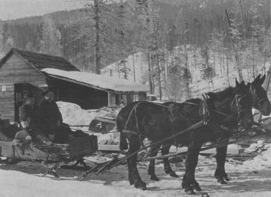
From Mule to Model T
Transportation in the region was by horseback and mule for the first several decades of the Forest Service administration. The region bought its first automobile in 1917, a Model T touring car for the ranger of the Ekalaka division of the Custer National Forest. Shortly thereafter, Savenac Nursery purchased a Model T 1-ton truck, complete with solid rubber tires.
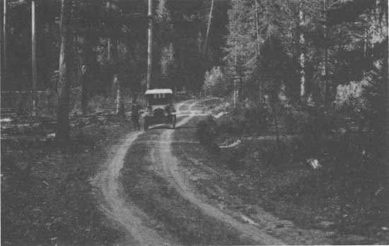
Road building by State and Federal authorities began in earnest. To publicize the opening of the road now designated the Yellowstone Trail, a Missoula man named Beck raced against time from Missoula to Wallace. After that, according to David S. Olson, automobiles appeared in ever-increasing numbers. [56]
Road building and automobiles soon became part of the timber industry. Perhaps anticipating the automobile in 1913, E.R. Johnson, a surveyor-draftsman who made a reconnaissance survey up the Coeur d'Alene River from Pritchard to "the Forks," a distance of 126 miles, recommended building a "wagon road" upriver from Pritchard along the east bank of the river. He believed that the cost would be justified by the ease of moving supplies in (he did not mention moving timber out) and that the timber companies would likely underwrite the cost by paying an additional 25 cents per thousand board feet of stumpage. The road also would provide "an excellent opportunity for automobile trips and camping, hunting and fishing." [57]
Thus the automobile age not only promised to improve logging and firefighting access, but it opened up a largely neglected resource of the national forests in the Northern Region—recreation. However, soon after the automobile was introduced into the hinterlands of the region, the airplane began to fly over those lands.
|
| Roadway in the Mission Mountains, Flathead National Forest, Montana. 1920. |
The Airplane
Region 1 was a pioneer in the use of aircraft for forestry work. Howard Flint, who entered the Forest Service in 1910, was instrumental in bringing the air age to the region as a timber cruiser on the Flathead in 1917. Assigned to fire control in the Regional Office in 1920, Flint began to seriously study the use of airplanes for scouting forest fires. He learned to fly and took his first flight on July 8, 1925. He began to experiment with aerial mapping and borrowed a camera from the Army in 1926. He published his findings extensively and stimulated widespread interest in aviation as a firefighting tool. In 1935, Flint was killed in a plane crash in the region. [58]
Another aviation pioneer in the region was Major Harold "Hap" Arnold, who flew reconnaissance flights in the 1930's before achieving fame as a general in command of the Army Air Corps during World War II. The Johnson Flying Service, discussed later, became synonymous with forest-related air operations in the Northern Region. [59]
The following is the region's chronology of its early flight experiments:
| 1919: | The Potlatch Timber Protective Association of
northern Idaho attempted an air patrol but abandoned it because of the
lack of suitable equipment. Howard Flint began to investigate the use of dirigibles for use in transporting men to fires. |
| 1920: | Discussions were held with Navy officials to test lighter-than-aircraft, but no tests were held |
| 1921: | Region 1 was represented at a conference at Mather Field, California |
| 1924: | Timber owners of northern Idaho contributed $1,000 to the Spokane airport for planes to be used for fire |
| 1925: | Region 1 received $10,000 for an air patrol. Howard Flint organized the first air patrol at Spokane. Flint made the region's first attempt at aerial cartography. |
| 1927: | This marked the first year of seasonal flying contracts in Region 1. |
By the close of the next decade, aerial operations in the region had progressed to the use of smokejumpers. [60]
The Beginnings of Research
Early Department of Agriculture foresters such as Bernard Fernow had organized information about timber species and their management even before the national forests came under the Department's jurisdiction. Species studies were begun as early as 1898, and information included species range; rate of growth; light, moisture, and soil requirements; method of reproduction, and behavior in either pure or mixed stands. This information, plus the various reports on forest conditions in the States and territories, formed a valuable reference on how to manage the national forests when it became the jurisdiction of the Department of Agriculture. [61]
The Section of Silvics was established in the USDA Bureau of Forestry in 1903 so silviculture field work began early on. By the second decade of the 20th century, more advanced studies and investigations were possible on the national forests, including those of the Northern Region. H.E. Fegley, forest assistant on the Sioux National Forest, issued an annual silvicultural report in 1910, "The Natural Extension of Western Yellow Pine to Grassland Areas," with his conclusion that tree planting would be successful on these areas. In 1912, Kenneth D. Swan presented a silvicultural report on the Sioux that contained a list of trees and shrubs found on the forest and observations about the effect of forested stands on soil moisture. An early but undated report on the Coeur d'Alene National Forest in northern Idaho recommended the exclusion of fire from tree stands because seed stored in the duff might not germinate until the second year after seedfall. [62]
The Forest Service term for formal research was "investigative work." There were field research stations in nearly every region, including the Northern Region. The Priest River Experimental Station, on the Kaniksu, was the site of early research on silvicultural problems. Studies included seed extraction, seed testing, source of seed, nursery practice, experimental planting, methods of cutting, and regeneration on cutover areas. [63] During the winters of 1915 and 1916, rangers from the national forests of the region were assigned duty at Priest River Experimental Station. The district forester proposed this work during a visit to the station in 1913. The rangers also received instruction in topographic sketching and estimating. [64] For the most part, practical forestry and the necessities of the moment tended to preoccupy research in the region during its formative years.
Seemingly the Best of Times
The Forest Service achieved a positive "presence" in the northern Rocky Mountains during the first three decades of the 20th century. Controls were established, and the forests and ranges were being replenished from the earlier depredations. The national forests were a resource reservoir to supply many of the needs of local people and their communities—things for use and things for enjoyment. The stage had been set for better things to come.
But worse times came instead! The Great Depression offered a challenge that confronted the strength and wisdom of the men and women of the Forest Service. Fortunately, the principles of sound resource management developed between 1905 and 1929 would serve the region well during the depression. The forests offered order and security that the greater economic and financial world for a time seemed unable to provide.
|
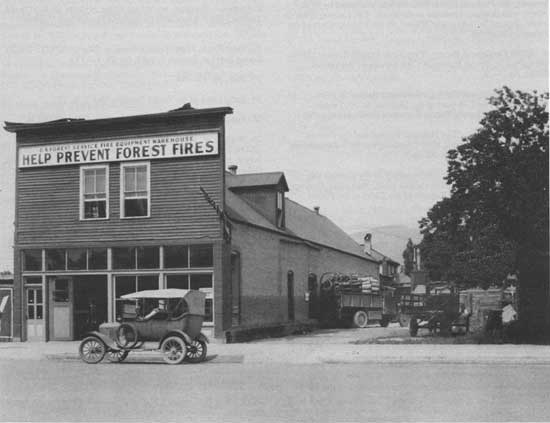
| Northern Region Fire Warehouse, Missoula, Montana, 1922. |
Reference Notes
1. William B. Greeley, "The Development of Forestry in the United States," December 1908, pp. 1-20; "The Administration of the National Forests," February 1909, pp. 1-23; "The Organization of the Forest Service: Its Requirements and Opportunities," March 1909, pp. 1-18, in historical files, Region 1, Missoula.
3. USDA Forestry Division, Report on the Forest Conditions of the Rocky Mountains and Other Papers, Bulletin 2, (Washington, DC: USDA Forestry Division, 1888), pp. 1-220.
4. Yearbook of Agriculture (Washington, DC: Department of Agriculture, 1907), pp. 279-280.
5. USDI Geological Survey, Nineteenth Annual Report, 1897-1898, Part I, Report of the Director (Washington, DC: U.S. Department of the Interior, 1898), pp. 9-10, 19. For instance, the Flathead Forest Reserve was examined by H.B. Ayres. who devoted 4 months to the work. J.B. Leiberg spent an entire season, June through October, to the Idaho portion of the Bitterroot Reserve.
6. USDI Geological Survey, Twentieth Annual Report, 1898-1899, Part V. Forest Reserves: The Forests of the United States, pp. 1-2.
7. USDI Geological Survey, Nineteenth Annual Report, 1897-1898, Part 1, Report of the Director, p. 29; Twenty Second Annual Report, Part 1, Report of the Director, p. 51.
8. Henry S. Graves, "The National Forests and the Farmer," Yearbook of Agriculture, 1914 (Washington, DC: Department of Agriculture, 1914), pp. 65-68.
9. See Annual Reports of the Secretary of Agriculture and the Yearbook of Agriculture for various years, Statistical Abstract of the United States, and Reports of the Chief of the Forest Service.
10. R.E. Benedict, "The Proposed Idaho Addition to the Bitter Root Forest Reserve," USDA Bureau of Forestry, 1904, pp. 1-24, in Federal Records Center, Seattle, WA, 095-63A0203. The addition was still in proposed status in July 1905 but was opposed by Idaho Senator Heyburn. See USDA Forest Service, Forest Reserves in Idaho, Bulletin 57 (Washington, DC: USDA Forest Service, 1905), p. 231.
11. USDA Forest Service, The Use of the National Forests (Washington, DC: USDA Forest Service, 1907), p. 8.
12. Rodney C. Loehr, Forests for the Future: The Story of Sustained Yield as Told in the Diaries and Papers of David T. Mason, 1907-1950 (St Paul, MN: The Forest Products History Foundation and Minnesota Historical Society, 1952), p. 22. Incidentally, in Missoula, Mason worked with three foresters who would later become chief foresters of the Forest Service.
14. USDA Forest Service, Region 1, Early Days in the Forest Service, Vol. 1 (Missoula, MT: USDA Forest Service, Region 1, n.d.), p. 1.
15. Federal Records Center, Seattle, WA, 095-67A0136.
16. Early Days in the Forest Service, Vol. 1, pp. 158, 164.
17. Federal Records Center, Seattle, WA, 095-67A0136.
18. Early Days in the Forest Service, Vol. 1, pp. 197-198.
20. Loehr, Forests for the Future, pp. 13-14.
21. The author of this chapter would sit in disbelief during the years 1949-1951 as an upper-division forestry major, while more than one professor at the school of forestry, University of California-Berkeley, would tell of the exploits of Jim Girard. Students got to know him through his Form Class Volume Tables.
22. Elers Koch, Forty Years a Forester (Missoula, MT: USDA Forest Service, Region 1, n.d.), pp. 29, 1-173.
24. Early Days in the Forest Service, Vol. 3, p. 232.
25. Federal Records Center, Seattle, WA, 095-67A0136.
26. Wilfred W. White, "Preliminary Statement of Policy," USDA Forest Service, Region 1, Bitterroot National Forest, July 1, 1921, pp. 1-4, in Federal Records Center, Seattle, WA, 095-67A0136. Contrast this document with the September 1987 Bitterroot Forest Plan containing 317 pages.
27. F.G. Clark, "Outline for Timber Management Working Plan, Deerlodge National Forest," April 23, 1921, pp. 1-7, in Federal Records Center, Seattle, WA, 095-67A0136.
28. C.K. McHarg, Jr., "Recent Progress in Methods of Cutting in the Western White Pine Type," April 1916, pp. 1-20, Federal Records Center, Seattle, WA, 095-77A0315.
29. "Proposed Timber Sale Policy for Administrative Units Effective July 1, 1908. District #1," in Federal Records Center, Seattle, WA, 095-67A0136.
30. Annual Reports of the Department of Agriculture for the Fiscal Year Ended June 30, 1906 (Washington, DC: Department of Agriculture, 1907), p. 55. As indicated, 10.7 percent of standing volume was sold on the Shoshone National Park) in that year, but the operator wanted to cut only one-sixth of that amount. See "Estimate of Timber Sale Policy Data, District 1," in Federal Records Center, Seattle, WA, 095-67A0136.
31. William B. Greeley, "National Forest Timber for the Small Operator," Yearbook of Agriculture, 1912, pp. 405-406.
32. U.S. Senate, Sale of Burnt Timber on Public Lands, 62nd Congress, 2nd Sess., Report No. 361 (Washington, DC: Government Printing Office, 1912), p. 1-2.
33. Henry S. Graves, "The National Forests and the Farmer," Yearbook of Agriculture, 1914, p. 78.
34. William B. Greeley, "National Forest Timber for the Small Operator," pp. 406-409.
35. Henry S. Graves to Secretary of Agriculture, June 17, 1912, in Federal Records Center, Seattle, WA, 095-67A0136.
36. USDI Geological Survey, Nineteenth Annual Report, 1897-1898, Part 1, Report of the Director, p. 17; James W. Girard, U.S. Swartz, and F.R, Mason, "Appraisal Report, Four Mile Creek, Lolo National Forest," December 28, 1915, pp. 1-13, map, in Federal Records Center, Seattle, WA, 095-67A0136.
37. Judson N. Moore, "Tamerack Grove on Clearwater River Honors Pioneering Timber Cruiser Who Came to Seeley Lake County in 1908," n.p., n.d., pp. 1-33, in historical files, Region 1, Missoula, MT.
38. Alfred A. Wiener, The Forest Service Timber Appraisal System: A Historical Perspective, 1891-1981 (Washington, DC: USDA Forest Service, 1982), p. 35.
39. Koch, Forty Years a Forester, p. 48.
42. "Early Plantations, Gallatin District, Gallatin National Forest, 1911-1960," n.d., pp. 1-2, in historical files, Gallatin National Forest.
43. Col. Edgar T. Ensign, Report on the Forests of North America, Bulletin No. 2 (Washington, DC: USDA Forestry Division, 1988), p. 101.
44. The Use of the National Forests (1907), p. 18; Koch, Forty Years a Forester, p. 68; Ferdinand A. Silcox, "Fire Prevention and Control on the National Forests," Yearbook of Agriculture, 1910, pp. 413-424; Early Days in the Forest Service, Vol. 3, p. 195.
45. Koch, Forty Years a Forester, pp. 79, 81; Early Days in the Forest Service, Vol. 1, p. 2; Vol. 3, p. 198.
46, Koch, Forty Years a Forester, pp. 86-100.
47. U.S. Senate, The Western Range, 74th Cong., 2nd Sess., Doc. 199 (Washington, D.C.: Government Printing Office, 1936), p. 119; Paul H. Roberts, Hoof Prints on Forest Ranges (San Antonio, TX: The Naylor Co., 1963), pp. 11, 1-151.
48. Northern Region Retirees History Review Committee to Henry C. Dethloff, January 24, 1989.
49. Charlie Shaw, The Flathead Story (Kalispell, MT: USDA Forest Service, Northern Region, Flathead National Forest, 1967), pp. 128, 1-145.
50. "Prospectus, National Forest Grazing Lands Situated in Western Montana and Idaho North of Salmon River," 1913, pp. 1-30, in Federal Records Center, Seattle, WA, 095-77A0315.
51. "Excerpts from the Old Camp Crook Newspaper Concerning the Activities of Forest Service Employees and Families, in historical files, Custer National Forest.
52. C.H. Adams to Supervisor, Nez Perce National Forest, January 8, 1916, in Federal Records Center, Seattle, WA, 095-63A0203.
53. USDA Forest Service, Selway National Forest, "Grazing Chapter—Supervisor's Annual Working Plan, 1916" and "Notice to Stockmen, Selway National Forest, Grazing Permits for 1918," in Federal Records Center, Seattle, WA, 095-63A0203.
54. Ralph S. Space, The Clearwater Story (Missoula, MT: USDA Forest Service, Region 1, 1964), pp. 79-80, 1-162.
55. Albert N. Cochrell, A History of the Nez Perce National Forest (Missoula, MT: USDA Forest Service, Northern Region, 1970), pp. 63-65, 1-129.
56. Early Days in the Forest Service, Vol. 3, p. 248.
57. Ibid., p. 248. Reference the currant controversy about roads in the region.
58. Northern Region Retirees History Review Committee to Henry C. Dethloff, January 24, 1989.
59. "Notable Forester Passes," The Timberman (November 1935), p. 86, in Federal Records Center, Seattle, WA, 095-58B297.
60. Ralph L. Hand, "History of the Use of Aircraft in Forest Service Work," pp. 1-8, in Federal Records Center, Seattle, WA, 095-58B297
61. Harold T. Pinkett, Gifford Pinchot: Private and Public Forester (Urbana, IL: University of Illinois Press, 1970), pp. 89-90, 1-481.
62. H.E. Fegley, "The Natural Extension of Western Yellow Pine to Grassland Areas," Sioux National Forest, Annual Silvical Report, December 6, 1910, pp. 1-10; Kenneth D. Swan, "Silvical Report, Sioux National Forest, December 1, 1912," pp. 1-5; "Conditions to be Met in White Pine Stands, Coeur d Alene National Forest," n.d., pp. 1-2, in Federal Records Center, Seattle, WA, 095-77A0315.
63. USDA Forest Service, Report of Investigations, Vol. 1 (Washington, D.C.: USDA Forest Service, 1913), pp. 54-61, 1-68.
64. "Report on the Assignment of Rangers to the Experiment Station, January 15 to March 15, 1915—and Proposed Plans for a Similar Assignment of Rangers in 1916," pp. 1-10, in Federal Records Canter, Seattle, WA, 095-63A0203.
| <<< Previous | <<< Contents>>> | Next >>> |
|
history/chap4.htm Last Updated: 10-Sep-2008 |