|
History of the Rogue River National Forest Volume 1 — 1893-1932 |
|
CHAPTER 4
CRATER NATIONAL FOREST
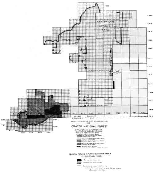
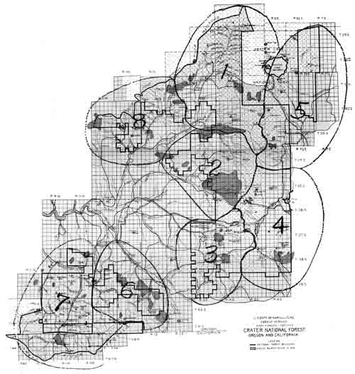
On July 1, 1908, President Theodore Roosevelt by Executive Order established the Crater National Forest from the Cascade (Mazama). A portion of the Klamath, and the Siskiyou Forests were added to the Crater by terms of the order. The map following this page illustrates those areas making up the Crater National Forest.
Personnel from July 1 to Dec. 31, 1908, were as follows:
Acting Forest supervisor — C. J. Buck. On Sept. 1 he was made Forest Supervisor. He was detailed to Washington, D. C., Sept. 15 and for most of October. On Nov. 20 he was transferred to Portland, Ore., as Assistant Chief of Operations in the District Office.
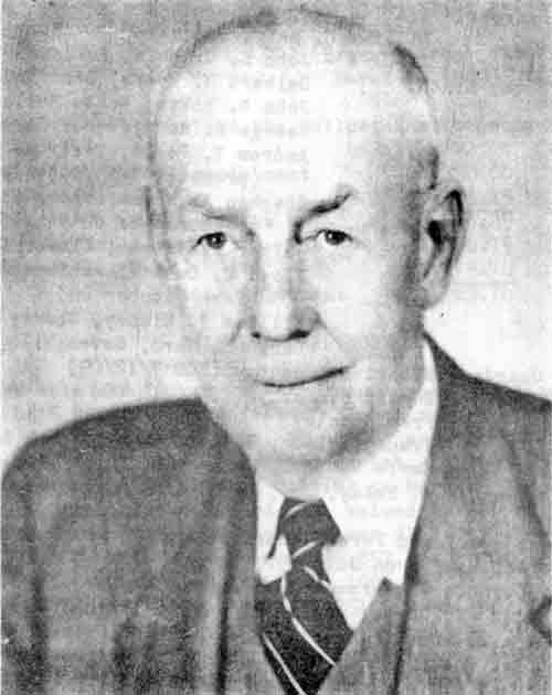
Martin L. Erickson was transferred to the Crater Forest on Dec. 1, 1908, as Forest Supervisor to replace Buck. His salary was $1,600 per year he was transferred from the District Office where he served as inspector.
Deputy Forest Supervisor — Samuel S. Swenning.
Forest Assistant — Harold D. Foster.
Forest Clerk — Horace G. Whitney.
Forest Rangers — Ira Tungate, Applegate.
Assistant Forest Rangers — Stephen A. Moore, Fort Klamath; J. Wesley Kelsoe, Butte Falls; Wm. T. Kinney, Cherry Creek.
Forest Guards — George H. West, Upper Rogue; John E. Gribble, Ashland. He was promoted on Sept. 18, 1908, to Assistant Forest Ranger at $900 per year; John D. Holst was appointed on August 12, 1908, as Forest Guard at $900 per year. Worked at Perche's Pasture from June 1 to October on Applegate, under Ira Tungate, under temporary worker until he was appointed. He was promoted on Sept. 18, 1908, to Assistant Forest Ranger at a salary of $900 per year; Chris Beale worked mostly on Klamath Indian Reservation on fire patrol, under supervision of Supervisor Buck.
Most of the work consisted of fire patrol, examination of Homestead claims under the Act of June 11, 1906, Special Use permits and timber sales. On Jan. 10, 1908, a Free Use permit was issued to the U. S. Reclamation Service for 2,700,000 board feet of timber valued at $6,750. The amount of timber cut was 2,073,690 board feet valued at $5,184.23.
SUMMARY OF FIRE ACTIVITY FOR 1908
1. Number of fires: *Class A — 20; Class B — 13; Class C — 18; Total 51.
2. Cause: Lightning — 9; Incendiary — 5; Campers — 13; Unknown — 24.
*Class A up to 1/4 acre in size; Class B 1/2 acre to 10 acres; Class C over 10 acres.
|
| (click on image for a PDF version) |
(The unknown cause was thought to be due to carelessness in leaving campfires, or maliciously set.)
3. Area burned over: 8,947 acres of which 6,330 acres were timberland, with an estimated loss of 9,192,000 board feet of timber valued at $22,431.00.
4. Cost of fire suppression:
| Labor, exclusive of rangers | $2,207.10 |
| Supplies | 454.11 |
| Ranger labor | 306.06 |
| Total cost | $2,967.27 |
5. Fire period: Three Class A fires occurred in May, no acreage burned; 1 Class A in June burning 1 acre; 2 Class A, 2 Class B, and 4 Class C (Total 8) burned over 300 acres in July; 6 Class A, 5 Class B, and 6 Class C fires burned over 5,258 acres in August; 8 Class A, 5 Class B, and 8 Class C fires (total 21) burned over 3,385 acres in September; and 1 class B fire burned over 3 acres in October.
LANDS
Harold D. Foster, Forest Assistant, made a detailed study of the boundaries of the Crater Forest. The following excerpts are from his detailed 38-page report which is on file in the Supervisor's Office of the Rogue River National Forest.
"Under instructions from the District Forester of District 6 and in accordance with circular letter 'OL — District Boundaries' dated May 12, 1909, and entitled 'Instructions for Examination and Report on Additions to and Eliminations from National Forests,' a complete examination of the boundaries of the Crater National Forest has been made with a view to determining positively and finally the proper boundaries of the National Forest. The field work has been conducted by several Forest officers connected with this Forest, and from their reports and maps this finished report and the type map accompanying it have been compiled.
"Information has also been drawn from the following reports and maps: A report by John B. Leiberg, Forest Expert, dated Nov. 25, 1905, on certain proposed eliminations in the Pelican Bay region; a (re)port by Forest Assistant John D. Guthrie, dated Jan., 1908, on proposed eliminations in township 34 south, range 2 east; a report by Deputy Supervisor Sam'l S. Swenning dated April 19, 1909, on the proposed elimination of township 32 south and 33 south, range 1 west, and 32 south, range 2 west; and a report by Sam'l S. Swenning and others, dated Feb. 1909, on the history and character of the Crater National Forest."
For the most part, with only a few exceptions, Foster's report resulted in the Proclamation of June 30, 1911, which added some and eliminated certain lands from the Crater. This proclamation and a copy of the accompanying map are further described in the 1911 portion of this report.
The following letters on allotments show not only that the supervisors corresponded direct with the Washington Office, but also they are indicative of the detail required in submitting estimates of needed work.
Medford, Oreg., June 26, 1908.
(Copy)
Forester:
Forest Service,
Washington, D. C.
Sir:
I submit herewith an estimate for permanent improvements for the Crater National Forest for the fiscal year 1908-09
ESTIMATED COST OF CONSTRUCTION OF THE PROPOSED FOREST SERVICE TELEPHONE LINE TO EXTEND FROM ASHLAND OREGON, TO THE ASHLAND BUTTE RANGER STATION; 15 MILES SOUTHWESTERLY FROM THE TOWN OF ASHLAND.
| Clearing of Right-of-way. | ||
| Labor clearing 15 miles of Right-of-way at $12.00 per mile | $ 180.00 | |
| Drilling and digging of holes. | ||
| Rock Work | Labor drilling 60 rock holes for poles | |
| Labor drilling 5 rock holes for braces | ||
| Total 65 rock holes at $l.25 each | 81.25 | |
| Explosives, powder, caps, & fuse, for 65 holes at .50¢ each | 32.50 | |
| Gravel work | Labor digging 28 gravel holes for poles | |
| Labor digging 4 gravel holes for braces | ||
| Total 32 gravel holes at .60¢ each | 19.20 | |
| Dirt work | Labor digging 16 dirt holes for poles | |
| Labor digging 3 dirt holes for braces | ||
| Total 19 dirt holes at 25¢ each | 4.75 | |
| Cutting and Peeling of Poles | ||
| Labor cutting and peeling of 104 poles and 12 braces, total 116 poles at 20¢ each. | 23.20 | |
| Hauling and Snaking of Poles | ||
| Labor & team work hauling and snaking 116 poles including braces to point of use along line at 25¢ ea. | 29.00 | |
| Amount Forward | $ 369.90 | |
(Page) TWO | ||
| Amount Forward | $ 369.90 | |
| Treatment of Poles & Braces | ||
| Labor and material for the treatment of 116 poles and braces at 35¢ each | 40.60 | |
| Nailing on brackets | ||
| Labor nailing on 600 brackets to poles and trees at .02¢ each | 12.00 | |
| Erecting & Bracing Poles | ||
| Labor erecting 104 poles at 25¢ each | 26.00 | |
| Labor putting up 12 braces at 50¢ each | 6.00 | |
| Labor Stringing of Line | ||
| Labor stringing 15 miles of grounded line at $5.50 per mile | 82.50 | |
| Team and Pack Train Work. | ||
| Team & Pack train work moving tools, material, and camp outfit along 15 miles of line at $2.50 per mile | 37.50 | |
| Approximate Cost of Line Material | ||
| 2500 lbs. #12 Iron wire for line | ||
| 500 lbs #12 Iron wire for ties, guys, and repairs. | ||
| —Total 3000 lbs. at $4.60 per cwt. | 138.00 | |
| 600 Oak Brackets for line) Total | ||
| 50 Oak Brackets for repairs) 650 # at $2.30 per cwt. | 14.95 | |
| 600 Glass Insulators for line) Total, | ||
| 100 Glass Insulators for repairs) 700 # at $3.00 per cwt. | 21.00 | |
| 12 5/8 x 11", 12", 12" Machine bolts for holding braces at 10¢ each | 1.20 | |
| 70 lbs. 60d Nails ) Total, | ||
| 50 lbs. 40d Nails ) 120 # at $4.50 per cwt. | 5.40 | |
| 10 lbs. 1-1/2" Wire staples at 5¢ per lb. | .50 | |
| Estimated R.R. Freight Charges on Wire Brackets & Insulators from Salt Lake City to Ashland, Ore. | ||
| 3000 lbs. 12# Iron Wire at $1.35 per hundred | 40.50 | |
| 425 lbs. Oak Brackets at $1.35 per hundred | 5.73 | |
| 525 lbs. Glass Insulators at $1.35 hundred | 7.08 | |
| Amount Forward | $808.86 | |
(Page) Three. | ||
| Amount Forward | $808.86 | |
| Estimated Wagon Freight and Pack Train charges on the distribution of material along the line to point of use. | ||
| 3000 lbs. Wire | ||
| 425 lbs. Brackets | ||
| 525 lbs. Insulators | ||
| 130 lbs. Nails & Staples | ||
| 4080 at 65¢ per hundred (Total) | 26.52 | |
| Cost of Instrument and Equipment | ||
| 1 Instrument Complete | 10.40 | |
| 3 Dry Batteries at 25¢ each | .75 | |
| 50 Ft. No. 18 Single R. C. Telephone Wire at 1¢ ft. | .50 | |
| $847.03 | ||
| Estimate of Cost of improving the Grants Pass & Eileen telephone line | |
| Brackets, Nails, Insulators, etc. | $ 10.00 |
| Labor digging 60 gravel holes at 60¢ each | 36.00 |
| Labor cutting and peeling 60 poles at 20¢ each | 12.00 |
| Labor in clearing present Right-of-Way | 80.00 |
| Labor Hauling & snaking 60 poles to point of use at 20¢ | 12.00 |
| Labor nailing on 300 Brackets to poles & trees at .02¢ | 6.00 |
| Labor Erecting 60 poles at 25¢ ea | 15.00 |
| Labor re-stringing present line and straightening it out | 58.00 |
| Labor 1 team moving tools and camp, 9 days, at $4.00 per. | 36.00 |
| Total cost | $ 265.00 |
| Estimate of Cost of Completing the Ashland Canyon Road to the end of the present unfinished grade | |
| Labor constructing one bridge, | $ 60.00 |
| Labor 1 Team 10m days on grade building at $4.00 | 40.00 |
| Labor 4 Men 10 days on grade building at $2.50 | 100.00 |
| Total cost | $ 200.00 |
| Estimate of Cost of constructing a Ranger Cabin at Mosquito Swamp Ranger Site. | |
| Log Cabin, 14' x 27' inside. One Porch 6' x 27' Estimated with two partitions, making 3 rooms of 9' x 14' | |
| Forward | |
| (Page) No. 4. | |
| 142 logs erected in place | $ 120.50 |
| 2000 sq. ft. lumber at $10.00 per M. | 20.00 |
| 2000 sq. ft. lumber laid at $5.00 per M. | 10.00 |
| 1300 shakes cut and laid at $11.50 per M | 14.95 |
| Chinking house | 10.00 |
| 1 day packing | 6.00 |
| 30 # 6d nails at 7¢ per lb. | 2.10 |
| 100 # 10d nails at 7¢ per lb | 7.00 |
| 40 # 30d nails at 7¢ per lb | 2.80 |
| Paint for roof | 10.00 |
| 1 cook stove and pipe | 25.00 |
| 6 windows at $4.00 | 24.00 |
| 6 doors (made) at $l.00 | 6.00 |
| Total cost | $258.35 |
| Estimate of Cost of constructing a log barn 16' x 16' with 12' shed at Mosquito Swamp Ranger Site. | |
| 130 logs erected in place | $ 92.10 |
| 800 shakes cut and erected at $11.50 per M | 9.20 |
| 10# 6d nails at 7¢ | .70 |
| 20# 30d nails at 7¢ | 1.40 |
| $103.40 | |
| Estimate of cost of telephone line from Pelican Ranger Station to the Klamath Tel. & Tel. Co. Telephone line, distance 1/2 mile. | |
| 1/2 mile #12 B.B. wire, 85 lb. at 6¢ | $ 5.10 |
| 9 Brackets painted oak, at 3¢ | .27 |
| 9 Pony No. 4 glass insulators at 3¢ | .27 |
| 25 split tree insulators at 10¢ | 2.50 |
| 1 ground rod | .20 |
| 1 instrument complete | 13.50 |
| 1 arrester | .35 |
| Nails and staples | .10 |
| 50 ft. double copper wire | .50 |
| Clearing 1/2 mile at $5.00 m | 2.50 |
| Stringing wire 1/2 mile at $6.00 m | 3.00 |
| 5 poles cut and peeled at 40¢ | 2.00 |
| 5 holes excavated at 40¢ | 2.00 |
| 5 poles erected at 20¢ | 1.00 |
| $33.29 | |
| Estimate of cost of telephone line from Seven Mile Ranger Station to Klamath Tel. & Tel. Co.s telephone line, distance 1/2 mile | |
| 1/2 mile #12 B.B. wire, 85 lbs. at 10¢ | $ 5.10 |
| 9 Brackets, painted oak at 3¢ | .27 |
| 9 Pony #4 glass insulators at 3¢ | .27 |
| 5.64 | |
| (Page) No. 5. | |
| Amount forward | $ 5.64 |
| 25 split tree insulators, at 10¢ | 2.50 |
| 1 ground rod | .20 |
| 1 Instrument complete | 13.50 |
| 1 Lightening arrester | .35 |
| Nails and staples, | .10 |
| 50 feet double copper wire | .50 |
| Clearing 1/2 mile at $5.00 m | 2.50 |
| Stringing wire 1/2 mile at $6.00 m | 3.00 |
| 5 poles cut and peeled at 40¢ | 2.00 |
| 5 poles erected at 20¢ | 1.00 |
| 5 holes excavated at 40¢ | 2.00 |
| Total cost | $33.29 |
| Estimate of Cost of Applegate Ranger Cabin, Lumber Cabin 24' x 24', hip roof with 2 porches 6' x 24', 12' to eaves. | ||
| Bill of Material: | ||
| 6 | pcs. 6x6x24' sills = | 432 |
| 6 | pcs. 2x4x24' plates = | 96 |
| 24 | pcs. 2x6x12' joists = | 288 |
| 24 | pcs. 2x4x12' joists = | 192 |
| 4 | pcs. 2x6x22' rafters = | 88 |
| 12 | pcs. 2x6x18' rafters = | 216 |
| 14 | pcs. 2x4x12' porch floor = | 112 |
| 20 | pcs. 2z4x16' porch roof = | 213 |
| 150 | pcs. 1x4x12' sheeting = | 600 |
| 100 | pcs. 1x4x12' battens = | 400 |
| 1" | boards 12' long | 3100 |
| Total Lumber | 5737 | |
| 5737 feet lumber at $23.00 | $ 131.95 | |
| 5737 feet lumber laid at $12.50 | 71.71 | |
| 2800 shakes cut and laid at 11.50 | 32.20 | |
| 30 # 6d nails at 7¢ | 2.10 | |
| 10 # 8d nails at 7¢ | .70 | |
| 60 # 10d nails at 7¢ | 4.20 | |
| 10 # 20d nails at 7¢ | .70 | |
| 8 windows at $4.00 | 32.00 | |
| 7 doors at $3.00 | 21.00 | |
| 7 sets locks and hinges at $1.00 | 7.00 | |
| Hauling material | 20.00 | |
| Total cost | $323.56 | |
| Estimate of cost of fencing 10 Acres pasture at Applegate Ranger Station. | ||
| 2500 | Lin. ft. barbed wire (3 strands, med. weight) | |
| (Page) No. 6. | ||
| 150 | posts cut and peeled at 5¢ | $ 7.50 |
| 150 | holes dug st 10¢ | 15.00 |
| 150 | posts erected at 5¢ | 7.50 |
| 430 | # barbed wire at 7¢ | 2.10 |
| 750 | 2 stays, cut and erected at 1-2/3¢ | 11.25 |
| stretching wire, 2500 ft. at $5.00 | 12.50 | |
| Hauling material | 7.00 | |
| $92.95 | ||
| Estimate of cost of Cabin at Perches pasture Ranger Site. | ||
| Log Cabin, 14' x 27' inside. One Porch 6'x27' Estimated with two partitions, making 3 rooms 9'x 14'. | ||
| 142 | logs erected in place | $ 120.500 |
| 2000 | sq. ft. lumber at $10.00 per M. | 20.00 |
| 2000 | sq. ft. lumber laid at $5.00 per M. | 10.00 |
| Chinking house | 10.00 | |
| 1300 | shakes cut and laid at $11.50 per M. | 14.95 |
| 1 | day packing | 6.00 |
| 30 | # 6d. nails at 7¢ per. lb. | 2.10 |
| 100 | # 10d. nails at 7¢ per lb. | 7.00 |
| 40 | # 30d. nails at 7¢ per lb. | 2.80 |
| Paint for roof | 10.00 | |
| 1 | Cook stove and pipe | 25.00 |
| 6 | windows at $4.00 | 24.00 |
| 6 | doors (made) at $l.00 | 6.00 |
| Total cost | $258.35 | |
| Estimate of cost of fencing 20 Acres for pasture at Perches Pasture Ranger Site. (3 strands, 1 pole). | ||
| 265 | posts cut and peeled at 5¢ | $ 13.25 |
| 265 | holes dug at 10¢ | 26.50 |
| 265 | posts erected at 5¢ | 13.25 |
| 450 | # barbed wire at 9¢ | 40.50 |
| 12 | 1/2 # 1&1/2 inch staples at 9¢ | 1.13 |
| 130 | poles cut at 7¢ | 9.10 |
| 130 | poles erected at 5¢ | 6.50 |
| Packing 480 # at 2¢ | 9.60 | |
| Packing poles and rails | 20.00 | |
| Stringing 2650 feet wire | 12.00 | |
| Total cost | $151.83 | |
| Estimate of cost of trail from
Mosquito Swamp R. Station, | ||
| 5 | miles clearing at $60.00 | 300.00 |
| 2 | miles grading at $80.00 | 160.00 |
| Total cost | $ 460.00 | |
| (Page) No. 7. | ||
| Estimate of cost of trail from Longs Cabin to Ashland Butte Cabin. Distance miles. | ||
| Clearing out 6 miles at $15.00 | $90.00 | |
| grading 6 miles at $40.00 | 240.00 | |
| Total cost | $330.00 | |
| Estimate of cost to complete Seven Mile Ranger Station. | ||
| Labor Two men, 5 days at $2.50 | $25.00 | |
| 1 | Heating stove | 10.00 |
| 50 | # nails at 7¢ | 3.50 |
| Total cost | $38.50 | |
| Estimate of cost of barn at Seven Mile Ranger Station. | ||
| 130 | logs erected in place | $92.10 |
| 800 | shakes cut and erected at $11.50 M. | 9.20 |
| 10 | # 6d. nails at 7¢ | .70 |
| 20 | # 30d. nails at 7¢ | 1.40 |
| Total cost | $103.40 | |
| Estimate of cost of completing Cabin, at Brown's Cabin Ranger Station | ||
| Labor to complete cabin, 15 days at $2.50 per day. | $ 37.50 | |
| 1 | Cook stove | 18.00 |
| 1 | Heating stove | 10.00 |
| Total cost | $ 65.50 | |
| Estimate of cost of pasture fence at Brown's Cabin Ranger Station. | ||
| 300 | ## Lin. feet barbed wire (2 strands) and one pole. | |
| 360 | # barbed wire & stapels delivered at 8¢ | $ 28.80 |
| 200 | posts cut and peeled at 6¢ | 12.00 |
| 200 | holes dug at 10¢ | 20.00 |
| 200 | posts erected at 5¢ | 10.00 |
| 200 | rails cut and erected at 7¢ | 14.00 |
| Stringing wire | 7.00 | |
| 60 | # 30d. wire nails at 9¢ | 5.40 |
| Hauling and distributing posts and rails, | 13.35 | |
| Total cost | $110.85 | |
| Total estimated cost of above projects, | $3675.00 | |
Very respectfully,
/s/ Samuel S. Swenning (?)
Acting Forest Supervisor.
(Copy)
UNITED STATES DEPARTMENT OF AGRICULTURE
FOREST SERVICE
WASHINGTON
July 3, 1908
BRANCH OF OPERATION
OFFICE OF ENGINEERING
Mr. C. J. Buck,
Crater National Forest,
Medford, Oregon.
Dear Mr. Buck:
The total amount of money which can be allotted to the Crater National Forest for improvement work for the fiscal year 1909 is $3677.90. This allotment must be expended under letters of authorization which will be issued to you to cover projects for which estimates have been submitted and approved.
A letter of authorization will be issued to you to day for $2313.40 to cover the cost of the following work in accordance with your estimate for permanent improvement work dated June 26:
|
Telephone line from Ashland, Oregon, to the Ashland Butte Ranger Station, 15 miles, | $698.77 | |||||
|
Repairing and improving the Grants Pass and Eileen telephone line, | 259.00 | |||||
|
Completing the Ashland Canyon wagon road, | 200.00 | |||||
|
Telephone line from Pelican Ranger Station to connect with Klamath Telephone & Telegraph Company's line, one-half mile, including one instrument in Pelican Ranger Station, | 29.24 | |||||
|
Telephone line from Seven Mile Ranger Station to connect with Klamath Telephone & Telegraph Company's line, one-half mile, including instrument in the Seven Mile R.S., | 29.24 | |||||
| Mr. C. J. Buck — 2 | ||||||
|
Trail from Mosquito Swamp Ranger Station to Fish Lake trail, 7 miles:
| $460.00 | |||||
|
Trail from Long's Ranger Station to Ashland Butte Ranger Station, six miles:
| 330.00 | |||||
|
Completing house at Seven Mile Ranger Station:
| 28.50 | |||||
| 10.00 | |||||
| 103.40 | |||||
|
Brown's Cabin Ranger Station: | ||||||
| 37.50 | |||||
| 18.00 | |||||
| 10.00 | |||||
| 99.75 | |||||
| Total, | $2313.40 | |||||
On the telephone line from Ashland to the Ashland Butte Ranger Station a number of changes have been made in your estimate. Holes in rock have been figured $1 each. This includes all labor and explosives. Holes in gravel have been reduced to fifty cents each. Cutting and peeling poles has been increased to 25 cents each. The treatment of poles and braces has been reduced to fifteen cents each, and the cost of erecting poles has been decreased to twenty
Mr. C. J. Buck — 3
cents each. The cost of wire has been decreased from $4.60 per cwt. to $3.92 per cwt. as No. 12 wire will be furnished at this price on annual contract f.o.b. Portland during the fiscal year 1909. The item of $53.31 for freight charges has been stricken from the estimate since the material will be shipped on Government bill of lading and the freight charges will not be charged against your letter of authorization. The corrected figures in your estimate are as follows:
| 65 holes in rock complete at one dollar each, | $65.00 |
| 32 holes in gravel at fifty cents, | 16.00 |
| Cutting and peeling 116 poles at 25 cents, | 29.00 |
| Labor and material for treatment of 116 poles at 15 cents, | 17.40 |
| Labor erecting 104 poles at 20 cents, 3000 lbs. No. 12 wire at $3.92 per cwt., | 20.80 |
| 117.60 |
Creosote used in the treatment of poles costs about 20 cents per gallon f.o.b. in the larger cities. It requires about one quart to treat a pole, and with the labor and hauling charges the cost of treatment will not be over fifteen cents.
The amount authorized for repairing and improving the Grants Pass and Eileen telephone line is $259 instead of
Mr. C. J. Buck - 4
$265 as requested by you. The cost of gravel holes has been reduced to fifty cents each and that of erecting poles to twenty cents each. The cost of cutting and peeling poles has been increased to twenty-five cents each. Please inform the Forester promptly of the length of this telephone line, and also the length of the Ashland Canyon wagon road which is to be completed.
No money has been authorized on the Mosquito Swamp, Applegate, or Perches Pasture Ranger Stations, since the Office of Lands states that there is no record of these stations having been withdrawn. If they have been withdrawn under some other name, please inform the Forester promptly, and if not they should be surveyed and requested for withdrawal in accordance with Forest Order No. 23, Part 4. No construction work will be authorized on any Ranger Station until it has been withdrawn.
On the telephone lines from Pelican Ranger Station and Seven Mile Ranger Station connecting with the line of the Klamath Telephone & Telegraph Company, the price of wire has been reduced from six cents to four cents per pound, and the cost of complete instruments from $13.50 to $11.15. The amount authorized on each of these projects is $29.24 instead of $33.29 as requested by you.
For the pasture fence at Brown's Cabin Ranger Station $99.75 has been authorized, your estimate being reduced
Mr. C. J. Buck — 5
by $10.80, barb wire having been reduced from eight cents to five cents per pound. As was stated in "OE" circular letter of June 29, barb wire will be carried in stock by the Forest Service during the fiscal year 1909 at Portland. The price will be $3.05 per cwt. and the cost of the freight will not be charged against your letter of authorization. It is thought that the additional two cents above the price of the wire in Portland will cover the cost of hauling. Please inform the Forester promptly of the number of acres enclosed by this fence.
As soon as the Ranger Stations for which money has not been authorized have been withdrawn, please notify this office promptly in order that your letter of authorization may be increased to cover the cost of work on these stations. In this connection I wish to call your attention to the price which you have estimates for lumber at the Perches Pasture Ranger Station. You state that this lumber can be purchased for $10 per M. This price seems very low, and I shall be glad if you will verify it when requesting an increase for this project.
It will not be possible to increase your letter of authorization in excess of the amount allotted to your Forest for any improvement work. Should you at a later date desire to purchase improvements on an administrative site, cooperate
Mr. C. J. Buck — 6
with individuals or communities in any improvement work, or do any class of work falling under the head of permanent improvements, it will be necessary to transfer the funds needed from some authorized project, or, in case you have not been given an authorization for your entire allotment, an estimate should be submitted for the approval of the Forester for the amount needed.
Accounts on each piece of work noted above must be kept separately and should be entered in your Project Ledger on a page by itself. Bear in mind that each fence, barn, and house on a Ranger Station is a separate project, and a separate progress report, on the form provided, must be made for each.
The names under which projects are approved must thereafter be used in referring to them in progress reports, correspondence, and on revised Form 99, in the same way that transactions are designated in timber sales, special uses, etc.
No money can be expended for improvements on a Ranger Station until notice of its withdrawal has been received from Washington.
In connection with your permanent improvement work, your attention is called to " OE" circular letters of January 21, March 2, March 5, April 3, and June 9, all of which are still in force.
Very sincerely yours,
/s/ E. C. Wales (?)
Acting Chief.
(Copy)
CRATER NATIONAL FOREST.
Medford, Ore., July 11, 1908.
Forester,
Forest Service,
Washington, D. C.
Sir:
I submit herewith an estimate of permanent improvement work which I would like to have approved and alloted for as soon as possible in addition to the $2313.40 allotted July 3, 1908.
Estimate of cost to complete Mill Creek Ranger Station Cabin.
| Four full windows at $2.00 | $8.00 |
| Two doors windows 1.50 | 3.00 |
| 300 ft. flooring | 11.00 |
| 30 lb. nails flooring 7¢ | 2.10 |
| Labor 6 days, 1 man | 15.00 |
| Total | $ 39.10 |
Estimate of cost of pasture fence at Mill Creek Ranger Station. 20 acres to be enclosed; 3 sides only need fencing. 2 strands and one pole.
| 330 lbs. barbed wire at 5¢ | $ 16.50 |
| Stringing wire and poles | 6.00 |
| Clearing right of way | 10.00 |
| 100 posts cut & peeled at 5¢ | 5.00 |
| 100 posts hauled and distributed | 4.00 |
| 100 posts erected at 5¢ | 5.00 |
| 100 holes dug at 10¢ | 10.00 |
| Total | $ 56.50 |
Very respectfully,
/s/ C. J. Buck
In December, according to the Field Program of the Forest Service, Divisions were established in the District offices. Those in the District 6 office at Portland, Oregon, and the officers in charge, were:
District Forester — E. T. Allen
Assistant District Forester — George H. Cecil
District Law Officer — C. R. Pierce
Division of Operation — Charles H. Florey, Chief
Section of Operation — C. J. Buck, Ass't. Chief
Section of Engineering — W. E. Herring
Section of Occupancy — W. F. Staley
Section of Accounts — A. H. Cousins, (District Fiscal Agent)
Section of Maintenance — Shirley Buck
Division of Silviculture — Fred E. Ames, Chief
Section of Timber Sales — C. S. Judd, Ass't. Chief
Section of Planting — J. F. Kummell
Section of Silvics — Thornton T. Munger
Division of Grazing — Howard K. O'Brien, Chief
T. P. McKenzie, Ass't. Chief
Division of Products — J. B. Knapp, Chief
H. B. Oakleaf, Ass't. Chief
With the establishment of the district offices into decentralized offices of the Forest Service, supervisors reported directly to the district office instead of to the Washington office.
|
|
Forest Supervisor Martin L. Erickson Crater National Forest (Medford) December 1, 1908 - March 24, 1918 |
1909
PERSONNEL
Supervisor — Martin L. Erickson
Deputy Supervisor — Samuel S. Swenning
Forest Assistant — Harold D. Foster
Bartle T. Harvey (EOD Aug.)
Forest Clerk — Horace G. Whitney
Forest Rangers — Ira Tungate, Applegate Div.
William C. Neff, Odessa
Assistant Forest Rangers ($75 per month) — John E. Gribble, Ashland
Delbert W. Myers, Dead Indian
John D. Holst, Butte Falls
George H. West, Upper Rogue
Andrew T. Poole, Trail (promoted 7/15/09)
Stephen A. Moore, Seven Mile (restored to duty 4/15/09)
Walter F. Wright, Clover Creek
Floyd M. DuBois, Ashland (from October on)
William T. Kinney, Cherry Creek
Carl E. Ward, Seven Mile
Forest Guards — $75 per mo. Albert L. Peachey (EOD 7/12/09)
Edward S. Kerby (EOD 6/14/09)
Fred Stanley
Frank Carlson, Pelican Bay
Earle N. Young
Scaler — Duncan L. McKay, Jr., @ $116.66 per month
Poole was appointed Forest Guard on May 1 and promoted to Assistant Forest Ranger on July 15.
John E. Gribble was promoted on January 1, 1909, as Deputy Forest Ranger at $1,200 per year. He was furloughed on January 6, 1909, to take a 2-1/2.month ranger course at the University of Washington, Seattle, Washington. On March 20, he was restored to the rolls and resumed his work as ranger on the Ashland District.
"John Kelsoe was furloughed for a month beginning March 1.
"West returned to duty February 15 and has been in the Supervisor's office since then.
"Ira Tungate fell in with hard luck at Seattle. He got the rheumatism, tried to stick it out, but finally was obliged to give it up. He returned to duty February 25. He has been in the office since then with the exception of a few days when he took a short trip in the woods.
"Forest Ranger W. C. Neff was transferred from the Fremont National Forest to the Crater March 1. Mr. Neff has had many years experience in timber work and will doubtless prove a valuable man in handling the timber sale business in the Klamath country, which is to be his district. Now that we have several advertised sales in this region we need more help in this class of work and Mr. Neff is heartily welcomed 'amongst our midst.'"
(Excerpt from "The Crater Ranger" March 1, 1909)
The Crater Forest received the following allotments for Fiscal Year 1909:
| Salaries, under appointment | $11,250.00 |
| Adjustments | 213.25 |
| Total salaries | $11,463.25 |
| General Expense | 1,886.75 |
| Improvement Fund | 4,373.74 |
| Total Allotment | $17,723.74 |
SILVICULTURAL WORK
A timber sale was issued to Utter and Burns, Ft. Klamath, Ore., for a total of 5,890,000 board feet of timber valued at $17,522.50. They applied for the sale on Sept. 25, 1908, and it was approved by George H. Cecil, Asst. Dist. Forester, on Feb. 23, 1909. Date of closing is unknown. They started cutting in March. Through December they cut a total of 648,210 bd. ft. valued at $1,816.19. Cost of sale administration through December was $140.36. They cut a total of 2,351,600 bd. ft. valued at $6,857.59.
Another sale was made on April 28, 1909, to J. V. Whitcomb of Klamath Falls. It included a total of 251,500 bd. ft. valued at $614.63, but out out only 125,000 bd. ft. valued at $335.48.
A sale was approved by Supervisor Erickson on May 12, 1909, to D. M. Griffith, Odessa, Ore., for 556,000 bd. ft. and 294 cords valued at $1,603.80.
A larger sale was approved on May 22, 1909, by E. T. Allen for Long Lake Lumber Co., Klamath Falls, for a total of 4,617,000 bd. ft. valued at $12,774.30. They started cutting in June. Through December they cut a total of 1,268,410 bd. ft. valued at $3,028.83. Cost of sale administration through December was $277.16. They cut 4,140,000 bd. ft. valued at $9,599.96.
The Moore Brothers (C. S. & R. S. Moore) applied for a sale on Feb. 24, 1909. It was approved on May 26, 1909, for a total of 10,877,000 bd. ft. valued at $29,800.60. It expired Feb. 25, 1912. They started cutting in May. Through December they cut a total of 2,521,090 bd. ft. valued at $7,191.95. Cost of sale administration through December was $565.40. They cut a total of 7,752,560 bd. ft. value at $,21,954.58.
This was the first large sale awarded on the Crater Forest. The District Forester was authorized to make sales for less than 10,000,000 board feet on the east side and up to 25,000,000 board feet on the west side of the Cascade mountains. Consequently this sale had to be referred to the Forester at Washington for approval. The application was approved and the advertisement started at an early date.
(Excerpt from "The Crater Ranger" March 1, 1909)
All of the above sales were in the vicinity of Pelican Bay and Odessa, except for the Utter & Burns sale which was north of Ft. Klamath.
During the year, Bartle T. Harvey, Forest Assistant, made an extensive reconnaissance of part of the Siskiyou Mountains and a part of the Rogue River Watershed. His preliminary report is in the historical files of the Rogue River National Forest.
MISCELLANEOUS WORK
Other work on the Forest consisted of examination of Homestead claims under the Act of June 11, 1906, fire fighting, some special use permits, trail maintenance, and telephone work.
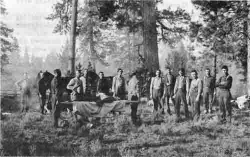
In October, the first rangers' meeting on the Crater Forest was held at Odessa, Ore., for the Crater and Fremont National Forests, from the 18th through the 21st. In attendance were:
CRATER: M. L. Erickson, Supervisor; William C. Neff and Ira Tungate, Forest Rangers; Delbert W. Myers, George H. West, John D. Holst, Floyd M. DuBois, Andrew T. Poole, Carl E. Ward, and Walter F. Wright, Assistant Rangers; Edward S. Kerby, Fred Stanley and Frank Carlson, Forest Guards; Scaler Duncan L. McKay; and Lumberman T. W. Andrews.
FREMONT: Guy W. Ingram, Supervisor; Gilbert Brown, Deputy Supervisor; Forest Rangers Jay Billings and Jason S. Elder; Assistant Ranger Carl M. Ewing; Forest Guards Elzie Linnville, Pearl V. Ingram, Lawrence Frizzell, Clifford Johnson and a Mr. O'Brien.
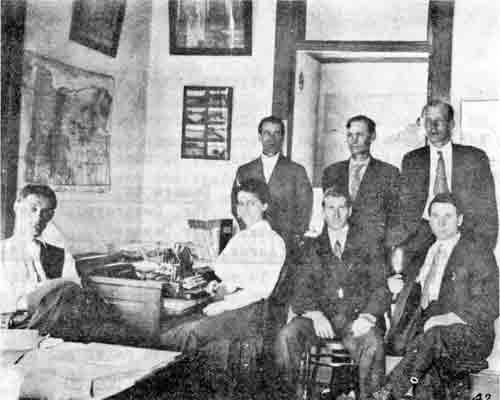
Crater—Fremont Ranger's Meeting
Odessa, Oregon
October 18 to 21, 1909
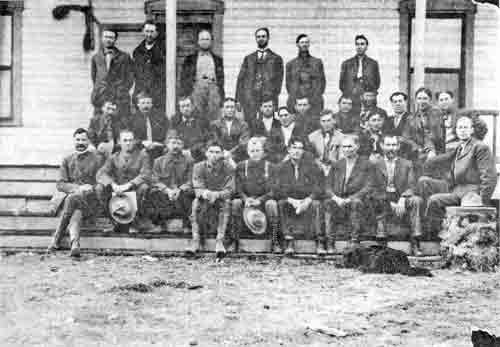
|
| Front row, left to right: 1. T. W. Andrews; 2. Ira Tungate; 3. William C. Neff; 4. Jay Billings; 5. Frank C. Carlson; 6. Edward S. Kerby; 7. Albert Peachey; 8. Delbert W. Myers; 9. Martin L. Erickson. Middle row, left to right: 10. John D. Holst; 11. Andrew T. Poole; 12. Lawrence Frizzel; 13. Pearl Ingram; 14. Fred Stanley; 15. Elzie Linville; 16. George West; 17. Carl Ewing; 18. Sam S. Swenning; 19. Jason Elder; 20. _______________; 21. Gilbert D. Brown; 22. Guy Ingram; 23. Martin O'Brien. Back row, left to right: 24. H. G. Whitney; 25. J. J. Simmerville; 26. _______________; 27. Stephen A. Moore; 28. Floyd DuBois; 29. _______________. The black dog is Bert Peachey's. |
LANDS
C. D. Willson of Klamath Falls, Ore., applied on Oct. 1, 1909, for a special use permit for a hotel at Rocky Point. A special use permit was issued on Nov. 9 for the same covering an area of 10.4 acres. It provided for a payment of $6.25 for the first year and a $25.00 fee for ensuing years.
The case folder has been destroyed. Above information was from the special use card, form 619. It is believed this is the first permit issued for a hotel at Rocky Point.
GRAZING
"Season started late due to heavy snowfall and late spring. No community interest. Each stockman runs his cattle independently of his neighbor. Better salting this year. Range divisions raised from 7 to 10. Ashland Watershed is closed to grazing. Driveways in use are: (1) Fish Lake Trail, (2) Ashland-Fort Klamath Wagon Road, (3) Rogue River Wagon Road to Natural Bridge, and (4) Golden Stairs from Natural Bridge to top of Umpqua Divide. No unusual losses. Experimenting with reseeding grasses. Recommendations: 8,250 cattle and horses, 7,000 sheep, for 1910. No change in seasons or fees."
The following grazing notice is illustrative of the type used to announce the grazing season and numbers permitted.
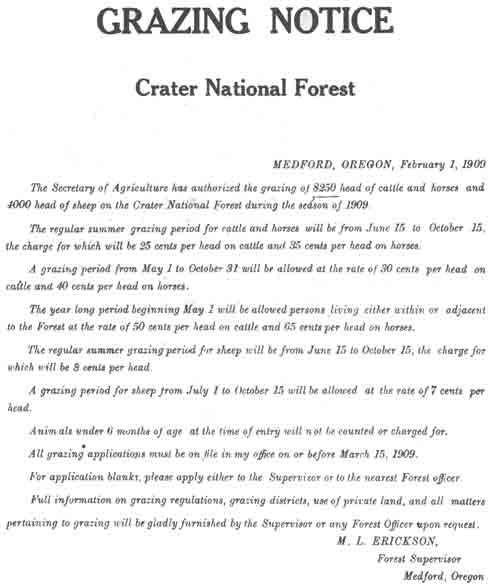
|
| (click on image for a PDF version) |
FIRE ACTIVITY
Supervisor Erickson wrote the District office on Jan. 28, 1909, requesting an additional summer force to help in reducing the number of fires and the high cost of fighting them. Quoting from his opening statement, "Last year the inadequacy of patrol on this Forest was convincingly demonstrated at a cost of about $25,390. From fighting fires alone, the cost amounted to over $2,967 and the damage to standing timber was placed at $22,431...... I strongly recommend that the patrol force of this Forest be doubled during the fire season. This will mean a summer force of 16 men instead of 8 last year."
He went on to cite examples of how the rangers were unable to examine claims, grazing allotments, timber sale work, etc. He goes on to say, "What in my opinion should be the effective and economical administration is an arrangement by which the higher class of rangers may have at least 50% of their time available for other forest work besides patrol. It is of course practicable to a certain extent to keep on the lookout for fires while carrying on general forest work. By limiting the districts to five or eight townships in this Forest, a ranger with one or two assistants for patrol can very effectively control such an area. In order to satisfactorily conduct the business of the Forest it is necessary that some of the rangers have a free hand and sufficient time to look after special uses, timber work, grazing, claims, improvement, etc."
Summary of Fire Activities for 1909
The following data was obtained from Form 926, "Annual Fire Report":
| Class & Number | |||||
| A | B |
C | Total | ||
| 1. | Fires originating on National Forest lands | 3 | 3 | 10 | 16 |
| 2. | Fires originating on private lands inside national forest boundaries | 1 | 7 | 8 | |
| 3. | Fires originating outside national forest boundaries | 1 | 4 | 5 | |
| Total number of fires | 3 | 5 | 21 | 29 | |
| Lightning | Incendiary | Campers | Unkown | Misc. | Total | |
| 4. Causes of all fires reported | 2 | 8 | 8 | 10 | 1 | 29 |
5. Damage from all fires:
| Damage to Timber, Reproduction, & Forage | ||||||||
| Location |
Timbered (Acres) |
Open (Acres) |
Total (Acres) |
Tbr. Destroyed or Damaged |
Reproduction Value |
Forage Value |
Total Value | |
| MBF | Value | |||||||
| Nat'l For. lands | 1,280 | 1,370 | 2,650 | 3,514 | $5,125.75 | $1,881 | $27 | $7,033,75 |
| Private lands inside nat'l for. bdries. | 1,967 |
445 | 2,412 | 3,744 |
6,001.00 | |||
| Total | 3,247 | 1,815 |
5,062 | 7,258 |
$11,126.75 | |||
6. Cost of fighting all fires:
| Division of Costs |
Temporary Labor |
Guard & Ranger Labor |
Tools, Supplies, Transportation |
Total Cost |
Value of Cooperation |
| Nat'l For, lands | $272.90 | $210.50 | $416.55 | $899.95 | $32.25 |
| Private lands inside nat'l. for. bdries. | 136.50 | 40.00 | 44.50 | 221.00 | 1.25 |
| Outside nat'l. for. bdries. | 67.75 | 12.50 |
17.70 | 97.95 |
----- |
| Total | $477.15 | $263.00 |
$478.75 | $1,218.90 |
$36.50 |
Area burned over equals .045 percent of forest.
Timber damaged equals .006 percent of total stand.
|
| Forest Supervisor's Office — Jackson County Bank Building, Medford, Oregon. 1909. Left to right: Front row: Sam S. Swenning, Annie D. O'Brien, Billie Shannon, John E. Gribble. Back row: Harold D. Foster, Bert Peachey, M. L. Erickson. |
|
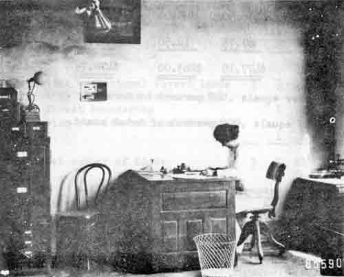
| Forest Supervisor's Office — Schemmerhorn Building, Medford, Oregon. 1910. Annie D. O'Brien at her desk. |
|
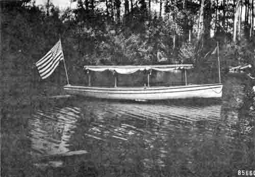
| Forest Service Launch on Odessa Creek at Odessa Ranger Station. This launch used for rapid transportation in case of forest fires and for communication between points on the Crater National Forest tributary to Klamath Lake. — Foster, 1910 |
1910
Following is a list of the entire force on the Crater in 1910 (from "The Crater Ranger" of July, 1910):
Forest Supervisor — Martin L. Erickson, Medford Deputy Supervisor — Samuel S. Swenning, Medford Forest Assistants — Harold D. Foster, Medford Bartle T. Harvey (until June) William E. White (EOD July 10) Forest Clerks — Billie I. Shannon, Medford Annie D. O'Brien, Medford
Administrative Divisions (Districts):
| No. | Name | Ranger in Charge | Title | Hdqtrs. |
| 1 Upper Rogue | George H. West | Asst. For. Rgr. | Mill Cr. RS | |
| 2 Butte Falls | John D. Holst | Asst. For. Rgr. | Mosquito RS | |
| 3 Dead Indian | James J. Simmerville | Asst. For. Rgr. | Dead Indian RS | |
| 4 Odessa | William C. Neff | Forest Rgr. | Odessa RS | |
| 5 Fort Klamath | Stephen A. Moore | Asst. For. Rgr. | Seven Mile RS | |
| 6 Ashland | Floyd M. DuBois | Asst. For. Rgr. | Long's Cabin | |
| 7 Applegate | Horace G. Whitney | Asst. For. Rgr. | Thompson Cr. RS | |
| 8 Trail | Andrew T. Poole | Asst. For. Rgr. | Trail RS | |
| 9 Bessie Creek | Edward S. Kerby | Forest Guard | Bessie Cr. RS | |
| 10 Clover Creek | Walter F. Wright | Asst. For. Rgr. | Clover Cr. RS | |
| 11 Hutton | William C. Fruit | Asst. For. Rgr. | Perches Pasture |
Forest Guards:
| District | Name | Hdqtrs. |
| Upper Rogue | Henry E. Koontz | Brown's Cabin RS |
| Dead Indian | Albert L. Peachey | Moon Prairie RS |
| Odessa | Frank Carlson | Pelican RS |
| Trail | Carl B. Neal | Trail RS |
| Trail | J. D. Van Dyke | Sugar Pine RS |
| Trail | Harry A. Young | Trail RS |
Reconnaissance Crews:
| Name | Title | Location |
| H. A. Winkenwerder | Forest Assistant | Odessa District |
| H. H. Barbur | Forest Guard | Odessa District |
| J. F. Pernot | Forest Guard | Odessa District |
| Harold D. Foster | Forest Assistant) | University Camp on Four Mile Creek |
| Clarence Underwood | Forest Guard ) | |
| R. Hodgson | Forest Guard ) | |
| H. D. Nuffler | Forest Guard ) | |
| A. Rosemond | Forest Guard ) |
Scaler:
Duncan L. McKay, Jr. — Pelican Bay sales

|
| (click on image for a PDF version) |
PERSONNEL CHANGES
Forest Clerk Horace G. Whitney took the rangers' examination in late 1909 and in the spring of 1910 was sent to Thompson Creek Ranger Station to take charge of the Big Applegate District.
Billie I. Shannon transferred in January, 1910, from the Treasury Department, Washington, D. C., to replace Whitney as Forest Clerk. Annie D. O'Bren also started in January, 1910, as assistant clerk.
Duncan L. McKay, Jr., scaler, was detailed to the Crater from the District office to assume charge of the sales and scaling at Pelican Bay. W. T. Andrews, lumberman, was also detailed to the Crater from the District office to examine proposed sales in the Pelican Bay area.
John E. Gribble was still on detail to the District office working on claims examination.
George H. West, John D. Holst, and Andrew T. Poole spent six weeks from January to March at Seattle, Washington, attending the rangers' short course at the University of Washington.
James J. Simmerville was appointed Assistant Forest Ranger in June.
Royal U. (Doc) Cambers started to work as a laborer on Ashland District.
William C. Fruit was appointed on May 12, 1910, as Assistant Forest Ranger in charge of the Hutton District.
ORGANIZATION
The enclosed map shows the boundaries of the Administrative Units (Ranger Districts) as they existed in 1909 and 1910. The Hutton Unit (No. 11) is not shown on the map, but it was referred to several times as a separate and distinct unit.
Following is the allotment estimate submitted by Supervisor Erickson for the year 1909-1910:
SUMMARY OF SALARY AND EXPENSE ALLOTMENT, 1910.
% salary and expense allotments __________
Area 1,119,834 acres.
Crater National Forest
Estimate 1909 - 1910
| No. | Title | Salary | Months | Total |
| 1 | Supervisor | $1600.00 | 12 | $1600.00 |
| 1 | Dep. Supervisor | 1400.00 | 12 | 1400.00 |
| 1 | F. Assistant | 1400.00 | 12 | 1400.00 |
| 1 | Dep. Ranger | 1200.00 | 12 | 1200.00 |
| 1 | Dep. F. Ranger | 1100.00 | 12 | 1100.00 |
| 7 | Asst. Rangers | 900.00 | 12 | 6300.00 |
| 3 | Asst. Rangers | 900.00 | 8 | 1800.00 |
| 4 | Asst. Rangers | 900.00 | 4 | 1200.00 |
| 1 | Clerk | 900.00 | 12 | 900.00 |
| $16,900.00 |
General Expenses
| Travel | $ 680.00 |
| Equipment | 150.00 |
| Office rent | 360.00 |
| Light and heat | 55.00 |
| Telephone rent | 24.00 |
| Toll charges | 20.00 |
| Printing | 5.00 |
| Repairs | 220.00 |
| Signs | 5.00 |
| Miscellaneous | 50.00 |
| Total | $ 1749.00 |
| Permanent force | Rangers | acres | 1,119,834 |
| Summer force | 16 | ||
| Cost per acre | .014 | ||
|
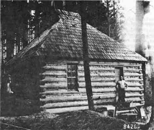
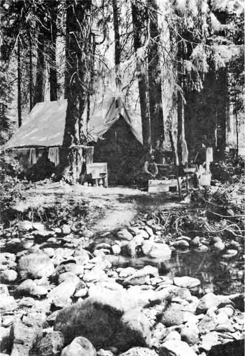
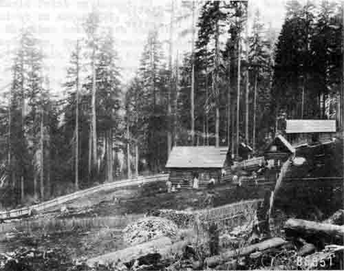
| Mosquito Ranger Station - Butte Falls District. |
|
| Thompson Creek Ranger Station - E. G. Whitney |
FIRES
The summer of 1910, an unusually dry one, witnessed an unprecedented number of fires upon the Crater Forest. Thirty-seven fires gained a start at different times during the dry season and burned over areas ranging from 25 to 32,768 acres, and totalling 60,800 acres before they were subdued. Some of them were confined to brush areas, but all told they killed on the Forest 250,000,000 feet board measure of merchantable timber. In addition, 75 small fires, ranging from abandoned camp fires to areas of five acres, were extinguished by rangers in the regular course of their patrol work.
A large part, perhaps a majority, of all the fires are believed to have originated from carelessness on the part of hunters and campers. Unfortunately, the open season for game in Southern Oregon begins on August l and brings many persons into the mountains when the fire danger is greatest.
At the beginning of the fire danger season the ranger and guard force on the Forest, available for patrol work, numbered 17 men. Each one of these had, on an average, 66,000 acres of rough, mountainous country to cover; and as a result, many fires had gained great headway before being discovered. During the summer 1,000 men were employed in fighting the fires on the Crater Forest, but even this number proved inadequate. Five companies of United States Troops were therefore ordered to the Forest by the War Department and rendered efficient service in subduing the flames. In all, the cost to the Forest Service for fire fighting on the Crater Forest during 1910 amounted to $40,000.
(From Bulletin #100, Forest Service,
USDA, The Crater National Forest, 1911)
A partial list of the largest fires occurring in 1910 follows:
| District | Name of Fire | Acres Burned | Timber Destroyed MM Bd. Ft. |
| Butte Falls | Cat Hill | 30,000 | 25 |
| Butte Falls | South Fork | 10,342 | 55 |
| Clover | Clover Creek | 5,960 | 28.5 |
| Trail | Buzzard Mine | 5,888 | 69 |
| Trail | Evans Creek* | 5,000 | 12 |
| Trail | Needle Rock | 2,000 | 20 |
| Applegate | Windy Peak | 2,500 | ? |
| Ashland | Glade Fork | 600 | ? |
| *4,000 acres burned on the Umpqua National Forest, but all control work was done by Crater personnel. | |||
Soldiers were used mainly on the Cat Hill, South Fork, and Brushy Hill (Ashland) fires. C. J. Buck from the District office, and Homer Ross, Deputy Supervisor of the Columbia (Gifford Pinchot) National Forest, were among the several officers detailed to the Crater to help with fire suppression.
Some of the hardships in patrolling for and fighting forest fires in the early days of administration of the national forests can be appreciated more by a few excerpts from the annual report of Horace G. Whitney, Assistant Ranger in charge of the Applegate District #7:
"There is approximately 80,000 acres of public land and 60,000 acres of alienated land within my district, making a total 140,000 acres of land to patrol. Sixty to seventy miles daily would have to be travelled in order to fully patrol this area.
"About 20 per cent of this area was protected by daily patrol. Twenty per cent by alternate daily patrol. Forty per cent of this area was protected by semi-weekly patrol, and 20 percent, including portions lying back in the mountains and practically inaccessible, protected by less frequent patrol......There are roads traversing the main creek valleys and in some places are branch roads running a mile or two up the larger tributaries. There are no Forest Service roads or trails in this district, and one must depend upon the cattlemens' trails; and none of these are graded up and usually follow the lines of least resistance and little or no swamping done.......In several cases this summer it was impossible to reach the fires with men and supplies until two days after first sighting the fires.......
"There are no Forest Service telephone lines in this district. There are about 30 miles of private line in the district. These lines, being built along the valleys where fire danger was slight, were not always available but were used to good advantage in collecting crews of men among the local ranchers and prospectors. A line or two built across the mountains would greatly increase the efficiency of patrol, making it easier to report without coming out to the valleys, thus leaving the forest unprotected, and for directing the movement of crews on other fires without abandoning patrol to do so in person."
TIMBER MANAGEMENT
Timber reconnaissance on the east side of the Forest was undertaken. Mr. Foster spent the entire field season on this project with a crew of four college students. Their first camp was at Odessa, then at Four Mile Creek, and later at Lake of the Woods. One more member of the crew was a cook-packer; supplies were shipped by water from Klamath Falls to Odessa, and then packed to the camp. Mr. Foster returned to Medford on Nov. 19, after an absence of five months, during which time he did not see his family.
The limitations of transportation and communication are evident in all the records; lack of dependable maps was also a handicap, and the rangers were constantly striving toward a better knowledge of their districts and the preparation of sketch maps.
Floyd M. DuBois, assistant ranger, was headquartered in Ashland; as nearly as can be determined his district consisted only of Ashland Canyon and the Wagner Gap country. Most of his time during the summer was spent on fire fighting, both on his own district and the Applegate. In November he established a planting camp at Long's Cabin, for the purpose of sowing seed on the new burns. He states that they worked in 14 inches of snow on Thanksgiving Day and were "thankful it is no deeper." In December he made timber estimates in Reeder Gulch, and then ran boundary lines for homestead entries.
J. J. Simmerville, assistant ranger, headquartered at Dead Indian Ranger Station "in the vicinity of Lily Glen." After rebuilding the headquarters cabin, he spent considerable time on range work, riding as far as Dead Indian Soda Springs, where he "visited with campers." Depending upon infrequent visits to ranches for obtaining fresh provisions, he lived for extended periods on "corn dodgers and boiled beans." Frequent climbs to the top of Brush Mountain provided fire detection. A rather plaintive note in his diary is indicative of the difficulties of the period: "I wish that I might have 200 ten or twelve-inch spikes to drive into trees on high points so as to be able to climb them. At every lookout one's view is more or less obstructed by surrounding trees. Ofttimes a fellow can climb a tree and does, but it's a touchy piece of business to be risking one's frame on brittle limbs in a lone forest several miles from anybody and a long, long way from home and the dependent babies. Spikes would offer a quicker, easier, safer and cheaper method of ladders than cleats or pegs."
William Fruit was assistant ranger at Hutton. He spent the early part of the summer on trail work and range riding. He frequently rode to Yellowjacket and Lilly Mountain to look for fires; through October he was on fire suppression, then joined the planting crew on the Butte Falls District. There was stage service from Jacksonville to Hutton.
Horace G. Whitney was assistant ranger at Thompson Creek. There were many fires on his district which were believed to be of incendiary origin; in August he was called to Medford for conference with C. J. Buck, A. H. Cousins and Mr. Melrose concerning fire trespass.
In December, Whitney and Forest Clerk Shannon took saddle and pack-horses to Pelican for wintering. Caught in a storm, they found a cabin with a little hay for the stock, where they spent two nights and a day. When the storm broke, they rode all one day, and part of the night (remarking on the beauty of the bright moonlight on the snow) then camped out "under a tree" and completed the trip the next morning.
W. C. Neff was stationed at Odessa, in charge of the district which included the C. S. & R. S. Moore timber sale. Odessa was an important center on the Forest. A Forest Service launch was used to travel to Klamath Falls; the ranger station was also a post office and Neff sorted and distributed the mail. Communication to Medford was by telephone through Lake Creek; there was also a line to Fort Klamath, which connected with Klamath Falls, and over which telegrams were transmitted when the Lake Creek line did not function.
|
| Cottonwood Camp of Forest Service timber estimators on Four Mile Creek. - H. D. Foster, 1910 |
|
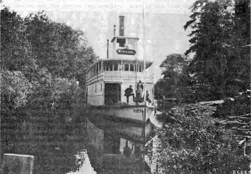
| Steamboat Winema at Odessa Ranger Station, Crater National Forest. The steamboat carried freight and passengers from Klamath Falls to points on Klamath Lake. -- H. D. Foster, 1910. |
|
| (click on image for a PDF version) |
|
| Caring for wounded firefighters, Anna Creek Fire - 1910. |
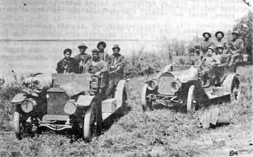
|
| Transporting firefighters, Anna Creek Fire - 1910. |
In the spring of 1910 oak and hickory trees were planted (or seeded) at Pelican. In October Neff found 42 oaks and 63 hickory trees there.
Timber sale administration was developing; Neff informed the operator on the Moore sale that the stumps were too high and that merchantable logs left in the woods would be scaled double.
When the Cat Hill fire started, Neff was instructed to obtain men and supplies. He went to Klamath Falls by launch, hired 47 men and bought food, and sent them to Odessa by commercial boat "Winema." They camped at Odessa overnight, and Neff cooked for them over camp fire He hired four four-horse rigs the next morning, and went with them to Four Mile, then on to Cat Hill.
In November, three of his children became ill with diptheria, and after three days' illness he took them to Klamath Falls by launch. After their recovery he improved the house by tacking cheese cloth to the walls and applying wallpaper, so winter quarters would be more comfortable. Then he split shakes and built a barn, pig pen and chicken coop. He "kept five stoves going" all winter, with temperatures as low as 17 below zero.
The first summer home lots on the Forest were surveyed by Neff and Scaler McKay at Rocky Point in 1910. The survey was suggested by application of Mr. S. A. Nye of Medford, and in one day ten lots were rented.
Community parties were held at Odessa Ranger Station where Mrs. Neff played the piano and served supper. Commercial boats ran on regular schedule to Klamath Falls. The Odessa House served as post office, store, hotel and general loafing place for the town of Odessa:
"The Odessa Louse (Hotel) which is also the property of the Southern Pacific Railway Co. has been closed, and the gates locked and labeled 'Pass On'. Odessa is now but a ranger station. But say who has seen such a ranger station. The front room is the office of the ranger of the district, also the post office of the postmistress of Odessa, who is none other than Mrs. Neff. A pathway flanked by noble red oaks, imported at great cost, leads down the terrace to the steamboat landing, and the famous Budd Spring. And the green grass grows all around. Such is Odessa — once a famous summer resort, later the sporting ground of a railway king and his factotum. Even the genial and pompous Colonel has passed away and is seen no more among the snipes and thunderpumps of the desolate marsh. But others there are who still abide — an ex-mayor is building a $4,000 mansion on Crystal Creek, while an 'influential citizen' has again applied for a frolicking ground for goats."
H. D. Foster, The Crater Ranger, July 1910
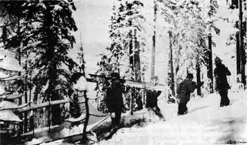
Frank Carlson, guard, was stationed at Pelican and worked under Ranger Neff's supervision. Pacific and Eastern Railroad surveyors camped at Pelican that summer. Carlson patrolled for fire during the summer, then went to the Cat Hill fire. After that he built a bridge on the road near Pelican. After taking the ranger examination in Medford on October 24 and 25, he helped establish the planting camp at Cat Hill. When rains started, he rode horseback from Twin Ponds to Odessa and return to get a tent. On December 22, after planting timothy seed at Mosquito, he walked to Fish Lake, and then made skis to cross the divide, stayed overnight at Lake of the Woods and arrived at Pelican at 1:00 P.M. on December 23.
Stephen A. Moore, assistant ranger, was stationed at Seven Mile; most of his time was spent on fire control and timber sale work. He found a fire on Gardner Peak on August 22 and had it controlled by August 30. In October he obtained permission from the supervisor to travel to Medford for fruit and vegetables. Leaving on October 6, with his wife and baby, he drove four horses and wagon to Prospect; he arrived at Medford at 8:00 P.M. on October 7. On the return trip he spent four days and stopped over at Derby, Prospect, and Whiskey Creek. He stayed at Seven Mile through the winter, driving to Fort Klamath with team and sleigh.
Andrew T. Poole, ranger, was stationed at Trail, but his family lived at Drew. Much of the spring and early summer was spent on trail work and "looking over the range" which he continually notes as "in good condition." He irrigated "tree plantation #8 near Trail Ranger Station," and on September 30 removed cans and hoods from the little trees. From August 20 to September 20 was spent on fires at Buzzard Mine and Needle Rock. In November he went to Portland to testify before the Federal Grand Jury regarding fire left burning by a hunting party at Buzzard Mine in August.
George West, ranger, was headquartered at Mill Creek Ranger Station, while his wife lived at Prospect. In July he counted 1,410 sheep at Anderson Camp (Minter's). On August 9 he found 20 wagons at "Wagon Camp" on Huckleberry Mountain, and a hundred people camped at Huckleberry City. On August 19, to reach a fire on Bald Mountain, with 15 men, he felled a log to cross Rogue River with men and tools. In September there were fires on Middle Fork and McCall Creek. In October he established the Crater Lake Road Camp and worked with crew through October and November, moving to Medford on December 7. (See list of 1910 improvements.)
John Holst was ranger in charge of Butte Falls district. Whether Butte Falls or Mosquito was considered his headquarters is not clear. The largest fires were on his district and he had little time during the summer for other work. In the fall he surveyed the burned areas, examined several homestead entries (usually referred to as "June 11 claims") and then established the Cat Hill planting camp.
Walter Wright was assistant ranger, headquartered at Clover Creek Ranger Station and in charge of the Clover District. He built a new wagon road from Clover Creek to Buck Lake, and started to work on a house. Then he fought the Clover Creek fire from August 18 to September 2, with crew of 65 men which he hired in Klamath Falls. Working alone, and dressing the lumber by hand, he built a two-story house. On October 13 he moved his family from tents into the house; later he put in the windows and finished the interior, and built a barn. He and his family remained at Clover through the winter in deep snow.
Albert L. Peachey, forest guard was assigned to the Dead Indian District, but worked on the Butte Falls fires and also helped Gribble on homestead inspections. In October and November he was with the Crater Lake road crew.
William E. White, forest assistant, camped at "Saw Mill" near Seven Mile and worked on timber reconnaissance. Later he moved camp to Devil's Peak and then to Malone Springs, Four Mile Lake and Clover. He returned to Medford in October and made fire study on Trail District in November. Then he located section corners above Union Creek. Travel from Medford to Seven Mile involved train trip to Klamath Falls via Weed, mail boat to Odessa, horse-drawn stage to Fort Klamath, where he was met by Moore with horses. Travel time: three days.
Samuel S. Swenning spent most of the summer on the Butte Falls District fires He guided the Army troops from Medford to the fire; train to Eagle Point on August 22, on foot to Big Butte Bridge and camp overnight on August 23; to Red Blanket Ranch and camp overnight on August 24; then broke into smaller groups and to different fires.
In September, Swenning made a joint range inspection with officers of Klamath National Forest, studying drift between the two forests. He spent most of November in vicinity of Trail and Elk Creeks, looking for evidence of fire causes, and inspecting homesteads He attended dance at Elk Creek schoolhouse for purpose of talking with settlers about the man-caused fires. In December he spent several days running survey lines so that the exact position of the Rogue River Gorge could be mapped, and also surveyed the Union Creek Ranger Station site.
IMPROVEMENTS
Improvements constructed in 1910 included the following:
Crater Lake Road — 10 miles from Park Boundary to Union Creek, of which 2-1/2 miles was new location, using $5,000 allotment. Crew consisted of 20 men, with mule teams. Work was done in October and November, mostly stormy weather. Guard Henry Koontz in charge, George West, Bert Peachey and Ed Kerby worked on crew.
Clover Ranger Station dwelling, 16 x 24, 2 stories — By Walter and Mrs. Wright.
Clover Ranger Station barn — By Walter and Mrs. Wright.
Odessa dwelling remodeled.
Bessie Pasture — 17 acres fenced by Ed Kerby.
Sterling Pasture — 20 acres fenced.
Wagner Glades Pasture — 6 acres fenced.
Clover Creek Pasture — 76 acres fenced by Walter and Mrs. Wright.
Pelican Pasture — 200 acres fenced by Frank Carlson.
Abbott Prairie — 17 acres fenced.
Except for the road, all of this construction work was done by the regular Forest officers, usually one man working alone with hand tools. Wire was packed in to remote locations, ready for fence construction the following spring, to Sugar Pine, Rabbit Ears, Woodruff Meadows, Imnaha, Black Bear, Luck, Lake of the Woods, Rainbow and Dead Indian.
|
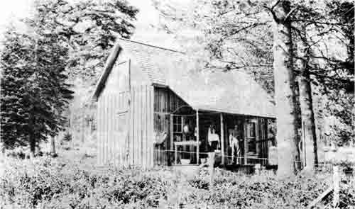
| Pelican Ranger Station - H. D. Foster, 1910 |
|
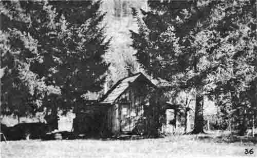
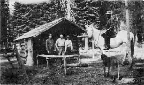
| Lake of the Woods Ranger Station Cabin. The one-room cabin was built by a trapper many years before the photograph was made. John D. Holst on the horse. |
|
| Clover Creek Ranger Station. Built by Walter and Mrs. Wright in fall of 1910; two-story house, 16' x 24'. — M. F. Patterson, 1913 |
|
| The Joe Hendricks Homestead. Picture taken on March 27, 1910 by J. E. Gribble, Claims Examiner, "shows the Hendricks home, family and improvements, the garden in which may be seen strawberry vines and remnants of last year cabbage, also a glimpse of the timber." |
SILVICULTURAL WORK
Major timber sales in operation were Pelican Bay Lumber Company on Varney and Four Mile; Fred Melhase, Moore Brothers, Utter and Burns and Long Lake lumber companies, all on Klamath District. (Closed timber sale cards are in files of the supervisor's office of Rogue River National Forest.)
Planting projects included Cat Hill, where approximately 1,000 acres were seeded to Scotch pine, European larch and Norway spruce, and 300 acres on Brushy Hill in Ashland Canyon. This seeding was all done on snow from November, 1910, to February, 1911. John Holst was in charge of the work, assisted by J. J. Simmerville, Bill Fruit, Frank Carlson, Carl Neal, Hodgson, Nuffer, and some temporary laborers. They camped in tents at Twin Ponds, elevation 5,500 feet above sea level. Supplies were hauled by wagon as far as roads were passable, then packed by horse. Snowshoe Camp was named by the fact that the crew worked on snowshoes. The deep snow permitted them to walk over the burned brush in areas which they could not otherwise have traversed. Work continued on every day that storms would permit, even on Thanksgiving and Christmas Days. Brief report of examination of plantation, made in 1911, shows that the broadcast-seeding of larch and spruce was a complete failure, but That the spot-seeding of Scotch and Yellow pine appeared to he partially successful. Assistant Forester W. B. Greeley and Assistant District Forester Ames examined the plantation and believed the soil was not suitable for the species.
In the fall of 1910, Region 1 circularized all forests, asking each forest officer to donate $1.00 for the care of injured and burial of persons killed on the Montana fires. This was before legislation provided for compensation for injury.
Cat Hill Seeding Project
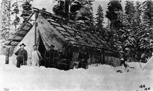
|
| Snowshoe Camp. (Shake roof under construction.) Forest officers' camp on the Cat Hill seeding project. |
|
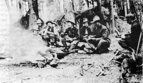
| Dinner time for the seeding crew. |
|
| Ranger Simmerville, Guards Nuffler and Hodgson and an unidentified laborer hauling in wood at Twin Ponds during the Cat Hill seeding project of 1910. |
|
| Reforestation of the Cat Hill burn by artificial seeding in the winter of 1910. |
|
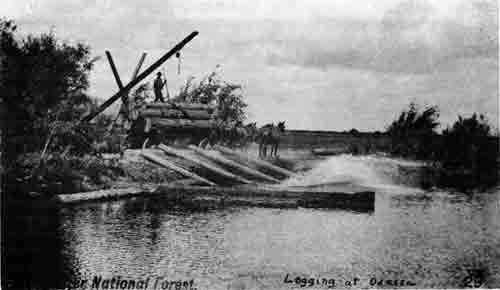
| Unloading logs at Odessa on Klamath Lake, 1908. |
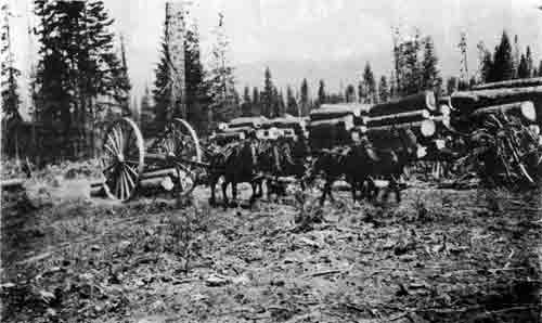
|
| Logging with the big wheels. Pelican Bay Lumber Company sale, 1913. |
GRAZING NOTES FOR 1910
General Grazing Conditions. Season started early and the range develop 2 or 3 weeks before opening of grazing season. No early entries permitted. No rain in summer resulted in severe drought. However, grass had a good start by July 1 and no hardship resulted.
Stock entered the forest in poor condition but due to good forage they soon fattened and by the latter part of August a large percentage of beef cattle was marketed. Some ranchers went out of business due to scarcity and high price of hay.
"Methods of Handling Stock. About 25% of the stock which came off the summer range never receive any hay during the winter. They are turned loose on the exposed foothills to shift for themselves. The foothill range has for the past 20 years been overstocked, and consequently the cattle that receive no attention during the winter come out in the spring in exceedingly poor condition. If there is no more than 25% loss, some of the stockmen consider their stock have passed the winter successfully.
"The lack of community interest among the stockmen is very noticeable and this same condition has existed ever since grazing in this section of the country began. No cooperation, except by one or two individuals prevails anywhere among users of the Forest. An attempt was made last year to get them to cooperate in buying salt and hiring riders, but it was impossible."
Range Divisions. No change over last year. Ashland Creek Watershed closed to grazing.
Driveways. No need for additional ones. Recommended 5 drift fences:
(1) Between Dailey Prairie and Elk Prairie — 3 miles.
(2) Between Little Elk and Dead Indian, and South Fork — 3 miles.
(3) Between Conde Range and Soda Range — 3 miles.
(4) Between Little Elk and Moon Prairie — 4 miles.
(5) Between Willetts Range and Minter Range — 1 mile.
"Permit Allotments. Due to so much patented land, 90% of permits are under Regulation 54. Recommend no maximum limit as there is no chance for range monopoly.
"Protection and Improvement. Losses negligible. Some reseeding being done on burned-over areas.
Stock Associations. No recognized grazing associations.
Recommendations.
| 8,250 cattle | ) | for 1911 |
| 5,000 sheep | ) | |
| 2,000 goats | ) | |
| 500 hogs | ) | |
| Seasons — no change (they varied from yearlong to 4 months). | ||
| Fees — no change. | ||
1911
PERSONNEL
| Forest Supervisor | — | Martin L. Erickson |
| Deputy Supervisor | — | Samuel S. Swenning |
| Forest Assistants | — | Harold D. Foster |
| William E. White | ||
| Forest Clerks | — | Billie I. Shannon |
| Annie D. O'Brien |
Administrative Divisions (Districts):
| District No. | VALIGN="bottom"Name | Ranger in Charge | Title | Hdqtrs. |
| 1 | Upper Rogue | George H. West | Asst. For. Rgr. | Mill Cr. R.S. |
| 2 | Butte Falls | John D. Holst | Asst. For. Rgr. | Mosquito R.S. |
| 3 | Dead Indian | James J. Simmerville | Asst. For. Rgr. | Moon Pr. R.S. |
| 4 | Odessa | William C. Neff | Forest Rgr. | Odessa R.S. |
| 5 | Fort Klamath | Stephen A. Moore | Asst. For. Rgr. | Seven Mile R.S. |
| 6 | Ashland | Floyd M. DuBois | Asst. For. Rgr. | Ashland |
| 7 | Applegate | Horace G. Whitney | Asst. For. Rgr. | Star R.S. |
| 8 | Trail | Andrew T. Poole | Asst. For. Rgr. | Trail R.S. |
| 9 | Bessie Creek | Edward S. Kerby | Forest Guard | Bessie R.S. |
| 10 | Clover | Walter F. Wright | Asst. For. Rgr. | Clover R.S. |
| 11 | Hutton | William C. Fruit | Asst. For. Rgr. | Hutton R.S. |
Scaler — Duncan L. McKay, Jr., Pelican Bay sales.
Forest Guards:
| Assigned to | Name | Hdqtrs. |
| Applegate | Clint Gallatin | Little Applegate |
| Applegate | Benjamin L. Campbell | Steamboat R.S. |
| Ashland | Robert Goodyear | Ashland Canyon |
| Butte Falls | Carl B. Neal | Lodgepole R.S. |
| Butte Falls | A. T. Sackrider | Lodgepole R.S. |
| Butte Falls | B. W. Read | 34—2 area |
| Dead Indian | Albert L. Peachey | Big Elk R.S. |
| Dead Indian | Royal U. Cambers | Moon Prairie R.S. |
| Odessa | Frank L. Carlson | Pelican Bay R.S. |
| Odessa | Mr. Zachary | Pelican Bay R.S. |
| Trail | J. D. Van Dyke | Trail R.S. |
| Upper Rogue | Henry Koontz | Brown's Cabin R.S. |
| Upper Rogue | Mark Koontz | Huckleberry Mt. R.S. |
PERSONNEL CHANGES
John D. Holst served as ranger on Butte Falls District until August. He was then assigned to work with Forest Assistant Foster.
They finished cruising on Labor Day. Upon arriving at Pelican Bay Holst was immediately assigned as scaler on the Pelican Bay Lumber Company sale at Pelican Bay.
James J. Simmerville was transferred to the Butte Falls District to replace Holst.
Albert L. Peachey, Forest Guard, was placed in charge of the Dead Indian District to replace Simmerville.
John E. Gribble returned to the Crater Forest in February from his detail to the district office on claims work.
Guard Carl B. Neal, reappointed Forest Guard on April 1, took a 9-months leave of absence starting September 2, to attend the Yale Forestry School. A. T. Sackrider replaced Neal as Guard at Lodgepole Ranger Station.
E. A. Braniff, Forest Assistant, was detailed to the Crater Forest for the summer, to help on reconnaissance work on the Forest. His tenure is believed to have been from February, 1911 to January, 1912.
Edward S. Kerby and Anna R. Kincaid were married on June 29, 1911, in Ashland, Oregon. Horace G. Whitney was married on September 16.
Edward S. Kerby, Forest Guard, was reappointed on April 3. Henry E. Koontz was reappointed Forest Guard on April 10.
Assistant Ranger Walter F. Wright requested leave of absence from October 16 to May 1.
Assistant Ranger Albert L. Peachey was on furlough from November 1 until May 31.
Bert McKee was reappointed Forest Guard during the worst part of the fire season and helped patrol the area around Steamboat.
Duncan L. McKay, Jr., scaler, resigned in July.
ALLOTMENTS FOR FISCAL YEAR 1912
| Miscellaneous Roll | $7,225 | ||
| General Expense: | Timber Sales | $5,500 | |
| Land Examination | 300 | ||
| Travel | 1,800 | ||
| Rent | 600 | ||
| Station Supplies | 200 | ||
| Horse Feed | 1,600 | ||
| Executive Expense | 400 | 10,400 | |
| Subtotal brought forward | $17,625 | ||
| Statutory Rolls | 15,800 | ||
| Total Allotments | $33,425 | ||
SILVICULTURAL WORK
The Cat Hill reseeding job went ahead during the early part of the year, finally ending in March. James J. Simmerville was in charge, assisted by William C. Fruit, Frank Carlson, R. Hodgson, H. D. Nuffer, George H. West, Andrew T. Poole, Horace G. Whitney, and three temporary men. Jess Fredenburg served as packer, supplying provisions for the camp. Supervisor Erickson also helped out for several periods of two weeks or less. They camped in tents at Elk Wallows in Section 16, T. 35 S., R. 4 E., W.M. There was six feet of snow on the ground at camp in January. A total of 1,100 acres were seeded to Scotch Pine, European larch, and Norway spruce, 500 acres by seed spots and 600 acres by scattering seed on the snow. A total of 1,135 pounds of seed was used. One man can seed eight acres per day on snowshoes.
Ranger DuBois also reseeded 350 acres on Brushy Hill up Ashland Creek, by the seed-spot method.
The timber sale to Pelican Bay Lumber Co., Klamath Falls, was approved by Chief Forester Henry S. Graves on May 29, 1911. It included a total volume of 103,512,000 board feet of timber valued at $271,889.75. It expired June 30, 1916. Sale area included Varney Creek and Four Mile Creek. The company built a canal from Pelican Bay to high ground. It was 3/4 mile long, 50 feet wide, 8 feet deep, and cost $6,000 to $8,000 to build. They also constructed a sawmill with a capacity of 150,000 board feet per day, 3 miles above Klamath Falls at the foot of Upper Klamath Lake, at Shippington. They built a large camp near Pelican Bay, employing a crew of 50 or 60 men in the woods. They will log in the most modern fashion, using donkey engines and logging railways.
Other sales made were to Fred Melhase on Jan. 12, 1911, for a total volume of 4,469,000 board feet of timber valued at $12,289.75.
Another sale was made on May 16, 1911, by Supervisor Erickson, to Eugene Fowler and F. A. Crane of Ashland for 500 cords of wood valued at $241.25. It expired on October 1, 1911. Cost of sale administration was $54.13.
Another sale to Utter & Burns, Fort Klamath, was approved by Charles H. Flory, District Forester, on Nov. 10, 1911, for a total volume of 3,445,000 board feet valued at $10,990.25.
E. A. Braniff, Forest Assistant, with a reconnaissance crew of about 15 forest students completed a survey and cruise of the timber on the east side of the Cascade Range, between Crater Lake Park and Pelican Butte.
Harold D. Foster and John D. Foist cruised the timber on a strip 300 feet wide from Willow Creek on the Butte Falls District across the mountain to Malone Springs, above Pelican Bay. This was done in the event that the Pacific and Eastern Railroad would extend across the mountains. They also cruised the timber at Four Mile Lake that will be flooded when the lake is raised to form an irrigation reservoir.
The rangers collected forest tree seed in the fall, mostly Western white pine and Noble fir. They shipped four or five wagonloads of seed from Central Point, collected by Rangers West, Kerby, and Peachey. Ranger Wright also collected seed around Clover Creek.
Bulletin #100 of the Forest Service, U. S. Department of Agriculture, entitled "The Crater National Forest, Its Resources and Their Conservation" was issued on Nov. 28, 1911. This bulletin is in the files of the Rogue River National Forest.
IMPROVEMENT WORK
Lodgepole Ranger Station house completed.
A trail 3-1/2 miles long was constructed by Simmerville, Peachey, Kerby and Underwood between Lodgepole and Black Bear Stations.
Rangers Whitney and Fruit built two trails up the Middle Fork of the Applegate to make Fruit's travel over his district easier.
The Crater Lake Road was completed on June 22. It was cleared for a width of 18 or 20 feet. All brush was burned. They constructed a new bridge across Whiskey Creek and 2-1/2 miles of new road. They moved camp to the John Day Trail and on July 5 had this 23 miles of trail completely cut out, so that now access was easy to Diamond Lake.
A small cabin, 12 x 16 feet, was built on Ashland Creek about 1/4 mile above the City intake.
A new cabin was built at the Star Ranger Station. A new fence was built at Moon Prairie which will be the headquarters for the Dead Indian District in place of Dead Indian near Lily Glen.
Telephone lines were constructed between Prospect and Brown's Cabin by P. Stidham, and between Butte Falls and Lodgepole by Ed Fry. By August 16, the telephone crews had built 66 miles of lines with about five miles to complete, between Imnaha Tool Cabin to Bessie Ranger Station. The Butte Falls-Brown's Cabin telephone system extends from Butte Falls, where connections are made with Medford, to Lodgepole, Prospect Trail, Imnaha Cabin, Prospect, Mill Creek, Woodruff Meadows, Union Creek, and Brown's Cabin. It was now possible to make connections from any point on this line with Medford via Butte Falls or via Prospect. Ranger Wright with one or two men built a line from Clover Creek Ranger Station to Buck Lake and the Dead Indian line, making it possible to talk to Medford. The telephone line from Ashland to Ashland Butte, a distance of about 15 miles, was completely repaired. Frank Carlson and one man constructed a telephone line between Four Mile Lake and Long Lake, a distance of four miles.
They also constructed a trail from Island Lake to Blue Canyon, and built the Lake of the Woods fence and the Long Lake Tool Cabin.
FIRE WORK
The Jackson County Fire Protection Association was formed on June 10, due to the diligent work of Supervisor Erickson, to get the timber owners to unite in a combined effort to reduce the annual fire loss. Messrs. F. A. Elliott, State Forester, and C. S. Chapman, Secretary and Manager of the Oregon Forest Fire Association, helped to organize the Jackson County Association. A fire warden was appointed by the State for Jackson County, and a number of guards were employed by the Association to patrol their holdings, and acted as State Fire Wardens.
Some of the rangers on the Crater also were commissioned as State Fire Wardens for the fire season.
A motorcycle was transferred from the Olympic National Forest to the Crater Forest in August, for patrolling the Crater Lake Highway. The patrol was necessary to search for careless campers who left their campfires, and to catch vandals who shoot the insulators along the telephone line. William E. White was detailed to this job as he was acquainted with motorcycles. The patrol was difficult as the deep pumice dust impeded travel. This was the first piece of mechanized equipment on the Crater Forest.
By September there had been 58 fires extinguished by forest officers on the Crater Forest. Five of these fires burned over 100 acres each, but the majority were small and about 20% were campfires.
The largest was at Woodruff Meadows, covering 480 acres. Next in size was the Annie Creek Fire, burning about 350 acres.
There was a noticeable improvement in the attitude of the public this year toward care with fire in the woods.
Hunting season opened August 1, and attention of the field officers was called to the increased fire danger resulting therefrom. The Supervisor also suggested that each officer wear a red cap or fasten a bell on the neck of his saddle horse.
MISCELLANEOUS NOTES (From "The Crater Ranger" 1911)
Desk calendars were supplied to the office force and rangers to replace the promise cards, to improve efficiency.
***
The supervisor's office rented in February a Burrough's type adding machine for $5.00 per month. They could not afford to buy one as they cost about $375.
***
During the absence of Mr. Erickson in February, Ranger Neff was Acting Supervisor.
***
Messrs. Erickson and Swenning made a trip in June to the Klamath country. They followed the Grizzly Ridge to Dead Indian, then over the trails to Fish Lake and Lake of the Woods. After completing their work at Pelican Bay they went to Seven Mile Lake, visited Braniff at his camp on Three Mile Creek, crossed the Cascade Mountains via Huckleberry Trail, McKie's Camp and Bessie Rock. They found six feet of snow on top of the mountains but it was solid enough to carry horses.
***
The Medford office moved on August 1 from the Jackson County Bank Building to the upper floor of the new Schemerhorn and Palm's Building on South Fir Street.
***
There were 500 people at Odessa on Labor Day; travel was by steamboat, and they enjoyed baseball, races and dancing.
LANDS ACTIVITIES
By Presidential Proclamation dated June 30, 1911, and effective July 1, 1911, some additions and eliminations were made to the Crater National Forest. The map following this page depicts, for the most part, these changes. One that is not shown on the map is the "Panhandle Area" east of Crater Lake National Park. This area was transferred to the Paulina National Forest, by the same Proclamation on June 30, 1911.
REPORT OF THE FORESTER - NOV. 24, 1911
(For Fiscal Year Ending June 30, 1911)
"The policy of reducing the overhead charges to a minimum and expending the available money on operating expenses has been carefully applied also on the Forests themselves. In general, the organization of a Forest consists of a supervisor, deputy supervisor, a forest clerk and a group of rangers. The need of the deputy supervisor is to enable constant field supervision of the rangers and their work. An efficient clerk is frequently able to handle the bulk of the routine office business, so that often the supervisor and deputy supervisor can be in the field at the same time.......Where the work requires it, a forest assistant is assigned to the supervisor's office to assist him in miscellaneous lines of technical work and in such experimental and scientific studies as may be conducted on the Forest, In general there is a group of permanent rangers on each forest employed during the entire year. The force of rangers is kept down to the smallest number compatible with a permanent organization. During the summer additional rangers are appointed for from three to six months of service. The latter are recruited from the civil service register, as in the case of the permanent rangers. Temporary forest guards are also appointed during the summer for fire patrol, the construction of trails, and other temporary work.
"A systematic plan has been introduced to bring about the most effective distribution of the ranger's time. A detailed cost keeping plan has been put into effect, and the forest officers are developing plans on each Forest to make the ranger's work more effective. Already excellent results are being obtained, for the rangers as well as the higher officers have undertaken the problem with enthusiasm."
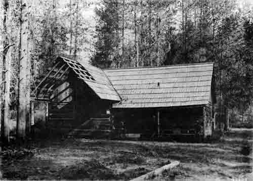
|
| Brown's Cabin Ranger Station. A three-room log cabin, fifteen miles north of Prospect. - A. G. Varela, 8-27-11. |
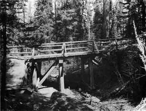
|
| Whiskey Creek Bridge from upstream, built on Medford-Crater Lake Road in 1911 by the Forest Service at a cost of $150. - A. G. Varela, 8-29-11. |
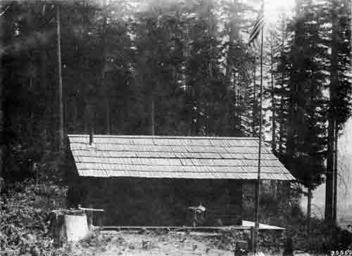
|
| Mill Creek Ranger Station, six miles north of Prospect. "Cabin was built years ago by a homesteader," according to the photographer. - A. G. Varela, 8-25-11. |
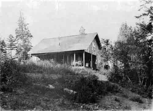
|
| Odessa Ranger Station. Ranger Neff and family on porch. - A. G. Varela, 9-2-11. |
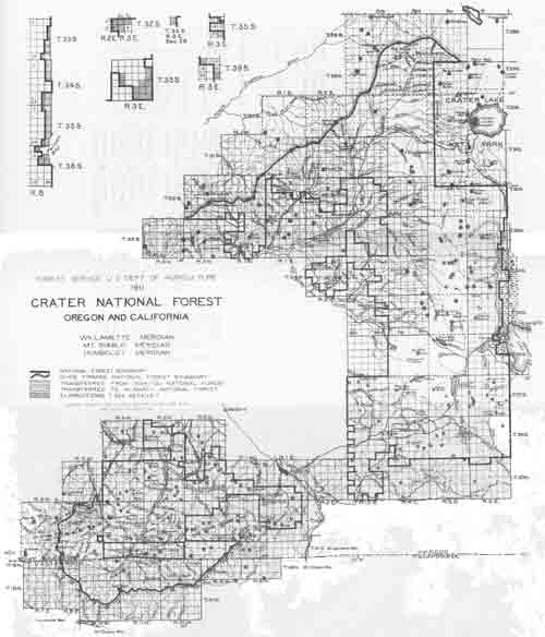
|
| (click on image for a PDF version) |
1912 TO 1916
Very few records were available for this five-year period. No diaries, except for one, Stephen A. Moore, were available. However, the data compiled is believed to be authentic. Mrs. Avah Kerby furnished data on her husband Edward S. Kerby's work at Pelican. M. L. Merritt, Portland, Ore., furnished data on the forest examiners, Deputy Supervisor Swenning, and several of the rangers. Bert A. Nason, James J. Simmerville, William T. Jones, John D. Holst, John E. Gribble, Royal A. (Doc) Cambers, Bruce Hoffman, and Martin L. Erickson also furnished data for this period. Mrs. Lee C. Port also furnished some information, as did Horace G. Whitney.
The personnel for this period would have been very sketchy without the help of the individuals mentioned above.
PERSONNEL
| Forest Supervisor | — | Martin L. Erickson |
| Deputy Supervisor | — | Samuel S. Swenning (until April 1913) |
| E. H. McDaniels (EOD July 1913) (Transferred June 1916) | ||
| A. E. Cohoon (EOD July 1916) | ||
| Forest Assistants | — | Harold D. Foster |
| (title changed to | William E. White (until December 1914) | |
| Forest Examiner, | E. A. Braniff (July 1911 to January 1912) | |
| 7/1/13) | Bruce Hoffman (EOD spring 1914) | |
| Oliver F. Erickson (EOD October 1916) | ||
| Forest Clerks | — | Billie I. Shannon (until November 1912) |
| E. Violet Cook (EOD Sept. 12, 1912) | ||
| Annie D. O'Brien (until April 1914) |
Forest Rangers:
| Dist. No. | Name | Ranger in Charge | Tenure | Hdqtrs. |
| 1 | Prospect | George H. West | Thru 1914 | Mill Cr. RS |
| Bert A. Nason | EOD 1915 | Mill Cr. RS | ||
| 2 | Mosquito | James J. Simmerville | Thru 1915 | Mosquito RS |
| William L. Jones | EOD spring 1916 | Mosquito RS | ||
| 3 | Big Elk | Albert L. Peachey | Moon Pr. RS | |
| 4 | Clover Cr. | |||
| 5 | Odessa | William C. Neff | Until Nov. 18, 1912 | Odessa RS |
| Edward S. Kerby | EOD September 1912 | Pelican RS | ||
| 6 | Ashland | Stephen A. Moore | 3/25/12 - 3/18/14 | Ashland |
| 7 | Star | Horace G. Whitney | Until spring 1913 | Star RS |
| John E. Gribble | 1913 | Star RS | ||
| Stephen A. Moore | 3/20/14 - 4/20/16 | Star RS | ||
| Joseph I. Mackechnie | EOD April 24, 1916 | Star RS | ||
| 8 | Trail | Andrew T. Poole | Until June 15, 1916 | Trail RS |
| William C. Fruit | EOD June 16, 1916 | Trail RS | ||
| 9 | Hutton | William C. Fruit | Until Mar. 24, 1915 | Hutton RS |
| 10 | Bessie | |||
| 11 | Seven Mile |
(The above district names taken from Crater Fire Plan for 1913.)
Scalers at Pelican Bay:
John D. Holst
George H. West (from 1915 on)
Stephen A. Moore (from April 20, 1916)
Andrew T. Poole (June 16, 1916 thru 1917)
Royal A. (Doc) Cambers (from 1914 on)
Some of the Forest Guards during this period were: William I. Jones, 1912-13 Huckleberry Mountain, 1914 Woodruff Meadows; Bert A. Nason, 1912-13 Hamaker Meadows, 1914 Brown's Cabin (as assistant ranger); Mark Koontz, Rogue River country; Clint Gallatin, 1912 at Sterling Ranger Station; Strickland, 1912 lookout on Ashland Butte; Royal Cambers, 1912 Moon Prairie, 1913 Lake of the Woods; Gus Stinson, 1913 lookout on Ashland Butte. Lee C. Port received his appointment as Forest Guard at $900 per annum on June 1, 1913, and was stationed at Sterling Ranger Station that summer. He was terminated on September 30. Port then received his appointment as Assistant Forest Ranger on June 1, 1914, and spent that summer at Lodgepole Ranger Station, and the summers of 1915 and 1916 at Hutton Ranger Station where he worked for Rangers Moore and Mackechnie.
Fort McKee was lookout on Palmer Peak; Rob Moore at Sturgis Ranger Station, 1914; J. C. Burton entered on duty May 4, 1915, at Star Ranger Station; Elmo Throckmorton also a guard; Cary Culy, lookout at Windy Peak; Dave Kennedy, guard at Sterling Ranger Station; Bert McKee, guard at Thompson Creek Ranger Station; all on Applegate District in 1915. William R. Parker was lookout on Rustler Peak, Butte Falls District, from 1913 until 1916. Mark Cline served at Lodgepole Ranger Station. (year unknown.)
PERSONNEL CHANGES
Deputy Supervisor Samuel S. Swenning transferred to the Tongass National Forest, Alaska, on March 20, 1913. He resigned from the Service on March 31, 1914. He was replaced by E. H. McDaniels from July 1913 until June 1916. A. E. Cohoon was assigned as Deputy Supervisor under Bartrum in 1905. It is not known where he was prior to his assignment to the Crater in 1916.
The "Forest Assistant" title was changed on July 1, 1913, to "Forest Examiner." William E. White was transferred in December, 1914. E. A. Braniff, Forest Examiner, left the Crater in January, 1912. Bruce Hoffman was transferred in the spring of 1914 to the Crater. Oliver F. Ericson, Forest Examiner, was on the Crater from about October 1916 to June 1917.
William J. Paeth, forest examiner, also had an assignment on the Crater during the spring of 1913. His tenure is not known.
Billie I. Shannon, forest clerk, transferred in November, 1912, to the District Office, Portland. He was replaced by Miss E. Violet Cook who entered on duty September 9, 1912. Annie D. O'Brien stayed on the job until April, 1914. Miss Cook took care of the office work alone after Miss O'Brien left, in a creditable manner, often serving as "Acting Forest Supervisor" during the supervisor's absence.
Some mention was made by Steve Moore on Oct. 1, 1914, that a Miss Lee was working in the supervisor's office at Medford. No other mention is made of her.
George H. West served as district ranger on Prospect District through 1914 when he was assigned as scaler at Pelican Bay. Bert A. Nason worked in 1912 and 1913 as forest guard at Hamaker Meadows for George L. West. He was appointed assistant forest ranger in 1914 and spent that summer at Brown's Cabin under West. He was placed in charge of the Prospect District in 1915 and worked in that capacity through 1917.
James J. Simmerville continued as district ranger at Butte Falls until the fall of 1915 when he resigned from the Service. William L. Jones worked as forest Guard at Huckleberry Mountain in 1912 and 1913. He worked at Woodruff Meadows as a patrolman in 1914, all under George H. West. He was placed in charge of the Butte Falls District in the spring of 1916.
William C. Neff resigned as forest ranger at Odessa on Nov. 18, 1912. He was reinstated in the same capacity on April 21, 1913, on the Whitman National Forest, Oregon, and resigned on April 10, 1915. Edward S. Kerby and his wife moved from Bessie Creek Ranger Station in September, 1912, to Pelican Ranger Station and served as forest ranger on the Pelican Bay District. Kerby attended the Ranger Short Course at the University of Washington, Seattle, with S. A. Moore, from Dec. 27, 1911, to March 22, 1912.
Frank L. Carlson moved to Seven Mile Ranger Station in the spring of 1912 as assistant ranger in charge of the Ft. Klamath District. Stephen A. Moore, assistant ranger, attended the Ranger Short Course at the University of Washington from Dec. 27, 1911, to March 22, 1912. He then bought a house in Ashland and assumed charge of the Ashland District on March 25, 1912. He served in this capacity until March 18, 1914, when he was transferred to the Star Ranger Station on the Applegate River. He served as assistant ranger in charge of the Applegate District until April 20, 1916, when he was assigned to scaling logs on the Pelican Bay sales. Moore and his family spent a year in a tent until the first house was built. His wife suffered much from the cold and was ill most of the winters. Joseph L. Mackechnie was assigned to the Crater on April 24, 1916, and was placed in charge of the Applegate District at Star Ranger Station.
Andrew T. Poole served as assistant ranger in charge of the Trail District until June 15, 1916, when he was assigned to scaling logs at Pelican Bay. William C. Fruit, assistant ranger, took over the Trail District on June 16, 1916. Fruit served as assistant ranger at Hutton Ranger Station until March 24, 1915, when he left for his home in the Willamette Valley. He later resigned on June 30, 1915, but was hired in June 1916, to replace Andy Poole as ranger in charge of the Trail District while Poole helped out on the scaling job at Pelican Bay. After Fruit left in 1915 the Hutton District was absorbed by the Applegate District.
ORGANIZATION
Sometime during this five-year period, ranger districts were re-organized. In 1916 there were but eight districts, while from 1910 to 1913 there were eleven. These eight districts are shown on the accompanying map and were described as follows in 1916:
District No. 1. Prospect — area 237,052 acres. Headquarters, Mill Creek Ranger Station, Prospect, Ore. District Ranger: Bert A. Nason.
District No. 2. Butte Falls — area 139,341 acres. Headquarters Mosquito Ranger Station, Butte Falls, Ore. District Ranger: William L. Jones.
District No. 3. Dead Indian — area 117,996 acres. Headquarters, Moon Prairie Ranger Station, Lilyglen, Ore. District Ranger: Albert L. Peachey.
District No. 4. Pelican Bay — area 178,436 acres. Headquarters, Pelican Ranger Station, Rocky Point, Ore. District Ranger: Edward S. Kerby.
District No. 5. Fort Klamath — area 132,150 acres. Headquarters, Seven Mile Ranger Station, Ft. Klamath, Ore. District Ranger: Frank I. Carlson.
District No. 6. Ashland — area 56,300 acres. Headquarters, Long's Cabin, Ashland, Ore. District Ranger: _____ _______
District No. 7. Big Applegate — area 208,619 acres. Headquarters, Star Ranger Station, Ruch, Ore. District Ranger: Joseph D. Mackechnie.
District No. 8. Trail — area 76,627 acres. Headquarters, Trail Ranger Station, Trail, Ore. District Ranger: William C. Fruit.
A joint rangers' meeting was held in Medford from Feb. 19 to 22, 1913, with the Crater, Klamath, Shasta and Siskiyou National Forests. C. J. Buck from district office; McDuff, supervisor of Siskiyou; Bartrum, supervisor of Umpqua; Florey, Romack, Rider, Foster, and Paeth were the instructors.
LANDS ACTIVITIES
By Presidential Proclamation dated July 19, 1915, eighty acres in Section 21, T. 48 N., R. 11 W., Mt. Diablo Meridian, near Hutton were eliminated from the Crater National Forest for the Copper townsite. Also, by the same Proclamation, the "Panhandle Area" east of Crater Lake National Park was transferred from the Paulina National Forest to the Crater. Remaining portions of the Paulina were transferred to the Deschutes and Fremont National Forests, and the Paulina National Forest ceased to exist. These changes are also shown on the map following this page, along with the boundaries of the eight ranger districts described above.
Official acreage of the Crater Forest is shown below. Source is a copy of the 446b report of June 30, 1916.
| State | County | Gross Acres | Alienated Acres |
Net Acres |
| California | Siskiyou | 61,020 | 10,755 | 50,265 |
| Oregon | Douglas | 57,125 | 227 | 56,898 |
| Jackson | 607,325 | 233,745 | 373,580 | |
| Josephine | 30,415 | 320 | 30,095 | |
| Klamath | 406,600 | 58,968 | 347,611 | |
| Forest total | 1,162,485 | 304,036 | 858,449 | |
| (Note on bottom of form:) | ||||
| Old Area Table — Crater | 1,080,500 | |||
| Eliminated 7/1915 | 80 | |||
| 1,080,420 | ||||
| Paulina — Forester's letter | ||||
| 11/3/15 | 82,065 | |||
| 1,162,485 | ||||
Prepared by H. D. Foster
Acting Forest Supervisor
SPECIAL POPULATION REPORT
Crater National Forest
Calendar Year 1912
| Occupation or Purpose | Within N. F. Boundaries | |||
| on N. F. Land | on Private Land |
Total | ||
| 1. | Resident Population: Settlers, etc. | |||
| Principally lumbermen or millmen | 7 | 11 | 8 | |
| Principally stock raisers | 4 | 121 | 125 | |
| Principally miners | 57 | 1 | 58 | |
| Principally farmers | 12 | 76 | 88 | |
| Forest Officers | 8 | -- | 8 | |
| Other occupations | 6 | 7 | 13 | |
| Women, children & dependents | 35 | 272 | 307 | |
| Total resident population | 129 | 488 | 617 | |
| 2. | Nomadic Population: Laborers, Campers, etc. | |||
| Logging: driving, scaling, clearing, etc. | 322 | 5 | 327 | |
| Grazing: herders, packers, etc. | 64 | 30 | 94 | |
| Prospecting, cruising, surveying, etc. | 106 | 20 | 126 | |
| Temporary Forest employees | 57 | -- | 57 | |
| Other occupations | 30 | 30 | ||
| Campers: hunting, fishing, berry- or nut-picking, boating, bathing, climbing, etc. | 3,500 | 3,500 | ||
| Guests: at houses, hotels, sanitaria, etc. | 125 | 55 | 180 | |
| Day visitors: picnickers, wayfarers, etc. | 2,100 | 145 | 2,245 | |
| Other purposes | 45 | 25 | 70 | |
| Total nomadic population | 6,349 | 280 | 6,629 | |
| TOTAL RESIDENT AND NOMADIC | 6,478 | 768 | 7,246 | |
| Men, women and children outside the forest, but intruding upon it | 160 | |||
| In addition to above, the total number of men, women and children outside the forest but dependent upon it for any purpose (except water) is | 1,000 | |||
Forwarded to the District Forester this 25th day of April, 1913
M. L. Erickson, Supervisor
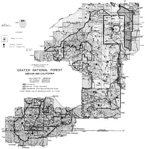
|
| (click on image for a PDF version) |
Forest Rangers who submitted a similar report for their districts were:
| Dist. No. | Name | Forest Ranger |
| 1 | Prospect | G. H. West |
| 2 | Butte Falls | J. J. Simmerville, Asst. |
| 3 | Dead Indian | Albert B. Peachey, Asst. |
| 4 | Clover Creek | |
| 5 | Odessa | by M. L. Erickson |
| 6 | Ashland | S. A. Moore |
| 7 | Big Applegate | W. C. Fruit, Asst. |
| 8 | Trail | Andrew T. Poole |
| 9 | Hutton | W. C. Fruit, Asst. |
| 10 | Bessie Rock | E. S. Kerby |
| 11 | Seven Mile | Frank L. Carlson |
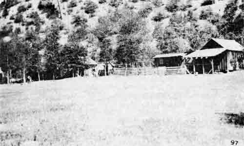
|
| Plaza at Hutton, Calif., on Elliot Creek. — By H. G. Whitney, 1912 |
(Copy)
Plans, General, Calendar year, 1913
The following shows the assignments of the administrative officers on the Crater National Forest:
District No. 1. The Ranger will go back to his District about May 1, and immediately engage in maintenence of trails, telephone lines, pastures and buildings in that District. The District comprises an area ranging in altitude from 3000 to 7000 feet. There are many miles of roads, trails and telephone lines to be repaired, and most of this work he will have to do alone. Some grazing starts in this District June 1, and from that date until the end of the grazing season he will probably devote 25% of his time to grazing. There will be some improvements constructed in this District this summer, and about 10% of his time will be devoted to that. June 11 examinations and special uses will occupy 10% of his time. Stationing lookout men and guards and helping them to get properly equipped and ready for their duties, and keeping them instructed as to their work during the summer, will occupy 25% of his time. Visiting the camps of the thousands of tourists that travel through this District and maintenance work will occupy another 25% of his time. The remaining time he may have will be devoted to fighting fires and directing the work of fire patroling in his District, and this of course will assume the preponderance to his other duties, and may occupy him if the season is bad fully 50% of his time during the summer season. About December 1 this District Ranger will be called from this District to engage on special assignments in other Districts, or perhaps on winter reconnaissance work. There is absolutely nothing for him to do in this District during the winter months, because at the ranger headquarters there is always three feet of snow from January to the latter part of March, and only a few trappers will be in the District.
District No. 2. This District comprises areas ranging from 2500 to 6000 feet in altitude. Fires may start here as early as July, but they never have because of the usual spring rains during May and June. The snow has all left the District at altitudes of 5000 feet and any kind of work can be carried on in it now. At the present time there is some June 11 work being carried on, and this work will occupy about 15% of the Ranger's time during the season. Maintenance of trails, telephone lines pastures and other improvements will occupy all of his time during May and June, and approximately 20% of his time during the rest of the season. The fire risk in this District is great. The ranger will probably devote 60% of his time to protection. Grazing while less important, will probably require 20% of his time. The rest of his time will be devoted to special projects, special uses, timber sales, and general administration.
District No. 3. This District is comprised of areas ranging from 2000 to 6000 feet altitude, mostly on the west side of the Cascade Mountains, and the snow goes early. Improvement and maintenance work can be begun as early as April, and in the higher altitudes that work can be begun in June. Grazing in this District is yearlong in the low altitudes, and it is the most extensive grazing District on the Forest. Probably 50% of his time is spent on that work. Trails and telephone lines, pastures and other improvements, require to be maintained, and fully 25% of the Ranger's time is devoted to that. Fire protection, special use, timber sales, administrative work, will completely occupy the remainder of the Ranger's time.
Districts 4 and 5. These two Districts are combined during the winter season. In the summer they are separated for convenience in fire protection and District 4 is administered by a Forest Guard. No work other than fire protection and improvement work exists in District 4, except a very little grazing.
In District 5 large timber sales occur, and the District Ranger spends about 50% of his time throughout the whole year on timber sale work. Special uses are also abundant and 15% of his time is devoted to them. The examination of June 11 claims occupies fully 10% of his time and the care of wintering stock occupies 15% of his time. Very little of his time can be charged to improvement work or fire protection. He is also supposed to take care of this work, and fire protection together with administration, occupy all the rest of his available time and more than the percentages indicated in bad fire years.
District No. 6. The Ranger in this District has enough June 11 work to occupy 30% of his time and grazing occupies about 25% of his time. Numerous small timber sales have all along taken up 25% of his time and special uses, maintenance of trails and telephone lines have comprised about one-fourth of his duties. The remaining time is spent on administration and general protection. This District includes the Ashland Creek watershed. Special protection is required for this and the Ranger can not very well afford to leave this area without some supervision for any long period of time. The fire risk in this District is rather great, and the boundaries of the Forest irregular, and administration is made rather difficult because of these things.
District No. 7. During all seasons except the fire season, this District is administered by the ranger in charge of District 6. The principal work in the District is grazing, examination of June 11 claims, maintenance of trails and fire protection. In summer the fire protection is the important work, and could occupy the ranger's entire time during July and August and September. Part of his time, however, is used on supervising construction work or in maintenence of trails and telephone lines.
District No. 8. The altitude varies from. 1500 to 5000 feet in this District, and is a yearlong district. The Ranger can not however, accomplish much in the winter time, except what little work he can reach from his station. This winter he was engaged at grubbing and clearing land and examining a few June 11 claims. The maintenance and repair of telephone lines and trails is a big item in this District because so many of them are necessary in order to cover the District. The topography is rough and there are no trails except those established by the Service. The fire risk in this District is one of the greatest on the Forest, and much additional protection in summer time is needed. The Ranger's time is probably divided as follows: 40% fire protection; 25% maintenance; 10% June 11 work; 10% grazing; 15% general administration.
District No. 9. This comprises the headwaters of the Applegate River and ranges from 2000 to 8000 feet in altitude. The topography is rough and many trails are therefore needed to properly reach all parts of the territory in the District. These improvements are expensive to construct and most of them are built from the improvement allotment. Considerable new improvement work is being carried on, together with the maintenance by the ranger himself. The grazing is limited, for only certain areas are suitable for forage. About 15% of the Ranger's time would go into grazing; about 50% to maintenance and supervision and about 30% to fire protection and the remainder of his time to special uses and general administration.
District No. 10. This is a summer District, varying in altitude from 3000 to 7000 feet. There is absolutely no work there in winter time and it is left to itself. In summer improvement work and maintenance occupies 50% of the guard's time and the remaining 50% is devoted to fire protection and general administration.
District No. 11. The altitude here varies from 4300 to 7000 feet. There is very little work in the winter time. Three feet of snow falls at the Ranger Station every year and remains from January to March. Unless there is cruising or some such similar work, the ranger is detailed to other districts during the winter months. Maintenance occupies possibly a month or two of the Ranger's time in May and June, while grazing and fire protection and new improvements occupy the major part of his time. Timber sales, including one sale of five million feet and 10 or 20 small sales, occupy 30% of his time. The remaining time is divided between fire protection and maintenance in about equal proportions.
(Copy)
Geography — Atlas
Names
Crater
FROM THE LIST
OF THE OREGON GEOGRAPHIC BOARD
Abbotts Butte, Jackson county, Oregon. — Named for Hiram Abbott, a former Indian agent, who settled in the vicinity in 1853.
Anderson spring, Crater lake National Park. — Named for Frank M. Anderson by Capt. O. C. Applegate, in 1888.
Annie Creek, Crater Lake National Park. — Named for Miss Annie Gaines in 1865. She, with Mrs. O. T. Brown, were the first women to descend to the waters of Crater Lake.
Applegate, Jackson county, Oregon. — Village and postoffice on Applegate river, a tributary of Rogue River. Named for Lindsay and Jesse Applegate, who explored the Rogue river region in 1846 and 1848.
Applegate Peak, Crater Lake National Park. — Elevation above the water 1958 feet. Named for Capt. C. C. Applegate, of Klamath Falls.
Arant Peak, Crater Lake National Park. — Named for W. F. Arant, of Klamath Falls, formerly superintendent of the park.
Ashland, Jackson County, Oregon, — Named for Ashland county, Ohio and the home of Henry Clay in Kentucky.
Aspen Lake, Klamath county, Oregon. — So named from the fine grove of aspen trees in the vicinity.
Bare Island, Klamath county Oregon. — An island in Upper Klamath lake. So called because it is bare of timber. Called by the Klamaths Onsma (or is it Ousma), meaning Isle of the Lake.
Buck Island, Klamath county, Oregon. — Known in 1865 as Rattlesnake island.
Buck Rock, Jackson county, Oregon. — On its top is a grove of live oaks, under which the deer formerly gathered and many a buck was shot there. Named in 1860 by Albert Winkle, a pioneer hunter and trapper.
Bybee Bridge, Jackson county, Oregon. — Located on Rogue River near Table Rock. For more than 50 years William Bybee operated a ferry at that point.
Cascade Range of Mountains. — So named for the cascades of the Columbia river, where that stream cut its way through.
Chiloquin, Klamath county, Oregon. — Derived from Chaloquins, the name of a noted Klamath chief, and signer of the great Indian treaty of 1864.
Dead Indian Road and Mountain, Jackson county, Oregon. — About 1854 some of the settlers of the Rogue River valley went up to the mountain valleys now called Dead Indian, and in one of them found two or three deserted wigwams, in which were the bodies of two Indians, supposed to have been Rogue Rivers. There was bad blood between the Rogue Rivers and Klamaths, and it was supposed hunting parties of the rival tribes met and left this mute evidence of a conflict. For over 20 years previous to 1870 this road only extended to Lost Prairie, in the Dead Indian region of the Cascades, but in that year Capt. C. C. Applegate, with a band of Klamath Indians, extended it to Pelican Bay on Upper Klamath Lake.
Eagle Point, Jackson county, Oregon. — Named in 1854 by John Mathews for an eagle's nest on a rocky point east of the town.
Flounce Rock, Jackson county, Oregon. — Named by Hiran Abbott, who lived near by, because the corrugations resemble the flounces of a woman's dress.
Four Bit Creek, Jackson county, Oregon. — So named in pioneer days because meals served at a wayside inn there cost four bits, or 50 cents.
Fourmile Lake, Klamath county, Oregon. — So named on the assumption that it was that long. Located on the Cascades near the base of Mount McLoughlin, on the old Rancheria Trail.
Gold Hill, Jackson county, Oregon. — Named by James Hayes, in April 1859. This refers to the hill itself where he discovered gold. The town was named for the mine.
Gold Bay, Jackson county, Oregon. — An electric power plant was established there by Col. Frank Bay of New York and so named by him.
Jackson county, Oregon. — Created Jan. 12, 1852 and named for Andrew Jackson.
Josephine county, Oregon. — Created Jan. 22, 1856 and named for Josephine Rollins.
Keno, Klamath county, Oregon. — The name first suggested was Klamath River, which was objected to by the postoffice department, as there were other offices using the word Klamath. Capt. O. C. Applegate then suggested Plevna, which was adopted. Later the office was moved up the valley and the name with it. This so incensed the inhabitants of the place that they secured a new office and named it for Capt. Ferree's dog Keno.
Klamath county, Oregon. — Created Oct. 17, 1882, and named for the Klamath Indians. This is not a Klamath word, but belongs to the Wasco tribe. Warm Springs Indians originally called those of the Klamath region "Claire Mote" meaning a clearing away of the fog. It is also claimed to come from two French words Clair Motis, meaning a light fog. The French Canadian trappers trapped through the Klamath region in winter when light mists or fogs hung over the lakes and springs. In his journal, made in the 30s, Peter Skene Ogden, a head trapper for the Hudson Bay Company, spelled the name Clammitte. A senate document of 1837 gives it as Clamet and Fremont in his journal of 1843 spells it Klamath. The Wasco Indian word Klamath means the ocean. The native name of the Klamath Indians is "Oux'-ka-ne", the people of Ouxy, or the Klamath marsh.
McLoughlin, Mount, Jackson county, Oregon. — So named by Donald McKay in 1832, for Dr. John McLoughlin, then the Hudson's Bay factor at Fort Vancouver. Name officially confirmed by the Oregon legislature, in House concurrent resolution No. 27, in February 1905. Once called Snowy Butte. Same as Mount Jackson of the Americans. Elevation 9,760 feet.
Medford, Jackson county, Oregon. — When the Oregon and California railroad was in course of construction, the postoffice was named for his home town, Medford, Massachusetts, by the chief engineer, in 1883.
Pelican Bay, Klamath county, Oregon. — So named by Capt. O. C. Applegate in 1866, because of the abundance of these birds there.
Pelican Peak, Klamath county, Oregon. — Elevation 7,250 feet. Named for the bay.
Persist, Jackson county, Oregon. — A man named William Willits met all sorts of ill luck, but persisted in staying there and in 1880, when a postoffice was established, it was called Persist in his honor.
Roxy Ann Peak, Jackson county, Oregon. — Originally known as Skinners Butte. Present name bestowed by pioneer packers in 1854, in honor of Roxana Baker, a pioneer woman who wielded a great influence over the Indians.
Ruch, Jackson county, Oregon. — Named by Capt. William Ruch in 1880, who was then postmaster.
Sams Valley, Jackson county, Oregon. — Named for Chief Sam of the Rogue River Indians, who formerly lived there.
Siskiyou Peak, Jackson county, Oregon. — Elevation 7,662 feet. Locally known as Wagner Butte.
Tolo, Jackson county, Oregon. — A man by the name of Cleophus Ragsdale, who lived on the site in 1885, petitioned for a postoffice, to be named Yolo, for his home county in California. The postoffice authorities took his Y for a T, and named it Tolo.
Trail, Jackson county, Oregon. — Located at the mouth of Stewart Creek and so named because a trail started north from that point, leading to Roseburg. The stream is usually referred to as Trail Creek, although it should be Stewart creek.
(Copy)
UNITED STATES DEPARTMENT OF AGRICULTURE
FOREST SERVICE
DISTRICT 6
ADDRESS REPLY TO
DISTRICT FORESTER
AND REFER TO
BECK BUILDING
PORTLAND, OREGON
Crater, Geography
Atlas (Names)
March 18, 1916.
Maps
Forest Supervisor,
Medford, Oregon.
Dear Mr. Erickson:
The U. S. Geographic Board at its meeting held December 1, 1915, January 5, 1916, and February 2, 1916, rendered the following decisions which pertain to names applied to topographic features on or near the Crater National Forest:
Hurryon; Creek, tributary to Rogue River, from the east, Jackson County, Oregon,
Lost; Creek, draining into Rogue River, Jackson County, Oregon.
Muir; Creek, draining into Rogue River, from the northwest Jackson County, Oregon.
Rock; Creek, emptying into Muir Creek, from the west, Jackson County, Oregon.
Weaver; Mountain, on boundary between Douglas and Jackson Counties, Oregon.
Very sincerely yours,
Acting Assistant
District Forester.
The famous Blue Ledge mining claims, located in the California portion of the Crater Forest at the head of Joe Creek, were patented on Jan. 8, 1912. First plats for these claims were filed in the Eureka Land Office on April 18, 1884. The survey plats (No. 4548) were filed on Aug. 14, 1908. Fourteen claims aggregating 248.76 acres were patented, known as Blue Ledge Consolidated Quartz Lode Mines. Patent was delivered in Washington, D. C. No evidence to the contrary was submitted, and all claims were patented.
SILVICULTURAL WORK
A timber cruising camp was set up at Mill Creek Ranger Station, north of Prospect, on Jan. 25, 1913. George E. Drake from the District Office, and D. W. Hodgman, forest assistants, were sent to the Crater to head up this survey work near Mill Creek Ranger Station. Crew members were S. A. Moore, George H. West, William C. Fruit, John E. Gribble, James J. Simmerville, Albert L. Peachey, Andrew T. Poole and William E. White (occasionally).
Pelican Bay Lumber Company, Klamath Falls, applied for a timber sale on Nov. 4, 1914. This sale was approved on June 11, 1915, by Henry S. Graves, chief forester. It included a total of 85,000,000 bd. ft. of timber on Four Mile Creek valued at $255,000. The company cut a total of 261,038,920 bd. ft. valued at $1,103,910.40.
The Lamm Lumber Company, Klamath Falls, was awarded a sale on Nov. 7, 1914, approved by Acting Chief A. F. Potter. It included a total volume of 20,650,000 bd. ft. of timber valued at $85,325. It expired June 1, 1919. The company cut a total of 29,888,820 bd. ft. valued at $89,919.91.
A planting crew worked on the Applegate District in the spring of 1916. They planted on Tallowbox Mountain. F. A. Willits was foreman in charge.
In June, 1913, S. A. Moore planted some Sequoia trees near Wash Out Gulch at the vicinity of Long's Cabin.
FIRE ACTIVITY
The disastrous fires of 1910, not only on the Crater Forest but in Washington, Idaho, Montana and other parts of Oregon, showed the necessity for a detailed plan of action on fighting forest fires. Quoting from the Report of The Forester for 1912, "...these plans outlined the system which would, at minimum expense, afford the maximum protection which the conditions demand; an inventory of all fire-fighting equipment; accurate maps showing types of forest cover, danger areas, means of communications and transportation, and location of lookout stations, fire breaks, camping grounds, settlements and other sources of supply for labor, equipment, food, and forage; determination of the fire liability of each type of forest based on the results of previous fires; means of transportation and communication between all portions of the forest and settlements where help can be obtained; detailed description of the lookout system necessary to cover the forest; what cooperation can be expected during the dry season or at the time of fires, and detailed instructions for each forest officer."
The fires on the Crater showed that more trails and telephone lines were also needed. Lack of trails hampered crews en route to fires. Foot messengers were used due to lack of telephone lines.
The first detailed fire plan for the Crater found in the files was for the year 1913. Following are excerpts from this plan.
CRATER NATIONAL FOREST
May 10, 1913.
Summary of Fire Plan. (next fire season)
Total area, 1,080,500 acres (Gross). Total value destructible resources, $12,883,000.00. Total cost of protection as planned $13,985 (Average)
Cost per acre 1.3 cents.
No. of Protective units, 11. Average area, 100,000 acres. No. of yearlong men, 8.
District headquarters — with telephone connection, 11. without telephone connection, 0. Primary Control Lookouts — with telephone connection, 3. (proposed) without telephone connection, 10. Secondary Lookouts — with telephone connection, 8.
Patrol Force.
Lookout men, 21. R. R. Patrolmen, 0. Ordinary patrolmen, 37. Cooperative patrolmen, 3. Per diem Guards, 0. Packers, 5. Teamsters, 2. Total, 65.
TRANSPORTATION EQUIPMENT.
| Class | Number now owned | *Total number needed | Available for hire |
| Pack Horses, | 1 | 10 | 47 |
| Teams | 0 | 2 | 38 |
| Motor Boats: | 1 | ||
|
Teams and pack horses distributed as shown on supplemental sheets. *Number owned plus additional number needed. | |||
The first table listed as Liability, the destructible resources with a total value of $13,883,000 for the eleven districts.
Table No. 2 listed the following conveyances available: Pack horses — government owned 1; available for hire at $1.50 per day - 47; Teams and wagons 38 at rates from $4.50 to $6.00 per day; motor boats 2; and 4 stages.
Table 3 listed the organization for the 11 districts as follows: Yearlong men 8; lookout men 21; patrolmen 37; cooperative patrolmen 3; packers 5; teamsters 2.
Table 4 listed the source of food supplies, number of available settlers, patrolmen and other available help for each district.
Table 5 listed the causes and number of fires by districts for the years 1909, 1910, 1911 and 1912.
Table 6 consisted of a separate table for each of the eleven districts showing the distances between important camps and watering places and the estimated hours of travel expressed in pack horse hours. A sample entry follows:
| From Supply Depot or Camp. Name. | Name of Road or Trail |
Miles No. | Hours No. | To Watering Place or Camp. Name. |
| Ashland | Dead Indian Rd. | 25 | 8 | Little Elk R.S. |
The next table listed an inventory of the various tools, canteens, cooking utensils, etc. for thirty seven different locations on the forest, including ranger stations, lookouts, ranches, and other cooperators.
The last table itemized the estimated cost of protection for the eleven districts. It included cost of supervision, tools, transportation, salaries of patrolmen, maintenance of protective improvements and other expense. Total estimated cost was $13,985.00 for an average cost of .013 cents per acre.
(Copy)
CRATER NATIONAL FOREST
District, Fire
Fire Plan.
In reference to circular letter of March 3:
PROTECTION - FIRE
Liability.
The liability of all resources on the Forest is tabulated in Table No. 2. The merchantable timber is valued at the present market price. The young growth is valued at what it costs to replace it, and the protection forest is valued at what it would cost to market the material reduced to cords locally. The determination of liability will not have so much to do with the allotment of funds for fire protection as is commonly supposed. Generally speaking, the areas possessing heavy, merchantable timber have the least hazard. This naturally, is so because there are less areas of dead timber, brush and exposed situations. The forest floor remains damp throughout the summer season, and any fire starting within the heavy, well-shaded timber is unable to gain headway before discovered and controled.
Hazard or Risk.
The maps will show the types and the relative hazard for each district.
In District No. 1 (Prospect) the hazard is confined largely to the old burns. In this district are some areas that bear heavy stands of timber where a fire could not make fast progress unless it had a wonderful start and a heavy wind prevailed. About one-third of the area in this district has been burned over and in these areas the great fire risk occurs. Campers in this district are numerous and diligent effort on the part of the Forest patrolmen is needed to watch the campers and to warn them of the dangers of leaving their camp fires. This district is also in the lightning zone, but since the lightning occurs in the early part of the season there usually is little difficulty in controlling lightning fires. Never yet has a lightning fire burned over more than 10 or 20 acres. The climate in this district permits of a fire season about 3 months long. The greatest danger, however, is from August 1 to September 15 when the fall rains may be expected. There are no logging operations or settlers in the district and it is difficult because of its distance away from settlements to secure fire fighters when needed. For that reason it would be always advisable to carry a large improvement crew throughout the summer in the district, or if this is impossible, to put on a number of laborers or guards who may be called upon to fight fire at any moment. Public sentiment in this district is good as far as the local people are concerned, but since it is a much patronized hunting and berry picking district, people from a distance with all sorts of sentiment visit it. The cost of fighting fires in this district is much higher than in some other districts largely because of the time required in getting men to the fires and the cost of transportation.
In this district there should be at least 2 lookoutmen and 4 patrolmen. In addition, there should be 2 improvement crews of 4 men each. In this way very little reliance is needed on local settlers and campers for fire fighting. The men already on the ground can get to the fire within an hour of the time it starts, and it need be very seldom that outside help would have to be called in.
The trails and telephone lines already existing in District No. 1 are shown on the map. Transportation for most parts of the district is very good, while there are some isolated areas very difficult to reach. One area in particular, lying just west of Rogue River in Township 31 South, Range 2 East, is difficult to reach. The river is impassable and no trails extend through it except from the Elk Creek side. The Abbott Butte region is difficult to get into and at present has no telephone communication. It is, this year, with the money possibly available proposed to extend a trail and telephone line to Abbott Butte. It is also proposed to build a line to Herschberger Mountain and this point will be used as a lookout. In this district there will be 2 lookout stations one at Herschberger Mountain and one at Bald Mountain, and if funds hold out, it is proposed to station 4 patrolmen in the district, one at Woodruff Meadows, one at Brown's Cabin, one at Huckleberry Mountain, and one at Hamaker Meadows. The man at Hamaker Meadows and the one at Huckleberry Mountain will be without telephone communication. As soon as funds permit we hope to extend the telephone lines to their camps.
It is possible to secure some cooperation adjacent to this district from the Jackson County Fire Partol Association. We have a standing agreement with them to report and fight fires 2 miles either side of the Forest boundary.
District No. 2. (Mosquito) The forest liability in this district is not so great as in District No. 1, but the fire hazard is exceedingly greater. On the slopes of Rustler Peak, the headwaters of Rancheria Creek, on Cat Hill, and on the slopes of Mt. Pitt, some of the greatest fire hazard in the Forest exists. The topography, too, is susceptible of large forest fires, because a fire can originate at the base of the mountain where many campers and hunters camp, and the wind always blows directly up the mountain side during the daytime. The fire season extends over a period of 3 months. Some of the old burns and the large brush areas are veritable fire traps. The greatest precaution in this district is necessary to prevent a fire starting in the brush and down timber, for such are difficult to extinguish with the general high wind prevailing. The map shows the relative fire risk, and the district warrants placing more men end expending more money in it than in some of our other areas. Except for the slopes of Rustler Peak and the headwaters of Rancheria Creek, the district is pretty well supplied with roads, trails, and telephone lines. A lookout is stationed on Rustler Peak and another lookout stationed on Robinson Butte can see over a large part of the district. These 2 lookoutmen can report most fires, but for the especially hazardous areas on Rancheria Creek and at the base of Rustler Peak there should constantly be two men on patrol. It is proposed to station in this district, one man in Township 34 — 2 East, one man on Rancheria Creek and one man at Snow Shoe and another man at Willow Prairie, if funds permit. There is a little plantation of about 100 acres of yellow pine adjacent to Snow Shoe. The fire risk adjacent to and in it is great. Tall grass and brush occur on all sides. A man should be stationed here if for no other purpose than to protect this little plantation.
The same sort of cooperation between the Jackson County Fire Patrol Association is available adjoining to this district as in District 1.
District No. 3. (Big Elk) Here we have a heavy liability and only a medium fire risk. The greatest hazard exists on the west side in the open, exposed ridges and burned over hillsides. Then in the south part of the district are some large brush patches. One particular area known as Brush Mountain is in itself a huge fire trap. The topography on the plateau is rather a help in checking fires because there are no great exposed areas. The climate allows a 3-month fire season and the greatest danger is from August 1 to September 15. The district is a pretty good camping and hunting ground, and it is always necessary to keep a close lookout of visitors from the cities. These sort of campers and hunters know very little about camp life and usually possess an unfavorable opinion of the Forest Service and believe in the annual light burning. In fact, this part of Southern Oregon is pretty well embedded in the sentiment that annual burning should be practiced. The settlers, too, in the south part of the district are strongly averse to the Forest Service, because some of them have not lived up to the homestead law. The causes of fire in this district are mostly from these campers and hunters. Lightning has never done any material damage. The relative hazard in the southern part of the district will warrant better protection there than we could heretofore give it. It is proposed to extend a telephone line to the top of Brush Mountain this summer and place a permanent lookout there. This will relieve the patrolman of the necessity of going on top of this mountain every day. He then can ride around other parts of the district. The north part of the district is pretty well covered by the lookoutman to be stationed on Robinson Butte. The ranger can ride the trails and visit camping places and try to be in telephone communication with the lookoutmen 3 or 4 times every day. Aside from this telephone line there are no improvements proposed, but there should be additional telephone lines. When funds permit such will be constructed as rapidly as possible. A pretty well assorted list of equipment is already available and located at the strategic points in the district.
We get very little cooperation in this district, but it is believed that the recent Oregon law, imposing a tax on private timber land owners will result in much badly needed cooperation which we do not now get. A great deal of private timber land is held in this district. The State of Oregon will render us the greatest cooperation in this respect. There is a heavily timbered region bordering on the west side of the district and the State men can patrol this and keep the fires from spreading on the Forest.
District No. 4. (Clover Creek) Old fires, much buckbrush, manzanita, lot of down timber, and exposed topography make this district pretty hazardous. Lightning causes a few fires in the early season but never does any great damage before we are able to control them. Campers are not numerous, but the public sentiment in and adjacent to this region is more unfavorable than favorable. In 1910 it was believed that a settler started the big Clover Creek fire. Naturally, he has a homestead. The last 2 years, however, were fairly free from fires because the lesson taught by the Clover Creek fire and other fires of 1910 even scared the unfavorably inclined.
A telephone line at the district headquarters connects with Klamath Falls and with the Forest Service telephone line in District 3. Some of the lookout stations are not available to a telephone, but in general it does not take long to reach a telephone station. No improvements are proposed in this district during the coming year. One wagon road enters this district and affords pretty reasonable access to the greater part of it. Trails are not numerous, but it is reasonably possible to get over the greater part of the district with pack horses. There are no regular lookout stations in the district but there are plenty of high points the patrolmen can reach in order to discover fires. It is proposed to have 2 horse guards stationed in this district during the summer season. The fire season lasts about 3 months. About 2 settlers are available in case of fire, but dependence is placed upon outside help in the event of larger fires than these men can control. Transportation from Klamath Falls is not bad and a crew of 10 or 20 men can be secured in 10 or 20 hours.
Some cooperation adjacent to this district is secured from the Klamath-Lake County Fire Protective Association. They have telephone lines running outside the boundaries of the Forest and we have free use of them. Our Clover Creek line connects directly with theirs. They would help us in securing men for any fire and would report fires on the Forest that we may not happen to discover. The district headquarters is well supplied with tools and cooking equipment. One of the men will be stationed at Clover Creek Station and the other will have a camp in the vicinity of Buck Lake. This arrangement divides the territory between them.
District No. 5. (Odessa) The resources of this district probably possess greater value per acre than any other district. We are making timber sales here. Unless some special arrangements are made it is doubtful whether we will get thorough protection of the cut-over areas. Since our object is to protect the young timber left on a cut-over area, we should give it special attention, and one man confined to those areas alone is no more than enough. When one man is expected to cover part of the whole district we cannot be sure of protecting our cut over areas. The fire hazard in the whole district is not comparatively great. About 2 guards and one lookoutman can cover the whole district. Besides these, the logging camps can readily furnish a supply of fire fighters. The pine needles occurring particularly on the cut-over areas will result in quick fires, and it is always feared we will lose the result of our careful silviculture because we cannot afford to give the cut over areas special protection. If funds permit, an effort will be made to do this the coming season.
The district is pretty well supplied with roads and telephone lines. There is only one decent trail in it, however, but since a great deal of the area can be traversed on foot, at least, we propose to make no improvements there the present year and use our money where it is thought to be more urgent.
There is no organized cooperation in this district but we always can depend upon the lessees of special use lots, hotels, etc. to aid us in fire control.
District No. 6. (Ashland) The relative liability is not very great in this district, but the fire hazard is. With a lookoutman stationed on Ashland Butte, and one guard patrolling the headwaters of Griffin, Anderson, Wagner, and Little Applegate, and another man especially detailed for the Ashland watershed, the cost of administration is going to run up greater for this district than on some other districts. But it is especially important to give the Ashland watershed special protection, and the lookoutman on Ashland Butte will be able to control parts of other districts. The climate permits of a 4-month fire season, and the topography stands out in bold relief, affording opportunity for the prevailing winds to carry fires to the very tops of mountains. Campers are quite numerous in the headwaters of streams, and some of them need careful watching in order to see that carelessness is not exercised. The public sentiment is about half and half. The idea is to cover the district so well by lookout and patrol so as to immediately discover fires and immediately extinguish fires.
A telephone line extends to the top of Ashland Butte, and some of the lower country is already tapped by telephones extending to settlers' homes. Trails are pretty well distributed in the district and there is very little difficulty of reaching nearly all parts of it with pack horses.
There has been no particular cooperation adjacent to this district, but we hope to get State and Association patrol adjacent to it this season.
District No. 7. (Star) This district possesses the least resources of any district on the Forest and at the same time in proportion to its area possesses the greatest fire risk. Brush, down logs, steep slopes, and dry climate all tend to make the fire risk dangerous. One compensating feature is that the public sentiment is, generally, in this district with us. A few outsiders come in who might leave fires or start fire purposely. Camping is not common because there is not enough timber to furnish the necessary shade. Hunting, however, in the brushy patches is pretty good and many people get over the district. It is often thought that the hunters become reckless with the use of matches and tobacco and would rather see the brush areas burned out to afford better hunting. The country has to be protected because of the water flow and because young timber is in many places coming up through the dense brush.
A main road follows the Applegate River and another road extends on the Thompson Creek side, affording pretty good communication by wagon. Trails are fairly numerous, and inaccessibility is not a question causing worry. It is proposed to construct a trail and telephone line to Palmer Peak and station a lookoutman there. From this point most of the area can be seen. In addition to this, a patrolman is needed along the lower slopes of Applegate River, and another man is needed on the Thompson Creek watershed. If funds permit, another man should be stationed in the vicinity of Forest Creek. It is pretty easy to secure a crew of 8 or 10 fire fighters in this district because the settlers are always anxious to secure work.
There is no cooperation except that furnished by settlers who always are glad to report fires and assist us in extinguishing them.
District No. 8. (Trail) This is another district in which the liability is not in proportion to the fire risk. A mild climate, low altitudes, exposed, sunny ridges, old brush, big brush patches, down timber, many campers and hunters all tend to make the fire hazard great. It is necessary to expend more money in proportion to the resources of this district for its protection than on some of the other districts. From past experience it is noticed that the fires start up in several different places simultaneously and spread rapidly. The settlers adjacent to the district are willing fire fighters and good ones, but their number is limited. By special patrol, all fires that start can receive immediate attention, and the 8 or 10 settlers that can be depended upon in the district with the assistance of the patrolmen will be able to control fires and protect the district satisfactorily, but with only 1 or 2 Forest officers in the district, whose presence in case of fire is needed at the fire, leaving no one on the area for patrol at such times, makes it almost impossible to properly protect the region. This was the situation in 1910 when a very serious fire occurred in this district. It is planned and hoped that sufficient funds are available to station a lookoutman at Blue Rock with telephone connections so that he and the lookoutman at Bald Mountain will be able to control most of the area. One of the guards will be stationed at Sugar Pine Camp, another very good lookout point but not connected with telephone, and possibly 2 other patrolmen may be available for patrolling the trails and visiting the camping grounds in the most frequented areas. With such a distribution of patrolmen it is possible to protect the area very well.
The only improvements that it is felt can be built this year is the telephone line to Blue Rock lookout. Many trails and other telephone lines are needed in the district, but their construction must be postponed until the improvement fund is large enough to permit of it.
In the north part of the district cooperation is secured with the Jackson County Fire Patrol Association. The same sort of cooperation as that described in District No. 1 will be had.
District No. 9. (Button) This district is located, for the most part, in California. It is important to protect it well because of the value of its resources and because the headwaters of the Applegate River are located within the district. The topography is rough and the climate permits of a 3-month fire season. Some old burns cover the district and afford serious fire traps. Campers and hunters are common. But it seems that they cooperate with us and very little danger so far from camp fires or from careless hunters has been reported from that region. Public sentiment in the district is strongly in favor with us. The greatest fire hazard is on Elliott Creek proper and on the Middle Fork of Applegate River. Some old burrs are located here, which if once a fire is well started in them will be very difficult to control.
Lack of telephone communication is one of the drawbacks to the protection of this district. During the coming season it is planned to build a spur line to the top of Windy Peak and another one to the top of Steve's Peak, thereby affording two lookouts which will fairly well cover the district. To complete the most satisfactory protection, a telephone line should be extended to the top of Whiskey Peak and another one to the top of Yellow Jacket Mountain. Then with telephone communication with the settlers and with the Medford office, if necessary, quite satisfactory protection is assured. These latter improvements cannot be made until our improvement fund will afford it. For the coming season it is planned to have a lookoutman stationed on Steve's Peak, one on Windy Peak, and a patrolman in the vicinity of Yellow Jacket, another one in the Steamboat watershed, and if possible, another man in the vicinity of Whiskey Peak. Trails are not numerous, but well distributed in this district. There are some regions quite inaccessible. Transportation, therefore, is a problem that will retard the proper protection of this district for some years.
In this district we have cooperation from the Klamath National Forest on the south and the Siskiyou National Forest on the west. Last summer the lookoutman on the Klamath National Forest reported several fires for us and assisted us very satisfactorily in locating the fires. An agreement is also reached with the Supervisor of the Klamath National Forest to help patrol and protect the south side of Elliott Creek which is given over to the grazing of Klamath River stock users. On the west side our relation to the Siskiyou is more difficult because of the high range of mountains. It is probably easier to approach Sugar Loaf Mountain and Grayback Mountain from Sucker Creek and Williams Creek on the Siskiyou side than it is from the Crater side. I am sure Mr. Macduff and I will reach some satisfactory adjustment before the season is started for better protection of this part of the district. About 6 or 8 men can always be depended upon for fire fighters in the district, and by calling for settlers far away it is possible to secure a force of 10 or 15 men within 10 or 20 hours. The district ranger is made a California State Fire Warden, and as you know, the California state law allows the ranger power to conscript persons for fire fighting.
District No. 10. (Bessie) This district has the greatest liability of any in proportion to area and probably has the least fire hazard in proportion to area. Consequently, the cost of administration per acre is much smaller than the other districts. The reasons for the small hazard are, first, lack of campers and hunters, second, heavy timber, making a damp forest floor, third, inaccessibility except by established trails, and fourth, the general favorable climatic and topographic conditions. Lightning is common in this district, but as mentioned before, lightning never causes us any serious trouble. We are always able to extinguish lightning fires before they gain noticeable headway. It is an interesting fact that on this Forest not a single lightning fire has ever gotten beyond control.
The existing trails are all Forest Service trails and it is pretty easy to keep check on the people that enter this district because they must traverse these trails and cannot hide very far away from them. One guard stationed at the district headquarters can be in constant touch with the lookoutman stationed on Rustler Peak and Bald Mountain who cover parts of this district. It is proposed this season to extend the telephone line from this station to the top of Bessie Rock and place a lookoutman here. In this way complete control of the district is assured. In addition, a patrolman at Black Bear Camp located midway between this district and District 3 will afford protection for part of this district in connection with his work on the other district. A few more trails are needed to better open up some parts of the region, but we need trails so much more in other districts that we can well afford to postpone these until our improvement funds will permit of constructing them.
District No. 11. (Seven Mile) The liabilities in this district are little less than the average and the fire risk is a little less than the average. One man at station headquarters, patrolling the well traveled roads and trails, one man at the northern part, patrolling the camping and watering places, and one lookoutman on Klamath Point are planned for this coming season. It is hoped that our improvement fund will permit of the construction of a telephone line to the top of Klamath Point. With this lookout the district will be pretty well cared for, and besides one adjoining district will be largely covered from this lookout station.
At present communication by telephone is limited to the outskirts of the district and the roads do not penetrate very far back into it. Trails, however, are very well distributed, but we need a few others connecting up different parts of the district. In all, however, it is not considered hard to control fires and with the lookout stations as proposed, very good protection of the district is certain.
Medford, Oregon,
May 13, 1913.
/s/ M. L. Erickson
Forest Supervisor.
The following contract between Pacific Telephone and Telegraph Company and the Secretary of Agriculture is believed to be the first such contract affecting the National Forest. It is included herein with that thought as this type of contract or agreement has been continuously used since the initial date.
CONTRACT
Between
THE PACIFIC TELEPHONE AND TELEGRAPH COMPANY
and
THE SECRETARY OF AGRICULTURE OF THE UNITED STATES
For Telephone Service in Connection
With the National Forests
THIS AGREEMENT, made this 27th day of August, 1915, by and between the Pacific Telephone and Telepraph Company, a corporation organized and existing under and by virtue of the laws of the State of California (hereinafter called the "Telephone Company") of the first part, and the SECRETARY OF AGRICULTURE OF THE UNITED STATES (hereinafter called the "Secretary") of the second part,
WITNESSETH:
WHEREAS the Telephone Company operates a general public commercial telephone exchange and toll line system, which includes certain exchanges and toll lines located in the neighborhood of certain national forests under the jurisdction of the Secretary and situated, in whole or in part, in the territory of the Telephone Company; and
WHEREAS the Secretary desires to utilize, as an aid to the administration, protection and preservation of said national forests and in fire prevention and control, certain special telephone facilities which the Telephone Company is able to supply, and the Secretary also desires to procure from the Telephone Company, in connection with fire prevention and control and in the administration of said national forests, telephone exchange and toll line service; and
WHEREAS the Telephone Company is willing to furnish, for the foregoing purposes, the special telephone facilities and the telephone exchange and toll line service hereinafter mentioned, and is also willing, to the extent and in the manner hereinafter set forth, to cooperate with the Secretary and to enlist as well, so far as possible, the cooperation of the Telephone Company's subscribers in the vicinity of said national forests, in facilitating and supplementing the operations of the Secretary in fire prevention and control;
NOW, THEREFORE, in consideration of the premises and of the covenents and agreements hereinafter set forth, it is agreed by the parties hereto as follows:
ARTICLE I.
The Telephone Company will, as the Secretary may, during the continuance of this agreement, from time to time request:
1. Connect, by telephone line or lines of suitable type, with the central office of the Telephone Company in any exchange then established in any municipality or settlement adjacent to or in the neighborhood of any national forest, telephone stations in such number, on any one such line, and at such locations, within or adjacent to said national forest and outside the limits of such an exchange, as the Department of Agriculture may require equip each such line, at the terminal thereof in such an exchange with such of the Telephone Company's standard terminal apparatus as will reduce to a practical minimum the chances of central office trouble interfering with the operation of such a line; and furnish thereover local exchange, local toll and long distance telephone service, under the terms and conditions and at the rates set forth in the annexed schedule marked "A" and hereby made a part hereof; provided, that the Department of Agriculture will, at its own expense equip, install and maintain, as herein provided, each of such telephone stations, and furnish and maintain, as herein provided, that portion of each such line which may extend to and between such stations and a point, to be designated by the Telephone Company, ordinarily at or near the central office of the exchange with which each such line may be connected or, in case of an exchange operated within a municipality, at or near the limits thereof; the Telephone Company to furnish and maintain that portion of each such line which may extend to and between said junction and the switchboard of the Telephone Company's said central office.
2. Furnish, for use by the Department of Agriculture in equipping any of the foregoing telephone stations, sets of telephones, with the necessary station equipment, appropriate for use hereunder and of any standard types then furnished by the Telephone Company to its subscribers and lessees in the exchange serving any such telephone station; each such set to be furnished upon the terms and conditions and at the annual rental specified in the annexed schedule "A".
3. Furnish to the Secretary in addition to the class of service hereinabove described in Section 1, in any public telephone exchange then operated by the Telephone Company, such of the Telephone Company's regular classes of exchange and toll line service, and such other service regularly furnished by it to the public, as such exchange may supply, and under the terms and conditions and at the rates expressed in said schedule "A".
4. Furnish without charge for the attachment of any telephone circuit furnished and maintained hereunder by the Department of Agriculture, space on any of the Telephone Company's pole lines located within any national forest contemplated hereby or extending therefrom to the nearest exchange of the Telephone Company, or, in case such an exchange is located in a municipality, then to a point, to be designated by the Telephone Company, at or near the limits of such municipality; provided, that any such attachments to the Telephone Company's pole lines shall in all cases be made under its supervision and direction, shall in all cases be made under its supervision and direction, and in accordance with its standard specifications and engineering practices, and then only whenever, in the judgment of the Telephone Company, spare facilities for such attachments exist.
5. Construct for the Department of Agriculture, in, through and adjacent to any national forest contemplated hereby, such telephone pole lines as said Department may require for use hereunder; string telephone circuits thereon; install the necessary telephone station equipment to be used in connection with such circuits; keep such pole lines, circuits and station equipment in repair; and, in cases of emergency, sell to the Department of Agriculture such telephone equipment and line material and supplies as can reasonably be spared from local stock rooms of the Telephone Company; all of the foregoing services to be performed by the Telephone Company for the Department of Agriculture at actual cost, including reasonable and proper charges for supervision, plus ten per cent. (10%) and all of the foregoing sales to be made at actual cost at point of delivery plus ten per cent. (10%); provided, that the Telephone Company shall not be bound hereunder to begin the construction of any line requested by the Department of Agriculture until the expiration of a reasonable time after the receipt by the Telephone Company of such request, which shall not be less than the time usually taken by the Telephone Company in preparing for the construction of its own lines.
6. Permit the Department of Agriculture, without charge and at its own expense, to attach to and maintain on the Telephone Company's poles, at such reasonable lookout points as may be agreed upon by the respective representatives of the parties hereto, designated as hereinafter provided, lock boxes equipped with sets of telephones, and to connect such sets of telephones directly with the Telephone Company's circuits attached to such poles, with the right to the Department of Agriculture to use such sets of telephones, in cases of emergency only, for telephonic communications over such circuits; and the Telephone Company will also, in such cases, allow the Department of Agriculture to connect its portable emergency sets of telephones, for like purposes, with the Telephone Company's circuits located within or adjacent to any national forest contemplated hereby; provided, that the right herein granted to connect such lock box telephone sets with such circuits may be refused by the Telephone Company when such connection would involve the use hereunder of a toll circuit connecting together any two public telephone exchanges, and that connections of lock box telephone sets shall be made hereunder with subscribers' circuits only after any necessary consents of other users of such circuits have been obtained.
7. Designate local officials or employees to cooperate with the officials or employees of the Department of Agriculture in the work of constructing, equipping and maintaining any telephone pole lines and circuits, and in the work of installing and maintaining any telephone station equipment, which the Department of Agriculture may undertake to provide and maintain hereunder; furnish engineering and other advice and information, together with plans, drawings, blue prints specifications and recommendations with reference thereto; actively cooperate with such officials or employees of the Department of Agriculture in providing emergency communication by telephone during forest fires; and in behalf of and as agents of the Department of Agriculture in securing the prompt delivery of any telegrams transmitted by telephone during such fires to or for any employee of the Department of Agriculture.
8. Keep open at any or all hours, under special conditions of emergency or public necessity, in any exchanges contemplated hereby, such of the Telephone Company's central offices not regularly open set all hours, as may at such time be designated by the Department of Agriculture, such special service to be performed by the Telephone Company for the Department of Agriculture at the actual cost thereof in each case.
9. Allow any employee of the Department of Agriculture to charge, to any of its telephone stations served hereunder by an exchange of the Telephone Company, any message which such employee may transmit from any lock box or portable emergency telephone set herein provided for, or from the telephone station of any subscriber of the Telephone Company, provided, that if the telephone station accepting such a charge is not the station called, it shall be a station connected with the exchange at which the call originates. In the case of a telephone message designated by the Telephone Company as "Two-Number", the message is to be charged to either the station called or to the station at which the message originates.
10. Require its employees to strictly observe all the rules and regulations of the Department of Agriculture relating to the care and protection of the national forests; exercise due care and caution to avoid injury to growing timber; and give prompt notice to the Department of Agriculture of any forest fires discovered by them, or of which they may receive notice, when engaged in any work in said forests.
11. Use its good offices in arranging, so far as possible, with its subscribers in or near any national forest to give prompt notice to the Telephone Company's central office directly serving such subscribers of any forest fires discovered by such subscribers or of which they may receive notice, and instruct its operators and other employees promptly to communicate such notice to the local forest officials.
12. Furnish to the Department of Agriculture maps showing the arrangement and location of the circuits, pole lines and exchanges of the Telephone Company in the neighborhood of any national forest contempleted hereby.
13. Use its good offices to secure for the Department of Agriculture, upon terms and conditions substantially similar to those herein provided for, suitable arrangements for the furnishing of service similar to the service herein provided for, by such of the connecting companies of the Telephone Company within its territory as the Department of Agriculture may in each case desire or approve.
14. Extend the telephone facilities and service covered by this agreement to State authorities and private timberland owners cooperating with the Department of Agriculture in forest protection in so far as, in the judgment of the Telephone Company such facilities and service may reasonably be so extended; provided, that any special rates for exchange or toll line service set forth in the annexed schedule "A" shall in no case be allowed any purposes other than forest protection.
ARTICLE II.
The Secretary will:
1. Upon request, from time to time, when compatible with the public interest, grant or cause to be granted to the Telephone Company, its successors and assigns, easements for rights of way for periods of fifty (50) years from the date of the issuance of such grants, for the construction, operation and maintenance of any telephone lines which the Company may have constructed, or may in future desire to construct, over, across and upon any of the national forests of the United States, or any land under the jurisdiction of the Department of Agriculture including the right to cut down or trim any trees which may interfere with or endanger such lines; provided, that the grant of such easements to the Telephone Company, under the Act of March 4, 1911 (36 Stat., 1235), shall be subject to general regulations issued thereunder by the Secretary of Agriculture in force at the time such grants are made.
2. Permit the Telephone Company, without charge, to attach the telephone circuits of its general commercial telephone system, to the pole lines of the Department of Agriculture, now or hereafter located within any national forest contemplated hereby or extending from such national forest to, or to points near, any public telephone exchange of the Telephone Company; provided, that such attachments shall be made in accordance with the rules and regulations of the Department of Agriculture and shall be permitted only when and where, in the judgment of the Department of Agriculture, spare facilities exist.
3. Sell to the Telephone Company in accordance with the regulations of the Department of Agriculture for the construction and maintenance of the lines of the company, timber from such of the National Forests as are traversed by or adjacent to such lines, when such lines are not necessary for the protection of the National Forests from fire; and furnish to the Telephone Company, free of charge, National Forest timber for poles and other purposes for the construction and maintenance of telephone lines within or adjacent to National Forests, when such lines are necessary for the protection of the National Forests from fire: Provided, That no sale or free use of timber shall be made or allowed that would, in the opinion of the Department of Agriculture, be injurious to said National Forests or inconsistent with the purposes for which they are created and administered.
4. Use or require to be used upon all telephone circuits, furnished and maintained by the Department of Agriculture for use hereunder in connection with the exchanges and lines of the Telephone Company, only such telephone transmitters, receivers, apparatus, appliances, equipment and material as shall in all cases be of a standard approved by the Telephone Company as suitable for the purposes of this agreement.
5. Equip at all times with such protective devices, and keep in such repair and maintain in such a manner as shall conform to the standard requirements of the Telephone Company for the performance of such work by its employees, all telephone transmitters, receivers, apparatus, appliances, equipment, material, wires and circuits maintained by the Department of Agriculture and used hereunder directly or in directly in connection with the exchanges and lines of the Telephone Company.
6. Protect, in accordance with the standard specifications and engineering practices of the Telephone Company, from all danger of or exposure to crosses or contact with or induction from high tension electrical circuits, all telephone circuits maintained by the Department of Agriculture and used hereunder in connection with the exchanges and lines of the Telephone Company or attached to its poles.
7. Observe, in the use of the telephone stations and circuits furnished or used hereunder in connection with the exchanges and lines of the Telephone Company, all reasonable rules and regulations of the Telephone Company governing the use of its subscribers' stations and not inconsistent with the provisions of this agreement.
8. Permit to the Telephone Company, at all reasonable times, access to any telephone station equipment or telephone circuit, used hereunder in connection with the exchanges or lines of the Telephone Company, for making such inspections or such service tests as may be requisite for the purposes of this agreement.
9. Pay, in accordance with the terms and conditions, and at the rates set forth in the annexed schedule "A", all charges for local exchange, local toll and long distance telephone service furnished hereunder by the Telephone Company, and also pay, in accordance with the provisions hereof, all other charges of the Telephone Company for any other services performed hereunder, or for instruments, equipment, material and supplies furnished to the Department of Agriculture, by the Telephone Company.
10. Designate officials and employees with authority to assist and cooperate with the designated officials and employees of the Telephone Company in the construction and maintenance of the telephone lines furnished and maintained hereunder by the Department of Agriculture and in generally effectuating the provisions of this agreement; and with the further authority to requisition or obtain, in behalf of the Department of Agriculture any telephone circuits, apparatus, appliances, equipment and material for use in emergencies, the construction, maintenance or repair of telephone lines used hereunder, or any benefit or thing accruing to or to be derived by the Department of Agriculture under or by virtue of this agreement.
ARTICLE III.
It is expressly understood and agreed between the parties hereto that:
1. This agreement does not contemplate the use hereunder in connection with any regular service of the Telephone Company, of any telephones and station equipment not furnished by it, except in cases of emergency, and the use of any such telephones and equipment is so permitted only in view of the public demand and necessity therefor.
2. No part of the facilities and service furnished hereunder by the Telephone Company to the Department of Agriculture shall be used in connection with any service for which a charge or compensation shall be received or collected by the Department of Agriculture from any person, firm, or corporation, without the express approval and consent in writing of the Telephone Company.
3. No telephone transmitter, receiver, apparatus, wire or circuit furnished to or used hereunder by the Department of Agriculture in connection with the exchanges and lines of the Telephone Company shall in any case, without its express approval and consent in writing, be connected directly or indirectly with any telephone transmitter, receiver, apparatus, wire, circuit or service other than that of the Telephone Company.
4. Unofficial business is to be routed over the lines of the Telephone Company whenever such routing is possible. To insure this in all cases where there is an alternative route via a line owned by the Department of Agriculture, the Secretary will make, and the Telephone Company will collect charges for the use of the line of the Department of Agriculture.
Unofficial business for the purpose of this agreement is the business in which the Department of Agriculture is not a party. The decision of the Forest Supervisor in the area concerned shall determine whether business is official or unofficial.
The Telephone Company assumes the risk and burden of making full collections hereunder, and may refuse the use of and service over the telephone lines of the Forest Service to any and all persons who refuse to pay for such unofficial service at these regularly established rates.
On or before the 25th day of January, April, July and October, the Telephone Company shall render to the designated District Forester, full and detailed accounts of all such use, service and conversations had of and over these telephone lines during the quarterly period then next preceding, and will at the same time pay over to the designated U. S. Depository, or such other officer or agent of the United States as may be hereinafter designated, seventy-five per cent of all moneys collected here under during such period.
The Telephone Company shall, during the life of this agreement have full authority to carry out the terms of this agreement and collect all tolls and charges herein provided for, and in that connection shall apply for, and may in the discretion of the District Forester, be granted permission to establish pay stations along the telephone lines of the Forest Service.
All lines of the Forest Service and all instruments and stations attached to and established along such lines of the Forest Service shall at all times be subject to the free use of Forest Officers, and official messages of the Forest Service shall have precedence over all other business.
5. Upon the termination of this agreement, as hereinafter provided, all connections of the telephone circuits furnished and maintained by the Department of Agriculture, theretofore made with the general commercial telephone system of the Telephone Company, may be discontinued and severed by either party hereto, but if, at the termination of this agreement, either party shall desire to continue the attachments made hereunder to the pole lines of the other, such attachments shall be allowed to remain on such poles under such terms and for such rental charges as may be agreed upon between the parties. In the event that the parties hereto are unable to agree as to the terms or rental charges for attachments other than those covered by specific easements, which may be retained on said poles, as above provided, all questions at issue between them shall be submitted to a Board of Arbitration composed of three members, one to be selected by each party, and the third to be chosen by the two thus selected, and the finding of the majority of such Board shall be final and binding upon both parties.
6. The provisions of this agreement shall be binding upon and shall accrue to the benefit of the successors and assigns of the Telephone Company.
7. No member of or delegate to Congress is or shall be admitted to any share or part in this agreement or to any benefit to arise therefrom. (Sections 3739-3714 United States Revised Statutes.)
8. The telephone company will not require or permit any laborer or mechanic employed by it on any construction work for the Department of Agriculture, contemplated by this agreement, to work more than eight hours in any one calendar day upon such work; that if it does so require or permit any laborer or mechanic to work more than eight hours upon such work as aforesaid it will pay to the United States a penalty of five dollars ($5.00) for each laborer or mechanic for every calendar day in which such laborer or mechanic shall be required or permitted by the telephone company to labor more than eight hours upon the work contemplated by this agreement, in manner as provided by the Act of Congress of June 19, 1912, limiting the hours of daily service of laborers and mechanics employed upon work done for the United States.
9. This agreement shall remain in force for a period of one (1) year from the date hereof, and thereafter shall be automatically renewed for periods of one (1) year, unless cancelled by written notice from either party to the other not less than sixty (60) days prior to the expiration of any one (1) year term; Provided, however, that nothing herein contained shall be construed as binding the Secretary to expend in any one (1) fiscal year any sum in excess of appropriations made by Congress for that fiscal year, or to involve the Government in any contract or other obligation for the future payment of money in excess of such appropriations.
IN WITNESS WHEREOF, the parties hereto have caused this instrument to be executed in duplicate the day and year, first above written.
THE PACIFIC TELEPHONE AND TELEGRAPH COMPANY
By (Signed) GEORGE E. McFARLAND,
President.
(Signed) H. D. PILLSBURY,
General Attorney.
Attest:
(Signed) FREDERIC W. EATON,
Secretary.
(Signed) C. E. MARVIN, Acting.
Secretary of Agriculture.
SCHEDULE "A"
LOCAL SERVICE TO FOREST LINES Article 1, Section 1.
1. Local exchange service over the lines described in Article 1, Section 1, of the attached agreement, and under the conditions specified in said article and section, shall be furnished free of charge by the Telephone Company to telephones for the exclusive use of the Forest Service of the Department of Agriculture.
Local exchange service over the lines described in Article 1, Section 1, of the attached agreement, when furnished to private subscribers of the Forest Service at the request of the Forest Service, shall be at the regular exchange rate of the exchange with which connection is made, applicable to subscribers similarly situated. The Forest Service agrees to use its good offices for the Telephone Company in the matter of collections.
Should the requirements of the Forest Service of the Department of Agriculture make it essential to place a station of the Forest Service in an office or residence of the Forest Service, located within the limits of an exchange of the Telephone Company, for direct connection with the line of the Forest Service, extending beyond the limits of such exchange, the Forest Service agrees to place such a station only in the event of such an office or residence of the Forest Service being supplied with the regular exchange service of the Telephone Company and further agrees to request the Telephone Company to furnish the circuit necessary for such connection, at the regular private line rental rates of the Telephone Company, applicable for such an exchange.
TELEPHONE APPARATUS — FOREST LINES — Article 1, Section 2.
2. Telephone station sets with necessary station equipment and batteries, as described in Article 1, Section 2, shall be furnished by the Telephone Company when requested by the party of the second part at an annual rental of Three and Fifty One-Hundredths Dollars ($3.50) per complete set. Batteries for replacement shall be furnished at the exchange upon request, without charge. All telephone sets brought to the exchange office of the Telephone Company shall be repaired or replaced by the Telephone Company, without charge.
LONG DISTANCE TELEPHONE SERVICE
3. All toll or long distance telephone service furnished by the Telephone Company to the Forest Service of the Department of Agriculture shall be at fifty per cent (50%) of the regular rates published in the tariff books of the Telephone Company and charged to its regular subscribers, it being agreed that a discount shall not apply to "Other Line" rates for toll or long distance telephone service, except where applicable under arrangement made by the Forest Service for the use of such other line, or to messenger service. The charge for toll or long distance telephone service on official business from a station or exchange of the telephone Company at a point where there is no telephone rented from the Telephone Company by the Forest Service or one of its officers, to another station or exchange similarly situated, when the charge is less than $1.00, payment at regular rates shall be made in cash. If the charge or charges for one or more than one such message, computed at the regular published rates of the Telephone Company is $1.00 or more, then 50% discount shall be applied and a voucher in payment prepared and executed on the prescribed voucher-form of the Forest Service (Form 5—A) and turned over to the agent of the Telephone Company at the station where the message or messages originate.
All toll or long distance telephone service furnished by the Telephone Company to subscribers other than the Forest Service of the Department of Agriculture, as provided for in Article 1, Section 1, of the attached agreement and under the personal business of the employees of the Forest Service shall be at the regular rates published in the tariff books of the Telephone Company.
REGULAR EXCHANGE SERVICE Article 1, Section 3.
4. Local Exchange Service provided for in Article 1, Section 3, shall be furnished to telephones subscribed for by the Forest Service of the Department of Agriculture, in the territory covered by the Telephone Company, at the regular exchange rates charged other subscribers, of the Telephone Company, similarly situated as to location and class of service.
The following history of the fire situation was prepared on June 22, 1916, by Forest Examiner Harold D. Foster.
CRATER NATIONAL FOREST
(Cir. 1,378)
Prospect, District No. 1
Area 237,052. acres
FIRE HISTORY
Douglas fir is the predominating timber in this District. It is of fair quality, some stands are excellent, cruising as high as 75,000 feet per acre. The greater portion of the District is covered with a uniform stand of Douglas fir and white fir as the predominating species in the mixture, and yellow pine, white pine and hemlock occur in mixture according to the type of forest. In higher altitudes the yellow and sugar pines give way to white pine, hemlock and white fir, Shasta fir and noble fire. Some areas, at altitudes between 5,000 and 6,000 feet are almost pure stands of lodgepole pine. The latter species does not occur commonly in mixture. Two-thirds of the area of the District has from time to time been burned over. The largest and most destructive burns occurred 30 or 40 years ago principally on the Middle Fork of Rogue River, where in some places the whole mountain side on the southern exposure has been swept clean, and is now covered with dense brush, most of which is restocking with douglas and white fir. Only one large fire has occurred since the forest has been under the jurisdiction of the Service, this was in 1910 and is known as the Middle Fork burn, which destroyed approximately 75 million feet of timber. Fully one-half of this was privately owned. There is evidence from the charred stumps of old trees, that the lodgepole pine areas were once covered with heavy fir forests. The old burns are a distinct fire menace, and with heavy winds a fire would do untold damage before it could be checked. Fortunately, periods of heavy winds occur only in cycles of 5 or 10 year periods. Since 1910 there have been no winds fierce enough to make a fire spread over large areas when afforded prompt protection. Most fires can be quickly controled when fire fighters reach the scene of the fire within a few hours after they originate. It is very seldom that a strong wind blows during the night time, and most fires not checked during the day can be put under control at night and in early morning before the next day's breeze starts. Since the altitude varies from 3,000 to 7,000 feet in this District, the danger of fires spreading is not such a menace as in the lower altitudes of other Districts.
Of the total of 61 fires in the District, 62.2% were lightning fires. This District is distinctly within a dangerous lightning zone. As a typical example, on August 22, 1915, twenty lightning fires started in this District during one storm. Before all of these fires could be reached by the patrol force, some of the fires developed into burns of 50 to 100 acres before they were extinguished. It is rare that so many fires start with one lightning storm and perhaps last year was an exceptionally unfavorable one. The records reveal that fact that during the exceptional year of 1915, fires occurred throughout September and up to October 22. It is noticed that fires burn more freely through the late season during September or October than in July or August.
The greatest causes of fires are lightning and campers and hunters. Incendiarism is not common in this District. There are few settlers and the numerous hunters that visit the region are more or less impressed by the efforts of the Forest Service to prevent fire, and considering the number that visit the District, (averaging 500 per season) they exercise wonderful precaution.
--- ---
CRATER NATIONAL FOREST
Butte Falls District, No. 2
Area 139,341. acres.
FIRE HISTORY
The principal timber in this District is Douglas fir of rather inferior quality. The region has been burned so extensively from time to time that nearly all the mature timber is affected by fire and distinctly shows deterioration from that cause. Yellow pine occurs in pure stands in one or two isolated places such as Four Bit Creek, and sugar pine occurs in mixture with yellow pine and fir in the exposed, drier portions of the District. White fir is nearly as abundant as Douglas fir, and is of much poorer grade than the white fir, occurring in dense stands where fire has never checked the forest growth. Some Shasta and noble fir occurs on the higher altitudes. In 1910 one very large fire, known as the Cat Hill fire, burned over 27,000 acres. Most of the burn was confined to brushy areas and old deadlings, which in previous years were repeatedly fired. The immense amount of dead stuff on the ground, of low brush and the exposure to prevailing winds from the west, make the District particularly susceptible to fire. Most fires can be easily controlled if they are reached quickly after starting, and the whole point in protection in this District means prompt detection and quick transportation. Fire fighting crews or patrolmen must he available at a moment's notice.
In 1915, the most serious fire season since 1910, 35 fires occurred in this District, of which 15 originated from lightning, the other 20 were caused by hunters and unknown persons, part of which were no doubt incendiary. Incendiarism, however, has been confined principally to lands outside the Forest. For all the years since 1909, 24.6% of all fires originated from lightning, but in 1910 and 1911, incendiarism played a large part toward making this one of the most dangerous fire Districts. The numerous old burns, with the large amount of inflammable material on the ground and standing snags, make fire patrol a difficult problem. In 1915 one fire originating from lightning, started in the center of an old burn and continued to jump the fire line of the patrol force from time to time because of the burning embers being carried long distances by the wind. A force of 50 men was required to finally check the fire, which had burned over 1000 acres, all within the old burn, but no green timber was damaged to any extent.
The records show that the majority of fires occur in August, with the exception of 1915, when most of them occurred in September. The fall rains usually start in about September 20, but in 1915 no rain occurred until October 22.
--- ---
CRATER NATIONAL FOREST
Dead Indian District, No. 3.
Area 117,996. Acres
FIRE HISTORY
This District lies mainly within the plateau of the Cascade Mountains, which bear heavy stands of Douglas and white fir. The species of mixture is yellow and sugar pine in the foothill slopes and white pine and Shasta fir in the higher altitudes. The timber is of inferior quality, and the white fir particularly is susceptible to defect. Fire in previous years has burned over 75% of the area, which has left the forest in a more or less dangerous condition. Because of the generally level conditions, the prevailing winds do not get the same sweep in this District as in other regions, and fire, consequently, is much easier to control. In the old burns there are standing snags. Fire may burn briskly during the heat of the day, but is comparatively easy to control in the evening.
One of the greatest causes of fire, in this District, as in others, is lightning, which started 36% of all fires. Campers started an equal number of fires, but the cause in this case is not so much leaving camp fires as carelessness of hunters. Incendiarism is not an important point of fire danger in this District. The largest fires occurred in 1910. The Short Creek Fire and Deadwood Fire burned over 2400 acres and 2330 acres respectively. Since then no large fires have occurred. The great fire risk is confined to certain spots, and more intensive control and protection is given these areas so that fires do not gain great headway before controlled. The majority of fires occur during August. Only three fires are reported as happening in September. Local showers, for some reason, seem to occur in this district sooner than other regions, and the fire risk ends approximately September 12. In 1915 which was unusual, the fall rains did not come until October 22.
--- ---
(Enclosure for No. 1733)
CRATER NATIONAL FOREST
Pelican Bay, Dist. 4.
Area, 178,436 acres.
FIRE HISTORY
The east slope of the Cascades furnishes a forest type distinctly different from that of the west slope. The prevailing species between altitudes of 4,000 and 4,500 feet is yellow pine. It seldom occurs in pure stands, but is found intermixed with Douglas fir, white fir, and incense cedar. The average percentage of pine is 60%. The timber is of excellent quality and is much sought for by the lumbermen. The principal timber-sale business of the Forest is located in District 4, chiefly because of the excellent pine timber there and the accessibility to water transportation. The upper slopes possess good stands of the fir type, and Douglas fir and transition types of forest. The principal species in the transition types are Shasta fir, forming 50% of the stand; Douglas fir, white fir, and lodgepole pine forming the remaining species.
In these higher altitudes fire seems in years past to have done more damage than in the yellow pine regions. The results are exhibited in big brushy burns covering in some places thousands of acres. No large fires have occurred in this district since it has been under the administration of the Forest Service. The largest fire occurred in 1910 and is known as the Clover Creek burn. It spread over approximately 2,000 acres and killed 11 million feet of mature timber. In general it is not a particularly difficult matter to stop a fire anywhere in the district, providing access to it is easy and a sufficient control force reaches the fire before it has a chance to spread. The classification of fires in this district is as follows:
| Causes | Number | Percent |
| Lightning | 25 | 45.4 |
| Campers | 14 | 25.4 |
| Sawmills | 1 | |
| Railroads | 0 | |
| Incendiary | 2 | 3.6 |
| Brush burning | 4 | 7.3 |
| Miscellaneous | 0 | |
| Unknown | 9 | 18.3 |
| 55 |
In all, since the Forest was placed under administration, there have been 55 fires in this district, 45.4% of which started from lightning. The district is within a distinct lightning zone and as many as eight lightning fires have occurred from one storm. Campers and hunters are a source of 25% of the fires, but very few of these fires are the result of carelessly leaving a camp fire. Last fall there was one fire burning at a high altitude which was discovered by a lookout man and could not be found by the patrolman; the next day in the afternoon it was discovered again by the lookout man and reported to the same patrolman, who attempted a second time to find it. This fire occurred for four successive afternoons. The patrolman gave up trying to locate it and eventually the fire burned out; but it was discovered afterwards, having burned an area of a few square rods. This fire occurred the latter part of September. There had been some heavy fogs and very light rains; so after the patrolman failed to easily find it it was decided to let it burn to determine whether or not the fire would go out without attention. This experiment undoubtedly demonstrates that many fires go out of themselves and helps to account for the fact that more fires occur throughout the whole Forest in later years, since the lookout system became established, than in previous years. It is apparently evident that many of the fires in previous years were never discovered.
From the records most of the fires occur in August. The fact that fires have been discovered early in May in this district does not prove that the district is an early-season one. On the yellow-pine, exposed slopes the needles dry out on the ground very early after the snow leaves and a ground fire may spread in pine needles in May and June. The August and September fires burn much more briskly than the June and July fires. In general the district is not a particularly hazardous one.
During the hunting season large numbers of campers come to Lake O'Woods to pick huckleberries and hunt. They always are a source of worry, but no large fires have resulted from their carelessness. Cut-over areas should receive more intense protection than the uncut areas, since the young trees left and the young reproduction growing up are a very valuable asset and the question whether silvicultural practice in cutting will be successful depends upon how well we can keep fires out. The refuse and brush on such areas is disposed of, but there still remains a heavy risk because of the pine needles accumulating every year on the ground. Fires starting on the pine type of forest develop rapidly into surface fires because of the great inflammability of the pine needles which are always present.
--- ---
Enclosure for No. 1733
CRATER NATIONAL FOREST
Fort Klamath, Dist. 5.
Area, 132,150 acres
FIRE HISTORY
This district possesses some excellent bodies of yellow and sugar pine in almost pure stands. The mixed forest is a Douglas fir, white fir, and pine type on the east slope of the Cascades. At altitudes of between 4,500 and 5,000 feet this type occurs in varying proportions of density and mixture. On the south, west, and east slopes pine prevails as the prominent species, while on the north slope white fir and Douglas fir are the prevailing species. The white fir and Douglas fir is of poor quality while the pine is excellent. As one progresses higher up the slope a transition type consisting of Shasta fir, white fir, Douglas fir, and Engelmann spruce prevails. This type of forest is near the headwaters of streams and serves largely as a protection forest. It has at present no protection value, for the fir of any species cannot be marketed at a profit.
The most inflammable areas are in the old burns which are covered with brush and filled with standing down and dead timber. These large burns took place thirty and forty years ago and probably resulted from lightning, which is the principal cause of fires in the district. Since the Forest Service assumed jurisdiction of the district there have been no fires of consequence. The largest one covered only 200 acres, which was in the yellow-pine flat and confined to surface fire, doing no damage to mature timber.
| Causes | Number | Percent |
| Lightning | 12 | 60 |
| Campers | 4 | |
| Sawmills | 0 | |
| Railroads | 0 | |
| Incendiary | 0 | |
| Brush burning | 0 | |
| Miscellaneous | 1 | 5 |
| Unknown | 3 | 15 |
| 20 |
In all, during the nine years this district has been under Forest Service protection, only 20 fires have occurred. Twelve of these, 60% of the total, were due to lightning. This district is not considered a difficult one to protect. It is protected by one district ranger and an assistant. On the edge of this district is a lookout station which covers most of this district and parts of several others. The greater number of fires occur in August, which is the hottest and dryest month of the year. Some fires have occurred as early as June, but they were confined to pine needles on exposed slopes. Four fires during these nine years occurred in September but did no material damage, because the nights in September and October are cold and a great deal of dew forms on the vegetation. A fire at night time often "dampens out". The fall rains usually occur from September 10 to September 15.
--- ---
(Enclosure for No. 1733)
CRATER NATIONAL FOREST
Ashland, Dist. 6.
Area, 56,300 acres.
FIRE HISTORY
This type is in the Siskiyou division of Crater Forest and the type of timber is different from that in the Cascade portion of the Forest. The principal species is Douglas fir, of fair quality; while yellow pine and sugar pine occur in mixture on the exposed ridges. The latter species are excellent. The country is exceedingly rough; in the higher altitudes Douglas fir and Shasta fir predominate. White fir occurs on the north slopes, intermixed with Douglas fir near the headwaters of springs. Large areas of this district are denuded of forest growth and covered with grass or brush. The grassy slopes are perhaps the result of repeated fires hundreds of years ago. The brushy areas are the result of repeated fires within more recent times. It is noticeable that the open grass areas occur almost universally on the south and west exposures. In the Ashland Creek watershed the fire risk since 1910 has not been serious; for the city of Ashland, which gets its water supply from this watershed, realizes the necessity of protecting this area and has made a game refuge of it.
In the year 1910 two serious fires occurred in this watershed, baring over several thousand acres. Large crews of men, both civilians and United States troops, were engaged to control it. The high wind prevailing then and the inexperience of the men handling the fire resulted in larger areas being burned over than would have perhaps been burned in later years when greater efficiency in fire control has been developed.
In the Little Applegate watershed, which is part of this district, there is a wagon road running 15 miles up the river-valley lands supporting a thickly settled community. The region is accessible, but the prevalent brush is a fire menace and the settlers are not entirely favorable to Forest Service protection of the brush areas. As a consequence, in 1914 and 1915 numerous incendiary fires occurred in this district, and particularly in 1915 large areas were burned over. The damage consisted mostly in the killing of reproduction and the denudation of brush-covered slopes. The fire risk is particularly great because in the afternoon high winds invariably blow up the slopes and fire developing in the inflammable brush areas is exposed to the full sweep of the wind, which often prevails at the rate of 30 miles per hour.
| Causes | Number | Percent |
| Lightning | 2 | 8.7 |
| Campers | 1 | 4.3 |
| Sawmills | 0 | |
| Railroads | 0 | |
| Incendiary | 1 | 4.4 |
| Brush burning | 0 | |
| Miscellaneous | 0 | |
| Unknown | 19 | 82.6 |
| Total | 24 |
In the classification of fires it is noted that only one incendiary fire is recorded while 19 are recorded as unknown; which comprises 82% of the total. From my later information it is very evident that a major portion of unknown fires resulted from incendiarism. The greatest fires of recent years have burned over three or four hundred acres and were not particularly difficult to extinguish; because the wind dies down at night usually and does not start up again until late in the forenoon of the next day, so the control force can work on the enervated fire at night and early morning to very good advantage. Sometimes it is almost useless to attempt fighting the fires during the heat of the day.
The records show that only one fire occurred in June and two in July while the bulk of fires occurred in August and September. While it is true that the region is a low-altitude country, fires do not occur as a rule until the hunting season opens in August; and then the struggle through the brush by the hunter is an incentive toward burning it in order to get rid of it. The classification of fires further shows that lightning is an unimportant element in the causes of fire, while in the Cascade division it is the principal origin of fires. Last year, 1915, fires occurred late in October. The fall rain did not set in until October 22. In ordinary years the season closes about September 20.
--- ---
(Enclosure for No. 1733)
CRATER NATIONAL FOREST
Big Applegate, Dist. 7.
Area, 208,619 acres.
FIRE HISTORY
The timber in this district is scattered. It grows only in clumps and isolated watersheds, particularly on north slopes where it has escaped the ravages of forest fires. Practically all the district has been burned over from time to time during the past one hundred years and many areas are entirely denuded except for manzanita, chaparral, and chemise brush, which always comes in after burns. The best timber occurs in the Steamboat country, where Douglas fir of good quality is the predominating species. Other species, intermixed, are white fir, incense cedar, Shasta fir, sugar pine, yellow pine, Jeffrey pine, and knobcone pine. In the Elliott and Middle Fork Applegate creeks watershed some good stands of sugar pine and yellow pine occur on the southwest slopes, but the prevailing species here too are Douglas fir and white fir. A few large specimens of McNab cypress and Port Orford cedar have been found in this watershed. In the lower Big Applegate the hills are rugged and steep, ranging in altitude from 2,000 to 5,500 feet. They have mostly been burned over 30 to 50 years ago and present on the south and west slopes barren brushy areas. These areas afford no grazing except early spring feed and are worthless for any purpose except to conserve the moisture and for the protection of timber. All evidence points to the fact that they once were heavily timbered with pine and fir.
The Big Applegate River valley supports a dense population and much good agricultural land is dependent upon the streams for irrigation water. The brush-covered hillsides exercise a large influence in holding the water from making spring freshets and keeping the streams alive during the dry summer months when irrigation is needed. From that standpoint alone the brush-covered areas are worth protecting. Because of the inflammable brush and the high winds occurring nearly every afternoon, the district presents a high risk.
| Causes | Number | Percent |
| Lightning | 18 | 9.4 |
| Campers | 14 | 7.3 |
| Sawmills | 0 | 38.5 |
| Railroads | 0 | 38.5 |
| Incendiary | 72 | 38.0 |
| Brush burning | 8 | 4.1 |
| Miscellaneous | 6 | 3.7 |
| Unknown | 74 | 38.5 |
| Total | 192 |
The classification of fires shows that incendiarism plays the largest part in the known causes of fire origin. This is 38% of the total. A large number of fires classified as "unknown" are undoubtedly of incendiary origin. Lightning forms the next largest percent of fire causes; while "campers" — who in some districts are responsible for most fires, — in this district falls to the fourth grade in importance. The increase in incendiarism is evident in the number of fires in 1914 and 1915. The principal reasons for this increase are the beliefs that burning the brush areas will provide better hunting and better range and furnish employment to the local people in fighting fires. Another important reason why incendiarism is so prevalent is because there is very little danger of catching the firebug and the risk from a punitive standpoint is not sufficiently great. The largest fire burned over one thousand acres. This occurred last year, 1915, on Palmer Creek. The fire was set out by incendiaries in several different places. This year, too, was a particularly favorable one for incendiarism; because the season lasted until late in October and the fires kept every Forest officer busy so that no one was available for detection of incendiaries and they felt free to continue setting out new fires.
In the 192 fires in this district only one occurred in June; the bulk of the fires occurring during July, August, September, and October. It is noted that two fires are recorded in April. These resulted from burning brush on timber-sale areas in Ashland Creek canyon and did very little damage. The greater number of fires occurred, this year, in October. The largest portion of the district is in low-altitude country which is exposed and the late fall fires seemed to burn more briskly. As a general rule the fall rains can be depended upon between the 20th and 30th of September, but last year was an unusually dry season. The sentiment of the community is in general unfavorable toward fire protection of the brush-covered areas. However, in the Upper Applegate the stockmen have just recently agreed to do everything possible to keep out the fires, and the stockmen in the lower Big Applegate seem to feel that their grazing interests are not being advanced by the repeated fires and probably will lend their influence to convince people that fires are not a good thing for the community. The risk in this district is great because of the brush; but fires are not usually difficult to handle, because the wind dies down in the evening.
--- ---
(Enclosure for No. 1733)
CRATER NATIONAL FOREST
Trail, Dist. 8.
Areas, 76,627 acres.
FIRE HISTORY
This district comprises the watersheds of Trail Creek and Elk Creek. Both streams head on the Umpqua Divide. The timber in the lower part of the district is a mixture of yellow pine, sugar pine, Douglas fir, and white fir in about equal portions. higher up the pine vanishes and Douglas fir, white fir, incense cedar, Shasta fir, and hemlock occur. The Douglas fir is of medium quality. White fir seems to be of little value, while both sugar pine and yellow pine are excellent. No particular areas possess dead stands. The timber for the most part has been scarred by fire and thinned out from that cause in nearly all localities. Some of the areas, particularly on the southerly exposures, have been completely burned and are now growing up with dense brush. The topography, particularly at the head of Elk Creek, is rough and many places are inaccessible. A wagon road runs up Trail Creek and over the Umpqua Divide, so that region — with the exception of Wall Creek canyon — is very accessible. Trails radiate from this wagon road. On Elk Creek the Bitter Lick, Timber Creek, and Hawk Creek watersheds are very rough and cut into deep canyons. No trails lead up and these canyons are therefore very inaccessible.
In 1910 a large fire occurred at the head of Bitter Lick Creek and burned over 2,000 acres, killing ten million feet of merchantable timber. It was at times a crown fire. No adequate communication existed in the region at that time and the local ranger battled with it for a period of two weeks with a total crew of 22 men and on account of the poor communication and scarcity of men was unable to secure a larger force. It was finally extinguished, and since then trails have been established and a telephone system installed.
| Causes | Number | Percent |
| Lightning | 8 | 11.5 |
| Campers | 8 | 11.5 |
| Sawmills | 0 | |
| Rail roads | 0 | |
| Incendiary | 45 | 64.3 |
| Brush burning | 2 | 2.8 |
| Miscellaneous | 2 | 2.8 |
| Unknown | 5 | 7.1 |
| Total | 70 |
The classification of the fires shows that 64% of the total were of incendiary origin. Both Trail Creek and Elk Creek are well settled and some of the settlers like to see the country burn over to improve hunting conditions. They have caused a great deal of trouble but it is believed that incendiarism in this district is dwindling. In 1913 18 fires occurred in the district and the greater number of them were of incendiary origin. Incendiarism has improved a little since that date, but vigilant action is needed to suppress it. The district is now covered by lookout stations and all fires reported promptly. Men are more easily secured and all fires gain little headway before being checked. The district is not particularly difficult to handle nor is the fire risk exceedingly great. It has been a fortunate fact that most of the fires have occurred near existing trails while the inaccessible regions have been fairly free from them. The greatest number of fires occur in August; only last year, when the fall rains did not set in till late in October, heavy fires occurred during that month. There were seven fires the past years in October, which is 40% of the total for that year. As a general rule the season ends between the 20th and 30th of September, when the fall rains occur.
--- ---
Incendiary fires were common among the ranches in the Applegate, Trail and Elk Creek drainages. Foster wrote a 12-page letter to the District Forester on Oct. 21, 1915, calling attention to this situation and recommending raising grazing fees and use of detectives to ferret out and catch these indendiarists in the act. Following are some excerpts from his letter:
"There have been reported to date this season 157 fires on the Crater Forest. Of these, 51, or 32 per cent, occurred on the Applegate District. Of this number, a large proportion were probably of incendiary origin, though how many is impossible to say.
"The sentiment of a large proportion of the resident population, including the cattlemen, is that it would be far better for the community were the brush all burned. This sentiment is openly advocated by prominent cattlemen......When seven fires start within a few days of each other close around the ranch of a respected officer of a stockmen's association with no voluntary assistance in fire fighting offered, but on the contrary the open expression of his opinion that the fires are doing more good than harm......
"The local officers have done all they could to apprehend the fire setters, and though they suspect several they have been unable to secure any tangible clues that would have any force in law. When a Forest officer is fighting fires continuously he has not time to play detective. He cannot do both at the same time, nor can he let the fires burn unheeded while he chases firebugs."
Foster went on to recommend detectives be hired to seek out the fire setters and bring them into court. The District Forester sent the letter to Washington and it was answered by Mr. James B. Adams, Assistant Forester. While he recognized and appreciated the problem, he stated it was impracticable and probably illegal. But he did say if no other method could solve the problem they would give the plan of using detectives a thorough try-out.
Harold D. Foster also spent most of 1915 and 1916 studying the fire lookout system on the Crater Forest. He investigated several high peaks within the Forest to determine their suitability as detection points. He recognized two classes of lookouts — primary and secondary. In the former class the observer would stay on the station at all times during the summer; while on the latter class the observer would remain at his station during an emergency to supplement the primary lookouts, or be used as patrolman. Quoting, "An ideal system of lookouts would be so situated that no point on the Forest would be further than fifteen miles from at least one lookout and every point on the Forest would be directly visible or in 'direct control' from at least one lookout, preferably two or more." He recognized the ideal system so described would be too costly to achieve. He recommended, however, that certain strategic points be equipped with lookout houses, permanent telephone lines, Osborne fire-finders, maps, and be selected reasonably close to water. He recommended further the following lookouts for the entire Applegate Drainage: Primary — Wagner Butte, Dutchman Peak, Little Grayback, Windy Peak, Steve Peak and Tallowbox; Secondary — Yellowjacket. Included in his report is a description of angles from several places on a lookout point to find the most suitable location and height for the tower, which system is still in use at the present time. He also mentioned the use of seen area maps to determine the best lookout points.
Communication was recognized as being important to good fire preparedness. Foster dwells some on auxiliary methods used, such as "winwagging, heliographs, etc." One other method used in 1913 by use of dynamite blasts is illustrated on the following page. Foster's comments on this method follow:
"In 1913 Trojan powder was provided for all the primary lookouts and a system of signals provided as illustrated in Figure 5. As it happened no phone line was out of order long enough to make necessary the adoption of this plan. If it had been necessary to use it, I seriously doubt whether the listener could have distinguished the variations in time pauses on which the intelligibility of the message depends....The observer would have no way of knowing whether the message were understood correctly, or even heard...It was found that this system of dynamite blasts was not successful....."
Foster's complete report, "The Hire Lookout System of the Crater National Forest," consisting of 91 pages, is on file in the office of the Forest Supervisor, Rogue River National Forest Medford, Oregon.
|
| (click on image for a PDF version) |
FIRE NOTES - 1912-1916
In checking over the annual fire reports for the years 1912 - 1916, some interesting items come to light.
For the above five-year period there were 606 fires on the Forest which cost $23,105,49 to suppress. These fires burned on a yearly average 6,255 acres. Suppression costs on these fires for the period averaged $46.38 per fire.
During this period there were 195 fires listed as of incendiary origin. This figure is five more fires from incendiary causes than started from lightning during the five year period. How many of the 126 fires listed as unknown could have been classed as incendiary, no one knows.
--- ---
Incendiary fires on the Applegate District were a constant problem to the forest officers and were on the increase. In 1915 the forest spent $3,000 for fire prevention and about $12,000, or about 70% of the forest total, on suppression on this district. This district had 107 fires in 1915 of which it was estimated about 50% were of incendiary origin.
Arthur C. Ringland, Forest Inspector, Washington D. C., made an investigation of this matter in the spring of 1916 in connection with a similar problem on the north end of the Klamath Forest, adjoining the Applegate District on the south. He found that fire protection was costing ten cents per acre on the Applegate, and public improvements such as roads, trails and telephone lines were negligible. Firefighting was also used to supplement the local people's economy by the circulation of several thousands of dollars of cash for fire fighting. Local people believed also burning was beneficial to the range. Ringland reasoned that the people envisioned the large areas of forests producing no present values and of very doubtful potential forest value. He recommended cooperative controlled burning on selected sites and the construction of more improvements, such as roads, trails, bridges, and telephone lines as a means of increasing the value of the forests. He also suggested wide publicity especially of the suggested improvement program to impress the local people with the fact that fires would prevent the fulfillment of the improvement program.
The district forester agreed to carry out the improvement program but asked the forester for more time and research on the controlled burning program.
"Six Twenty-Six" Items
"The Six Twenty-Six," a news media, was originated in the District 6 office on Nov. 1, 1916. Quoting from Volume 1, No. 1, of above date: "The Six Twenty-Six is not, as its name might imply, the number of a railroad train nor the type of an automobile. Instead it is the initial number of a District Six publication designed to bring all units and members of District Six into closer association and better understanding of what is being done. The 'Six' comes from the number of our District and the 'Twenty-Six' from our number of supervisors' offices and also from a well-known form designed to show what the individual worker has done. As Form 26 is prepared monthly for the individual, Six Twenty-Six will be prepared monthly for all of us. Nothing contained on the pages of Six Twenty-Six is to be construed as official instructions; the contents are intended for use as interesting and helpful news."
Among the silvicultural news listed in Vol. I, No. 1, is a list of the six largest timber sales in District 6. Heading the list as having the largest sale is the Crater, with a sale volume of 382,000,000 board feet of yellow pine (principal species) priced at $3,375 and $3.00 per thousand board feet. Time for removal of timber was from January 1, 1917, to December 31, 1928.
From the December, 1916, issue:
"Forest Ranger MacKechnie (Applegate) recently discovered a small group of Macnab Cypress trees on the Crater Forest about five miles north of the Oregon-California line. Cupressus macnabiana is a rare and little known tree of northern California and heretofore has not been reported officially as occurring in Oregon."
Miscellaneous quotes from the same issue:
"The Oregon State Highway Commission has approved the following highways for the State program:......Roseburg to Trail via Tiller......
"The Crater is listed as being in possession of a launch." (Located at Pelican Bay.)
"A very interesting and valuable report on the lookout points on the Crater Forest has recently been prepared by Forest Examiner Foster. One lookout tower described consists of a tree 99 feet high surmounted by an observation box. A spiral series of pegs driven into the tree furnish one means of ascent; a counterweighted bucket swung on cable made of telephone wire furnishes another means of ascent. The average person would hesitate on going up by either of these means, but the builder, Mr. Pederson, has no fear. There is little liklihood of this station being burglarized." (Brush Mountain Lookout — Dead Indian District.)
IMPROVEMENTS
An incomplete list of improvements accomplished during this period is a follows:
Ashland Butte Road (West Fork Ashland Creek). Surveyed and work started in fall of 1912 and work continued in spring of 1913.
S. A. Moore, Martin J. Erickson (Supervisor) and Guard Strickland surveyed the route. Stephen A. Moore, Lee C. Port, Royal U. (Doc) Cambers and L. A. Wright worked on road in fall. Frank L. Carlson helped Moore in spring of 1913.
Lamb's Mine Trail (Ashland District). S. A. Moore and Frank L. Carlson worked in fall of 1913 and spring of 1914 on this trail.
Middle Fork Bridge. In April, 1916, Forest Rangers S. A. Moore, Albert L. Peachey, and John F. Gribble built the Middle Fork Applegate River Bridge. It was 60 feet long and 20 feet above water.
Star Ranger Station House. On November 10, 1914, Forest Rangers S. A. Moore and J. D. Holst started to build the new house at Star Ranger Station, on the Applegate river. Fred Fick was hired as a carpenter; James J. Simmerville and George H. West helped out throughout the winter. Moore, his wife and small child lived in a tent. They finally moved into the new house on February 10, 1915, before it was completed inside, as a heavy wind and rain storm blew down their tent.
LANDS ACTIVITIES
The Special Use Permit issued on May 11, 1905, to the Fish Lake Water Company was closed in 1912. The Rogue River Valley Canal Company took over from the Fish Lake Water Company. The former company applied for and secured an easement from the Secretary of Interior for the reservoirs at Fish Lake and Four Mile Lake, and the delivery canal connecting these two reservoirs. This use is still carried today under the name of the Rogue River Valley Canal Company.
GRAZING
Crater National Forest
1912
General Range Conditions — Rainfall was abundant, resulting in a good forage crop throughout the year. About 70% of the Crater is not available for grazing due to the large amount of timber. Some cattle were in rather poor condition in the spring, but all of them put on weight during the season. Market conditions were good this past year. In fact, the price of cattle is so high that I doubt whether some of the users are able to run as many cattle next season as before.
Range Divisions — No changes in range divisions are recommended Lake O' Woods area recommended for cattle rather than sheep. Ashland Watershed should remain closed. Small areas such as Blue Canyon Lakes, Lake O' Woods, and Huckleberry City should be closed to grazing for use by the public. No lambing grounds on the Crater. Present driveways are adequate.
Estimate of Grazing Capacity:
| District No. | Cattle | Sheep | Hogs | Goats |
| 1 | 300 | 3,000 | ||
| 2 | 1,000 | 100 | 500 | |
| 3 | 2,500 | 1,800 | 400 | 400 |
| 4 | 300 | 700 | 200 | |
| 5 | 400 | 500 | 200 | |
| 6 | 800 | 200 | 200 | |
| 7 | 1,500 | 500 | ||
| 8 | 700 | |||
| 9 | 100 | 500 | ||
| 10 | 200 | |||
| Total | 7,800 | 6,700 | 500 | 2,000 |
It is proposed to distribute the stock as closely as possible on the range in accordance with the estimated capacity. There will not be enough cattle to fully stock the range, but it is believed that all sheep range can be utilized.
Established grazing seasons are adequate and are as follows:
| Fees | ||||
| May 1 to Oct. 15, 1912 | ) | Cattle & Horses | ( | 30¢ C 40¢ H |
| June 1 to Oct. 15, 1912 | ) | ( | 25¢ C 35¢ H | |
| Yearlong, ending Apr. 30, 1913 | ) | ( | 50¢ C 65¢ H | |
| May 1 to Oct. 31, 1912 | ) | Hogs | ( | 15¢ |
| Yearlong ending Apr. 30, 1913 | ) | ( | 25¢ | |
| June 15 to Oct. 15, 1912 | ) | Sheep & Goats | ( | 8¢ |
| July 1 to Oct. 15, 1912 | ) | ( | 7¢ | |
Permit Allotment — After considerable difficulty the first few years a satisfactory distribution of range and a recognized Forest user's privilege is established. It is now very easy to determine the relative merits of each grazing application received and on what conditions it can be approved. With the cow range not fully utilized and the sheep range so limited it hardly seems advisable to establish protective and maximum limits.
Enforcement of Protective Regulations — Quarantine regulations in the County are not very strict. Stockmen are never forced to dip their sheep for scabies or treat their cattle for blackleg or other diseases. There is no scab in sheep and many of the stock men on their own initiative do the necessary dipping.
Sheep are counted upon entering the Forest. Cattle cannot be satisfactorily counted as they are turned on the spring range and drift onto the Forest about the time the season opens. Term permits are not recommended. They have never been established on the Crater Forest.
No livestock Associations in the vicinity of the Crater Forest.
Recommendations:
Cattle 7,800; Sheep 6,700; Hogs 500; Goats 2,000.
Seasons and fees — No change.
Part Two — Protection and Development
Recommended a grazing reconnaissance of District 3, Dead Indian. Work to be done by the ranger at odd moments when he is not occupied at regular duties.
Water developments — Not needed at this time as water supply is ample.
Other improvements — Some trails constructed give access to to new range. Need a cabin at Sugar Pine Camp for use by ranger and stockmen.
Revegetation — 2,000 acres on head of Elk Creek should be reseeded. It was badly burned in 1910. Some reseeding was done at Mill Creek Ranger Station, 4 acres at Imnaha Bridge and at Mosquito Ranger Station, and 6 acres at Sugar Pine Camp.
Herbarium — Have need for one. Only about 10 or 15 plants collected so far.
Stockmen will be encouraged to form associations, and to let their stock run in common with one rider looking after several owners' stock.
GRAZING
Crater National Forest
1914
General Range Conditions - Past season driest on record. Rainfall below normal. Forage short, dried out early.
Summary of Grazing Use —
| Stock | Permitted No. | No. Permittees | Free Permits |
| Cattle | 3,831 | 106 | 140 |
| Horses | 145 | 28 | 100 |
| Sheep | 5,081 | 10 | |
| Swine | 40 | 9 | |
| Total | 9,097 | 153 |
No change in Range Divisions; Capacity; Permit Allotments and Enforcement of protective regulations.
Recommendations:
| Cattle 7,800; Sheep 6,700; Swine 500; Goats 2,000. Fees, a slight increase for 1915. | |||
| Season | Cattle | Horses | Hogs |
| May 1 to Oct. 15, 1915 | 34¢/hd | 42¢/hd | |
| June 15 to Oct. 15, 1915 | 26¢/hd | 30¢/hd | |
| Yearlong ending April 30, 1916 | 64¢/hd | 80¢/hd | 38¢/hd |
| May 1 to Oct. 31, 1915 | 22¢/hd | ||
| Sheep | Goats | ||
| June 15 to Oct. 15, 1915 | 6-1/2¢/hd | 6-1/2¢/hd | |
| July 1 to Oct. 15, 1915 | 6-1/4¢/hd | 6-1/4¢/hd | |
| Term permits not recommended. | |||
Part Two. Protection and Development
"Need a grazing reconnaissance of District 3, Dead Indian."
"A few stock died of blackleg while on the range — under 1%."
"Less than 1% died from predatory animals."
"Bad fire season prevented much improvement work."
"Herberium — 285 plants collected to date; 119 identified. 119 specimens in office herbarium."
"Seems impossible to form associations or to run the cattle on common use within an allotment."
"Soda Springs in District 3 believed to be poisonous to cattle. They like the water, but several died. Will fence the spring next year."
GRAZING
Crater National Forest
1915
"General Range Conditions — Extreme drought again this year dried out the forage early."
| Stock | Permitted No. | No. Permittees | Free Permits |
| Cattle | 4,386 | 155 | 140 |
| Horses | 113 | 37 | 30 |
| Sheep | 4,235 | 8 | |
| Swine | 46 | 9 | |
| Total | 8,780 | 209 | 170 |
"Severe drought dried up the foothill range causing the stock to remain on the National Forest range about a month or six weeks longer than usual.
" Swine will be eliminated from Keene Creek range and the Dead Indian range, unless they are ringed to prevent rooting. Also Little Butte Creek at the Medford water source.
"No change in Range Divisions, Capacity, Seasons."
Protective Limits established as follows:
| Butte Falls | D 2, 104 | Little Applegate | D 6, 44 |
| Dead Indian | D 3, 100 | Big Applegate | D 7, 61 |
| Little Butte | D 3, 35 | West Applegate | D 7, 47 |
| Keene Creek | D 3, 70 | ||
Protective limits not needed on other districts. Maximum limits not needed.
Enforcement of Protective Limits — Early in 1915 Associations were formed and recognized as follows:
Keene Creek Cattle & Horse Assn; Dead Indian Cattle & Horse Assn;
Upper Big Applegate Stock Assn; Applegate (Lower) Stockmen's Assn;
South Butte Stock Assn.
Seasons and fees same as in 1915.
| Season | Cattle | Horses | Swine | Sheep |
| Yearlong, May 1 | 60¢ | 75¢ | 35¢ | |
| May 1 to Oct. 15 | 33¢ | 41¢ | ||
| May 1 to Oct. 31 | 22¢ | |||
| June 1 to Oct. 15 | 21¢ | 34¢ | ||
| June 15 to Oct. 15 | 6¢ | |||
| July 1 to Oct. 15 | 5-3/4¢ |
Recommended 41 miles of trails at cost of 2825 dollars.
Herbarium — 291 plants collected, 240 identified, 233 in forest herbarium.
GRAZING NOTES
1916
"Condition of Range — Range was poor at start of season due to dry year. Grass was short and just beginning to grow when the cattle were turned on. Much grass was trampled by stock on ground that was just free of snow. This condition plus overstocking of the ranges did much damage through the forest.
"Condition of Stock — Cattle appeared to be thinner than usual when turned on the range. They fared about the same as in other years and came off the range surprisingly good. The past winter was severe and hay was scarce, which contributed to the poor condition of the stock.
"Losses of Stock — No unusual losses. Some due to larkspur and a few due to blackleg. The carcasses from blackleg were burned on the National Forest range. Apparently they were not burned outside the Forest.
"Method of handling — Stock are generally turned out and drift to their summer range. Salting is done where convenient, at watering places, open areas along roads, or wherever the stockmen find a gathering of cattle. Most of the rangers recommended better salting plans to get better distribution of stock throughout the range. Many unused areas were noted and the rangers recognized the need for better salt distribution to these unused areas. Very little herding was done on the range."
General remarks — Several of the rangers recognized their inability as range experts. One ranger recommended meeting to discuss prover range management, with an expert in this field. They tried to look after the range but with an active fire season the range inspection was sadly neglected. It is best described by the annual report for 1916 prepared by J. J. Simmerville for District No. 2, Butte Falls. (Simmerville resigned in fall of 1915 but worked as forest guard during the season of 1916.)
"The grazing business on Ranger District #2 is a polyglot, without definite beginning or ending or fixed parts. The district ranger goes up and down the roads and trails, clearing out same and repairing phones, and sometimes leaving the trails or roads on some specific errand bent — like fighting a fire or looking out an improvement or hunting up a four-bit timber sale, etc., etc., etc. Sometimes he sees the cattle gathered at the watering places or finds them afar in the woods, grazing or browsing in scattered ranks. Sometimes he finds where salt has been placed at the convenient old log near the water hole. He didn't see anybody place it there but it's been done just the same. Sometimes, he meets a cowboy who seems rather shy and diffident or apathetic or distant or unapproachable or something like. It seems to an apprehensive person that cattlemen are just a bit averse to the advice of 'upstarts' not in the business."

|
| 1800 head of sheep return to night camp from grazing on the west slope of Mt. Ashland. Summit of the mountain in the background, erosion gullies in the foreground. - J. E. Gribble, Sept. 7, 1915 |
An historian of the 1930's set down the following story of the building of the Brush Mountain lookout tower and tribute to its builder:
In 1913, when the Rogue River National Forest was younger, there wasn't much that a man could take for granted. Consequently, when Dan Pederson, then about 40 years old, was sent to Brush Mountain as a lookout, it mattered little to him that Brush Mountain was only a peak with a telephone. Setting up his compass on a post, he went to work looking for fires and — poorly equipped as he was — did a good job of it. But the discontent with "good enough" was just as strong then as now in the Forest Service. Dan soon decided he needed a higher point from which to work "to see more country." Just down from the crest of the hill grew a Shasta fir, its top looking proudly down from fifty feet above any point on the hill. "Here," decided Pederson, "is the place for Brush Mountain Lookout," — and with an axe, an auger and a pair of pliers, he built a lookout tower!
How easy to say that — "he built a lookout tower," — and pass by the building of a monument as magnificent as any marble shaft rising to the memory of a great man. Why a "monument" and why "magnificent", you ask? You'd have to know the story of Dan Pederson and his tower to understand why. You might never hear the story from Dan — he's slow to talk of himself — but those who have worked with him will tell you what they know, and then you'll understand.
This was no "project", no plan, the building of Brush Mountain tower. No ranger said, "Dan, we ought to have better detection from Brush Mountain." Dan decided we did, and when he had found the tree he wanted, he started to work. It was in the fall of 1915 he began. Starting at the ground, he peeled the tree and bored holes for two inch yew pegs that made a spiral ladder up the tree. As he progressed up, limbing and peeling the tree as he went, he sat on each peg just put in and bored the hole for the peg above until he reached the height he wanted, 104 feet — and then topped the tree.
Remarkable as the job in itself was, it becomes even more remarkable when old-timers insist that he worked with no safety belt!
Yet it is not hard to believe when one hears Russell Winn, now P.A. at Lake O' Woods Ranger Station, tell one of many similar anecdotes describing similar feats that occurred after the tower was built.
While on telephone construction near Soda Springs, Russell will tell you, the crew had tied the line to a large pine standing on Grasshopper Flat and then strung the No. 9 to a cedar tree standing 300 feet above the flat, the cedar seeming barely to cling to the almost vertical cliff which rose above Grasshopper Flat. Quite naturally, no one seemed eager to make the tie in that cedar. Yet, "spry as a chipmunk" for all of his 50 years, Dan Pederson climbed up through the limbs, made the tie, and then, nonchalantly standing on each limb in turn, he trimmed those which fouled the line!
Brush Mountain Lookout
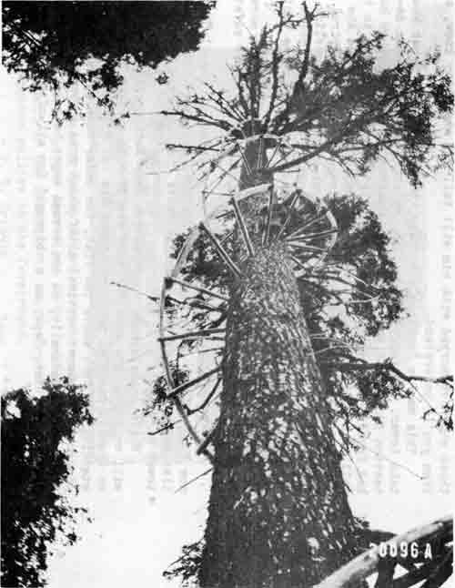 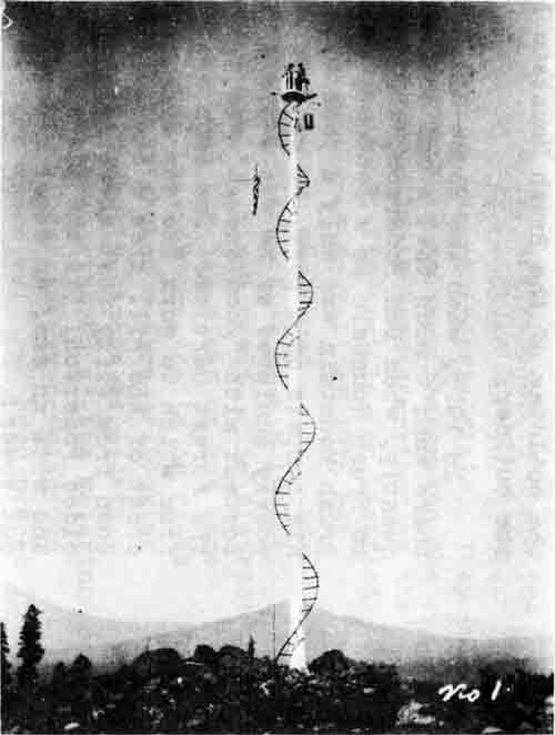
|
| At top, lookout tree on Brush Mountain soon after construction began. The spiral ladder was 80 feet high, made of yew pegs driven one foot into the tree, with a railing of Douglas fir poles. (Photo by H. D. Foster) At bottom is shown the completed structure in 1916. Lookoutman Dan Pederson constructed the tower alone, including rigging the 5 x 5 foot square platform weighing 250 pounds, and installing the elevator (the bucket-shaped object hanging below and to the right of the platform). (Photo by A. D. Peachey) |
His fearlessness is more easily understood when one recalls that Dan worked on sailing ships as a young man. Days and nights in the rigging must have given him that absolute disregard for heights that would let him trim the end off the limb he stood up on 300 feet above the flat or work while sitting on a slim wooden peg a hundred feet high.
The most difficult part of his job done, Dan hastened to complete his tower. Yew poles, bent and wired to the ends of the pegs, made the stairway more secure. Reminiscent of those sailing days, a five foot "crow's nest" built in Ashland and later raised to the top gave Dan Pederson a place to stand while watching for that first puff of smoke.
Like the rest of the tower, the fire finder was Dan's own idea. A map board was built on rollers so as to revolve around the crow's nest, and Dan told many lookouts how he had to level the fire finder and orient it on Mt. Pitt for each shot, and with a sly grin he tells how it became a habit, explaining almost apologetically that "it only took a few seconds."
One would think that after the tower had been completed Dan would be content to take life easy for a while, but not he! For a long time the only phone at Brush Mountain was on a post at the foot of the tree. Each time he reported, Pederson had to clamber down his spiral stairway to the phone and then back up to the fire finder. Although "Report Time" and "Getaway Time" were never thought of in those days, this extra delay irritated Dan until he rigged two buckets in a cable, counterbalanced against his weight with rocks so that a pull on the cable would send him shooting down to the phone or back up again. Though the phone was later moved to the crow's nest, Dan preferred to zip up or down in his homemade elevator while visitors clutched dizzily at the rungs of the ladder on their way to the top.
For eleven years Pederson stayed on as lookout at Brush Mountain, and though building that tower was a job to be proud of, he was not at all content to rest on his laurels. Although the lack of living quarters on Brush Mountain made it necessary for Dan to walk a mile from the lookout to and from his cabin in Big Draw, even though his conscience would not let him miss a daylight hour "on top," he still found "spare time" jobs. A watering trough, hewed from a log down below his lookout, was one of the jobs. He did it well, too, so well that it still looks as though it had been planed instead of hewed. Indeed, Dan Pederson's axe work is as famous as his tower is remarkable. On homesteads, in trapper's camps, at forest guard stations there are standing today cabins and barns whose distinctive corner joints mark them for his work. They have become almost a trademark for him, these corner joints, dovetailed closely together to prevent slipping, yet sloping in such a way that water will not collect in the corners and so rot out the loge.
Nor was he content with being an expert axeman. He had to be an expert lookout, too. Had to be because of the man he is, and because smoke chasers, guided only by the lookout's report, were too few and scattered for them to be forced to hunt for their smoke. Bill Jones, who is now Superintendent of Construction for the forest, will tell you of one time when Dan sent him to a fire. "It's about 220 odd feet from the 1/4 corner, I think," Dan had said, and when Bill checked, he found that Dan was only three feet off his distance from the 1/4 corner. Moreover, this was not an isolated instance, almost every man who worked with Dan will tell you of similar cases.
Of course, Pederson was not a "born" lockout, he had to be made and, characteristically, self-made at that. After every fire season he would throw a pack on his shoulders and walk through the country, running down section corners, learning every knoll and draw in the district. Consequently, when Dan said cautiously, "I think the fire is about 200 feet from the spring at the head of Daley Creek's south fork," no smoke chaser wanted more; straight to that fire he went. Cross shots or no cross shots, Dan's "description by local landmarks" was all that was needed.
But the tale would grow long, though never weary, if it included all the yarns of Dan and his work that the old timers press upon you with a reverent, "There's a man who was a real lookout." "And all man," you'll add, if you see him at his homestead on the Lake O' Woods District, still active, busy, and slyly ginning at life though over 60 years have slipped behind him.
Yes, there wasn't much to take for granted in 1913. Nor was anything expected. Quietly, on horseback or afoot, the "old-timers", those forest guards of not so long ago, built trails and communication, fought fires without benefit of roads, trucks, pumpers, "cats", CCC — and built the Forest Service, built an intangible something the Forest Service could not do without, yet can very easily take for granted today.
Though the tower on Brush Mountain, the tower Dan Pederson put up alone because he thought we needed it, was built for use and not for "the memory of" — as long as it stands defiantly waiting for its end, there stands a tribute, more magnificent than any monument of stone, to Dan, to all the old-timers, and to the "good old days" they made.
1917
Personnel
| Forest Supervisor — | Martin L. Erickson |
| Deputy Supervisor — | A. E. Cohoon (until Sept. 1917) |
| Harold D. Foster (Oct. 1917) | |
| Forest Examiners — | Harold D. Foster (until Sept. 1917) |
| Bruce Hoffman (until June 1917) | |
| Oliver F. Ericson (until June 1917) | |
| Fred A. Matz (EOD July 1917) | |
| Forest Clerks — | E. Violet Cook |
| H. B. Burton | |
| Ivy I. Boeck (EOD Sept. 1917) | |
| Forest Rangers: |
| No. Dist. | Name | Ranger in Charge | Title | Hdqtrs. |
| 1 | Prospect | Bert A. Nason | Asst. For. Rgr. | Mill Cr. RS |
| 2 | Butte Falls | William L. Jones | Forest Ranger | Butte Falls |
| 3 | Dead Indian | Albert L. Peachey | Asst. For. Rgr. | Moon Pr. RS |
| 4 | Pelican Bay | Edward S. Kerby | Forest Ranger | Pelican RS |
| 5 | Ft. Klamath | Frank L. Carlson | Forest Ranger | Seven Mile RS |
| 6 | Ashland | John E. Gribble | Forest Ranger | Long's Cabin |
| 7 | Big Applegate | Joseph L. Mackechnie | Forest Ranger | Star RS |
| 8 | Trail | Andrew T. Poole | Forest Ranger | Trail RS |
| (from June) | William C. Fruit | Trail RS |
Forest Guards:
| District | Name | Headquarters |
| Prospect | Ace Hollenbeck | Huckleberry RS |
| Ray Davis | Woodruff Meadows | |
| Warren Tison | Union Creek | |
| Paul Peyton | Herschberger LO | |
| Butte Falls | A. R. Marion | Lodgepole RS |
| Dee Wright | Rustler Peak LO | |
| W. H. Hughes | Trail maintenance | |
| Dead Indian | Robert Peachey | Big Elk RS |
| George Hargadine | Keene Creek | |
| Dan Pederson | Brush Mountain LO | |
| Ernest Smith | Mt. Pitt LO | |
| ______ Beach | Robinson Butte LO | |
| Harvey Chissinger | Teamster | |
| Dee Wright | Packer | |
| Ed Frey | Telephone Operator | |
| J. J. Simmerville | Range Rider | |
| Pelican Bay | Carl Richardson | Clover Creek RS |
| Sam Hill | Buck Mountain LO | |
| Ben Little | Lake of the Woods | |
| Zimmerlee Roys | Trail Work | |
| Ft. Klamath | C. Gray | Devils Peak LO |
| Ashland | Dave Kennedy | |
| Harley Brower | ||
| Mark Kline | ||
| George Pursel | ||
| _________ Beagle | ||
| _________ Burton | ||
| _________ Randles | ||
| _________ Hake | ||
| Applegate | Lee C. Port | Hutton RS |
| J. J. Desdmond | Star RS |
Scalers at Pelican Bay:
| Fred A. Matz — officer in charge. | |
| Scalers — | John D. Holst |
| Andrew T. Poole | |
| Royal U. (Doc) Cambers | |
| Oliver F. Ericson | |
| Bruce Hoffman | |
| L. D. Hurt | |
PERSONNEL CHANGES
A. E. Cohoon left the Crater in September, 1917. Harold D. Foster, forest examiner, replaced Cohoon in October as deputy forest supervisor.
Bruce Hoffman and Oliver F. Ericson, forest examiners, both transferred to the district office in June. Fred A. Matz was assigned to the Crater on July 1, 1917.
H. B. Burton is listed as a forest clerk during the year. Miss Ivy I. Boeck started as a clerk in the Medford office in September.
John E. Gribble, forest ranger, served as ranger on the Ashland District. He was headquartered at Long's Cabin in the Ashland Canyon.
Andrew T. Poole, forest ranger, spent the winter and spring at Trail Ranger Station. Lee Port assisted him in February on construction of the Trail Ranger Station road. On June 3 William C. Fruit took over the Trail District as Poole was assigned to the Pelican Bay Timber Sale as a scaler.
MISCELLANEOUS NOTES
Automobiles were getting more numerous. Bert Peachey mentions in his diary for January, "Spent several days learning to drive an auto." He also mentions that grazing trespass was quite prevalent. He carried a gun with him at all times, as some of the stockmen were still violent over government regulation of their ranges.
Ranger Kerby reported in January that there was 40 inches in snow at Pelican Ranger Station and 8 feet at Four Mile Lake. On May 3 the latter place had 10 feet of snow. Ranger Kerby owned a Ford car and Carlson had a Buick. Mackechnie used a motorcycle on the Applegate District. He purchased a new Chevrolet in May.
Mr. Marshall of the Klamath Indian Agency went to the Red Blanket area in August and failed to return. Supervisor Bedford of the agency took 17 men into the area on August 18. Later a dog from Klamath Falls was sent to Seven Mile and Carlson took the dog and three other men to join in the search. Indians joined in the search, and on September 9 Carlson returned to the search area to help bring out Marshall's body. No mention was made of the cause of his death, whether by exposure or from natural causes.
Report of the Forester, Oct. 1, 1917;
For Fiscal Year Ended June 30, 1917.
"The decision of the War Department to organize as a part of the Engineer branch of the service a special force for forest work followed a request from Great Britain for a regiment made up of men skilled in lumbering and sawmill operating, to assist in the production in France of timber products required by the British Army. Since all French forests are managed under the careful practice of forestry to meet the request a regiment was needed which could meet the special conditions imposed by this fact. The assistance of the Forest Service was therefore sought. Officers were selected for recommendation to the War Department, of whom a majority were trained foresters. For the rank and file woodsmen and millmen were drawn from all the main lumber regions of the country. To make preliminary arrangements for the work of the regiment and for similar work by such additional units as might be needed later the forester received leave of absence from the Department of Agriculture, and was sent abroad by the War Department as a major attached to the staff of the Commander of the American Expeditionary Force. A number of other members of the Forest Service have been commissioned by the War Department in connection with the work. Owing to the very large needs of our own expedition for wood supplies abroad it has been necessary to plan for a considerable addition to the forestry force already sent to France."
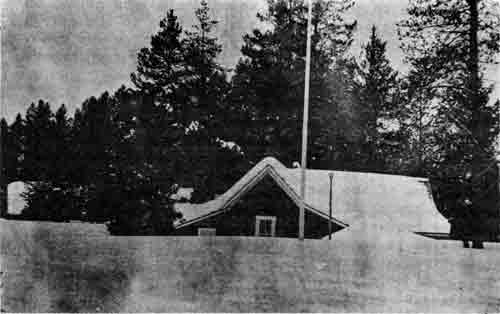
|
| House at Seven Mile Ranger Station. February, 1917. |
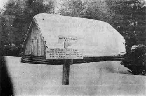
|
| Barn at Seven Mile Ranger Station, February 1917. |
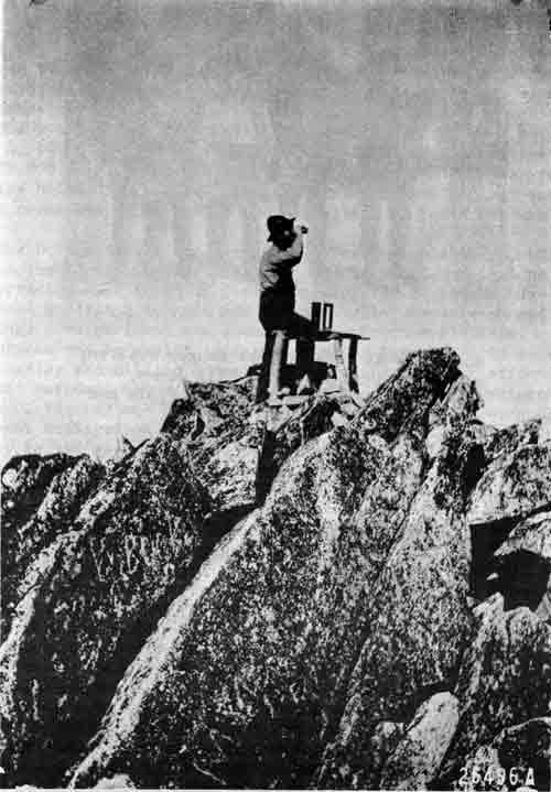
|
| Wagner Butte Lookout, Applegate District, showing Osborne firefinder in place. "This pinnacle of rock obviated the necessity of an observation tower." - Foster, 9-16-15. |
|
| Road crew at Soda Springs Ranger Station, winter of 1917 and 1918; Bill Jones, John Holst, John Gribble, Andy Poole and Lee Port. |
|
| Selection cutting in western yellow pine forest, Pelican Bay Lumber Company Sale (Four Mile Unit). - E. Kerby, Oct. 21, 1916 |
Operation Notes from "Six Twenty-Six"
A supervisor's meeting was held in the District 6 office on March 19 to 25 inclusive. All supervisors except T. M. Hunt of Seward, Alaska, were present. Twenty-five supervisors were in attendance.
The 1918 appropriation bill, signed by the President on March 4, 1917, provided for a five per cent raise in salaries from $1,200 to $1,800 per year, and a ten per cent increase in salaries below $1,200 per year for all statutory positions and to all permanent employees on the Miscellaneous Rolls on June 30, 1917.
The United States declared war on Germany on April 6, 1917. In June the Forest Service was asked by the War Department to help organize a regiment of foresters, logging engineers, experienced woodsmen, loggers and men of similar experience and training. The regiment was a unit of the Engineers' Corps. Its purpose was to assist in forest work in France and to conduct logging and milling operations to further the war effort. The unit was designated the 10th Engineers (Forestry) Regiment. Ernest C. Peachey and Howard J. Eberly, forest guards, were the only ones employed on the Crater to be assigned to this unit. Peachey served as a private in Company B and Eberly served as a lieutenant in Company D. Former employees on the Crater who served in the 10th Engineers (Forestry) were:
Paeth, Wm. J., from the Siuslaw,
White, Wm. E., from the Minan.
The regiment went to France in September.
District 6 also contributed funds, solicited from employees, to furnish and equip two ambulances for the Forest Regiment (10th Engineers). The War Department agreed to accept these for this regiment. In the fall the War Department again asked the Forest Service to assist in organizing ten more battalions of foresters and engineers to be known as the 20th Engineers (Forestry) Regiment. Another ambulance was furnished and equipped by funds contributed from Forest Service employees. The War Department agreed to place the Forest Service shield on the side of the ambulance sent from the North Pacific District (District 6) to accompany the 20th Engineers (Forestry) Regiment. Those contributing to the ambulance fund from the Crater were: Kerby, E. S.; Erickson, Paul; Foster, H. D.; Peachey, A. L.; Carlson, F. L.; Gray, C.; Matz, Fred; West, G. H.; Fruit, W. C.; Holloway, G. B.; Lewis, A. W.; Cook, E. V.; Jones, W. L.; Holst, J. D.; Mackechnie, J. P.; Gribble, J. E.; Moore, S. A.; Burton, J. C.; Poole, A. T.; Richardson, Carl; Camber, R. U.; Pederson, Dan; Nason, Bert A.; Peachey, R. I.; Ohnemus, Ben; Hughes, Wm. H.; Wright, L. A.; Marion, A. R.; Patton, Chas. I.; Coffman, Rob't.; Higinbotham, Oscar; Hildreth, E. A., Jr.; Anderson, Natham; Boeck, Ivy I.; Smith, E. W.; Wilkinson, C. E.; Dorn, Ernest; Jenns, J. H.; Port, L. C.; O'Connol, W. H.
By December the ambulance funds from all Forest Service units amounted to $3,545.05, of which District 6 people contributed $1,429.78.
"Buy Bonds" was the favorite slogan and the Crater personnel contributed their share to this worthy cause.
The following regulation was approved by the Secretary of Agriculture during the year:
"Reg. A—12. Forest Officers and employees assigned to field duty may be required, under such conditions as the Forests may prescribe, to furnish at their own expense clothing of standard design and materials for their personal use in the performance of official duty."
The Forester immediately designated a committee to work out standards and rules. This was the first official act to establish an official uniform for members of the Forest Service.
District 6 led all other districts of the Service in total receipts for the first four months of Fiscal Year 1918, with a total of $156,640. The Crater Forest led all other forests in District 6 for the same period, with total receipts of $43,825.
IMPROVEMENT WORK
"Ranger Jones of Butte Falls District reports a water tank had been built on Rustler Peak in 1915. When examined in 1917 by Jones and Hughes it was full of good clear water even though there was three inches of solid ice on top."
A tower was built on Rustler Peak during the summer. Material was hauled by mules to the site. A lookout house was also built on Mt. Pitt. Material was packed to the top by pack mules.
During February, March, and April, Rangers Jones, West, Carlson, Hurt, Gribble, and Peachey camped at Dead Indian Soda Springs Ranger Station and worked on constructing a new road in to the Ranger Station. They camped in tents, fought the mud with mule teams, made their own signs, and constructed the road with mules using plows, scrapers and good, hard, hand work.
SILVICULTURAL WORK
Mention was made of the great loss of yellow pine timber from beetle epidemics in Northern California and Southern Oregon. The Bureau of Entomology and Plant Quarantine made a reconnaissance in Southern Oregon in 1916. Some control work was done on private lands in the Klamath Basin during 1917.
Credit was given to Ranger William C. Fruit for finding and reporting in 1914 some Macnab cypress on the Applegate District. (Same trees credited to Mackechnie.)
The Pelican Bay Lumber Company camp at Pelican Bay opened in April and cutting of national forest timber continued until late November when snow conditions forced them to close down for the winter.
The Barnes Logging Company camp, also near Pelican Bay, opened in May.
Robert Weitknecht, forest examiner from the district office, check-scaled the scalers at Pelican Bay in June.
Fall rains started in November. Ranger Kerby had a crew burning slash and snags on the timber sales.
Stephen A. Moore spent part of the summer at Ft. Klamath scaling logs on the Utter & Burns timber sale.
A planting project was started on Tallowbox Mountain on the Applegate District, under supervision of Ranger Mackechnie.
FIRE NOTES
The supervisor reports that stockmen are more cooperative toward fire prevention and indicate that controlled burning only brings on brush growth instead of grass. (Six Twenty-Six.)
Supervisor Erickson also reports he is using foot patrolmen with a fire pack and three days' provisions to replace horse patrolmen. They can cut across country after leaving at once, without having to catch a horse. Oftentimes a horse cannot get close into a fire. (Six Twenty-Six.)
The Forest Service has been protecting for past three years the O & C lands, giving direct protection to those inside the Forest boundaries and arranging with the States and Associations for protection of O & C lands outside the Forest boundaries. The Forest Service receives $25,000 annually for this work. (Six Twenty-Six.)
TRANSPORTATION ON THE CRATER
In order to speed up the getting of men, supplies, and equipment to forest fires, Supervisor Erickson of the Crater uses an auto truck into which are loaded not only men and outfit but also pack animals and equipment. After going as far as possible by auto, the outfit is packed on the burros to the place it is needed. (Six Twenty-Six.)
A picture of this outfit follows on the next page.
No serious fires occurred on the Forest during 1917 although there were many of them. Ranger Gribble of the Ashland District reported a total of 21 fires, with some trouble from stockmen setting fires to rid the areas of brush in hopes that grass would take over the area.
Bert Nason was restored to the rolls May 4, 1917. He served as forest ranger, Prospect District, at Mill Creek until Dec. 3, 1917.
|
| Out-fit for packing firefighters and their equipment. The truck carries the men, outfit and burros as far as possible; the burros pack in from the road over the trails - 1917. - Crater National Forest |
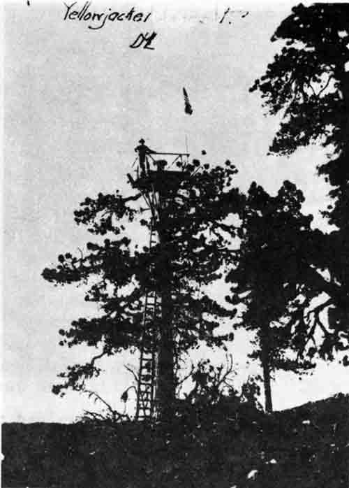
|
| Yellowjacket Lookout - Applegate District, 1917. - By J. L. Mackechnie |
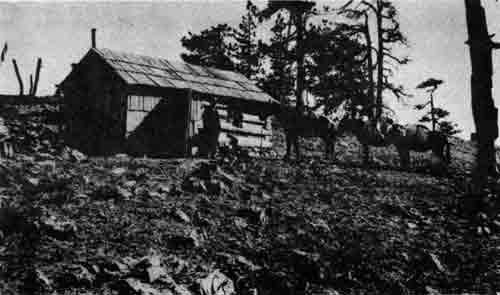
|
| Cabin at Yellowjacket Lookout - Applegate District, 1917. - By J. L. Mackechnie |
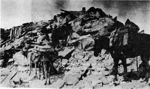
|
| Dee Wright with pack train ready to unload near the summit of Mount McLoughlin in 1917. Note building materials previously packed in and piled for use in the construction of the planned lookout house. (Although "Mt. McLoughlin", sometimes misspelled "McLaughlin", became the official name for the peak known previously as "Mt. Pitt" in 1911, both names continued to be used interchangeably by map makers and residents alike.) - Photo by E. W. Smith |
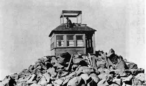
|
| Mt. McLoughlin Lookout house under construction by Lookoutman Jenns, Sept. 27, 1917. Construction was completed in October. - Photo by E. W. Smith |
GRAZING
Crater National Forest
1917
Part One not available.
Part Two. Protection & Development
"Grazing reconnaissance badly needed on Applegate and Dead Indian. Some has been done in connection with timber reconnaissance but money should be allotted for this purpose.
"48 cattle lost by blackleg. Stockmen vaccinate calves but some do not comply with this requirement. All carcasses are burned. Six cattle and 50 sheep poisoned by parsnip and 8 cattle by larkspur. 30 cattle and 10 sheep killed by wolves. Biological Survey employs hunters, but none killed. Bounty of $25 on wolves.
"Prairie dogs and gophers doing considerable damage in Dead Indian District.
"63 miles of trails constructed for benefit of grazing.
"Summary of rangers' reports shows a total of $15,155 estimated for all range improvements thought needed. (Drift fences, 7 miles, $655; Driveways, 22 miles, $1,095; Salt troughs, 8, $275; Grubbing poison areas, 4, $200.)
"O'Brien and Bigelow Areas so badly depleted they have been closed. Siskiyou Summit, Silver Fork and Freezeout Areas are badly overgrazed and in need of reseeding. Cottonwood Glade Range is also overgrazed.
"Associations are helpful by adopting special salt rules."
| <<< Previous | <<< Contents>>> | Next >>> |
|
6/rogue_river/history/1/chap4.htm Last Updated: 15-Jun-2012 |