|
Mountaineers and Rangers: A History of Federal Forest Management in the Southern Appalachians, 1900-81 |
|
Chapter VIII
Recreational Development of the Southern Appalachians: 1960-81
The recreational development of the Southern Appalachian Mountains during the 1960's and 1970's was extensive. It brought widespread changes in landownership patterns, greater visitation and use of the region's forests, and a vocal, organized, and critical response from the Southern Appalachian mountaineer. After 1965 the Federal Government provided millions of dollars from the Land and Water Conservation Fund to acquire private lands. Then a series of Federal laws established National Recreation Areas, Wild and Scenic Rivers, a National Trail, and finally confirmed and extended wilderness areas in the region's National Forests. At the same time, second-home builders and resort developers helped increase the pattern of absentee landownership already typical of the region. In response to the accelerating loss of private and locally held land and local land-use control, residents throughout the mountains organized to protest. The people of the Southern Appalachians now seemed much more determined to resist giving up ownership of land than they had been in the past.
As discussed in chapter VI, outdoor recreation became more and more a national pursuit and a national concern after World War II, as the spendable income, leisure time, and mobility of Americans increased rapidly. Concern with the Nation's ability to satisfy recreational demands was expressed in Federal legislation in June 1958, when President Eisenhower created the Outdoor Recreation Resources Review Commission (ORRRC). [1] The Commission's task was to inventory and evaluate America's outdoor recreational resources, both current and future, and to provide comprehensive information and recommendations so that the necessary quality and quantity of resources could be assured to all. It was composed of four senators, four congressmen, and seven private citizens.
The Commission's immense report was issued in 1961, in 27 volumes. In essence, it found that America's recreational needs were not being effectively met, and that since future demands would accelerate, money and further study were needed at the Federal, State, and local levels. The Commission provided more than 50 specific recommendations, which can be grouped into five general categories. These were: (1) the establishment of a national outdoor recreation policy, (2) guidelines for the management of outdoor recreation, (3) increased acquisition of recreational lands and development of recreational facilities, (4) a grants-in-aid program to the States for recreational development, and (5) the establishment of a (Federal) Bureau of Outdoor Recreation. [2]
Bureau of Outdoor Recreation Is
Created
During the next 10 years, virtually all the ORRRC recommendations were enacted. In April 1962 the Bureau of Outdoor Recreation (BOR) was established in the Department of the Interior. [3] Edward C. Crafts, former Assistant Chief of the Forest Service, became its first Director. The Bureau's purpose was to coordinate the recreational activities of the Federal Government under a multitude of agencies and to provide guidance to the States in planning and funding recreational development. At the same time a policymaking Recreation Advisory Council was established by executive order. It was composed of the Secretaries of the Interior, Agriculture, Defense, and Health, Education and Welfare, and the Administrator of the Housing and Home Finance Agency. [4] The Outdoor Recreation Act of 1963 was passed to expedite coordination of recreational planning by Federal agencies and initiate a comprehensive national recreation plan. [5] A year later, the Land and Water Conservation Fund Act was passed to provide funds for Federal and State recreational development.
This heavy Federal legislative and administrative emphasis on outdoor recreation was to have a decided impact on the Southern Appalachians during the 1960's and 1970's. Many of the Federal recreation programs and dollars spent on recreation were channeled into the region. The number of annual visitors to the southern mountain forests rose substantially, as increased recreational development—both public and private—increased tourist attractions and investment possibilities. In addition, the renewal of Federal funding for recreation made land acquisition appear much more urgent than it had previously been for general National Forest purposes. Consequently, the Forest Service decided to exercise its condemnation power as a final option, if needed, to acquire especially worthy sites from owners unwilling to sell. Such condemnation aroused residents in several areas, many of whom organized for the first time in often bitter protest of Federal land acquisition policies.
Since the early 1900's, with the genesis of the movements for National Parks in the Great Smoky and Blue Ridge Mountains and for the Blue Ridge Parkway, the recreational potential of the region's natural resources had been well recognized. By 1960, decades of Federal land acquisition throughout the region had put together very large tracts close to the Eastern Seaboard that appeared ripe for recreational development.
Studies conducted for the Appalachian Regional Commission were somewhat contradictory. One made for ARC by the Bureau of Outdoor Recreation in 1966-67 declared the Southern Appalachian region had great potential to provide for rapidly rising demands for public recreation. The study, in estimating demand for outdoor recreation from 373 counties and parts of 53 Standard Metropolitan Statistical Areas within 125 miles of Appalachia, calculated that to meet 1967 needs, at least 600,000 more acres were required for boating, 20,000 acres for camping, and 30,000 for picknicking. By the year 2000, it predicted, the recreational demands placed on the region would be "staggering"; thus, an intensive effort was believed necessary to provide recreational supplies to meet the demands. However, another study, made jointly by two private firms less than a year earlier for ARC, had warned against major public investment. [6]
The Land and Water Conservation Fund (LWCF), established in September 1964, was the principal Federal step taken to meet these perceived recreational demands. [7] The Fund, administered by the Bureau of Outdoor Recreation, could be used for Federal acquisition of lands and waters—or interests in lands and waters such as scenic easements. The properties would be used to create National Recreation Areas in the National Parks and in the National Forests and to purchase private inholdings in the National Forests "primarily of value for outdoor recreation purposes" including wilderness. [8] The ORRRC report had stressed the need to rectify the imbalance between the abundance of Federal recreation lands in the West and their scarcity in the East. The Land and Water Conservation Fund was to address the need. [9] Within the Southern Appalachian forests, LWCF monies were used in the Mount Rogers National Recreation Area in southwestern Virginia, the Wild and Scenic Rivers System, and the Appalachian Trail. The Mount Rogers NRA was perhaps the most visible and most controversial use of LWCF funds in the region.
National Recreation Areas (NRA's) were first conceived and established by the President's Recreation Advisory Council. The first NRA's created in 1963, were administered by the National Park Service, and were principally based on a large reservoir, such as Lake Mead above Hoover (Boulder) Dam on the lower Colorado River. NRA's were defined to be spacious areas of not less than 20,000 acres, designed to achieve a high recreational carrying capacity, located within 250 miles of urban population centers. Each was to be established by an individual act of Congress. [10] The first National Recreation Area in the Appalachians was the Spruce Knob-Seneca Rocks NRA, established in September 1965 in the Monongahela National Forest in West Virginia. The Mount Rogers NRA, centered on Whitetop Mountain and Mount Rogers—the highest point in Virginia—was established in the Jefferson National Forest on May 31, 1966. [11]
|
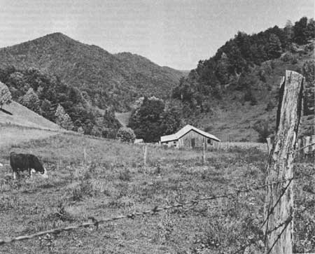
| Figure 111.—Hereford cattle grazing in mountain pasture adjoining Jefferson National Forest near Taylors Valley, Washington County. Va., between Damascus and Konnarock, close to the Tennessee State line and the present Mt. Rogers National Recreation Area administered by the Forest Service, in November 1966. White pine and northern hardwoods are visible on nearby slopes and ridges. (Forest Service photo F-515652) |
Mount Rogers National Recreation
Area
The Mount Rogers NRA was originally conceived as an intensely developed recreational complex of 150,000 acres with a 63-mile scenic highway, campgrounds, and nearby reservoirs. (Two of these reservoirs were part of the proposed Blue Ridge Project on the New River, to be discussed later.) Mount Rogers was expected not only to help satisfy future regional demands for outdoor recreation, but also to provide an economic boost to the economy of southwestern Virginia. As the Secretary of Agriculture stated in congressional testimony on the NRA:
The counties involved [in the NRA] are in areas of continued and substantial unemployment and a relatively low rate of economic activity. A national recreation area will benefit this situation both immediately and in the long run through the inflow of funds and accelerated development and intensified administration and the upbuilding of a permanent economic base oriented to full utilization of all the national forest resources. [12]
However, the scope and intensity of development originally planned for Mount Rogers were not realized. The Forest Service finally shifted its priorities away from encouraging more motorized recreation such as those activities enabled by reservoirs and scenic highways, to more active, "dispersed" recreation, such as canoeing and backpacking [13] This shift is reflected in recreational use data by type of activity for two representative Southern Appalachian forests, the Cherokee in eastern Tennessee and the Chattahoochee in northern Georgia. For both forests between 1968 and 1980, automobile traveling declined somewhat, not in volume but as a percentage of all recreational activities. In the Cherokee, the decline was from 18 percent to 15 percent; in the Chattahoochee, it was from 22 to 19 percent. On the other hand, hiking more than doubled as a percentage of all recreational activities: in the Cherokee from 2.4 to 8 percent, in the Chattahoochee, from 4 to 8.9 percent. [14]
The legislation establishing the Mount Rogers NRA provided for acquisition of such lands, waters, or interests in them, by purchase, donation, exchange, transfer, or condemnation, as the Secretary of Agriculture deemed "needed or desirable." [15] The Land and Water Conservation Fund was to be used as the source of acquisition monies. The final Forest Service-developed plan for the NRA called for Federal ownership of 123,500 acres within the approximately 154,000-acre NRA boundary. By 1966 much of the desired acreage had already been acquired; some 58,000 acres were deemed "needed or desirable" to complete the future NRA. [16]
The defined "need" was based on the premise of protection, as the Secretary of Agriculture explained to Congress:
To fully develop and assure maximum public use and enjoyment of all the resources of this area, there will need to be come consolidation of landownership. The present ownership pattern, particularly in the immediate vicinity of Mount Rogers, precludes effective development for public use. Acquisition of intermingled private forest and meadowlands and of needed access and rights-of-way is essential to fully develop the outdoor recreation potential by protecting the outstanding scenic, botanical, and recreational qualities of the area . . . [17]
Of the approximately 58,000 desired acres remaining in private lands, the Forest Service estimated acquiring about 32,000 "during the next several years." Of the other 26,000, it was hoped that scenic easements could be used for a good portion, although the exact amount of land to be acquired or easements obtained could not be estimated. However, no scenic easements were obtained during the next 15 years. At the end of 1981 the first easement was acquired, 20 acres along a road in the Brushy Creek area, and another easement on a similar small tract was in the process of being acquired. The new plan for the NRA places strong emphasis upon scenic easements. [18]
Between 1967 and early 1981, approximately 25,000 more acres in 312 separate transactions were acquired for the Mount Rogers NRA. The lands selected for acquisition were generally in stream and river valleys where developed recreation facilities (campgrounds, roads, trails, parking, and picnic areas) could be located, and where the Forest Service generally had not previously acquired land. The acquisition process proceeded gradually over a 15-year period, dependent upon the funds available for purchase (mostly from the Land and Water Conservation Fund) and the operational plans of the Forest Service staff, and influenced by the local peoples' reactions to such acquisition. [19]
Of the 312 tracts, 51, totaling about 7,100 acres, were taken for the NRA through condemnation, Of these 51 tracts, 20 had full-time residents, 15 of whom did not want to sell at all. (Five agreed to sell, but wanted more money than the Forest Service offered.) The majority of the condemnation cases were filed between 1972 and 1975, in preparation for specific development projects. Most tracts were in western Grayson County, in the area of Pine Mountain, where a ski resort was planned under special use permit, and Fairwood Valley, where resort accommodations and camping facilities were planned. The Forest Service acquired the Pine Mountain lands to keep the area free from extraneous commercial development and thus maintain a natural camp setting. Resort to condemnation was minimized by Public Law 91-646 (1970) which liberalized relocation assistance benefits to displaced landowners who were living on their properties. However, some still resisted. [20] Many residents of the Mount Rogers area were angry and puzzled by the rationale for the taking of land. A newsletter of a local protest group declared:
Nowhere has the Forest Service lost more credibility and generated more ill will than in its land condemnation and acquisition practices. Everyone in the affected area has either lost land or had friends or relatives who did. These are people who ancestral homes are here, whose parents, grandparents, great and great-great-grandparents have lived here, and until recently were coerced into selling their land at a fraction of its worth.
The Forest Service has been condeming land for years, making sweeps through the area taking thousands of acres at a time while assuring residents "that's all the land we're going to buy." A few months later they sweep through again enlarging their borders. [21]
As a result of their disgruntlement, local citizens organized to combat the tentative Forest Service development plans. The Citizens for Southwest Virginia, which formed shortly after the Forest Service issued the Draft Environmental Impact Statement for the NRA in spring 1978, was composed of citizens from the five-county area affected. They formed a Board of Directors of prominent citizens whose families had been in the area for generations. The organization claimed in 1978 that almost 10 percent of the five-county population had signed their petition of protest against further NRA development. [22]
Largely as a result of local citizen protest, supplemented by that of environmental groups nationwide, the Forest Service modified some of its initial development plans for Mount Rogers. The proposals for a scenic highway and for a ski resort were dropped completely. Projections that reservoirs would be constructed, that an excursion rail line would be built, that local investment capital would supplement Federal development proved too optimistic. The regional reservoirs and rail line were never built; the Mount Rogers Citizens Development Corporation, created to raise capital for local development use, failed to achieve its funding-raising goals. Regional economic conditions, however, began to improve without such massive development efforts.
The popular mandate, the Forest Service concluded, was clearly for dispersed recreation at Mount Rogers, with emphasis on hiking, camping, canoeing, and the like. [23]
In 1981 some members of the Citizens for Southwest Virginia were still active. Although in general they were satisfied with the modified development plans for the NRA, they were skeptical about a Forest Service "access road" being built between Troutdale and Damascus on the path of the supposedly defunct Scenic Highway. Citizens were still uneasy about Forest Service acquisition techniques, convinced that local landholders were sometimes intimidated through harassment and a lack of knowledge of their rights. [24] By 1981, the Citizens for Southwest Virginia had joined the National Inholders Association, a California-based organization created in early 1979 to change Federal land acquisition policies nationwide. [25]
|
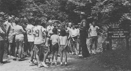
| Figure 112.—Visitors listening to forest interpreter on a guided trail walk in Daniel Boone National Forest, Ky., in July 1966. (Forest Service photo F-514898) |
The Big South Fork NRA
Another National Recreation Area in the Southern Appalachians that was still in the preliminary development stage in early 1981 was the Big South Fork National River and Recreation Area in McCreary County, Ky., and Scott County, Tenn. The Big South Fork basin of the Cumberland River, although rich in coal deposits, had not been extensively mined or developed, because of the high sulfur content of the coal as well as the physical limitations imposed by the narrow shoreline, high cliffs, and generally rugged terrain of the river basin. The area was largely uninhabited, most of its acreage owned by the big Stearns Coal and Lumber Co., which had bought the land around 1900. [26]
Since the end of World War II, the Corps of Engineers had tried unsuccessfully to win Congressional approval of an almost 500-foot dam on the Big South Fork near Devil's Jump for hydroelectric power and flood control. The dam was generally supported by local legislators and was strongly sponsored by the Kentucky Senator, John Sherman Cooper; it was opposed by private power companies: the Kentucky Utilities Co., the Cincinnati Gas and Electric Co., as well as the Associated Industries of Kentucky.
In 1967 Howard Baker was elected Senator from Tennessee. During the 1950's and early 1960's, Baker had represented the Stearns Coal and Lumber Co. in litigation and in efforts to persuade the Forest Service to allow strip mining under Stearns' reserved mineral rights. Between 1962 and 1966, he served on Stearns' Board of Directors. [27] Shortly after his election to the Senate in 1967, the fate of the Big South Fork was decided, Baker called various government officials together to determine the best development strategy for the area; the plan to develop an NRA was an administrative and legislative compromise. [28]
Authorized under the Water Resources Act of March 7, 1974, the NRA was to encompass approximately 123,000 acres. Of these, 3,000 belonged to the State of Tennessee, 1,000 to the Corps of Engineers, and about 16,000 lay in the Daniel Boone National Forest. All public lands were to be transferred to the National Park Service—the designated managing Federal agency—when sufficient private land had been acquired. [29] The Federal land acquisition agency, as well as planner, designer, and construction agent of the NRA, was the U.S. Army Corps of Engineers.
The Corps' land acquisition program began in August 1979, when Stearns Coal and Lumber Co. sold 43,000 acres of surface rights, and 53,000 acres of mineral rights, in the Big South Fork area, for $16.5 million. (Although the authorizing legislation did not require that subsurface rights be acquired for the NRA, it did prohibit prospecting and mining. Thus, the Corps of Engineers felt obligated to acquire mineral rights as well as land.) During 1980 several smaller tracts were acquired, including those of over half the 38 families living in the area. By March 1981 about half the privately owned land remained to be acquired, but the timetable for that acquisition was uncertain, depending as it did upon congressional appropriation.[ 30]
Local reaction to the development of the National Recreation Area was mixed. Although at first McCreary County citizens, having long supported the Corps dam, were generally opposed to the NRA, by 1978 many were beginning to regard the development favorably. There was some feeling that the area might prove a major tourist attraction, even to the point of tacky overdevelopment, characteristic of Gatlinburg. [31]
However, in spite of the promises of local economic boom assured by NRA promoters, the former Forest Service employee of McCreary County, L. E. Perry, was scornful:
Some local leaders have been brainwashed to the point they believe the National Recreation Area . . . is holy salvation, placidly accepting the fact that not one major highway leading from Interstate 75 to anywhere near the Big South Fork is in the foreseeable future, which is further proof that the people of the region have been had. [32]
The Wild and Scenic Rivers Act and the National Trails Systems Act, which also guided recreational development in the Southern Appalachians, were passed in 1968. The former established a system of rivers judged to possess "outstandingly remarkable scenic, recreation, geologic, fish and wildlife, historic, cultural, or other similar values" to be preserved in a free-flowing state. [33] Rivers of the system were classified as "wild," "scenic," or "recreational," depending on the degree of access, development, or impoundment they possessed; each class was to be managed according to a different set of guidelines. The Act designated 8 rivers, all west of the Mississippi, as the first components of the system, and named 27 others to be considered for wild and scenic designation. By 1980, only two Southern Appalachian rivers had been designated part of the Wild and Scenic Rivers System—the Chattooga River, forming the border between northeastern Georgia and northwestern South Carolina, and a portion of the New River near the western North Carolina-Virginia border. [34]
The Scenic New River
Controversy
A 26.5-mile segment of the New River in Ashe and Alleghany Counties, N.C., was designated a "scenic river" in March 1976 by the Secretary of the Interior. [35] This designation was a deliberate obstruction to a development proposed in 1965 by the Appalachian Power Co. called the Blue Ridge Project, designed to provide peak-demand power to seven States in the Ohio River Valley. The project would have created two reservoirs—one in Grayson County, Va., the other in Ashe and Alleghany Counties, N.C.—totalling over 37,000 surface acres. The reservoirs would have dislocated nearly 1,200 people and over 400 buildings. Nevertheless, the project promoters promised the local population construction jobs and revenues from reservoir recreational visitation. [36]
Citizens of the North Carolina counties affected by the Blue Ridge Project organized a protest against it. A National Committee for the New River, based in Winston-Salem, N.C., mounted a well-financed publicity campaign with letters, brochures, and reports. [37] By 1973, the commissioners of Ashe and Alleghany Counties, and the two candidates for governor of North Carolina, denounced the Blue Ridge Project and endorsed the preservation of the river. [38] In 1974, the North Carolina legislature designated 4.5 miles of the New River a State Scenic River. Public pressure was applied at the Federal level through the Federal Court of the District of Columbia, which was responsible for the Federal Power Commission license, through the Congress, and through the Department of Interior. Although the FPC license was upheld in March 1976, the Secretary of the Interior designated the 26.5-mile portion of the New River as part of the national Wild and Scenic River System 3 weeks later, in effect revoking the FPC license. [39]
The Final Environmental Statement prepared by the Bureau of Outdoor Recreation, although conceding that the scenic river designation resulted in the projected loss of some 1,500 temporary construction jobs, and a certain loss in projected increased land values adjacent to the reservoirs, emphasized the benefits of the scenic designation. These were principally intangible—the preservation of a unique, free-flowing river, the preservation of wildlife and of archeological and geological assets, and the preservation of a way of life in an Appalachian river valley. The direct recreational benefits from the scenic designation to the local communities were estimated to be low. The activity areas to be established along the river were expected to accommodate annually 50,000 canoeists, hikers, and picnickers. Private entrepreneurs were anticipated to have little opportunity for riverside development, due to the existence of easements and floodway zoning. [40]
Incorporation of the New River segment into the Wild and Scenic River System provoked little local protest. In general, the scenic designation brought only minor changes to life along the river. Nearly 5 years after the designation of the New River segment, the County Manager of Ashe County summed up its impact as "very little." [41] The State of North Carolina, which has managed the 26.5-mile, 1,900 acre river segment, established a State park along a portion of its banks; a few canoe rental firms and river outfitters receive seasonal revenues from recreationists. Overall, however, inclusion of the New River in the Wild and Scenic Rivers System has had only a small local impact.
|
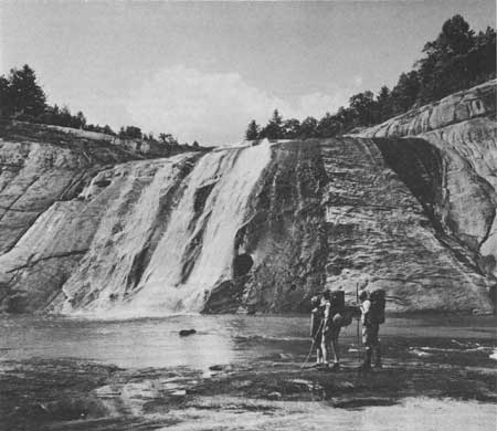
| Figure 113.—Family hiking party at spectacular falls over a bald on upper Toxaway River near Toxaway Lake, Transylvania County, N.C., Nantahala-Pisgah National Forests. Spot is southwest of "Cradle of Forestry" and Brevard, N.C., near the South Carolina State line, about 15 miles from the upper Chattooga River; July 1964. (Forest Service photo F-511344) |
The Wild Chattooga River
The designation of the Chattooga River had larger repercussions. Public reaction was more outspoken, largely because most of the nearly 57-mile segment of the river, which included over 16,400 acres of adjacent land, was designated "wild" and was therefore slated for more restrictive management, and because the Forest Service sought to acquire lands along the river to establish a protected corridor.
The Chattooga River portion of the Wild and Scenic Rivers System was so designated by legislation of May 10, 1974. [42] The designated river segment lay within the Nantahala National Forest and on the border between the Chattahoochee and Sumter National Forests. A corridor up to 1 mile wide was outlined for acquisition along the designated river. In 1974, 47 tracts consisting of nearly 6,200 acres had to be acquired for the river corridor. [43] By early 1981, 85 percent of the desired corridor acreage had been acquired, mostly through exchange, and all from willing sellers.
In general, acquisition along the Chattooga River proceeded smoothly; land management of the area, however, met with considerable local protest. Because some 40 miles of the 57-mile corridor were designated "wild," river access was deliberately restricted in keeping with the guidelines established by BOR. These guidelines stipulated that administration of a wild river required restricted motorized travel, removal of homes, relocation of campgrounds, and the prohibition of structural improvements. [44] Consequently, upon land acquisition, the Forest Service closed several of the jeep trails that had provided river access. Not all the river jeep trails were closed, just those the Forest Service judged were allowing excessive and inappropriate use of the Chattooga that was not in keeping with its wild and scenic designation. [45]
The rationale for restricting access, however, was not strongly supported or well understood by the local population. As an Atlanta newspaper reported:
When the Forest Service attempted to keep the jeeps away from the protected Chattooga River, the mountain dwellers torched vast tracts of National Forest land; if they couldn't use the land as they wished, they wanted no one else to use it at all. [46]
Over the years, as the Chattooga River became increasingly popular with urban recreationists for white-water canoeing, rafting, and camping, local resentment mounted. In 1980, nearly 130,000 visitor-days were spent in watercraft recreation along the 57-mile river segment; 70,000 were spent in swimming, and 60,000 in hiking. Altogether, the Chattooga Wild and Scenic River received nearly a half-million visitor days of use in 1980. [47] With a high frequency of visitors, it appeared to some local people that the Forest Service was catering to outsiders who came to the Chattooga to canoe, raft, and camp. Those who lived in the area often resented the restriction on using four-wheel drive vehicles. As one Clayton, Ga., resident wrote to the Forest Service in 1978:
Special interest & minority groups, plus environmentalists got the Government to close off the Chattooga River, in Rabun County. Look at the river now & it is more filthy and more trashy, from no one but people who ride the river, & if any, very few local people ride the river. Local people of Rabun County don't destroy beauty, it's our home. [sic] [48]
|
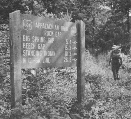
| Figure 114.—Hiker passing new Forest Service sign on Appalachian Trail at Rock Gap, Nantahala Mountains, in Standing Indian Wildlife Management Area of Nantahala National Forest southwest of Franklin, N.C., near Georgia State line, which is much closer as the crow flies than sign indicates. Photo was taken in July 1960. (Forest Service photo F-494684) |
The Appalachian Trail
Another piece of post-ORRRC recreational legislation was for the full development and protection of the Appalachian Trail. The Trail, running for over 2,000 miles from Georgia to Maine, mostly along the high ridges of the Appalachians, was actually originally cleared and built between 1925 and 1937 by the Appalachian Trail Conference, a group of Trail enthusiasts composed of outdoorsmen, parks and planning staff, foresters, and governmental officials, in cooperation with State and Federal agencies. Most of the Trail was constructed by volunteers, on private lands, whose owners gave permission. Nearly a third of the Trail was built by the Forest Service and National Park Service on their lands. Both agencies have helped promote and maintain the Trail. [49] In the Southern Appalachian forests, 441.4 miles out of a total 592, or 75 percent, were "protected" before 1969 with an acquired right-of-way or scenic easement. [50]
The same was not true, however, of those portions of the Trail not under Forest Service or Park Service jurisdiction. Over the years, as the Appalachian Trail received increasing public use, concern for the Trail's protection and uniform management mounted, resulting in the National Trails System Act of October 2, 1968. [51] The Act established a national system of recreation and scenic trails, with the Pacific Coast Trail and Appalachian Trail as the major components of the system. The former was to be administered by the Secretary of Agriculture, the latter by the Secretary of the Interior, although specific stretches of either trail were to be managed directly by the agency whose land the trail traversed.
Specifically, the National Trails System Act charged the Secretary of the Interior with establishing the right-of-way for the Appalachian Trail, provided that, "insofar as practicable," it coincided with the right-of-way already established. [52] The required dimensions of the right-of-way were not specified in the 1968 Act; thus, the adequacy of Trail protection at a given location was open to interpretation. Right-of-way purchases could include entire tracts, strips of tracts, or even easements, so long as the adjacent land uses were compatible with the Trail's scenic qualities.
The authority to condemn lands of an unwilling seller for the Trail right-of-way was clearly provided in Section 7(g) of the Act but was to be utilized "only in cases where . . . all reasonable efforts to acquire such lands or interests therein by negotiation have failed." [53] Further, a limitation was placed on the amount of land that could be taken—no more than 25 acres per mile of Trail. Most condemnation cases simply involved clearing title to the land. An example of a tract that in 1980 appeared likely for such condemnation was the Blankenship tract along the Tennessee-North Carolina border, owned by more than 50 heirs. Condemnation would clear title, but all 50 owners had to be contacted before the suit could begin, and the proceedings were obviously complicated. [54]
Until 1978, unprotected stretches of the Appalachian Trail were acquired by the various jurisdictions with acquisition authority, but generally—except for the Forest Service—at a desultory pace. The slowness was due largely to the multiplicity of agencies and States responsible for right-of-way acquisition and management. This was compounded by the fact that the two principal Federal agencies—the Park Service and Forest Service—were unable to develop a uniform approach to Trail policy, which, in part, was due to differing interpretations of the 1968 Act. [55] The Park Service maintained that a mile-wide strip on either side of the Trail, that was free of parallel roads, which had been established in a 1938 Forest Service-Park Service agreement, was the appropriate right-of-way. The Forest Service stressed that the Trail right-of-way could not exceed 25 acres per mile. [56]
In addition, the two agencies disagreed over the funding and timing of Trail purchases. The National Trails System Act established a $5-million fund for Trail purchases that the Forest Service felt it could draw upon. The Park Service considered this fund to be for State purchases only. Further, the Park Service imposed acquisition deadlines on the Forest Service that were impossible to meet, given the time-consuming nature of surveys, title searches, and buyer-seller negotiations. Several deadlines were established and subsequently extended. [57] Nevertheless, between 1969 and mid-1977, 110 miles of the Appalachian Trail in the National Forests of the Southern Appalachians were acquired. Of the 61 tracts involved in this acquisition, 4 were obtained through condemnation: one in the Nantahala, 2 in the Pisgah, and one in the Cherokee. [58] By mid-1981, only 14.3 miles (2.1 percent) of the 677.0 miles for which the Forest Service has responsibility in the mountains of four States were unprotected. Of the 263.5 miles delegated to the National Park Service, 42.8 miles (16.2 percent) were still unprotected. [59] A summary of the status of Appalachian Trail protection in the Southern Appalachians in October 1981 is shown in table 20.
Table 20,—Protection status of the Appalachian National Scenic Trail in the Southern Appalachians, October 1981
| USDA Forest Service |
National Park Service, USDI |
State-owned land | ||||
| Location of trail |
Protected | Still to be protected |
Protected | Still to be protected |
Protected | Still to be protected |
| miles | miles | miles | ||||
| Virginia | 303.7 | 4.4 | 152.0 | 42.8 | 18.6 | 6.0 |
| Tennessee-North Carolina | 208.9 | 9.9 | 68.7 | none | none | none |
| Georgia | 78.1 | none | none | none | none | none |
| Total | 662.7 | 14.3 | 220.7 | 42.8 | 18.6 | 6.0 |
Source: Land Acquisition Field Office, Appalachian National Scenic Trail, U.S. Department of the Interior, Martinsburg, W. Va., Tennessee and North Carolina mileage is combined because much of the trail follows the State line. Virginia data includes stretches not included in the study area of this publication.
Amendments to the National Trails System Act passed in 1978 substantially improved the administration of the Trail acquisition process and clarified most of the management problems. [60] Substantial additional funds were provided for acquisition, and condemnation authority was extended to allow acquisition from unwilling sellers of up to 125 acres per mile of Trail. In addition, the amendments stipulated that the acquisition program was to be "substantially complete" by the end of fiscal year 1981 (September 30). [61]
Under the 1978 amendments, the acquisition process proceeded with available funding. [62] By January 1981, all but 14 miles of Trail strips in the Southern Appalachian National Forests had either been acquired or were in the final stages of acquisition. Most of the remaining private tracts involved appeared to be obtainable only through condemnation, Some were held by implacable owners who simply refused to sell. John Lukacs, as resident of Florida, was one. Lukacs owned about 1,500 acres in the Cherokee National Forest, near Johnson City, Tenn., which he planned to develop someday. The Appalachian Trail cut diagonally across one small corner of his property. The Forest Service wanted to purchase a strip of land along the Trail as well as the 11.6-acre "uneconomic remnant"—the corner cut off by the Trail. Lukacs refused to sell, citing as his reason a spring in the corner remnant. In 1978 the Forest Service referred the case to the Department of Justice for prosecution. [63] Late in 1981 Justice agreed to press ahead with the suit.
Another long-resistant owner was the Duke Power Co., which had several large tracts along both sides of the Trail on the Tennessee-North Carolina State line in the Cherokee and Nantahala National Forests. Duke Power finally exchanged its Nantahala tract for equivalently valued National Forest acreage. Although the Forest Service needed only a narrow strip nearly 5 miles long, Duke insisted on selling the whole Cherokee tract intact, about 1,705 acres. The Forest Service made an offer which was refused by Duke, but after another potential buyer dropped out, further negotiations produced agreement on the sale price for the whole tract and the Forest Service set aside funds for it. Completion of the purchase was expected by early 1982. This would reduce the agency's remaining Trail strip to be acquired to less than 10 miles out of its total Trail responsibility of 677 miles in the four affected States, less than 1.5 percent. [64]
|
| Figure 115.—The static mountain community of Nada, Powell County, Ky., on old State route 77 which tunnels through the mountain close by and forms part of the Red River Gorge Loop Drive on the Daniel Boone National Forest. The modern Mountain Parkway also now passes near the town, and the Frenchburg Civilian Conservation Center, established 3 years before the photo was taken in September 1968, is just a short distance sway. A scene still common today throughout the Southern Appalachians. (Forest Service photo F-519027) |
Kentucky Red River Gorge
Aside from Mount Rogers and the Appalachian Trail, the only other location in the Southern Appalachians where the Forest Service has taken lands from unwilling owners by condemnation for recreational purposes was the Red River Gorge of the Daniel Boone National Forest. Named a geological area in 1974, the Gorge covers 25,663 acres along the north and middle forks of the Red River, in Powell, Menifee, and Wolfe counties, Ky. Once part of an ancient sea and the product of centuries of weathering and erosion, the area is unusually scenic, with natural arches, caves, bridges, and rocky outcrops along the cliffs of the gorge. It has been managed as a special forest unit, both for recreation and to protect and preserve a unique environment. Lumbering is prohibited in the Gorge. [65]
Condemnation in the Red River Gorge has been used to acquire summer-house lots held by absentee owners along Tunnel Ridge Road, a high-use portion of the area. Altogether five tracts involving 45 acres have been condemned, although several owners have sold under threat of condemnation. [66] In 1973, when the Forest Service's draft plan for the Red River Gorge was developed, the Red River Area Citizens Committee protested the use of condemnation. Since 1973, some Red River inholders, having observed its use in spite of their opposition, began to protest any additional Federal land acquisition. The Gateway Area Development District, for example, passed a resolution in April 1979 opposing "further acquisition of land within the . . . area." [67]
The opposition appears to have been inflamed by the RARE II proposals to designate nearly one-half of the Red River Gorge (Clifty area) as wilderness (to be discussed later); however, the concern developed out of general experience with Forest Service acquisition policies and procedures. As in the cases of Mount Rogers, Chattooga River, and the Appalachian Trail, legislative development and Forest Service management plans appeared to threaten, with little warning, the pattern of local landownership. In the Red River Gorge area many people believed that, although the Forest Service usually aired its land-management alternatives in public, it often did not adequately inform them of final land-use decisions. Because people sometimes felt uncertain of their options, the threat of Federal acquisition was not entirely removed. [68] As long as the Federal Government was a neighbor, the mountaineer felt he could never be certain that his land would remain his own.
Private Recreation Business Is a Major
Force
One conclusion of the ORRRC report was that the "most important single force in outdoor recreation is private endeavor—individual initiative, voluntary groups . . . , and commercial enterprises." [69] Indeed, the heightened Federal attention to outdoor recreational resources and and Federal legislation passed following the report apparently triggered a substantial private recreational development, particularly in the Southern Appalachians. The natural beauty of the region and its proximity to the population centers of the East were recognized as assets that had not been fully exploited. National corporations opened new resorts in the mountains; vacation home communities spread in clusters outside the National Forests; the number of retail establishments catering to tourists increased, and speculators bought numerous tracts of mountain land, throughout the region, hoping to turn a profit by subdividing. The impact of these actions was considerable, not only on the local population but also on the managers of Federal land.
In its first years, the Appalachian Regional Commission funded a series of studies to ascertain the potential role of the recreation industry in the region's economic development. The benefits of tourism to the local population had long been acclaimed by recreational developers seeking to gain support for their programs. Promoters of the Blue Ridge Parkway and the Great Smoky Mountains National Park had both predicted a regional tourist boom. [70] Nevertheless, although recreational visitation and tourism in the Southern Appalachians increased dramatically over the years, by 1960 no such boom had developed.
The first ARC study in 1966 concluded that the economic impact of recreational development on local areas is "marginal" and should be justified principally because it gives open-space recreation to people living in metropolitan areas. It cautioned that recreational employment is seasonal, low-paying, and undemanding, and that the indirect benefits of tourism are small. Thus, the 1966 ARC report pointedly advised, "major public investment in non-metropolitan recreation resources would rarely be justified solely or even primarily, for the sake of the economic impact on the local area." [71] So the recreation industry, like the timber industry, was not the solution to Appalachia's economic ills. Nevertheless, seemingly ignoring the prudent findings of its first study, and favoring the rosy BOR report of 1967, ARC continued to encourage heavy recreational development. [72] In 1967 the Commission began an inventory and analysis of selected multicounty sites, 23 of which were labeled of greatest potential. Twelve such sites were in the Southern Appalachians, and seven of these, all relatively undeveloped, were selected for further analysis. [73] All seven were near, or enclosed, National Forests, National Parks, or TVA reservoirs. Thus, the large Federal landownership in the region was recognized as a major recreational asset. Private investment, it was felt, could "piggy-back" on the existing recreational attraction of public sites.
For example, the Upper Hiwassee River Interstate complex, a seven-county highland area of northern Georgia, southeastern Tennessee, and southwestern North Carolina, just south of Great Smoky Mountains National Park, was credited with enormous potential because of the Chattahoochee, Cherokee, and Nantahala National Forests and four TVA reservoir lakes. However, the area lacked road access, accommodations, and camping spaces. Although it was implied that Federal or State funds would be required for roads and other public services, ARC said private developers could profitably build hotels, motels, and second homes. [74] Similarly, the Boone-Linville-Roan Mountain complex in the Pisgah National Forest section of North Carolina, just east of the park, was seen to exhibit "great potential" for attracting vacationers, especially skiers. [75] Overall, the ARC study concluded, if the 14 recreation sites were fully developed, by 1985 there would be a $1.7-billion "total economic impact." Even in the smallest counties where a lower level of expenditure could be assumed, "a sizable amount of private business development and/or expansion could be expected, and services would probably be considerably expanded." [76]
In 1960, private recreational development was not spread evenly over the Southern Appalachians; rather, it was concentrated in distinct county clusters. The principal clusters were near Great Smoky Mountains National Park—Sevier and Swain; in the Nantahala National Forest—Graham, Jackson, and Macon; the northern Georgia counties in the Chattahoochee National Forest—Towns, Union, Fannin, and principally, Rabun; and Watauga and Avery counties, in the upper Pisgah National Forest, near Boone, N.C., and the Blue Ridge Parkway. Clearly, the National Forests, parkway, and National Park of the region were integral to the development of the private tourist-recreation industry. [77]
Nevertheless, physical recreational resources alone do not explain the locational pattern of the recreation industry. Hancock County, Tenn., for example, one of the 12 study counties we chose for more detailed analysis, located north of Knoxville near Cumberland Gap, had "a mountain environment, clean air and streams, an uncommercialized and unspoiled countryside, and a unique county culture group . . . . Tourists, however, have not visited the county in large numbers." [78] Major factors in recreational development were relative ease of access and a resort history. That is, the counties with the greatest recreational growth in this period were those that had a history of tourism and that seemed unable to attract other economic activities, because of their remoteness. [79] Southern Appalachian counties with the most lodgings and tourist-related jobs were relatively inaccessible, lacked a diverse economic base, but had been frequented for many years by vacationers.
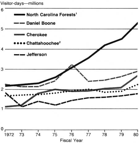
The Federal lands that provided the regional recreation base attracted vacationers throughout the 1960's and 1970's, most of them at an increasing rate. Statistics for the fiscal years 1972-80 reveal the general trend, as shown in figure 116. [80] The Chattahoochee and Jefferson National Forests did not show substantial visitor growth over the 8-year period, and the Cherokee did so only in 1980, when visitation increased 150 percent over 1979. In the four North Carolina forests, it increased steadily by 240 percent over the period. In the Daniel Boone, including the Redbird unit, the peak was reached in 1976. Notably, compared to all National Forests in the United States, the Daniel Boone and North Carolina forests rose dramatically as ranked by number of recreation "visitor-days" reported. By 1980, the Daniel Boone ranked 26th out of 122 National Forest units; the North Carolina forests jointly ranked eighth. [81]
|
|
Figure 116.—Volume of Recreational Visitation in
Southern Appalachian National Forests, 1972-80. 1Includes the small Croatan and Uwharrie National Forests of the Piedmont and coast. 2Includes the small Oconee National Forest of the Piedmont. Source: "Resistive Standings of the National Forests According to Amount of Visitor-days of Use," Recreation Management Staff, Forest Service, Washington, D.C. A visitor-day is any aggregate of 12 person-hours, ranging from one person for 12 hours to 12 persons for one hour each. |
Private Development Varies
Greatly
The extent of private recreational development that occurred during the 1960's and 1970's varied considerably from county to county across the Southern Appalachian region. Some became the focus for heavy second-home development; others grew in commercial facilities; others, although remaining relatively important as recreational concentrations, developed very little. One area that achieved wide publicity for its heavy, uncontrolled commercial development is Gatlinburg, Sevier County, Tenn.—western entrance to Great Smoky Mountains National Park. [82]
During the 1980's changes in landownership began to occur suddenly in the Gatlinburg area where for years land had been closely held by a few families. After 1960 "outsiders with no apparent intention of establishing residency . . . increased their holdings." [83] Most of these "outsiders" were northern corporations, such as Rapoca Resources Coal Co. of Cincinnati, or national chains, such as Holiday Inn. A very high number of franchise or chain ownerships located there. [84]
Investments were made not only in resort attractions (resort hotels, restaurants, and shops), but in residential land as well. Individuals and corporations bought acreage all around Gatlinburg, so that by 1972 almost half the landowners were outsiders. Many of them bought land for summer or retirement homes but some, with no intention of settling, bought for pure speculation. Although in the mid-1970's sizable tracts outside Gatlinburg were still in the hands of local inhabitants, the slightly more distant tracts, upon which higher capital gains could be realized, were largely in the hands of outsiders. [85]
Although the town was unusual in the Southern Appalachians in that it had been an established resort area for several decades, its pattern of land development by outside investors was repeated throughout the region. Watauga and Avery Counties, N.C., were heavily developed in the 1960's, first by local entrepreneurs. For example, Hugh Morton transformed Grandfather Mountain into a recreational complex that included condominiums, a subdivision of Scottish manor houses called Invershiel, a lake, and the Grandfather Mountain Golf and Country Club, with a professional golf course. [86] His family had owned some 16,000 acres of mountain land since the end of the 19th century; when his father died, Morton inherited the mountain as a parcel of land no one else in the family wanted. Although a movement was started to purchase Grandfather Mountain for the National Park Service, Morton finally decided to develop the land. With the aid of professionals, he built one feature after another. By 1978, Grandfather Mountain boasted, in addition to traditional resort facilities, a bear habitat, a nature museum, and a mile-high swinging bridge.
Later, corporate developments, such as Sugar Mountain and Beech Mountain, owned by Carolina-Caribbean Corp. of Miami, followed. Some Winston-Salem businessmen and the L.A. Reynolds Construction Co. built Seven Devils nearby. All included golf courses, lakes, tennis courts, and ski slopes, as well as second homes spread in subdivision fashion across the hills. [87]
Northern Georgia has also attracted heavy recreational investment, particularly in vacation-home communities, As of 1974, approximately 210 second-home subdivisions were being "actively developed" in 12 counties, some as large as 5,000 to 9,000 acres. [88] On a smaller scale, the Highlands area of Macon County, N.C. became the site of many second homes whose owners had permanent residences in Atlanta, Savannah, Jacksonville, and other southern urban areas. [89] However, recreational subdivisions per se did not become a common feature of the southwestern North Carolina landscape. In the 11-county "Southern Highlands" region of North Carolina, including Buncombe, Henderson, Graham, Macon, and Swain Counties, there were only 12 second-home development firms that controlled 30 or more homes or sites each in 1973. Macon County, had the most, with four. [90]
The increase in second-home development throughout the Southern Appalachians was part of the general reversal of the heavy outmigration the region experienced in the two decades after World War II. As discussed in chapter VII, between 1970 and 1975 a distinct change in migration patterns occurred in all study counties; either net outmigration slowed dramatically or net inmigration took place. This shift appears to have applied across the whole region, and must be seen as part of a national change. In general, over the United States as a whole, after 1970, nonmetropolitan areas attracted increasing numbers of people while Standard Metropolitan Statistical Areas lost population. In particular, nonmetropolitan places of a recreation or retirement character attracted heavy numbers of inmigrants. Although the Sunbelt States were the chief recipients of inmigrants, parts of the Southern Appalachians previously identified as areas of recreational development were also among the migration-destination targets. [91]
No Economic Boom Results
However, in spite of the isolated clusters of resorts, the localized proliferation of second homes, and the reversal in migration trends, recreational development in the Southern Appalachians in the 1960's and 1970's did not create an economic boom. Development was initiated largely by individual or corporate outside investors, and secondary growth was often limited. Ten years after the initial ARC recreational study of 1966, reports and statistics of actual results generally confirmed this study's conclusion that the net economic impact of recreational development on the Southern Appalachian region would be "marginal."
For example, over the 11-county area of southwestern North Carolina, almost no growth occurred in the local recreation industry between 1966 and 1972. Specifically, the North Carolina Outdoor Recreation Areas Inventory discovered an actual decline in the number of resorts offering camping and recreation/amusement facilities between 1966 and 1972. This decline was most extreme for commercial resorts, which dropped in number by 25 percent; whereas resorts on government land actually increased by 60 percent. [92]
Employment in recreation-related businesses over the 11-county area generally increased between 1960 and 1970; however, as a percentage of total employment, recreation business employment showed little gain. Only employment in construction and in hotels, lodging places, and amusement services increased, both absolutely and relatively. Employment in eating and drinking places, gas stations, and real estate experienced relative declines. [93] The only real recreation-related growth shown was in the actual number of firms servicing the recreation, tourist, and second-home market. [94] This growth, however, may more accurately reflect exogenous investment than it does local capital development.
Over the Southern Appalachian region as a whole, as represented by the 12 study counties, growth from recreational development can be partially gauged from the increase in the number of, and sales from, eating and drinking places. Table 21 shows these increases over the years for which data are available:
Table 21.— Eating and drinking places in 12 selected Southern Appalachian counties: number and percentage of total retail sales, 1972 data compared to 1954 and 1967
| High proportion of National Forest |
Little or no National Forest | |||||||||||
| Year | Union, Ga. | Graham, N.C. | Macon, N.C. | Unicoi, Tenn. | McCreary, Ky. | Bland, Va. | Habersham, Ga. | Ashe, N.C. | Henderson, N.C. | Hancock, Tenn. | Knox, Ky. | Buchanan, Va. |
| Number of eating and drinking places | ||||||||||||
| 1954 | 6 | 4 | >11 | 14 | 5 | 2 | 16 | 5 | 44 | NA | 16 | 20 |
| 1972 | 12 | 8 | 27 | 19 | 8 | 5 | 23 | 14 | 49 | 2 | 27 | 28 |
| Percentage of total retail sales from eating and drinking places | ||||||||||||
| 1967 | 2.0 | 10.0 | 3.4 | 4.0 | 1.3 | 2.4 | 3.8 | 2.2 | 4.4 | D1 | 4.7 | 3.4 |
| 1972 | 3.7 | 11.3 | 5.4 | 5.4 | 2.6 | 4.5 | 2.3 | 2.4 | 4.1 | D | 4.6 | 4.7 |
1D=Disclosure laws prohibit publication for only one or two firms.
Source: U.S. Bureau of the Census, County and City Data Book, (Washington: Government Printing Office, 1957, 1967, 1972).
Although the number of eating and drinking places increased in both the counties with a high proportion of National Forest land and those with little or none, the percentage increase was greater for the former group. For two thirds of the former, the number of eating and drinking places at least doubled, an increase that suggests the rise in tourism those areas experienced. Similarly, that group of counties showed a gain in the relative importance of sales from eating and drinking places between 1967 and 1972; whereas, over the same period, the relative importance of such sales generally decreased in the latter group. This differential probably reflects the failure of the heavily national-forested counties to build as broad an economic base as those counties without much such land, as well as their increase in recreational development. [95]
Pace of Recreational Development
Slows
Although the recreation industry of the heavily national forested counties experienced a period of relative growth in the 1960's and 1970's, the extent of neighboring Federal landownership was no assurance of a successful recreation investment. The pace of development has slowed. For example, the privately owned Bear Paw Resort on Lake Hiwassee in the extreme southwestern corner of the Nantahala National Forest—one of the areas identified by ARC as showing substantial recreation development potential—suffered major financial losses during most of the 1970's. [96] The resort, a 99-acre complex with 40 rental cottages, built by TVA when the Hiwassee Dam was constructed, included tennis courts, a swimming pool, an ice-skating rink, marina, stables, and restaurants. In 1979 the North Carolina Department of Natural Resources and Community Development negotiated to buy the property for a State park. But, as one of the owners lamented, "the thing is a loser. There's no way for us to make money or even for the state to . . . The property isn't worth $200,000, so far as a going concern . . ." The purchase did not take place. [97]
Furthermore, whatever growth may have occurred in the recreation industry in selected counties during the 1960's and 1970's, the employment in the industry was repeatedly acknowledged to be small, sporadic and low-paying. [98] In 1975, in 12 mountain counties of North Carolina, where recreational development was a feature of the landscape, only 6.6 percent of the labor force worked in the recreation industry, and then only seasonally, for low wages. [99] As Lewis Green of Asheville has written, in spite of the promises developers make for the local economy:
. . . all that one can see for the little man is maintenance and custodial jobs. Maids and waitresses. At the end of the season, the big money goes to Florida—to return here again to buy up some more old homeplaces. [100]
Even more significant, some feel, is the fact that such employment introduces "a job orientation no longer directly associated with the land." Although in itself such orientation may not be bad, it "serves to undermine the spirit of independence so long characteristic of the mountain people, and places them in a position of almost perpetual subordination to the outside-dominated financial manipulators." [101]
During the 1960's, commercial and individual private land acquisition began to alter the mountaineer's perception of his land. Land became "significant as property," and valued for financial investment. [102] On the whole, private investment in the Southern Appalachians during the 1960's and 1970's substantially inflated the price of land. In southwestern North Carolina, "hilly woodland that sold for $50 to $100 [per acre] in 1955 could have easily been sold ten years later for $450 and more." [103] Such inflation consequently raised property valuations, causing increased property taxes, and thus a higher property tax base. Whether such changes were ultimately beneficial or detrimental is open to some controversy. Edgar Bingham has described the circumstances that have led to the inflation of land values:
Buyers from . . . large corporations . . . offer prices for land which unsuspecting natives find difficult to refuse. The prices offered are in truth inflated relative to the value of the land in its traditional subsistence or semi-subsistence farm use . . . . Many sell, assuming that they will buy other property within the general area, but they find that land values overall have gone up radically, so they either must give up their former way of life and become menials for the developer, or, as is often the case, they leave the community altogether. Even those who are determined to retain their land find that its value has become so inflated that it is no longer practical to use it for farming, so either they become developers themselves or they sell to the developer. [104]
This process has been clearly documented in Ashe, Avery, and Watauga Counties, N.C., where the number of out-of-State landowners and the amount of land they owned increased dramatically between 1960 and 1980. [105] A study by the North Carolina Public Interest Research Group found that outside speculators increased their landownership by 164 percent in Watauga County and 47 percent in Avery County between 1970 and 1975. [106] One result of such increase is that, as land values inflated, farmers found it more and more difficult to pay taxes. By the mid-1970's, approximately half the farmers in Watauga and Avery Counties worked at least 100 days per year off their farms to supplement their incomes. The long-range predicament is that, as farmland prices escalate, a farming career ceases to be viable. [107]
Net Benefits Are Questionable
Although second-home developments and investments in mountain land increased the property tax base of many Southern Appalachian counties, the cost of services also increased considerably. Due to a lack of substantive documentation, it is not certain whether revenues kept up with costs. The 1966 ARC study found that resorts and vacation homes generally strengthen the property tax base. Also, because the highest single item of public expenditure—education—is usually not increased as a result of recreational development, the study claimed that vacation homes and establishments do "yield a profit on the municipal balance sheet." [108]
However, a mid-1970's study of the Georgia, North Carolina, and South Carolina State agencies responsible for recreation suggested that the cost of providing services to second-home developments can be more than the increased taxes they generate, particularly if the developments are not adjacent to existing population concentrations. [109] Specifically, Avery and Watauga Counties, with very limited road-maintenance budgets, allowed ski roads in demand for tourist developments to be maintained, while farm roads suffered. Hospitals, fire departments, and police all were found understaffed and underfinanced to handle the temporary vacationing population. [110] Similarly, in Sevier County, Tenn., three resort developments studied by the State Planning Office in 1977 were found to have cost the county at least $23,000 more in services than they generated in tax revenues. [111]
In addition, many have claimed that resort and recreational home development in the Southern Appalachians has brought environmental degradation similar to that resulting from the exploitation of timber and coal resources decades earlier. [112] Problems of erosion, inadequate water supplies, and sewage treatment facilities have been cited. [113] Some of the degradation has been clearly visible, as the description of a Rabun County, Ga., development, named Screamer Mountain, testifies:
Seen from a helicopter, it is as though an entire mountain had been assaulted by a road-building spider and left entangled and throttled in a network of gouges and tracks. Since this development is dense and the gradients are steep, much of the vegetation is gone; mud turning to liquid mud in the rain, is left behind. Since this development constitutes a mountain, it is visible from all sides. It is particularly worthwhile to imagine several such developments on the tops of approximately contiguous hills. These fortresses of deforestation, frowning upon each other across their several valleys, would then constitute their inhabitants' only views . . . . It is hard to see what amenity would remain. [114]
Such visual blight has occurred largely because most counties in the region have not had appropriate zoning or land use controls. In North Carolina, although most county governments have zoning ordinances, they are generally of poor quality, and are often set aside or lightly administered under economic pressures. In addition, development has often taken place in the unincorporated areas of a county, where land-use controls have been even more lax. [115]
Big Influx of Temporary
Residents
Finally, recreational development has brought to the mountains a new group of temporary residents, most of whom have a value system and attitude toward the land that are alien to the mountaineer. Writing of the suburban newcomers, Bingham has explained:
The effect on the human population [of recreational development] over recent years has been to replace the natives with "new" mountaineers. Mountaineers without a real attachment to the land and whose demands or expectations have tended to be in conflict with rather than in harmony with the mountain habitat. His automobiles, motorcycles, and the service vehicles meeting his more elaborate demands clog the mountain roads and disturb the rural quiet with the roar of their engines. His ski slopes have cut huge slashes in the natural cover of the most attractive mountains, and the most appealing trails and associated vistas suddenly become off-limits to the people who have always lived here. [116]
Perhaps the greatest misunderstanding between the old and new mountaineer is in the matter of trespass. The southern mountaineer has his own sense of landownership rights. Holding title to the land is but one type of possession; long residence in an area entitles one to certain rights as well—for example, free access for hunting, wood gathering, and berry picking. This attitude toward the land is based on historical precedent; in the past, each farmer had his own bottomland acreage but regarded the forested ridges as common ground. [117]
Thus, although over 4 million acres in the region were in Federal ownership, local residents still felt free to use much of that land in the traditional way. As George Hicks has written:
Timber is recognized as private property and one must buy trees before cutting them. Scavenging for fallen tree limbs to use as firewood, however, falls into the same category as galax: it belongs to the gatherer. The same is true for wild fruits—huckleberries, blueberries, blackberries, and so on. [118]
Although permits were required for some activities—tree cutting, gathering evergreens, or hunting—the Forest Service at times overlooked violations. As Hicks wrote of local use of the North Carolina National Forests, "evergreen collectors take it as a game to evade the forest rangers and Federal officers, and they declare that the officials have a similar playful attitude." [119] A similar "game" has been observed between local hunters and Forest Service personnel along the Appalachian Trail:
"Foot Travel Only" trails ... [are] being (hopefully, at least) protected by Forest Service signs designed to exclude two-wheeled and four-wheeled vehicles. During hunting season, it seems that the signs are taken down and hidden; and vehicles enter. Violators profess innocence . . . claiming they saw no signs excluding vehicles. To combat this, the Forest Service erects heavy wooden posts. The posts are cut down with chain saws, and vehicles obtain entrance. The Forest Service retaliates with more wooden posts, and this time drives one-inch thick steel rods diagonally through the posts and into the ground. And so the battle goes on . . . each side thinking of new ways to outwit the other. [120]
When the new group of vacation homeowners and resort developers came, they established the boundaries of their newly acquired property with fences and often "No Trespassing" or "No Hunting" signs. [121] This exclusion became a source of misunderstanding and antagonism. Why, the mountaineer reasoned, was he prohibited from woodgathering or hunting on lands his family had used for years? Incidences of arson were traced to such resentment. In Macon County in 1976, an outbreak of fires struck a sawmill, several patches of woods, and a tourist attraction called Gold Mountain. A man was later quoted as saying, "The posted signs burned right off early. They didn't last no time." [122]
Because the mountaineers, the newcomers, and the Forest Service staff live in close proximity throughout the mountains, a triangular relationship developed in which the Forest Service was often perceived by the mountaineers to be catering to the ways of the newcomers. There was a "conflict—real or perceived—between the expectations and desires of forest users distant from the forest scene and local economic aspirations." [123] The forest officers, following administrative directives from Washington, felt caught in the middle. In no case was this situation more dramatic than in the battles that were staged during the late 1970's over wilderness.
|
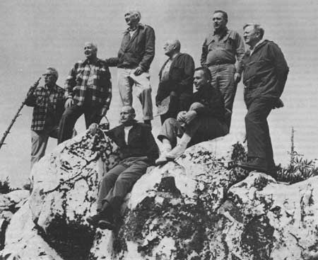
| Figure 117—Prominent wilderness leaders who accompanied Forest Service officials on a 4-day "show-me" trip through National Forests in the Southern Appalachian Mountains, were here looking over the new Shining Rock Wild Area, later called Wilderness, from the crest of Shining Rock on the Pisgah National Forest, N.C., in September 1962, 2 years before passage of the Wilderness Act. The spot is near the "Pink Beds," "Cradle of Forestry." and Blue Ridge Parkway, southwest of Asheville and not far from Great Smoky Mountains National Park. Standing, left to right, were: North Carolina National Forests Supervisor Peter J. Hanlon; Southern Regional Forester James K. Vessey; Harvey Broome, a lawyer and co-founder in 1934 of the Wilderness Society, a leader in the Great Smoky Mountains Hiking Club; William W. Huber, Southern Regional information chief; Pisgah District Ranger Ted S. Seeley; and Supreme Court Justice William O. Douglas. a hiking and wilderness enthusiast. Seated: Ernest M. Dickerman, then director of field services, eastern region, Wilderness Society, later also Washington representative of Tennessee Citizens for Wilderness Planning, and (1982) vice-president of Conservation Council of Virginia; and Charles Rickerhauser. (Forest Service photo F-504012) |
Wilderness Act Sparks Much
Conflict
The Wilderness Act of September 3, 1964 gave Federal statutory recognition to wilderness designation through the establishment of a national system of wilderness areas. [124] The Act was the culmination of 8 or 9 years of intensive legislative debate and lengthy testimony. The first wilderness bill had been introduced by Senator Hubert Humphrey in 1956 following the opposition to and defeat of the proposed Echo Park Dam on the Green River in Dinosaur National Monument, northern Utah and Colorado. That preservation-versus-development controversy illustrated both the political power of militant conservationist groups and the substantial base of their popular support. [125]
Debate over the Wilderness Act focused on three issues: the amount of land to be included in the wilderness system; the addition of lands to the system; and the status of logging and mining in wilderness areas. [126] Most timber, mining, petroleum, agriculture, and grazing interests opposed the legislation; the Forest Service, although a pioneer in establishing wilderness areas, also was strongly against the bill at first, largely because its administrative and land-management prerogatives would be restricted. The statement in the Multiple Use-Sustained Yield Act of 1960 that "the establishment and maintenance of areas of wilderness are consistent with the purposes and provisions of . . . multiple use," anticipated to some extent the wilderness legislation to come. [127] Support for a separate wilderness act was strong, however, and the Forest Service ultimately acceded to the popular movement, lending its expertise to the long bill-drafting and modification process.
The Wilderness Act defined wilderness areas as places "where the earth and its community of life are untrammeled by man, where man himself is a visitor who does not remain." Wilderness areas were to be preserved in a roadless, forested, undeveloped condition. Specifically prohibited in the wilderness system were motor vehicles (land or water), motorized equipment, and the landing of aircraft, except where already established, as well as permanent buildings and lumbering. In general, hunting, fishing, and grazing (but not crop farming) were allowed. Where rights had been previously established, mining and prospecting could continue until January 1, 1984.
The wilderness system defined by the Act incorporated over 14 million acres of areas that were already being administered by the Forest Service as wilderness. In 1924 its Southwestern Region had established the Gila Wilderness Area in New Mexico. In 1929 the Forest Service had set aside large primitive areas in the West and upper Great Lakes region for protection under Regulation "L-20." In 1939 the "U" Regulations formally established a system of wilderness, wild, and primitive areas. (Later the Boundary Waters Canoe Area in Minnesota, much of which had been pledged by the Secretary of Agriculture in 1926 to remain roadless, was added as a distinct administrative entity.) Lumbering, roads, commercial establishments, motor boats, and resorts were all prohibited in the system. Except for size, Forest Service wilderness and wild areas were the same; wilderness areas were larger than 100,000 acres, wild areas were between 5,000 and 100,000 acres. Primitive areas were tracts set aside for further study, although they were administered as wilderness. Altogether, in 1964, the system encompassed over 14,600,000 acres. [128]
The Wilderness Act included the Forest Service's 54 previously designated wilderness and wild areas as the sole initial components of the national wilderness system. Its 34 primitive areas, which accounted for over a third of the 14,600,000-acre system, were to be reviewed over a 10-year period for possible inclusion. Each area could be added to the system only by an act of Congress; prior to congressional action, each area had to be the subject of a public hearing where testimony from Governmental officials and private citizens would be taken.
By 1973, only three areas in the East, formerly designated wild areas, had been included in the wilderness system: Great Gulf, in the White Mountain National Forest in New Hampshire, and Linville Gorge and Shining Rock, both in the Pisgah National Forest. In designating wilderness, the Forest Service had maintained a strict interpretation of its own guidelines. [129] In the East, where most lands had been occupied, logged, or burned, only a few select areas of more than 5,000 acres qualified for wilderness consideration. However, the 7,655-acre Linville Gorge and 13,400-acre Shining Rock tracts were not altogether free from the imprint of man; parts of both areas had been logged and burned about 1900. [130]
However, the national movement for wilderness was strong. Local conservationists expressed dissatisfaction with the exclusion by definition of all but a few eastern lands from the wilderness system. [131] Furthermore, the eastern areas that had been designated wilderness were experiencing a phenomenal increase in public visitation. Linville Gorge and Shining Rock had a recreational use of 5,300 and 5,200 visitor-days respectively in 1968; by 1974, the figures were 21,800 and 12,400 visitor-days. [132] Recognizing the pressure for designating more areas as eastern wilderness, the Forest Service in 1972 asked conservation organizations and natural resource associations for recommendations on ways to classify and preserve wilderness in the East, taking into consideration the special problems posed by the fragmented landownership pattern, the fact that most mineral rights were privately held, and the fact that most rivers and bodies of water within National Forests were not federally owned. [133]
Beginning in 1972, bills were introduced in Congress to establish a special wilderness system; the Eastern Wilderness Act of 1975 resulted. [134] The bill did not attempt to define wilderness as such, but catalogued the value of wilderness as, "solitude, physical and mental challenge, scientific study, inspiration and primitive recreation," Altogether, the Act designated 16 eastern National Forest areas totaling over 207,000 acres as the initial components of the system. Five of the areas were in the Southern Appalachians, as listed in table 22.
Table 22.—New areas designated in Southern Appalachia by the Eastern Wilderness Act of 1975.
| Wilderness | National Forest | Acreage |
| Beaver Creek | Daniel Boone (Ky.) | 5,500 |
| Joyce Kilmer-Slickrock | Nantahala, Cherokee (N.C.-Tenn.) | 15,000 |
| Ellicott Rock | Nantahala, Sumter, Chattahoochee (N.C., S.C., Ga.) | 3,600 |
| Gee Creek | Cherokee (Tenn.) | 2,570 |
| Cohutta | Chattahoochee, Cherokee (Ga., Tenn.) | 34,500 |
| Total | 61,170 | |
Source: The Eastern Wilderness Act. See also Hendee, Stankey, and Lucas, Forest Service, USDA, Wilderness Management, (Washington: Government Printing Office, October 1976), pp. 116, 117, 121.
In addition, the Act named 17 study areas for consideration for inclusion in the wilderness system. They were to be administered as wilderness until a final determination on their status was made, which was to be no later than 1980. Three were in the Southern Appalachian forests: the 1,100-acre Craggy Mountain area in Pisgah National Forest, and Big Frog and Citico Creek in the Cherokee, totaling 18,500 acres.
The Roadless Areas Reviews (RARE)
Before the Eastern Wilderness Act was passed, efforts had been underway to expand the national wilderness system. In 1971, the Forest Service initiated a review process called RARE (Roadless Area Review and Evaluation) in which National Forest roadless areas not included in the previously named Primitive Areas were identified and rated for possible wilderness designation. [135] The result of the RARE process was a list of 274 study areas, published in late 1973. Very few, however, lay east of the 100th meridian.
Although the Eastern Wilderness Act of 1975 established an eastern wilderness system, public pressure for more wilderness, and Federal dissatisfaction with the slow process of study and evaluation before public land use could be allocated, precipitated another review of potential wilderness sites. [136] Another Roadless Area Review and Evaluation was begun in 1977, which immediately came to be known as RARE II.
RARE II was proposed as a national town meeting wherein the public would help select potential wilderness sites and then evaluate them. The RARE II process thus built upon and extended the requisite for public involvement in Forest Service planning that had been expressed in legislation since 1964. [137] The evaluation demanded a quick decision: within a year and a half, each site was to be designated either "wilderness," "nonwilderness," or "needing further planning"—subject to congressional approval or modification. During the summer of 1977, workshops were held throughout the country to review a preliminary list of Forest Service-proposed wilderness sites and to suggest designation of others. On August 6, 1977, a public workshop was held in Dahlonega, Ga., to comment on wildernesses proposed in the Chattahoochee National Forest. At this meeting, the public literally drew boundaries on maps around areas they favored for wilderness.
After considering the public comments, the Forest Service selected 2,688 areas nationwide for possible wildernesses. The criteria for eastern wildernesses were different from those of western areas; for example, they could contain one-half mile of improved road for every 1,000 acres. Nevertheless, relatively few areas were named in the eastern forests, and not even 3 percent were in the forests of the Southern Appalachians. [138]
In June 1978 the Forest Service published its Draft Environmental Statement announcing the potential wildernesses, and during the summer and early fall, solicited public response. Town meetings were held to explain the RARE II process, to outline the possible wilderness areas, to clarify wilderness management, and to receive public questions and comments. Largely through announcements in local newspapers and other media, the agency openly sought letters, written comments on pre-printed forms, and visits from the public. [139]
The size and intensity of the public reaction surprised some in the Forest Service. Altogether, 264,093 separate responses (with 359,414 signatures) were received nationwide, "the largest number of comments the agency had ever received on a Draft Environmental Statement—or on anything else for that matter." [140]
Mountaineers Protest Strongly
The response of southern mountaineers, although part of the national reaction, was particularly strong, one-sided, and widespread. In one sense, the emotions expressed went beyond their typical and long-standing mistrust of government, frequently noted by Appalachian scholars; in another, they were no more than a release of pent-up frustrations and dissatisfactions with the Federal Government. [141]
From the beginning of the land acquisition program the Forest Service had filled many roles in relation to the local population: Buyer, patron, employer, persuader, educator, disciplinarian, friend. In most of these roles the agency activated some respect of the relationship and guided it toward a predefined goal. For example, from earliest days it chose to crusade against man-caused forest fires. This effort led to interactions with the local population that varied according to the personalities of the ranger and careless burner or incendiarist involved. [142] The mountaineer's resistance, although not always passive, had been generally silent. His frustrations became increasingly pronounced during the 1960's, however. The relationship between Forest Service managers and both the recently arrived and long-settled local populations became more and more strained by complexity and distance.
One factor that contributed to the strain was the change in the defined role of the district ranger. Because of the growing public demands on the National Forests and the increased complexity of land management, the ranger was drawn more and more into an administrative role. He was expected to be the "whole man," handling all aspects of land management and public relations. [143] To ensure that the ranger performed his job well, much of the time he had formerly spent training forest technicians and work crews was transferred to his district staff. As paperwork multiplied, he had to spend more time in his office and less in the forest. [144]
During the 1960's, throughout the region, the ranger's office was moved from the forest into nearby towns. Such relocation was done primarily to give the towns an economic boost and to enhance public access to the ranger, but it proved generally detrimental to his relationships with the people in his district. As a Chattahoochee forester explained the problem, rural folk traditionally came to town only once a week—Saturday. Thus, if the ranger was based in town and tied to his desk, people would see him at most only one day out of seven. [145]
This distance between the ranger and the rural residents was even more pronounced in the case of the forest supervisor. The former ranger assistant, L. E. Perry of McCreary County, writes with some acidity and apparent disgruntlement on the remoteness he perceived in the Daniel Boone forest managers:
The office of the forest supervisor of the Daniel Boone forest was located as far from the national forest as politely possible, at Winchester, Kentucky, in the heart of Bluegrass country, amidst horse farms, stately homes and country clubs. From this comfortable position the supervisor with a large staff of subalterns has directed the activities of his district rangers. As the forest supervisor he belongs to an elite group of minibureaucrats because he holds one of about 150 such positions in the United States. On rare occasions a forest supervisor makes a brief tour of the ranger stations on the forest but keeps a discreet distance from the general public, taking great pains to shun all politicians below the office of Governor or a U.S. Congressman, and aloof from most corporation executives or professional people unless circumstances dictate otherwise. [146]
Perry's description of the role and attitude of the forest supervisor, if strongly biased and inaccurate, nonetheless reflects the estrangement the mountaineer sometimes felt between himself and the Forest Service.
Another factor that contributed to this estrangement was the replacement in the mid-1960's of the fire warden system. Under this system, which had been in existence for decades in the eastern forests, a fire warden—a local man selected by the ranger for his leadership and reliability—headed a team of about 10 citizens who could be summoned immediately on notice of a fire. Fires were reported to the warden, who is turn reported to the district ranger. [147] Over the years, however, the type of person suitable to serve as warden had become harder to find. Increasingly, such citizens commuted to work in nearby towns or cities; they were not at home to respond to fire emergencies or to activate a fire crew. [148]
In the 1960's, aerial detection and special fire crews became the chief means of fire control, and the need for fire towers, crews to man them, and local labor declined. Although the new fire protection system was more efficient and helped substantially to reduce the size and number of fires, a chain of communication between the ranger and local community was broken. "Gone was much of the direct contact with the local folks and their appreciation of the Forest Service attitudes, interests and personnel." [149] The same was true of local involvement with timber stand improvement and tree planting, as during the 1960's much of this work was contracted out to professionals. [150]
Thus, it is apparent that during the 1960's and 1970's, as the size of the Forest Service administrative staff increased, and as mountaineers were contacted less often about its activities, local resentments towards Federal land managers in the Southern Appalachians increased. At the same time, throughout the region, public land acquisition intensified: the Federal Government had pressed for recreational land even to the point of taking it by condemnation, and more and more outsiders had arrived to buy whatever was left. In the eyes of many mountaineers, its proposal to designate local land as wilderness was an intolerable last straw.
The Forest Service, however, was sensitive to local feelings. It was specifically asking the people to voice opinions on a major land-management issue. Such a request was part of a recently increased Servicewide effort to involve the public in the National Forest planning process; however, it was not only new to the mountain people, but also alien to their usual method of handling community problems:
[It] may be that the methods used by the Forest Service to elicit public input are not those that fit with the social and cultural ways of local Western North Carolina people. Natives of this area have generally been reluctant to speak in public meetings, write letters to public officials, or organize to put political pressure on national government organizations, especially if there is any division of opinion within their own communities on an issue. [151]
Reluctance notwithstanding, RARE II sparked an historically atypical response in the region that often surprised forest officers.
On the whole, the mountain people opposed more wilderness, especially in the Cherokee and Chattahoochee forests. Even in North Carolina, where out-of-State interest in RARE II was strongest, about 62 percent of respondents opposed more wilderness, 32 percent supported more. [152]
Opposition to wilderness was directed at the Federal Government in general. A citizen of Elizabethton, Tenn., for example, said simply, "Upper East Tennesseans do not want anyone in Congress to tell us what is Wilderness. I am opposed to it." [153] More often, however, people responding to RARE II focused on specific sites. Certain areas drew particular interest—like Blood Mountain in the Chattahoochee, Clifty area of the Red River Gorge in the Daniel Boone, Southern Nantahala in the Nantahala and Chattahoochee forests, Cheoah Bald in the Nantahala, and Citico Creek in the Cherokee forest, Many people wanted some of the areas to be wilderness; other areas were almost universally favored for nonwilderness, and some drew a mixed response. [154]
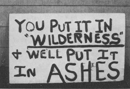
|
| Figure 118.—Homemade sign on plywood made by opponents of expanded wilderness areas in North Georgia during the Forest Service's second Roadless Area Review and Evaluation (RARE II) hearings in the late 1970's. (Photo by Chattahoochee National Forest) |
Restrictions, Outsiders Seen as
Threats
Opposition to more wilderness in the region was based on several issues: (1) the ban on logging in wilderness; (2) the threat of losing county tax revenue; (3) the exclusion of motorized vehicles from wilderness; (4) the "invasion" of the area's National Forests by "outsiders"; (5) the threat to private holdings within and adjacent to wilderness areas, and (6) the rights of the Federal Government versus those of the private citizen.
These issues were not always clearly understood or articulated. In spite of the town meetings and press releases, misinformation circulated widely, even through the local newspapers. The Watauga Democrat of Boone, N.C., stated in August 1978 that under RARE II, "There will be no hunting, fishing, or other recreational use of the [wilderness] lands." [155] Two newspapers in Towns, Ga., implied that the wilderness nearby was being established for blacks and the unemployed. (There were no blacks in Towns County.) Thus, as one pro-wilderness resident of Hiwassee, Ga., wrote, "fear and bigotry was the reason" for RARE II opposition. [156]
Lumbermen throughout the Southern Appalachians strongly opposed wilderness proposals. As Opel Smallwood of Frenchburg Ky., expressed it, "There's a world of timber in there . . . just falling down and will go to waste." [157] Areas where the lumber industry was predominant were particularly opposed. The Shady Valley community of Carter County, Tenn. for example, had two sawmills employing about 30 men, heavily dependent on Cherokee forest timber. The timber operators feared that designating the nearby Beaver Dam Creek area as a wilderness would force them to close their mills. The Forest Service's internal assessments concurred that one or both mills might close if Beaver Dam Creek was declared a wilderness. [158]
Similarly, in remote Graham County, N.C., on the southern border of Great Smoky Mountains National Park, where 75 percent of the labor force was employed in timber-related jobs, antagonism toward RARE II was strong. Six of the roadless areas under study, including Cheoah Bald, were in the county—which is 60 percent in National Forest. In 1977 the Doyle Brock Bemis Lumber Co. of Robbinsville began petitioning the forest supervisor's office in Asheville, and several citizens' groups were organized in the area. [159]
The timber interests expressed opposition to RARE II primarily through lobbying and newspaper campaigns. Long accustomed to supporting and protecting their interests, they were familiar with methods of political persuasion. In addition to writing letters to their district rangers, timber groups visited their city councils and congressmen, or wrote letters to local newspapers. The Appalachian Hardwood Council, which represents many of the South's largest timber companies, sent officials to Washington in the summer of 1978 to protest further wilderness in the southern mountains. [160]
Numerous letters to district rangers expressed fear of counties losing incoming because of wilderness. RARE II gave many people the chance to express their belief that the Federal Government had been shortchanging their local governments for years. Although the Payment-In Lieu-of-Taxes Act had substantially increased payments to Southern Appalachian counties with National Forests, some either were unaware of the increase, or considered 75 cents per acre still inadequate compensation. [161]
Probably the most widely expressed opposition to the proposed wilderness in the Southern Appalachians was based on the exclusion of roads and motorized vehicles. Although hunting and fishing were to be permitted in wildernesses, access was limited to horseback or foot travel. Hunters and fishermen, accustomed to entering the woods in a pickup or 4-wheel drive vehicle, loudly attacked the restriction. Protests came from sportsmen's clubs, such as the Carter County Hunting and Fishing Club in Tennessee, as well as from individual sportsmen. As a resident of Lakemont, Ga., wrote, "I like to hunt and fish, but would like to drive within easy walking distance." [162] The letters of protest also came from mountaineers who use the woods for berrying and gathering firewood. Quite a few complained that the roadless designation was discriminatory. A Rabun County citizen wrote:
If roads are closed, only the young, hale and hearty will be able to use the inner-regions of the wilderness while the elderly, handicapped and those who are not well-in-body will have to nibble around the edges. It's not right . . . it's not American. [163]
Some of the protest against wilderness designation focused on the outsiders who visit the National Forests. A Marble, N.C., man, interviewed by CBS News, wondered, "People in Raleigh and Washington, D.C., they don't have to make their living here. They don't have to heat with wood. Where we gonna' get heater wood? Where's these men gonna' work over here?" [164] Although many expressed concern about the general overuse of wildernesses, some spoke disparagingly of the type of people attracted to them. Throughout the region, the mountaineers made a clear distinction between themselves and the weekenders who hiked the Appalachian Trail, rode the Chattooga River, or backpacked near the Red River Gorge of the Daniel Boone. A Georgia resident wrote, "I used to be able to drive with my family down on the Chattooga and camp out. Now it is only open to river riding hippies." [165] Another Georgia resident wrote, "I like to be able to get out and ride Dune Buggies and 4 Wheel. I don't like these city slickers and Hippies taking over." [166]
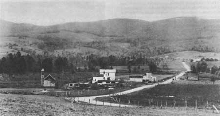
|
| Figure 119.—Shady Valley, Tenn., in December 1928, then a cluster of farms surrounded by forested hills with some fields returning to forest, adjoining the Unaka (now Cherokee) National Forest. (NA:95G-230401) |
Private Inholdings Are
Protected
Emotions sparked by RARE II also ran high over the question of private inholdings within designated wildernesses. The Eastern Wilderness Act provided for acquisition of inholdings, but put no specific restrictions on the use of private land within or adjacent to wilderness. The Act authorized condemnation or exchange when the use of an inholding was incompatible with wilderness, but it did not define incompatibility. Since some of the proposed wildernesses contained several inholdings, the ambiguity created some alarm. For example, the 11,115-acre Clifty area in the Red River Gorge contained 2,145 acres in private ownership. Most was in summer-home lots and vacation cabins, but there was one permanent resident, the elderly Mrs. Ernie Tyra. Mrs. Tyra, who had optioned 115 of her 250 acres for sale to the Government, seemed less concerned about the wilderness designation than the second-home owners in the area, many of whom sent written comments to the forest supervisor. [167] Although the Clifty area was finally selected for wilderness, it was determined that the inholdings, if their present use continued, were not incompatible with wilderness, and that nothing in the area would change, "except that it [the designation] will never be changed." [168]
In the Chattahoochee National Forest, the proposed Blood Mountain and Broad Camp roadless areas stirred inholders' reactions. When their perimeters were originally drawn, several summer homes in the vicinity of Lake Winfield Scott, and private lands with farms, chicken houses, and commercial enterprises were included. Clearly, some of these would be incompatible with wilderness. People asked what would become of these settlements—would their land-use options be restricted? Would the Forest Service take their land? The Forest Service, however, was unable to give a precise, definitive answer.
A public meeting was called in April 1978, in Suches, Union County, Ga., to which the Chattahoochee supervisor was called to explain the agency's intentions, Suches is a hamlet of only a few families cradled in the hills, but over 200 people were gathered in the local Woody Gap School. The crowd was visibly hostile; the supervisor was grateful to have had an assistant and two local ministers, Baptist and Methodist, acting as moderators and protectors. [169]
The meeting passed without violence. Primarily as a result of the meeting, the supervisor acted to insure that the boundaries of the areas recommended for wilderness were redrawn to eliminate all private lands. He published a letter to the citizens of northern Georgia acknowledging a Forest Service error, and the validity of local concern. [170]
How Much Wilderness?
Finally, some of the opposition to RARE II was based on the general issue of Federal rights and the particular issue of how much land and land-use control the Federal Government should have. "Must the Forest Service be so greedy?" a Young Harris, Ga., woman asked. [171] A Blairsville, Ga., dentist wrote, "Although I'm an avid environmentalist, I feel that the current proposed legislation imposes too much upon the citizens' rights under our Constitution." [172]
Throughout the Southern Appalachians, citizens were not content simply to write protest letters to their district rangers. Many of them organized protest groups. Jack Brettler, of Franklin, N.C., started the Save America Club; Jimmy Rogers, a Baptist minister with interests in timber, organized the Stop RARE II Coalition in western North Carolina and northern Georgia. The Coalition issued "Stop RARE II" bumper stickers, which were popular on the mountain roads. [173] By far the largest and most effective local organization was SORE—Save Our Recreational Environment. SORE was formed in September 1977, in Tellico Plains, Monroe County, Tenn., and was led by the mayor, Charles Hall. SORE boasted about 2,500 members, but it sponsored many times that number of protest letters. SORE inundated the Cherokee forest office with written comments on RARE II. Indeed, Tennessee ranked fifth nationally in the number of responses received, more than half of them sponsored by SORE. [174]
The intense, instant opposition to RARE II in the Tellico Plains area can be explained largely by the concern already present over the halting of the Tellico Dam and Tellico-Robbinsville Scenic Highway. Both of these projects had been stopped by environmentalist protest but were favored by the local population because they would boost the area's marginal economy. [175] The Tellico Dam, a proposed TVA project on the Little Tennessee River, was halted by a court ruling based on the threat to the snail darter, an endangered fish species. [176] The Scenic Highway, which had been approved in 1964, was opposed from the beginning by environmentalists because its path traversed a portion of the Joyce Kilmer Memorial Forest, a remote and pristine area of the Nantahala National Forest. [177] The original route was shifted, and one-third of the highway had been completed through the Cherokee National Forest on the Tennessee side when it was halted by environmental opposition.
SORE thus represented a convergence of issues. Moreover, the success of SORE was partly attributable to the ease with which local residents and vacation homeowners could work together. In contrast to the situation in northern Georgia and southwestern North Carolina, many second-home owners in the East Tennessee mountains had roots there. Although they lived in Chattanooga or Knoxville, their families had come from the mountains, and they felt at home there. They drove the same cars, and looked and talked the same, as the full-time local residents. Thus, the two groups worked easily together for a common goal: no more mountain wilderness. [178]
Considering the high level of emotion, concern, and involvement generated by RARE II, it is not surprising that antiwiliderness protest threatened at times to become violent. The level of hostility at RARE II meetings was often high. In Franklin, N.C., in early August 1978, the Forest Service presented an "information meeting," which brought "a caravan of cars and pickups, heavy log-loaders and tractor-trailer rigs" to town. [179] Citizens had previously agreed to refrain from verbal comment at the meeting. However, when one unidentified man yelled, "We don't want no more damned wilderness," the mayor of Franklin, claiming to be a protestor himself, led a walkout. [180]
The most widespread threat expressed was burning the forests, should they be designated wilderness. For example, in the Chattahoochee National Forest in the summer of 1978, a plywood roadside sign was posted that read, "You put it in 'wilderness' and we'll put it in ashes." [181] Such threats were verbal as well as written, and became a popular subject of local newspaper editorials and analyses. April 1978 was a month of unusually numerous fires across the Southeast, attributable in part to unseasonably dry weather. Some of the fires, however, were called deliberate. [182] That month, the Asheville Citizen-Times in an editorial discussed reasons for deliberate forest burning. Acknowledging the Southern tradition of burning the woods for the purpose of clearing land and eliminating rodents, snakes, and insects, the article also cited revenge and 'misguidance' as motivations, "'Big government,' . . . an unresponsive society . . . foresters," all were cited as targets of vengeful burning. [183] (Ironically, that very month, in McCreary County, Ky., the Forest Service was embarrassed when a debris-burning fire it had set to clear a 100-acre plot flattened by a tornado spread out of control, aided by very dry brush and gusting winds, until it had covered 1,400 acres in the Daniel Boone National Forest. [184]
However, although there were threats and hints of violence, there were almost no violent acts documented. Rangers on the Cherokee observed that, even at the height of the RARE II conflict, the number of incendiary fires remained about the same as for the previous 10 years. [185] In both the Pisgah and Nantahala forests, although the total number of man-caused fires (accidental or deliberate) in 1978 was greater than in 1977, it differed little from that of 1976. [186] In general, mountain people were striving to control the forests for the uses most important to them—hunting, fishing, gathering, fuel, and timber. In spite of the threats, there was no hostile intent toward the forests themselves, [187]
By the end of 1978, the wilderness recommendations were announced—only 89,000 acres in the Southern Appalachians, a large portion of which was the Southern Nantahala area of the Nantahala and the Chattahoochee National Forests. Other sizeable designations were the Brasstown Bald area of northern Georgia and the Clifty area of Kentucky. In Tennessee, only one roadless area, the Bald River Gorge east of Knoxville, was recommended for wilderness—less than 4,000 acres. Considerably more land was slated for nonwilderness status than was put into the further planning category. In the Cherokee forest, only 38,100 acres were assigned to further planning; in the Chattahoochee, more than 93,000. Further planning areas are to be managed as wilderness until their status is finally decided. [188]
With the announcement in early January 1979 of the outcome of the RARE II process, the public furor subsided. However, the issues raised during RARE II remained alive, and only partially resolved. The RARE II outcome obviously could not please everyone, and, as expected, some of the groups that contributed heavily to the public response were not pleased with the results. In Tennessee, where only Bald River Gorge was committed to wilderness, environmentalists were outspoken in their disappointment. In Tennessee and North Carolina, the Wilderness Coalition, the Sierra Club, and other prowilderness groups vowed to exert strong pressure for the areas under "further planning" to be designated wilderness. [189]
In some mountain areas, people continued to protest any land being designated wilderness; and some felt that too few areas were designated nonwilderness. Jack Brettler, of the Save America Club in North Carolina, expressed disappointment that the Harper Creek tract, which contains uranium deposits, was recommended for further study. [190] Antiwilderness forces of Robbinsville, N.C. were upset that three out of the six sites in Graham County were designated wilderness, and vowed to get the other three assigned to multiple use. "We're going to fight just as hard for those areas as if there were six. We're going to fight full steam." [191] In northern Georgia, many mountain communities expressed concern about the acres set aside for further planning. As the Towns County school superintendent said, "People are afraid that the federal bureaucracy will take a little more each year, and you lose more and more." [192]
Mining Issue Is Unresolved
A potentially more explosive issue was not addressed by the RARE II process and remained unresolved: mining in National Forest wilderness areas. Shortly after the Wilderness Act was passed, the Chief of the Forest Service expressed concern that this issue could cause "some of our most difficult administrative problems." [193] Under the Wilderness Act and Eastern Wilderness Act, mining was permitted in designated wilderness areas, according to terms of preexisting leases and permits, until December 31, 1983. [194] (In the eastern National Forests, mineral rights under one-third of the land are not owned by the Government; either they were reserved by the seller when Federal acquisition occurred or they were already outstanding in third parties. In the Daniel Boone and Jefferson forests, where coal deposits are known to exist, even more of the subsurface mineral rights are held by private interests. For example, of 85,000 acres on the Clinch Ranger District of the Jefferson, 55,000—or 65 percent—have privately held mineral rights.)
Although the Forest Service has been unable to dictate the extent of mining in parts of the Southern Appalachian forests, mineral extraction prior to 1975 was limited, and most was through deep mining, which generally did not jeopardize other forest uses. [195] However, as strip-mining of marginal lands became more economically feasible, the threat of major land-use controversies grew. In the late 1970's, such a controversy erupted over strip-mining in the Beaver Creek wilderness of the Daniel Boone National Forest.
In 1975, the Greenwood Land and Mining Co., which operated four deep mines in the Daniel Boone forest, purchased rights to 5,000 acres of coal under the Beaver Creek wilderness in McCreary County—rights that had been reserved when the land was sold to the Government in 1937. Greenwood applied for a permit to prospect for coal at 27 sites, 22 of which were in the wilderness. The prospecting would have involved the use of motorized equipment and excavation. Ultimate recovery of the coal would require some contour stripping. [196]
The Forest Service denied the permit, on the basis that the prospecting was not compatible with wilderness management. Greenwood filed suit in U.S. District Court in November 1976; the court ruled in favor of Greenwood, but, commenting on an issue beyond the immediate suit, added that strip-mining could not occur on public property. [197] Meanwhile, the Forest Service began planning to acquire Greenwood's interests in the Beaver Creek area, as the mining company appealed its case. Neither initiative had been settled by early 1982. [198]
A similar case in the same county had a different outcome. In 1976 the Stearns Coal and Lumber Co. applied for a permit to strip-mine 15 acres of National Forest land on White Oak Creek. The Forest Service denied the application, citing the Secretary of Agriculture's Rules and Regulations of 1911 with which Stearns' reserved rights had to comply. [199] Stearns "wholly rejected" the premises of the Forest Service denial, and took the case to court for resolution. [200] In 1978, the Kentucky State Supreme Court upheld the Kentucky tradition that, in the case of a broad form deed, mining rights take precedence over surface rights, even if the surface owner is the United States Government and the surface is "public property."
The case went to Federal court, and in early 1982 was still unsettled, The outcome of the case will have repercussions not only in McCreary County, where Greenwood Land and Mining Co. is seeking to traverse and possibly strip within the Beaver Creek wilderness, but throughout the Daniel Boone and other eastern National Forests. The most decisive recourse for the Forest Service would be acquisition of or exchanging other land for the mining rights to such land—either a very expensive solution.
By early 1982, Congress had not yet acted to establish the recommended new wilderness areas in the Southern Appalachians. In the meantime, public use of most of the areas that had been previously designated wilderness was increasing substantially. In only 3 years, between 1977 and 1980, the estimated recreational use of the eight wildernesses of the Southern Appalachians increased by over 13 percent. [201] The pressures on the forests of the region, from backpackers, Federal recreation developers, and the mountaineers, seemed focused on wilderness areas. Yet the issues surrounding wilderness—particularly strip mining and the acquisition of inholidings—remained unresolved.
Reference Notes
2. "The ORRRC Recommendations—1962," in Phillip O. Foss, Conservation in the United States: A Documentary History (New York: Chelsea Publishers, 1971), pp. 581-587. See also Edwin M. Fitch and John F. Shanklin, The Bureau of Outdoor Recreation (New York: Praeger Publishers, 1970), pp. 60-78.
3. The Bureau of Outdoor Recreation (BOR) was created April 2, 1962, by Interior Secretary Stewart L. Udall under the authority of Reorganization Plan No. 3 of 1950. Foss, Conservation in the United States, p. 595. See also Fitch and Shanklin, The Bureau of Outdoor Recreation, BOR was deactivated January 25, 1978 by Secretary Cecil D. Andrus, and its functions shifted to the new Heritage Recreation and Conservation Service, which was abolished February 19, 1981 by Secretary James Watt and most functions shifted to the Park Service.
4. "Executive Order Establishing the Recreation Advisory Council, April 27, 1962," in Foss, Conservation in the United States, pp. 601, 602.
5. 77 Stat. 49., Foss, Conservation in the United States, pp. 601-623.
6. U.S. Department of the Interior, Bureau of Outdoor Recreation, A Report on Outdoor Recreation Demand, Supply, and Needs in Appalachia. Prepared for the Appalachian Regional Commission, September 1967, pp. 20-27. Recreation As An Industry, Appalachian Research Report No. 2. Prepared for the Appalachian Regional Commission by Robert R. Nathan Associates, Inc. and Resources Planning Associates, Washington, D.C., December 1966, p. v.
7. 78 Stat, 897. See Chapter VII for discussion of LWCF acquisition in the Southern Appalachian forests.
8. LWCF Act, Section 6 (a) (1).
9. Fitch and Shanklin, The Bureau of Outdoor Recreation, p. 74.
10. "The Recreation Advisory Council Policy on National Recreation Areas, March 26, 1963," in Foss, Conservation in the United States. pp. 444-448.
12. Letter from the Secretary of Agriculture in Establishment of the Mount Rogers National Recreation Area in Virginia, Report to Accompany H.R. 10366, 89th Congress, 1st Session, p. 5.
13. Letter from the Secretary in Mt. Rogers Report, pp. 5-7. See also William E. Shands and Robert G. Healy, The Lands Nobody Wanted, p. 44. (Washington: The Conservation Foundation, 1977).
14. Recreation-Use Information, computerized data on microfiche, Recreation Management Staff, USDA, Forest Service, Washington, D.C.
15. Act to Establish Mount Rogers, Section 3 (a).
16. Establishment of the Mount Rogers National Recreation Area in Virginia, pp. 4, 5. (See note 12).
17. Letter from the Secretary of Agriculture in Establishment of the Mount Rogers National Recreation Area in Virginia, 5.
18. Letter from the Secretary of Agriculture, 5. Update on easements obtained by Frank J. Harmon, History Section, Washington Office, in telephone conversation with Philip B. Etchison and William E. Clark, Lands Staff, Southern Region, Forest Service, Atlanta, Ga., January 28, 1982.
19. Information on general acquisition perspectives on Mount Rogers NRA provided by Charles A. Blankenship, Recreation Staff, Jefferson National Forest, Roanoke, Va., February 19, 1981.
20. Information provided by William E. Clark, Lands Staff, Forest Service, Regional Office, Atlanta, Ga., February 20, 1981, and January 29, 1982. Additional data provided by Philip B. Etchison, Group Leader, Landownership, Lands Staff, Southern Regional Office, USDA Forest Service, Atlanta, Ga., September 15, 1981. PL 91-646, known as the Uniform Relocation Assistance and Real Property Acquisition Act of 1970 (84 Stat. 1894), became law on January 2, 1971. See Title I, paragraph 101. An example of a Mount Rogers condemnation case based on a dispute over the price of land is that of John Kabler, Kabler, a banker from Delray Beach, Fla., purchased a 106-acre tract in the Fairwood Valley area of Smythe County in June 1972 for $22,000. According to the Forest Service correspondence file on the Kabler case, Kabler had been informed bfore purchasing the property that the Forest Service needed it for the NRA. Almost immediately after acquisition, he began improvements to the property, including a vacation cabin, septic field, roads, and clearing. The Forest Service began efforts to acquire the tract but Kabler, although continually informing the Forest Service of his improvements, professed a complete unwillingness to sell. He wrote letters and visited politicians to protest both the acquisition itself and the approximately $40,000 appraised value the Forest Service offered. The case was finally settled in court in June 1974 when Mr. Kabler was awarded $75,000, nearly three and a half times the value of the tract two years before.
21. Newsletter of the Citizens for Southwest Virginia, Troutdale, May 1978, p. 7.
22. Newsletter of the Citizens for Southwest Virginia, August 1978, p. 3.
23. Interview with Charles Blankenship, Jefferson National Forest, Roanoke, Va., February 1981.
24. Telephone interview with Lawrence Pierce, Citizens for Southwest Virginia, Troutdale, Va., February 25, 1981.
25. Interview with Charles Cushman, President, National Inholders Association, Sonoma, Calif., March 6, 1981.
26. A detailed account of the Big South Fork project is in Perry, McCreary Conquest, pp. 151-164; updated by author's interview with Robert Strosnider, Lands, Daniel Boone National Forest, Winchester, Ky., March 10, 1981. See also, Patrick E. Tyler, "Why It Helps to Know Sen. Howard Baker," The Washington Post, March 15, 1981.
27. Tyler, "Why It Helps to Know Sen. Howard Baker."
28. L.E. Perry, McCreary Conquest, A Narrative History (Whitley City, Ky.: L. E. Perry, 1979), p. 164; Tyler, "Why It Helps to Know Sen. Howard Baker."
29. 88 Stat, 12, 43; PL 93-251, Section 108. Telephone interview with Charles Hooper, Chief, Real Estate Division, Nashville Office of the U.S. Army Corps of Engineers, March 13, 1981.
30. Interview with Charles Hooper, U.S. Army Corps of Engineers. Tyler, "Why It Helps to Know Sen. Howard Baker."
31. "The Lesson of Gatlinburg, Courier Journal, Louisville, Ky., September 12, 1978.
32. Perry, McCreary Conquest, p. 164.
34. Some confusion over the Federal designation of a Wild River versus a State designation is apparent in the case of the Big South Fork of the Cumberland River in the Daniel Boone National Forest. L. E. Perry, in his book McCreary Conquest, stated that the Big South Fork had been designated under the Wild and Scenic Rivers Act of 1968; in fact, the river became a Kentucky Wild River under the Wild Rivers Act of 1972, and is administered by the Kentucky Department for Natural Resources and Environmental Protection, "Wild Rivers of Kentucky," publication of Department of Natural Resources and Environmental Protection, Frankfort, Ky., n.d.
35. This designation was legislatively confirmed by PL 94-407, September 11, 1976.
36. Environmental Impact Statement—Modified Blue Ridge Project No. 2317, Federal Power Commission, June 1973, pp. 37, 38.
37. A glossy folded brochure entitled, "The New River, A Heritage Endangered," with colored photographs, was distributed by the National Committee for the New River. Reports were regularly printed in Committee letterhead,
38. National Committee for the New River, "Up-Dated Report, People Versus Power," Winston Salem, N.C., n.d., p. 7.
39. "New River—Chronology of Events," Bureau of Outdoor Recreation internal document, April 16, 1976.
40. Final Environmental Statement—Proposed Scenic Designation of South Fork New River, U.S. Department of Interior, Bureau of Outdoor Recreation, March 1976, pp. 199, 200; Revised Management Plan—South Fork New River and Main Stem New River, North Carolina. North Carolina Department of Natural and Economic Resources, June 1975.
41. Interview with County Manager, Ashe County, N.C., February 19, 1981.
43. Information provided by Charles D. Huppuch, Lands Staff, USDA Forest Service Regional Office, Atlanta, Ga., February 1981.
44. "Guidelines For Evaluating Wild, Scenic and Recreational River Areas Proposed for Inclusion in the National Wild and Scenic Rivers System Under Section 2, Public Law 90-542," Department of the Interior, February 1970, pp. 7, 8.
45. Interview with Pat Thomas, Supervisor, Chattahoochee National Forest, Gainesville, Ga., July 11, 1979; supplemented with interview with Charles Huppuch, Lands Staff, USDA Forest Service Regional Office, Atlanta, Ga.
46. Steve Oney, "The Wilderness Campaign," The Atlanta Journal and Constitution Magazine, Atlanta, Ga., September 24, 1978, p. 18.
47. Recreation-Use Information, Recreation Management Staff, USDA Forest Service, Washington, D.C.
48. Comments provided by P. Ledford, Clayton, Ga., to Chattahoochee National Forest Headquarters, Gainesville, Ga., June 30, 1978.
49. Sally Kirk Fairfax, "Federal-State Cooperation in Outdoor Recreation Policy Formation: The Case of the Appalachian Trail," (Ph.D. dissertation, Duke University, 1974), pp. 12-33. See also Edward B. Garvey, Appalachian Hiker II (Oakton, Va.: Appalachian Books, 1978), pp. 6-20.
50. "Appalachian Trail Protection Progress Report," Status as of August 1981. Provided by Land Acquisition Field Office, National Park Service, Martinsburg, W.Va.
52. 82 Stat, 919; Section 5 (a).
53. 82 Stat. 919; Section 7 (g).
54. Interview with Vince McCormack, Lands Staff, USDA Forest Service, Regional Office, Atlanta, Ga., July 10, 1979. Confirmed in telephone interview with Charles D. Huppuch, Lands Staff, February 17, 1981.
55. Sally Kirk Fairfax, "Federal-State Cooperation in Outdoor Recreation Policy Formation: The Case of the Appalachian Trail," pp. 132-143. The Forest Service and Appalachian Trail Club also differed over interpreting the 1968 Act.
58. Information provided by Charles D. Huppuch, Lands Staff, USDA Forest Service Regional Office, Atlanta, Ga., February 17, 1981.
59. Land Acquisition Field Office, Appalachian National Scenic Trail, U.S. Department of the Interior, Martinsburg, W.Va., October 30, 1981.
61. 92 Stat. 159; Section 5 (a) (1).
62. In fiscal year 1980, no funds were appropriated from the Land and Water Conservation Fund for Appalachian Trail right-of-way acquisition. However, other LWCF funds from the West were utilized for Trail purposes. Acquisition was slowed, but did not stop. Some funds also became available late in FY 1981. Information provided by Lands, Staff, USDA Forest Service, Regional Office, Atlanta, Ga., February and October, 1981.
63. Forest Service Lands Staff, Atlanta, Ga., February, 1981.
64. Information provided by Charles D. Huppuch, Lands Staff, USDA Forest Service Regional Office, Atlanta, Ga., February and October, 1981.
65. U.S. Department of Agriculture, Forest Service, Southern Region, "Red River Gorge—Land of Arches," See also Robert F. Collins, A History of the Daniel Boone National Forest (Lexington, Ky.: University of Kentucky Press, 1975), pp. 270-279.
66. Interview with Robert Reynolds, Lands, Daniel Boone National Forest, Winchester, Ky., March 13, 1981.
67. Joe Lamb, "Forest Service Criticizes Gateway Opposition to Wilderness Areas," Morehead News, Morehead, Ky., May 25, 1979.
68. Interview with Dr. Billie DeWalt, University of Kentucky anthropologist employed by the Forest Service to study Red River Gorge community, Winchester, Ky., July 27, 1979.
69. Fitch and Shanklin, The Bureau of Outdoor Recreation, p. 73. (See notes 2, 3, and 9.)
70. See Jesse R. Lankford, Jr., "The Campaign For a National Park in Western North Carolina, 1885-1940," Master's thesis, Western Carolina University, 1973, and Harley E. Jolley, "The Blue Ridge Parkway: Origins and Early Development," Ph.D. dissertation, Florida State University, 1973, as cited in Chapter V.
71. Recreation As An Industry, Appalachian Research Report No, 2. Prepared for the Appalachian Regional Commission by Robert R. Nathan Associates, Inc. and Resources Planning Associates, Washington, D.C., December 1966, p. v.
72. ARC's turnabout is cynically described by Anita Parlow, "The Land Development Rag," in Helen Matthews Lewis, Linda Johnson, and Donald Askins, Colonialism in Modern America: The Appalachian Case (Boone. N.C.: The Appalachian Consortium Press, 1978), pp. 190, 191.
73. Neil Walp, "The Market for Recreation in the Appalachian Highlands," Appalachia 4 (November-December 1970).
74. Walp, "The Market for Recreation in the Appalachian Highlands," p. 30.
77. A recent disseration identified six counties with high concentrations of tourism in the Southern Appalachians, based on the relative importance of lodging facilities and the percent of labor force employed in hotels and campgrounds. The six are Rabun County, Ga., Graham, Jackson, Swain, and Watauga Counties, N.C.; and Sevier County, Tenn. Jeffrey Wayne Neff, "A Geographic Analysis of the Characteristics and Development Trends of the Non-Metropolitan Tourist-Recreation Industry of Southern Appalachia," Ph.D. Dissertation, University of Tennessee, 1975.
80. Recreational use statistics are not comparable for the years before and after 1965; in that year the Forest Service shifted from reporting "visits" to "visitor-days." One visitor-day is equal to recreational use of national forest land or water that aggregates 12 visitor-hours. This may entail one person for 12 hours, 12 persons for one hour or any equivalent combination of use, continuous or intermittent. Recreation Management Staff, USDA Forest Service, Washington, D.C.
81. Recreation-Use data on the North Carolina forests include the Pisgah, Nantahala, Uwharrie, and Croatan National Forests; the data on the Chattahoochee include the Oconee.
82. Gatlinburg was cited in the Response of Citizens for Southwest Virginia as an example of what they hoped Mount Rogers would never become, pp. 40-42.
83. Jerome E. Dobson, "The Changing Control of Economic Activity in the Gatlinburg, Tennessee Area, 1930-1973," (Ph.D. dissertation, University of Tennessee, 1975), p. 83.
84. Jeffrey Wayne Neff, "A Geographic Analysis of the Characteristics and Development Trends of the Non-Metropolitan Tourist-Recreation Industry," p. 53.
85. Dobson, "The Changing Control of Economic Activity in the Gatlinburg, Tennessee, Area," pp. 83-91.
86. Background on Hugh Morton is from "Morton and Mountain Lifetime Dream," Greensboro Daily News, Sunday, October 1, 1978. Descriptions of Morton's development can be found in Parlow, "The Land Development Rag," p. 178, and John Van Noppen and Ina Van Noppen, Western North Carolina Since the Civil War, (Boone, N.C.: Appalachian Consortium Press, 1975), p. 412.
87. Anita Parlow, "The Land Development Rag," and Edgar Bingham, "The Impact of Recreational Development on Pioneer Life Styles in Southern Appalachia," in Lewis, Johnson, and Askins, Colonialism in Modern America, pp. 177-198, and 57-69; Van Noppen and Van Noppen, Western North Carolina Since the Civil War, p. 412.
88. Frank O'Neill, "Greatest Menace Yet to Southern Mountains," Southern Voices, May-June, 1974, p. 73.
89. Shands and Healy, in The Lands Nobody Wanted, cited Highlands, along with Massanutten Mountain in the George Washington National Forest, as an example of the "blighting developments" that exist "in almost every eastern national forest," p. 157 (See note 13.)
90. Data on Recreation-Tourism-Second Home Development Firms, Table 1, in Southern Highlands Mountain Resources Management Plan, Georgia Department of Natural Resources, North Carolina Department of Administration, South Carolina Department of Parks, Recreation, and Tourism, June 1974.
91. Curtis C. Roseman, Changing Migration Patterns Within the United States, Association of American Geographers Resource Paper No. 77-2, pp. 18-21.
95. These data support for findings of Neff, "A Geographic Analysis of the Characteristics and Development Trends of the Non Metropolitan Tourist-Recreation Industry."
96. "State Might Buy Troubled Resort For State Park," Greensboro Daily News, August 10, 1979.
97. Greensboro Daily News, August 10, 1979. Telephone query to Supervisor, National Forests in North Carolina, February 23, 1982.
98. Marion Clawson and Jack Knetsch, in Economics of Outdoor Recreation (Baltimore: The Johns Hopkins University Press, 1966), have found that, in general, only a small percent of recreationists' total expenditures stay in the local area. The Neff dissertation, "A Geographic Analysis of the Characteristics and Development Trends of the Non-Metropolitan Tourist—Recreation Industry of Southern Appalachia," confirms this, as does Charles Garrison's study of TVA's Norris Lake, "A Case Study of the Local Economic Impact of Reservoir Recreation," Journal of Leisure Research, 1974.
99. North Carolina State Report, "Preliminary Draft," Prepared for the Land Task Force of the Appalachian Alliance, 1980, p. 36. See Edgar Bingham, "The Impact of Recreational Development of Pioneer Life-Styles in Southern Appalachia," Proceedings of the Pioneer America Society, 1973, p. 60; Jeffrey Wayne Neff, "A Geographic Analysis of the Characteristics and Development Trends of the Non Metropolitan Tourist-Recreation Industry of Southern Appalachia;" and ARC's Recreation As An Industry.
100. Lewis W. Green, "Strangers on the Land," Appalachian Journal, Fall 1976, p. 14.
101. Edgar Bingham, "The Impact of Recreational Development on Pioneer Life-Styles in Southern Appalachia," Proceedings of the Pioneer America Society (1973): p. 60.
102. George L. Hicks, Appalachian Valley, (New York: Holt, Rinehard and Winston, 1976), p. 50.
105. Draft North Carolina State Report.
106. Parlow, "The Land Development Rag," p. 180. (See note 87.)
107. Draft North Carolina State Report, p. 26.
108. Recreation As An Industry, pp. 51, 52.
109. Southern Highlands Mountain Resources Management Plan, p. 33.
110. Parlow, "The Land Development Rag," p. 184-186.
111. Response of Citizens for Southwest Virginia, Troutdale, 1978, p. 40.
112. The analogy between recreational development and coal and timber exploitation appears, for example, in Bingham, "The Impact of Recreational Development on Pioneer Life-Styles in Southern Appalachia;" O'Neill, "Greatest Menace Yet to the Southern Mountains;" and Parlow, "The Land Development Rag."
113. Parlow, "The Land Development Rag," pp. 186-188.
114. O'Neill, "Greatest Menace Yet to the Southern Mountains," p. 78.
115. Southern Highlands Mountain Resources Management Plan, pp. 36, 37. Similar lack of appropriate zoning in Virginia and West Virginia is noted in Shands and Healy, The Lands Nobody Wanted, p. 162.
116. Bingham, "The Impact of Recreational Development on Pioneer Life-Styles in Southern Appalachia," p. 62.
117. Margaret J. Boland, Public Involvement in Forest Planning, Community Research Center, Mars Hill College, January 15, 1979, p. 14.
118. Hicks, Appalachian Valley, p. 52.
120. Garvey, Appalachian Hiker II, p. 167. (See note 49.)
121. Garvey, also Green, "Strangers on the Land," p. 13.
122. Green, "Strangers on the Land," p. 15.
123. Shands and Healy, The Lands Nobody Wanted, p. 159.
125. Richard A. Cooley and Geoffrey Wandesforde-Smith, eds., Congress and the Environment (Seattle: University of Washington Press, 1970), p. 53; Frome, Battle for the Wilderness, pp. 130, 131.
126. Cooley and Wandesforde-Smith, Congress and the Environment, pp. 55-58.
127. 74 Stat. 215, 16 U.S.C. 529; (Section 2); Cooley and Wandesforde-Smith, Congress and the Environment, p. 54; Federal Agencies and Outdoor Recreation, ORRRC Report 13, p. 27.
128. Frome, Battle For the Wilderness, p. 121, 125, 145; Federal Agencies and Outdoor Recreation, p. 26. John C. Hendee, George H. Stankey, and Robert C. Lucas, Wilderness Management (Forest Service, U.S. Department of Agriculture, October 1978), pp. 61-64. Michael McCloskey, "The Wilderness Act: its background and meaning," Oregon Law Review 45(4):288-321. Memorandum, Office of the Secretary, Department of Agriculture, September 17, 1926, "The Policy of the Department of Agriculture in Relation to Road Building and Recreational Use of the Superior National Forest, Minnesota," Forest Service, History Section files.
129. Hendee, Stankey, and Lucas, Wilderness Management, p. 75.
130. Shands and Healy, The Lands Nobody Wanted, pp. 45, 46; Frome, Battle For the Wilderness, pp. 170, 171.
131. Frome, Battle For the Wilderness, pp. 170-175.
132. Recreation-Use Information, on microfiche, Recreation Management Staff, USDA Forest Service, Washington, D.C.
133. Washington National Records Center, Forest Service Records, Acc. No. 95-78-0002, "Alternatives for Preserving and Managing National Forest Wild Land Values in the East."
135. Hendee, Stankey, and Lucas, Wilderness Management, pp. 103-105.
136. Hendee, Stankey, and Lucas, Wilderness Management, 103-105. See also, "RARE II Questions and Answers," Forest Service document obtained from USDA Forest Service Regional Office, Atlanta, Ga., n.d., pp. 1, 2.
137. The National Environmental Policy Act of 1969 (83 Stat. 852), the Forest and Rangeland Renewable Resources and Planning Act of 1974 (88 Stat. 476), and the National Forest Management Act of 1976 (90 Stat. 2901) all call for impact analyses and public involvement in forest planning.
138. "RARE II Questions and Answers," p. 5.
139. For example, the Greenville, Tenn., Sun, on August 16, 1978, published a Forest Service invitation for groups interested in a program on RARE II proposals to contact their local ranger station for scheduling. The July 2, 1978 Lexington. Ky., Herald Leader presented the RARE II proposals for the Daniel Boone and explained where copies of the Draft Environmental Impact Statement could be obtained.
140. "Fact Sheet," Computer printing of Questions and Answers, Summary of Public Comment Analysis, and Comments by the Secretary, Cutler, and Chief, U.S. Forest Service, January 3, 1979, pp. 11, 577-580.
141. See, for example, John D. Photiadis, "The Economy and Attitudes toward Government in Appalachia" in John D. Photiadis and Harry K. Schawrzweller, eds., Changes in Rural Appalachia: Implications for Action Programs (Philadelphia: University of Pennsylvania Press, 1970), pp. 122-126.
142. Kaufman, The Forest Ranger: A Study in Administrative Behavior, pp. 48-56. See also, "A List of Different Kinds of Things the Forest Service and Forest Officers Do Which Influence Residents."
143. National Archives, RG 95, Records of the Forest Service, Division of Operation, Organization, Servicewide Organization Study, Implementing the P.M. Aspects of the Organization Study Recommendations, 1961, Booklet of lesson plans, p. I-IV.
144. Implementing the Organization Study, p. I-IV.
145. Interview with Forest Supervisor Pat Thomas, and Foresters Howard Orr and Steve Briggs, Chattahoochee National Forest, Gainesville, Ga., July 11, 1979.
146. Perry, McCreary Conquest, p. 223.
147. Kaufman, The Forest Ranger, p. 52.
148. Interview with Pat Thomas and Howard Orr, Chattahoochee National Forest, Also, interview with Jack S. Kelley, Legislation, Regional Office, U.S. Forest Service, Atlanta, Ga., July 10, 1979.
149. Sidney Weitzman, Lessons From the Monongahela Experience, An In-Service Analysis Based on Interviews with Forest Service Personnel, December 1977, p. 8.
150. Weitzman, Lessons From Monongahela, 8.
151. Margaret J. Boland, Public Involvement in Forest Planning, Community Research Center, Mars Hill College (N.C.), January 15, 1979, pp. 12, 13.
152. Margaret J. Boland and Larry N. Stern, "Public Impact and Decision-Making in the U.S. Forest Service" Community Research Center, Mars Hill College, p. 6.
153. RARE II Oral Comment dated September 13, 1978, Cherokee National Forest Headquarters, Cleveland, Tenn.
154. "Narrative, RARE II Public Input Analysis, Southern Region," tabulation of RARE II responses, USDA Forest Service, Regional Office, Atlanta, Ga.
155. "Ah, Wilderness . . . When is Enough Enough?" Watauga Democrat, Boone, N.C., August 14, 1978.
156. Letter No, 08-00-002746-30546-1-1 to USDA Forest Service Regional Office, Atlanta, Ga., from resident of Hiwassee, Ga. See also Steve Oney, "The Wilderness Campaign," p. 27 (note 46).
157. Ed Ryan, "U.S. Urges Protection of Red River Gorge," Courier Journal, Louisville, Ky., January 5, 1979.
158. Based on analysis of questionnaires sent to district rangers as part of RARE II Individual Area Social Analysis, USDA Forest Service Regional Office, Atlanta, Ga.
159. Analysis of RARE II questionnaires, Atlanta, Ga.
160. Oney, "The Wilderness Campaign," p. 17.
161. See, for example, Lee Vance, "For the Record," Erwin Record, Erwin, Tenn., September 6, 1978.
162. RARE II Oral Comment dated June 24, 1978, received by Chattahoochee National Forest Headquarters, Gainesville, Ga.
163. Letter No. 08-03-01 137-30525-1-1 to Forest Service, Tallulah Ranger District, Clayton, Ga., from resident of Clayton, Ga.
164. "Department of Agriculture Announces RARE II Proposals," CBS Evening News, Thursday, January 4, 1979, Radio-TV Monitoring Service, Inc.
165. RARE II Oral Comment dated June 24, 1978. See also Boland, Public Involvement in Forest Planning p. 15.
166. RARE II Oral Comment dated June 30, 1978, received by Chattahoochee National Forest headquarters, Gainesville, Georgia. The aspersions cast by some mountaineers on the urban recreationists were sometimes matched and exceeded by outsiders' comments on the protestors. A man from Pocatello, Idaho, enraged by a national news story citing Georgia residents threatening to burn the wilderness, wrote to the regional forester in Atlanta, "I'd like to see those stupid mountain YA HOOS try to burn them down. The national forests belong to everyone, not just some fat-bellied and round-assed Georgia locals." Letter 08-00-002377-83201-1-1.
167. "Bergland Proposes State Forest Be Included in Wilderness Area," Lexington Herald, Lexington, Ky., January 5, 1979.
168. "Want Forest To Be in 'Wilderness'," Menifee County News. January 1979.
169. The information on the Suches meeting is based on an interview with Pat Thomas, Supervisor of the Chattahoochee National Forest, Roger Frantz, and Steve Briggs, Gainesville, Ga., July 11, 1979. The incident described is very similar to the experience of citizens of Bristol, Vermont over the designation in 1975 of the Bristol Cliffs wilderness area in the Green Mountain National Forest. Inholders learned of the wilderness only after it had already been created; they formed the Bristol Cliffs Wilderness Area Landowners Association and eventually succeeded in having all private inholdings removed from the wilderness area. Shands and Healy, The Land Nobody Wanted, pp. 166, 167.
170. "Open Letter to the Citizens of North Georgia," from W. Pat Thomas, Forest Supervisor, Chattahoochee National Forest, May 1, 1978.
171. Letter to Supervisor, Chattahoochee National Forest from resident of Young Harris, Ga., August 19, 1978.
172. letter No. 08-03-00489-30512-1-1 to Forest Service, Brasstown District, Blairsville, Ga., from resident of Blairsville, July 31,1978.
173. "U.S. Forest Service Caught Between Interests in NC.," The Times, Gainesville, Ga., January 7, 1979.
174. "SORE's Charles Hall Asks Wilderness Area Help," Cleveland Daily Banner, April 18, 1978; Randall Higgins, "Wilderness Mail Swamps Office Before Deadline," The Tri-County Observer, October 4, 1978; "Questions and Answers, Summary of Public Comment Analysis, Comments by the Secretary, Cutler, and Chief, U.S. Forest Service," 1, 25.
175. Dan Hicks, Jr., "Wildlife Resources Commission Opposes Our Dam, Scenic Highway." Madisonville Observer, January 17, 1979.
176. Hicks, "Wildlife Resources." The Endangered Species Act of 1973 (87 Stat. 884) provides for the protection of threatened and endangered species. Work on the dam has since resumed.
177. Frome, Battle For the Wilderness, p. 175. It is now a wilderness.
178. Discussion of SORE based on interviews with Russell Griffith, Bruce Jewell and John Moser, Cherokee National Forest, Cleveland, Tenn., July 17, 18, 1979.
180. "Ah, Wilderness . . . When is Enough Enough?"
181. From a photograph in the possession of Pat Thomas, Forest Supervisor, Chattahoochee National Forest, Gainesville, Ga.
182. "Clip Sheet, Southern Region, Southeastern Area," Collection of newspaper articles pertaining to fires in Region 8 national forests, April 1978, from USDA Forest Service Regional Office, Atlanta, Ga.
183. "Why Do Citizens Burn Precious Dixie Forests?" Asheville Citizen-Times, Asheville, N.C., April 16, 1978.
184. Ken Hoskins, "McCreary Fire Deliberately Set—by Forest Service," Courier Journal, Louisville, Ky., April 12, 1978.
185. Interview with Russell Griffith, Bruce Jewell, and John Moser, Cherokee National Forest, Cleveland, Tenn.
186. "Summary—Statistical Data, Forest-District-By Yearns," computer printout, National Forests of North Carolina, Asheville, N.C.
187. Barry King, "Wilderness Plan Facing Roadblock," The Atlanta Journal and Constitution, January 6, 1979.
188. U.S. Department of Agriculture, Forest Service, Summary—Final Environmental Statement, Roadless Area Review and Evaluation, January 1979.
189. "Group Disappointed in Recommendation," Bristol Vir.-Tenn., Bristol, Tenn., January 5, 1979; "In Cherokee Forest-Wilderness Area Reaction is Mixed Locally," Maryville Times, Maryville, Tenn., January 5, 1979.
190. "U.S. Forest Service Caught Between Interviews in NC.," The Times, Gainesville, Ga., January 7, 1979.
191. "U.S. Forest Service Caught," January 7, 1979.
192. King, "Wilderness Plan Forcing Roadblock."
193. Bruce M. Kilgore, ed., Wilderness in a Changing World, Proceedings of the 9th Wilderness Conference. San Francisco: Sierra Club, 1966, p. 165.
194. The Wilderness Act, Section 4(d)(3); The Eastern Wilderness Act, Section 6(a).
195. Shands and Healy, The Lands Nobody Wanted, p. 58-62.
196. Mineral Prospecting in the Beaver Creek Wilderness, Final Environmental Statement, Daniel Boone National Forest, Winchester, Ky., January 1978.
197. Livingston Taylor, "A Tale of Two Lawsuits or How U.S. Forest Can Be Strip-Mined," Courier Journal, Louisville, Ky., September 30, 1977.
198. Taylor, "A Tale of Two Lawsuits." See also, "Opinion—Forest Strip-mine Decision Compounds an Old Injustice," Courier Journal, Louisville, Ky., March 19, 1978.
199. Letter to Mr. Robert Gable, President, Stearns Coal and Lumber Company, from Forest Supervisor, Daniel Boone National Forest, January 31, 1978.
200. Letter to Forest Supervisor, Daniel Boone National Forest from Robert E. Gable, Stearns Coal and Lumber Co., February 21, 1978.
201. Recreation-Use, Wilderness Use data, on microfiche, Recreation Management Staff, USDA Forest Service, Washington, D.C.
| <<< Previous | <<< Contents>>> | Next >>> |
region8/history/chap8.htm
Last Updated: 01-Feb-2008