War in the Pacific
War in the Pacific National Historic Park
Historic Resource Study
|

|
B. ASAN BEACH UNIT, ASAN INLAND UNIT AND FONTE PLATEAU UNIT
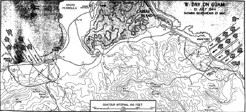
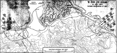
On W-Day, July 21, 1944, the lead elements of the 3d U.S. Marine
Division crossed a reef from 200 to 500 yards offshore and landed on
Asan Beach, which was defended by the Japanese 320th Independent
Infantry Battalion and naval troops manning the coastal defense guns.
The 1.3-mile-long landing area was flanked by two rocky points, "the
devil's horns," extending into the lagoon. On the east (left) was Adelup
Point. West and to the rear of Adelup was steep Chorrito Cliff which
extended almost to the water's edge. Farther west, the cliff gave way to
low level land covered with rice paddies. Asan River joined the sea in
this area and the small village of Asan lay scattered among palm trees
on the beach. At the western end, rocky Asan Point bordered the beach.
From east to west, two battalions of the 3d U.S. Marines Regiment landed
on Beach Red 1; one battalion of the 3d U.S. Marines landed on Beach Red
2; three battalions of the 21st U.S. Marines came ashore on Beach Green,
in the middle; and three battalions of the 9th U.S. Marines landed on
Beach Blue adjacent to Asan Point. The Japanese held their fire until
the landing vehicles were close to shore, the 3d U.S. Marines
particularly receiving heavy fire from Adelup Point and Chorrito Cliff
on their left flank.
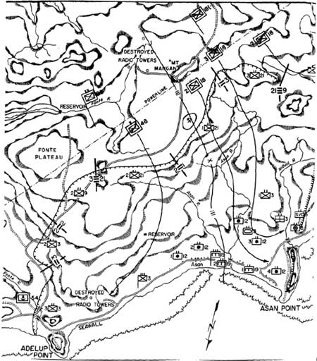
By noon the 3d U.S. Marines had reached the top of steep Chorrito
Cliff and in the afternoon overcame the enemy on Adelup Point. Inland
from Chorrito Cliff, the terrain becomes a ruggedly hilly area cut by
deep ravines and covered with man-high sword grass and other jungle
vegetation. The marines named one 400-foot-high rocky outcropping
Bundschu Ridge for Capt. Geary R. Bundschu, who was assigned to take
this ridge. Here, the Japanese held off the marines throughout the day
and inflicted heavy casualties, including the life of Captain
Bundschu.
In the center of the landing beach, the 21st U.S. Marines advanced up
the Asan River valley against only moderate resistance until they
reached a series of ridges from which Japanese fire forced the marines
to dig in for the night.
|
|
(click on image for an enlargement in a new window)
|
|
|
(click on image for an enlargement in a new window)
|
To the west, right, the 9th U.S. Marines made the day's greatest
advance, but suffered casualties from caves on Asan Point. It crossed
the rice paddies swiftly and reached the inland ridge. Part of the
regiment swung to the southwest, crossed a bridge near the mouth of
Matgue (then called Nidual) River, and moved on to a point 400 yards
short of Taguag River near Piti. When these marines crossed the Matgue
River, fire from Japanese positions on the west side of Asan Point fell
on them. By nightfall, however, all enemy opposition on the point had
been silenced. Through the night, Japanese reinforcements plugged gaps
in their lines on the ridges above Asan. And through the night, small
groups of Japanese counterattacked along the 3d Marine Division's front,
the most serious blow being against the 3d U.S. Marines in the Chorrito
Cliff area.
On July 22, the 3d U.S. Marines renewed their attack on Bundschu
Ridge. Despite repeated attempts against the natural stronghold, the
marines gained no ground and continued to suffer heavy casualties. The
21st U.S. Marines to the right attempted to make contact with the 3d,
but "the nightmare of twisting ravines, jumbled rocks, and steep cliffs
that hid beneath the dense vegetation" precluded the effort. [2] That night, the Japanese counterattacked again,
and again suffered severely. Unknown to the marines, the Japanese
withdrew from Bundschu Ridge before dawn.
To the right, the 9th U.S. Marines continued their advance on July
22, entering the Piti area and taking the old navy yard and a Japanese
three-gun coastal battery.
On July 23, after occupying Bundschu Ridge, the 3d U.S. Marines
pushed their attack toward the high ground west of lower Fonte River.
The 21st U.S. Marines in the center spent the day improving their
positions, establishing outposts, and beating off Japanese patrols. Not
until the next day, July 24, was the gap between the 3d and 21st closed.
On the night of July 25-26, the Japanese launched their last major
counterattack against the 3d Marine Division. One of the most bitter
struggles involved the 9th U.S. Marines on the forward slopes of the
Fonte Plateau, the high ground toward which the marines had been
struggling since W-Day. Along the entire front, Japanese infiltrators
made their way down to the beach, striking at various targets including
the division hospital near Asan Point. The counterattack was in vain,
however, for the Japanese lost 3,200 men that night. On July 27, the
Third Division launched an all-out attack on the Fonte area. By the 28th
all the Fonte area was in American hands except for a depression on the
plateau which was silenced on the 29th. General Takashima was dead,
having been hit by machine gun fire from an American tank. Japanese
forces began a general retreat toward northern Guam.
Following the battle for Guam, great changes occurred in the
Asan-Fonte area. The rice paddies on the beach gave way to a motor pool
area and a cemetery for American dead. Seabees constructed a four-lane
highway, Marine Drive, along the shore, changing the face of the
Chorrito Cliff. Still later, the motor pool gave way to a naval
hospital. Asan Point was opened as a coral quarry, destroying remaining
fortifications and changing the point into low, level ground. The old
village of Asan was destroyed during the fighting, and a new town of the
same name was erected farther inland to the east. The high land of Fonte
was renamed Nimitz Hill and Admiral Nimitz moved his CINCPAC
headquarters there from Hawaii. In recent times, a large modern school
was constructed on Adelup Point and a flood-control project was
completed at the mouth of Asan River.
I. Asan Beach Unit
The Asan Beach Unit consists of 109 land acres and 445 acres of
water. It includes all of Asan Point, the landing beaches seaward of
Marine Drive, and the western side and tip of Adelup Point. (The
identifying numbers used below are those used by the National Park
Service up to now. A new numbering system, which will provide more
order, presently being developed by the area.)
|
|
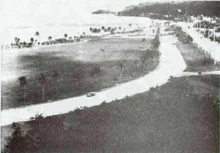
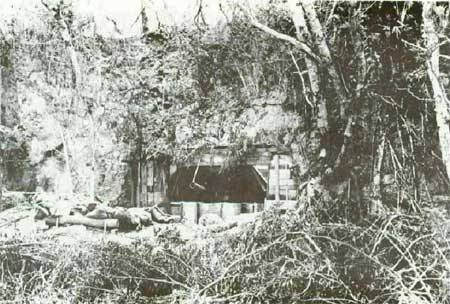
Adelup Point, 1944.
|
|
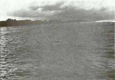
|
Asa Point from Adelup Point, Asan Beach, 1984.
|

|
|
Agana from Adelup Point, 1984.
|
Adelup Point
No. 28. Japanese Pillbox. On the west side of the point. Presently
owned by the Government of Guam, it consists of a single concrete wall,
5 feet in length, and containing a small embrasure. It lacks a roof. The
field of fire was toward Asan Point. Battle damage is limited, but rock
has fallen into the firing position. Japanese lire from the west side of
Adelup Point hit the 3d U.S. Marines on Beaches Red 1 and 2 on W-Day.
The point was captured by the end of the day.
No 29. Japanese pillbox. On the east side of Adelup Point. It is
outside the boundaries of the national park. Built into the limestone
cliff, this pillbox has two gun embrasures, one of which is now sealed
with concrete. The rear entrance, from the top of the dill, is filled
in. Located on the east side of the point, this pillbox played no direct
rote in the W-Day landings. One may be assured, however, that its
occupants partook in the defense of Adelup Point when U.S. Marines
stormed it that afternoon. While the National Park Service has no
responsibilities concerning the pillbox it is recommended it be
identified in any interpretive literature that may be developed for
Adelup Point.

|
|
No. 29. Japanese pillbox, Adelup Point, 1984.
|
|
|
No. 29. Japanese pillbox, Adelup Point, 1984.
|
No. 30. Japanese pillbox. On the east side of Adelup Point, outside
the boundaries of the National Park. This fortification has been
described as a "dual" pillbox, having two rooms (one large and one quite
small), each with a gun embrasure. The cliff parallel to the westernmost
embrasure has been chiseled out to increase the field of fire. A
concrete observation port remains on top. As with No. 29, the pillbox
played no direct role in the W-Day landings. It is recommended that it,
too, be identified on any trail guides for Adelup Point. This is an
excellent example of an essentially undamaged and completed Japanese
pillbox.
|
|
No. 30. Japanese pillbox, Adelup Point, 1984.
|

|
|
No. 30. Japanese pillbox, Adelup Point, 1984.
|

|
|
No. 30. Japanese pillbox, Adelup Point.
|

|
|
No. 30. Japanese pillbox, Adelup Point.
|
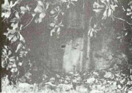
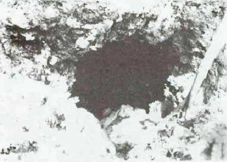
No. 31. Natural cave. On the north tip of Adelup Point, within the
park boundaries. This small cave may or may not have been defended.
Pieces of concrete have been found within. It measures 6 feet in depth
and 5.5 feet in width.

|
|
No. 31. Cave, Adelup Point, 1984.
|
No. 32. Cave and foxhole. These are on the west side of Adelup Point,
within the park boundaries. The Government of Guam is the present owner.
The natural cave, measuring about 5.5 feet in width and 10.8 feet in
depth, could well have served as a weapon emplacement. On top of the
cliff above the cave is a depression in the earth 3 feet in width, 6 in
length, and 3 feet in depth, that probably was a machine gun
emplacement. Both machine gun and mortar fire from Adelup Point fell on
Beaches Red 1 and 2.
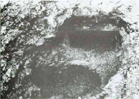
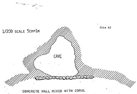
No. 42. Cave. It, too, is on the west side of Adelup and within the
park boundaries. The Government of Guam is the present owner. This
natural cave is faced with a coral rock and concrete wall. The cave
measures 6.5 feet in width and 8 feet in depth. Its field of fire
covered Beaches Red 1 and 2.

|
|
No. 42. Cave, Adelup Point, 1984.
|
|
|
No. 42. Cave, Adelup Point.
|
No. 41. House foundation. This large, concrete foundation on the
highest part of Adelup Point marks the site of the pre-war Kroll home.
It is believed that the Japanese dug tunnels into the landward sde of
the foundation for storage; there is a definite evidence that this wall
was breached and later resealed. Also, a photograph taken on July 23,
1944, shows at least one opening in the wall. A long concrete flight of
steps from the house to lower ground from before the war remains. These
steps are bordered with small, rock-walled flower terraces of an
uncertain date (after the battle an American officers' club was
established on the house foundation). It provides an excellent platform
for viewing Asan Point to the west and Aqana to the east and is an
outstanding location for on-site interpretation,

|
|
No. 41. Kroll House, Adelup Point.
|

|
|
No. 41. Kroll house foundation, Adelup Point, 1944.
|
Asan Landing Beaches
No. 33. Seawall. This rock and concrete seawall is within the park
boundaries and is owned by the Government of Guam. It is near the base
of a small knoll on the beach, 2,000 feet west of Adelup Point. It is
part of a longer seawall that existed in 1944. The rocky Knoll is
separated from Chorrito Cliff by Marine Drive. The original seawall
protected the federal road from Agana to Piti that ran along the base of
Chorrito Cliff in this area. The existing wall is 75 feet in length and
40 inches in height. (The original wall was about 440 feet in length.)
The writer suspects that the wall existed before 1941, when the U.S.
government funded maintenance of the road. The wall is subject to
potential storm damage. It is recommended that the seawall not be
interpreted onsite. Parking on MarinebDrive in this area is extremely
dangerous.

|
|
No. 33. Seawall, Asan Beach, 1984.
|

|
|
No. 33. Seawall, Asan Beach, 1984.
|

|
|
No. 33. Seawall, Asan.
|
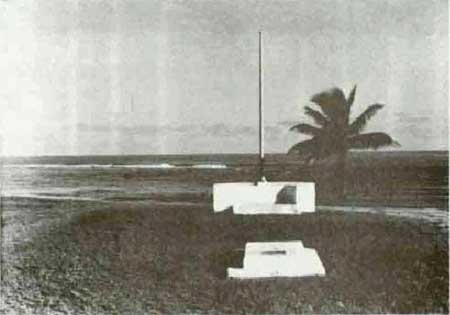
No number. Civilian Landing Memorial. It is near the beach in front
of the present town of Asan and east of the mouth of the Asan River. It
is a simple concrete wall with a flagstaff rising from its center. On
the wall in front of the flagstaff an artillery round is mounted
upright. Good views of the landing beach and the hills to the south are
found here. Guamanians gather there annually to commemorate the
liberation of their island.
No number. U.S. Landing Monument. It is near the water's edge on
Beach Green where the 21st U.S. Marines landed and where the old village
of Asan stood. The white, concrete monument is rectangular in shape; at
the top of the spire is a metal reproduction of the U.S. Marine Corps
insignia. Four metal plaques, one on each side, have texts that outline
the history of the battle, list the several commanders, and dedicate the
monument to all American dead. The monument was dedicated by Gen. Lemuel
C. Shepherd, Jr., Commandant of the U.S. Marine Corps, 1952-1955. In
1944, Brigadier General Shephard commanded the Agat landings on Guam.
The area around the monument has been pleasantly landscaped with palm
trees. The monument is in excellent condition, requiring only periodic
painting. (An identical monument has been erected on Wake island.)
|
|
Civilian Landing Monument, Asan Beach, 1984.
|

|
|
U.S. Landing Monument, Asan Beach, 1984.
|
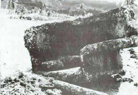
No. 102. Japanese Pillbox. It is in the water just of the beach
approximately on the right flank of Beach Blue. It was severely damaged
in the 1944 invasion and is overturned. It is obviously not on its
original site and probably was placed there when the Americans cleared
the general area for logistical operations. In its ruined state, the
pillbox is a dramatic example of the destruction rained on Guam by
American firepower. Since it is not in situ, the pillbox could be
replaced on dry land to reduce the erosion by the sea. No restoration
should be attempted.
|
|
No. 102. Japanese pillbox ruins, Asan Beach, 1984.
|
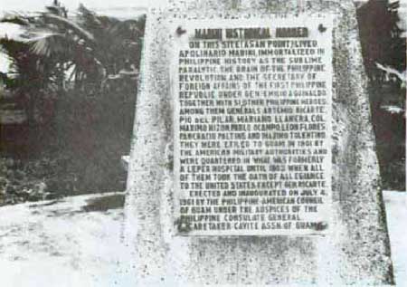
Nos. 45 and 52. Two Mabini Monuments. They are on the water's edge
approximately on the right flank of Beach Blue. The monuments are not
associated with World War II. They commemorate the place of exile of a
group of Filipino insurgents, including Apolinario Mabini, "the Brains
of the Revolution," who had refused to take an oath of allegiance and
criticized the American military government. They arrived at Asan in
1901. Most returned to the Philippines in 1902. Mabini himself returned
home in 1903, just before his death. The west monument, No. 45, is a
crushed coral pyramid having a legend inscribed in marble. It is
surrounded by the concrete benches. A chain (some sections missing)
encircles the whole. The monument was erected in 1961 by the
Philippine-American Council of Guam. The east monument, No. 52, is a
simple concrete slab with a metal plaque attached. Some corrosion has
occurred to the metal. This marker was erected in 1964 by the
Philippines Historical Committee.

|
|
Nos. 45 and 52. Two Mabini monuments, Asan Beach, 1984.
|
|
|
No. 45. Legend on Mabini monument, 1984.
|
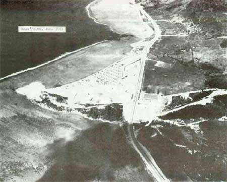
Asan Point
Asan Point as the other "devil's horn" flanking the American landing
beaches. After the battle, American forces opened a quarry on the tip of
the point and on the ridge behind, forever destroying any Japanese
fortifications located at these sites. On the east side of the ridge,
i.e., facing the American landings, only a Japanese tunnel remains. On
the ridge's west side, a complex of pillboxes remains. Some of these
played an important role when the 9th U.S. Marines crossed Matgue River
and pushed southwest toward Piti. Once the Marines passed Asan Point,
the Japanese here opened fire, forcing the Marines to turn around to
counter the attack. Asan Point was neutralized by the end of W-Day. The
fortifications on the west side are reached via a road/trail (that needs
a sign identifying it) beginning on the east side of the ridge and
descending the west side via recently installed steps. The trail on top
of the ridge continues south to the highest point directly overlooking
Marine Drive. This overlook provides an excellent view of the landing
beaches all the way east to Adelup Point and offers good possibilities
for on-site interpretation. The trail along the base of the west side of
Asan Point, from feature 54 to feature 69, has recently been partly
disrupted by rockfall caused by an earthquake. Plans are to redirect the
trail around the boulders and add earthquake history to the
interpretation of the area.

|
|
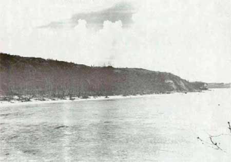
Asan Point and Asan village, July 31, 1944.
|
|
|
Asan Point, June 1943.
|
|
|
Asan Beach area from Asan Point, 1984.
|
No. 61. Japanese pillbox. Constructed of reinforced concrete, it is
on the west base of Asan Point. It has a gun embrasure and two rifle
firing ports. It was extensively damaged by a direct hit above the
embrasure and by a satchel charge on its roof. The pillbox cannot be
entered in its present condition. Although the damage should not be
repaired, the entranceway to the pillbox could be cleared.
|
|
No. 61. Japanese pillbox, Asan Point, 1984.
|

|
|
No. 61. Japanese pillbox, Asan Point.
|

|
|
No. 61. Japanese pillbox, Asan Point.
|
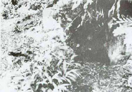
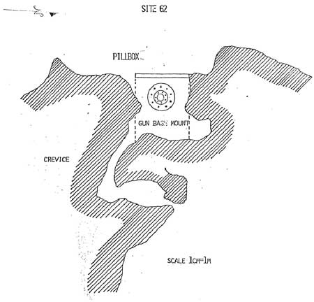
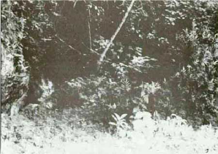
No. 62. Japanese pillbox (large caliber gun emplacement). Also
located on the west base of Asan Point. Here, the Japanese took
advantage of a large, winding crevice in the limestone cliff. A
reinforced-concrete was built against the cliff. A low
reinforced-concrete wall was added to the front of the opening. To the
rear, the crevice was used for ammunition storage. In areas where the
rock walls of the crevice were low, the Japanese built them up with rock
and concrete. A steel gun base remains. (Marines recorded finding three
20 cm. (8-inch), short barrel naval guns in this area.) The horiztonal
I-beams supporting the roof have rusted considerably and other iron work
is heavily corroded. Some spalling of the concrete ceiling has
occurred. Park maintenance has installed stout wooden planks as a
temporary support to the ceiling. This pillbox should receive early
attention from historical architects, addressing the issues of
preservation and visitor safety.

|
|
Asan Point, October 1944.
|

|
|
No. 62. Japanese gun emplacement, Asan Point, 1984.
|

|
|
No. 62. Japanese gun emplacement, Asan Point, 1984.
|

|
|
No. 62. Japanese gun emplacement, Asan Point.
|
|
|
No. 62. Japanese gun emplacement, Asan Point.
|
No. 63. Japanese wall. At the base of the west side of Asan Point,
two natural crevices, side by side, lead into the limestone cliff. In
front of these, the Japanese erected a coral rock and concrete wall for
the protection of the crevices which they used for storage or shelter.
Only a part of the wall remains which ranges in height from 20 inches to
3.5 feet. Vegetation tends to grow profusely on the wall, resulting in
the never-ending chore of removing it. Historic preservationists may
wish to examine this structure to determine a permanent cure for the
vegetation problem.

|
|
No. 63. Japanese rock and concrete wall, Asan Point, above crevices in
cliff behind wall, below.
|
|
|
No. 63. Japanese rock and concrete wall, Asan Point, above crevices in
cliff behind wall, below.
|

|
|
No. 63. Japanese rock and concrete wall, Asan Point.
|
No. 64. Japanese pillbox (large caliber gun emplacement). This
structure is also built into the base of the limestone cliff on the west
side of Asan Point. An entrance was constructed on the north side of the
structure and is concealed from view as one faces the large embrasure. A
low concrete wall forms the face and it does not meet the south side of
the emplacement, thus providing a second entrance. A steel gun base
remains installed in the floor, suggesting this structure housed another
of the 20cm coastal guns. To the rear are two caves, one of which
extends upward to the top of Asan Point. Near the tunnel's exit on top
are the remains of the foundation of a small rectangular structure whose
function is unknown. Like No. 62, the iron I-beams supporting the
ceiling of the emplacement have greatly rusted. Also, one or the caves
is filled with rock rubble. Historical architects should study this site
for its preservation and safety needs.
No. 67. Cave. This natural cave is just north of feature No. 64, at
the base of the west side of Asan Point It is a small cave measuring 4
feet in depth and 6.7 feet in width. The Japanese protected its entrance
with a concrete wall, a portion of which remains on either side of the
entrance. The cave is sufficiently large for a machine gun
emplacement.
|
|
No. 64. Japanese gun emplacement, Asan Point, October 1944.
|

|
|
No. 64. Japanese gun emplacement, Asan Point, 1984.
|

|
|
No. 64. Japanese gun emplacement, Asan Point.
|
No. 106. Japanese tunnel. This Chamorro-built (forced labor) tunnel
is the sole surviving Japanese defense structure on the east side of
Asan Point. The large cave is easily accessible to visitors. Like all
tunnels, rock rubble gathers on the floor and as a matter of visitor
safety must be regularly checked. Interpretation, on- or off-site,
should be developed for this tunnel and all of Asan Point.

|
|
No. 106. Japanese cave, Asan Point, 1944.
|
|
|
No. 106. Japanese tunnel, Asan Point, 1984.
|

|
|
No. 106. Japanese tunnel, Asan Point, 1984.
|

|
|
No. 106. Japanese tunnel, Asan Point.
|
II. Asan Inland Unit (593 acres)
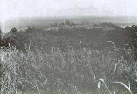
Chorrito Cliff and Bundschu Ridge (Sabanan Adelup). As it was in
1944, this area is extremely difficult to explore. It remains in a
natural state, with little evidence of the fierce fighting of 1944.
Tall, thick, sharp sword grass, vines, tangantangan thickets, steep
ravines, and rocky outcroppings, combined with heat and humidity, make
travel exceedingly difficult and exhausting.
|
|
Chorrito Cliff from Adelup Point, Asan, October 1944.
|
|
|
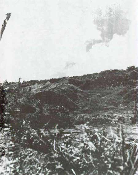
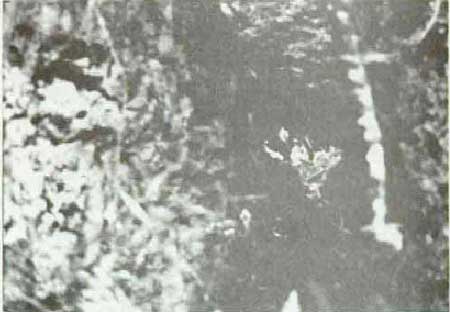
Stalemate on Bundschu Ridge, Asan, July 22, 1944.
|
|
|
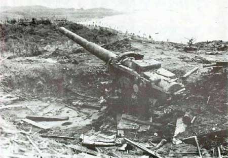
Japanese 150mm gun on Chorrito Cliff, Asan Point in distance, October
1944.
|

|
|
Asan Point from Bundschu Ridge, 1984.
|
|
|
Looking over Chorrito Cliff area to the sea, 1984.
|
No. 57. Natural caves and crevices. Presently privately owned but
within the park boundaries. These are on a ridge above Bundschu Ridge in
an area where heavy fighting occurred. Several small caves and crevices
provided protection to Japanese soldiers. Unexploded shells and Japanese
gas masks and mess kits were found here. Access to the area is
difficult.
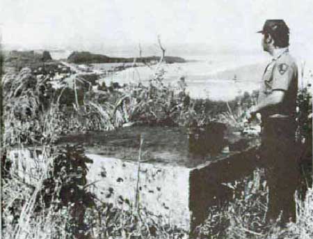
No. 59. Japanese observation post. This concrete post or artillery
fire control station was not completed. Its roof is missing. Most of the
structure is underground, which is typical of such posts. This structure
may have been a fire control center for three 150mm guns emplaced lower
down, on Chorrito Cliff.
No. 85. Japanese pillbox. This reinforced-concrete pillbox on
Chorrito Cliff is the only substantial structure in the Asan Inland
area. It has one embrasure and most likely served as an automatic
weapons emplacement, wreaking havoc on U.S. Marines attempting to scale
the cliff. Some slight shell damage occurred to the exterior of the
pillbox. A great view of the Asan landing beaches is to be had from
this site. It is recommended that if an interpretive trail is developed
on Sabanan Adelup, it take in this pillbox, which is not easy of access.
It is also recommended that an archeological examination be made of the
area, with the view to making the interior of the pillbox
accessible.
|
|
No. 85. Japanese pillbox. Asan Island, 1984.
|

|
|
No. 85. Japanese pillbox. Asan Island.
|
No. 85A. U.S. dump. Here, high on the Sabana Adelup is a dump
established by the American forces. Among the artifacts are the rusting
scraps of American jeeps, coke bottles, and navy china. The site is
heavily overgrown with tangantangan.
No. 98. Foxholes and shell craters. An unknown number of shell
craters and foxholes are scattered along the ridge. Vegetation is thick
in this area and other features may exist.
No. 100. Trench, gun emplacements, and caves. There is a well-defined
trench running along the forward slope of the ridge. American and
Japanese grenades were found here.
|
|
No. 100. Trench, Asan inland, 1984.
|
|
|
No. 100. Cave, Asan inland, 1984.
|

|
|
No. 100. Cave, Asan inland.
|
Matgue (Nidual) River Area
No. 86. Bridge. Concrete bridge over the Matgue River, near its
mouth. The bridge now serves a short, dirt road that runs up the west
side of the river. In 1944 a bridge existed in this area, serving the
Agana-Piti road. On W-Day, elements of the 9th U.S. Marines crossed the
bridge and came under fire from Japanese dug into the west side of the
Asan Point. Following the battle for Guam, U.S. forces established four
large petroleum storage tanks in the river valley. A service road joined
this storage area to the newly constructed Marine Drive, crossing the
river where the bridge now stands. The consensus appears to be that
today's bridge was built in this period. The writer disagrees, believing
the bridge to be a part of the pre-war route from Agana to the Piti Navy
Yard. A document, uncovered by Historian Charles Snell, that was
prepared by the U.S. Office of Naval Intelligence prior to the American
invasion of Guam discussed the pre-war bridges and roads on Guam. In
part, this report states, "On the AGANA-PITI-SUMAY road, which is
maintained by the [U.S.] Federal Government, all bridges are two-way,
and of heavy reinforced concrete construction until the ATANTANAO River
is crossed." [3] The deck of the bridge
measures 32.5 feet in length and 19 feet in width. An iron pipe rail is
affixed to the north side. Thick vegetation prohibits a clear photo.
|
|
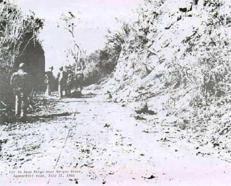
Cut in Asan Ridge near Matgue River, Agana-Piti road, July 21, 1944.
|

|
|
Matgue River bridge, Asan, 1984.
|

|
|
Matgue River bridge, Asan, 1984.
|
Nos. 88 and 89. Caves. Two man-made caves tunneled into the side of
the cliff along the west side of Matgue River. No. 88 is 10 feet in
depth and 4.3 feet in width, and No. 89 is 10 feet deep and 7 feet wide.
Both were suited as personnel shelters or for storage.

|
|
No. 88. Japanese cave, Matgue Valley, Asan, 1984.
|
|
|
No. 89. Japanese cave, Matgue Valley, 1984.
|
Nos. 90, 94, and 97. Caves. Man-made. No. 90 has two entrances and is
13.5 feet in depth. Ore of these entrances is blocked with rock rubble.
No. 94 consists of three small caves that have collapsed. No. 97 is a
large cave, 27 feet deep, suited as a personnel shelter.
No. 106(?). Gun emplacement. It is on the ridge west of Matgue River
and south of Asan Point. The principal feature is a gun emplacement,
cup-shaped, 8 feet in diameter and 2.5 feet in depth. A raised lip
surrounds it. Possibly an emplacement for a Japanese antiaircraft gun.
In the vicinity are several foxholes or shell craters. (No. 106 seems to
have been assigned to two sites.)
III. Fonte Unit (approximately 38 acres)
The Fonte area was that area captured by U.S. Marines July 27-29,
1944, including the Fonte Plateau as shown on the official maps. In
analyzing the combat narratives and reports, it is clear that the term
was used to include all the high land above Asan from the Plateau in the
east to Mt. Mangan, 1,500 yards to the west, i.e., the high, fairly
level area known as Nimitz Hill. At the rear of the plateau proper is a
concrete bunker having two concrete-arch entrances. This feature has
traditionally been called the command post of General Takeshima. The
plateau itself was captured by a battalion of the 9th U.S. Marines. The
21st U.S. Marines captured the high ground west of the plateau. This
report identifies the bunker as a major Japanese naval communications
center, not a command post. [4] Similar to the
communications center at Agana it was still under construction when U.S.
forces landed on Guam. Three radio towers were at the head of Fonte
River on the rear slope of Mt. Manqan.
The climax of the fighting for the Fonte area occurred on the morning
of July 29 when the 9th U.S. Marines wiped out the Japanese defenders in
a bowl-shaped depression on Fonte Plateau proper, "the Fonte Bowl,"
which was honeycombed with caves. The marines took the bowl without a
single casualty while killing from 35 to 50 Japanese. This action
completed the capture of the Fonte area. Although some writers have
concluded that the depression was General Takeshima's command post, this
report regards it only as the site of the last Japanese resistance in
the Fonte area.
Where was the general's command post? It appears he had more than
one. up to July 26, he had established a command post in a natural cave
about 300 meters to the "west of Fonte." When his major counterattack
against U.S. forces on the night of July 25-26 ended in failure,
Takeshima moved from the cave "to the Fonte command post." [5] U. S. Marines commenced their attack on Fonte
on July 27. On July 28, the 21st U.S. Marinas captured all of the high
ground west of the plateau, including Mt. Mangan and the head of Fonte
River to the rear (south). That same day, the commanding general of the
III Amphibian Corps recorded that marines had captured a large command
in Target Area 561, which area is just west of the Fonte Plateau (TA
562). He added that marines had not been able to search the area because
of snipers and booby traps. [6] Also on July
28, the Third Marine Division's Intelligence Section reported that this
was the Japanese Twenty-ninth Division's command post and that it
covered from three to five acres. Finally, the U.S. Marine Corps
official history records that the 21st U.S. Marines, on July 28, overran
the 29th Division's headquarters caves, "located near the head of the
Fonte River valley close to the wrecked radio towers, and wiped out the
last defenses of Mt. Mangan as well." [7] The
conclusion is that the command post of General Takeshima's, the 29th
Division's, and General Obata's as well, is outside the boundaries of
the Fonte Unit.
General Takeshima ordered the main defense force in the Fonte area to
withdraw during the night of July 27-28 and the morning of the 28th. We
oversaw this retreat until about noon on the 28th. Then, he too withdrew
and about two hours later was killed near the north foot of Mt. Macagna.
[8]
Today, there is a large, abandoned quarry on the south edge of the
Fonte Plateau, adjacent to the concrete Japanese communications center.
It has not been determined when this quarry was first opened, but it was
in operation soon after the liberation of Guam when haste was made to
construct Admiral Nimitz's CINCPAC headquarters on Fonte. At the time
the marines captured the Fonte area another quarry existed at Mt.
Mangan. [9]
Maj. General Kiyoski Shigematsu, commander of the 48th Independent
Mixed Brigade, had his command post in this quarry and was killed there
on July 26 by US. Marines. [10]
It is not known if the U.S quarry on the Fonte Plateau destroyed the
bowl-shaped depression that held out to the last until captured by the
9th U.S. Marines. Today, east of the main quarry and south of the main
transmission line is a small depression on the plateau. The area is
excessively overgrown with lush vegetation, prohibiting a close
examination. Another depression is identified on USGS map, Sheet "Agana,
Guam" immediately north of the "Borrow Pit." Whether or not the
depression can be positively identified, the Fonte Unit is a significant
part of the national park. A 3d Marine Division battle report for July
27, 1944, when the marines had reached the nose of the plateau, said,
"the nose of FONTE RIDGE was brought under our control revealing that
FONTE is the center of the main enemy defenses of the island." [11] A marine historian described the Fonte hill
mass as the strategic high ground along the entire Final Beachhead Line.
It had been organized and defended by a battalion of Japanese. During
the fighting, another battalion and a half had been rushed into it. Its
importance may be judged by the eleven Japanese counterattacks launched
to retain it and the 800 dead left on the battlefield. [12]
In the Fonte Unit today, the prime feature is the Japanese
communications center, No. 65. Park staff has determined that the
concrete walls and ceiling of this large bunker were installed after the
battle for Guam. Other modifications have been made, including electric
lights, iron gates at the two entrances, and a plastered, wooden wall in
the northeastern corner of the main room. Within the east entrance is a
concrete platform that may well have been used by the Japanese as a
generator platform.
Besides this feature, the Fonte Unit marks a significant phase of
the battle for Guam. As a result of this action, the Japanese were in
full retreat and American forces had achieved a commanding position from
which to commence the final phase of the battle.
Today, Fonte Plateau provides a magnificent view of the entire Agana
area and inland, looking over north-central Guam.

|
|
No. 65. Japanese communications center, Fonte Plateau, 1984.
|

|
|
No. 65. Japanese communications center, Fonte Plateau, 1984.
|

|
|
No. 65. Japanese communications center, Fonte Plateau, 1984.
|

|
|
Agana as seen from Fonte Plateau, 1984.
|
|
|
A depression on the Fonte Plateau, 1984.
|
|
|
A depression on the Fonte Plateau, 1984.
|

|
|
No. 65. Japanese communications center, Fonte Plateau.
|

|
|
Fonte Plateau, Nimitz Hill, April 1945.
|

|
|
Fonte Plateau, Nimitz Hill, 1951.
|
wapa/hrs/secb.htm
Last Updated: 07-Mar-2005
|