War in the Pacific
War in the Pacific National Historic Park
Historic Resource Study
|

|
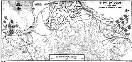
D. AGAT UNIT AND MT. ALIFAN UNIT
The Japanese defenders of the Agat area consisted principally of the
39th infantry Regiment. On W-Day, the First Provisional Marine Brigade
landed on Agat Beach: one battalion of the 22d Marines landed on beach
Yellow 1 just south of Agat village, and another battalion of the 22d
landed on Beach Yellow 2 to the right (south). The 4th U.S. Marines
landed on Beaches White 1 and 2 on the right flank, just short of Bangi
Point. The 22d U.S. Marines entered ruined Agat village in the
afternoon. That regiment's tank company landed on the 4th U.S. Marines'
beaches then rolled northward along the shore to join the 22d. En route
these tanks encountered Japanese defenses at Gaan Point which had
survived the pre-invasion bombardment. These reinforced-concrete
pillboxes had delivered heavy fire against the 22nd U.S. Marines landing
on Beach Yellow 2. The tanks quickly knocked out the two 75mm guns and
smaller weapons on this rocky knoll between Beaches Yellow 2 and White
1. By nightfall the 22nd Marines had fought inland to reach the lower
portion of Harmon Road that led from Agat to Maanot Pass.
On the south, the 4th U.S. Marines advanced inland against moderate
resistance. Little Japanese fire came from Bangi Paint on the regiment's
right flank. Elements of the 4th turned south and easily captured Bangi
Point but ran into heavy enemy machine gun fire from Hill 40, a small
mound inland from Bangi Point. The hill was taken in a sharp firefight,
as were the fortifications on Bangi Island and undefended Alutom Island,
both off Bangi Point. By night, the 4th U.S. Marines had reached the
foot of Mt Alifan, the dominant peak in the Agat area and where the
Japanese command post was located.
Brig. Gen. Lemeul C, Shepherd, Jr, in command of the southern forces,
opened his command post in the afternoon 200 yards southeast of Gaan
Point, about where the Agat Cemetery is now. Also on shore in the
afternoon were the first elements of the U.S. Army's 77th infantry
Division.
|
|
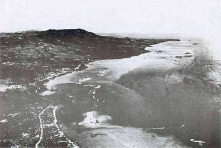
Agat landing beaches, July 31, 1944.
|
During the night of July 21-22, the Japanese mounted the standard
counterattacks on the beachhead. One of these attacks hit Company K, 4th
Marines on Hill 40. Twice, the Japanese drove the Marines off the mount;
and twice, the Marines recovered their ground. Other Japanese
infiltrated all the way to the beaches and Japanese tanks attempted to
move down Harmon Road. The attacks failed in the end and the Japanese
38th Regiment was practically finished as a fighting unit.
On July 22, 4th U.S. Marines received the task of assaulting the
steep, grassy slopes of Mt. Alifan, while the Army's 305th Infantry
Regiment was assigned the lower foothills of Mt. Alifan to the north.
Overcoming log bunkers and caves on the lower slopes, marines climbed
the mountain, one patrol reaching the peak. The 77th Infantry Division
troops replaced the 4th Marines on Mount Alifan on July 24. On the left
flank, the 22nd Marines advanced north along the Agat-Sumay Road heading
for Orote Peninsula, wiping up the enemy on Apaca and Rizal points.
Following the massive Japanese counterattack against the 3d Marine
Division on the night of July 25-26 and the securing of the Fonte area
by marines, the American forces easily achieved the Final Beachhead Line
by July 28. As a part of this activity, elements of the 77th Infantry
Division seized all of Mt. Tenjo and beyond to join up with the Third
Marine Division which had taken the heights of Mt. Chachao.
I. Agat Unit (38 land acres, 557 water acres)
Apaca and Rizal Points
Fortifications on the south side of Rizal Point were heavily damaged
during the pre-invasion bombardments and the ruins are dramatic evidence
of the assault. Apaca Point contains a pleasant, tree-shaded picnic area
behind the point.
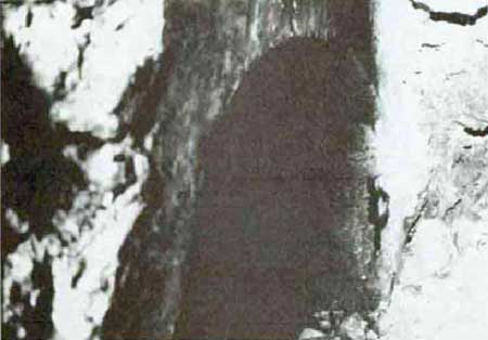
No 1. Japanese pillbox. This reinforced-concrete pillbox is in the
southeast corner of Apaca Point near water level. A tunnel leads to the
pillbox from the land side of the limestone knoll. The pillbox contains
an embrasure and a rifle slit. Roots have grown over part of the
embrasure. Access to the pillbox is not now possible because of the
tunnel being partially blocked with rock.
|
|
No. 1. Japanese pillbox, Apaca Point, Agat 1984.
|
|
|
No. 1. Japanese pillbox, Apaca Point, Agat 1984.
|
|
|
|
No. 1. Japanese pillbox, Apaca Point, Agat.
|
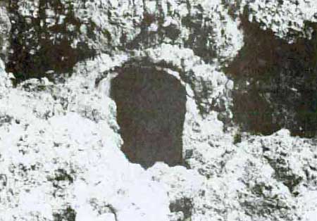
No. 2. Japanese pillbox. This combination reinforced-concrete and
limestone-cliff pillbox is on the south side of Apaca Point. The
Japanese took advantage of natural crevices in the limestone and closed
them up with a concrete wall having one automatic weapon embrasure and
one rifle port. The interior is readily accessible via another crevice
at the rear. The pillbox is in good condition and is an interesting
exhibit in place here on the north flank of the Agat landing
beaches.
|
|
No. 2. Japanese pillbox, Apaca Point, Agat 1984.
|
|
|
No. 2. Japanese pillbox, Apaca Point, Agat 1984.
|
|
|
No. 2. Japanese pillbox, Apaca Point, Agat.
|
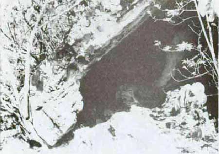
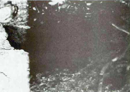
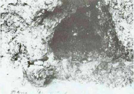
No. 4. Japanese cave. It is at the southeast corner of Rizal Point at
the former mouth of Namo River which has been relocated. It is man-made
and measures 8 feet in depth and 6 feet in width.
|
|
No. 4. Japanese cave, Rizal Point, Agat 1984.
|
No. 5. Japanese pillbox. This reinforced-concrete pillbox, at the
southwest corner of Rizal Point, was almost completely destroyed in the
American invasion. The roof is the largest piece of concrete remaining.
The underside of the roof shows the imprint of palm logs on which the
concrete was poured.
|
|
No. 5. Japanese cave, Rizal Point, Agat 1984.
|
No. 103 Cave. It is on Apaca Point and measures 14 feet in length and
2 feet in width. Originally it was longer but suffered a cave-in.
Function is unknown.
Agat Beaches
No. 3. Landing Monument. It is near the beach in front of the site of
old Agat village. The simple monument consists of an artillery round
mounted on a concrete parapet. A flagstaff stands nearby. It was erected
by the American Legion, Guam, and is dedicated to the U.S. Armed Forces
who landed there on July 21, 1944. It is outside the park
boundaries.
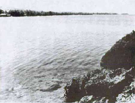
|
|
The Agat landing beaches from Apaca Point; Bangi Island, far upper
right.
|
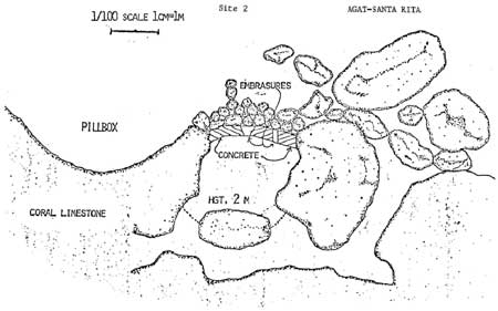
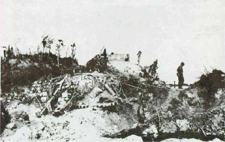
Gaan Point
Gaan Point is the most impressive or the Japanese fortifications
remaining on the southern landing beaches. The role this stronghold
played in the landings and its subsequent capture by U.S. Marines is
well documented--which cannot be said of many other individual works.
This rocky outcrop escaped destruction during pre-invasion bombardments.
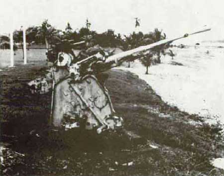
When the 22nd U.S. Marines approached the shore, the two casemated 75mm
guns, a 37mm gun, and machine guns emplaced here created havoc on the
marines and their landing craft. Not until later in the day did U.S.
tanks knock out the stronghold. The area today is exceptionally well
maintained. The casemated gun positions and concrete observation posts
are extant, if battle scarred. Tunnels remain around the base of the
position. Two Japanese weapons are displayed nearby: a single-barrel,
dual-purpose 25mm machine cannon, and a 2Ocm, short-barrel naval gun.
Three flagstaffs fly the flags of the United States, Guam, and Japan.
Gaan Point is the key site for interpreting Japanese coastal defense and
the landings of the Southern Landing Force.
|
|
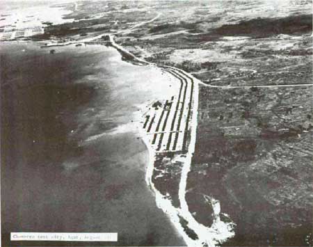
Chamorro tent city, Agat, August 1944?
|
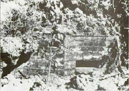
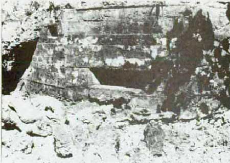
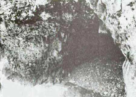
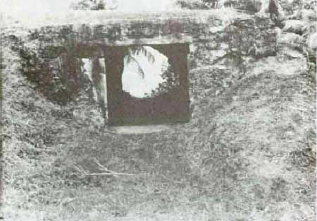
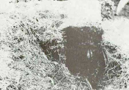
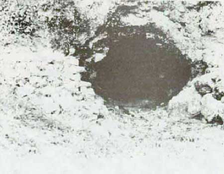
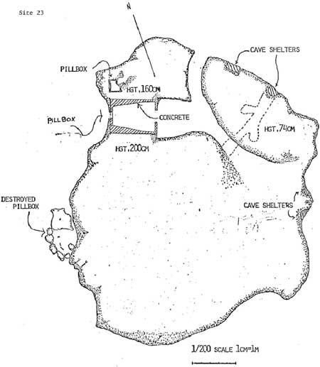
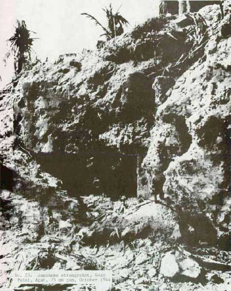
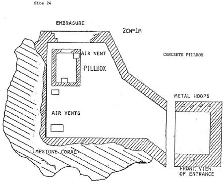
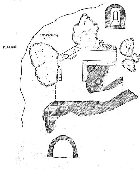
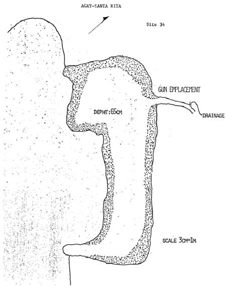
Nos. 23 and 24. No. 23 is the knoll and is described as the "Gaan
Point Strongpoint" and No. 24 is called Japanese pillbox. No. 23
consists of casemates for a 75mm gun and a 37mm gun. Several caves,
partially collapsed, are around the land side of the base of the knoll.
The interior of the 75mm casemate has internal damage indicating it was
fired upon from the rear, as the documentary evidence supports.
Considerable damage also occurred to the wall that contained the
embrasure. Ruins of a third probable emplacement (pillbox) are found on
the ocean side of the knoll.
|
|
No. 23. Japanese strongpoint, Gaan Point, Agat 1984.
|
|
|
No. 23. 75mm emplacement, Gaan Point, Agat 1984.
|
|
|
No. 23. 37mm gun position, Gaan Point, Agat 1984.
|
|
|
No. 23. Japanese cave, Gaan Point Strongpoint, 1984.
|
|
|
No. 23. Japanese strongpoint, Gaan Point, Agat.
|
|
|
No. 23. Japanese strongpoint, Gaan Point, Agat, 75mm gun, October 1944.
|
|
|
No. 23. Japanese strongpoint, Gaan Point, Agat, 75mm gun, October 1944.
|
|
|
No. 24. Japanese pillbox, Gaan Point, Agat 1984.
|
|
|
No. 24. Japanese pillbox, Gaan Point, Agat.
|
|
|
Japanese 25mm dual-purpose gun, Gaan Point, 1984.
|
Pillbox No. 21 stands immediately to the north of No. 23. The large
embrasure for the 75mm gun shows considerable battle damage, as does the
embrasure on the concrete observation post on top. Photographs taken in
1944 show that these fortifications were more extensive than they are
now.
No. 7, Latrine foundation. In shallow water off Gaan Point, it is
owned by the Government of Guam. This humble, concrete structure
measures 6 feet by 12.5 feet. Its historical significance far outweighs
its original functions. Even while the battle for Guam continued to be
fought, U.S. Forces began the rescue of Guamanians. Many of the island
people were brought here to Agat where a large tent city was
established. For sanitation purposes, the military constructed a line of
concrete latrines in the water, each connected to the camp by a walkway.
This latrine foundation is an important reminder of the days following
the American invasion and the liberation of the people of Guam. (An
aerial photo of the tent city shows six of these latrines along the
shore.)
|
|
No. 7 Latrine foundation, Gaan Point, 1984.
|
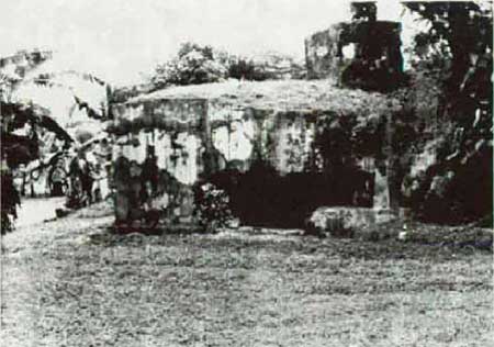
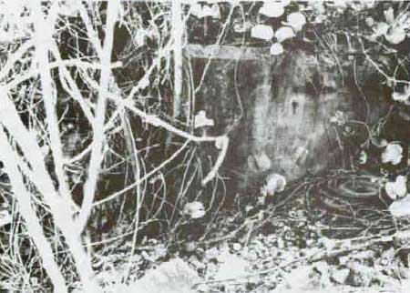
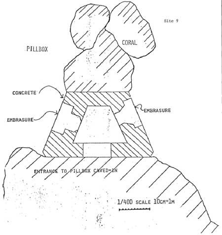
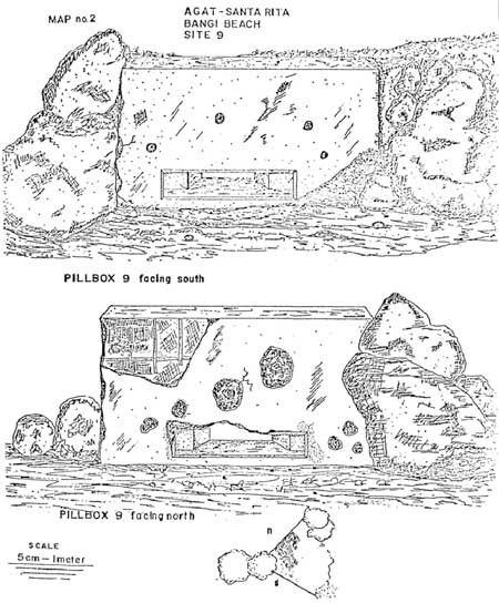
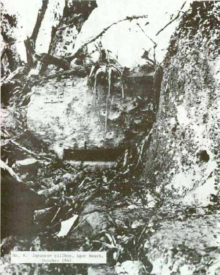
No. 9. Japanese pillbox. This reinforced-concrete pillbox is on the
beach 1,000 feet southwest of Gaan Point. It has two embrasures with
fields of fire to both the north and south along the beach. The
embrasures are of a baffle design which is rarely found on Guam. Access
is impossible because the rear entrance has fallen in. Nearby private
property results in trash in the area. Vegetation has grown around the
pillbox to the extent it is difficult to spot and to photograph.
Archeological excavation is recommended inasmuch as the pillbox is the
only surviving Japanese fortification between Gaan and Bangi points.
|
|
No. 9. Japanese pillbox, Agat Beach, 1984.
|
|
|
No. 9. Japanese pillbox, Agat Beach.
|
|
|
No. 9. Japanese pillbox, Agat Beach.
|
|
|
No. 9. Japanese pillbox, Agat Beach, October 1944.
|
Bangi Point and Bangi Island
Although within the boundaries of the park, the historic resources at
Bangi are presently privately owned. Bangi Island may be reached by
wading the shallow water from Bangi Point. Also, it is possible to wade
around the island, even at high tide--providing the water is calm. Large
coastal guns on Bangi island flanked the 4th U.S. Marines' landing on
Beaches White 1 and 2.
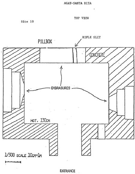
No. 10. Japanese pillbox. Like No. 9 above, this reinforced-concrete
pillbox on Bangi Point has two embrasures for covering the beaches to
the north and south. There is also a rifle slit on the west side which
faces Bangi island.
|
|
No. 10. Japanese pillbox, Bangi Point, Agat.
|
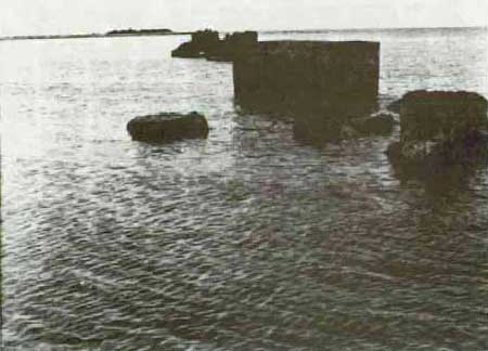
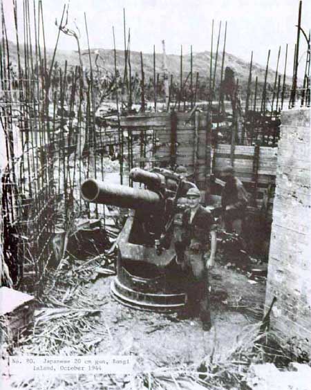
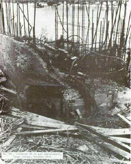
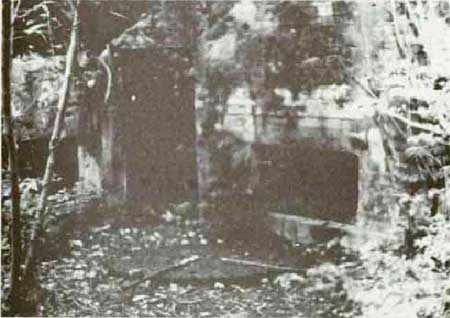
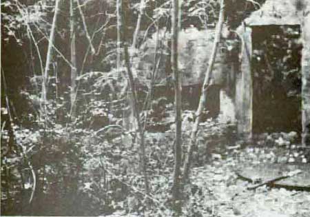
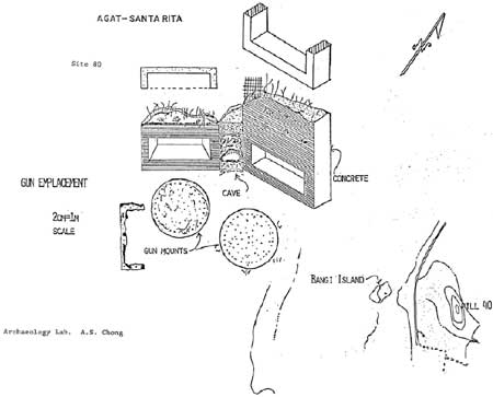
No. 80. Japanese coastal gun emplacements. At the time of the
American invasion, the Japanese had two 20cm (8-inch), short-barrel guns
emplaced on the north side of Bangi Island. The reinforced-concrete
pillboxes to protect the guns Ware. still under construction. Two
unfinished conrete walls remain standing.
|
|
No. 80. Japanese 20cm gun, Bangi Island, October 1944.
|
|
|
No. 80. Japanese 20cm gun, Bangi Island, October 1944.
|
|
|
No. 80. Japanese 20cm gun emplacement, Bangi Island, 1984.
|
|
|
No. 80. Japanese 20cm gun emplacement, Bangi Island, 1984.
|
|
|
No. 80. Japanese gun emplacement, Bangi Island, Agat.
|
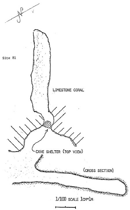
No. 81. Japanese cave. It is on Bangi Island adjacent to No. 80,
above. Probably used for storage or a personnel shelter.
|
|
No. 81. Japanese cave, Bangi Island, 1984.
|
|
|
No. 81. Japanese cave, Bangi Island, Agat.
|
No. 82. Japanese cave. It is on Bangi Island in the cliff directly
above No. 83, below.
|
|
No. 82. Japanese cave, Bangi Island, 1984.
|
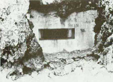
No. 83. Japanese pillbox. It is so sited on Bangi Island as to cover
beaches to the south; thus, it played no direct role during the American
invasion. Here, the Japanese took advantage of holes in the limestone
cliff and added a reinforced-concrete wall with an embrasure to the
front. Two tunnels, each lined with concrete, lead into the gun
emplacement. The more easterly tunnel is in relatively good condition;
the other, exposed to storms, is more fragile. Rock rubble has fallen
into both tunnels and into the pillbox. The gun embrasure is placed so
low to the high-tide water level, that water occasionally enters. The
Japanese, however, provided a drain. Although not tacticalty important
during the American landings, the pillbox's engineering is of sufficient
interest for it to be included in an interpretive program.
|
|
No. 83. Japanese pillbox, Bangi Island, 1984.
|
|
|
No. 83. Japanese pillbox tunnels, Bangi Island, 1984.
|
|
|
No. 83. Japanese pillbox tunnels, Bangi Island, 1984.
|
|
|
No. 83. Japanese pillbox, Bangi Island, Agat.
|
No. 104. Aluton Island. It is off Bangi Point and within the national
park boundaries. It was occupied by the 4th U.S. Marines who found it
undefended.
No. 105. Yona Island. Also off Bangi Point and within the park
boundaries, Yona Island had a Japanese 75mm field piece which, in
conjunction with the 75mm guns on Gaan Point, placed a crossfire on
American landing craft, sinking 20 of them. A recent survey of Yona
Island failed to disclose a gun emplacement.
II. Mount Alifan Unit (158
acres)
Compared to the Chorrito Cliff-Bundschu Ridge area, Mount Alifan is a
gentle giant rising 871 feet above the Agat beaches. Less convuluted
than the northern ridges but nonetheless steep in its upper reaches, the
grass-covered and strongly defended mountain presented a challenge to
the 4th U.S. Marines. A hike over the lower slopes through sometimes
head-high grasses today is still a chore in Guam's tropical heat and
humidity. The mountain contains more remains of the 1944 fighting than
any other unit. For the most part, however, these remains are not
reinforced concrete, but craters, foxholes, emplacements, caves, and
rifle-pits in Alifan's red earth. Only two small features are
constructed of concrete. Moreover, following capture of the mountain,
American demolition teams sealed many caves on the forward slopes. The
slopes contain many artifacts from the battle, including shell and bomb
fragments and bullets. Any interpretive trail on the mountain will have
to be routed to avoide damaging the fragile earthen remains and to
discourage souvenir hunters.
|
|
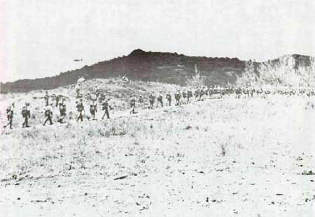
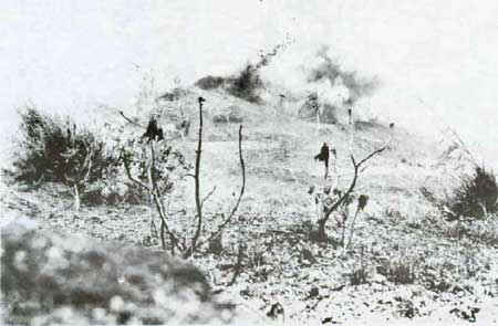
Marines advancing up the slopes of Mt. Alifan, July 21, 1944.
|
|
|
Demolition teams blowing up Japanese dugouts, Mt. Alifan, July 21, 1944.
|
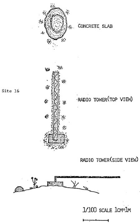
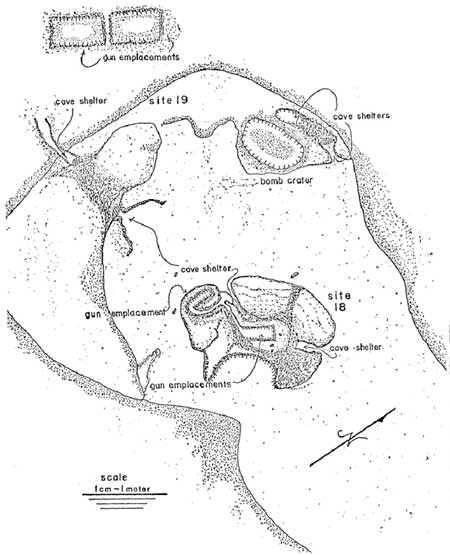
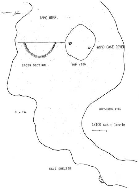
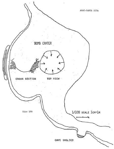
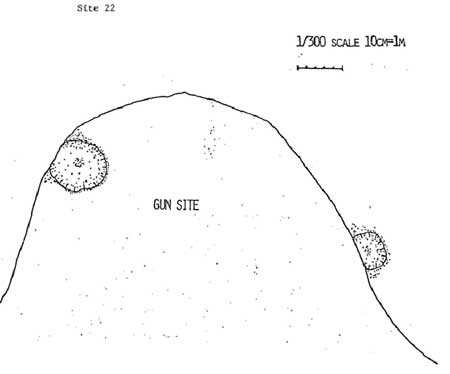
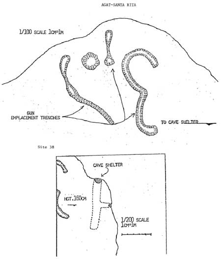
Nos. 16, 18 19, 19a, and 19b. These features are on a ridge running
between Agar Junior High School arid Togcha River. No. 16 is a concrete
base with a steel frame set in it. t is possibly the remains of a radio
tower. Many artillery shell fragments were found in this area. Nos. 18
and 19 are two Japanese gun positions. Shelter caves are present at both
sites. As elsewhere on Guam, the caves appear to have been partly closed
by American demolition teams. These two sites most likely mark the
location of a Japanese battery of two 150mm (6-inch) guns emplaced in
this area. Nos. 19a and 19b are lightly east of No. 19, one on either
side or Togcha River. No. 19a was a Japanese ammunition dump that
exploded. Numerous shell casings were found here, particularly in the
8-foot depression caused by the explosion. Japanese and American hand
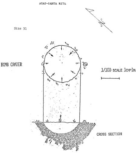
grenades were also found. No. 19b is a large bomb crater. Nearby is a
small shelter cave.
|
|
No. 16. Radio tower, Mt. Alifan.
|
|
|
Nos. 18 and 19. Gun emplacements and caves, Mt. Alifan.
|
|
|
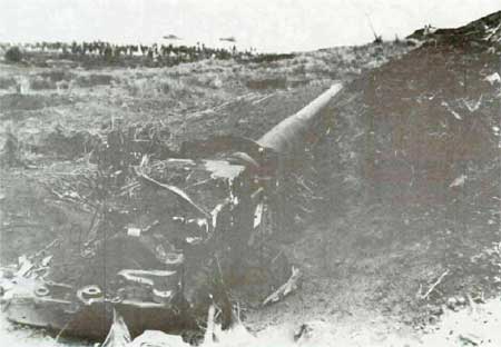
Japanese 150mm gun, Mt. Alifan, August 1944 (Mt. Alifan features Nos. 18
and 19).
|
|
|
No. 19A. Ammunition dump, Mt. Alifan.
|
|
|
No. 19B. Bomb crater, Mt. Alifan.
|
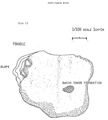
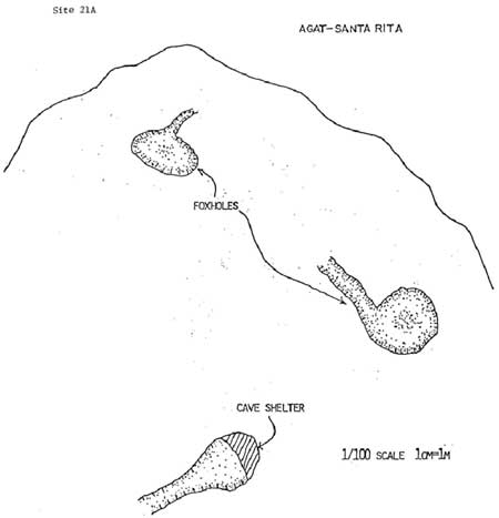
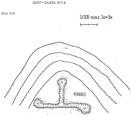
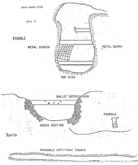
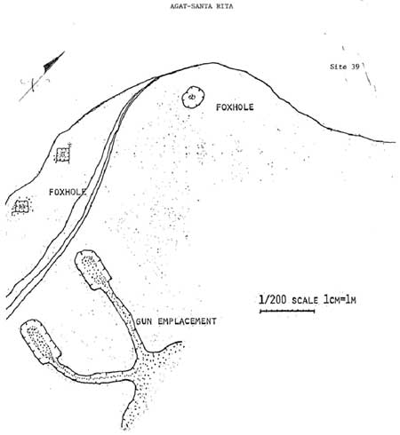
Nos. 15, 21a and 21b, and 22. These features are on the lower slopes
of Mount Alifan between Togcha River and the community of Santa
Rita.
|
|
No. 15. Foxhole, Mt. Alifan.
|
|
|
No. 21A. Foxholes and cave, Mt. Alifan.
|
|
|
No. 21B. Foxholes, Mt. Alifan.
|
|
|
No. 22. Infantry position, Mt. Alifan.
|
No. 15 is a foxhole or a gun emplacement. It measures 4 by 8 feet.
Remains of a possible radio tower are nearby. Shrapnel was found in this
area. No. 2la consists of two depressions in the earth that appear to be
foxholes. Nearby is a small, partly-sealed shelter cave. No. 21b, near
21a, is a depression on a ridge that possibly was an infantry position.
No. 22 is also a depression on the edge of a ridge similar to No. 21b.
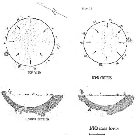
Nos. 11, 12, 13, 14, 43, 44, and 45. These several features are on
the ridges between Togcha River and Torres School. No. 11 consists of
two large bomb craters 800 feet west of Torres School. Each crater has a
diameter of 33 feet. The area contains shrapnel, shell casings, and
small arms ordnance. Vegetation has grown over both craters. No. 12 is a
6-inch naval shell that has been exploded. This fragile slope is covered
with shrapnel. No. 13 is another bomb crater, wheras No. 14 is a shell
crater. Erosion has occurred in this area because of foot travel. No. 43
is a profusion of shell casings and shrapnel. No. 44 consists of shell
casings and shrapnel, and a hand grenade was found here. No. 45 is a
foxhole north of Torres School.
|
|
No. 11. Bomb crater, Mt. Alifan.
|
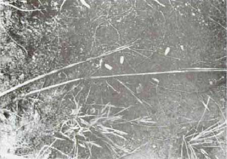
|
|
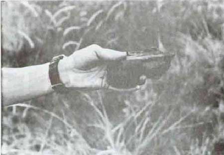
Mt. Alifan, .30 caliber bullets and a shell fragment near feature No.
44, 1984.
|
|
|
Mt. Alifan, .30 caliber bullets and a shell fragment near feature No.
44, 1984.
|
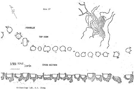
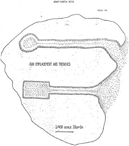
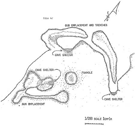
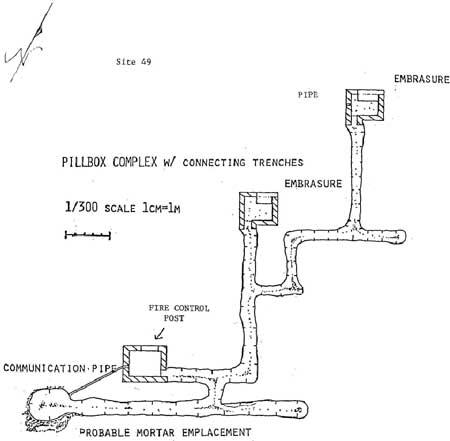
Nos. 34, 35, 37, 38, 39, 46, 47, 49, 50, and 51. This area
encompasses the lower slopes of Mount Alifan between the inland boundary
of "new" Agat and the headwaters of Togcha River. Although subject to
erosion, this area possesses a potential for the development of an
interpretive trail. No. 34 is an infantry trench 5 feet deep. No. 35
consists of gun emplacements reinforced with iron I-beams. A Japanese
75mm round was found here. No. 37 is a series of foxholes along a ridge.
No. 38 Consists of trenches and a foxhole on a ridge. Also, a shelter
cave was cut into the hillside. No. 39 furthers the concept of how
heavily defended this area was. It, too, is composed of foxholes and
trenches suited for the emplacement of automatic weapons. No. 46 is more
gun emplacements and trenches. No. 47 has trenches, shelter caves, gun
emplacements, and a foxhole. No. 49 contains a rarity on Mount
Alifan--reinforced concrete. It consists of three emplacements for
automatic weapons which are connected by a trench system (filled with
sword grass). One emplacement is earthen, while the other two are small
reinforced-concrete structures with one embrasure each. A third concrete
structure served as a fire control center. The interiors of the cramped
concrete structures are stifling hot. No. 50 is a large cave cut into
the side of a day hill, It has two entrances. Finally, No. 51 is a bomb
crater.
|
|
No. 34. Infantry trench, Mt. Alifan.
|
|
|
No. 35. Gun emplacements, Mt. Alifan.
|
|
|
No. 37. Foxhole, Mt. Alifan.
|
|
|
No. 38. Trenches and foxhole, Mt. Alifan.
|

|
|
No. 39. Machine gun emplacement, Mt. Alifan, 1984.
|
|
|
No. 39. Trench, Mt. Alifan, 1984.
|
|
|
No. 39. Trenches, machine gun emplacements, and foxhole, Mt. Alifan.
|
|
|
No. 46. Trenches and machine gun emplacements, Mt. Alifan.
|
|
|
No. 47. Trenches, caves, foxholes, and gun emplacements, Mt. Alifan.
|
|
|
No. 49. Pillboxes and connecting trenches, Mt. Alifan.
|
|
|
No. 49. Two concrete pillboxes, Mt. Alifan, 1984.
|
|
|
No. 49. Two concrete pillboxes, Mt. Alifan, 1984.
|
|
|
No. 51. Bomb crater, Mt. Alifan.
|
wapa/hrs/secd.htm
Last Updated: 07-Mar-2005
|