|
YELLOWSTONE
The History of the Construction of the Road System in Yellowstone National Park, 1872-1966 Historic Resource Study, Volume I |

|
|
Part One: The History of the Construction of the Road System in Yellowstone National Park, 1827-1966 and the History of the Grand Loop and the Entrance Roads |
CHAPTER XII:
HISTORY OF GRAND LOOP ROAD*
*In order for this document to be useful as a management tool, the history of the Grand Loop Road's construction has been divided into the following seven sections: Mammoth Hot Springs to Madison Junction, Madison Junction to Old Faithful, Old Faithful to West Thumb, West Thumb to Lake Junction, Lake Junction to Tower Junction, Tower Junction to Mammoth Hot Springs, Norris Junction to Canyon Junction.
MAMMOTH HOT SPRINGS TO MADISON JUNCTION
During Superintendent Philetus Norris' first year, 1877, in Yellowstone, he proposed a route or bridle-path from Mammoth Hot Springs to the Firehole River region via the Gardner Falls and the Gibbon River which would connect the only two entrances to the Park, the west and north. This proposal was part of a larger scheme which included the construction of a wagon road from Mammoth Hot Springs to Henry's Lake via the Tower Falls, Mount Washburn, Yellowstone Falls, Yellowstone Lake, Firehole Basin, and exiting the Park on the older western route into the geyser basin region. Norris felt that the wagon road would connect almost all of the major points of interest and also connect the two entrances into the Park. In addition to the Mammoth Hot Springs to Firehole bridle-path, another bridle-path was proposed, from the Stillwater River to the Upper Geyser Basin via the Clark's Fork mines, Soda Butte, through the petrified forests to Amethyst Mountain, Pelican Creek, the outlet of Yellowstone Lake, Shoshone Lake, and on to Old Faithful in the geyser basin. Norris also planned to build facilities at Mammoth Hot Springs.
Upon arriving in the Park the following year with the first congressional appropriation of $10,000, Norris' priorities for building facilities and beginning the construction of the wagon road were changed due to the previous year's conflict with the Nez Perce Indians and a continual threat from the Bannock Indians. Instead, Norris began construction of the first permanent road in the Park, Mammoth Hot Springs to the Lower Geyser Basin. Completion of the road would facilitate the movement of military from Fort Ellis, Montana, to Henry's Lake in Idaho or Virginia City, Montana and of course, would be used by the ever-increasing number of visitors to the Park. [1]
Prior to his explorations for appropriate routes, Norris viewed possible routes from the top of Sepulcher Mountain. He could spot the route that he had taken in 1875 and he visualized a route to the south through the park via Gibbon Canyon, Firehole Basin, the Continental Divide and on to the Tetons. Norris knew construction through the canyons could prove difficult and dangerous, but it appeared to be the most straightforward and practical wagon route. [2] Furthermore, the unusual conditions, the presence of huge masses of obsidian, in the Obsidian Cliff area posed problems for road construction.
In the survey of the road section immediately south of Mammoth Hot Springs, Norris located three possible routes from Mammoth Hot Springs to the plateau near Swan Lake. One route, the longest and most precipitous, followed the Gardner Canyon over the pass via the Osprey Falls and Rustic Falls to the plateau (route later became the Bunsen Peak Road); another route, which had a more gradual grade but also had a sheer wall section to be transversed, was the opening created by Glen Creek on to Swan Lake; the third and chosen course was the most direct route, but with steep grades, through Snow Pass above the hot spring terraces. A visitor described this first section through Snow Pass as "So steep is the climb that if the tail-board of a wagon falls out . . . the whole load is promptly dumped out in the road. A good road, though, a longer one, might have been built over the same ground." [3]
From the flat area near Swan Lake to the Obsidian Cliff area, no great construction difficulties were encountered, however penetrating the "glass mountain," Obsidian Cliff took ingenuity. Norris described his technique:
Obsidian there rises like basalt in vertical columns many hundreds of feet high, and countless huge masses had fallen from this utterly impassable mountain into the hissing hot spring margin of an equally impassable lake, without either Indian or game trail over the glistening fragments of nature's glass, sure to severely lacerate. As this glass barricade sloped from some 200 or 300 feet high against the cliff at an angle of some 45 degree to the lake, we . . . with the slivered fragments of timber thrown from the height . . . with huge fires, heated and expanded, and then, . . . well screened by blankets held by others, by dashing cold water, suddenly cooled and fractured the large masses. Then with huge level steel bars, sledge, pick and shovels and severe laceration of at least the hands and faces of every member of the party, we rolled, slid, crushed and shoveled one-fourth of a mile of good wagon-road midway along the slope; it being, so far as I am aware, the only road of native glass upon the continent. [4]
Leaving the "glass mountain," the 1878 road followed in an southeasterly direction to Lake of the Woods, Solfatara Creek into the Norris Geyser Basin. Norris' road proceeded through Elk Park, Gibbon Meadows into the Gibbon Canyon. At an approximate point where the Gibbon River flows in a westerly direction, the road left the canyon in a gap between cliffs and traversed pine covered slopes connecting with the Madison Junction to Old Faithful Road south of the present day Madison Junction.
During 1879, Norris supervised improvements to the grades at Obsidian Cliff, in the Norris area and into the Gibbon Canyon. He found spanning the Gibbon, Firehole and Madison rivers, or their creeks and streams could prove to be very interesting. He wrote "Few of the anomalous features of the LAND OF WONDERS are of greater scientific interest or of more practical value than the placid, uniform water-flow in its hot spring and geyser-fed rivulets and streams." Because these water courses are generally "broad, shallow, grassy and flowers carpeted to the water's brim, . . . with long stretches of flowing grass and occasional hot spring pools in the channels, . . . with overhanging turfy banks," Norris decreased the need for some bridges by cutting a slope through the turf forming a very good and permanent ford. Instead of a bridge he placed "long, limber poles and foot-logs, only a few inches above the low stage of water." [5]
The following season, bridges were built to span the Gardner and Gibbon rivers, including costly, long causeways, turnpikes, and grades along the Norris fork of the Gibbon River. An extension of the road to the Forks of the Gardner River was finished and a road "through the eastern branch nearly half-way through its terrible canon, necessitated a grade of over 1,000 feet within two miles." [6] In 1882, the new superintendent, Patrick Conger who accomplished little in road construction, was responsible for the construction of a substantial bridge over the Gardner River. The construction was supervised by Capt. E. S. Topping. The bridge, which was 12 miles south of Mammoth Hot Springs, was built in two weeks. The 96 feet long structure had abutments built well out into the river on both sides. The center pier and the abutments were constructed of log in a V-shaped configuration, pinned at the corners and filled with rock above the high water mark. The bridge was covered with hewn logs, 5 inches thick. [7] Topping and his crew built and repaired culverts and crossways, removed rocks and boulders, and still Conger wrote "Our road is still in a mountainous and rugged country, requiring much labor and expense before it can be said to be a good road." In his appeal for more appropriations for road work, he described the situation:
. . . when you consider the extent of the territory and the great natural obstructions that have to be encountered, it seems to me it must be evident, . . . the amount heretofore placed at the disposal of the Secretary of Interior for the protection and improvement of Yellowstone National Park is entirely inadequate . . . . But to proceed with our road we have to pass over some very high hills to reach the valley of the main Gibbon, where we encounter a wide low bottom called the Geyser Meadow, a place where it will require a large amount of labor to make a good road. After passing the meadow our road enters the Gibbon Canyon and follows the river down several miles, close on the edge of the stream, crossing the same three times in as many miles over difficult and dangerous crossings in time of high water. After passing through this canyon our road gains the highlands, by a steep grade along the side of the mountain on the south side of the river. We soon come to the great falls of the Gibbon where the river plunges over a perpendicular precipice of 75 feet, which in the stillness of the evergreen forest that covers this country renders the scene as enchantingly beautiful as 'fairyland'. [8]
Army engineer Lt. Dan Kingman, who assumed the responsibility for road construction in the Park in 1883, found this section of road to be the most heavily traveled in the park and in the worst condition. His largest work crews reported there until heavy snows of 18 to 30 inches fell during the middle of October of 1883. With the exception of a 3 miles stretch in the Gibbon Canyon, this 40 miles section was widened and straightened, boulders and stumps removed and slopes reduced. Frequently spaced turnouts and a new ford were built. The existing bridges were repaired and the corduroy sections were covered with sod and earth. The work on this section cost approximately $6,300 or $170 per mile. [9]
In 1885 major projects and changes were made to Mammoth Hot Springs to Firehole Basin area. Substantial bridges were completed, one over the Gardner River at the ford, one over the Gibbon River at the lower ford, and one over the Gibbon River at the third crossing.
Work was completed on the new route immediately south of Mammoth Hot Springs. The 4-1/2 miles Mammoth Hot Springs to Gardner via Golden Gate and the West Fork of the Gardner River, which was started in 1883, was completed in a seven month period. Twelve hundred and seventy-five pounds of explosives were used and over thirteen hundred shots in drilled holes were fired. As a result, fourteen thousand cubic yards of solid rock was excavated in addition to a large amount of broken and crushed rock. This dangerous section of road was completed without any loss of life or injury. The completion of this section reduced the route by 1-1/3 miles and the time to many areas in the park from 2 hours to 1/2 day depending on the type of wagon and load. The reduced ascent of 250 feet to Swan Lake plateau enabled loaded wagons traveling in opposite directions to now pass with relative ease. The near vertical stone walls of the canyon prevented an excavated roadway, thus a 228 feet wooden trestle carried the roadway. Lieutenant Kingman noted in his report for 1885 that the "natural stone monument at the end of the trestle" marked what "visitors have called the Golden Gate." [10]
Kingman established a road camp near the Norris Geyser Basin in order to begin work on the new road between Norris Geyser Basin and Beaver Lake where it would connect with the old road at the head of the lake. The poorly located old road ran in an easterly direction south of Beaver Lake, before entering the woods near Lake of the Woods, then the road followed Solfatara Creek and crossing the Continental Divide near the confluence of the rivers near Norris Junction. Due to excessive snow depths and heavy timber covering, the snow covered the road well into May. The poor subsurface drainage caused by the heavy clay soils and the "saucer-like shape" of the pass produced "horrible conditions" for travelers. Kingman noted that it was not uncommon "to see a team lying in the mud, tangled in their harness and floundering about in almost in inextricable [sic] confusion while the drivers looked on in despair." Consequently, Kingman had sought a new route which would provide more exposure to the sun, better drainage and soil conditions. The 7 miles of new road, completed by the middle of October, cost $6,269.80. Before the close of the 1885 season, the crews replaced "a long and rather unsafe structure built of poles" with a "single span King-post truss of 30 feet" combined with a causeway, over the Gibbon River near the Norris Geyser Basin. [11]
In 1887, the wooden trestle through Golden Gate was strengthened by placing new timber supports and road-bearer cross beams. A log and pole temporary bridge had to be placed over Obsidian Creek at the ford due to the unusually high runoff. Lieutenant Kingman's replacement, Capt. Clinton Sears, proposed building a new 7 miles road from Swan Lake Flats to Beaver Lake, a new road between Norris Basin and Gibbon Canyon which would complete the 6 miles gap, and build a new road from Gibbon Canyon to the Firehole Basin. With a small appropriation for 1888, he was able to build a road from Norris Hotel across the Gibbon Meadow connecting with the road into Gibbon Canyon and a 7 miles stretch from Obsidian Cliff northwards. [12]
In 1889, a King and Queen post-truss through span of 40 feet was built over the Gardner River at the south end of Swan Lake Flats. It had a trestle span of 20 feet, a roadway width of 14 feet and a height above low water of 6-1/2 feet. A 86 feet long trestle bridge with a 13 feet and 8 inch width roadway between guardrails, a 5-1/2 feet above the low water, was built over the Gibbon River in the canyon. The engineers felt that a trestle bridge could be safely built because the river, which has many hot springs in its bed, would not receive ice build-up. Thus at the end of 1889, the following bridges were in service on the Mammoth Hot Springs to Madison Junction:
1. three spans of 33 feet over Gardner River—no truss
2. three spans of 32 feet over Gardner River—King post
3. trestle of 224 feet—Golden Gate
4. one span of 14 feet over West Gardner—no truss
5. two spans of 40 feet and 20 feet over Gardner River King and Queen post
6. one span of 32 feet over Obsidian Creek—King post
7. one span of 16 feet over Obsidian Creek—no truss
8. one span of 32 feet over Obsidian Creek—King post
9. One span of 34 feet over Gibbon River—King post
10. one span of 20 feet over slough at Norris—no truss
11. two spans of 40 feet over Gibbon River—Queen post
12. trestle of 75 feet over Gibbon River—Queen post
13. one span of 24 feet over Gibbon River—no truss
14. one span of 24 feet over Gibbon River—no truss
15. one span of 20 feet over Gibbon River—no truss [13]
During 1890, one of the two major projects in the Park was the construction of retaining walls in the Gibbon Canyon area. [14] In 1895, the Army completed another bridge over the Gibbon River at an old ford, near the mouth of the canyon. [15] The next major road projects for this section would be a part of Capt. Hiram Chittenden's 1900 multi-year plan for completion of the Grand Loop Road.
Among Chittenden's proposals for the multi-year project, he recommended a new widened road through Golden Gate Canyon including a new bridge to replace the wooden trestle around the cliff, raising 3 miles of road 2 or 3 feet in Gibbon Canyon and cutting out 1 mile of dangerous grades, and constructing 4 miles of new road down the Gibbon to connect with the western entrance road. [16]
About one mile of the original wagon road along the Gibbon River Canyon remained in 1900. The road had two very steep grades, one of which had a sharp curve at the bottom right at the river's bank. Chittenden found this particular stretch to be most dangerous as the failure of brakes or any other emergency might bring a team and wagon into the river. He called the road through Gibbon Canyon "One of the most pleasing in the park. It runs immediately along the bank of the river and is of easy grade. Unfortunately it is not built high enough above the river to make it safe. The river at every heavy flood goes clear over the road and has washed it out twice in the past six years." By 1903 the two bad grades had been cut out, one mile of new road had been constructed and a new steel bridge with concrete abutments had been built. During the winter of 1902, rock was hauled on sleds for about a mile to be used in the construction of the new heavy retaining wall on the newly reconstructed section of road about a half mile below Gibbon Falls. [17]
In 1904, a worn-out bridge in the Gibbon Canyon was replaced with a small 45 degree skew span and the following year the bridge over the Gibbon near Norris Junction was reconstructed and a steel truss was built over the Gardner River at the 7 mile post (Seven Mile Bridge). [18] Chittenden completed the construction work on the Golden Gate during 1902. [19]
Before Captain Chittenden left Yellowstone to begin supervision of the roads in Mount Rainier, he made the following recommendations for improvements to the Mammoth Hot Springs to Madison Junction road:
. . . great care should be taken in widening the road through the 'Hoodoos' to prevent the destruction of unusual rock formations. It will be better to let the right of way have an irregular alignment—being narrower in some places than in others—than to sacrifice this peculiar formation in order to get a uniform width throughout. . . . it would be better to require all teams to come to a walk there than to remedy the defect by blasting out those picturesque rocks.
Forested areas at Apollinaris Springs, a point 8-1/2 miles from headquarters, Crystal Springs, and at mileposts 13, 14, and 17 miles out should be cut back on the east side about 30 feet to expose the snow to the sun. However, if these forests contained fine specimens of trees, the stands should be preserved. The Apollinaris Spring, Kepler Cascade, Mud Geyser and other coach unloading platforms should be rebuilt and extended to a length of 100 feet.
The first hill just beyond the Growler can probably be brought to the adopted grade of 8% by a small amount of cutting and filling and no relocation of the old road is deemed necessary. The second hill just beyond the first milepost can probably be dealt with better by going around it to the south. A personal reconnaissance of the ground indicates the entire practicality of such a line. If built, it should leave the present road at the foot of the first hill near the Minute Man Geyser and rejoin near the foot of the second hill at the beginning of the tangent across Elk Park.
The maintenance of the retaining wall along the Gibbon River between Elk Park and Gibbon Meadow can probably be avoided advantageously by putting the road back farther into the rock. If the wall is retained it will have to be relaid in mortar. [20]
1st Lt. Ernest Peek, who replaced Hiram Chittenden, agreed with Chittenden's earlier suggestion of building all stone drywalls in the park and in 1907 began repairs on the drywalls near Gibbon Falls. In order to efficiently coordinate the work on this section, he established a number of road camps including one near Obsidian Cliff and one near Beryl Springs. The camps had floored and frame tents. [21] In 1908, Peek requested sufficient funds to purchase three bridges, including two for the Gibbon River, but his request was not honored. Thus very little major work occurred, but road surfacing was carried out from Silver Gate to the 5 milepost across from Swan Lake Flats. Near Crystal Spring, "considerable work was done on the roadside in order to deepen the ditches and give the road a good high crown." Surfacing was also done on the Norris to Fountain road from 2-1/2 to 2-3/4 miles. The 25 foot bridge at Obsidian Cliff and the 15 foot bridge at Apollinaris were each replaced by fills with 4 feet culverts. At Obsidian Cliff, the road was raised over 2 feet to improve the grade and it was also straightened. A fill of a foot was also made at Apollinaris. [22]
In 1909, Army Captain Willing conducted an inspection of the bridges in the Park which stated condition and made recommendations for improvements. On this section of the road, Willing found:
Bridge No. 2 across the Gibbon River, 5-5/8 miles south of Norris Station—The present structure consists of one wooden span with two wooden approaches, and was built in 1895. The timber in the bridge is sawed pine lumber, which at present is in a decaying condition, some of the floor beams being broken and held in place by props. The structure is in an unsafe condition, and it is recommended that it be replaced by two 50' low truss, pin connected steel spans, resting on two concrete abutments and one concrete center pier.
Bridge No. 3, Gibbon Canon Bridge, across Gibbon River, 7 miles south of Norris—The present structure is a trestle bridge 80' long, built 1891, of sawed pine timber which is in a decaying condition. It is recommended that this bridge be replaced by an 80' low truss, pin connected steel span, resting on concrete abutments. As the bridge crosses the stream, at an angle of about 45 degrees, it will be necessary to make this bridge askew.
Bridge No. 4, Gibbon Canon Bridge, across Gibbon River, 9 miles south of Norris Station. The present bridge consists of two piers in the stream, two abutments of logs, and log stringers spanning the space between these piers. It was built in 1892, is 65' long is in shaky and decaying condition. It is recommended that it be replaced by a 65' low truss, pin connected steel span, resting concrete abutments. It will be necessary that this bridge also be built askew as the road crosses the river at an angle of about 45 degrees.
Bridge No. 5, across the Gibbon River at Wylie's Lunch Station. The present structure consists of one pier in the middle of the stream, and two log abutments with log stringers spanning the space between. The bridge was built about eight years ago and is in a fair condition, but two light in construction for the travel it has to carry. It is recommended that it be replaced by a 40' steel plate girder span, resting on concrete abutments.
Bridge No. 7, at the mouth of the Gibbon River, near the junction with Firehole River. The present bridge consists of one wooden span with approach at one end, resting on wooden piers and abutments, total length 66'. This bridge was built in June and July, 1896, and is also in the advanced state of decay and is unsafe. It is recommended that this bridge be replaced by a 65' low truss, pin connected steel span, resting on concrete abutments. [23]
During 1909, the road between mileposts 8 and 15 was ditched and crowned and the road was raised about 1-1/2 feet at the culvert fill across Willow Creek. The ruts caused by heavy traffic and water were filled with surfacing material. [24] In 1911, the road from Gardiner to Norris Junction was regraded and 21 miles of the road was graveled. Also that year, the engineers recognized the need to replace section of the dry, rubble wall along the Gibbon River. [25] During the winter of 1912, Captain Knight recommended that additional dry rubble guard walls be built on the outside edges of curves through the Golden Gate. He suggested the road along the Gibbon River between points 8 and 9 be raised two feet for 1-1/2 miles to keep it from overflowing in the spring and that sections of the dry rubble retaining walls be rebuilt. [26] He also felt that the old, crumbling retaining wall between Norris and Fountain should be replaced and that the narrow road should be widened. [27]
In 1914, gravel was placed over the middle 8 to 10 feet of the Golden Gate to Swan Lake Flats road to bring up the crown and fill in the wagon ruts. The gravel, which was taken from a pit just east of the 4 milepost was loaded through a trap by drag scrapers. It took approximately 1/4 yard of gravel per linear foot of road. [28] Some of the old bridges on the Mammoth Hot Springs to Madison Junction were replaced during the year. A two 40 feet span reinforced concrete bridge was built over the Gibbon River, 7 miles from Norris, and one 65 feet single span girder and slab constructed bridge was built over the Gibbon near the confluence with the Firehole River. A 40 feet steel arch bridge was built over the Gibbon River near the Wylie Camp, 17 miles from the West Entrance. More reconstruction of stone retaining walls was done in the Gibbon Canyon and the road crews built a barn in the Gibbon Meadows camp, a cabin at the Beaver Lake camp, and two "public-comfort houses" were built in the Norris Geyser Basin. [29]
No major road projects occurred on this section of the Grand Loop Road for a few years. Shortly after the National Park Service was created, Secretary of the Interior, Franklin Lane visited the Park. During his inspection of the road system, he recognized a safety and visual problem in the Gibbon Canyon, the growth of small trees along the road. He found that the trees obstructed the view of the river and in turn made for dangerous driving. He also felt the removal of a few trees at the Gibbon Falls would "afford a better view of the falls." Other comments of condition on this section were:
On top of hill on main road two miles from Mammoth, a number of very bad and hard rolls and bumps. Two serious holes, more than half way across Swan Lake Flats. Bridges at Upper Gardner River, Willow Creek and Gibbon River at Norris, below and above road levels. Road at Roaring Mountain in poor shape. Road Norris to Fountain down the Gibbon Canyon very rough, full of large chuck holes and broken culverts. Also contains one or two improvised log bridges where culverts have been washed out. Wylie Gibbon Camp over Mesa Road to Firehole River, about four very bad chuck holes that could be filled with little expense. [30]
During 1921, a new steel and concrete bridge was placed over the Gibbon River near Norris and wooden mess halls were built at Madison Junction and at Gibbon Meadows. [31] For the next few years, small allotments financed minor road projects, mostly accomplished on short sections at the end of the season. In September 1927, a crew composed of men and teams from disbanded work groups, began a grading project along the Gibbon River. The 1928 appropriation provided sufficient funds for work for a complete season. Foreman John Benson established a temporary work camp at milepost 17 on May 17, 1928 in order to begin the heavy steam shovel work in rock cuts and to arrange detours for traffic. Later the camp was moved to Norris Junction to continue the project which was finally finished in May 1929.
In June, 1930, Foreman O.A. Weisgerber established a camp at the old Beaver Lake road camp in order to begin work on the Bijah Springs-Obsidian Cliff section. A dangerous curve was reconstructed near milepost 15 and between the Gardner River crossing and the Glen Creek crossing, the crews were stalled by underground springs which required the installation of subdrainage. Material from a rhyolite slide north of Obsidian Cliff was used for a rock sub base. An Osgood gas shovel, which had been moved up the Gibbon River-Norris Junction section was used on this section. The next section mostly required light cuts in the existing roadway and side cuts to straighten and widen the road. On this section, the banks were sloped up to an 8 or 10 feet cut on a 1-1/2 and a 2 to 1 slope. It was felt that the slopes, which would present a pleasing appearance, would also suffer less erosion from heavy runoff and the vegetation would take root easily. Upon completion of the excavation of this segment, the shovel removed rhyolite material from a pit behind the Norris Ranger Station for use as a light coating material for surfacing. The camp was dismantled in November. [32]
In October, 1929, when the weather became too bad to work in the interior of the Park, the crews resumed work on 600 feet of road in the Mammoth Lodge area. Most of the project was in fill, but the additional rough fill material needed was obtained from the demolished concrete grainery near the Tower Falls and Mammoth Hot Springs junction and from abandoned concrete flumes near the Mammoth Lodge. The removal of these structures were part of the Landscape Division's plan for the Mammoth area. The rough fill was covered by material obtained from the road slopes above the Mammoth reservoir and the finer material for surfacing came from the pit on Capitol Hill. In addition to the road construction, the old wooden sidewalk and the continuing gravel walk to the Mammoth Lodge was replaced with a stone curb sidewalk. The new sidewalk was described as:
a stone curb walk, 2,412 feet in length, and with an emulsified asphalt surface. Curbing of locally quarried sandstone, is twelve inches wide and with a clear face of eight inches on the street side. Width of walk between curbs is five feet, an overall width of seven feet. The space between curbs was filled to within three inches of the top with any available material. Above this was spread two courses of grade size gravel, each coat being sprayed with a penetrating coat of Bitumen and rolled to a true cross section. A final coat of fine native sand was then broomed into the surface, giving a natural gray finish to the walk. [33]
After the Bureau of Public Roads assumed the road construction and improvement responsibilities for the Park in 1926, the Mammoth Hot Springs to Madison Junction was considered as a major project, however, adequate funding for location surveys was not received until 1929 and 1930 and as earlier stated, the lower segment of the section was constructed by National Park Service day labor work. The location survey for the Mammoth Hot Springs to Obsidian Cliff segment was made during the fall of 1930. At that time additional funds were requested for more investigation of the Golden Gate and for designs for a new viaduct.
A better route south from Mammoth Hot Springs was investigated, however, an improvement to the existing route through Golden Gate was deemed more advisable than the old route through Snow Pass and/or Bunsen Peak, or a preliminary proposal by the Park's engineering department of following a higher location through Golden Gate Canyon toward Mammoth Hot Springs through the Hoodoos. The National Park Service's landscape division did not approve of cutting.
The Bureau of Public Roads' proposed route followed the older Army road from Mammoth Hot Springs south except at the Gardner River crossing and the Obsidian Creek crossing, where it moves approximately 1/4 mile eastward for a distance of about 3/4 mile.
The 18 feet standard roadway design by the Bureau of Public Roads was used on this road segment. The design provided an 18 feet surfaced roadway with three feet shoulders on each side, both on fills and cuts. Three feet standard ditches, one foot deep with 2 to 1 slopes into the ditch, from the shoulder, were provided for sections in cuts. The cut slopes were designed for slopes 1 to 1 or flatter in common material as specified by the Landscape Division of the National Park Service. For the use of materials other than common, the cut slopes were designed at slopes thought to be stable for the particular material, except that all cuts four feet were designed with one to one slopes. The fill slopes were all designed at 1-1/2 to 1.
The Bureau called for the use of corrugated, galvanized metal pipe culverts with cement rubble headwalls for the minor drainages and for reinforced concrete box culverts with cement rubble headwalls for creek crossings. They also recommended the construction of a reinforced concrete structure, 75 or 80 feet long of 2 or 3 spans at the crossing of the Gardner River at station 233 +50.
In assessing the Golden Gate viaduct situation, the Bureau found the present viaduct below the grade of the located line and too narrow thus, a new a new viaduct was necessary. In order not to incur further scarring, a wider and slightly higher structure was needed. They recommended cement rubble retaining walls on either end of the viaduct and the respective length of the wall. The new reconstruction would also require a tunnel approximately 100 feet in length.
Finding snow conditions worse in the Swan Lake Flats area, snow fences were suggested to control the conditions on the flats. The Bureau did not project possible snow conditions at either entry to the tunnel, but they did try to consider snow problems on the route in case of possible winter use of the road.
A sand and gravel pit on Swan Lake Flats was approved for concrete aggregate material, but its conspicuous location limited the amount that could be extracted from it. [34]
Following the completion of the Location Survey, the Denver office of the Bureau of Public Roads designed the road and also the plans and specifications for the Seven Mile Bridge over the Gardner River. The Bureau's plans designated grading and draining on an 18 feet 1930 standard roadway width. Concrete box culverts and corrugated metal pipe were designed for drainages; tile drain and rubble drains were planned for wet and swampy areas.
Following the advertisement for bids in the Rocky Mountain News, Denver, The Billings Gazette, Billings, Montana, and the Salt Lake Tribune, Stevens Brothers of St. Paul, Minnesota was awarded the contract with a bid of $140,126.65 or 73% of the engineer's estimate. The contractor, who was awarded the contract on August 5, 1931, set up camp immediately and began construction work on August 13.
Three camps were used for this contract. During 1931, the camp near station 55, or near Apollinaris Springs was used, then moving the camp to station 300 at Swan Lake Flats in October, 1931. For the remainder of the construction time, a camp near station 515 was used. These camps consisted of portable cabins positioned on wheels for cook houses, office and bunk houses, and tents to accommodate extra crews. The average daily crew working on the project was 57 men using the following equipment:
3 - "60" Caterpillar tractors
2 - Hydraulic Bodies
2 - Hydraulic Fresnos
1 - Concrete mixer
1 - Hydraulic Bulldozer
1 - Hydraulic scarifier
1 - Elevating Grader
14 - Teams with dump wagons
1 - 1-1/4 yard gas shovel
4 - 3 ton dump trucks
4 - 1 ton trucks
1 - Grader, 12' blade
1 - Compressor
1 - Small electric light plant [35]
One of the partners of the firm, C.R. Stevens, served as superintendent of the project. Using mostly long-time firm employees, he also hired common labor locally. The foreman was paid $140 per month, skilled labor, $100 to $140 per month, common labor, $55 per month. The contractor gave a $45 per month subsistence sum.
During 1931 season, grading began at a point south of Obsidian Cliff and in 2-1/2 months had progressed to station 245 near the crossing of the Gardner River, but cold weather forced the crews to move toward the other end of the project near Mammoth. Prior to shutting down for the winter, all concrete work had been done, the Seven Mile Bridge begun, some masonry work finished and the drainage projects completed as the grading progressed.
The contractor started the 1932 season on May 12 with shovel and dump trucks working in the Hoodoos. Extensive blasting was required to break up and loosen the huge wedged rocks, then more blasting was needed to break the rocks into manageable sizes for hauling. Grading continued on the project until August. During the 1932 season, the Seven Mile Bridge was completed, pipes, head walls, and rubble drains, were completed as grading permitted, and an old road was obliterated. The old road, from station 465 to station 496, required tearing out old retaining walls, cutting of the old shoulders, and hauling out the waste material. The new road approximately paralleled the old road.
Two concrete box culverts were installed, one 8' x 6', at station 64, the Obsidian Creek crossing and an 8' x 4' at station 369, the Glen Creek crossing. Corrugated metal pipes with masonry headwalls were installed over the other drainages. Tile and rubble drains and rock sub-base were installed in the swampy ground in areas of springs. The project required the installation of 1922 feet of tile drain and 5,955 feet of rubble drain.
The types of material the grading crews faced throughout the project were varied. From just south of Obsidian Cliff to near the Glen Creek crossing, the cuts were through solid rock, loose rock, gravel, muddy swamps and common earth. From the Hoodoos to the end of the project at the Mammoth Terraces, cuts were through solid rock and very large loose rocks, with some common earth and gravel toward the end. Since the Park required that all borrow pits should not be visible from the road, some difficulty was experienced in finding suitable material with a reasonable hauling distance. [36]
The engineering crews occupied three portable cabins built by the contractor at the National Park Service's Beaver Meadow maintenance camp during 1931, then moving to Mammoth Hot Springs until the end of the project. In addition to retracing the center line and cross-sectioning the entire project, staking culverts, and drains, the engineers placed concrete center-line markers at intervals of approximately one-half mile over the entire project. A light palliative oil treatment, 4,000 gallons per mile, was applied to the entire project to aid in the dust nuisance and serve as an interim measure until a surface course of crushed rock or gravel was applied. The project was completed by September 6, 1932 for a total cost of $136,810.94. [37]
Several landscape architecture issues were identified during 1932. During Landscape Architect Mattson's inspection of the guard rail between Mammoth Hot Springs and Norris in July, he objected to the use of the dark stain. The Bureau attributed the use of the stain as the result of competitive bidding, but he was willing to work with the Park to achieve a desired effect. After discussing the use of oil to thin the stain, Mattson was assured that the stain would bleach to a lighter shade. However, in discussing the staining of the guard rail at Madison Junction, he "asked them not to stain the guard rail at Madison Junction until it was complete and then use every effort to obtain the original desired color." [38]
Vista clearance and guard rail installation was also considered by the Park landscape architects in their July report:
| sta.93 | work will be done under road contract to provide turnout when waste material is cleaned up. |
| sta.122 | Road ditch to be filled making 10 ft. dalite available for distance of 100 ft. No guard rail required. Few trees to be selected and removed. |
| sta.125 | Dalite already available between sta. 124 and sta. 126 needs oil surface and 150 ft. guard rail. Some trees to be removed. |
| sta.150 - 151 | some trees to be removed-no turnout no guard rail required. Vista will be available while autos are in motion. |
| sta.160 | remove numerous matured trees at edge of meadow for vista. No parking required, no guard rail. |
| sta.173 - 175 | This location is on the outside of a curve. It would require considerable yardage to fill three feet deep and ten feet wide. Guard rail would be required. |
| sta.185 | Several dead trees and a few mature trees to be removed. No parking or guard rail. [39] |
Upon the completion of the Mammoth Hot Springs to Obsidian Cliff segment, the short steel Seven Mile Bridge which the new road bypassed was removed by Park crews then the old road obliterated. The new road location required the removal of 5,460 feet of telephone lines. The 18-wire system was relocated through a 16 feet right-of-way in a wooded area. [40]
In October, 1933, John McLaughlin of Great Falls, Montana, was awarded the surfacing contract for the 11.99 miles of road between Obsidian Cliff and Mammoth Hot Springs. Upon receiving the contract, McLaughlin set up camp about 600 feet to the right of station 520, a site which had been used by two previous contractors. McLaughlin purchased the frame buildings which the other contractors used for use as cook house, office, and bunk houses. He completed the camp by adding tents for use as additional sleeping quarters.
The crews began quarrying the widened heavy cut through solid rock in the Golden Gate between stations 418 and 421. The rock, obtained from the high cliffs, was blasted, put through a primary crusher and then stock piled to the left of station 409 at Swan Lake Flats. [41] The crews worked through the winter in order to avoid the traveling public during the visitor season. By the beginning of May, 1934, sufficient rock was stock piled and some surfacing had begun. By July 17, the project was complete.
The finished roadway had a 22 feet shoulder-to-shoulder width, a 4 inch base of 1-1/2 inch maximum size aggregate and 1 inch top of 1 inch maximum size aggregate. The earlier grading contract had graded the road on the 1929 standard, but on this project the super elevation on all curves conformed to the 1932 standard. The surfacing courses consisted of rhyolite. At the conclusion of the project, a palliative oil treatment was applied. A plant mixed oil course was scheduled for application during the summer of 1935. [42]
In October of 1934, Taggart Construction Company received the oiling and seal coat bid for $99,836. This project covered 36.29 miles of road, with 11.99 miles receiving a plant-mix oiled material and 24.29 miles receiving a seal coat. The contractor established his camp approximately 1000 yards left of the gravel pit which was to provide the surfacing material at station 255. A frame cook house was constructed, portable tents were used for bunkhouses and a portable building on wheels served as the office. The project required the services of about 65 men. A Pioneer Duplex crushing and screening plant was placed at the gravel pit which was approximately 1000 feet left of station 260. The crushed and screened material was stock piled nearby. [43] The project began on May 15, 1935.
Upon the completion of oil matting, the crews built masonry guard rail, performed cut slope treatment, cleaned up any slide material, obliterated old roads and borrow pits, placed top soil and planted approximately 275 trees of which 28 died. Parking areas were constructed near the Beaver Dams at station 100, at Appollinaris Spring and Roaring Mountain. The Beaver Dams parking was considered by the engineers to be a "pleasing and useful asset to the road."
The project, which extended from Mammoth Hot Springs to the Firehole Cascades was completed on September 30, 1935. With the exception for the needed construction and or/replacement on four bridges over the Gibbon River, "The smooth, wide highway, with easy curves and grades, should add greatly to the comfort and safety of the increasing volume of tourists who come to visit Yellowstone National Park each year." [44]
With the exception of bridge construction along this route, no major work was completed on the road until 1948 and 1949 when the road received another bituminous seal coat surface. The project, which was classified as a maintenance project and funded from Park funds, was awarded to Peter Kiewit Sons' Company of Sheridan, Wyoming, for a cost of $77,250.00. The park hoped that this treatment would extend the life of the existing pavement and lower the cost of maintenance on this road section. The crushed and screened material was stockpiled at locations along the route, however, the bituminous material was trucked in directly from a refinery at Cody, Wyoming. Most of the equipment and supplies were brought in from West Yellowstone or Gardiner, Montana. In order to transport the crushing and screening plant over the Madison River Bridge, the bridge had to be reinforced with the addition of eight temporary timber bents. The project was completed on August 2, 1949. [45]
The next major road project between Mammoth Hot Springs and the Firehole Cascades was the construction of the Norris Junction bypass, a project initiated by the National Park Service's Mission 66 program for FY65. The 6.32 miles long project channelized the intersection for the Grand Loop Highway and the Norris-Canyon Cutoff. The new alignment intended to provide a bypass of the Norris Museum and the Norris Geyser Basin and reduce the traffic congestion in that area.
The plans for this bypass were designed in the Region 9 Federal Highway Projects Office during the winter and spring of 1964-65. Both aerial and ground survey methods were used in siting the new alignment and automatic data processing equipment was used in its design. The mainline roadway was designed for a 38 feet graded width with 5-1/2 inches of base. The upper 1-1/2 inches of base were bituminous stabilized with a surface width of 30 feet. The two spurs road leading of the bypass were graded to a 32 feet width with a 5-1/2 inches base of which the top 1-1/2 inches were bituminous stabilized with a surface width of 24 feet. The shoulders were defined it cover aggregate resulting in a travel way of 22 feet on the main road and 20 feet on the spur roads. A 12 degree maximum curve, a 5.4% maximum grade, and minimum horizontal and vertical sight distances of 250 feet and 240 feet, respectively, were other design features.
The contract was awarded to R. J. Studer and Sons of Billings, Montana who submitted the low bid of $817,815.00. During May of 1966, subgrading began in an unstable, marshy area across from Elk Park, then moving on to a soaked peat bog near the Gibbon River. In addition to the grading operation, corrugated metal culvert pipe, vitrified clay culvert pipe, and perforated corrugated metal pipe underdrains were installed. Drop inlets, headwalls, and concrete curb and gutters were installed in October of 1966. By the end of October, 1966, the old road had been obliterated in the Norris Geyser Basin area, the areas of the old Gibbon River bridge, and the old Norris Junction. Seeding was done in one procedure with a 1,200 gallon capacity tank hydroseeder, seed, fertilizer, and green-dyed wood cellulose mulch. The one operation covered approximately 1/4 acre.
The guide posts treatment was changed from chemonite or greensalt to pentachlorophenol which produced a brown rather than green color. Other landscape details required the coloring of visible portions of concrete box culverts to be the same color as the curbs and gutters and, the removal of downed trees along part of the route. The crushed aggregate came from a pit sited to the left of station 1362+50 on Route 12, the Northeast Entrance road, the material came from an alluvial deposit and some from a highly disturbed rhyolite formation next to the alluvial deposit. A pit at Corwin Springs, Montana, provided the concrete aggregate and the cement came from the Ideal Cement Company at Three Forks, Montana. Almost all of the corrugated metal pipe, which was spot welded, came from the Bethlehem Steel Corporation. The contractor completed the project on November 7, 1966.
Upon its completion, the route now provided safer passage through this area. In the past, a common complaint and worry to Park officials was the reduced visibility caused by the steam blowing across the road from the geyser basin. The cars, which were pulled off on the road's shoulder for better viewing of the geyser basin, also caused a safety hazard. One recommendation the officials made at the end of the project was that the roadway receive a high type bituminous surface at some time in the future to replace the 1-1/2-inch thick plant-mix base which had been applied as a temporary measure. [46]
|
|
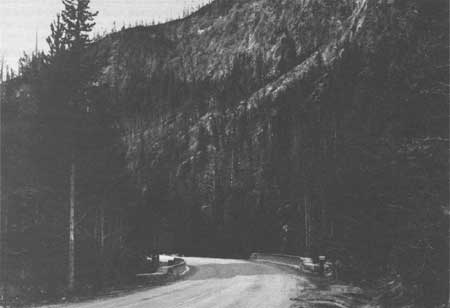
Golden Gate, early 1900s Courtesy Yellowstone National Park Archives |
|
|
Golden Gate, early 1900s Courtesy Yellowstone National Park Archives |
|
|
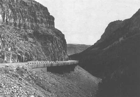
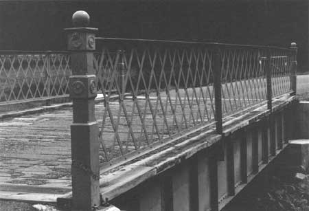
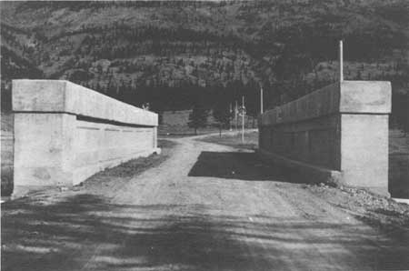
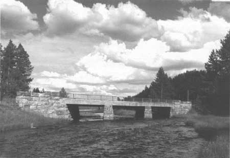
Golden Gate Viaduct, 1989 Courtesy Historic American Engineering Record, Jet Lowe, 1989 |
|
|
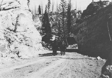
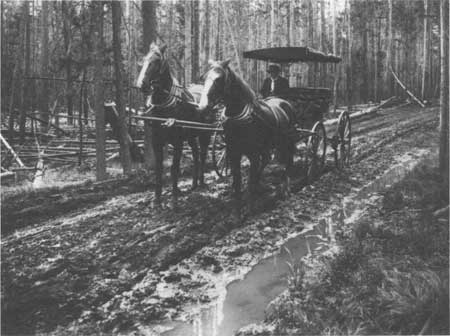
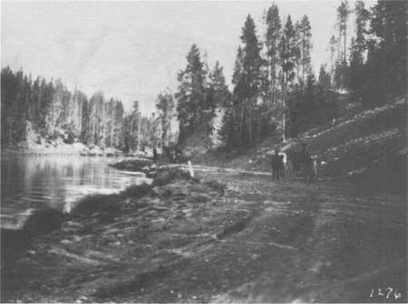
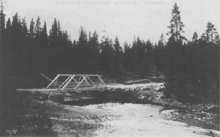
Buggy at Silver Gate in the Hoodoos, ca. 1895 Courtesy Yellowstone National Park Archives |
|
|
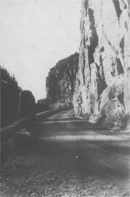
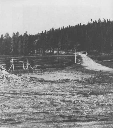
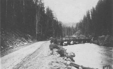
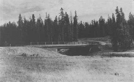
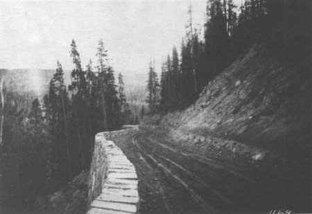
Road Below Golden Gate, ca. 1900 Courtesy Yellowstone National Park Archives |
|
|
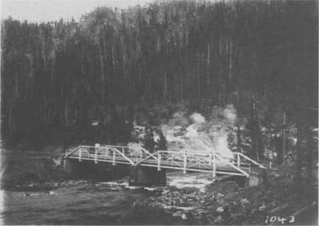
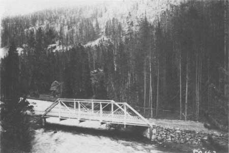
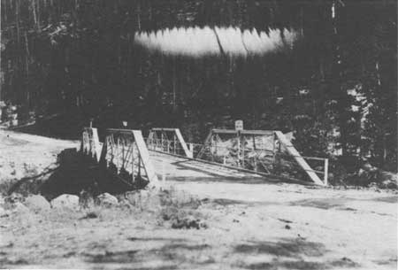
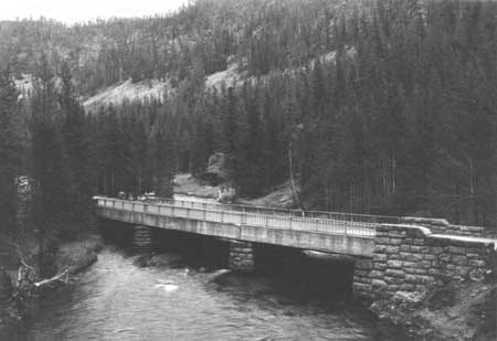
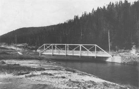
Seven Mile Bridge, ca. 1900 Courtesy Yellowstone National Park Archives |
|
|
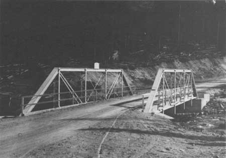
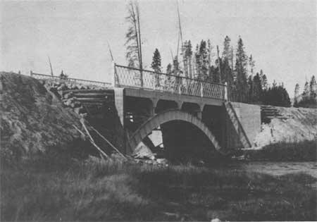
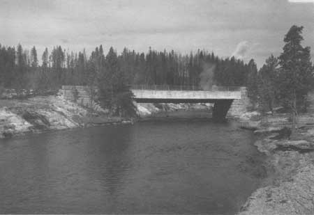
Seven Mile Bridge, 1989 Courtesy Historic American Engineering Record, Jet Lowe, 1989 |
|
|
Obsidian Creek Bridge, 1989 Courtesy Historic American Engineering Record, Jet Lowe, 1989 |
|
|
Detail of Obsidian Creek Bridge, 1989 Courtesy Historic American Engineering Record, Jet Lowe, 1989 |
|
|
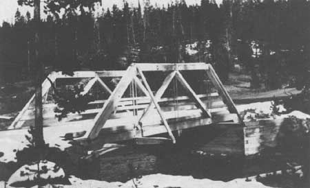
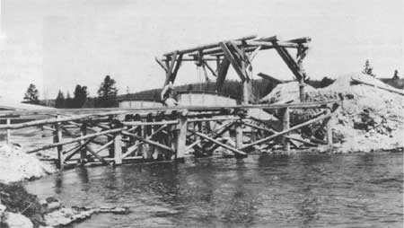
Gibbon River Bridge, near Norris Junction, 1912 Courtesy Yellowstone National Park Archives |
|
|
Gibbon River Bridge, near Norris Junction, 1953 Courtesy Yellowstone National Park Archives |
|
|
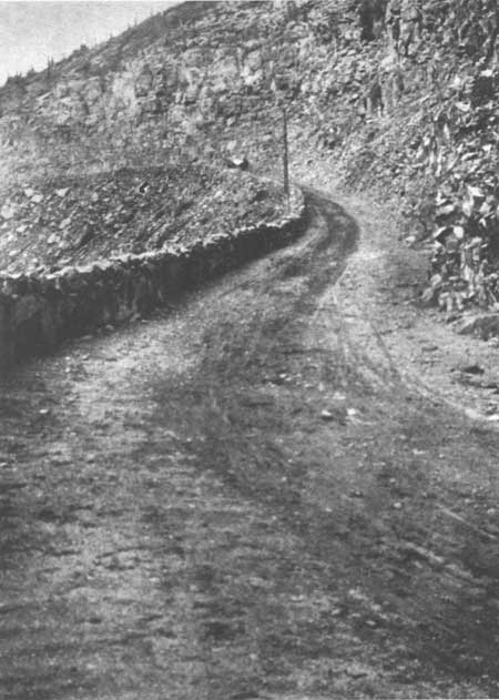
Road near Obsidian Cliff, 1905 Courtesy Yellowstone National Park Archives |
|
|
Road near Norris Soldier Station, ca. 1900 Courtesy Yellowstone National Park Archives |
|
|
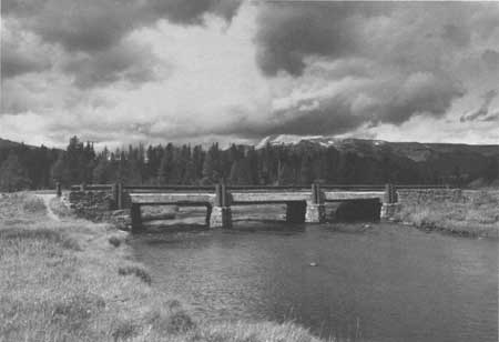
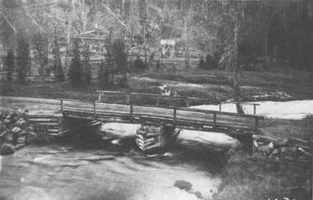
Gibbon River Bridge near Beryl Springs, 1912 Courtesy Yellowstone National Park Archives |
|
|
Gibbon River Bridge, 1912 Courtesy Yellowstone National Park Archives |
|
|
Norris to Madison Junction Road, 1912 Courtesy Yellowstone National Park Archives |
|
|
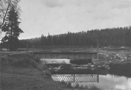
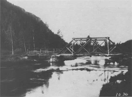
Gibbon River Bridge, near 7 Milepost, Norris Junction to Madison Junction, 1912 Courtesy Yellowstone National Park Archives |
|
|
Gibbon River Bridge, 6 Milepost, Norris Junction to Madison Junction, 1912 Courtesy Yellowstone National Park Archives |
|
|
Gibbon River Bridge below Wylie Camp Lunch Station, 1912 Courtesy Yellowstone National Park Archives |
|
|
Gibbon River Bridge near Madison Junction, 1912 Courtesy Yellowstone National Park Archives |
|
|
Gibbon River Bridge near Madison Junction, 1961 Courtesy Yellowstone National Park Archives |
|
|
Gibbon River Bridge, 1917 Courtesy Yellowstone National Park Archives |
|
|
Gibbon River Bridge near Madison Junction, 1917 Courtesy Yellowstone National Park Archives |
|
|
Gibbon River Bridge, later placed over Firehole River on Fountain Freight Road, 1917 Courtesy Yellowstone National Park Archives |
|
|
Road near Gibbon Falls, 1908 Courtesy Yellowstone National Park Archives |
|
|
Gibbon River Bridge in Gibbon Canyon, 1953 Courtesy Yellowstone National Park Archives |
|
|
Gibbon Canyon Road, 1953 Courtesy Yellowstone National Park Archives |
|
|
Gibbon River Bridge, 1989 Courtesy Historic American Engineering Record, Jet Lowe, 1989 |
|
|
Gibbon River Bridge, 1989 Courtesy Historic American Engineering Record, Jet Lowe, 1989 |
MADISON JUNCTION TO OLD FAITHFUL SECTION
As early as 1873, a road had been completed from Virginia City, Montana to the Lower Geyser Basin, via the Madison Canyon. Gilmer Sawtell, who catered to park visitors at his hotel on Henry's Lake in Idaho, built the west entrance road and named it The Virginia City and National Park Free Road. [47] Four years later, the second superintendent of the Park, Philetus Norris proposed in his first report to the secretary of the interior, the construction of a wagon road connecting the "wonders" of the park which included a route connecting Lake Yellowstone through the geyser basins and exiting on the west side. As a result of the Nez Perce conflicts during the summer of 1877, the construction of a road from the headquarters at Mammoth Hot Springs southward to the Lower Geyser Basin became the highest priority construction project. This completion of the section of road would facilitate the movement of the military from Fort Ellis, Montana to Henry's Lake in Idaho or Virginia City, Montana, and of course, be used by the ever increasing number of visitors to the park. [48]
In 1880, improvements were made to the Firehole River Road including opening a road into the midway geyser area. [49] The following year, two footbridges were constructed over the Firehole in the Upper Geyser Basin. The next major work took place after the U.S. Army Corps of Engineers assumed responsibility for road construction in the park in 1883. At that time, the roads in the park were described as "barely passible and are daily growing worse. Just Sunday a lady was thrown out of the carriage and badly hurt at Fire Hole River. Between the 2 fords on Gibbon River, my wagon was turned over sideways and my wife thrown out. . . . The roads are terribly worn down on one side which makes it difficult to keep in a wagon." [50] Under the direction of Lt. Dan Kingman, a new bridge was built over the West Fork of the Firehole and some stretches of corduroy road were repaired and ruts filled. Finding the Mammoth Hot Springs to the geyser basins the most heavily traveled in the park, he also noted that it had the most serious natural obstacles and thus the "worst" in the park.
Kingman constructed a new road between the Firehole River and Upper Geyser Basin, as the old, poorly located road would be very costly to improve. The "unnecessarily long" and old road crossed a "kind of geyser swamp" in some places and crossed soils of a "black obsidian sand" in others. [51] As the road neared the Upper Geyser Basin, the alignments of the old and new roads were almost the same. The new route, which cost a total of $6,042.53, reduced the three to four hour travel time from the Marshall Hotel at the Forks of the Firehole River the Upper Geyser Basin to one hour. Kingman described it as "well built" and said that the bridges and culverts had "substantial character." He further describes it as "sensibly level, and as the roadbed is mostly composed of gravel that packs well, it is a very pleasant road to drive over." [52]
The first trestle bridge built in the park crossed the Firehole River above Hell's Half Acre. Kingman felt that this bridge was well suited to the unusual conditions of the locality, "enormous quantity of hot water that this river received, it never carried any ice, and as its discharge is remarkably uniform (there is hardly a difference of a foot between high and low water) it bears little or no drift wood." The trestle bridge, costing $400, was covered with 4-inch hewed planks. [53]
In 1889, 3.5 miles of new road had been built along the Firehole River above the Upper Geyser Basin and two bridges, in addition to the trestle bridge had been built—a two span of 36 feet each over Firehole River, no truss and a one span of 38 feet over the Firehole River, no truss. [54] In 1892, Lt. Hiram Chittenden urged the rebuilding of "the worst, most tedious, and least interesting drives in the park," the road from the Gibbon Falls to the Lower Geyser Basin. [55] In 1894, a new road was completed from a point on the old road near Gibbon Canyon south across the flats toward the Firehole and also connecting with the road west down along the Madison River. At the same time, a bridge spanning the Firehole River near Excelsior Geyser was built permitting teams to cross the river at this point and join the main road in the edge of the woods opposite. [56] The next year the new road had been extended to Nez Perce Creek. In 1897 a new bridge was built over the Firehole near the Riverside Geyser and a new footbridge built over Firehole River near Biscuit Basin. [57]
During the first few years of the 20th century, several bridges were built along this section. In 1903, a new steel truss bridge, whose material came from the American Bridge Company, was built over the Firehole River, 1/2 mile above Excelsior Geyser. [58] More bridge construction and reconstruction occurred during 1905 and 1906. During the 1905 construction program, a steel truss bridge over Nez Perce Creek and two wooden bridges were reconstructed, one on the old road from the Lower Geyser Basin to Excelsior Geyser, and the other just above the Upper Geyser Basin. During 1906, the wooden bridges over the Firehole River on the old freight road near the Fountain Hotel and over the Firehole River above the Upper Geyser Basin were reconstructed. "An attractive footbridge of rustic design was constructed over the small stream between the Castle Geyser and Old Faithful Inn." [59]
In 1907, the Army engineer supervised the repair of many of the park's wooden bridges and the replacement of some bridges with culverts. On this road section, a new wooden abutment was built at the bridge over the Firehole River on the Fountain to Upper Geyser Basin road and tile culverts were laid at 7-7/8 miles on the Norris to Fountain section. [60] The following year, new decking was laid on two bridges spanning the Firehole River, one crossing being near the Riverside Geyser and the other on the Upper Geyser Basin to West Thumb at the junction with Spring Creek. One 12-inch corrugated sheet iron culvert was placed at 9-1/2 miles on the Norris to Fountain road. [61]
In 1909, a bridge inspection was done for all of the Park bridges. The bridges on this section of road were described as follows:
Bridge No. 9, across the Firehole River at Riverside Geyser, Upper Geyser Basin. The present bridge consists of a two-truss wooden span on wooden piers and abutments. This bridge is entirely too light for the service required at this point. It is located at one of the most important points in the Park, and in addition to the vehicle traffic, is at times loaded with sightseers viewing the Geysers. It is recommended that, owing the the importance of the bridge, and its location, it should be made an attractive appearing structure, and further recommended that two 32' plate girder spans with curved effect underneath be used resting on concrete piers and abutments, and that the roadway be 20' in width so as to accommodate the sightseers without interference with the vehicle traffic.
Bridge No. 8, across the Firehole River at Hell's Half Acre, near Excelsior Geyser. This bridge was built in 1895, of white pine lumber, and consists of two spans with one pier in the center of the stream and two abutments. It is now in a decaying condition and its factor of safety is so much reduced that it should be removed at once. It is recommended that it can be replaced by two 50' low truss, pin connected steel spans and concrete pier and abutments.
As part of the inspection report on the bridges in the Park, it was recommended that plans be drawn for a reinforced concrete bridge to be constructed over the Firehole River near Riverside Geyser. Capt. Wildurr Willing of the Corps of Engineers felt that since this was one of the most visited areas in the park, it was necessary that the bridge be of an aesthetic design. [62] However, because of costs, a 65 feet steel arch bridge was built was built by the Minneapolis Steel and Machinery Company in 1911. As late as 1923, the 1911 bridge was still in use. [63]
Not many major changes or improvements were made to this road section after the Army left the Park and the newly created National Park Service assumed the road construction program. The new director did suggest the completion of the Firehole Cutoff road. [64] The 4 mile long freight road, which paralleled the main road between the Fountain Soldier Station and the Excelsior Geyser, was closed in 1917 due to its unsafe condition of the wooden truss bridge over the Firehole River about 1 mile from the soldier station. A new 50 feet bridge was built as a replacement and a 40 feet bridge over Nez Perce Creek was reconstructed. [65] And in 1921, a new foot bridge was constructed over the Firehole River near Castle Geyser. [66]
Prior to the next major construction program initiated after the Bureau of Public Roads took over the road work in Yellowstone in 1926, the Firehole River Road south of the Firehole Cascades for 3.5 miles was widened for two way traffic. [67] The work began in May, 1925 in the immediate vicinity of the Firehole Cascades and a camp was set up near the cascades. By the middle of July, 5,160 cubic yards of excavation had been removed by hand and team labor. Of the total, 4,400 cubic yards was of solid rock. The crews installed approximately 150 feet of drainage culvert. The cost of the project was approximately $6,000. In 1926, Director Mather reported that the work along the Firehole River between Madison Junction and the Firehole Cascades was "constructed on the highest standards of any used in the National Park Service" as "the beauty of the canyon justifies the very great attention that is being given to details of wall and fill construction." [68] The 1926 project, which involved widening a 1.5 miles section of the road in very narrow places and new construction for 1.5 miles, had originally been started by the Army engineers, but abandoned in 1916. The project required 1 foreman, 1 cook, 1 flunkey, 1 compressor operator, 2 Jackhammer men, 1 powder man, 1 grade man, 14-horse teamster, 2 2-horse teamsters, 1 axe man, 1 blacksmith, 6 laborers, and 3 teams. The project required the excavation of 360 cubic yards of common material, 820 cubic yards of loose rock, 2,945 cubic yards of solid rock and the installation of 120 linear feet of 12" C.M.P. culvert in place and 24 linear feet of 18" C.M.P. culvert in place. All excavated material was used on the project. "Neither the amount of material nor the nature of the country would permit fills on a naturally stable slope and all embankment was constructed with hand placed fill or rubble wall on slopes of 1/4 to 1/2 to 1." [69]
Work also began on a new bypass road at Fountain Paint pot as the old road was widened and improved to become a short loop road. The necessary fill material was hauled from the cut at the 7 milepost, about 1-1/4 miles distant. About half of the construction in this section was through sandy material which required a binder to create a stable surface. A sharp curve above the Firehole River Bridge at Excelsior Geyser was widened by the excavation of 600 cubic yards of solid rock. The borrow for the material on this project came from a pit near Firehole Lake. The project was finished in July, 1930. A total of 2.16 miles of road had been built and 196 linear feet of 18" CMP culvert had been installed. [70]
7Shortly thereafter, the crews began lessening the curvature and widening the grade on a sharp curve at a point five miles north of Old Faithful. This project required the hand excavation of about 475 cubic yards of material which was then used to widen the grade from 18 to 24 feet, both at the curve and a distance of 200 feet on either end. All of the excavation was through a sand-clay formation, thus no additional surfacing was required. It was finished with an application of oil. [71]
In 1930, the realignment of the Norris Junction to Madison Junction road resulted in two steel bridges across the Gibbon River approximately 9-1/2 miles below Norris Junction being abandoned. It was proposed that both would be removed, however one bridge, which served the old stage road (Mesa Road) to the Firehole Cascades, was still needed as diverted traffic used this route while the new road was being completed. The other Gibbon River Bridge, a steel arch bridge with concrete floor, constructed in 1913 at a cost of $4,010, was dismantled and reassembled over the Firehole River on the Fountain Freight Road. This relocated bridge replaced an unsafe timber bridge. This bridge has since been removed. [72]
In an inter-bureau conference held in San Francisco in 1931, the National Park Service requested a reconnaissance survey be completed for the road between Firehole Cascades and Old Faithful. The average daily traffic during that period was about 600 vehicles per day with about 10% of the total being trucks and busses. The survey found that the first 2.5 miles from Madison Junction to the Firehole Cascades, which had been reconstructed by day labor of the National Park Service and surfaced by the Bureau of Public Roads in 1931, to be in satisfactory condition. Thus most of the survey was for the remainder of the road. The Park requested the feasibility of rerouting the main road via the Firehole Lake, the east end of Biscuit Basin and Black Sand Basin. They also felt that if this was not desirable then they wanted loops built in these areas. The recently built bypass of the Fountain Paint Pot proved to have reduced the interest at this point, thus the Park desired a rerouting producing a closer approach. Within 10 days, the survey crew recommended many slight variations from present alignment, flattening of curves, reducing curvatures and widening the present road. It was estimated that approximately 10 culverts would be needed for every mile. The width of the road from shoulder to shoulder should be 28 feet for the main roads and 22 feet shoulder to shoulder for the proposed loop roads. The four bridges on the project were considered too narrow and too light of construction to carry the average daily traffic load, and therefore should be replaced. [73]
The location survey for this project was completed in 1932 and the Morrison-Knudsen Company, of Boise, Idaho was awarded the grading contract on July 17, 1934, for the low bid of $188,216.10. The contractor began establishing his camp at Goose Lake on July 19, 1932. The camp had frame buildings which facilitated 125 men. Family members were provided for at a camp just across the creek from the main camp. The engineers camp, which consisted of two 16' x 16' portable houses and two tents, was located at Riverside Geyser. Work began immediately and closed for the season on December 26 with 84 percent of the project completed. The 1935 season began in May and with 95% of the project finished by September 9 when the contractor closed down for the year.
By the end of the 1935 construction season, the road had been graded to a minimum width of 28 feet at the recommendation of the National Park Service. The Bureau of Public Roads standard for that time was a 26 feet roadway, shoulder to shoulder. The bridge construction was handled by separate contracts. All cross and side drainage structures were corrugated metal (1,898 linear feet) and Vitrified Clay Pipes (4,254). Since many of the drainages are through areas of unusual chemical composition, vitrified clay pipe was preferred. The 271 cubic yards of rock for the masonry work was obtained at a quarry at a point where the Mesa Road leaves the Grand Loop Road between Gibbon Falls and Madison Junction. Because of the superior condition of the subgrade, it was deemed possible for traffic to move over the road for a season or two until the final surfacing is done. [74]
Concurrently with the road construction project, a bridge contract was awarded to McLaughlin Construction Company of Livingston, Montana, for the construction of the Nez Perce Creek Bridge, the Firehole River Bridge and a foot bridge over the Firehole River at Excelsior Geyser. Work began in 1934 and the bridges were completed on September 6, 1935. Following the completion of the bridges, the Park felt that "great improvements" had been made in the roadways. The use of four to one slopes on low embankments was preferable, however, that combined with not diverting branch streams left:
some undesirably conspicuous culvert headwalls especially on the road recently completed between Madison Junction and Old Faithful. It is believed that a change in design of culvert headwall is desirable and that an improvement in appearance can be readily obtained. One plan would be to move the headwalls closer to the road shoulder, to bevel the projecting corner, and to provide 90 degree wingwalls on the same slope as the embankment. Another method would be to bevel the end of the culvert and protect the bank by hand placed embankment or by masonry laid flush with the surface of the embankment. While the masonry of large bridges adds to the attractiveness of the roadway it seems to be undesirable to make the headwalls of small culverts conspicuous and the more invisible they can be the better the appearance of the road side. [75]
Another landscape issue identified with this section's bridge work was the type of curbing desired. The Park felt:
that a concrete curb is more serviceable than a masonry curb. It is, however, suggested that the appearance of wingwalls would be improved by making the wingwalls all of masonry including a masonry curb rather than introducing a concrete curb as a portion of a masonry wall. A single course of masonry above a concrete curb does not give the appearance of being adequately bound into wall. [76]
Both the newly constructed Nez Perce Creek Bridge and the Firehole River Bridge have the combination of the concrete curb with the masonry walls.
The next major project on this road section was the relocation of approximately 2-1/2 miles of road between a point on the Grand Loop Road immediately north of Madison Junction to a point on the Grand Loop Road near the Firehole Cascades. The old road, which is along the Firehole River through a narrow canyon, was first constructed by the Army engineers, but abandoned in 1910 because of construction costs and the very heavy character of the work. In 1925, National Park Service day labor forces resumed construction on the section and it was eventually surfaced by the Bureau of Public Roads in 1931. The 1938 Preliminary Location Survey proposed the construction of a new bypass road to alleviate the serious bottleneck imposed by the narrow road through the Firehole Canyon. The engineers specified that the new bypass be built on the same standards as the rest of the Grand Loop Road. Upon completion, the old road could be used as a scenic drive. [77] This report resulted in preliminary plans, however, the construction did not occur for several years. In 1949, a 38 miles chip sealing project on the Mammoth Hot Springs to Firehole Canyon road and a grading and base surfacing project in the Firehole Canyon began. [78]
Many improvements, such as widening the roadways and bituminous surfacing, were made on the Madison Junction to Old Faithful section during the 1960s. A number of remanents of old roads were obliterated and the scenic loop roads were resurfaced and improvements made to the shoulders. Rock work was repaired after the 1959 earthquake. [79]
|
|
Along Firehole River, ca. 1900 Courtesy Yellowstone National Park Archives |
|
|
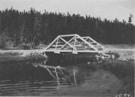
Firehole River Bridge No. 5, North of Old Faithful Courtesy Yellowstone National Park Archives |
|
|
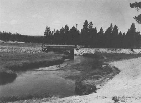
Firehole River Bridge, 1913 Courtesy Yellowstone National Park Archives |
|
|
Firehole River Bridge, 1931 Courtesy Yellowstone National Park Archives |
|
|
Nez Perce Creek Bridge, 1989 Courtesy Historic American Engineering Record, Jet Lowe, 1989 |
|
|
Firehole River Bridge, near Morning Glory Pool, 1989 Courtesy Historic American Engineering Record, Jet Lowe, 1989 |
OLD FAITHFUL TO WEST THUMB
Army Engineering Officer William Craighill became the first person to survey the Old Faithful to West Thumb route. Not knowing the precise route that the road would take, Craighill had the crews working from each end. Before the road was completed, Craighill was replaced by a significant figure in the park's history, Lt. Hiram Chittenden. One of Chittenden's first assignments was to complete Craighill's project, the construction of the road from Old Faithful to West Thumb road. In 1891, Congress required that the route be built by the shortest practicable route. [80]
Thus, Chittenden's recommended route, which closely paralleled today's road, did not skirt Shoshone Lake as Captain Kingman proposed, but instead crossed Isa Lake and crossed the Continental Divide twice. According to a Yellowstone National Park historian, Aubrey Haines, Chittenden discovered that the crew on the Old Faithful end were following the old Norris trail. "That was Mr. Lamartine's idea of locating a road—to follow a trail with all its irregularities and excuses of gradients, regardless of what improvements could be made by something of a survey." Haines wrote that "Chittenden found it necessary to do the locating himself, working alternately at the two ends of the line with a hand level, a five foot staff, and the assistance of two laborers." [81] The road, completed during the summer of 1892, is one-third shorter than Kingman's proposed route via Shoshone Lake. [82]
In 1891 or 1892, a pole bents and stringers trestle bridge was constructed to span a ravine 1-1/2 miles from West Thumb and the Log Cabin Bridge across Herron Creek was built. The Log Cabin Bridge consisted of "two piers built up of logs resembling a log cabin, hence its name. There are also two wooden abutments. The spaces between the piers are spanned by stringers of white pine logs." [83]
The Grand Loop was finally completed in 1905. In 1908, a new, small bridge was built on the flat near DeLacy Creek and repairs were made to the bridges over Herron Creek and DeLacy Creek. [84] In 1909, Engineering Officer Wildurr Willing, made a thorough inspection of the bridges in the Park. He recommended that the trestle bridge, 1-1/2 miles from West Thumb, be replaced with a low truss, pin connected steel span, 60 feet in length, which would rest on concrete abutments. He called for the replacement of the Log Cabin Bridge with a 60 feet steel arch span with steel approaches at either end. Due to the fact that at one end of the bridge the road makes a sudden turn, that end had to be widened "so as to permit the four-horse teams to swing onto the bridge with ease." Another trestle bridge, 60 feet in length and constructed of pole bents and stringers, which spanned a ravine 1 mile west of West Thumb, was scheduled to be replaced by a 4 feet culvert pipe. [85] It was replaced in 1913 by a concrete culvert and earthfilled wooden crib. [86] In 1912 a road assessment was conducted to determine the suitability from an engineering standpoint, of the system for the introduction of automobile traffic in the Park. The Army Corps Officer Captain Knight, concluded that it would be better if the existing system were reconstructed than creating a separate system for motorized vehicles as some had suggested. Not much work was done on the Old Faithful to West Thumb Road but a 25 feet long bridge had been constructed in 1911 (exact location not known). [87] In 1915, three concrete culverts from 4 to 6 feet spans and been built along Spring Creek and the foundation for three more, plus several galvanized culverts had been put in along the road segment. These replaced older wooden ones. [88]
In 1926, a Park report suggested that the wooden bridge just south of Old Faithful be replaced with a concrete structure and that all of the Dry Creek culverts have their capacity increased. The report also called for the installation of metal culverts for that section of the road. [89]
Intensive reconnaissance surveys of this segment were completed by Worth Ross in 1927 and by A. C. Stinson in 1934 at the request of Superintendent Roger Toll. Toll urged for a speedy completion of the survey with expectations of going into construction the following year. Records for 1934 recall that this segment, which was, and is, an integral part of the Grand Loop system, was the "lowest type and poorest main road in the Park." [90]
The Bureau of Public Roads engineers felt that the road was far below the standards of the roads elsewhere in the Park. During 1934, the road was being traveled by approximately 250 cars daily, whereas the approximate daily use for other segments was 500 cars daily. These figures were based on records of previous years indicating 50,000 cars entering the park during the 100-day season. Officials felt that the low usage of this segment was no doubt due to the one-way traffic regulations and the poor condition of the road.
A $10,000 allotment for the 1934 survey was approved; the survey began July 5, 1934. The 15-man crew completed the staked lines survey October 22, 1934. Later, an additional $4,000 was approved for the survey project. The surveying crew found the crooked and narrow one lane road following, "most of the devious windings of the water courses, which it employs in the ascent to and descent from the two crossings of the Continental Divide. The road employs a great many sharp curves and a few sketches of excessive grades . . . ." [91] The road width varied from 12-15 feet to 18-20 feet. The wider width sections were found in the flatter country and also at the beginning of the ascent to Craig Pass which also has some of the rockiest sections of the route. Less rocky country, but very crooked alignment was found in the lower section of Dry Creek, while the upper section of Dry Creek was described as "rolling hilly country of less rugged nature." The descent road from the second Continental Divide crossing to West Thumb ranged from gentle to very steep slopes as one neared Yellowstone Lake. The survey team reported that the earlier work had been designed to incorporate a "fine view" of the Yellowstone Lake at one of the very sharp curves and further down the road, an overlook was built for a view of Duck Lake, a spring-fed lake lying between the bluffs and Yellowstone Lake.
At the conclusion of the survey, the Bureau of Public Roads made seven different proposals, some of which proposed similar alignments, but proposed different methods to overcome specific problem areas. The selected proposed route was a compromise between the National Park Service, who imposed strict guidelines concerning landscape, design, vistas, and the use of the segment for interpretation, and the Bureau of Public Roads whose aim was to find the most suitable ground for a modern highway. The 1934 survey report recommended some new road construction, some incorporation of the earlier road, and the use of a 24 inch culvert as an equalizer between the two lakes (Isa Lake) with the road running on the left side of the first lake and the right side of the second lake. It proposed parking spaces at Shoshone Point for views of Shoshone Lake and the Teton Mountains, at Mt. View where selected clearing would provide fine views of mountain peaks, and Yellowstone Lake. Other vistas considered on this segment were views of Flat Mountain at the south end of Yellowstone Lake, the Trident in the southeastern section of the park, and views of Yellowstone Lake. The report stated, ". . . This is a magnificent and worthwhile view (Yellowstone Lake) and should be preserved." The engineer admitted that another approach to West Thumb was more favorable and less expensive but "does not develop this view, and, although occupying better exposure, results in probably a little less satisfactory alignment." [92]
The proposed route shaved 2.7 miles off the earlier route. The length of the 1934 route was 17 miles, the route crossed the Firehole River and four creeks. The report recommended concrete box culverts for the creeks and remaining drainage cared for by corrugated, metal pipes or in high erosion areas, paved inverts for some of the pipes. The Park afforded one of the major concessioner, W. M. Nichols, president of Yellowstone Park Hotel Company, to comment on the proposed new alignment. He suggested that the old section through the Spring Creek Canyon, which he considered "one of the prettiest short trips on the Loop", might be also retained as a one-way east bound road. He stated that "As for our own buses, it would make a delightful trip, because, as you know, the buses have their tops down most of the time, and people can view scenery even in a narrow canyon like Spring Creek. [93]
Prior to the 1934 survey, the discussion of road width was an important topic and one of disagreement between the Bureau of Public Roads and the National Park Service. In a 1931 letter, the Bureau's district engineer discussed the construction width, shoulder-to-shoulder for all sections of the Grand Loop Road. The National Park Service reacted by telegram and called it "a matter of over-design." After several conversations and the Bureau's reason for the greater width, the 28-feet width was accepted and some projects proceeded using the 28-feet standard. In a February 12, 1934, letter from Superintendent Toll to the director of the National Park Service, Toll questioned whether a recognized agreement on the 28-feet width existed. [94] The previous 24-feet accepted standard for all park was raised to 28-feet for the Grand Loop Road and to 26-feet for the entrance roads.
By 1936 and 10 years after the initial road survey, 200 miles of the park road system had been improved to a drain and grade standard. Approximately 100 miles had been base course surfaced which consisted of crushed rock, spread the full width of the graded section to a compacted thickness carrying from 4 to 9 inches depending on subgrade conditions. Approximately 50 miles had a bituminous treated surface which was 20 feet wide with a 2-1/2 inch minimum compacted thickness with a seal coat and a wearing surface of stone chips. This treatment was the desired ultimate completed surfacing for all of the roads. Approximately 30 miles was under construction for bituminous surfacing; 19 major bridges including the new Golden Gate Viaduct were either completed or near completion. With approximately 60 percent of the project completed the total cost including 1936 work in progress was $7,000,000. However, the Old Faithful to West Thumb segment was not completed. [95]
Refinements of the details and revisions of the 1934 report and recommendations began almost immediately after the publication of the report. In fact, in the published report, the author acknowledges the cooperation of Superintendent Toll, but indicates that they had "less effective" cooperation with the landscape division of the National Park Service. [96] Perhaps this hint of "less effective" cooperation with the landscape division is a sign of the importance of the landscape division's input toward the completion of the park's road system to park standards. One of the requests from Sanford Hill, resident landscape architect, was that "the cleanup of old logs and down timber along the small creeks and particularly along Isa Lake be held to the minimum. We feel that the cleanup along these streams would tend to destroy a natural condition, and also destroy a natural check on erosion." [97]
Very early in the park road development history, the concern for visual quality, interpretive values, and the limited destruction to the landscape is evidenced in U. S. Army Corps of Engineer's Captain Kingman's standards and it was continued through the 1920s, 1930s, and 1940s period. The landscape architects in the branch of plans and design of the National Park Service collaborated with the engineers of the Bureau of Public Roads during the survey, and throughout the planning and design stages of construction. The Park's resident landscape architect monitored the actual construction and supervised the development and construction of landscape features. Among the examples throughout the park of a landscape architects input are the roadside pullouts, trails, and the cut and fill slopes which were rounded and other special design features. "The rounding of tops of cut slopes and the flattening of cut and fill slopes in earth material" had long been standard practice for the National Park Service road design. In the Rocky Mountain West, the state highway departments adopted the same practice. Another landscape problem was the rehabilitation of abandoned roads, a problem which existed on the Old Faithful to West Thumb segment. The problem was addressed by reversing the construction procedures and "placing the materials from fills back into the cuts and attempting to reestablish the original contour and topography of the terrain." [98] In wooded areas, much tree planting was done and in barren areas, the old roads were covered with duff and top-soil to promote vegetative cover and prevent erosion.
Travel on this segment of the Grand Loop had increased to nearly 1,200 cars daily. The new alignment at a point just east of Isa Lake followed the old road, swinging north, crossing Herron Creek, and down to DeLacy Creek crossing on a high fill to Shoshone Point. A parking area was constructed at Shoshone Point to enable the visitors to experience the beautiful view of Shoshone Lake with the Teton Mountains as a backdrop on the horizon. From the parking area, the new road followed the older road until leaving the old alignment and headed to Dry Creek continuing in a southeasterly direction "along the west slopes of Dry Creek and DeLacy Creek basins to the rim of the Continental Divide then the descent into the West Thumb. As the road descends on a combination of tangent and very light curves, the mountains to the east become visible. As the road passes through a triple compound curve to the right, one could see Yellowstone Lake just before reaching West Thumb. This view was intended to take in not just Yellowstone Lake, but the lake's islands and the Absaroka Range. It was during this approximate time that the steel Herron Creek bridge was removed and culvert work was done at DeLacy Creek. Log guardrails were constructed on both segments. At one point on the road the landscape architects had a hand-placed embankment tree well put around a Lodge pole pine tree just on the edge of the road." [99]
The grading project continued from 1935 to 1938, with contractors under the supervision of the Public Roads Administration completing the job. Combined with the final costs on the surfacing which was completed in July, 1941, the total for the 17.083 miles was $359,949.75 or approximately $21,000 per mile. At its completion, the engineers recommended centerline striping over the entire 17 miles plus road with double-line striping for curves. The engineers felt that the maintenance work would be reduced if the gutters were paved and other roadside measures taken. The engineers felt that "No unusual or difficult engineering problems were encountered . . . ." [100]
In 1944 the road project was considered 67% finished with some miscellaneous minor work and the bituminous surfacing yet to be completed. By October 1947 the major construction project was completed. The road, in 1947, was considered the heaviest traveled in the park carrying between 3100 and 3800 vehicles per day during July and August.
By 1945, seeding of the roadsides had been completed, but the planting of trees, as specified in the contract, had not been done. The contract called for an unspecified number of 2-year old pine and fir seedling stock trees and additional number of trees up to 8 feet in height. The National Park Service felt that some natural reseeding of lodgepole pines had already begun and that any transplanted stock would have to come from within the Park. [101]
In 1947, work on completing the surfacing of the road continued. Using material from the following sites, McLaughlin, Incorporated of Great Falls, Montana, began work on June 15, 1947:
Plant mix aggregate — Stockpile at Dry Creek pit 4-1/2 miles east of project.
Cover aggregate — Stockpile at Old Faithful-originally produced from Basalt rock slide 2-1/2 miles east of West Yellowstone
Concrete aggregate — Sand from pit left of Sta. 342
Sec. 1-C2, Gravel from Yellowstone River at Livingston
Topsoil — Pit on old road 5-1/2 miles east of project.
Liquid Asphaltic — Rusky Oil Company refinery, Cody, Wyoming.
C.G.S.M. Pipe — Armco pipe from Hardesty Manufacturing Company, Denver, Colorado
When the project was completed the following materials were stockpiled for use by the maintenance crews
1850 tons plant mix — at Dry Creek pit
165 tons 2" base course — at Dry Creek pit
700 tons 3/4" cover aggregate — at Dry Creek pit
85 tons 3/8" cover aggregate — along road 6 miles east of Old Faithful, and at Old Faithful power house [102]
The new contractor used the same road camp, that was approximately at the midway point of the project, that the previous contractor, Peter Kiewit had used in the early 1940s. Part of this final work was the surfacing and finishing of the parking area on the east side of Isa Lake Bridge. The finished work included a boulder pavement guide marker between the traffic lane and the parking area. The guide marker at the Kepler Cascade parking area, completed at the same time, was a black, 1" chip material.
During the 1950s, 1,000 linear feet of log guardrail was replaced with guide posts. [103] The entire road section was rebuilt in the late 1980s.
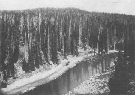
|
|
Road at Isa Lake, 1912 Courtesy Yellowstone National Park Archives |
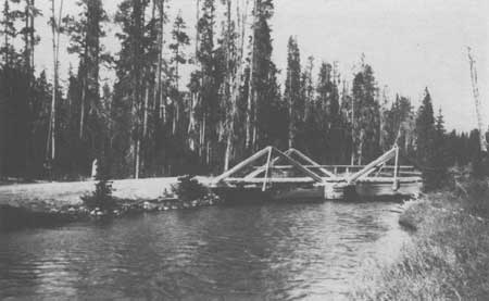
|
|
Firehole River Bridge, Upper Basin to West Thumb Road, 1912 Courtesy Yellowstone National Park Archives |
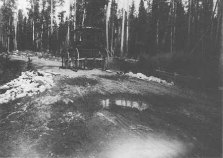
|
|
1 to 2 Milepost on Old Faithful to West Thumb Road, 1912 Courtesy Yellowstone National Park Archives |
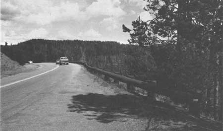
|
|
Old Faithful to West Thumb Road, 1989 Courtesy Yellowstone National Park Archives |
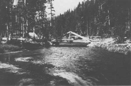
|
|
Firehole River Bridge at Junction of Firehole River and Spring Creek, 1912 Courtesy Yellowstone National Park Archives |
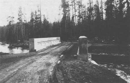
|
|
Firehole River Bridge near Spring Creek Courtesy Yellowstone National Park Archives |
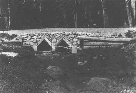
|
|
Culvert on Old Faithful to West Thumb Road, 1913 Courtesy Yellowstone National Park Archives |
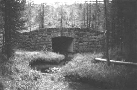
|
|
Culvert on Old Faithful to West Thumb Road, 1989 Courtesy Yellowstone National Park Archives |
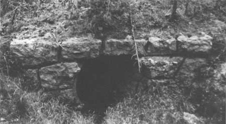
|
|
Culvert on Old Faithful to West Thumb Road, 1989 Courtesy Yellowstone National Park Archives |
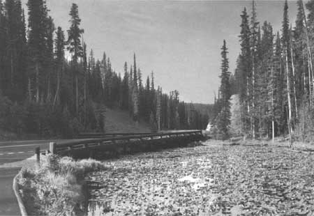
|
|
Isa Lake Bridge, 1989 Courtesy Historic American Engineering Record, Jet Lowe, 1989 |
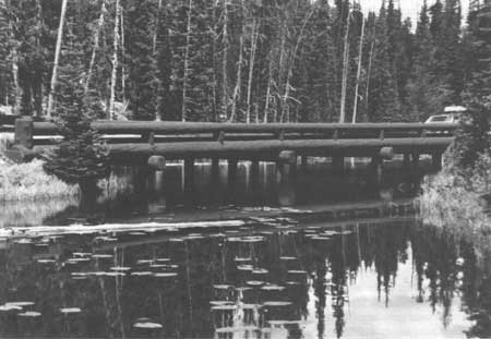
|
|
Isa Lake Bridge, 1989 Courtesy Historic American Engineering Record, Jet Lowe, 1989 |
WEST THUMB TO LAKE JUNCTION
One of the prominent but hidden features of this road section is the geologic feature, the Natural Bridge. Philetus Norris' survey for possible routes in this area, he found the bridge to be his answer for bypassing the sandy spits, ponds, and numerous gullies near Bridge Bay. The bridge showed evidence of its use as a long-time game trail and Norris felt that as soon as funds became available, he would prepare the bridge for tourist use. In his 1880 report to the secretary of the interior, Norris described the area:
What is now the bridge was once the brink of a cataract nearly one hundred feet high, over a ledge of peculiarly hard, durable, variegated trachyte upheaval to the vertical across the stream. Directly across this ledge countless ages of erosion have formed first a shallow, trough-like channel; then, or simultaneously with this channel, a vertical orifice, several feet long by one foot wide, between the strata, some two feet from the brink. There is farther upstream . . . one of the finest archways I have ever seen, has about ten feet of stone support for a carriage way above, and about thirty feet of waterway beneath. The chasm is fully spanned by the bridge, which, by measurement, I found to be twenty-nine feet long, and including the above mentioned vertical orifice, ten feet high above the top of the arch, and forty-one feet to the bedrock of the chasm, which, at this point is a rapidly deepening cascade. As the two outside layers of the vertical orifice, as well as the ancient channel, can readily be filled or floored with timbers. . . . This route will be on of the most traveled, and this natural bridge one day be crossed by thousands of pilgrims to this wonderland. [104]
Historical records indicate that the road across the Natural Bridge was not built by Norris and the travelers continued to use the Mary Mountain route to Yellowstone Lake until 1891 when a road followed the shore for much of the way from West Thumb to the lake outlet. In 1895, Captain Anderson completed a road from the Lake Hotel to the Natural Bridge. [105] In 1899, Hiram Chittenden began to plan the construction of 8 miles of road across the peninsula to replace the 12 miles of road built in 1891. The 1891 road that followed the shore had been severely eroded by the lake and had been abandoned and the portion that passed through the wooded section had been constructed over uneven and rough ground. Chittenden believed that this road was "the most monotonous drive in the park" [106] and that the road he planned would reduce the distance by four miles, it would be a better road and that the road would offer the visitors a view of the Natural Bridge. Chittenden estimated that the new road would cost approximately $2,000 per mile or a total of $16,000. In 1902, the new road was "put over the mountain by way of the natural bridge and the knotted woods" and the old section along the shore was abandoned. [107] In 1908, the road was surfaced and ditched and the 1909 report listed the road as in "very good condition." [108]
In 1923, the route from Lake Junction to West Thumb was evaluated again. The National Park Service's engineering division found the:
existing road between Arnica Creek and Bridge Bay passes over high divide, necessitating a hard climb on one side and an equally difficult descent on the other. This 9 miles section is entirely void of scenic attractions and is a difficult piece of road to maintain because of steep grades and the absence of water for sprinkling. It is proposed to reconstruct the old original road along the shore of the lake, making an attractive drive on practically a water grade, and abandon the present road over the hill. . . . This crew (Cosey's Crew) is now moving to West Thumb to rebuild the log bulkhead along the lake shore. They should also place culverts and make fills in places of the three log bridges between West Thumb and Arnica Creek. [109]
Two years later, this section of road was included as part of the first 3-year improvement program with the intentions for this portion to be completed in 1925. In a letter to the director, Albright described the project:
I have discussed this project very thoroughly with our engineers and we have reached the conclusion that we can do this work cheaper by force account. If this was a case of constructing an entirely new road, there would be no question but what is ought to be done by contract. However, it is purely a matter of reconstruction. The old original road between Thumb and Lake Hotel followed the Lake shore quite closely as you note from old maps. In 1901 this road was abandoned when the cut-off road was built across the mountains. This cut-off road was apparently built to shorten the distance, but in order to make the change it was necessary to construct a highway with grades running up to 16 percent. The road possesses no scenic qualities whatever, has many sharp turns and narrow places where cars cannot pass and as I have just stated a maximum grade 16 percent. When the old road was abandoned in 1901, it was usable for several years, apparently was used; however, gradually the culverts and bridges which were of wood decayed and for the past 20 years the road has been impassable except to saddle horses and pedestrians. I have been over the road several times and there are many miles that are in excellent condition today; all these stretches of road will require widening and installation of drainage structures which, under our plans, will be galvanized iron culverts of proper sizes. We expect to do away with the two or three bridges by putting in culverts and making fills. In three places the road will be realigned in order to give better scenic effects of Lake Yellowstone, but these stretches are short. [110]
By 1926, the reconstruction of the 11 miles stretch along Yellowstone Lake between Bridge Bay and West Thumb replaced the steep, narrow, and uninteresting section that went over the hill. A 3/4 mile section at Bluff Point had been widened. [111] Major landscape improvements were made to this section as part of the parkwide road cleanup project funded by John D. Rockefeller, Jr. [112]
The road which had been brought to the standard of the other main park roads, with the exception of side drainages, was oiled in 1928, and a new 2 inch oil top placed upon it during 1931. The 1931 oiling expedited the necessity for improvements to the side drainages to lower the water table under the road to avert corrugation from capillary action. [113]
In 1935 a field survey was completed for this road section, however no more major work was done until the Mission 66 period other than replacing 1,500 linear feet of guardrail with guideposts. [114] The Final Construction Report for work on this section during 1960-61 listed the project as:
The major improvement on this project begins at the Natural Bridge Road, approximately four miles south of Lake Junction, at Station 888, elevation 7753, and extends northerly 3414.82 feet to Station 922, elevation 7759. At Station 894+50, the road crosses the inlet to the Bridge Bay Lagoon on a 237 feet 8 inches three-span steel welded plate girder structure. All of the main improvement are on new alignment except for the last 200' to 300' on the north and where a tie is made to the existing Grand Loop Road. Immediately to the south, the project abuts the Bridge Bay-Arnica Creek project, which is now under construction. To the north of the project is a section extending to Lake Junction, approximately 3 miles long, which is still unimproved to Mission 66 standards. [115]
Other work completed on the project was the construction of spur roads, one extending 2,000 feet to the west end of the Bridge Bay Lagoon and another extending 400 feet to a future lake front parking area for fishermen's use. By the end of 1963, Long Construction Company of Billings, Montana, had completed the work totaling $861,986.23. This section of road had received clearing, grading, an emulsified stabilized base course, a wearing surface of plant mix base course, bituminous and concrete curbs for traffic and water control, and a box culvert on Bridge Creek. The old Gull Point by-pass section was converted to a fishermen access and the construction of the Lake by-pass was begun in late 1969. [116]
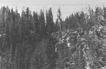
|
|
View of Natural Bridge, 1989 Courtesy Yellowstone National Park Archives |
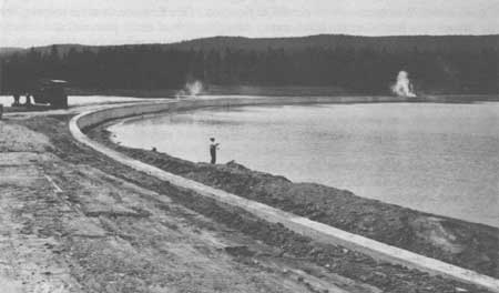
|
|
Bridge Bay Courtesy Yellowstone National Park Archives |
LAKE JUNCTION TO TOWER JUNCTION
The first superintendent of Yellowstone National Park, Nathanial P. Langford, planned the present circuit system (the Grand Loop Road) soon after taking his position in 1872. His idea for a route through this section of the park called for the wagon-road to follow the Yellowstone River northward from its outlet to the Yellowstone Falls, past Mount Washburn and on to Tower Falls. Then Capt. William Jones' 1873 survey for a wagon-road route from Camp Brown in northwestern Wyoming to Fort Ellis, Montana, recommended that the route follow the Upper Yellowstone River, via Yellowstone Lake, to Tower Junction and on to Gardiner, Montana through Mammoth Hot Springs. [117] The Park received no appropriation until 1878, and by that time, the second superintendent, Philetus Norris had to use the first appropriation for the construction of the road south from Mammoth Hot Springs. However, Superintendent Norris, who spent part of 1878 exploring this section of the Park, described the difficulties of finding a suitable route:
From the falls of Tower Creek I explored its canon and the canon and valley of Antelope Creek above it, the timbered plateau between them, and also that between the latter and the Grand Canyon. I found the latter very elevated, but open, smooth, and grassy, with a fine lake upon its summit, mainly an excellent route, with magnificent scenery along the yawning, sulphur scented and stained canon, for some 6 or 8 miles, and past the ruins of an ancient once loopholed, earth-roofed block-house some 16 by 20 feet in diameter and of unknown origin, to a dense forest at the foot of a bald rocky spur of Mount Washburn. . . . a careful exploration of the first one from its towering front in nearly a foot of newly fallen snow, through a belt of dense pine, fir, and cedars to near the main mountain, resulted in there finding a pass excellent for a bridle-path, and practicable for a wagon-road, at a much lower altitude than the old route. . . . I there, in the gathering twilight, thankfully enjoyed the greeting shout and blazing camp-fire of my men, just safely arrived with the welcome intelligence that they had found a route in all respects preferable to that over the mountain to Cascade Creek. . . . As before stated, portions of any possible route upon either side of the Grand Canyon between the forks and the falls of the Yellowstone will be elevated and expensive especially for a wagon road. That upon the eastern side of the canon is utterly impracticable that within it, unknown but doubtless mainly so, while the two remaining that I explored is the shortest, least elevated, and the easiest of construction, in fact, in all respects so preferable that I have no question of its adoption for all purposes other than a lofty, bridle-path lookout, for which purpose a portion of the old route, a branch from the new one over Mount Washburn or both will be ever desirable. Not only was the route thus found less rugged and difficult than feared, but also the Grand Canyon was shorter and especially its lower portion less deep and yawning than has been considered. Still it is especially from its yellow and crimson geysers to the falls, beautiful and grand beyond conception, a leading wonder of the park, and of the world, every way worthy of a route along or as near as possible to its misty and sulphur-tinted walls. [118]
The next year, 1879, Norris and his crew improved an existing trail from the outlet at Yellowstone Lake to the east canyon of the Gardner River, via the Mud Volcano, Sulphur Mountain, Great Falls and Canyon of the Yellowstone, Mount Washburn, Tower Falls, and the Forks of the Yellowstone. The abundance of snow prevented Norris from completing a trail along the rim of the Grand Canyon of the Yellowstone, which he continued to feel was the "true one" for a wagon-road or bridle-trail to the eastern spurs of Mount Washburn, instead of over it. [119]
In 1880, several bridges were completed in the Park, including ones over Tower Creek, Cascade Creek, and other creeks near the Great Falls of the Yellowstone. [120] The following year, two bridges were built on Alum Creek, two bridges over Sage Creek and two bridges over Hot Spring Creek. [121] These bridge projects were part of Norris' overall project of completing the Mammoth Hot Springs to the West Entrance route via Tower Falls, Yellowstone Lake, the geyser basins, and the forks of the Firehole River. Norris knew that the road between Tower Falls and the mouth of Alum Creek would be costly to build. Together with the abysmal Tower Creek Canyon, the ascent of Mount Washburn via Rowland's Pass, the extensive need of rock work, culverts, and timber cutting, grading, and bridging along the route, Norris calculated that an appropriation of at least an additional $10,000 to supplement the regular appropriation might cover the cost of the road. The use of this amount would not allow for any other construction projects elsewhere in the park. [122]
Finding the construction of the section along the bank of the Yellowstone River as costly as Norris predicted, his successor, P. H. Conger, completed a three mile section of road along the bank of the Yellowstone River near the falls and canyon. This provided the tourists with safer and more comfortable access to the wonders. [123]
Compared to the road work between Mammoth Hot Springs and Madison Junction, very little work was done on this section after the U. S. Army Corps of Engineers assumed the responsibility for road construction and improvement in 1883. By 1885, $25,000 had been spent on the construction of a road from the Yellowstone Falls via the east trail over Mount Washburn to Yancey's on the Mammoth Hot Springs Road. In 1887, the road from the Yellowstone Falls to Yellowstone Lake was described as "not ordinarily in condition for travel before about the middle of July, the altitude being such as to prevent the early melting of the snow." [124]
During 1888, the engineers recommended that the 14 miles of rough road from Yellowstone Lake along the Yellowstone River to the Grand Canyon of the Yellowstone be improved and completed and a new 20 mile road from the Grand Canyon to Yancey's be built. In the 1889 report to the secretary of war, Major Allen noted the bridges in the park. Among those listed were a 115 feet trestle, with a 14-feet-wide roadway and 30 feet above the low water at the middle point near Yellowstone Falls and a 40 feet, one span, King and Queen post-truss bridge with a trestle approach of 30 feet over Cascade Creek. The height above the low water was 20 feet. [125]
The road from the Grand Canyon of the Yellowstone to West Thumb via Yellowstone Lake was one of Lt. Hiram Chittenden's first projects after he assumed the responsibility of the road improvement and construction in the Park in 1891. By 1892, the 52-mile road from the Grand Canyon to the Upper Geyser Basin via Yellowstone Lake, which opened during the fall of 1891, was in good condition. [126] In 1893, work continued on the road that passed near the Upper Falls and a road near the Grand Canyon at Inspiration Point was opened. [127] The next year the crews completed an arch bridge near the Upper Falls and the following year, 1895, a new road was built from the brink of the Grand Canyon to Inspiration Point, via a point over the Lower Falls, and a new road from just south of Alum Creek around Sulphur Mountain, joining the old road near Antelope Creek. [128]
In 1896, Capt. George Anderson, the Park superintendent, engaged the chief engineer of the Northern Pacific Railway, to develop plans for an iron bridge across the Yellowstone River above the Upper Falls. Determined that the visitors should be able to view the Grand Canyon from the eastern bank, Anderson decided that if the cost were not excessive, he would have an attractive iron bridge built. [129]
Hiram Chittenden returned to Yellowstone in 1899 to resume the responsibility for the road construction projects. In his 1899 report, Chittenden described the road along Yellowstone River:
This length of 15 miles is one of the best-graded roads in the park, carefully laid out by instrumental survey and equal in this respect to any road in the world; but the material of which it is made is for the most part utterly worthless. The road becomes practically impassable in wet weather and well nigh intolerable from dust in dry weather. It must be surfaced with rock or gravel. The work is urgently needed and should be done during the next season. . . . This road [new road on right of Grand Canyon] is to connect with the bridge and give access to the right bank of Grand Canyon for about 3 miles below bridge. The present road is one of the hardest to maintain in the park. It has steep grades, is very narrow and is held up by loose retaining walls which are constantly caving in. The material is also very bad and cuts all to pieces in wet weather. It is proposed to bridge Cascade Creek farther upstream and carry the road to the hotel at a higher level. This work will greatly relieve the task of maintenance in this vicinity. [130]
During the summer of 1903, two crews constructed approximately 5 miles of well-graded road, a portion of the road was near the Canyon Hotel and the other, near Tower Falls. The work near Tower Falls, which extended into the winter, was of "a very heavy character" as part of the road lies under an overhanging cliff. Chittenden described this segment as a "road of great scenic beauty." [131]
The construction season began late due to remaining snow and soaked ground, leaving few places for desirable camps. However, by the end of the 1904 season, a passable wagon-road on the canyon side was opened to within a mile beyond Dunraven Pass and 2-1/2 miles from the summit of Mount Washburn, but Chittenden urgently requested that more money be programmed for the final completion of the road. He stated in his report for 1904 that "This will be by far the finest road for scenery in the park", but "as it rests on the precipitous sides of the mountain it is important to expend considerably more money to increase its width and erect guard walls at dangerous places." Captain Chittenden feared that the stage companies would not use the single width road until it was completed. Chittenden found this particular project to be very difficult mainly due to the lack of desirable camping places, the high altitude, and the great proportion of work through rock.
One of Chittenden's major achievements, the Yellowstone River Bridge, later known as the Chittenden Bridge, was a steel and concrete bridge completed in 1903 with great difficulty. Chittenden felt that it's prominent location in the park merited the bridge be of an artistic design. For many years the idea of a bridge in this location had been contemplated, but lack of funds prevented its construction. Chittenden spent considerable time on the site selection. Not wanting to introduce an artificial structure at the most desirable and obvious site, the brink of the Upper Falls where the gap narrows to 50 feet, Chittenden chose a 120-feet span between two jutting rocks, about 1/2 mile above the Upper Falls at the rapids. Despite the volcanic rhyolite rock being of inferior quality for construction, Chittenden reported ". . . the fact that it has resisted for an indefinite geological period the action of the river, it must have considerable stability." [132]
Including dangerous rapids below, Chittenden had many obstacles to overcome. One of the most serious was the construction of the framework and related framing. All of the rough material was cut locally, but the finer lumber came from the Pacific Northwest. Using a small dynamo, which was borrowed from the hotel company, connected to the rock-crusher engine and a temporary plant to provide artificial light, the crews were able to complete the concrete work by working around the clock. Due to the position the bridge had in the public's eye and its unique construction difficulties, the owners of the Melan arch patent relinquished all royalty payments. Some of the material for this bridge as well as material for the others built that year came from the American Bridge Company. [133] After considerable controversy, the bridge was removed in 1962.
Before transferring to Mount Rainier National Park at the end of 1905, Major Chittenden summarized the state of the road system in the Park, and made sound recommendations for future work. For this section of the Grand Loop, Major Chittenden recommended:
Lake Junction to Canyon Junction—Concrete culverts should replace the bridge over Sulphur Creek and the one over a stream to the south of Otter Creek. Eighteen-inch pipe culverts should replace two short bridges on the sidehill grade above the second milepost from the Grand Canyon. The Alum and Otter creek bridges should be rebuilt with shorter spans.
Canyon Junction to Tower Junction—earthen embankments and pipe culverts should replace most of the temporary bridges on this route. In some cases, wooden cribs should support the lower side of the embankments. Chittenden believed that these timber cribs when filled with rocks would last for twenty or thirty years. The Major suggested a possible change to the road location from about 1-1/4 miles south of Dunraven Pass to the top of the ridge, where the climb from the hotel at Canyon ends. The original intent was to build on a near level line, however, the surveyor who was told to run a constant grade between the two points, became leery after seeing that a swampy area lay in his path. Without permission he ran the line above the swamp resulting in a rise and fall of 70 feet on the line. Chittenden did not feel that the difference was that great but wrote, '. . . nevertheless, the location is not what was intended and not what it ought to be'. [134]
Other recommendations for this section called for:
The little hill about 5-1/2 miles below the Lake Hotel and another hill a little farther down, where a branch of the Yellowstone flows around an island very close to the road and forms a fine trout pool should each be cut down about 10 feet. The considerable hill in road below the sixth milepost should be cut down to the level for the bench on which the road lies on either side of the hill. A strong timber crib should be built in the water's edge to support the road. . . . The side road from the steel-concrete bridge to Artist Point should be given extra width at the lower end, in order that coaches after unloading at the Point may return far enough to be out of each other's way while waiting for the passengers. All of the down timber in the narrow and picturesque valley near the Point gathered up and burned. [135]
In 1907, a survey for a new lower level road to connect Canyon and Tower Falls was undertaken since the existing road was not passable until the middle of July. The crews replaced railings on the bridge at Canyon Junction, replaced the bridge over Sulphur Creek with a iron culvert 3 feet in diameter and covered with fill 100 feet long and 14 feet deep, replaced the another bridge, 20 feet long, 2-1/2 miles south of Canyon with a culvert and necessary fill, and installed three culverts on the Canyon to Inspiration Point road. [136]
In 1912, the 60 feet Alum Creek bridge, with a sunken center pier was in very bad condition. A pile trestle bridge was suggested as its replacement. A pile trestle bridge consisting of pile bents and wooden stringers was recommended as a replacement for the 32 feet Otter Creek Bridge which was also in very poor condition. In 1913, a rock filled log crib was constructed at the canyon near the Upper Falls to replaced a retaining wall which had collapsed during the spring of 1912. [137]
Prior to the road improvements and construction program being turned over the newly created National Park Service, Capt. John Schultz summarized the condition of the Park's road in 1917. The Tower Falls to Lake Junction segment were described:
Lake to Canyon road should be routed via Sulphur Mountain from Trout Creek. Sulphur Mountain is very interesting and should be shown to the passengers. This road is not more than a mile or so longer than the present road. There is an old road going this way which is in very good condition and could be traveled if one or two culverts are replaced. This takes one farther into Hayden Valley, where elk are very often seen.
Bridge across Alum Creek a foot below the road bed and about four inches above the water level.
Road along the Yellowstone at the rapids and upper falls very narrow and dangerous. Heavy guard rail should be placed along there.
Approach to the concrete bridge from the opposite side of Yellowstone River in very bad condition.
Going from Canyon toward Dunraven Pass along the hillside half a mile before reaching the entrance of Dunraven Pass, the road should be graded to slope toward the bank and logs should be imbedded along the outer edge of the entire road from this point for about a mile.
Road over top of Mt. Washburn should be cleared of rocks small and large. It is very difficult for a large car to go up there at the present time and extremely hard on tires, as the road is practically covered for miles at a time with sharp stones which have blown onto it.
The last three miles before reaching Tower Falls the road is very rough and narrow and worn. Two or three severe chuck holes. [138]
The next major project for this road was a widening project over Dunraven Pass and at the Grand Canyon of the Yellowstone and the construction of stone parapets between the Upper Falls and the Canyon Bridge in 1921. [139]

|
|
Alum Creek Bridge, 1907 Courtesy Yellowstone National Park Archives |
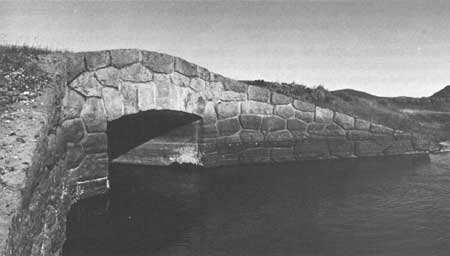
|
|
Antler Creek, 1989 Courtesy Yellowstone National Park Archives |
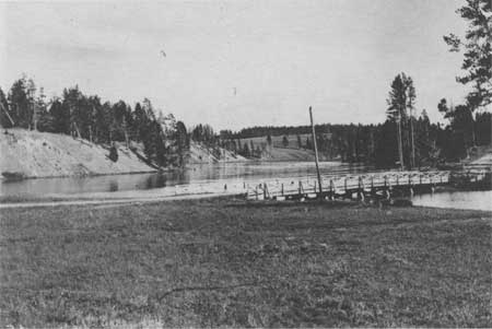
|
|
Yellowstone River Bridge near Otter Creek, 1900 Courtesy Yellowstone National Park Archives |
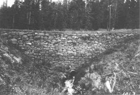
|
|
Retaining Wall near 2 Milepost, Lake to Canyon Road, 1912 Courtesy Yellowstone National Park Archives |
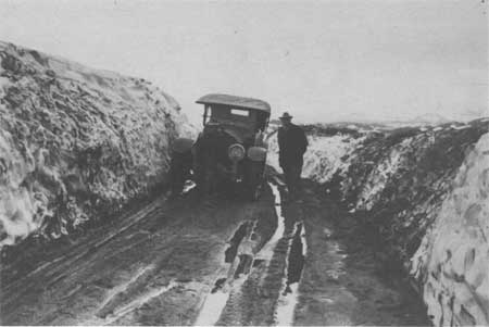
|
|
Snow Drift near Trout Creek in Hayden Valley, Superintendent Horace
Albright and Park Engineer A. W. Burney, 1923 Courtesy Yellowstone National Park Archives |
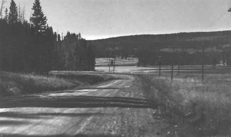
|
|
Telephone Lines along Lake to Canyon Road, 1925 Courtesy Yellowstone National Park Archives |
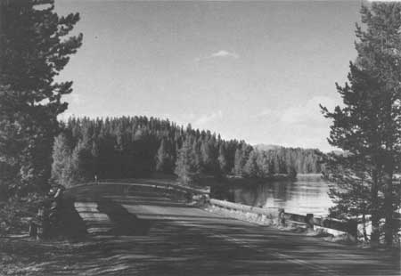
|
|
Otter Creek Bridge, 1989 Courtesy Historic American Engineering Record, Jet Lowe, 1989 |
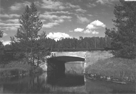
|
|
Otter Creek Bridge, 1989 Courtesy Historic American Engineering Record, Jet Lowe, 1989 |
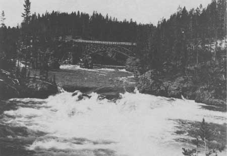
|
|
Wooden Arch Bridge near Canyon Courtesy Yellowstone National Park Archives |
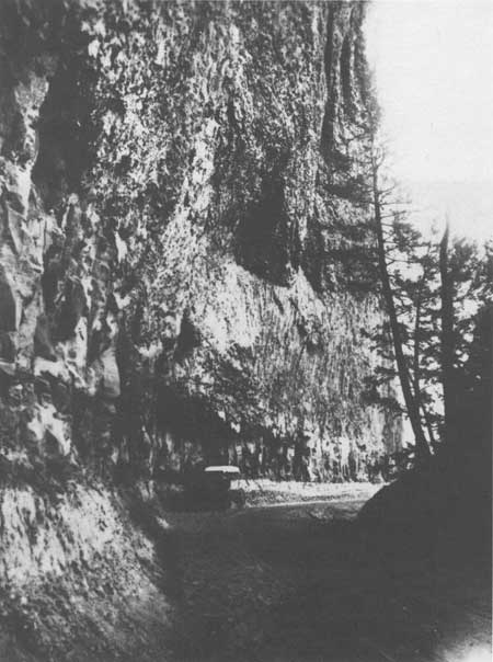
|
|
Road at Overhanging Cliff near Tower Junction, 1913 Courtesy Yellowstone National Park Archives |
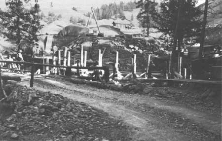
|
|
Tower Falls Log Bridge, 1932 Courtesy Yellowstone National Park Archives |
WEST THUMB TO LAKE JUNCTION
One of the prominent but hidden features of this road section is the geologic feature, the Natural Bridge. Philetus Norris' survey for possible routes in this area, he found the bridge to be his answer for bypassing the sandy spits, ponds, and numerous gullies near Bridge Bay. The bridge showed evidence of its use as a long-time game trail and Norris felt that as soon as funds became available, he would prepare the bridge for tourist use. In his 1880 report to the secretary of the interior, Norris described the area:
What is now the bridge was once the brink of a cataract nearly one hundred feet high, over a ledge of peculiarly hard, durable, variegated trachyte upheaval to the vertical across the stream. Directly across this ledge countless ages of erosion have formed first a shallow, trough-like channel; then, or simultaneously with this channel, a vertical orifice, several feet long by one foot wide, between the strata, some two feet from the brink. There is farther upstream . . . one of the finest archways I have ever seen, has about ten feet of stone support for a carriage way above, and about thirty feet of waterway beneath. The chasm is fully spanned by the bridge, which, by measurement, I found to be twenty-nine feet long, and including the above mentioned vertical orifice, ten feet high above the top of the arch, and forty-one feet to the bedrock of the chasm, which, at this point is a rapidly deepening cascade. As the two outside layers of the vertical orifice, as well as the ancient channel, can readily be filled or floored with timbers. . . . This route will be on of the most traveled, and this natural bridge one day be crossed by thousands of pilgrims to this wonderland. [104]
Historical records indicate that the road across the Natural Bridge was not built by Norris and the travelers continued to use the Mary Mountain route to Yellowstone Lake until 1891 when a road followed the shore for much of the way from West Thumb to the lake outlet. In 1895, Captain Anderson completed a road from the Lake Hotel to the Natural Bridge. [105] In 1899, Hiram Chittenden began to plan the construction of 8 miles of road across the peninsula to replace the 12 miles of road built in 1891. The 1891 road that followed the shore had been severely eroded by the lake and had been abandoned and the portion that passed through the wooded section had been constructed over uneven and rough ground. Chittenden believed that this road was "the most monotonous drive in the park" [106] and that the road he planned would reduce the distance by four miles, it would be a better road and that the road would offer the visitors a view of the Natural Bridge. Chittenden estimated that the new road would cost approximately $2,000 per mile or a total of $16,000. In 1902, the new road was "put over the mountain by way of the natural bridge and the knotted woods" and the old section along the shore was abandoned. [107] In 1908, the road was surfaced and ditched and the 1909 report listed the road as in "very good condition." [108]
In 1923, the route from Lake Junction to West Thumb was evaluated again. The National Park Service's engineering division found the:
existing road between Arnica Creek and Bridge Bay passes over high divide, necessitating a hard climb on one side and an equally difficult descent on the other. This 9 miles section is entirely void of scenic attractions and is a difficult piece of road to maintain because of steep grades and the absence of water for sprinkling. It is proposed to reconstruct the old original road along the shore of the lake, making an attractive drive on practically a water grade, and abandon the present road over the hill. . . . This crew (Cosey's Crew) is now moving to West Thumb to rebuild the log bulkhead along the lake shore. They should also place culverts and make fills in places of the three log bridges between West Thumb and Arnica Creek. [109]
Two years later, this section of road was included as part of the first 3-year improvement program with the intentions for this portion to be completed in 1925. In a letter to the director, Albright described the project:
I have discussed this project very thoroughly with our engineers and we have reached the conclusion that we can do this work cheaper by force account. If this was a case of constructing an entirely new road, there would be no question but what is ought to be done by contract. However, it is purely a matter of reconstruction. The old original road between Thumb and Lake Hotel followed the Lake shore quite closely as you note from old maps. In 1901 this road was abandoned when the cut-off road was built across the mountains. This cut-off road was apparently built to shorten the distance, but in order to make the change it was necessary to construct a highway with grades running up to 16 percent. The road possesses no scenic qualities whatever, has many sharp turns and narrow places where cars cannot pass and as I have just stated a maximum grade 16 percent. When the old road was abandoned in 1901, it was usable for several years, apparently was used; however, gradually the culverts and bridges which were of wood decayed and for the past 20 years the road has been impassable except to saddle horses and pedestrians. I have been over the road several times and there are many miles that are in excellent condition today; all these stretches of road will require widening and installation of drainage structures which, under our plans, will be galvanized iron culverts of proper sizes. We expect to do away with the two or three bridges by putting in culverts and making fills. In three places the road will be realigned in order to give better scenic effects of Lake Yellowstone, but these stretches are short. [110]
By 1926, the reconstruction of the 11 miles stretch along Yellowstone Lake between Bridge Bay and West Thumb replaced the steep, narrow, and uninteresting section that went over the hill. A 3/4 mile section at Bluff Point had been widened. [111] Major landscape improvements were made to this section as part of the parkwide road cleanup project funded by John D. Rockefeller, Jr. [112]
The road which had been brought to the standard of the other main park roads, with the exception of side drainages, was oiled in 1928, and a new 2 inch oil top placed upon it during 1931. The 1931 oiling expedited the necessity for improvements to the side drainages to lower the water table under the road to avert corrugation from capillary action. [113]
In 1935 a field survey was completed for this road section, however no more major work was done until the Mission 66 period other than replacing 1,500 linear feet of guardrail with guideposts. [114] The Final Construction Report for work on this section during 1960-61 listed the project as:
The major improvement on this project begins at the Natural Bridge Road, approximately four miles south of Lake Junction, at Station 888, elevation 7753, and extends northerly 3414.82 feet to Station 922, elevation 7759. At Station 894+50, the road crosses the inlet to the Bridge Bay Lagoon on a 237 feet 8 inches three-span steel welded plate girder structure. All of the main improvement are on new alignment except for the last 200' to 300' on the north and where a tie is made to the existing Grand Loop Road. Immediately to the south, the project abuts the Bridge Bay-Arnica Creek project, which is now under construction. To the north of the project is a section extending to Lake Junction, approximately 3 miles long, which is still unimproved to Mission 66 standards. [115]
Other work completed on the project was the construction of spur roads, one extending 2,000 feet to the west end of the Bridge Bay Lagoon and another extending 400 feet to a future lake front parking area for fishermen's use. By the end of 1963, Long Construction Company of Billings, Montana, had completed the work totaling $861,986.23. This section of road had received clearing, grading, an emulsified stabilized base course, a wearing surface of plant mix base course, bituminous and concrete curbs for traffic and water control, and a box culvert on Bridge Creek. The old Gull Point by-pass section was converted to a fishermen access and the construction of the Lake by-pass was begun in late 1969. [116]
|
|
|
View of Natural Bridge, 1989 Courtesy Yellowstone National Park Archives |
|
|
|
Bridge Bay Courtesy Yellowstone National Park Archives |
LAKE JUNCTION TO TOWER JUNCTION
The first superintendent of Yellowstone National Park, Nathanial P. Langford, planned the present circuit system (the Grand Loop Road) soon after taking his position in 1872. His idea for a route through this section of the park called for the wagon-road to follow the Yellowstone River northward from its outlet to the Yellowstone Falls, past Mount Washburn and on to Tower Falls. Then Capt. William Jones' 1873 survey for a wagon-road route from Camp Brown in northwestern Wyoming to Fort Ellis, Montana, recommended that the route follow the Upper Yellowstone River, via Yellowstone Lake, to Tower Junction and on to Gardiner, Montana through Mammoth Hot Springs. [117] The Park received no appropriation until 1878, and by that time, the second superintendent, Philetus Norris had to use the first appropriation for the construction of the road south from Mammoth Hot Springs. However, Superintendent Norris, who spent part of 1878 exploring this section of the Park, described the difficulties of finding a suitable route:
From the falls of Tower Creek I explored its canon and the canon and valley of Antelope Creek above it, the timbered plateau between them, and also that between the latter and the Grand Canyon. I found the latter very elevated, but open, smooth, and grassy, with a fine lake upon its summit, mainly an excellent route, with magnificent scenery along the yawning, sulphur scented and stained canon, for some 6 or 8 miles, and past the ruins of an ancient once loopholed, earth-roofed block-house some 16 by 20 feet in diameter and of unknown origin, to a dense forest at the foot of a bald rocky spur of Mount Washburn. . . . a careful exploration of the first one from its towering front in nearly a foot of newly fallen snow, through a belt of dense pine, fir, and cedars to near the main mountain, resulted in there finding a pass excellent for a bridle-path, and practicable for a wagon-road, at a much lower altitude than the old route. . . . I there, in the gathering twilight, thankfully enjoyed the greeting shout and blazing camp-fire of my men, just safely arrived with the welcome intelligence that they had found a route in all respects preferable to that over the mountain to Cascade Creek. . . . As before stated, portions of any possible route upon either side of the Grand Canyon between the forks and the falls of the Yellowstone will be elevated and expensive especially for a wagon road. That upon the eastern side of the canon is utterly impracticable that within it, unknown but doubtless mainly so, while the two remaining that I explored is the shortest, least elevated, and the easiest of construction, in fact, in all respects so preferable that I have no question of its adoption for all purposes other than a lofty, bridle-path lookout, for which purpose a portion of the old route, a branch from the new one over Mount Washburn or both will be ever desirable. Not only was the route thus found less rugged and difficult than feared, but also the Grand Canyon was shorter and especially its lower portion less deep and yawning than has been considered. Still it is especially from its yellow and crimson geysers to the falls, beautiful and grand beyond conception, a leading wonder of the park, and of the world, every way worthy of a route along or as near as possible to its misty and sulphur-tinted walls. [118]
The next year, 1879, Norris and his crew improved an existing trail from the outlet at Yellowstone Lake to the east canyon of the Gardner River, via the Mud Volcano, Sulphur Mountain, Great Falls and Canyon of the Yellowstone, Mount Washburn, Tower Falls, and the Forks of the Yellowstone. The abundance of snow prevented Norris from completing a trail along the rim of the Grand Canyon of the Yellowstone, which he continued to feel was the "true one" for a wagon-road or bridle-trail to the eastern spurs of Mount Washburn, instead of over it. [119]
In 1880, several bridges were completed in the Park, including ones over Tower Creek, Cascade Creek, and other creeks near the Great Falls of the Yellowstone. [120] The following year, two bridges were built on Alum Creek, two bridges over Sage Creek and two bridges over Hot Spring Creek. [121] These bridge projects were part of Norris' overall project of completing the Mammoth Hot Springs to the West Entrance route via Tower Falls, Yellowstone Lake, the geyser basins, and the forks of the Firehole River. Norris knew that the road between Tower Falls and the mouth of Alum Creek would be costly to build. Together with the abysmal Tower Creek Canyon, the ascent of Mount Washburn via Rowland's Pass, the extensive need of rock work, culverts, and timber cutting, grading, and bridging along the route, Norris calculated that an appropriation of at least an additional $10,000 to supplement the regular appropriation might cover the cost of the road. The use of this amount would not allow for any other construction projects elsewhere in the park. [122]
Finding the construction of the section along the bank of the Yellowstone River as costly as Norris predicted, his successor, P. H. Conger, completed a three mile section of road along the bank of the Yellowstone River near the falls and canyon. This provided the tourists with safer and more comfortable access to the wonders. [123]
Compared to the road work between Mammoth Hot Springs and Madison Junction, very little work was done on this section after the U. S. Army Corps of Engineers assumed the responsibility for road construction and improvement in 1883. By 1885, $25,000 had been spent on the construction of a road from the Yellowstone Falls via the east trail over Mount Washburn to Yancey's on the Mammoth Hot Springs Road. In 1887, the road from the Yellowstone Falls to Yellowstone Lake was described as "not ordinarily in condition for travel before about the middle of July, the altitude being such as to prevent the early melting of the snow." [124]
During 1888, the engineers recommended that the 14 miles of rough road from Yellowstone Lake along the Yellowstone River to the Grand Canyon of the Yellowstone be improved and completed and a new 20 mile road from the Grand Canyon to Yancey's be built. In the 1889 report to the secretary of war, Major Allen noted the bridges in the park. Among those listed were a 115 feet trestle, with a 14-feet-wide roadway and 30 feet above the low water at the middle point near Yellowstone Falls and a 40 feet, one span, King and Queen post-truss bridge with a trestle approach of 30 feet over Cascade Creek. The height above the low water was 20 feet. [125]
The road from the Grand Canyon of the Yellowstone to West Thumb via Yellowstone Lake was one of Lt. Hiram Chittenden's first projects after he assumed the responsibility of the road improvement and construction in the Park in 1891. By 1892, the 52-mile road from the Grand Canyon to the Upper Geyser Basin via Yellowstone Lake, which opened during the fall of 1891, was in good condition. [126] In 1893, work continued on the road that passed near the Upper Falls and a road near the Grand Canyon at Inspiration Point was opened. [127] The next year the crews completed an arch bridge near the Upper Falls and the following year, 1895, a new road was built from the brink of the Grand Canyon to Inspiration Point, via a point over the Lower Falls, and a new road from just south of Alum Creek around Sulphur Mountain, joining the old road near Antelope Creek. [128]
In 1896, Capt. George Anderson, the Park superintendent, engaged the chief engineer of the Northern Pacific Railway, to develop plans for an iron bridge across the Yellowstone River above the Upper Falls. Determined that the visitors should be able to view the Grand Canyon from the eastern bank, Anderson decided that if the cost were not excessive, he would have an attractive iron bridge built. [129]
Hiram Chittenden returned to Yellowstone in 1899 to resume the responsibility for the road construction projects. In his 1899 report, Chittenden described the road along Yellowstone River:
This length of 15 miles is one of the best-graded roads in the park, carefully laid out by instrumental survey and equal in this respect to any road in the world; but the material of which it is made is for the most part utterly worthless. The road becomes practically impassable in wet weather and well nigh intolerable from dust in dry weather. It must be surfaced with rock or gravel. The work is urgently needed and should be done during the next season. . . . This road [new road on right of Grand Canyon] is to connect with the bridge and give access to the right bank of Grand Canyon for about 3 miles below bridge. The present road is one of the hardest to maintain in the park. It has steep grades, is very narrow and is held up by loose retaining walls which are constantly caving in. The material is also very bad and cuts all to pieces in wet weather. It is proposed to bridge Cascade Creek farther upstream and carry the road to the hotel at a higher level. This work will greatly relieve the task of maintenance in this vicinity. [130]
During the summer of 1903, two crews constructed approximately 5 miles of well-graded road, a portion of the road was near the Canyon Hotel and the other, near Tower Falls. The work near Tower Falls, which extended into the winter, was of "a very heavy character" as part of the road lies under an overhanging cliff. Chittenden described this segment as a "road of great scenic beauty." [131]
The construction season began late due to remaining snow and soaked ground, leaving few places for desirable camps. However, by the end of the 1904 season, a passable wagon-road on the canyon side was opened to within a mile beyond Dunraven Pass and 2-1/2 miles from the summit of Mount Washburn, but Chittenden urgently requested that more money be programmed for the final completion of the road. He stated in his report for 1904 that "This will be by far the finest road for scenery in the park", but "as it rests on the precipitous sides of the mountain it is important to expend considerably more money to increase its width and erect guard walls at dangerous places." Captain Chittenden feared that the stage companies would not use the single width road until it was completed. Chittenden found this particular project to be very difficult mainly due to the lack of desirable camping places, the high altitude, and the great proportion of work through rock.
One of Chittenden's major achievements, the Yellowstone River Bridge, later known as the Chittenden Bridge, was a steel and concrete bridge completed in 1903 with great difficulty. Chittenden felt that it's prominent location in the park merited the bridge be of an artistic design. For many years the idea of a bridge in this location had been contemplated, but lack of funds prevented its construction. Chittenden spent considerable time on the site selection. Not wanting to introduce an artificial structure at the most desirable and obvious site, the brink of the Upper Falls where the gap narrows to 50 feet, Chittenden chose a 120-feet span between two jutting rocks, about 1/2 mile above the Upper Falls at the rapids. Despite the volcanic rhyolite rock being of inferior quality for construction, Chittenden reported ". . . the fact that it has resisted for an indefinite geological period the action of the river, it must have considerable stability." [132]
Including dangerous rapids below, Chittenden had many obstacles to overcome. One of the most serious was the construction of the framework and related framing. All of the rough material was cut locally, but the finer lumber came from the Pacific Northwest. Using a small dynamo, which was borrowed from the hotel company, connected to the rock-crusher engine and a temporary plant to provide artificial light, the crews were able to complete the concrete work by working around the clock. Due to the position the bridge had in the public's eye and its unique construction difficulties, the owners of the Melan arch patent relinquished all royalty payments. Some of the material for this bridge as well as material for the others built that year came from the American Bridge Company. [133] After considerable controversy, the bridge was removed in 1962.
Before transferring to Mount Rainier National Park at the end of 1905, Major Chittenden summarized the state of the road system in the Park, and made sound recommendations for future work. For this section of the Grand Loop, Major Chittenden recommended:
Lake Junction to Canyon Junction—Concrete culverts should replace the bridge over Sulphur Creek and the one over a stream to the south of Otter Creek. Eighteen-inch pipe culverts should replace two short bridges on the sidehill grade above the second milepost from the Grand Canyon. The Alum and Otter creek bridges should be rebuilt with shorter spans.
Canyon Junction to Tower Junction—earthen embankments and pipe culverts should replace most of the temporary bridges on this route. In some cases, wooden cribs should support the lower side of the embankments. Chittenden believed that these timber cribs when filled with rocks would last for twenty or thirty years. The Major suggested a possible change to the road location from about 1-1/4 miles south of Dunraven Pass to the top of the ridge, where the climb from the hotel at Canyon ends. The original intent was to build on a near level line, however, the surveyor who was told to run a constant grade between the two points, became leery after seeing that a swampy area lay in his path. Without permission he ran the line above the swamp resulting in a rise and fall of 70 feet on the line. Chittenden did not feel that the difference was that great but wrote, '. . . nevertheless, the location is not what was intended and not what it ought to be'. [134]
Other recommendations for this section called for:
The little hill about 5-1/2 miles below the Lake Hotel and another hill a little farther down, where a branch of the Yellowstone flows around an island very close to the road and forms a fine trout pool should each be cut down about 10 feet. The considerable hill in road below the sixth milepost should be cut down to the level for the bench on which the road lies on either side of the hill. A strong timber crib should be built in the water's edge to support the road. . . . The side road from the steel-concrete bridge to Artist Point should be given extra width at the lower end, in order that coaches after unloading at the Point may return far enough to be out of each other's way while waiting for the passengers. All of the down timber in the narrow and picturesque valley near the Point gathered up and burned. [135]
In 1907, a survey for a new lower level road to connect Canyon and Tower Falls was undertaken since the existing road was not passable until the middle of July. The crews replaced railings on the bridge at Canyon Junction, replaced the bridge over Sulphur Creek with a iron culvert 3 feet in diameter and covered with fill 100 feet long and 14 feet deep, replaced the another bridge, 20 feet long, 2-1/2 miles south of Canyon with a culvert and necessary fill, and installed three culverts on the Canyon to Inspiration Point road. [136]
In 1912, the 60 feet Alum Creek bridge, with a sunken center pier was in very bad condition. A pile trestle bridge was suggested as its replacement. A pile trestle bridge consisting of pile bents and wooden stringers was recommended as a replacement for the 32 feet Otter Creek Bridge which was also in very poor condition. In 1913, a rock filled log crib was constructed at the canyon near the Upper Falls to replaced a retaining wall which had collapsed during the spring of 1912. [137]
Prior to the road improvements and construction program being turned over the newly created National Park Service, Capt. John Schultz summarized the condition of the Park's road in 1917. The Tower Falls to Lake Junction segment were described:
Lake to Canyon road should be routed via Sulphur Mountain from Trout Creek. Sulphur Mountain is very interesting and should be shown to the passengers. This road is not more than a mile or so longer than the present road. There is an old road going this way which is in very good condition and could be traveled if one or two culverts are replaced. This takes one farther into Hayden Valley, where elk are very often seen.
Bridge across Alum Creek a foot below the road bed and about four inches above the water level.
Road along the Yellowstone at the rapids and upper falls very narrow and dangerous. Heavy guard rail should be placed along there.
Approach to the concrete bridge from the opposite side of Yellowstone River in very bad condition.
Going from Canyon toward Dunraven Pass along the hillside half a mile before reaching the entrance of Dunraven Pass, the road should be graded to slope toward the bank and logs should be imbedded along the outer edge of the entire road from this point for about a mile.
Road over top of Mt. Washburn should be cleared of rocks small and large. It is very difficult for a large car to go up there at the present time and extremely hard on tires, as the road is practically covered for miles at a time with sharp stones which have blown onto it.
The last three miles before reaching Tower Falls the road is very rough and narrow and worn. Two or three severe chuck holes. [138]
The next major project for this road was a widening project over Dunraven Pass and at the Grand Canyon of the Yellowstone and the construction of stone parapets between the Upper Falls and the Canyon Bridge in 1921. [139]
|
|
|
Alum Creek Bridge, 1907 Courtesy Yellowstone National Park Archives |
|
|
|
Antler Creek, 1989 Courtesy Yellowstone National Park Archives |
|
|
|
Yellowstone River Bridge near Otter Creek, 1900 Courtesy Yellowstone National Park Archives |
|
|
|
Retaining Wall near 2 Milepost, Lake to Canyon Road, 1912 Courtesy Yellowstone National Park Archives |
|
|
|
Snow Drift near Trout Creek in Hayden Valley, Superintendent Horace
Albright and Park Engineer A. W. Burney, 1923 Courtesy Yellowstone National Park Archives |
|
|
|
Telephone Lines along Lake to Canyon Road, 1925 Courtesy Yellowstone National Park Archives |
|
|
|
Otter Creek Bridge, 1989 Courtesy Historic American Engineering Record, Jet Lowe, 1989 |
|
|
|
Otter Creek Bridge, 1989 Courtesy Historic American Engineering Record, Jet Lowe, 1989 |
|
|
|
Wooden Arch Bridge near Canyon Courtesy Yellowstone National Park Archives |
|
|
|
Road at Overhanging Cliff near Tower Junction, 1913 Courtesy Yellowstone National Park Archives |
|
|
|
Tower Falls Log Bridge, 1932 Courtesy Yellowstone National Park Archives |
TOWER JUNCTION TO CANYON JUNCTION
In the fall of 1926, E. E. Snyder of the Bureau of Public Roads made a reconnaissance survey for road improvements and construction of the Tower Junction to Canyon Junction section of the road, followed by a location survey by A.O. Stinson, of the Bureau of Public Roads, in the fall of 1929. The location survey revealed that the plans to use as much of the existing road between station 230 and 413 was not feasible. The National Park Service wanted to use the alignment of the old road for scenic reasons and to also maintain the Mt. Washburn connection. However, the Park officials agreed with the Bureau that few scenic views would be sacrificed by using a more direct and economical route at a lower elevation. Thus in May, 1930, another survey was completed. In August of 1930. Morrison-Knudsen Company of Boise, Idaho, received the contract and began work by August 9.
The contractor selected three camp sites, Camp "A", which accommodated 100 men, on the left of station 105, Camp "B", which accommodated 40 men, on the right of station 450, and Camp "C", which accommodated 60 men, on the left of station 740. The road camp buildings were constructed of rough pine, with heavy tar paper roofs and thin paper walls.
This construction project extended from a point 1/2 mile south of Tower Falls to a point 1-1/2 miles north of the Grand Canyon rim. The grades from station 0.00 to station 230 ranged from 2 to 7% where it goes over Dunraven Pass, then follows a near level grade along the flank of Mount Washburn, then goes from 4 to 6% grades, crossing over the ridge to Antelope Creek basin, terminating at Antelope Creek at the end of the project, station 839+75. Prior to this improvement, most of the traffic that entered the Park from the south and east entrances turned off at Canyon Junction to avoid the excessive grades and sharp curves on the narrow road. In 1930, the cutoff from Canyon Junction to Norris Junction was the major freight route from Mammoth Hot Springs.
The contract called for the construction of an earth graded 18 feet Standard Type 100 road and the installation of 4' x 4', 5' x 5', 6' x 6', and 8' x 8' concrete box culverts, 24", 30", and 36" corrugated galvanized metal pipe culverts, all of which were to have rustic cement rubble masonry headwalls. The contract also specified the construction of cement rubble masonry and wood guard railing.
A 1-Yd Northwest gas shovel, two 7-yd. LaTourneau Hydraulic scrapers, a scarifier and three 60 Caterpillar tractors began work on September 3. A 60 Caterpillar and cables lowered materials for the 6' x 6' box culvert down the mountainside at station 194+50. Five wood-burning stoves were fired up upon the arrival of cold nights and before closing down for the winter on November 14, the Caterpillars and scrapers had to clear a road through the snow for the men to leave in their trucks and cars. During the winter, a watchman was left at Camp "A" and one at Camp "C".
Work resumed on May 19, 1931. The snow was still 3 to 5 feet deep between stations 230 and 538, but the contractor was able to open ditches and get his equipment prepared. Between stations 833 and 836, the crews built hand-laid rock embankment on a 1-1/4 slope which merged into the newly built cement rubble masonry retaining walls of a 1/4 to 1 slope in such a manner that "it made an exceptionally neat appearing job for which there were many compliments." [140]
Six box culverts were installed on the segment, but no major structures were part of the project. The sand and gravel material for the box culverts came from a pit along the Yellowstone River about 12 miles from the project. The surfacing material for the section between stations 704 and 839 was obtained from a pit on the left of station 725. Other surfacing material came from the cut area between stations 109 and 112.
The grading project was completed ahead of schedule on September 15, 1931, despite 65 of the men being "drafted" by the National Park Service to fight the Heart Lake fire for a month during July and August of 1931. [141]
By the fall of 1933, the project was surfaced and the Tower Creek Bridge had been completed. Between the time of the grading and the final surfacing, this segment had experienced may slides and many of the fill areas had settled from one to two feet. Thus the beginning of the 1933, these problems had to be resolved. It became apparent that much of the segment needed additional drainage. The engineers realized in Yellowstone "the necessity for stage construction and the use of an oil processed crushed rock surface for a considerable period of time before the placing of a permanent surface." [142]
In early October, 1933 and a few days after the surfacing had been completed on the Tower Falls to Canyon Junction segment, a massive slide occurred on the vertical face of Overhanging Cliff near Tower Junction. Due to the instability of the formation and the risk to property and life, the slide removal and restoration was delayed until the next season. Plans had to be drawn to take off part of the cliff during the slide removal. S.J. Groves and Sons Company of Minneapolis, Minnesota, received the contract for the low bid of $11,435.00. Following the removal of the debris, the masonry guardrails and the hand laid rock embankment with masonry toe wall had to be reconstructed. [143] In 1935, more columnar basalt dropped into the ditch under Overhanging Cliff. The Bureau of Public Roads planned for one of their contractors to use the stone, however, the National Park Service wanted it left to protect the underlying gravel in hopes it would prevent further erosion and hence prevent more of the columnar basalt from falling. The National Park Service did allow the contractor to use the loose, talus slides just south of the Overhanging Cliff for use as surfacing aggregate. [144]
Also during 1935, time was spent trying to obliterate and improve old roads, including one between the Chittenden Bridge and Canyon Lodge and one north of Tower Falls and the southside of the first gulch east of Camp Roosevelt. [145]
The next major project on this stretch, planned prior to the beginning of World War II, but was not actually completed until 1949, was a grading and surfacing project in the vicinity of the connecting road leading to the rim of the Grand Canyon of the Yellowstone and the connecting road into Canyon Hotel and parking areas. Shortly thereafter, minor slides and one major slide involving about 4,000 cubic yards covered the new road between 13 and 18. The investigation into the cause of the major slide revealed that:
numerous indications of previous land movements in the area immediately above and to the left of centerline of the new highway between stations 12 and 60. The main cause of these land movements appeared to be the extremely 'greasy' character of the soil, aggravated by water seeping from a series of ancient pits or 'Buffalo Wallows' above the new highway. It was at one these pits, approximately 175 feet left of the centerline of the new highway, that the major slide apparently originated. Test holes were drilled on a parallel line, approximately 200 ft. left of centerline, and entrapped water was encountered at a depth varying from 5-1/2 to 6 feet below the surface of the natural ground. This trapped water apparently seeped through a stratum of soft material overlying a stratum of hard clay. Corrected measures consisted of excavating a 400-foot-long trench to the depth of the hard material, installing 6-inch vitrified clay pipe and backfilling with previous sand backfill to a depth approximately 6 inches below natural ground surface. This was in turn covered with heavy rock to prevent surface erosion. The excavated material was shaped into a neatly rounded berm below the trench. This construction served the double purpose of removing the trapped water and also of conducting surface water away from cut slopes and roadway and depositing it in a natural drainage channel left of station 19. Excavated material from the slide was spread uniformly over the fill slopes between stations 6+50 and 12+50 of the Cascade Creek fill. [146]
At the completion, a standard 28-feet shoulder-to-shoulder grading was followed with 6 inches of crushed stone base course treated with MC-1 asphaltic prime. Many minor culverts were installed and the timber guardrail was replaced. [147]
In 1957, new guardrail was installed on the Tower Junction to Canyon Junction section and in 1960, the section was resurfaced and repairs were made to the earthquake (1959) damaged sections. More improvements were carried out in 1962 and in 1966, the Calcite Springs overlook and parking area was reconstructed. In 1985, 4,787 linear feet of wooden guardrail was installed between Dunraven Pass and Tower Junction and more repair to the rock wall along the roadside at Calcite Springs was done. [148]
CANYON JUNCTION TO LAKE JUNCTION
In 1931-32, a Location Survey Report was prepared for the Lake Junction and to Canyon Junction Road. The report found the Lake Junction to be "favorably situated with regard to traffic in either direction on the Grand Loop, but unfavorably located with respect to the development at Lake Lodge and Lake Hotel, . . . Tourists entering the Park via the East Entrance, may pass north of Lake Junction without being aware of the accommodations at these places". [149} The report described the road from Lake Junction northwards to Canyon Junction:
average twenty feet in width and is partially surfaced and all treated with an oil dust palliative. The alignment and grade is fair throughout a large part of the distance, except for occasional dangerously sharp curves and steep grades which appear without warning other than road signs. The most dangerous part of the road is the so-called Trout Creek Hill descending Elk Antler Creek, a small creek seemingly in the Trout Creek valley. This hill combines a sudden excessive drop in grade, when driving northward on the road, with two sharp reverse curves on a steep slope just above the Yellowstone River. [150]
The report described the recently constructed low type load road up Otter Creek to the newly built Bear Feeding Grounds, however the report supported the reconstruction of the road to a higher standard. It also stated that the branch road over the Chittenden Bridge to Canyon Lodge on the east bank of the Yellowstone River was being improved at the time. The engineers found the beautiful, narrow Chittenden Bridge to be adequate for the present, however signs of disintegration were noted. [151]
The Inspiration Point Road from Canyon Hotel Junction had been improved to a higher standard and was deemed adequate for a number of years. Some of the improvements had included widening. [152]
Another Location Survey Report for possible relocation of portions of the Canyon Junction to Lake Junction section was completed in 1937. The report recognized that the construction of an 800 feet bridge over Cascade Creek would boost the expense of the project. In order to conform with the improved portions of the Grand Loop Road adjacent to this section, the report called for the section to be graded to a 28-feet shoulder to shoulder width with an ultimate surfaced width of 20 feet. Due to the poor subgrade materials along the entire route, subgrade reinforcement for a depth of 6 inches compacted would be necessary. The engineers suggested that this material could come from a quarry on Dunraven Pass. [153]
By 1939, no progress had been made on this section. The Bureau of Mines was consulted in regard to possible gas hazards on proposed bridge foundation sites in the Park. The Cascade Creek Bridge was one of the questionable proposed new bridge sites. The Bureau, who investigated the effect of sulphur compounds on various materials, concluded that ". . . it would not be sound engineering to set concrete piers or steel structures in or on the rhyolite formation investigated by them in the acid or sulphate areas of Yellowstone Park. Evidences points to the ultimate failure of concrete foundations in such locations due to one or all of several causes — subsidence, slides, and chemical action." [154]
All major work in the Park was suspended at the outbreak of World War II, and with the increased construction costs and several other unanticipated factors, the accepted designs did not consider some essentials. Drainage structures in necessary areas were eliminated, the rolled earth gutter section across the embankment at Cascade Creek was not adequate to prevent erosion, and many of the surfaced areas were not satisfactory. During the early 1950s, 2,000 linear feet of guardrail was replaced with guide posts and 5,000 linear feet of guardrail was treated with linseed oil. [155] More of the surfacing for the Grand Loop and the Canyon parking areas was done in 1952, with additional surfacing work being done in 1962. Also in 1962, 3,058 linear feet of guardrail was installed and work on done at Otter Creek. In 1985, 110 linear feet of new roadside concrete gravity wall with stone face veneer and masonry parapets, 35 feet of 6 inch asphalt curb, and 260 feet of 2 inch asphalt walk was put in at the Sulphur Caldron. [156]
TOWER JUNCTION TO MAMMOTH HOT SPRINGS
In Superintendent Philetus Norris' first report to the secretary of the interior in 1877, he deemed the construction of a wagon road from Mammoth Hot Springs to Henry's Lake via the Tower Falls, Mount Washburn, Cascades, Yellowstone Falls, the Lake, Firehole Basin, and the Nez Perce route through to the west side a "pressing necessity". Norris felt that this route could connect almost all of the major points of interest and the existing approach road into the Park. [157] The following year, Norris' top priority was the construction of a road from Mammoth Hot Springs to the Lower Geyser Basin however, a small crew did begin work on a new road on the Gardner River toward the Yellowstone Falls and Yellowstone Lake. [158] In 1879, the road crews improved the route from Mammoth Hot Springs to Yellowstone Lake via the Mud Volcano, Sulphur Mountain, the Falls, Mount Washburn, Tower Falls, the Forks of the Yellowstone, and the east canyon of the Gardner River. [159] Evidently not satisfied with the route from Mammoth Hot Springs via the Falls to Yellowstone Lake, Norris spent the last few days of the 1880 season exploring for a new and shorter route from the Cascades of the East Gardner, through a pass in the Stephens Range east of Thompson's Peak, and through another pass of the Washburn Range at the head of the a fork of Cascade Creek, west of Dunraven Pass. Bridges were constructed on several streams including branches of the Gardner River. [160] In 1881, Norris' assistant, C. M. Stephens, supervised the construction of a bridge over the East Fork of the Gardner River, at the head of the middle falls, one bridge at the head of the upper falls of the East Fork of the Gardner River, one bridge over the main Blacktail Deer Creek, and one bridge over Elk Creek near Dry Canyon. [161]
In 1887, the Army, who assumed the responsibility for road construction in 1883, described this section of the road and on to Cooke City over which all supplies for the mining camp are freighted as "rough and hilly country and throughout the greater portion of its extent is unimproved. Some slight grades have been made where it was absolutely necessary and a few crude bridges constructed. The road has been chiefly built and kept in repair by private enterprise and is by far the worst road in the Park, being will nigh impassable a large portion of the year. . . . In my last annual report I recommended the construction of a good road . . . to be continued down the Yellowstone to a junction with the present road to Cooke City, the latter road to be improved from the point of junction to Mammoth Hot Springs." [162]
In 1896, a survey was completed for a new improved route eastward from Mammoth Hot Springs. [163] The following year, the Army planned to build a new road section from Undine Falls on the East Gardner, on the south side of the canyon to Mammoth Hot Springs. The older mail route to Cooke City followed along the north side of the canyon which is "both difficult and dangerous for vehicles." The Army found that this section required "About one mile of the heaviest, most difficult and most expensive work, . . . requiring in one place a stone retaining wall and substantial danger guard . . . the remainder with the exception of the approaches to the proposed bridge across the Middle Gardner embraces no difficulties of importance." [164]
Another survey was made on a section of the Mammoth Hot Springs to Tower Falls road during April and May of 1902. The crew covered a six miles segment from Crescent Hill to a crossing of the Yellowstone and beyond. Captain Chittenden of the Army Corps of Engineers described the work in his report of 1902:
The old road down into the valley while comparatively direct takes a drop of 1300 feet in about 3 miles and with grades corresponding and it was to eliminate these gradients that the new road was located and constructed. From Crescent Hill the location for the new road was carried well up on the side of the mountain to avoid drifting snow in the winter time. A 6% grade was used for 1,600 feet in gaining the summit. In getting down to the river from the summit at Crescent Hill and the Yellowstone River at the crossing was found to be 1,571 feet, while the distance was 5 miles. Immediately upon crossing the river a 10% grade for about 1300 feet was established in order to reach the high land above the river quickly and to avoid heavy rock work. The construction party consisting of 40 men and 10 teams with camp equipment left the Springs on the 10th of March and Crescent Hill was reached and camp established on the 13th. The instructions to the road crew were to construct a correct but narrow road down the mountain surveyed, the idea being that the road once established on proper lines could be brought up to the standard of the park roads at a later season. Considerable rock was encountered during the construction and to avoid work of this character as much as possible considerable cribbing was put in, 260 linear feet all told. The amount of solid rock handled was 2,176 yards costing $1395. The amount of loose rock handled was 3,643 cubic yards costing $1,092.90. The amount of earth handled was 17,709 cubic yards at a cost of $3,187.62. The right of way cleared of timber to an average width of 33 feet. All stumps were grubbed and the refuse either burned or hauled to one side. There was 14,800 linear feet of bridging built, including 80 linear feet of culverts, part of the lumber used was sawed on the ground. The balance was hewed logs and poles. The bridges are 16 feet wide. The cost of the 431 linear feet of bridging was $599.86 at the rate of $1.39 per linear foot. The cost amount given above does not include the subsistence of the men nor the prorated office expenses the party. [165]
By 1903, grading had almost been completed on the road from Mammoth Hot Springs and three piers of the new high bridge for the Gardner River crossing had been placed. The steel for this bridge and eight others had been delivered from the American Bridge Company. [166] The next year a half mile section of the old road was rebuilt and rerouted to eliminate a dangerous segment near Ox Bow Creek and the Crescent Hill Canyon road was "widened to full width." [167]
The new 5-span steel-arch bridge over the Middle Gardner River, also described as the "new high bridge," was the largest bridge in the Park. Each span was 76 feet and the 2 approaches were each 15 feet, making a total length of 410 feet. The floor was 70 feet above the river surface. The construction of this bridge at this location eliminated nearly 2,000 feet of road and 60 feet rise and fall at this crossing of the river as compared with the old road. [168] During 1905, Captain Chittenden studied the possibility of rerouting at least 1,000 feet of the road near the head of the falls of the East Gardner River and at its crossing. Chittenden questioned the siting of the dangerous section which had been built eight years before. He felt that it probably should have been built on the lower location. Several very large slides during the winter of 1905-1906 destroyed large sections of retaining walls and the resulting condition of the road just reiterated Chittenden's position. The transportation companies also expressed their concern over the safety and condition of the road. The concessionaires felt that even if the retaining walls were rebuilt, the width of the road made it too dangerous for four-line teams to pass safely. Chittenden knew that in order to make the road safe, the road would have to be widened. This would be a costly procedure as a considerable distance of widening would be through solid rock with a depth of 20 feet or more. Thus, Chittenden recommended a new lower route which would be more satisfactory. His successor, Lieutenant Peek, agreed with this recommendation, however lack of funds prevented any action in 1906. [169] Numerous bad slides occurred on the road about 3-1/2 miles east of Mammoth Hot Springs during 1907. The bad conditions in this section of the road reenforced Lieutenant Peek and Major Chittenden's decision to reroute the road to better ground and also to avert a long grade. [170]
A period of inactivity followed for the next few years. Chittenden and Peek's recommendation was tabled, but the "high" bridge was repainted in 1913 as part of a parkwide bridge improvement program. [171] The next major road program affecting this section came after the Bureau of Public Roads assumed road construction responsibility in 1926. [172]
Among the first reconnaissance surveys planned by the National Park Service for the Bureau of Public Roads, was the Mammoth Hot Springs to Tower Junction segment. [173] Location surveys for the road were made in 1930 and in 1932. In 1933, Emergency Conservation Work funds employed local men to work on the Mammoth Hot Springs to Tower Junction project. The men worked well into the winter on this segment nearly completing the grading between Tower Junction and Lava Creek. [174] The grading and surfacing were handled under several contracts with the bituminous surfacing completed in 1936. Attention and study had been given to the "high bridge site" as early as 1929. A well known Landscape Architect Gilmore Clark, of the New York Westchester County Park Development included his assessment of the bridge site in his "Mammoth Plan". Clark agreed with the proponents of a "high bridge" plan as it was suitable from a landscape viewpoint. The Bureau of Public Roads ran differing alternate lines and figured several cost estimates for the bridge location. Finally in 1935, all interested parties mutually agreed that the "high bridge" should be constructed. [175]
During the construction of the "high bridge," the Gardner River Bridge, the road crews obliterated many of the old road scars from the various routes, some dating to the 1880s. [176]
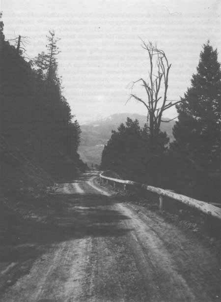
|
|
Road near Undine Falles, 1925 Courtesy Yellowstone National Park Archives |
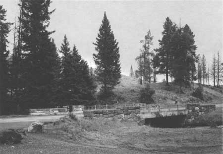
|
|
Lava Creek Bridge, 1898 Courtesy Historic American Engineering Record, Jet Lowe, 1989 |
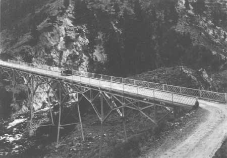
|
|
Gardner River Bridge, 1917 Courtesy Yellowstone National Park Archives |
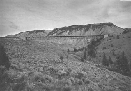
|
|
Gardner River Bridge, 1989 Courtesy Historic American Engineering Record, Jet Lowe, 1989 |
NORRIS JUNCTION TO CANYON JUNCTION
During 1885 and 1886, James Blanding, Oscar Swanson and the road overseer, Ed Lamartine began construction of the first road from Norris Geyser Basin to Canyon. [177] In 1887, $12,000 was spent on finishing the 12 mile road, which had only been graded for the first 8 miles east of Norris. [178]
By the end of the century, Army Corps officer Hiram Chittenden considered the reconstruction of this section of road "of pressing importance." He described the road as having:
three of the worst and most dangerous hills on the entire system. . . . The Virginia Cascade hill is a positive menace to the lives of travelers. Several accidents have occurred here, . . . Stage drivers are often compelled to make passengers alight and walk down the hill. The Devil's Elbow—a very short turn of nearly 80 degrees is another dangerous place. Blanding Hill is a long, difficult, and dangerous ascent which is impossible to maintain in good condition. The long hill descending into the valley of the Yellowstone is composed of wretched material, which so cuts up in wet weather as to be impossible of ascent by loaded wagons. The dense forests on top of the plateau retain the snow so late that it has to be shoveled out every spring at great expense. It is proposed to cut out some of the hills, reduce the grades on others, surface the bad stretches and clear the timber away on the north side of the road so as to let the sun in. . . . It is estimated to cost as much as an entire relocation or about $2,000 per mile for 10 miles. [179]
In 1903, Chittenden relocated the most dangerous section, eliminating the bad hills and the dangerous curve, the Devil's Elbow by carving a road into the face of the cliff. In addition to achieving a safer route, "this road had materially added to the scenic effect of this canyon." [180]
In Hiram Chittenden's assessment of the roads in the Park just prior to his transfer to Mount Rainier National Park, in 1905, he called the Norris Junction to Canyon "the least satisfactory road in the park." Despite correcting the most dangerous curves, eliminating the bad hills, clearing timber for 30 feet on the south side of the road, he recommended:
To further improve this road and produce the best practicable solution of a very difficult problem, the remaining hills and hollows should be graded out, the roadbed should be built up more deeply with the native material, so that there will be a heavier cushion over the underlying rock, and the entire road should be sprinkled if possible so as to hold the surface from disintegration in extremely dry weather. With these measures taken it is believed that the road can be kept in fair condition. The cost of transporting crushed rock or gravel from any available quarries is too great to be considered for the greater portion of the road. [181]
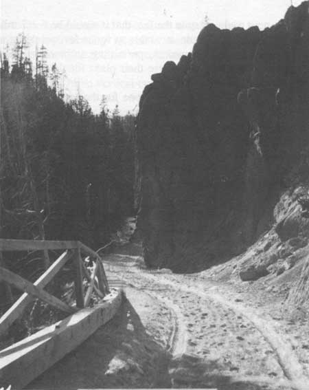
|
|
Road Near Virginia Cascades on Gibbon River, 1900 Courtesy Yellowstone National Park Archives |
The 1909 spring snow, which laid very deep on the road, caused significant damage to the road despite the struggle by the road crews to drain it. Two crews ditched and graded the hills and made necessary gravel fills so that at the end of the 1909 fiscal year, the Army engineering officer considered the road to be in "very good condition." [182]
The entire road was graded in 1911 and numerous culverts and one bridge were repaired. Two years later, the retaining wall at Virginia Cascades had been destroyed as a result of severe weather conditions. The crews repaired two bad washout sections and they constructed a dry rubble guard wall. Part of the road section was resurfaced with local materials. [183]
In 1914, a new route was suggested for the stretch of road from Canyon west to the Virginia Cascades. The road would leave the Canyon area, proceed to Cascade Creek to Grebe Lake, following the Gibbon River into Virginia Canyon. All of the transportation companies operating in the Park endorsed the new route, despite the fact that it would be 6-1/2 miles longer than the old route. Other factors favored the route—nearness to water for sprinkling and traveling along a river is generally more scenic. [184] However, permitting automobiles to enter the Park the following summer prompted the Park to reverse their plans for the new route.
It is recommended that this work be not done for the reason that automobiles have been authorized to use the park, beginning August 1, 1915, and that undoubtedly automobiles will increase to the point where animal transportation will be the exception and not the rule. Since considerable increases in distance and grades is of little consequence to automobiles and as the road from Mammoth Hot Springs to Canyon by way of Dunraven Pass or Mt. Washburn and Tower Falls is one of the scenic routes in the park, all automobiles will take it, so that within five years the Norris to Grand Canyon will be used only for freighting, which will probably be mostly automobile trucks and occasionally by persons in autos and carriages who desire for one reason or another to make a short cut. Therefore while the construction of this new road would be a vast improvement in grades, ease of maintenance and scenic value, over the present road it would be still only a connecting road between the east and west roads of the main belt line, and used only incidently the moment autos became general. [185]
In 1926, another survey of the road conditions stated that extensive reconstruction was needed on this section. Many places needed widening, many grades needed improvements, and "numerous sags and humps" needed elimination. The report called for the installation of metal culverts, construction of "substantial retaining wall and parapet at Virginia Cascade" and surfacing the road with crushed rock and oil treatment. [186]
This section received more attention in 1934, in the planning of a new junction at Norris. The Park and Bureau officials felt that the road should be moved approximately 15 feet to take "develop the views of the Cascades and the Canyon to the best possible advantage." No precise location was decided and no substantial work was initiated. [187]
Five years later, no major work had been done and the condition of the road became a discussion point at the congressional appropriation hearings. Arthur Demary, associate director of the National Park Service, stated:
this road section has been purposely kept in a low-class secondary condition and tourist traffic over it discouraged as much as possible. About five years ago we laid down a substantial oil mat in place of the dust oiling treatment which we had been carrying on annually. This improved surface proved a temptation to speeds higher than the grade and alignment could safely carry, hence our justification for allowing a measure of surface deterioration, but it is not felt that this had contributed to the traffic hazard if the restricted speed regulations are observed. [188]
Demaray explained to the congressional committee that it would be a number of years before any major reconstruction or rerouting would be done, but with some additional funding he proposed a betterment program for an interim solution. The temporary measure would include:
cutting down of several blind vertical curves that have been the contributing cause of the majority of accidents on this road, widening the cross section in cuts too narrow for safe passage, stabilization of the wet grade in the last mile into Canyon Junction, and complete oil treatment of most of the section. The surplus material from excavation of the vertical curves would be used to raise the grade on poorly drained sections and some additional material would have to be hauled in for grade raising and select surfacing material. [189]
America's entry into World War II prevented only the most minimal road construction or maintenance in the Park, thus the reconstruction of this section was delayed again. Only a hot spot was repaired by covering it with a concrete slab during the 1940s.
At the end of the decade, the South Entrance Road and this section were deemed to be in the worst condition of the whole system. [190]
In 1952, a Location Survey Report was completed by the Bureau of Public Roads, but it would be September, 1966, before this road section was completed. The 38-feet wide road had a 1-1/2 inches thick bituminous base covering 30 feet. This project also included the Norris by-pass and road obliteration. [191] The road has been resurfaced in recent years.
CHAPTER XII:
ENDNOTES
1. P.W. Norris, Report Upon the Yellowstone National Park for the Year 1877, to the Secretary of the Interior (Washington D.C.: Government Printing Office, 1877), 841. P.W. Norris, Report Upon the Yellowstone National Park for the Year 1878, to the Secretary of the Interior (Washington D.C.: Government Printing Office, 1878), 979.
2. Norris, Report Upon the Yellowstone National Park for the Year 1878, to the Secretary of the Interior, 979-980.
3. Herman Haupt, The Yellowstone National Park (New York: J.M. Stoddart Co., 1883), 49.
5. P.W. Norris, Report Upon the Yellowstone National Park for the Year 1879, to the Secretary of the Interior, (Washington D.C.: Government Printing Office, 1879), 7.
6. P.W. Norris, Annual Report of the Superintendent of Yellowstone National Park for the Year 1880 (Washington D.C.: Government Printing Office, 1881), 13.
7. P.H. Conger, Annual Report of the Superintendent of the Yellowstone National Park to the Secretary of the Interior for the Year 1882 (Washington D.C.: Government Printing Office, 1882), 5.
8. Conger, Annual Report of the Superintendent of Yellowstone National Park to the Secretary of the Interior for the Year 1882, 6.
9. Dan Kingman, "Construction of Roads and Bridges in Yellowstone National Park," quoted in Annual Report of Capt. Clinton B. Sears, Corps of Engineers, for the fiscal year ending June 30, 1887.
12. Captain Moses Harris, Annual Report of the Superintendent of Yellowstone National Park for the Year 1888, 7 and 12.
13. Maj. Charles J. Allen, Annual Report of Maj. Charles J. Allen, Corps of Engineers, Officer in Charge, for the Fiscal Year Ending June 30, 1889 (Washington D.C.: Government Printing Office, 1889), 2863.
14. Captain F. Q. Boutelle, Report of the Superintendent of the Yellowstone National Park (Washington D.C.: Government Printing Office, 1890), 8 and 9.
15. Capt. George Anderson, Report of the Acting Superintendent of Yellowstone National Park to the Secretary of the Interior, 1895 (Washington D.C.: Government Printing Office, 1895), 8.
16. Hiram Chittenden, "Roads in Yellowstone National Park," Senate Document 226, 50th Congress, 1st Session. Acting Secretary of War Transmitting in Response to Resolution of the Senate of March 12, 1900.
17. Hiram Chittenden, Annual Report Upon the Construction, Repairs, and Maintenance of Roads and Bridges in the Yellowstone National Park and Construction of Military Road from Fort Washakie to Mouth of Buffalo Fork of Snake River, Wyoming and Erection of Monument to Sergeant Charles Floyd in the Charge of Hiram Chittenden, Captain, Corps of Engineers, Appendixes FFF, III, and JJJ of the Annual Report of the Chief of Engineers for 1901 (Washington D.C.: Government Printing Office, 1901), 3780.
18. Hiram Chittenden and John Mills, Annual Report Upon the Construction, Repair and Maintenance of Roads and Bridges In the Yellowstone National Park and the Road Into Mount Rainier National Park; Survey for Wagon Road From Valdes to Fort Egbert, Alaska, and Survey for Military Trail Between Yukon River and Coldfoot, Alaska, Appendixes FFF and KKK of the Annual Report of the Chief of Engineers for 1904 (Washington D.C.: Government Printing Office, 1904), 4174. Hiram Chittenden and John Mills, Annual Report Upon the Construction, Repair and Maintenance of Roads and Bridges in the Yellowstone National Park and the Road into Mount Rainier National Park (Washington D.C.: Government Printing Office, 1905), 2811.
19. For a detailed history of the Golden Gate Viaduct, see HAER NO. WY-46 report, Yellowstone National Park.
20. Hiram Chittenden and John Mills, Annual Reports Upon the Construction, Repair, and Maintenance of Roads and Bridges in the Yellowstone National Park and the Road Into Mount Rainier National Park, Appendixes FFF and KKK of the Annual Report of the Chief of Engineers for 1905, 2820.
21. Ernest Peek, Annual Report of the Chief of Engineers for 1907 (Washington D.C.: Government Printing Office, 1907), 2821, 2466 and 2467.
22. Ernest Peek, Annual Report of the Chief of Engineers for 1908 (Washington D. C.: Government Printing Office, 1908), 2547.
23. Wildurr Willing, "Report of Inspection of Bridges in the Yellowstone National Park, made September 24, 25, and 26, 1909, with recommendations by request of Capt. Wildurr Willing, Corps of Engineers, U.S.A."
24. 1st Lt. Wildurr Willing and Maj. C. W. Kutz, Report Upon the Construction, Repair, and Maintenance of Roads and Bridges in the Yellowstone National Park," Appendixes GGG and HHH for 1909 (Washington D.C.: Government Printing Office, 1909), 2511.
25. Capt. C. H. Knight, Maj. J. B. Cavanaugh, and Maj. Jay J. Morrow, Report of the Chief of Engineers for 1912 (Washington D.C.: Government Printing Office, 1912), 3031.
26. Capt. C. H. Knight to Chief Engineer, Army Corps of Engineers, 12 February 1912. Yellowstone National Park Archives, Yellowstone National Park.
27. Capt. C. H. Knight to Chief Engineer, Army Corps of Engineers, 19 February 1912. Yellowstone National Park Archives, Yellowstone National Park.
28. Maj. Amos Fries, "Report to the Chief of Engineers for October, 1914."
29. Maj. Amos A. Fries and Maj. Jay J. Morrow, Report Upon the Construction, Repair, and Maintenance of Roads and Bridges in the Yellowstone National Park; and Report Upon Crater Lake National Park, Appendixes EEE and FFF (Washington D.C.: Government Printing Office, 1914), 3393-3395.
30. Chester Lindsley, Office of Superintendent, Yellowstone National Park to Capt. John Schultz, 9 October 1917. Yellowstone National Park Archives, Yellowstone National Park.
31. Stephen Mather, Report of the Director of the National Park Service to the Secretary of the Interior for the Fiscal Year Ended June 30, 1921 and Travel Season 1921 (Washington D.C.: Government Printing Office, 1921), 169.
32. C. A. Lord, "Final Report Mammoth-Norris Road-Project #502."
33. Lord, "Final Report Mammoth-Norris Road-Project #502."
34. Unnamed document, but probably a Location Survey report for the Obsidian Cliff to Mammoth Hot Springs road section. Yellowstone National Park, File No. 332.1 Firehole-Cascade-Old Faithful Section 1-C-2. Yellowstone National Park Archives.
35. C.F. Capes, "Final Construction Report Project 1-Al, A3, Grading Mammoth Terraces — Obsidian Cliff Section, Grand Loop National Park Highway Yellowstone National Park Wyoming, June 19. 1933."
36. The following quoted material is from the Landscape Architect report of July, 1932 by Kenneth C. McCarter and Frank Mattson:
July 6 - Permission was given to Mr. Anderson of the B.P.R. to use the material which had been stocked-piled near Sta. 70 for top dressing on the elimination of old borrow pits.
Mr. McCarter located a borrow pit at sta. 300. Many borrow sites have been prospected on this job which have proved worthless, in one instance the material which had been borrowed had the tendency to air-slake after being put into the road. Much boulders or "nigger-heads" generally develop after the pits are opened which cannot be used in the base of the shallow fill across Swan Lake Flats. The relocation between sta. 300 and 315 to avoid the double crossing of the Mammoth water supply concrete pipe line was recommended by McCarter. The proposed location turns slightly to the left, following closer to the natural fringe of trees and then reverses with easy curvature to the right and ties in with the main line again. This change obliterates much of the old road by following the present road more closely which is very desirable from the landscaping viewpoint.
July 10 - Mr. Toll phoned Mr. Wiggins regarding the waterline at the borrow pit at sta. 370. Mr. Wiggins believed the pipe to be about 16 ft. underground. If 2 ft. of covering were left over the pipe it would be satisfactory to Mr. Wiggins to excavate the dike.
July 12 - Mr. Anderson, B.P.R., resident engineer, asked for a relocation of borrow. The pit which had been prospected behind the old barns at the south end of Swan Lake Flats proved inadequate and of undesirable material.
July 13 - Mr. Wiggins does not favor the suggestion of cutting the water pipe line at the borrow pit at sta. 370 and use the marsh as a channel from there to Rustic Falls. His reasons were that the water would spread over the marsh and form a wallow for elk. Channeling would probably cause ice problems and flooding.
July 14 - The removal of the dike which supports the water pipe is still the controlling factor in the obliteration of this most unsightly borrow pit. It was decided that further borrow outside of the dike could be obtained with the prospect of future replacement of the pipe line. When the pipe line is replaced it can be located in the toe of slope of the road and the dike can be smoothed out. This will permit the blending of the slopes of the borrow pit into the side slopes of the marsh. The dike will then be the only unnatural feature remaining. . . . McCarter recommends that when the entire line is replaced that the line through the dike also be replaced for emergency purposes and that the dike be eliminated. The pipe line proved to be about two feet below the surface so the dike could not be partially excavated. It will be rounded off and sloped to fit the new conditions as well as possible.
37. Capes, "Final Construction Report (1931-32) Project 1-A 1, A-3, Grading. Mammoth Terraces-Obsidian Cliff, Grand Loop Project Yellowstone National Park Wyoming."
38. Kenneth McCarter and Frank Mattson, Landscape Architects Reports, July, 1932.
39. McCarter and Mattson, Landscape Architect Reports for July, 1932.
40. C.A. Lord, "Final Report Mammoth Terraces-Obsidian Cliff, Post Construction Project #558, 1933."
41. E.O. Anderson, "Final Construction Report, 1933-1934 on Project NE 1-Al, A3, A4, A5 Surfacing, Grand Loop Highway, Yellowstone National Park, Wyoming, January 11, 1935." Equipment used on this contract included the following:
1 - 1/2 yard Speeder gas shovel
1 - 1-1/4 yard Bucyrus-Erie gas shovel
1 - 60 Caterpillar tractor with bulldozer
1 - 30 Caterpillar tractor with fresno
9 - 3-1/2 ton dump trucks
1 - 3/4 ton truck
1 - 1/2 ton truck
2 - 310 compressors
2 - 15 x 36 Universal crushers
1 - 95 HP Allis-Chalmers engine
1 - 120 HP Waukesha engine
1 - Pioneer-Duplex crushing, screening, and loading plant
1 - 10 ton roller
1 - Auto patrols (10 foot blade)
1 - Tool car.
42. Anderson, "Final Construction Report, 1933-34 on Project NR 1-Al, A3, A4, A5 Surfacing, Grand Loop Highway, Yellowstone National Park, Wyoming, January 11, 1935."
43. E. O. Anderson, "Final Construction Report, 1935 on Project NR 1-Al, A3, A4, A5, Oiling, 1-A2, B, and C-1, Seal Goat, Grand Loop Highway, Yellowstone National Park, Wyoming, January 11, 1936." This project required the following major equipment:
1 Pioneer Duplex crushing and screening plant
1 Madson oil mixing plant
1 Diesel Caterpillar tractor
1 Diesel Auto Patrol (12' blade)
6 3-ton dump trucks
1 3-ton hoist truck
3 1-1/2-ton dump trucks
1 1-1/2-ton flat bed truck
1 welder truck
1 roller
1 distributor
1 sweeper
1 stone chip spreader
44. Anderson, "Final Construction Report, 1935 on Project NR 1-Al, A3, A5, Oiling, 1-A2, B and C-1, Seal Coat, Grand Loop Highway, Yellowstone National Park, Wyoming, January 11, 1936." The bituminous surfacing had a thickness of 3 inches loose and a width of 22 feet. It was constructed on 5 inches loose thickness of crushed rock base course which had been placed the previous year. A prime coat of Liquid Asphaltic Road Material, type MC-1 was used on the base course where needed, however most of it was in excellent condition, thus little priming was needed. Crushed gravel consisting of fairly hard rhyolite boulders and pebbles with sand filter and a small amount of dirt was the aggregate. The bituminous material, which consisted of liquid Asphaltic Road Material, type NC-4 was added into the mixture at a temperature of 175 degrees, then transported to the road at a temperature of 210 degrees or more. The material set up very quickly. A seal coat, which consisted of Liquid Asphaltic Road Material, type RC-1, was then covered with a cover of stone chips which had been crushed to a maximum size of 5/8 inch from basalt slide rock. The color to the chips was a blue gray which lightened the road surface for night driving.
45. E. O. Anderson, "Final Construction Report (1948-49) on Grand Loop National Highway-Wyoming, Project 1-A, B, C-1 Reseal, Yellowstone National Park, State of Wyoming, February 8, 1950."
46. "Final Construction Report (1965-1966) on Yellowstone National Park Project 1-A(1), B(1) and 12(1), Grading and Bituminous Stabilized Base, Grand Loop and Norris-Canyon Cutoff, Yellowstone National Park, State of Wyoming." This report gives very good details of the types materials and equipment used on this project.
47. Robert R. O'Brien, "The Yellowstone National Park Road System: Past, Present, and Future," (Ph.D. Diss. University of Washington, 1964).
48. Norris, Report Upon the Yellowstone National Park for the Year 1878, to the Secretary of the Interior, 979.
49. Norris, Report of the Superintendent of the Yellowstone National Park for the Year 1880, 13.
50. John Hartman to Secretary of the Interior Teller, 20 August 1883. Yellowstone National Park Archives, Yellowstone National Park.
54. Report of the Secretary of War Being Part of The Messages and Documents Communicated to the Houses of Congress and The Beginning of The First Session of the Fiftieth Congress in 4 Volumes, Volume II- in four parts, Part IV (Washington D.C.: Government Printing Office, 1889), Annual Report of Major Charles J. Allen, Corps of Engineers, Officer in Charge, for the Fiscal Year Ending June 30, 1889, 2863.
55. George S. Anderson, Report of the Superintendent of the Yellowstone National Park to the Secretary of the Interior, 1892 (Washington D.C.: Government Printing Office, 1892), 3 and 5.
56. Anderson, Report of the Acting Superintendent of the Yellowstone National Park to the Secretary of the Interior for 1895, 8.
57. Colonel S.B.M. Young, 3rd Cavalry, Report of the Acting Superintendent of the Yellowstone National Park to the Secretary of the Interior, 1897 (Washington D.C.: Government Printing Office, 1897), 4.
58. Chittenden, Annual Reports Upon the Construction, Repairs, and Maintenance of Roads and Bridges in the Yellowstone National Park and Construction of Military Roads from Fort Washakie to Mouth of Buffalo Fork of Snake River, Wyoming, and Erection of Monument to Sergeant Charles Floyd in the Charge of Hiram Chittenden, Captain, Corps of Engineers, Appendixes FFF, KKK, and JJJ of the Annual Report of the Chief of Engineers for 1903 (Washington, D.C: Government Printing Office, 1903), 2893.
59. Chittenden, Annual Report Upon the Construction, Repairs, and Maintenance of Roads and Bridges in the Yellowstone National Park in the Charge of Hiram Chittenden, Captain, Corps of Engineers, Appendixes GGG and KKK of the Annual Report of the Chief of Engineers for 1905, 2810. Chittenden, Annual Report Upon the Construction, Repair, and Maintenance of Roads and Bridges in the Yellowstone National Park and the Roads Into Mount Rainier National Park, Appendixes GGG and JJJ of the Annual Report of the Chief Engineers for 1906 (Washington D.C.: Government Printing Office, 1906), 2255.
60. Peek, Annual Report of the Chief of Engineers for 1907, 2,463.
61. Peek, Annual Report of the Chief of Engineers for 1908, 2,544 and 2,545.
62. Willing, "Report of Inspection of Bridges in the Yellowstone National Park, made September 24, 25, and 26, 1909, with recommendations by request of Capt. Wildurr Willing, Corps of Engineers, U.S.A."
63. Capt. C. H. Knight, Maj. J.B. Cavanaugh and Maj. Jay J. Morrow, Report Upon the Construction, Repair, and Maintenance of Roads and Bridges in the Yellowstone National Park, and Report Upon the Roads Into Mount Rainier National Park, Appendixes HHH and III, 3,031-3,032.
Horace Albright to Henry Jacoby, 30 October 1923. Yellowstone National Park Archives, Yellowstone National Park.
64. Stephen Mather, Report of the Director of the National Park Service to the Secretary of the Interior for the Fiscal Year Ended June 30, 1919 (Washington D.C.: Government Printing Office, 1919), 25-26.
65. Lt. Col. Amos Fries and Col. George Winn, Report Upon the Construction, Repair, and Maintenance of Roads and Bridges in the Yellowstone National Park and Report Upon Crater Lake National Park (Washington D.C.: Government Printing Office, 1917), 3748-3749.
66. Mather, Report of the Director of the National Park Service to the Secretary of the Interior for the Fiscal Year Ended June 30, 1921 and the Travel Season 1921, 167.
67. Stephen Mather, Annual Report of the Director of the National Park Service to the Secretary of the interior for 1925 (Washington D.C.: Government Printing Office 1925), 78-79.
68. Stephen Mather, Annual Report of the Director of the National Park Service to the Secretary of the Interior for 1926 (Washington D.C.: Government Printing Office, 1926), 56.
69. A.W. Burney, Assistant Engineer, "Report of Work Done on Projects No. 6 and 9, Yellowstone National Park, July 2, 1925." C.A. Lord, "Madison Junction-Old Faithful Project 1C (503) (525.1), 1930." Yellowstone National Park Archives, Box, Construction of Roads, FY 1926.
70. Lord, "Madison Junction-Old Faithful Project 1C (503) (525.1), 1930."
71. C.A. Lord, "Final Report Project #525.9, Loop Betterment, (Old Faithful 5 Milepost)."
72. C.A. Lord, "Final Report Project #530, Madison-Norris Oiling, Cleanup, Bridge Removal 1930."
73. "Reconnaissance Report-1931, Route 1. Firehole Cascades-Old Faithful Project, Section 1-C of the Grand Loop, Yellowstone National Park, Wyoming."
74. C.F. Capes, "Location Survey Report, 1932 on Firehole Cascades - Old Faithful Section of Grand Loop Highway, Yellowstone National Park, Wyoming, April 14, 1934." F.C. Ammann, "Final Construction Report (1934-35) Project N.R. 1-C-2 Grading of the Grand Loop Highway, Yellowstone National Park, Wyoming, April 18, 1936."
75. Yellowstone National Park official (unnamed) to Mr. Thomas Vint, Branch of Plans and Design, National Park Service, 18 September 1935. Yellowstone National Park Archives, Yellowstone National Park.
77. T.A. Smith, "Preliminary Location Survey Report on Grand Loop Highway Firehole River Cascades to Madison Junction 1-C1 Relocation Yellowstone National Park, Wyoming, 1938, January 16, 1939."
78. "Annual Report of the Superintendent of Yellowstone National Park for 1949."
79. Fixed Property Records for Yellowstone National Park, Rocky Mountain Regional Office, National Park Service, Denver, Colorado.
80. W. A. Jones, Construction and Improvements of Roads and Bridges in the Yellowstone National Park, in Appendix of the Annual Report of the Chief of Engineers for 1891 (Washington D.C.: Government Printing Office, 1891) 3932.
81. Aubrey Haines, The Yellowstone Story, (Boulder: Colorado Associated Press, 1977), Vol. II. 218.
82. Robert R. O'Brien, "The Yellowstone National Park Road System: Past, Present, and Future," (Ph.D Diss., University of Washington, Seattle, Washington, 1964), 106.
83. Willing, "Report of Inspection of Bridges in the Yellowstone National Park, Made September 24, 25, and 26th, 1909, With Recommendations by Request of Capt. Wildurr Willing, Corps of Engineers, U. S. A."
84. Capt. Ernest Peek and Maj. Hiram Chittenden, Report on the Upon the Construction, Repair, and Maintenance of Roads and Bridges in the Yellowstone National Park and Report Upon the Road Into Mount Rainier National Park (Washington D. C.: Government Printing Office, 1908), 2544
86. Capt. C. H. Knight, Maj. J. B. Cavanaugh and Maj. Jay J. Morrow, Report Upon the Construction, Repair, and Maintenance of Roads and Bridges in the Yellowstone National Park. Report Upon the Road Into Mount Rainier National Park, Report Upon Crater Lake National Park (Washington D. C.: Government Printing Office, 1913), 3268.
87. "Summary of Necessary Improvements ending June 30, 1912."
88. "Report Upon Operations for May 1915," 9.
89. "Tentative Suggestions for Improvements to Park Roads, 1926."
90. A. C. Stinson, "Location Survey Report, 1934 on the Old Faithful-West Thumb Road Section D, Route 1, Grand Loop Highway. Yellowstone National Park Wyoming." United States Department of Agriculture, Bureau of Public Roads District No. 3, October 4, 1935. p. 2. File Box: Roads. Grand Loop 1931-42. 1971. Yellowstone National Park Archives, Yellowstone National Park.
93. Letter to Mr. Baggley, acting superintendent, Yellowstone National Park from Mr. W. M. Nichols, President Yellowstone Park Company, 28 August 1934. I have found no evidence that this section of road was regularly used after the completion of the new road.
97. Memorandum to Mr. C. F. Capes, Bureau of Public Roads from Sanford Hill, Resident Landscape Architect, 2 June 1936. Yellowstone National Park Archives, Yellowstone National Park.
98. Capes, "Highway Improvements in Yellowstone National Park."
99. F. E. Ammann, "Final Construction Report (1936-37-38) Grand Loop, Yellowstone National Park Project 1-D2 Grading Yellowstone National Park," Public Roads Administration, D-3 Federal Works Agency. Office of Maintenance Division, Yellowstone National Park.
100. C. F. Capes, "Final Construction Report (1939-40) on Grand Loop National Park Highway, Project 1-D2, E2, pt. C2, Bit. Surfacing Yellowstone National Park, State of Wyoming." Office of Maintenance Division. Yellowstone National Park.
101. Letter to B. W. Matteson, District Engineer, Public Roads Administration from Lawrence Merriam, Regional Director, Region Two, National Park Service, 5 June 1945. Yellowstone National Park Archives, Yellowstone National Park.
102. E. H. Cowan, "Final Construction Report (1947) on Grand Loop National Park Highway Project 1-D1, D3 Bit. Surfacing Yellowstone National Park, Wyoming." Office of Maintenance Division. Yellowstone National Park.
103. Superintendent Yellowstone National Park to Regional Director, Region 2, National Park Service. 17 March 1950. National Archives and Records Center, Denver, Colorado. Yellowstone File Box: 25. Folder:630-01 Major Road Programs.
104. Norris, Annual Report of the Superintendent of the Yellowstone National Park for the Year 1880, 23.
105. Anderson, Report of the Acting Superintendent of the Yellowstone National Park to the Secretary of the Interior, 1895, 8.
106. Hiram Chittenden, "Roads in Yellowstone National Park," - Senate, 226, 50th Congress, 1st Session. Acting Secretary of War Transmitting in Response to Resolution of the Senate of March 12, 1900, Letter from Chief of Engineers, U.S.A., Together with the Copies of Originals of All Reports Relating to the Present Condition and Aggregate Plans for the Development of the System of Roads in the Yellowstone National Park. Horace Albright, Superintendent, Yellowstone National Park, to T. E. Hofer, 16 October 1926. Yellowstone National Park Archives, Yellowstone National Park.
107. Albright to Hofer, 16 October 1926. Yellowstone National Park Archives, Yellowstone National Park.
108. Willing and Kurz, Report Upon the Construction, Repair, and Maintenance of Roads and Bridges in the Yellowstone National Park, and Report Upon the Road Into Mount Rainier National Park, Appendixes GGG and HHH, 2511.
109. "Report of Proposed Projects for 1923." This report was attached to a memorandum from Assistant Park Engineer Burney to Superintendent Horace Albright, 21 August 1923. Yellowstone National Park Archives, Yellowstone National Park.
110. Horace Albright, Superintendent of Yellowstone National Park, to Stephen Mather, Director of the National Park Service, 2 June 1925. Yellowstone National Park Archives, Yellowstone National Park.
111. Arno B. Cammerer to Thomas MacDonald, 11 September 1926. File Box: - Roads, General Correspondence 1919-1926, File - Roads, Correspondence May-December 1926, Yellowstone National Park Archives, Yellowstone National Park.
112. Horace Albright, "Report on Roadside Cleanup, Yellowstone National Park 1927," Record Group III 2 E, Box 83, File 774, Rockefeller Archive Center, Tarrytown, New York.
113. Guy Edwards, Assistant Superintendent, Yellowstone National Park, to Horace Albright, Director, National Park Service, 10 November, 1932. Yellowstone National Park Archives, Yellowstone National Park.
114. Superintendent Yellowstone National Park to Regional Director, National Park Service. 17 March 1950.
National Archives and Records Center, Denver, Colorado. Yellowstone File Box 25, Folder 630-01. Major Road Programs.
115. "Final Construction Report (1960-61) Project 1-E, Bridge and Approaches, Grand Loop, Yellowstone National Park, Wyoming." Office of Maintenance Division. Yellowstone National Park.
116. "Narrative Statement for Completion Report for Route 12-E Arnica Creek-Bridge Bay Road, Contract No. 14-10-0100-1242 Work Order No. R-39-Yel-BPR." Arnica Creek - Bridge Bay 1E Folder. Yellowstone National Park Archives, Yellowstone National Park. Jack K. Anderson, Superintendent Yellowstone National Park to John Amerman, Yellowstone National Park Company. 11 June 1969. Yellowstone National Park Archives, Yellowstone National Park.
117. William A. Jones, Report Upon the Reconnaissance of Northwestern Wyoming Including Yellowstone National Park Made In the Summer of 1873 (Washington D.C.: Government Printing Office, 1875), 58.
118. Norris, Report Upon the Yellowstone National Park for the Year 1878, to the Secretary of the Interior, 983-984.
119. Norris, Annual Report of the Superintendent of the Yellowstone National Park for the Year 1879, to the Secretary of the Interior.
120. Norris, Annual Report of the Superintendent of the Yellowstone National Park for the Year 1880, 38.
121. Norris, Fifth Report of the Superintendent of the Yellowstone National Park, September, 1881, 69-70.
122. Norris, Fifth Annual Report of the Superintendent of the Yellowstone National Park, September, 1881.
123. Conger, Annual Report of the Superintendent of the Yellowstone National Park to the Secretary of the Interior for the Year 1882, 6.
124. Report of the Secretary of War Being Part of the Messages and Documents Communicated to the Two Houses of Congress in Four Volumes (Washington D.C.: Government Printing Office, 1887), Appendix AAA, Annual Report of Capt. Clinton B. Sears, Corps of Engineers, for the Fiscal Year Ending June 30, 1887, 3138-3139.
125. Report of the Secretary of War Being Part of the Messages and Documents Communicated to the Houses of Congress and The Beginning of The First Session of The Fiftieth Congress in 4 Volumes, Volume II- in four parts, Part IV, Annual Report of Maj. Charles J. Allen, Corps of Engineers, Officer in Charge,for the Fiscal Year Ending June 30, 1889, 2857-2859.
126. George Anderson, Report of the Superintendent of the Yellowstone National Park to the Secretary of the Interior, 1892, 3 and 5.
127. Anderson, Annual Report of the Superintendent of the Yellowstone National Park to the Secretary of the Interior, 1893 (Washington D.C.: Government Printing Office, 1893), 8.
128. Anderson, Report of the Acting Superintendent of the Yellowstone National Park to the Secretary of the Interior, 1895, 8.
129. Anderson, Report of the Officer in Charge of Construction and Maintenance of Roads, Etc., in the Yellowstone National Park to the Secretary of War, 1896 (Washington D.C.: Government Printing Office, 1896), 5.
130. Hiram Chittenden, "Roads In Yellowstone National Park."
131. Hiram Chittenden, Annual Reports Upon the Construction, Repairs, and Maintenance of Roads and Bridges in the Yellowstone National Park and Construction of Military Roads from Fort Washakie to Mouth of Buffalo Fork of Snake River, Wyoming, and Erection of Monument to Sgt. Charles Floyd in the Charge of Hiram A. Chittenden, Captain, Corps of Engineers for 1903, 2891.
132. "Technical Report Upon the Improvement of Yellowstone National Park, 1904," 58. This document does not list an author, however, it is presumed to have been written by Captain Hiram Chittenden.
133. "Technical Report . . . 1904," 58.
134. Chittenden, Annual Report Upon the Construction, Repairs, and Maintenance of Roads and Bridges in the Yellowstone National Park in the Charge of Hiram A. Chittenden, Captain, Corps of Engineers, Appendixes GGG and KKK of the Annual Report of the Chief of Engineers for 1905, 2818.
136. Ernest Peek, Annual Report of the Chief of Engineers for 1907, 2664.
137. Capt. C. H. Knight, Maj. J. B. Cavanaugh, and Maj. Jerry J. Morrow, Report Upon the Construction, Repairs, and Maintenance of Roads and Bridges in the Yellowstone National Park; Report Upon the Road Into Mount Rainier National Park; and Report Upon Crater Lake National Park, Appendixes EEE and FFF, 3269.
138. Chester Lindsley from Capt. John Schultz, 17 October, 1917. Yellowstone National Park Archives, Yellowstone National Park.
139. Stephen Mather, Report of the Director of the National Park Service to the Secretary of the Interior for the Fiscal Year Ended June 30, 1921 and the Travel Season 1921, 167.
140. "Final Construction Report, 1930-1931, on Canyon Junction-Tower Junction Project, 1-G-1 Grading, Yellowstone National Park, State of Wyoming, January 30, 1932."
142. F.A. Kittredge, Chief Engineer, National Park Service, to Director of the National Park Service, September 5, 1933. File 332.1, Box-Road Construction, 1933, Yellowstone National Park Archives, Yellowstone National Park.
143. H.E. Dalton, "Final Construction Report (1934) on Grand Loop, Slide Removal Section NR 1-02, Yellowstone National Park, Wyoming, March 4, 1935."
144. C.F. Capes to Mr. Russell, Bureau of Public Roads, August 31, 1935. Yellowstone National Park Archives, Yellowstone National Park.
145. Roger Toll, Superintendent of Yellowstone National Park to C.F. Capes, Bureau of Public Roads, 23 October, 1935. Memorandum from Roger Toll to Mr. Emmert, Yellowstone National Park, 3 September, 1935. Yellowstone National Park Archives, Yellowstone National Park.
146. James Smith, "Final Construction Report (1948-49) on Grand Loop National Park Highway Project 1-F3, G4 Grading and Base Surfacing Yellowstone National Park, State of Wyoming, March 2, 1950." This report contains good information on the disturbance to the ground in Canyon Junction area. It contains copies of good photographs of the land fill near Cascade Creek. Office of Maintenance Division. Yellowstone National Park.
148. Real Property Record for Tower Creek Bridge, Yellowstone National Park, National Park Service, Rocky Mountain Regional Office, Denver, Colorado.
149. A.O. Stinson, "Location Survey Report 1931-32 on Bridge Bay - Inspiration Point Survey including Section F and parts of Sections E and G of Route I, the Grand Loop System, and a part of Section D of Route 5, the East Entrance Highway, Yellowstone National Park, Wyoming, January 20, 1934." File Box: Roads. Grand Loop 1931-1942, 1971. Yellowstone National Park Archives. Yellowstone National Park.
150. Ibid. This report contains very good detailed information regarding the condition of this road section, segment by segment.
153. Robert Bond, "Preliminary Location Survey Report on Relocation of Portions of Sections 1-F, 1-G Grand Loop Highway, Yellowstone National Park, Wyoming 1937, February 26, 1938." File Box: Roads. Grand Loop 1931-1942. 1971. Yellowstone National Park Archives. Yellowstone National Park.
154. Excerpt from Report on "Investigation of Gas Hazards Proposed Bridge Foundation Sites in Yellowstone National Park" by S.H. Ash District Engineer, Bureau of Mines, and W.W. Kessler. 1939. Pg. 79. File Box 40, Yellowstone National Park, Canyon Junction Vicinity - Cascade Creek, Part 2 January 1, 1940 to December 31, 1943. National Archives and Records Center, Denver, Colorado.
155. Memorandum to Regional Director, Region Two, National Park Service, from Superintendent, Yellowstone National Park. 8 June 1950. Superintendent to Regional Director, Region Two, National Park Service. 17 March 1950. National Archives and Records Center, Denver, Colorado. Pg. 79. Yellowstone File Box 25. Folder: 630-01, Major Road Programs.
156. Real Property Record for Tower Creek, Yellowstone National Park, National Park Service, Rocky Mountain Regional Office, Denver, Colorado.
157. Norris, Report Upon the Yellowstone National Park to the Secretary of the Interior for the Year 1877, 843-844.
158. Norris, Report Upon the Yellowstone National Park, for the year 1878, to the Secretary of the Interior, 984.
159. Norris, Report Upon the Yellowstone National Park for the Year 1879, 6-7.
160. Norris. Annual Report of the Superintendent of the Yellowstone National Park for the Year 1880, 10, 38.
161. Norris. Fifth Annual Report of the Superintendent of the Yellowstone National Park by P. W. Norris, Superintendent, 9, 69-70.
162. Capt. Moses Harris, U. S. Army, Annual Report of the Superintendent of the Yellowstone National Park, 1887 (Washington D. C.: Government Printing Office, 1887), 9.
163. Capt. George Anderson to Secretary of War, Monthly Report, July 3, 1897.
164. "Report from Col. S. M. Young, Acting Superintendent, Yellowstone National Park to Quartermaster General, U. S. Army, August 13, 1897."
165. Capt. Hiram Chittenden, Improvement of Yellowstone National Park, Including the Construction, Repair and Maintenance of Roads and Bridges in the Annual Report of the Chief of Engineers for 1902, Appendixes FFF and III (Washington D. C.: Government Printing Office, 1902), 3045-46
166. Chittenden, Annual Report Upon the Construction, Repairs, and Maintenance of Roads and Bridges In The Yellowstone National Park and Construction of Military Road from Fort Washakie To Mouth of Buffalo Fork of Snake River, Wyoming, Appendixes GGG and KKK of the Annual Report of the Chief of Engineers for 1903, 2893.
167. Chittenden, Annual Report Upon the Construction, Repair and Maintenance of Roads and Bridges In The Yellowstone National Park, Appendixes FFF and KKK of the Annual Report of the Chief of Engineers for 1904, 4173. According to Lee Whittlesey's Yellowstone Place Names, Oxbow Creek flows north to the Yellowstone River from above Phantom Lake. In 1878, Ferdinand Hayden named the creek, "Geode Creek", but the name was officially switched to Oxbow Creek between 1915 and 1921.
168. Chittenden, Improvement of Yellowstone National Park, Including the Construction, Repairs and Maintenance of Roads and Bridges in the Annual Report of the Chief of Engineers for 1904, Appendixes FFF and KKK.
169. Capt. Hiram Chittenden, Improvement of Yellowstone National Park, Including the Construction, Repairs and Maintenance of Roads and Bridges. Annual Report of the Chief of Engineers for 1905, Appendix FFF, 2818-2819. Maj. Hiram Chittenden, 1st. Lt. Ernest Peek, Maj. John Mills, and 1st Lt. Francis Pope. Annual Reports Upon the Construction, Repairs, and Maintenance of Roads and Bridges In The Yellowstone National Park and the Roads Into Mount Rainier National Park, Appendixes GGG and JJJ of the Annual Report of the Chief of Engineers for 1906, 2257.
170. 1st Lt. Ernest Peek and Maj. Hiram Chittenden, Report Upon The Construction, Repairs, and Maintenance of Roads and Bridges In The Yellowstone National Park and Report Upon the Road Into Mount Rainier National Park (Washington D. C.: Government Printing Office, 1907.), 2465.
171. Capt. C. H. Knight. "Improvement of Yellowstone National Park, Including the Construction, Repair and Maintenance of Roads and Bridges." in the Annual Report of the Chief of Engineers, 1913, Appendix EEE.
172. A discussion of the entire Gardiner, Montana to Cooke City, Montana road can be found in the History of the Northeast Entrance Road. This history describes the interaction between the National Park Service and private industry over the construction and maintenance of this road. Part of the discussion involves the Mammoth Hot Springs to Tower Falls segment.
173. Arno B. Cammerer to Thomas McDonald, 11 September 1926, File Box: Roads, General Correspondence 1919-1926, File, Roads Correspondence May-December 1926, Yellowstone National Park Archives, Yellowstone National Park.
174. "Annual Report of the Superintendent of Yellowstone National Park for 1933."
The existing road to Tower Falls from Mammoth Hot Springs is unsatisfactory as to both gradient and alignment. Its point of departure from the Mammoth area, however, is from a satisfactory and logical point which is retained in the proposed plan. I carefully inspected the routes proposed by the Bureau of Public Roads engineers as well as the existing road. I do not approve of the location recommended by them on the north side of Gardner River and Lava Creek for the following reasons:
1. a new wide scar would be created on the slopes of Mt. Evarts which would take many years to heal
2. because there is no timber growth on the south slope of Mt. Evarts the entire road would always be in full view from many points
3. a switchback is necessary and would require exceedingly heavy construction on the steep slopes
4. the fine views of Mt. Evarts and those down the Gardner River Valley now obtained on the existing road, would be lost on the proposed location.
After studying the problem and discussing it with Chief Landscape Architect Vint, I recommend that the new road to Tower Junction be constructed along the south side of Lava Creek utilizing as much of the existing alignment as may be practicable. At a point about 1/4 mile down stream on the Gardiner River from the present steel bridge, a new high level bridge could be erected, if necessary constructed on a grade. This structure would be entirely satisfactory if built of steel, preferably with open, fully centered arches, and then painted gray to harmonize with the color of the existing rock outcrops. If a switchback was found to be necessary between the bridge over the Gardner River and Undine Falls, there is a wide stretch of land between Lava Creek and the existing road, which would lend itself well for such a purpose. The south bank of Lava Creek is well wooded and the road from the bridge to Undine Falls would be hidden from view and at the same time views from it are obtained of Mt. Evarts, the distant mountains down the Gardner River Valley, and the Hot Springs formations at Mammoth Hot Springs. Mr. Vint advised me, upon his arrival at Mammoth Hot Springs that he had previously worked out such a scheme as I have recommended and he concurred in my views.
Report by Clark Gilmore, Landscape Architect, Westchester County Park Development, New York, to Horace Albright, Director of the National Park Service, June, 1930. C. F. Capes, "Final Survey Report (1937) 1-H3 Bridge Investigation and Design Grand Loop Highway Yellowstone National Park, Wyoming." File Box: Roads. Grand Loop. 1931-1942. 1971. Yellowstone National Park Archives. Yellowstone National Park.
176. C. S. Cape, "Progress Report, Season of 1939 on Public Administration Activities on the Yellowstone National Park Highway System, Yellowstone National Park, Wyoming. Federal Works Agency Public Roads Administration District No. 3. December 18, 1939." Technical Information Center, Denver Service Center, National Park Service, Denver, Colorado.
177. Lee H. Whittlesey, Yellowstone Place Names (Helena, Montana: Montana Historical Society Press, 1988), 26.
178. Report of the Secretary of War Being Part of the Messages and Documents Communicated to the Two Houses of Congress in Four Volumes (Washington D. C.: Government Printing Office, 1887), Appendix AAA, Annual Report of Captain Clinton B. Sears, Corps of Engineers, for the Fiscal Year Ending June 30, 1887, 3138-3139.
179. Hiram Chittenden, Improvement of the Yellowstone National Park, Including the Construction, Repair and Maintenance of Roads and Bridges Annual Report of the Chief of Engineers for 1899, Appendix EEE (Washington D. C.: Government Printing Office, 1899).
180. Chittenden, Improvement of Yellowstone National Park, including the Construction, Repair and Maintenance of Roads and Bridges (Annual Report of the Chief of Engineers for 1903, Appendix GGG), 2890.
181. Chittenden, Improvement of Yellowstone National Park, Including the Construction, Repair and Maintenance of Roads and Bridges (Annual Report of the Chief of Engineers for 1905, Appendix FFF), 2819.
182. Willing and Kutz, Report Upon the Construction, Repair and Maintenance of Roads and Bridges in the Yellowstone National Park, and Report Upon the Road into Mount Rainier National Park, Appendixes GGG and HHH, 2511.
183. Clarence Knight, Improvement of Yellowstone National Park, Including the Construction, Repair and Maintenance of Roads and Bridges. Annual Report of the Chief of Engineers, 1911, Appendix GGG. (Washington D. C.: Government Printing Office, 1911) 3031. Clarence Knight, "Improvement of Yellowstone National Park, Including the Construction, Repair and Maintenance of Roads and Bridges." Annual Report of the Chief of Engineers, 1913, Appendix FFF. (Washington D. C.: Government Printing Office, 1913), 3269-3270.
184. Amos Fries, Major, Army Corps of Engineer, to Acting Superintendent Col. Lloyd Brett, 11 September 1914. Yellowstone National Park Archives, Yellowstone National Park.
185. Amos Fries, Major, Army Corps of Engineers, to Chief of Engineers, Army Corps of Engineers, 5 May 1915. Yellowstone National Park Archives, Yellowstone National Park.
186. "Tentative Suggestions for Improvement to Park Roads," n.d. File: General Road, 1925-26. Yellowstone National Park Archives, Yellowstone National Park.
187. "Monthly Narrative Report for September 28 to October 28, 1934." "Report to the Chief Architect for June 25 to July 25, 1934." Yellowstone National Park Archives, Yellowstone National Park.
188. Edmund Rogers, Superintendent, Yellowstone National Park, to Arno Cammerer, Director, National Park Service, 18 May 1939. Yellowstone National Park Archives, Yellowstone National Park.
190. "Annual Report of the Superintendent of Yellowstone National Park for 1948." "Annual Report of the Superintendent of Yellowstone National Park, 1949."
191. "Final Construction Report (1965-1966) on Yellowstone National Park Project 1-A(1), B(1), and 12(1) Grading and Bituminous Stabilized Base. Grand Loop and Norris-Canyon Cutoff. Yellowstone National Park. State of Wyoming." Division of Maintenance. Yellowstone National Park.
| <<< Previous | <<< Contents>>> | Next >>> |
hrs-roads/chap12.htm
Last Updated: 20-Apr-2016