|
YELLOWSTONE
The History of the Construction of the Road System in Yellowstone National Park, 1872-1966 Historic Resource Study, Volume I |

|
|
Part One: The History of the Construction of the Road System in Yellowstone National Park, 1827-1966 and the History of the Grand Loop and the Entrance Roads |
CHAPTER III:
THE CHITTENDEN ERA, 1891-1905
The first difficulty arises from the wretched nature of the material through which the roads pass. Unquestionably there is no other spot of equal area on the face of the earth where there is such a remarkable variety of substances, and such curious combinations, in the composition of the soil . . . . He may expect to encounter in any single mile of road construction all the varities of work which he would find in building a turnpike from Portland in Maine to Portland in Oregon.
Lieutenant Hiram Chittenden, U.S. Army Corps of Engineers, 1894
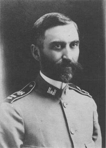
Lt. Hiram Chittenden who took over the responsibility of the road improvement and construction from Lieutenant Craighill in 1891, immediately took up the work being done on the West Thumb and Old Faithful route and on the road from the Grand Canyon to West Thumb, via the Lake Hotel area. The acting superintendent noted that Chittenden was "zealous, untiring, and remarkably efficient." [121]
Because the 1891 appropriation was awarded so late in the year, Lieutenant Chittenden had two years worth of appropriations totaling $120,000 to use during the late spring and summer of 1892. All of the existing roads were put into good condition, including the 52-mile road from the Grand Canyon to the Upper Geyser Basin, via Yellowstone Lake, which opened during the fall of 1891. The road had not settled properly before the snow fell, and was thus very badly washed out and very muddy. While many of that day thought the Canyon to Old Faithful road via Lake was one of the "most picturesque drives in the park," Chittenden urged the rebuilding of "the worst, most tedious, and least interesting drives in the park," the road from the Gibbon Falls to the Lower Geyser Basin. [122]
In 1892, the Acting Superintendent Capt. George S. Anderson, recommended to the secretary of interior that the road construction appropriation be under the control of the park superintendent, a cavalry officer, not the supervising Army Corps of Engineers officer. In response to this suggestion, Lieutenant Chittenden and Lieutenant Scott made light of the proposal:
He who builds a road occupies a peculiar position. Of necessity he is in the eyes and nose and mouth of every one who passes that way. He fills the first with admiration (or tries to), the second with dust, and the third with a miscellaneous assortment of praise and blame. If there is any one thing that every citizen of the United States feels perfectly competent to do, it is to build a road. And hence, when it catches an engineer—who thinks he alone knows it all—building one, the public takes an inning. This is as it should be. In the present case the officers of one branch of the public service are doing their duty as well as they can, while the public and the officers of coordinate branches sit in judgment and make them smart for every flaw. This also is as it should be. We welcome it and will take our medicine right along. We will cheerfully wear our brothers as a hair shirt and go with our duty. The officers of the Corps of Engineers seek neither place nor duty. They go where put, stay put, and cheerfully perform their duties as put, as best they may. They are neither pinks of perfection nor angels of radiant light. The under-signed makes mistakes, and is glad of it. To err is to be human, to be perfect, a mugwump. [123]
Other recommendations by Captain Anderson were for the construction of a road from Cinnabar to Cooke City and from the Upper Basin to the south boundary of the park on the Snake River. [124]
Acting Superintendent Anderson reflected his denial of control of the appropriations in his Annual Report for 1893 stating "Of the roads I can say little, as I have no voice in their construction or maintenance." However, Anderson kept his admiration for Lieutenant Chittenden and expressed his unhappiness with Lieutenant Chittenden's transfer in the early spring of 1893, "The unfortunate relief of Lieutenant Chittenden last spring has been a most serious blow to road building here. He was greatly interested in his work, tireless in his attention to it, and ably equipped for it." [125]
Insufficiency of funds and their distribution plagued the road construction projects during 1893 and 1894. By early spring, all of the previous year's monies were exhausted and ongoing repair work was done by the soldiers or by the transportation company employees. In 1893, timber clearing was completed on the West Thumb to Lewis Lake Road, a new road was laid out and begun along the Gibbon River to avoid the Canyon Creek Hill, work continued on the road that passed near the Upper Falls, and a road near the Grand Canyon at Inspiration Point was opened. [126] During 1894, the acting superintendent reported very little road work except for the near completion of a bridge over a dry ravine near Canyon. [127]
Shortly after Captain Anderson submitted his 1894 annual report, an order came from the secretary of war advising Anderson of the long awaited transfer of funds and management to the acting superintendent. With little time left in the 1894 construction season, the crews were able to complete an arch bridge near the Upper Falls, did some repair work, and built a new road between Gardiner and Mammoth Hot Springs, 1-1/2 miles from headquarters. The new road avoided the steep grades of the old road. Activity during the 1895 season increased over the previous construction season. Several new roads, one from the brink of the Grand Canyon to Inspiration Point, via a point over the Lower Falls, one from just south of Alum Creek around Sulphur Mountain, joining the old road near Antelope Creek, one from Lake Hotel to the Natural Bridge, and one beginning at a point on the old road near Gibbon Canyon south across the flats toward the Firehole and also connecting with the road down the Madison River. A bridge over the Firehole, south of Excelsior Geyser, and a bridge over the Gibbon near the mouth of the canyon at an old ford, were completed. [128] In Anderson's report he outlined proposed plans but called upon the secretary of the interior to press for more liberal appropriations. Anderson suggested that a sum of $100,000 per year, for three years, would allow the road system to be brought up to a standard where the travelers would not be bothered by excessive dust or mud and the funds necessary for annual repair and maintenance would be decreased. [129]
Despite a fairly light winter, heavy snow fell throughout the Park. The crews spent much time shoveling out the roads and travelers did not reach the Upper Geyser Basin and the Lake area until June 20th. By August, a new road from the last crossing of the Gibbon River and down the Firehole River to Nez Perce Creek had been built. A bridge, over the only crossing of the Madison River was built as part of roadwork toward Riverside. Roadwork continued toward the south entrance, including the construction of a bridge over the lower crossing of the Snake River. By the season's close, five miles at the southern end of the project had been graded and were in good condition. Anderson's assessment of the condition of the south, west, and east approach roads was that the south road was open, but needed extensive work; the west road, nearly completed, was in very good condition; and the east road, from Cooke City to Soda Butte, would be graded by the end of the 1896 season. The road from Cooke City into the Park, which had suddenly become very popular with camping parties entering from Wyoming, was now considered the worst of all of the roads.
The road crews spent time reducing the steep grades on many sections of the old road and all of the nonfunctioning culverts and unsafe bridges were replaced throughout the Park. Anderson engaged Mr. McHenry, the chief engineer of the Northern Pacific Railway, to develop plans for an iron bridge across the Yellowstone River above the Upper Falls. Determined that the visitors should be able to view the Grand Canyon from the eastern bank, Anderson decided that if the cost were not excessive, he would have an attractive iron bridge built. [130]
In his appeal for sufficient funds, the acting superintendent presented a comparative case of Yellowstone with the state of Connecticut. He explained that the $30,000 appropriation the Park had received for the past few years was not adequate for keeping the roads in good repair, for surveying and construction of new roads. He wrote "There is not an impoverished community occupying a similar area within the limits of the United States that does not yearly devote more money to the single work of road repairs." [131] Anderson believed that he could have first-class roads with the expenditure of approximately $1,000 per mile or $200,000 for the entire park. Also included in his request for funds was an amount of $5,000 to settle the longtime claim of "Yellowstone Jack" Baronett for his bridge. A proposal had been made to extract the $5,000 for the claim from the current funds for park improvement and protection. Anderson replied that acquisition of the decayed structure could never be conceived to be a work of improvement." [132]
Captain Anderson was replaced as the acting superintendent in June 1897 by Col. S.B.M. Young, of the Third Cavalry. In addition to the task of opening and maintaining the existing roads, platforms or sidings were built for tourists to use to get out of coaches or other vehicles at different points of interest on the regularly traveled route. Also, seven new bridges were built, [133] new roads located, and assistant army engineer and his crew determined the altitude at each milepost over the Continental Divide between Norris and West Thumb, thus completing the marking of all sections of the entire park. [134] Colonel Young shared the opinions of his predecessors, ". . . the thorough repairs of the main traveled roads being of more importance than the opening of new roads." [135]
During 1897, the public pushed for a commission to establish the new road locations which would insure that the public had access to all of the wonders and grand scenery of the park. The commission, composed of an Army Corps of Engineer officer, a private citizen, and a member of the U.S. Geological Survey, were to advise the acting superintendent of their suggestions. [136]
By the end of 1897, 10,825 tourists had visited the Park with almost half using the transportation concessionaires, half, private conveyance and 235 people, by either foot or bicycle. The increasing number of visitors made more demands on the road system, so Young desired "a generous appropriation by Congress" to maintain the present roads, and hopefully macadamize a major portion, build strong revetments to protect the roads, and build permanent stone guardrails at dangerous points. [137]
As usual, inadequate funds were forthcoming and Young, who was transferred before the end of 1897, left a balance of $66.01 for his successor, Capt. James B. Erwin of the 4th Cavalry. With this amount, Erwin was faced with keeping the Gardiner to Mammoth Hot Springs road open during the winter, opening and repairing 170 miles of park roads to visitors by June 1, and protecting the game in Yellowstone from poachers throughout the winter months. In his report to the Secretary of the Interior, Erwin appealed for adequate appropriation:
I have not the data available to make the comparisons but I doubt if there is any road in the country which is traveled so much by the public, demanding a good road, which costs so little per mile. Here is also seen the impossibility of yielding to the demands of the tourists for more new roads leading to places of interest and beauty reached now only by trails, and not to be carried over twice some portions of the route now used. The amount now appropriated is the smallest amount with which the protection and present road condition in the park can be maintained, and if Congress intends to ratify and make good its dedication of the park to the people of the United States as a pleasuring ground for its benefit and enjoyment, it should yield to the demands of the people and make additional appropriation for the construction of new roads, which will add to their pleasure and benefit by opening new and wonderful phenomena and scenery. [138]
In 1899, the road construction and improvement program responsibilities returned to the Army Corps of Engineers and fortunately under the direction of by then, Capt. Hiram Chittenden. After receiving his orders to take charge of the engineering work in Yellowstone, Chittenden immediately used his previous two years' experience in the park to formulate a plan for the completion of the 300-mile road system. His knowledge of past inadequate appropriations and the untimely schedule for distribution of funds, prompted him to press for a one-time appropriation of $300,000, which he felt would be sufficient to complete the Park's road system. This project would cover the completion of the Belt Line (Grand Loop), the construction of the other needed roads and bridges on the Belt Line and the approaches to the Park, a new office, other necessary buildings, construction plant, equipment and supplies, and maintenance and repairs of existing roads for the 1899 season. Chittenden envisioned the need for two separate types of appropriations; one for construction and one for maintenance. [139] Chittenden pointed out that the only time real progress was made on the system was in 1891 when two appropriations for a combined total of $120,000 were used to construct 60 miles of road.
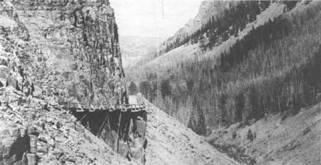
Despite an organized approach to the road work, Yellowstone only received $89,465 for 1899 and 1900. For the first time, the appropriation included a qualifying clause which earmarked $20,000 of the funds for the construction of a road from Yellowstone Lake to the eastern boundary of the forest reserve in the Shoshone Valley. Without receiving his requested appropriation of $300,000, combined with the addition of 50 miles plus of the new road construction, Chittenden did not complete his ambitious plan for 1899; but he began to tackle major projects. He began the multiyear reconstruction of the Golden Gate viaduct, and he began the locational survey and preliminary work on the East Entrance Road (Yellowstone Lake to forest reserve). In addition to construction projects, Chittenden purchased various types of construction equipment and vehicles. [140]
At last in March 1901, Congress made a reasonable appropriation of $113,000 immediately available to Chittenden. Allowed more flexibility to use the money where needed, Chittenden felt that the he was able to get 20 percent more work done, dollar for dollar. By the end of the year, the engineers had begun a road from near Yancey's to Soda Butte and to Tower Falls. Chittenden preferred to call the Soda Butte road (which is part of the Yellowstone River to Cooke City Road) a side road and not an approach road, since there were no plans for it to be used as an approach to Yellowstone. [141] The road through the Gardner Canyon was shifted to the left bank of the river to eliminate a dangerous section. Work continued on the east and south approach roads and construction extended into the Teton Forest Reserve. [142] In addition to general repairs and a few minor projects, Chittenden experimented with the use of sprinkling on a 4-mile stretch of road from above Golden Gate to Swan Lake Flats, to eliminate the ongoing dust nuisance. Chittenden considered this section as "by far the best in the Park, and it is the only section that can strictly be called a completed road." [143]
In estimating his funding needs for 1902-03, Captain Chittenden figured $25,000 in the annual repairs necessary for about 250 miles of road in the Park and the forest reserve. He also faced the overwhelming problem of the road's surface and resulting dust and/or mud. Having three years' experience of seeing the impact caused by the increased visitation on the road surfacing and having completed his experiment with sprinkling, Chittenden put this problem as a high priority. He felt that the resolution was to metal the entire roadbed, using crushed rock or another similarly good material. His goal was to make the surfaces so hard that it would be difficult for ruts to form. This method, Chittenden thought, would reduce the maintenance problem by three-quarters and sprinkling the roads would eliminate any remaining dust. The estimated cost for covering the 18-foot width with an average thickness of 6 inches of crushed rock or gravel was approximately $2,000 per mile or $300,000 total for the necessary principal roads. As an interim measure and a more realistic goal, Chittenden considered finishing only half of the road surface of the most urgent road sections (about 60 miles). Hence for the season beginning in 1903, Captain Chittenden submitted a request for $250,000 for road projects. [144]
While maintenance had been performed on the road system in Yellowstone National Park for a number of years, Capt. Hiram Chittenden can be attributed with giving it a major place in the budget and in the daily operations of the Park. Soon after his return to Yellowstone National Park in 1899, he called for the separation of appropriations into two parts, with one being used strictly for maintenance.
In a speech before the International Good Roads Congress in 1901, Captain Chittenden described the unusual conditions of building and maintaining a road in this very diverse area. The physical conditions of Yellowstone presented the engineers with tough challenges:
The torrential waters of the streams and their susceptibility to springtime flooding had to be reckoned with; the climate of the park falls between two extremes, frequent and heavy rain in the spring and later in the summer, lack of rain causes the road surface to completely dry out and then the travelers suffer from excessive dust; the composition of the soils and rocks in the park "present a greater variety, in all probability, than any other region of like extent upon the face of the globe" (it ranges from the granites to the very softest material of the geyser formations). Chittenden felt that on the whole the material found in the park was "inferior character" for road work. Most of the rock was of volcanic origin and not hard enough to withstand the wagon wheels, the soft geyser formation material was considered worthless, and the soil found over much of the park, contained crystals of black rock, resembling obsidian, which had no adhesive power and was easily cut through by the wagon wheels. [145]
Chittenden explained to the International Good Roads Congress that the roads were principally designed for tourist traffic and secondarily, for use in freight haulage. The main Belt Line's (Grand Loop) limiting gradient was 8 percent, but on the forest reserve to Yellowstone Lake Road, a 10-percent gradient had to be used in places to surmount natural obstacles. A 10-percent gradient was also used in other areas where light vehicles were mainly used. In order to deal with long ascents and help wagon drivers with the strain of holding the brakes on for long periods, level sections were added approximately every half mile. For the most part, curves were designed for more than a 100-foot radius. However in some cases, the radius had to be 50 feet.
The 18-foot road width was flanked by 6-foot ditches or slopes. The normal clearing or right-of-way had been 30 feet. Chittenden found that in some cases more clearing needed to be done on the south side of east and west routes, to allow more sun in to aid in melting the accumulated snow. The ditches proved to be adequate for drainage, and until that point, no blind drains or other methods had been used. In some cases, Chittenden built stone road beds or used corduroy, which was submerged under water, to prevent decay. Because of the dry period and the dust problem during part of the season, the engineers tried to retain moisture and thus did not like to drain the water from the ground.
Chittenden announced to the group that the road system required an enormous number of culverts. Up to that time (1901), most culverts had been built of wood, but he was systematically replacing them with vitrified-clay or iron pipe. The wooden bridges with rock-filled wooden abutments and piers, were being replaced by steel constructed bridges with solid concrete abutments or tubular piers.
Captain Chittenden pointed out that his most serious and pressing problem was road surfacing and the resultant dust and he explained to the gathering his plan for coping with it. Reiterating the problems with the locally available materials, he cited his plan to macadamize the roads in areas where he found good quality, rock or where the hauling distance was not prohibitive. He found that a particular "pinkish" color formation produced an acceptable surfacing material.
In addition to trying to macadamize as much of the system as possible, Chittenden initiated an extensive sprinkling program. Prior to his one year experiment on the Swan Lake Flats section south of Mammoth Hot Springs, Chittenden investigated the use of oiling the roads during visits to San Francisco and Bakersfield, California, where this method was considered a complete success. Despite the variables in weather, and soil conditions and the high cost of transportation, Chittenden felt it might be worth a trial. Chittenden envisioned one oiling per season and he thought that during the wet season, the oil would probably cause the water to run off the roads, thus reducing the mud problems.
In his talk, Chittenden explained that the obvious problem of snow, was not as great as one would think since the visitor season was quite short, June 1 to September 30. The main snow related problem was the spring runoff. In most years, the snow on the main circuit melted by June 1. However, shoveling was resorted to if necessary and the construction of snowsheds was being considered for roads kept open during the winter.
Mileposts and information signs, giving traveler information and identifying objects of interest, had been placed on the main roads; but Chittenden felt it was time to "perfect and embellish" the road system. This highly placed priority would "greatly enhance the beauty and value of the roads." The engineer proposed to clear all dead and downed timber for the distance of 100 feet and to thin the living trees to allow grass to grow among them and to encourage the game that frequented the area. He planned to rebuild the retaining walls with fine masonry and position strong guardrails at the most precarious points; the slopes and cuts would be thoughtfully aligned, and where possible, small water courses would be carried along the routes. Chittenden felt that, "In these and other ways the roads will themselves be made one of the interesting features of this most interesting region." [146]
In Chittenden's closing remarks at the meeting, he emphasized that the completion of a good road system in the Park would probably reduce the ongoing pressures from others to permit railroads or electric railways within the Park. The efforts to introduce the railroads were usually based upon the complaints of disgruntled travelers. The Army engineer relayed to the group a philosophical goal that guided his plans in the Park:
It is not the policy of the Government to permit any undue extension of the road system of the Yellowstone National Park. On the other hand, it is intended to restrict the roads to the absolute necessities of making the more important features accessible. But while it is not proposed to build any roads not actually needed, nor to change in any unnecessary way the original face of the country, it is proposed to make such roads as have to be built as perfect as any mountain roads in the world. . . . It is the purpose of the Government to maintain these reservations as far as possible in their original condition, unchanged by the hand of man. [147]
One aspect of maintenance that Chittenden knew needed serious consideration was supplying and positioning the necessary number of men in the appropriate locations for work. In 1901, the government provided housing and subsistence, for which the workers were paid 40 cents a day. All of the working parties lived in a road camp.
During 1902, work continued on previous years' projects, including the Gardner Canyon Road, the East approach road, the South approach road, the Bunsen Peak Road, reconstructing the Golden Gate, and general repairs and maintenance. The tourists and Captain Chittenden considered the 1901 sprinkling experiment successful. Besides significant reduction in dust, the treatment seemed to discourage the deterioration of the road surface.
The major drawback to the experiment was the poor water supply throughout the Park, which resulted in the construction of six large wooden tanks for filling the sprinkler. [148] Overhead flow was provided into three of the tanks. A platform on the rear of the sprinkler held a two-handled diaphragm force pump. Two men could fill a 750-gallon capacity sprinkler in 15 minutes from a direct connection near the bottom of the tank, which forced the water in. An 18-foot-long, 3-inch hose connected the pump to the tank. The sprinkler's front axle was built 12 inches shorter than the rear axle, allowing the machine to double as a road roller. Generally, the sprinklers ran early in the morning and late in the evening. The choice not to apply water during the sunnier, and in many cases, windier part of the day, resulted in a much lower evaporation rate. Chittenden believed that if a unit could cover 5 miles, the cost for 75 days would be approximately $125 per mile. [149]
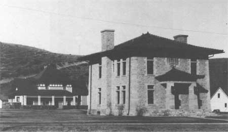
During 1903 and 1904, several of Captain Chittenden's major contributions to Yellowstone National Park were initiated and completed: the Engineers Building, the Yellowstone River Bridge, North Entrance Arch, and the Mount Washburn Road. A number of buildings including the United States Engineering Office, a commissary and storehouse, a machine shop with quarters above, two storage sheds, a stable and a bunk house were built. The stone and concrete Engineers Office, was heated by hot water and was wired for telephones and electricity. [150]
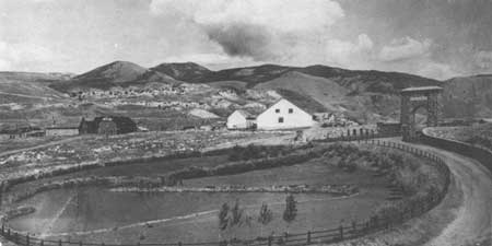
Captain Chittenden felt that the heavily traveled highly visible northern entrance at Gardiner, Montana, deserved an impressive entrance gate. The Northern Pacific Railway's train station, designed by Robert Reamer, had been completed adjacent to the boundary on the western edge of the Gardiner and a new route into the Park was scheduled for construction. Chittenden called Reamer "an architect of great originality and particularly skillful in adapting his work to natural surroundings." [151] Chittenden felt that with the completion of the new rustic design train station, the timing was right to further improve the north entrance with a compatible entrance arch. The railroad and the wagon roads ended in two loops, with the train station placed in between. One side of the station was used to unload the passengers and the other side, for the conveyance of carriages. On the carriage driveway side, an artificial pond was constructed. Approximately 30 feet above the train station grounds, Chittenden constructed the entrance arch.
The gate consists of two square stone towers with a batter of one in thirty, the bottom dimension being 13 feet 3 inches square. The clear space between the towers at the ground is 19 feet 8 inches. It is closed over by an arch, the crown of which is 30 feet above the ground. This arch curtain is 5 feet thick and is built up to the same height as the towers. The entire structure is 50 feet high and is capped with a concrete roof, roughly shingled with the chippings from the cut stone used in arch. The character of the masonry is entirely original. It consists of columnar basalt taken from a quarry nearby in approximately hexagonal prisms. Stones have been used just as found with the least possible dressing, retaining their natural weather worn condition. The points of the prisms project beyond the plan of the face, to the whole structure a novel appearance in a masonry work. The two base courses are roughly cut, as, of course, are the stones in both the small and the large arch openings. The cutting of this stone was a very difficult matter, owing to the extremely hard quality of the rock.
The side of the structure which faces the station is ornamented with three tablets. The largest is 3 feet 10 inches by 20 feet 8 inches, and bears the inscription: "FOR THE BENEFIT AND ENJOYMENT OF THE PEOPLE," an extract from the Act creating the Park. The smaller tablet on the left tower is inscribed, "YELLOWSTONE NATIONAL PARK," that on the right, "CREATED BY ACT OF CONGRESS MARCH 1, 1872." These tablets were molded entirely of concrete. The forms for the letters were manufactured by the Stillwater Manufacturing Company of Stillwater, Minnesota, and were cut out in with great accuracy. They were made so as to give a depressed letter in the concrete and with a triangular cross section so as to be easily removed after the concrete was set. They were nailed upon a suitable frame which was placed in position to close a recess left for the purpose in the masonry. For the larger tablet this space was 18 inches deep, that is 18 inches from the face back into the wall. The concrete used was in the proportions 1 — 2 — 4. A mortar facing was put in at the same time, sufficiently thick to cover the letters. The concrete rested directly upon the masonry below it. As such as the space was filled and before the concrete had set, the course of stones above was laid upon it, so that their weight pressed into the block making it perfectly laid. The forming was held in position by means of rods laid in the wall.
Extending from the center of the arch in both directions for a distance of about 50 feet are two wing walls 12 feet high, terminating in square towers about 14 feet high. From the tower, walls 8 foot high, extend along each branch of the loop to the Park boundary. [152]
The corner stone for the North Entrance Arch (also known as Gardiner Arch) was laid in a ceremony attended by President Theodore Roosevelt on April 24, 1903, and the first visitors passed through the arch on September 1, 1903. [153] A fence was built to protect the newly landscaped pond area from cattle. Grass was sown and shrubbery planted in the entrance gate park, which was irrigated from the Gardner River. During the spring of 1904, the pond had to be dredged to remove the silt that had poured down from the surrounding hills with the snow water. Trees were planted along the new road across from the Gardiner flats. [154]
During 1903-1904, the road received additional work. Since it was the most heavily traveled road, its width was increased to 25 feet and its gradients reduced to 8 percent. The entire road was surfaced with gravel or macadam. Material taken from the steep bluff, 1/2 mile from the entrance gate, was used to surface the first 2-1/2 miles from Gardiner. All culverts were replaced with vitrified clay pipe or cast iron, and four steel bridges with concrete abutments were built. [155]
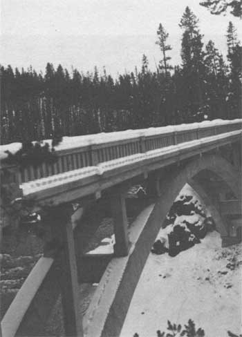
Nine important bridges were constructed in the Park during 1903. The most impressive was the Melan Arch Bridge over the Yellowstone River, above the Upper Falls. The steel and concrete bridge was completed with great difficulty, however, Chittenden felt that this location merited an artistic design because of its prominent location in the Park. For many years, the idea of a bridge in this location had been contemplated, but lack of funds prevented its construction. Chittenden spent considerable time on the site selection. Not wanting to introduce an artificial structure at the most desirable and obvious site, the brink of the Upper Falls where the gap narrows to 50 feet, Chittenden chose a 120-foot span between two jutting rocks, about 1/2-mile above the Upper Falls at the rapids. Despite the volcanic rhyolite rock being of inferior quality for construction, Chittenden stated, ". . . still from the fact that it has resisted for an indefinite geological period the action of the river, it must have considerable stability." [156]
Including dangerous rapids just below, Chittenden had many obstacles to overcome. One of the most serious was the construction of the framework and related framing. All of the rough material was cut locally, but the finer lumber came from the Pacific Northwest. Using a small dynamo, borrowed from the hotel company and connected to the rock-crusher engine and a temporary plant to provide artificial light, the crews were able to complete the concrete work by working around the clock. [157]
Due to the position the bridge had in the public's eye and its unique difficulties, the owners of the Melan arch patent relinquished all royalty payments. Some of the material for this bridge as well as material for the others built that year came from the American Bridge Company. [158]
Work continued on the Mount Washburn Road during 1903, with 10 miles of well-graded road being finished. The section of the road lying under an overhanging cliff near Tower Falls proved to be a difficult section. Working through the winter, this very scenic section was completed. Additional new sections were completed on both sides of Dunraven Pass and a new road replaced a dangerous section near Ox Bow Creek between Tower Falls and Mammoth Hot Springs. The Crescent Hill Canyon Road was widened.
The sprinkling program expanded to include the road from Gardiner to Norris Junction. Sixteen sprinklers were used on approximately 55 miles of roads. [159]
The following year, 1905, was the last full year that Maj. Hiram Chittenden directed the improvements in the Park, before being transferred to Mount Rainier National Park in Washington, to supervise road construction projects there. During his last year, sprinkling had been extended to over 100 miles of park roads. The installation of gravity tanks in various locations on the Belt Line reduced the expense of the extra labor involved in manual pumping. Many road reconstruction projects were underway — widening, resurfacing, cutting down the hills and filling the hollows, and realignments.
One of the most important road projects was completion on the Mount Washburn Road between Tower Falls and the Grand Canyon of the Yellowstone. Chittenden found that the presence of solid rock on most sections of the road made construction very difficult and slow. The road's width ranged from 18 to 20 feet. Other projects involved most of the other sections of the park. [160] Many bridges were built and/or reconstructed during this time. Most of the existing wooden bridges were redecked. [161]
Prior to his departure for Mount Rainier, Major Chittenden summarized the status of the road system and made recommendations for future work in his report to the chief engineer. He stated that all roads that had ever been proposed had been built, a few roads would need minor realignments, the sprinkling program had been completed to the expected level, the dust problem had been largely resolved, and the east and south approach roads would be adequate unless rail facilities were brought closer to the Park in those directions. Chittenden felt that Yellowstone had a good road system in spite of the volume of traffic almost doubling since the turn of the century. However, Chittenden warned that if traffic increased in like proportions in the near future, "a new situation is created, which must be met in the near future." [162]
General recommendations included: widening the 180 miles of Belt Line roads to a width of at least 25 feet; building guard walls where steep sidehill slopes occurred; building the new guard walls in mortar and rebuilding the existing ones in the same manner; clearing dead and downed timber for a width of 100 feet from the roadway as a precaution against fire and as a scenic improvement; continue replacing wooden bridges with steel or concrete bridges; continue replacing wooden culverts with vitrified clay-pipe culverts; possibly modifying the ditches to meet the requests of the stage companies, who wanted at least one side of the road available for possible meeting of runaway coaches or other needs; bringing the western approach road up to the standard of the Belt Line; and continuing maintenance and development.
Chittenden warned that the road surfacing problem remained a cause of concern. He explained that in the past four years, nine-tenths of the Belt Line had been surfaced. Machine crushed rock, hand broken stone and gravel were all used. Chittenden recommended the use of crushed rock for both the foundation and the surfacing material, with subdrainage if necessary. He stated that good gravel, also an excellent material, was easier on horses than rock. Major Chittenden estimated that the cost of surfacing and widening the roads, the construction and reconstruction of the guard walls, building and maintaining the side roads, plus 10 percent contingencies would total $2,023,065. Thus far, the average cost per mile in Yellowstone National Park amounted to approximately $3,000 per mile, compared to the average cost in the Eastern United States of $5,000 to $8,000 per mile. Chittenden's projected estimate would raise the parkwide average to approximately $8,700 per mile. He felt that considering the remoteness of the location, the short construction season, the high transportation costs, the unusual geological conditions, this higher amount was still reasonable. Major Chittenden believed that the future work, spread over 10 years, would result in the park road system rivaling any of the best roads in Europe. Chittenden pointed out that as the Park grew in importance, the demands on the roads would increase. He outlined specific projects that needed attention:
MAMMOTH HOT SPRINGS to NORRIS—great care should be taken in widening the road through the "Hoodoos" to prevent the destruction of unusual rock formations. "It will be better to let the right of way have an irregular alignment—being narrower in some places than in others—than to sacrifice this peculiar formation in order to get a uniform width throughout. . . . it would be better to require all teams to come to a walk there than to remedy the defect by blasting out those picturesque rocks." [163] Forested areas at Apollinaris Springs, a point 8-1/2 miles from headquarters, Crystal Springs, and at mileposts 13, 14, and 17 miles out should be cut back on the east side about 30 feet to expose the snow to the sun. However, if these forests contained fine specimens of trees, the stands should be preserved. The Apollinaris Springs, Kepler Cascade, Mud Geyser and other coach-unloading platforms should be rebuilt and extended to a length of 100 feet.
NORRIS TO FOUNTAIN—the route of the road from Fountain Hotel to Firehole Lake and the Great Fountain Geyser should be changed with great care given in the hot springs vicinity. The wooden bridge at Riverside Geyser should be replaced with an ornamental bridge. The new bridge should be moved downstream a few hundred yards to remove the unnecessary twist in the road.
UPPER BASIN TO THUMB—great care should be given in widening this section of road to prevent ruining the attractive landscape features—the clumps of willow shrubs. "Wherever the openings in the shrubbery permit, the roads should be given extra width, with narrow stretches between the clumps of willows." [164]
LAKE HOTEL TO CANYON—an 18-inch pipe culvert and an embankment should replace the small bridge over the dry ravine 4-1/2 miles below Lake Hotel. Concrete culverts should replace the bridge over Sulphur Creek and the one over a stream to the south of Otter Creek. Eighteen-inch pipe culverts should replace two short bridges on the sidehill grade above the second milepost from the Grand Canyon. The Alum and Otter creek bridges should be rebuilt with shorter spans.
CANYON TO TOWER FALLS—earthen embankments and pipe culverts should replace most of the temporary bridges on this route. In some cases, wooden cribs should support the lower side of the embankments. Chittenden believed that these timber cribs when filled with rocks would last for twenty to thirty years. The Major suggested a possible change to the road location from about 1-1/4 miles south of Dunraven Pass to the top of the ridge, where the climb from the hotel at Canyon ends. The original intent was to build on a near level line, however, the surveyor who was told to run a constant grade between the two points, became leery after seeing that a swampy area lay in his path. Without permission he ran the line above the swamp resulting in a rise and fall of 70 feet on the line. Chittenden did not feel that the difference was that great but, he wrote ". . . nevertheless, the location is not what was intended and not what it ought to be." [165]
TOWER FALLS TO MAMMOTH HOT SPRINGS—if the maintenance to the existing road, which he felt should never have been built in 1898, became excessive due to landslides, a lower route should be constructed.
NORRIS TO CANYON—Chittenden felt that this, the route of worst road in the Park had been ill chosen. However, consideration of the amount of work that had gone into it, and the "fixed termini" discouraged the planning of a new route. Almost the entire route was on native rock; it's character was such that it disintegrated quickly. He felt that the repeated ups and downs gave the road an unattractive appearance. Although the steep grades on Blanding Hill and a steep hill on the slope next to the Grand Canyon had been reduced, he called for the remaining hills and hollows to be evened.
SOUTHERN APPROACH—Chittenden recommended that instead of the road terminating at the mouth of the Buffalo Fork in Snake River, a road should be built at the foot of Jackson Lake then over the Teton Pass to the forest reserve boundary. This would give access to southeastern Idaho.
WESTERN APPROACH—due to the proposed construction of a new railroad station and the proposed hotel to be built at Riverside, a short section of road had to be relocated. Chittenden suggested that "While the ground would probably admit a single tangent over the entire relocation, it is recommended that whoever lays out the road adopt a sinuous line, so as to shorten the view ahead and enhance the interest to travelers." [166]
Major Chittenden believed that the sprinkling program served three important purposes. The primary purpose was to the eliminate the problem of dust; secondarily, the sprinkling aided in the maintenance of the roads, as prolonged droughts caused rapid deterioration of the surfaces; and since most of the manmade fires were in close vicinity of the roads, the repeated passing of the sprinkling wagons assisted in spotting the fires soon after their inception.
Chittenden proposed the construction of road camps for crews of 13 to 15 men including a cook. Besides bunkhouses and mess halls, the camps should have buildings in which to store forage. In order to avoid damaging the roads by hauling forage during the spring when they were soft, Chittenden felt the forage should be stored during the fall. His idea was for two crews to work from one camp, with each crew responsible for about five miles of road. The road camps would be situated approximately 8 to 10 miles apart. Chittenden felt that if this scheme were carried out, the Park would have a systematic method for general maintenance, sprinkling, and development of the road system.
Chittenden called for Yellowstone National Park to be made a separate district within the Army Corps of Engineers because he felt that the amount of work required in Yellowstone was hampered by the additional duties assigned for projects outside the park boundaries. He recommended that all work be continued with the use of hired labor. His experience with contractors had always been unsuccessful, thus he suggested that the hiring of teams be done in the open market at a fixed rate schedule. In 1905, the hiring of teams was the only type of contract labor remaining. [167]
Chittenden warned the chief engineer that the proposals by the people of Bozeman and Red Lodge, Montana, for two new roads into the Park were objectionable to him. He believed that Yellowstone had enough roads and that the four existing approach roads met the needs of the public. The two roads proposed by the citizens of the two communities would be "of local importance mainly, and as such are not justified as public measures." Chittenden estimated that both roads, which would have to cross high country, would only be available for travel for an average of two months a year. He figured the Red Lodge to Cooke City Road would cost approximately $80,000 plus maintenance, and the Bozeman road through the northwest part of the Park would cost approximately $50,000 plus maintenance. Chittenden wrote, "It would be bad policy to increase that burden unless there is positive public necessity for it. It will be a great deal better to develop and perfect the present system of roads than to extend it unduly." [168]
|
|
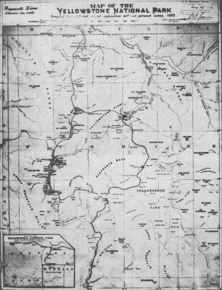
Yellowstone National Park — 1892 Courtesy Yellowstone National Park Archives |
|
|
Hiram Chittenden, U.S. Army Corps of Engineers Courtesy Yellowstone National Park Archives |
|
|
Gardiner, Montana, 1904 Courtesy Yellowstone National Park Archives |
|
|
U.S. Army Corps of Engineers Office — Chittenden Residence in Background, 1905 Courtesy Yellowstone National Park Archives |
|
|
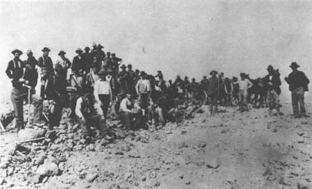
Road Crews on Mt. Washburn, 1903 Courtesy Yellowstone National Park Archives |
|
| Chittenden Bridge |
|
|
Golden Gate Viaduct, late 1880s Courtesy Yellowstone National Park Archives |
|
|
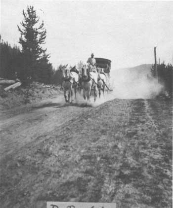
Stage Coach and Dust on Park Road, ca. 1900 Courtesy Yellowstone National Park Archives |
|
|
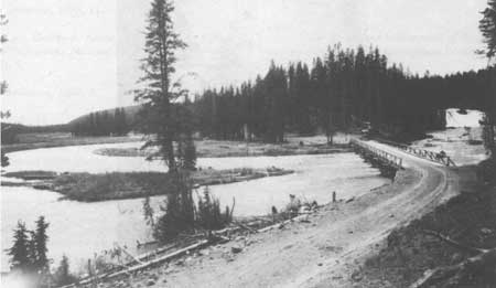
Lewis River Bridge, 1905 Courtesy Yellowstone National Park Archives |
|
|
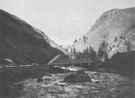
Middle Gardner River Bridge, early 1900s Courtesy Yellowstone National Park Archives |
|
|
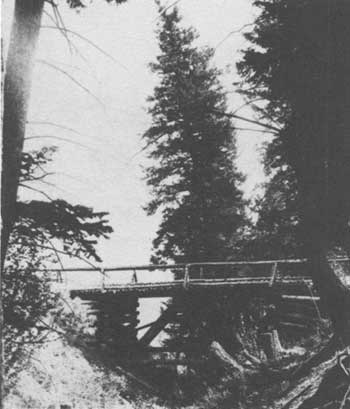
Middle Gardner River Bridge on Hill Road to Gardiner Montana, early 1900s Courtesy Yellowstone National Park Archives |
CHAPTER III:
ENDNOTES
121. Capt. George S. Anderson, Report of the Superintendent of the Yellowstone National Park to the Secretary of the Interior, 1891 (Washington, D.C.: Government Printing Office, 1891), 6.
122. Capt. George S. Anderson, Report of the Superintendent of the Yellowstone National Park to the Secretary of the Interior, 1892 (Washington, D.C.: Government Printing Office, 1892), 3 and 5.
123. Maj. W. A. Jones, Corps of Engineers, "7th Indorsement U.S. Engineer Office, Saint Paul, Minnesota, November 14, 1892."
125. Capt. George S. Anderson, Annual Report of the Superintendent of Yellowstone National Park to the Secretary of the Interior, 1893 (Washington, D.C.: Government Printing Office, 1893), 8.
127. Capt. George S. Anderson, Report of the Acting Superintendent of the Yellowstone National Park to the Secretary of the Interior, 1894 (Washington, D.C.: Government Printing Office, 1894), 8.
128. Capt. George S. Anderson, Report of the Acting Superintendent of the Yellowstone National Park to the Secretary of the Interior, 1895 (Washington, D.C.: Government Printing Office, 1895), 8.
130. Capt. George S. Anderson, Report of the Officer in Charge of Construction and Maintenance of Roads, Etc., in the Yellowstone National Park to the Secretary of War, 1896 (Washington, D.C.: Government Printing Office, 1896), 5.
133. Col. S. B. M. Young, 3rd Cavalry, Report of the Acting Superintendent of the Yellowstone National Park to the Secretary of the Interior, 1897 (Washington D.C.: Government Printing Office, 1897), 4. Bridges built in 1897: (1) Trout Creek, (2) Firehole River at Riverside Geyser, (3) over ravine near West Thumb, (4) Gibbon River in Virginia Meadows, (5) Green Creek, (6) footbridge over Firehole River near Biscuit Basin, and (7) over east branch of Gardner River above Undine Falls.
134. Col. S. B. M. Young to the Quartermaster General, 13 August 1897. Yellowstone National Park Archives, Yellowstone National Park.
136. Young, Report of Acting Superintendent, 1897, 24. There is little historical documentation relating to this commission.
138. Capt. James B. Erwin, Report of the Acting Superintendent of the Yellowstone National Park to the Secretary of the Interior, 1898 (Washington, D.C.: Government Printing Office, 1898).
139. Hiram Chittenden, "Roads in Yellowstone National Park," - Senate, 226, 50th Congress, 1st Session. Acting Secretary of War Transmitting in Response to Resolution of the Senate of March 12, 1900, Letter from Chief of Engineers, U.S.A., Together with the Copies of Originals of All Reports Relating to the Present Condition and Appropriate Plans for the Development of the System of Roads in the Yellowstone National Park. The monies would cover:
| 1. New road in Gardner Canyon, including three steel bridges | $10,000 |
| 2. Road through Golden Gate Canyon, including new steel bridge to replace wooden bridge around cliff, and widening road along cliff, the latter all solid rock | 15,000 |
| 3. Raising (sic) 3 miles of road in Gibbon Canyon and cutting out 1 mile of dangerous grades; also opening 4 miles of new road down the Gibbon to connect with the western approach | 16,000 |
| 4. Completion of 8 miles of road near Fountain Hotel | 8,000 |
| 5. Completion of southern approach along Snake River 20 miles | 20,000 |
| 6. New road from West Thumb to Natural Bridge, cutting out present line around Lake Shore, 8 miles | 16,000 |
| 7. Surfacing new road from Lake Hotel to Grand Canyon, 15 miles | 6,000 |
| 8. New bridge across the Yellowstone, near the falls | 20,000 |
| 9. New road down right bank of Grand Canyon, 3 miles | 6,000 |
| 10. New road near Grand Canyon to cut out dangerous hills | 5,000 |
| 11. New road, Canyon to Norris, 10 miles | 20,000 |
| 12. New road, Grand Canyon via Tower Falls to Mammoth Hot Springs, 36 miles | 72,000 |
| 13. New bridge over Yellowstone near Tower Falls | 10,000 |
| 14. New bridge over Lamar River | 5,000 |
| 15. Completion of east approach, 15 miles | 15,000 |
| 16. New plant | 5,000 |
| 17. New office and other buildings | 5,000 |
| 18. Current repairs and maintenance for season of 1900 | 10,000 |
| 19. New bridges at various points, six needed at once | 12,000 |
| 20. Office, Transportation, and miscellaneous expenses | 10,000 |
| 21. There should also be added for clearing out and rendering more easily passable the numerous trails throughout the park, which are essential to its proper police and protection | 5,000 |
| TOTAL | 300,000 |
Annual Reports Upon the Construction, Repairs, and Maintenance of Roads and Bridges in the Yellowstone National Park and Construction of Military Roads from Fort Washakie to Mouth of Buffalo Fork of Snake River, Wyoming, and Erection of Monument to Sergeant Charles Floyd in the Charge of Hiram A. Chittenden, Captain, Corps of Engineers, Appendixes FFF and JJJ of the Annual Report of the Chief of Engineers for 1901 (Washington, D.C.: Government Printing Office, 1901).
140. Chittenden, Annual Reports Upon the Construction, Repairs, and Maintenance of Roads and Bridges in the Yellowstone National Park and Construction of Military Roads from Fort Washakie to Mouth of Buffalo Fork of Snake River, Wyoming, and Erection of Monument to Sergeant Charles Floyd in the Charge of Hiram A. Chittenden, Captain, Corps of Engineers, Appendixes FFF, III, and JJJ of the Annual Report of the Chief of Engineers for 1901, 3778-3780. Additions to the plant were two and 1 single-seated surrey for inspections uses, 1 boom derrick with complete fittings, 1 hoisting engine, 2 dump carts, 2 hovelcarts, 1 pile-driving outfit, 6 wheel scrapers, and 63 tents.
141. Ibid., 3,784 and 3,787-3,788.
142. Chittenden to Brigadier General G.L. Gillespie, Chief of Engineers, U.S. Army, 7 December 1901, 1-2. Yellowstone National Park Archives, Yellowstone National Park.
144. Chittenden, Annual Reports Upon the Construction, Repairs, and Maintenance of Roads and Bridges in the Yellowstone National Park and Construction of Military Roads from Fort Washakie to Mouth of Buffalo Fork of Snake River, Wyoming, and Erection of Monument to Sgt. Charles Floyd in the Charge of Hiram A. Chittenden, Captain, Corps of Engineers, Appendixes FFF, III, and JJJ of the Annual Report of the Chief of Engineers for 1901, 73.
145. Chittenden, The Government Road System of the Yellowstone National Park, U.S. Department of Agriculture Public Road Inquiries — Bulletin No. 21. Proceedings of the International Good Roads Congress held at Buffalo, New York, September 16-21, 1901 (Washington, D.C.: Government Printing Office, 1901), 73.
148. Hiram Chittenden, Annual Reports Upon the Construction, Repairs, and Maintenance of Roads and Bridges in the Yellowstone National Park and Construction of Military Roads from Fort Washakie to Mouth of Buffalo Fork of Snake River, Wyoming, and Erection of Monument to Sgt. Charles Floyd in the Charge of Hiram A. Chittenden, Captain, Corps of Engineers, Appendixes FFF and III of the Annual Report of the Chief of Engineers for 1902 (Washington, D.C.: Government Printing Office, 1902), 3,037 and 3,038.
Approximate location of the six wooden tanks:
1. one from the Fort Yellowstone water supply,
2. one from the overflow from the hot springs under Jupiter Terrace,
3. one about 1-1/2 miles up the hill, from a small spring near the road,
4. one a half of a mile farther, one from another small spring on the roadside,
5. one from a large spring 3/4 of a mile farther on, but about 500 feet from the road and considerably below it,
6. one from Glenn Creek above Golden Gate.
150. Hiram Chittenden, Annual Reports Upon the Construction, Repairs, and Maintenance of Roads and Bridges in the Yellowstone National Park and Construction of Military Roads from Fort Washakie to Mouth of Buffalo Fork of Snake River, Wyoming, and Erection of Monument to Sgt. Charles Floyd in the Charge of Hiram A. Chittenden, Captain, Corps of Engineers, Appendixes GGG and KKK of the Annual Report of the Chief of Engineers for 1903 (Washington, D.C.: Government Printing Office, 1903), 2888-2889. The Engineers Office is adjacent to the Mammoth Hot Springs Hotel and across the esplanade from the Albright Visitor Center.
151. "Technical Report Upon the Improvement of Yellowstone National Park, 1904, 50." This document does not list an author, however, it is presumed to have been written by Captain Hiram Chittenden U.S. Army Corps of Engineers.
153. Hiram Chittenden, Annual Reports Upon the Construction, Repairs, and Maintenance of Roads and Bridges in the Yellowstone National Park and Construction of Military Roads from Fort Washakie to Mouth of Buffalo Fork of Snake River, Wyoming, and Erection of Monument to Sgt. Charles Floyd in the Charge of Hiram A. Chittenden Captain, Corps of Engineers, Appendixes FFF and KKK of the Annual Report of the Chief of Engineers for 1904 (Washington, D.C.: Government Printing Office, 1904), 4,171, for 1903 2,889.
156. "Technical Report . . . 1904," 58.
157. After considerable controversy the bridge was removed in 1962.
158. Chittenden, Annual Reports Upon the Construction, Repairs, and Maintenance of Roads and Bridges in the Yellowstone National Park and Construction of Military Roads from Fort Washakie to Mouth of Buffalo Fork of Snake River, Wyoming, and Erection of Monument to Sgt. Charles Floyd in the Charge of Hiram A. Chittenden, Captain, Corps of Engineers, Appendixes FFF, KKK, and JJJ of the Annual Report of the Chief of Engineers for 1903, 2893, for 1904, 4174.
Other bridges built with material from American Bridge Company:
Yellowstone River Bridge near Yancy's
Gardner River Bridge near Mammoth Hot Springs
Gardner River Bridge near 7th Milepost south of Mammoth Hot Springs
Firehole River Bridge 1/2 mile above Excelsior Geyser
Gibbon River Bridge near 6th Milepost south of Norris
Cascade Creek Bridge near Grand Canyon of the Yellowstone River
159. Ibid., 1903, 2289, 1904, 4171.
160. Hiram Chittenden, Annual Report Upon the Construction, Repairs, and Maintenance of Roads and Bridges in the Yellowstone National Park in the Charge Of Hiram A. Chittenden, Captain, Corps of Engineers, Appendixes GGG and KKK of the Annual Report of the Chief of Engineers for 1905 (Washington, D.C. :Government Printing Office, 1905), 2809 and 2810.
161. Ibid., 1905: The following bridges have been built:
The 5-spanded steel-arch bridge over the Middle Gardner River, the erection of which was in progress at the date of the last annual report, was finally completed.
The steel truss over the same river at the 7-mile post between Mammoth Hot Springs and Norris was also constructed.
Steel-truss bridges were built over Nez Perce Creek near the Fountain Hotel, and over the Firehole River, above Excelsior Geyser.
A fine steel-arch bridge was erected over Tower Creek, where the road crosses a short distance above Tower Falls.
Several wooden bridges were also built, the principal ones being the following:
A large crib structure without trusses over the Lamar River on the Cooke City road.
Bridges over the Big and Little Blacktail creeks on the road between Mammoth Hot Springs and Tower Falls. Reconstruction of the bridge over the Gibbon River at Norris. Reconstruction of two bridges over the Firehole River, one on the old road from the Lower Basin to Excelsior Geyser, and the other just above the upper Geyser Basin.
Relocation and reconstruction of bridges over Trout and Antelope creeks.
Construction of a new bridge over Grinnell Creek on the East road and the construction of a viaduct, by which the road down the mountain on the east side of Sylvan Pass is made to pass over itself, in order to secure the necessary reduction of gradient. Numerous small bridges have been built or reconstructed and most of the existing wooden bridges have been redecked.
1906: The following bridges had been built:
The wooden bridges over Gibbon River near Norris, the Firehole River on the old freight road near the Fountain Hotel, and over the same stream above the Upper Geyser Basin were reconstructed.
A 150-foot wooden viaduct was built at the east end of Sylvan Pass on the East road.
A new wooden bridge was erected over Grinnel Creek on the east road. All of the old bridges and culverts on the East road were inspected and necessary repairs made.
An attractive footbridge of rustic design was constructed over the small stream between the Castle Geyser and Old Faithful Inn. Many vitrified clay-pipe culverts were laid during the season, but the work of replacing the old wooden culverts with clay pipe was not extended as far as desireable, owing to lack of funds.
162. Chittenden, "Annual Report of the Chief of Engineers for 1905," 2,816.
| <<< Previous | <<< Contents>>> | Next >>> |
hrs-roads/chap3.htm
Last Updated: 20-Apr-2016