|
YUKON-CHARLEY RIVERS
Yukon Frontiers Historic Resource Study of the Proposed Yukon-Charley National River |

|
HISTORIC SITES IN PROPOSED YUKON-CHARLEY NATIONAL RIVERS
The historical significance of the Yukon-Charley area derives not from a single nationally significant site but from a whole spectrum of sites expressive of several broad historical themes. The upper Yukon represents a great chunk of Alaskan and American history that the historical narrative treated in the light of national, state, and local themes. It belies the common assumption that the Yukon is important only as part of the gold-rush story. Other themes—the fur trade, English-Russian-American relations, aboriginal uses and lifestyles, the rise and development of towns, border amicability with Canada, twentieth-century mining and trapping, and international activities such as the telegraph, trails, steamboats, and mail delivery—historians have largely ignored.
Several National Park Service historical themes and subthemes are represented in Yukon-Charley. Primarily the area illustrates the Westward Expansion theme with most of its subthemes, but it also depicts Original Inhabitants, European Exploration and Settlement, America at Work, and Society and Social Conscience. Moreover, several sites are associated with people of state, local, and even national significance, such as Roald Amundsen, Billy Mitchell, Robert Campbell, James Wickersham, Ed Biederman, Ernest Patty, Jack McQuesten, and Father Monroe. Enough fabric remains to illustrate and commemorate these themes and people not with one site but with a series of sites whose individual significance merits less than national attention but as a district, viewed as a continuum, attracts national interest if not significance.
Although expensive, at least one site illustrative of each theme should be preserved and interpreted. Fortunately each site within the proposal retains its integrity. Many sites from the earlier epochs, however, have been lost to the ravages of time and nature or to succeeding generations that have salvaged the older sites for valuable and reusable parts. Others, however, such as the modern trapping period, have a number of similarly constructed buildings that local traditions characterize with different stories, events, and individuals.
The following thumbnail sketches locate, describe, and evaluate individual sites that the historical narrative has broadly interpreted. Although each site adds flavor, details, and human interest, some are more significant than others. Thus, some merit National Register nomination while others best illustrate the passage of time and the fragility of human history.
|
|
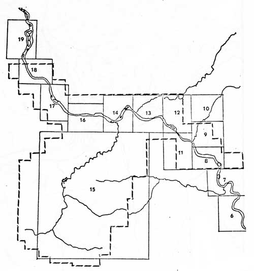
MAP 5. MASTER MAP SHOWING INDIVIDUAL SITE MAPS AND PROPOSED BOUNDARIES
FOR YUKON-CHARLEY NATIONAL RIVERS (click on image for a PDF version) |
|
|
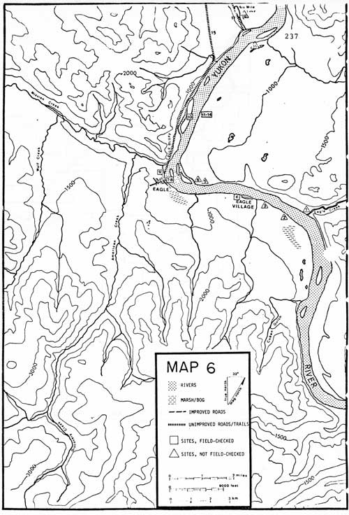
MAP 6. (click on image for a PDF version) |
#1 OLD PORCUPINE'S FISH CAMP
LOCATION:
Old Porcupine's Fish Camp is 4-1/2 miles up the Yukon
River from Eagle or 2 miles from Eagle Village and 1/2 mile
downriver from Eagle Creek, on the right bank of the river.
SIGNIFICANCE:
Local significance.
PLACE IN HISTORY:
Old Porcupine's Fish Camp represents the traditional
fish camp of the Han Indians during the late nineteenth and early
twentieth centuries. The location of this fish camp is indicative of the
summer settlement patterns of the people. Archeological investigation of
some of the fish camps from this area might provide valuable information
on the life ways of the Han as they were involved in the taking of one
of their major food resources - salmon.
CONDITION:
This site was obtained through oral research for
Section 14(h)(1) of the Alaska Native Claims Settlement Act that allows
selections of historic sites by regional corporations. This site was not
visited, thus, it's condition is unknown. This may be a Native
allotment.
TREATMENT:
This site should be visited, and recommendations
regarding preservation determined after a full evaluation has been done
even though this fish camp is outside the proposed park.
SOURCE:
Elizabeth Andrews' 14(h)(1) survey.
#2 CHARLIE STEVEN'S FISH CAMP
LOCATION:
Charlie Steven's Fish Camp is 1-1/2 miles above
Eagle Village or 4 miles above Eagle, on left bank of the Yukon.
SIGNIFICANCE:
Local significance.
PLACE IN HISTORY:
Charlie Steven's Fish Camp represents the traditional
fish camp of the Han Indians during the late nineteenth and early
twentieth centuries. The location of this fish camp is indicative of the
summer settlement patterns of the people. Archeological investigation of
some of the fish camps from this area might provide valuable information
on the life ways of the Han as they were involved in the taking of one
of their major food resources - salmon.
CONDITION:
This site was obtained through oral research for
Section 14(h)(1) of the Alaska Native Claims Settlement Act that allows
selections of historic sites by regional corporations. This site was not
visited, thus, it's condition is unknown. This may be a Native
allotment.
TREATMENT:
This site should be visited, and recommendations
regarding preservation determined after a full evaluation has been done
even though this fish camp is outside the proposed park.
SOURCE:
Elizabeth Andrews' 14(h)(1) survey.
#3 SELINA JOSEPH'S FISH CAMP
LOCATION:
Selina Joseph's Fish Camp is 3/4 mile upriver from
Eagle Village or 3 miles from Eagle on the left bank of the Yukon near
the mouth of Buckeye Creek.
SIGNIFICANCE:
Local significance.
PLACE IN HISTORY:
Selina Joseph's Fish Camp represents the traditional
fish camp of the Han Indians during the late nineteenth and early
twentieth centuries. The location of this fish camp is indicative of the
summer settlement patterns of the people. Archeological investigation of
some of the fish camps from this area might provide valuable information
on the life ways of the Han as they were involved in the taking of one
of their major food resources - salmon.
CONDITION:
This site was obtained through oral research for
Section 14(h)(1) of the Alaska Native Claims Settlement Act that allows
selections of historic sites by regional corporations. This site was not
visited, thus, its condition is unknown. This may be a Native
allotment.
TREATMENT:
This site should be visited, and recommendations
regarding preservation determined after a full evaluation has been done
even though this fish camp is outside the proposed park.
SOURCE:
Elizabeth Andrews' 14(h)(1) survey.
#4 EAGLE VILLAGE
LOCATION:
Eagle Village is indicated by name on the Eagle
Quadrangle, scale 1:250,000 and Eagle (D-1), scale 1:63,360. It is
on the left bank of the Yukon River, 9 miles from the Canadian
border.
SIGNIFICANCE:
Regional significance.
PLACE IN HISTORY:
In 1883 Lt. Frederick Schwatka first documented a
fishing village as Johnny's Village which may be Eagle Village or the
site maybe near its vicinity. Early traders, however, had been drawn to
the Han Village before Schwatka's trip. The Mercier brothers and Arthur
Harper had trading posts near the village to exchange goods with the
Indians. The arrival of the gold-rush miners changed the traders
philosophy but the Han Indians had become dependent on the trade
items, thus, continued their barter. The building of Fort Egbert, the
telegraph line, and the boundary survey all had additional impacts on
traditional lifestyles. By 1932, Cornelius Osgood, ethnographer,
discovered that much of the Han culture had been lost. White man's
education and religion helped to separate the Indian from his
traditional culture. Eagle Village is the only Han Indian village on
American soil.
CONDITION:
The village houses have changed a number of times
since Schwatka first recorded Johnny's Village. Currently the buildings
are of frame and log construction without regard to traditional
materials. Money obtained from the Native Claims Settlement Act and
loans or funds from certain government agencies have started some remodeling. The village
appears in a state of transition.
TREATMENT:
The village is an important element in the history of
the Yukon River. Its story should be told along with the white history
of Eagle and Fort Egbert. Since the community is changing, some guidance
might be lent by the National Trust for Historic Preservation or NPS in
evaluating those structures worthy of preservation, even
restoration.
SOURCE:
Frederick Schwatka; James Wickersham Leroy McQuesten;
Eagle City Records; Cornelius Osgood.
#5 WALTER BENJAMIN'S FISH CAMP
LOCATION:
Walter Benjamin's Fish Camp is 1-1/2 miles downriver
from Eagle Village and 1-1/2 miles upriver from Eagle on the right
bank of the Yukon.
SIGNIFICANCE:
Local significance.
PLACE IN HISTORY:
Walter Benjamin's Fish Camp represents the
traditional fish camp of the Han Indians during the late nineteenth and
early twentieth centuries. The location of this fish camp is indicative
of the summer settlement patterns of the people. Archeological
investigations of some of the fish camps from this area might provide
valuable information on the life ways of the Han as they were involved
in the taking of one of their major food resources - salmon. Walter
Benjamin was Cornelius Osgood's Drincipal informant for The Han
Indians and was a Native minister of the Episcopal Church. He died
in 1951.
CONDITION:
This site was obtained through oral research for
Section 14(h)(1) of the Alaska Native Claims Settlement Act that allows
selections of historic sites by regional corporations. This site was not
visited, thus, its condition is unknown. This may be a Native
Allotment.
TREATMENT:
This site should be visited, and recommendations
regarding preservation determined after a full evaluation has been done even
though this fish camp is outside the proposed park.
SOURCE:
Elizabeth Andrews' 14(h)(1) survey.
#6 PETER LUNDEEN'S FARM
LOCATION:
The farm is across the Yukon River from Eagle near
the upriver end of Lundeen Slough.
SIGNIFICANCE:
Local significance.
PLACE IN HISTORY:
Lundeen's was an unusually large farm for the Yukon
River. It provided fresh produce, milk, and eggs for the military at
Fort Egbert from about 1900 to 1910.
CONDITION:
Unusually large and well constructed buildings remain
but all without their roofs. Among them are a two-story barn, a large
house, a small out-building and a chicken coop. Without roofs many of
the walls have fallen. The once cleared fields have returned to the
forest.
TREATMENT:
Restoration is not advised. Preservation would be
recommended of this unusual site. Pragmatically, however, the costs of
replacing the roofs and securing the walls of a site not within the
borders of Yukon - Charley proposed park would be prohibitively high. It
is unlikely that state or private monies would be available for
preservation. This may be a Native allotment.
SOURCE:
C.A. Bryant.
#7 NIIBEEO ZHOO
("place of skin-houses")
LOCATION:
The village is on the outskirts of Eagle less than
1/2 mile from the center of town.
SIGNIFICANCE:
Regional significance.
PLACE IN HISTORY:
This is the only Han Indian archeological site
excavated by professional archeologists. The site may have been occupied
as early as 1860 but was abandoned before the establishment of Fort
Egbert in 1899. Artifact recovery consisted of items of Native and
non-Native manufacture including several stone skin scrapers, one skin
flesher, bone arrowpoint, 2000 glass trade beads, various sizes of
cartridge cases, glass and metal buttons, a muzzle-loading gun barrel,
a metal trap, and a pair of scissors. The site is also one of the few
house sites of the early historic period that has been excavated.
CONDITION:
The site contained 7 house depressions. The houses
were elliptical in shape approximately 22 by 15 feet. Structural remains
indicate that the frame consisted of diamond willow timbers and branches
lashed together. Each house contained a central hearth about 3 feet in
diameter. One house may have been used as a sweatbath. The site had been
overgrown with willow and alder and was not discernable as an
archeological site.
TREATMENT:
Analysis of the excavation is still progressing. The
site is of sufficient significance and importance to be nominated to the
National Register. Since the site is now recognized, it should be
protected from pot-hunters. Preservation is strongly recommended. The
site is outside Yukon - Charley's proposed boundaries.
SOURCE:
Elizabeth Andrews.
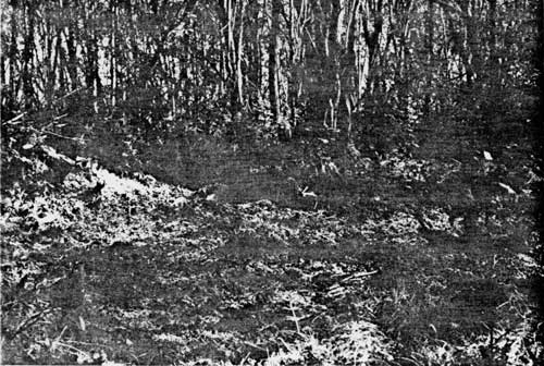
|
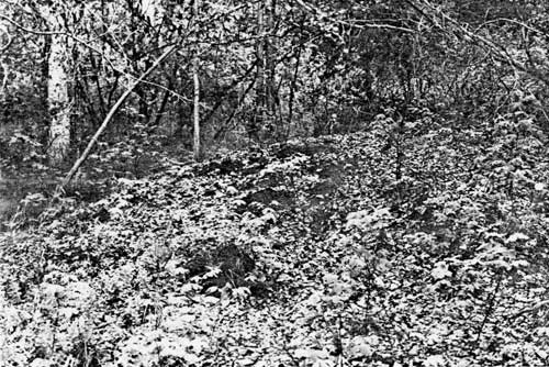
| PLATE 1. #7 Niibeeo Zhoo, view to the west of House pit 4, vegetative cover cleared. |
#8 EAGLE - FORT EGBERT
LOCATION:
Eagle is located on the left bank of the Yukon River
approximately 12 miles from the Canadian boundary. It is indicated by
name on Eagle Quadrangle, scale 1:250,000 and (D-1), scale 1:63,360.
SIGNIFICANCE:
State significance.
PLACE IN HISTORY:
Eagle or Belle Isle was founded in 1880's as a
trading post for the nearby village of Han Indians. With the 1897
Klondike gold rush Eagle became a mining supply center for mines in the
surrounding area. The Army established Fort Egbert in 1899 to maintain
law and order along the upper reaches of the Yukon River. At the same
time, the first judicial seat in Alaska's interior was established under
Judge James V. Wickersham. In 1901 Eagle became the second incorporated
city in Alaska. The Washington Alaska Military Cable and Telegraph System
joined Eagle and Valdez and later the continental United States. Ronald
Amundsen in 1905 telegraphed from Eagle his successful discovery of the
Northwest Passage. Steamboats plying the Yukon made Eagle an important
supply center. The 1902 stampede to Fairbanks brought a decline in
population, and Wickersham moved the judicial seat to Fairbanks. Fort
Egbert closed up most of the post in 1911. The wireless telegraph
required less trail and line maintenance. Finally the Alaska Railroad
killed the Yukon River steamboat traffic. Eagle went from the hub of
Yukon military, judicial, communication and transportation concerns to a
small supply town for a few persevering miners.
CONDITION:
The city and fort complex exude a frontier
flavor practically undisturbed by modern intrusions. The 5 buildings on
Fort Egbert are currently being restored as is the Wickersham
Courthouse. There are hospital ruins and archeological remains for most
of the fort's demolished buildings. The city is attempting to keep its
flavor despite new construction.
TREATMENT:
The National Trust for Historic Preservation and the
Bureau of Land Management have formulated preservation plans for the
city - fort complex. The district is already on the National Register.
Since this is an important historic site adjacent to Yukon - Charley
proposal, cooperation with federal and private concerns is
recommended.
SOURCE:
James Wickersham; National Register Nomination; Melody Grauman.
#9 EAGLE BLUFF SITE
LOCATION:
The site is on the bluff at the end of Fort Egbert
parade ground approximately 1/4 mile from the center of Eagle.
Eagle is indicated by name on Eagle Quadrangle, scale 1:250,000 and
Eagle (D-1), scale 1:63,360.
SIGNIFICANCE:
Local significance.
PLACE IN HISTORY:
The archeological site known as Tsi-tao a
tai-n meaning "place where the water hits the point coming down" is
an old village site. Informants and survey archeologists estimate the
period as prehistoric and early historic. The site might yield
additional information regarding the Han at the time of contact.
CONDITION:
The site's integrity is very poor. It is found at the
end of Fort Egbert's parade ground. The building of the fort and the
subsequent construction of the airstrip have compromised the site and
may have destroyed a portion of it. Furthermore, general erosion of the
bluff by the elements has probably lost even more.
TREATMENT:
The site should be archeologically salvaged before
nature and pot-hunters destroy what little remains. The information on
the Han is so sparse that any little bit will add considerably to the
data base. Since the site is close to the center of town, the site
should be protected. The site is outside the proposal's boundaries.
SOURCE:
Elizabeth Andrews' 14(h)(1) survey.
#10 JOE MALCOLM'S FISH CAMP
LOCATION:
Joe Malcolm's Fish Camp is 4-3/4 miles downriver from
Eagle Village or 2-1/4 miles from Eagle on the river side of the
large island.
SIGNIFICANCE:
Local significance.
PLACE IN HISTORY:
Joe Malcolm's Fish Camp represents the traditional
fish camp of the Han Indians during the late nineteenth and early
twentieth centuries. The location of this fish camp is indicative of the
summer settlement patterns of the people. Archeological investigation of
some of the fish camps from this area might provide valuable information
on the life ways of the Han as they were involved in the taking of one
of their major food resources - salmon.
CONDITION:
This site was obtained through oral research for
Section 14(h)(1) of the Alaska Native Claims Settlement Act that allows
selections of historic sites by regional corporations. This site was not
visited, thus, it's condition is unknown.
TREATMENT:
This site should be visited, and recommendations
regarding preservation determined after a full evaluation has been done
even though this fish camp is outside the proposed park.
SOURCE:
Elizabeth Andrews' 14(h)(1) survey.
#11 BOB STACEY'S FISH CAMP
LOCATION:
The fish camp is 2-1/4 miles downriver from Eagle
on the right bank of the Yukon.
SIGNIFICANCE:
Local sigificance.
PLACE IN HISTORY:
The fish-drying racks and log-ribbed fish caches
provide an example of an on-going traditional Native subsistence
activity. Fish wheels and gill nets have been used since early historic
times. The presence of no permanent structure suggests the typical
tent-camp lifestyle. Oral traditions tell of day-to-day activities,
not just economic and subsistence involvement, but social and kinship
relationships as well.
CONDITION:
The fish camp is in good condition. The drying racks
are standing. The site is not old but rather may occasionally be used
today.
TREATMENT:
Preservation would consist of protecting the site
from vandals. Since the site is visible from the river and since this is
a Native allotment, it is unlikely that the site will remain unchanged.
This site is outside the proposed boundaries.
SOURCE:
David Evans.
Photograph.
#12 FISH WHEEL BASKETS AND POSSIBLE CACHE
LOCATION:
The fish wheel baskets are 2-1/4 miles from Eagle
on the right bank of the Yukon.
SIGNIFICANCE:
Local significance.
PLACE IN HISTORY:
The baskets are characteristic of large baskets of a
by-gone era when large quantities of salmon were caught for winter
supplies and to feed large dog teams. More recent fish-wheel baskets are
smaller.
CONDITION:
The baskets measure 10 feet high and 8 feet long. The
frame is covered with 2-inch-square chicken wire. One side is more or
less complete; the other is in disrepair. Nearby is a small
3-foot-square cache that stands only 2 logs high. Three 55-gallon
barrels of the heavy metal variety were left in the area. It lies only
15 yards farther downriver from Stacy's fish camp. This may be a Native
allotment.
TREATMENT:
No treatment suggested unless the Biederman fish
baskets are lost or destroyed. If that should happen, these baskets
should be evaluated for preservation as an example of a lifestyle and
craft no longer practiced to that great an extent. This site is outside
the proposed area.
#13 MAN MADE DRAINAGE DITCH
LOCATION:
The ditch is 2-1/4 miles downriver from Eagle on
the right bank of the Yukon.
SIGNIFICANCE:
Unknown significance.
PLACE IN HISTORY:
It is uncertain what this man-made feature represents
or why it was constructed, thus, its place in history is unknown.
CONDITION:
Between the fish camp and the cabin depression lies a
50-yard-by-15-yard-square ditch. The ditch is 2 feet deep with all
the dirt piled on the inside side of the square. There are no remains of
any other structures. The ditch could have served for drainage or
fencing purposes.
TREATMENT:
No treatment is recommended. This site is also
outside the proposed area. This may be a Native allotment.
#14 CABIN DEPRESSION
LOCATION:
The depression is 2-1/4 miles downriver from
Eagle, indicated on Eagle (D-1), scale 1:63,360 as a cabin.
SIGNIFICANCE:
Local significance.
PLACE IN HISTORY:
No information as to when the cabin was built or by
whom or for what purpose. Thus, its place in history is unknown at the
present. It can serve as an example of a dug-out cabin, which were once
fairly common in the Arctic.
CONDITION:
The cabin depression occurs 500 yards downriver from
Bob Stacy's fish camp. It measured 8 by 8 feet with a small
entrance-way. In building the cabin the ground was dug out about 18-24
inches, then logs served as the framework with more dirt and sod piled
up around the logs for greater insulation. No logs remain now, however;
it is possible that a fire burned the cabin down.
TREATMENT:
No treatment is recommended. This site is outside the
Yukon - Charley proposal area. This may be a Native allotment.
#15 MAIL TRAIL FROM BOULDER CREEK TO SEVENTYMILE
RIVER
LOCATION:
The mail trail is 4 miles downriver from Eagle on the
left bank of the Yukon at Boulder Creek, up the Creek 1/4 mile,
across muskeg to Ford Lake, across more flats to the mouth of
Seventymile River.
SIGNIFICANCE:
Regional significance.
PLACE IN HISTORY:
This trail not only carried the mail from 1898-1938
but served as the major winter transportation trail. Although the
military used a portion of the trail, today's trail departs slightly
from the turn-of-the-century trail. It is the only portion of the mail
trail from Eagle to Circle that is still used routinely today. It
illustrates a valuable period of history and a lifestyle that has been
subsequently modified by snowmachines and sparser population.
CONDITION:
This portion of the trail is easily followed in
summer or winter. The winter trail is brushed out to 4-5 feet wide while
the summer trail is about 2 feet wide. The trail goes up Boulder Creek,
crosses the creek, up a slope, and then along a bench to Ford Lake which
it then crosses and comes out near the mouth of the Seventymile River.
Side trails branch off to trapping cabins.
TREATMENT:
Preservation and adaptive use of the trail is
recommended. Since local residents of the river use the trail to travel from
their homes to Eagle, it is expected that the local traffic will keep
the trail in order. This portion of the trail is outside the Yukon -
Charley proposed area.
SOURCE:
Horace Biederman, Jr.; George Beck, David Evans.
Photograph available.
#16 ANDREW SILAS' FISH CAMP
LOCATION:
Andrew Silas' Fish Camp is 5 miles downriver from
Eagle or 7-1/2 miles downriver from Eagle Village on the right bank
of the Yukon River.
SIGNIFICANCE:
Local significance.
PLACE IN HISTORY:
Andrew Silas' Fish Camp represents the traditional
fish camp of the Han Indians during the late nineteenth and early
twentieth centuries. The location of this fish camp is indicative of the
summer settlement patterns of the people. Archeological investigation of
some of the fish camps from this area might provide valuable information
on the life ways of the Han as they were involved in the taking of one
of their major food resources - salmon.
CONDITION:
This site was obtained through oral research for
Section 14(h)(1) of the Alaska Native Claims Settlement Act that allows
selections of historic sites by regional corporations. This site was not
visited, thus, its condition is unknown.
TREATMENT:
This site should be visited, and recommendations
regarding preservation determined after a full evaluation has been done
even though this fish camp is outside the proposed park.
SOURCE:
Elizabeth Andrews' 14(h)(1) survey.
#17 OLD ARMY TRAIL
LOCATION:
The old Army trail begins at Eagle City, but for 6
miles it runs along the left bank of the Yukon River. Then it bisects a
horseshoe on the river near Sixmile Lake. It crosses Sixmile Lake and
gradually joins what is now recognized as the mail trail near Ford
Lake.
SIGNIFICANCE:
Local significance.
PLACE IN HISTORY:
The trail was pioneered, cleared, and maintained by
the U.S. Army from 1898 until at least 1903. Much of the mail trail
later used segments of this trail. The trail allowed winter
transportation and communication between army posts and camps until the
telegraph line was built. A roadhouse known as Fox Roadhouse was built
along this trail between Sixmile Lake and the Yukon.
CONDITION:
The trail was not found, thus, its condition cannot
be evaluated.
TREATMENT:
The Army trail should be documented in greater detail
especially those areas where it diverges from the better-known mail
trail. After the trail has been documented and evaluated,
recommendations for it's preservation can be better made.
SOURCE:
Horace Biederman, Jr.; George Beck.
#18 FOX ROADHOUSE
LOCATION:
The roadhouse is located on the old Army trail
between the Yukon River and Sixmile Lake approximately 6 miles from
Eagle.
SIGNIFICANCE:
Local significance.
PLACE IN HISTORY:
The original Army trail of 1898-1910 between Eagle
and Nation went to Sixmile Lake and up to Ford's Lake whereas the mail
trail went up Boulder Creek and crossed overland to Ford's Lake. The Fox
Roadhouse served the Army trail offering a hot meal and a bed if needed.
The first woman married in Eagle was brought up here.
CONDITION:
The exact location is uncertain, thus, the condition
of the Roadhouse is unknown.
TREATMENT:
The location should be documented, local history
explored, and the site evaluated for historical significance and
preservation even though the roadhouse is outside the proposed
boundaries.
SOURCE:
Horace Biederman, Jr., C.A. Bryant, Wyman
Fritsch.
|
|
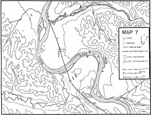
MAP 7. (click on image for a PDF version) |
#19 ART STEVEN'S FISH CAMP
LOCATION:
Art Steven's Fish Camp is 9-1/2 miles downriver
from Eagle or 12 miles downriver from Eagle Village, on the right bank
of the Yukon, near the mouth of Shade Creek.
SIGNIFICANCE:
Local significance.
PLACE IN HISTORY:
Art Steven's Fish Camp represents the traditional
fish camp of the Han Indians during the late nineteenth and early
twentieth centuries. The location of this fish camp is indicative of the
summer settlement patterns of the people. Archeological investigation of
some of the fish camps from this area might provide valuable information
on the life ways of the Han as they were involved in the taking of one
of their major food resources - salmon.
CONDITION:
This site was obtained through oral research for
Section 14(h)(1) of the Alaska Native Claims Settlement Act that allows
selections of historic sites by regional corporations. This site was not
visited, thus, its condition is unknown. This may be a Native
allotment.
TREATMENT:
This site should be visited, and recommendations
regarding preservation determined after a full evaluation has been done
even though this fish camp is outside the proposed park.
SOURCE:
Elizabeth Andrews' 14(h)(1) survey.
#20 JUTS' OK
LOCATION:
The village is said to be near Seventymile Lake. It
is uncertain which lake is known by the Natives by that name. An
assumption is made that the village is between Ford Lake and the Yukon
River on the left bank of the Yukon.
SIGNIFICANCE:
Local significance.
PLACE IN HISTORY:
Juts'ok means "summer house". Sarah Malcolm
reports seeing remnants of the hemisphere-shaped houses of poles and
stick when she was a little girl. The site is estimated to belong to the
early historic period. Juts'ok might make a valuable complement
to Niibeeo Zhoo and add substantially to sparse information on
the Han Indian.
CONDITION:
The site was not visited, thus, the condition is
unknown.
TREATMENT:
The site should be exactly located and the condition
evaluated. The site should be protected from pot-hunters even though it
is outside the proposal's boundaries. This may be a Native
allotment.
SOURCE:
Elizabeth Andrews' 14 (h)(1) survey.
#21 WILLIE JUNEBY'S CABIN NEAR FORD LAKE
LOCATION:
The cabin is 12 miles from Eagle on the left side of
the Yukon River, located on Eagle (D-1) 1:63,360.
SIGNIFICANCE:
Local significance.
PLACE IN HISTORY:
The cabin is representative of a subsistence
lifestyle that exists today—a rough-hewn log cabin chinked with
moss made without power tools. It is just off the Ford Lake trail that
has been used as far back as precontact time as a resource area for
ducks and muskrats. The cabin was built by an Eagle Native, Willie
Juneby.
CONDITION:
The cabin measures 16 by 16 feet but lacks a roof.
All 4 walls remain standing. Window and door frames made from lumber
help hold the walls secure. Although 2 caches have fallen, the outhouse
framework remains.
TREATMENT:
Preservation tactics would mainly include protection
from vandals. Restoration or elaborate preservation is not recommended.
More information is required to evaluate its significance. This cabin is
outside the proposal area. This may be a Native allotment.
SOURCE:
George Beck.
Photograph available.
#22 INDIAN VILLAGE
LOCATION:
The village is said to be 13-1/2 miles from Eagle
or 16 miles from Eagle Village on the right bank of the Yukon just below
Calico Bluff.
SIGNIFICANCE:
Local significance.
PLACE IN HISTORY:
The village is indicated on a 1951 U.S.G.S. relief
map of Eagle Quadrangle. Informants and written sources recall no such
village at that location. It may just be a mistake in cartography but
should be investigated before ruling it out.
CONDITION:
Since the site was not visited, condition is not
known.
TREATMENT:
The area should be surveyed to find out if such a
village did exist. Until the site is found, the area should be protected
as if the village were there. The village is outside the boundaries of
Yukon - Charley.
SOURCE:
U.S.G.S., 1951 relief map, scale 1:63,360.
#23 PICKERAL SLOUGH CABIN REMAINS AND CONCRETE FIRE PLACE
LOCATION:
The cabin is 15 miles downriver from Eagle on the
right bank and upper end of Pickeral Slough.
SIGNIFICANCE:
Local significance.
PLACE IN HISTORY:
A fireplace of any kind is most unusual in Yukon -
Charley cabins. A concrete fireplace with inlaid brick and local stone
is unique. Len Hart and his wife, who was a fiction writer, packed all
supplies in on their backs and built the house. Unfortunately they built
the large house with green logs that promptly froze and offered little
insulation. With only a fireplace to heat the large house, they were
exceedingly cold. When Len Hart froze his toes, his wife had to wrestle
the firewood. She ended up tearing down the back room for firewood. Len
was flown to Fairbanks for treatment, and at break-up she left too.
Neither returned.
CONDITION:
The fireplace stands 15 feet high with a rock and
mortar facade. Bricks outline the firehole. It appears cast on the spot.
Ten yards away is a root cellar lined with logs but filled with water.
There appears to be little or no foundation and no debris. Horace and
Charlie Biederman probably salvaged the logs from this house for their
cabin or for firewood. If the root cellar and fireplace are part of the
same house, the house would measure 45 by 24 feet which is unusually
large.
TREATMENT:
The fireplace, because of its regional uniqueness,
should be preserved and protected from vandals. The lack of a supportive
structure is a loss. This site is outside the proposal's area.
SOURCE:
George Beck; Charlie Biederman.
Photograph available.
#24 PICKERAL SLOUGH CABIN
LOCATION:
The cabin is 15 miles downriver from Eagle on the
right bank and upper end of Pickeral Slough.
SIGNIFICANCE:
Local significance.
PLACE IN HISTORY:
The cabin was built by Charlie and Horace Biederman
in 1939 from logs salvaged from an adjacent cabin. Horace used the cabin
for trapping.
CONDITION:
The 10-by-12-foot cabin has no roof. It has
probably been flooded. The peeled logs, salvaged from the adjacent Len
Hart cabin, are mixed with unpeeled logs and chinked with moss. It is 7
logs high.
TREATMENT:
Protection from vandals is recommended. This cabin is
outside the Yukon - Charley proposal area.
SOURCE:
Charlie Biederman; George Beck.
Photographs available.
#24A ED OLSON'S CABIN, PICKERAL SLOUGH
LOCATION:
The cabin is 15 miles downriver from Eagle on the
right bank and very upper end of Pickeral Slough, 300 yards up the
slough from cabin #24.
SIGNIFICANCE:
Local significance.
PLACE IN HISTORY:
During the 1920's Ed Olson built the cabin to use for
trapping. Trapping prices were high during those years, and the Pickeral
Slough area was a productive fur region. In the early 1930's Charlie
Biederman remembers obtaining some moose from Olson's cache.
CONDITION:
The cabin was not visited nor specifically located.
Charlie Biederman reported that the cabin was falling down when he and
Horace built cabin #24. Otherwise Horace would have used Olson's cabin
as his trapping cabin.
TREATMENT:
The cabin remains should be located and evaluated.
Since this cabin is outside the proposal area and there are a number of
trapping cabins within the proposal, documentation of the site would be
sufficient.
SOURCE:
Charlie Biederman.
#25 TOM YOUNG'S FISH CAMP
LOCATION:
Tom Young's Fish Camp is 14-1/2 miles downriver
from Eagle or 17 miles downriver from Eagle Village on a large island
across from Pickeral Slough.
SIGNIFICANCE:
Local significance.
PLACE IN HISTORY:
Tom Young's Fish Camp represents the traditional fish
camp of the Han Indians during the late nineteenth and early twentieth
centuries. The location of this fish camp is indicative of the summer
settlement patterns of the people. Archeological investigation of some
of the fish camps from this area might provide valuable information on
the life ways of the Han as they were involved in the taking of one of
their major food resources - salmon.
CONDITION:
This site was obtained through oral research for
Section 14(h)(1) of the Alaska Native Claims Settlement Act that allows
selections of historic sites by regional corporations. This site was not
visited, thus, it's condition is unknown.
TREATMENT:
This site should be visited, and recommendations
regarding preservation determined after a full evaluation has been done
even though this fish camp is outside the proposed park.
SOURCE:
Elizabeth Andrews' 14(h)(1) survey.
#26 CAPTAIN DALPHUS/BOB STACEY'S FISH CAMP
LOCATION:
The cabin is 16-1/2 miles downriver from Eagle on
the right bank of the Yukon River, located on U.S.G.S. map Eagle (D-1)
scale 1:63,360.
SIGNIFICANCE:
Local significance.
PLACE IN HISTORY:
Fish camps are illustrative of a traditional Native
lifestyle. Fish camps provided summer sustenance, and any surplus was
dried and stored for winter. Cultural activities took place at these
camps giving another texture and dimension to Native life. This fish
camp currently belongs to Bob Stacey but was once known as Captain
Dalphus' Fish Camp. Captain Dalphus was living at Charley Village in
1914 when it washed out. Later he cared for the dogs at Biederman
Camp.
CONDITION:
Only 2 walls, 5 logs high, remain. The rest have been
washed away by flooding and age. There are 3 visible cache pits. In the
river below is a large eddy where gill nets were placed. It is now a
Native allotment.
TREATMENT:
Protection from vandals of the remains is
recommended. This fish camp is outside the proposed area.
SOURCE:
Elizabeth Andrews' 14(h)(1) survey; George Beck;
David Evans.
#27 STAR - SEVENTYMILE CITY
LOCATION:
Star City is 16-1/2 miles downriver from Eagle,
on the left bank of the Yukon River, directly across the river from Bob
Stacy's Fish Camp, 1/4 mile off the river on a bench.
SIGNIFICANCE:
Regional significance.
PLACE IN HISTORY:
An early gold-rush town built in 1898 and generally
abandoned by 1905. There is some confusion in the documents as to its
name. Tappan Adney says Star City washed away. The U.S. Geological
Surveyists, Alfred Brooks and E.C. Barnard, have Seventymile City at the
mouth of Seventymile River and Star City one mile upriver. Donald Orth
gives the description of Star City as being 1 mile east of Seventymile.
James Wickersham reports staying overnight in Star City in 1901, and
local tradition calls the town Star City. A post office was maintained
here from 1898-1902. This is one of four mining camps constructed during
the Yukon gold rush boom of 1898-1910. More fabric remains at Star City
than at any of them. Additionally, the town's integrity is intact,
threatened only by the forest and time.
CONDITION:
Ten cabins remain on a bench approximately 100 yards
away from the river. All cabins have lost their roofs, but most of the
walls are standing. Built mostly of unpeeled logs, the insides are
generally squared off. The average size measures 12 by 14 feet. There
are a few caches and a couple of rotting boats along the side of the
cabins.
Very little trash was found; a few metal cans and a leather boot were about all. Initially the townsite is difficult to determine because the cabins are 50-75 yards apart and a thick growth of trees separate them from each other. The town cannot be seen from the river nor is it on any maps, thus, obscurity has preserved it from man's ravages. The last cabin at the town at the mouth of Seventymile River washed away by the 1950's.
TREATMENT:
Preservation is recommended. A National Register
nomination would be valid. The town can tell a visitor quite a bit about
the men that lived there. This townsite is outside the Yukon - Charley
proposal area.
SOURCE:
Melvin Ricks; Donald J. Orth; James Wickersham;
Alfred H. Brooks; E.C. Barnard; Tappan Adney; George Beck; Barney
Hansen; Charlie Biederman.
Photographs available.
#28 TRAPPER'S LINE CABIN ON MAIL TRAIL
(Seventymile Area)
LOCATION:
The cabin is 1 mile from the mouth of Seventymile
River along the mail trail.
SIGNIFICANCE:
Local significance.
PLACE IN HISTORY:
A recent trapper built this line cabin. The cabin of
unpeeled logs, chinked with moss, complete with sod roof, is
illustrative of trappers line cabins both historically and currently.
Trapping has always been an important activity for the Yukon - Charley
area, and this lifestyle needs fabric for interpretation. In addition
the mail trail is now used as a trapper's trail.
CONDITION:
The cabin has been built in recent years. Although it
slants slightly, the roof is intact. It stands 9-10 logs high with a
bunk opposite the door. The cabin is roughly built and not as tight as
the home-base cabin would be.
TREATMENT:
Preservation for possible interpretation is
suggested. This cabin is outside the proposed area.
SOURCE:
David Evans.
Photograph available.
#29 MILLER'S CAMP
LOCATION:
Miller's Camp is on the right bank of the Yukon River
near the mouth of the Tatonduk River, located by name on U.S.G.S.
Charley River Quadrangle, scale 1:250,000 and Charley River (A-1), scale
1:63,360.
SIGNIFICANCE:
Local significance.
PLACE IN HISTORY:
Frank Charles "Heine" Miller initially chopped
cordwood for the steamboats at Montauk. Then he went to the mouth of
the Tatonduk River and bought out Lucky Laughton. Here he built what
came to be known as "Miller's Camp". He hired John Pierson to build the house
for him. The ridgepol is one of the largest in the country but Pierson's
response: "a little too small". Nothing was large enough for the man. Miller
obtained a patent to this homestead March 30, 1925. He used the land as
a wood cutting area for the riverboats plying the Yukon River. His house
also served the mail carriers and other visitors as a roadhouse. Miller
died in 1936. When mail ceased to be carried by dogs and steamboats
ceased operating, the roadhouse lost its importance.
CONDITION:
The site consists of a log house, cabin, cache, and
storage shed. The house is in ruins caused by a Yukon flood that washed
the house off its foundation. The excellent workmanship of the house is
still graphically visible with a ridge pole of 15 inches in diameter,
glass windows, wall-papered walls, and two rooms, each measuring 10 by
15 feet. The cache, storage shed, and cabin are still intact, although
the cache is now seated on the ground. The cabin, with a barrel stove,
is still used as a stop-over by winter travelers today. Remains of a
home-built canoe and boat can be seen. This land is privately owned.
TREATMENT:
Preservation is recommended. Although the site cannot
be seen from the river, it is on the topographic maps and, therefore,
subject to vandalism and destruction. A National Register nomination
could be completed. The camp is outside the proposal area.
SOURCE:
Barney Hansen; Horace Biederman, Jr.; Roger L.
Trimble's Antiquities; Charlie Biederman.
Photographs available.
#29A, 29B WOODCHOPPER CABINS
(not specifically located on the Tatonduk River)
LOCATION:
The cabins are up the Tatonduk River from Miller's
Camp. Cabin #29A may be the cabin indicated on Charley River Quadrangle,
scale 1:250,000. It is uncertain where Cabin #29B is.
SIGNIFICANCE:
Local significance.
PLACE IN HISTORY:
Since steamboats travelling upstream used 40-50 cords
of wood a day, they needed enormous quantities of cord wood for a 21-day
trip. At the steamboats peak, during the Klondike rush, over 130 of them
plied the river. Woodchoppers signed formal woodchopping contracts with
the transportation companies to supply a certain quantity of wood at an
agreed upon price, usually $8-10. From the 1920's to 1936, Heine
Miller had such a wood contract. He hired a number of men to chop wood
for him. Two of these woodchoppers lived up the Tatonduk River. They
were close enough to be able to haul the wood to Miller's Camp without
hardship but far enough away to find good timber. The men usually
chopped wood all winter then during the summer went into Eagle where
they grew gardens.
CONDITION:
These cabins were not visited nor specifically
located. They are off the Yukon but still may be susceptible to floods
on the Tatonduk. Since they are contemporary with the cabin on Wood
Island, it is likely that the roofs have collapsed.
TREATMENT:
Even though the cabins are outside the proposed area,
the woodchopper's story is interesting and significant. Thus the cabins
should be specifically located and evaluated. Most of the
interpretation, if any is to be given, can be done at the Wood Island
cabin.
SOURCE:
Charlie Biederman; James T. Gray; Walter Curtin.
#29C MAX DREWS' CABIN
LOCATION:
The cabin is approximately 1/2 mile from
Miller's Camp on the right bank of the Yukon River. It is indicated on
the Charley River Quadrangle, scale 1:250,000.
SIGNIFICANCE:
Local significance.
PLACE IN HISTORY:
Max Drews built the cabin in the late 1920's as a
woodchopper's cabin. He chopped wood for Heine Miller who had the wood
contract for that portion of the Yukon. Transportation companies
contracted for several thousand cords of wood each year, usually placing
one man in charge of a certain camp. Max Drews, an old-timer from the
area, arrived with the Klondike rush then went to work as a woodchopper
for Heine Miller. Men seemed to enjoy wood-chopping because it allowed
them to be their own boss. Generally independent and self-sufficient,
the solitary life of a woodchopper and trapper attracted men like Max
Drew who also did a little mining during the summer.
CONDITION:
The cabin is in excellent shape. The roof has been
restored by a trapper from the area. It is currently used as a fish
camp, and may be a Native allotment.
TREATMENT:
The cabin is outside the proposal boundaries but does
characterize the woodchopper's life and more particularly, Max Drews.
The cabin should be preserved with adaptive use. The cabin began as a
woodchopper's cabin, and now is a fish camp. Several scenes of Yukon life
occurred here.
SOURCE:
Charlie Biederman.
|
|
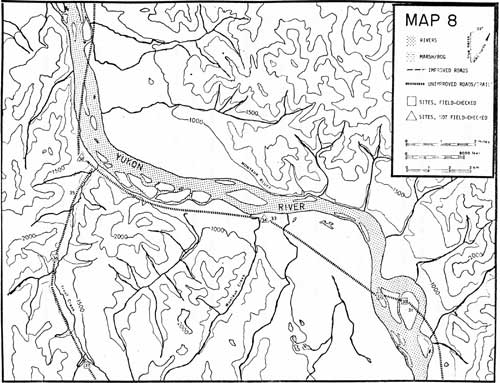
MAP 8. (click on image for a PDF version) |
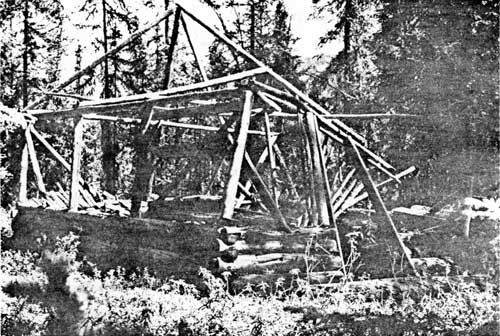
#30 WOOD ISLAND CABIN
LOCATION:
The cabin is 4 miles from Miller's Camp on the
largest of 3 islands referred to locally as "Wood Islands".
SIGNIFICANCE:
Local significance.
PLACE IN HISTORY:
Bane Beechman from the University of Hawaii built the
cabin in the late 1930's. After spending one summer floating the Yukon
with some University of Hawaii students, Beechman returned to stay for a
winter. He spent the winter cutting wood and writing. When he left to
move to Central, Heine Miller used the cabin for a woodchopper he
employed. The cabin is probably the woodchopper's cabin used by Willie
Juneby and can be used to interpret life of a woodchopper. Hundreds of
cords of wood were chopped for the sternwheeler that plied the Yukon.
Later the wood was dragged by caterpiller to Miller's camp. Enough
fabric remains, in addition to a trash pile, that a feeling for the life
is created. The cabin was also used by Angus Alec when he trapped the
adjacent area.
CONDITION:
The cabin that measures 17 by 13 feet and stands 8-11
logs high is without a roof. The door and window frames are painted
white. Boxes nailed to the wall served as shelves and a small table near
the door completed the interior furnishings. Cans, bottles, and trash
give details to the life of a woodchopper.
TREATMENT:
Preservation is definitely recommended. This was the
only woodchopper's hut found still standing. Since few people know of
its existence, it has not been vandalized or picked apart by souvenir
seekers. A National Register form could be completed.
SOURCE:
Wyman Fritsch; George Beck; Horace Biederman, Jr.;
Richard Cook; Charlie Biederman.
Photograph available.

|
| PLATE 2. #30 Wood Island Cabin, view to the south. |
#31 WOOD ISLAND ROAD
LOCATION:
The road is 4 miles from Miller's Camp on the largest
of 3 islands referred to locally as "Wood Islands".
SIGNIFICANCE:
Local significance.
PLACE IN HISTORY:
Willie Juneby dragged the cord wood by caterpiller
during the winter to Miller's Camp. This road cuts across the island
through a stand of spruce near the center of Wood Island. At least 6
spur roads branched off the main road.
CONDITION:
Although the road has become overgrown with willow,
alder, and rose bushes, it is still visible as a double track trail. It
passes next to the Woodchopper's Cabin.
TREATMENT:
Preservation or, at least, minor maintenance in
accordance with preservation of the Woodchopper's Cabin is
recommended.
SOURCE:
Wyman Fritsch; George Beck; Richard Cook.
#32 INDIAN HUNTING CAMP
LOCATION:
The camp is 4 miles from Miller's Camp on the
smallest of 3 islands known locally as "Wood Islands".
SIGNIFICANCE:
Local significance.
PLACE IN HISTORY:
An Indian hunting camp, although of recent origin, is
illustrative of traditional subsistence and lifestyles.
CONDITION:
The camp consists of a few benches and a table around
a rock fireplace. Racks for drying meat are still standing back in the
woods.
TREATMENT:
Little remains to actually preserve. The site,
however, should be interpreted as the continuation of a Native cultural
lifestyle. The hunting camp is within the Yukon - Charley
proposal.
SOURCE:
David Evans.
#33 MAIL TRAIL NEAR MONTAUK
LOCATION:
The mail trail is 10 miles from Miller's Camp, near
the mouth of Montauk Creek, directly across from Montauk Bluff, and runs
parallel to the Yukon for 2 miles.
SIGNIFICANCE:
Regional significance.
PLACE IN HISTORY:
This is part of the Eagle-Circle mail trail used by
all winter river travellers as a means of communication and
transportation. It served to join communities and give greater cohesion
and unity to the region. The trail's greatest use came during
1898-1940.
CONDITION:
The trail is very visible. The black scrub spruce
line both sides of the trail. A 7-foot width has been brushed out,
but the muskeg is over shin-deep. This portion of the trail cuts off a
horseshoe bend in the Yukon. There are several different trails all
leading the same direction. After 2 miles the visible trail is lost.
TREATMENT:
Preservation would simply entail keeping the trees
from encroaching on the trail.
SOURCE:
George Beck; Charlie Biederman.
Photograph.
|
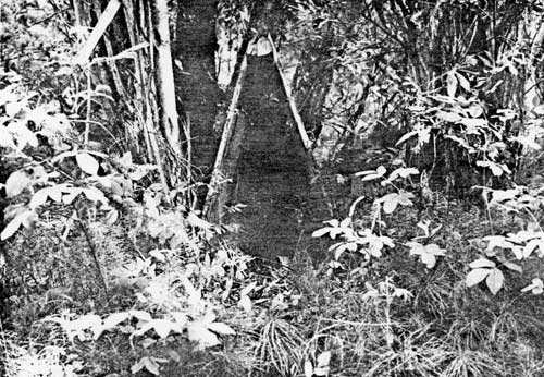
| PLATE 3. #33 Mail Trail near Montauk. |
#34 MONTAUK ROADHOUSE
LOCATION:
The roadhouse is on a bench of land directly across
from Montauk Bluff.
SIGNIFICANCE:
Local significance.
PLACE IN HISTORY:
Although described by James Wickersham and C.A.
Bryant, the roadhouse must have fallen into disrepair upon the rise of
Miller's Camp as a roadhouse. C.A. Bryant tells about the owner
becoming insane and being a danger to river travellers. Later the
roadhouse or the location became mostly a wood camp. Tom Gazu had it
then Heine Miller. Initially the main channel of the Yukon passed near
the left bank rather than the right bank as it does today, thus the
location was ideal for a wood stop.
CONDITION:
The exact location was not found. It may have been
washed away or it may have fallen down and is out of sight among the
woods. This may be a Native allotment.
TREATMENT:
Finding the exact location of the site and preserving
what remains is recommended. The site should be documented.
SOURCE:
George Beck; James Wickersham; C.A. Bryant; Charlie
Biederman.
#35 TROUT CREEK TRAIL
LOCATION:
The trail begins 7-1/2 miles upriver from Nation
City, indicated on U.S.G.S. Charley River Quadrangle, scale 1:250,000
and Charley River (A-2), scale 1:63,360, and follows Trout Creek
for 6 miles.
SIGNIFICANCE:
Local significance.
PLACE IN HISTORY:
Jack Duvald who was a partner with Johnny Olson and
Axel Johnson on the Seventymile River, brought in a caterpiller at the
mouth of Trout Creek, followed the creek to its head, then dropped down
into the Little Washington Creek, and onto the Seventymile claims.
Trapper Al Arp used the trail and two prospectors Joe Donahue and Mickey
Rich. The trail is illustrative of a trapper's and miner's trail. It
joins the Gillman Creek Cabin with the Yukon River. Not only was the
trail used for trapping but as the main trail for carrying supplies.
There are trappers' blazes along the trail indicating trap sets.
CONDITION:
Unfortunately, the forest fire of 1969 has made the
trail almost non-existent. Even out of the burn area, the trail is
easily lost among the muskeg and swamp.
TREATMENT:
The burn has made it difficult to preserve. The area
may once again be trapped and the subsequent trappers will find and
maintain the trail for their own adaptive use.
SOURCE:
Charlie Biederman.
#36 TROUT CREEK TENT-FRAME CAMP
LOCATION:
The camp is 3 miles from the mouth of Trout Creek
along the Trout Creek Trail.
SIGNIFICANCE:
Local significance.
PLACE IN HISTORY:
Al Arp built it for a trapping line cabin. Al trapped
Michigan Creek and Fourth of July Creek as well. His main base camp was
the old Ivy City. A typical way station for trappers or a halfway point
to Gillman Creek Cabin. Enough remains to piece together a lifestyle of
the person using the camp.
CONDITION:
The tent frame is five logs high with a framework
onto which a canvas tent can be placed. There are bunks in the rear and
shelves along the frame. Part of the framework has fallen down. Ten feet
away is a teepee pole arrangement with a Yukon stove built out of an oil
barrel and a water bucket with a wooden handle made from a blazo
can.
TREATMENT:
Protection from vandals and souvenir seekers is
recommended until more information is gained.
SOURCE:
Charlie Biederman.
|
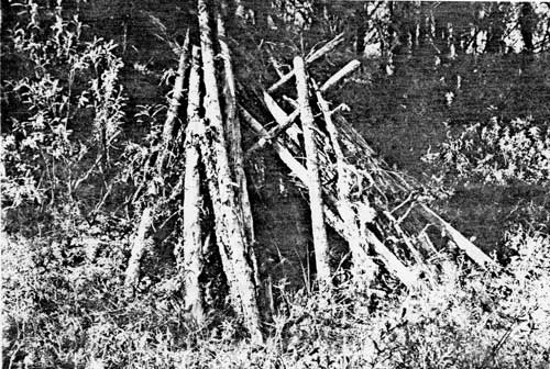
| PLATE 4. #36 Trout Creek tent-frame camp, view to the northeast. |
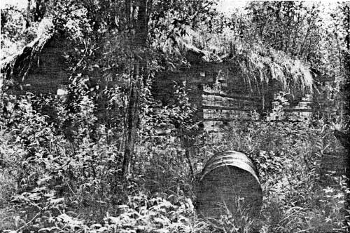
#37 GILLMAN CREEK CABIN
LOCATION:
The cabin remains are 6 miles from the mouth of Trout
Creek at the terminus of the Trout Creek Trail.
SIGNIFICANCE:
Local significance.
PLACE IN HISTORY:
Joe Donahue and Mickey Rice built the cabin as they
prospected the surrounding area. They stayed at the cabin until 1941. No
one else used the cabin after that. The 1969 forest fire burned the
cabin to the ground.
CONDITION:
The cabin, cache, and dog house were all burned to
the ground during the 1969 forest fire. All that remains are 2 of the
poles that held up the cache, marked by metal piping typically used to
keep small animals out of the cache. Nothing remains of the
10-by-12-foot "cabin". It lies in a depression as if part of the hill
had been dug out for the cabin. Even the foundation logs are badly
burned. Inside the ruins are badly burned junk metal of cans, Yukon
stove, and lanterns.
TREATMENT:
Since nothing but the site remains and the forest
fire destroyed much of its integrity, recognition of the site is all
that is suggested.
SOURCE:
Charlie Biederman.
|
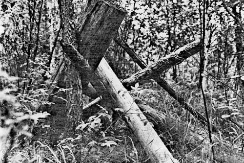
| PLATE 5. #37 Gillman Creek Cabin, view to the north showing cache poles. |
#38 TROUT CREEK MOUTH CABIN
LOCATION:
The site is approximately 7-1/4 miles upriver from
Nation City near the mouth of Trout Creek.
SIGNIFICANCE:
Local significance.
PLACE IN HISTORY:
Max Drew built the cabin about 1935. He built it of
cottonwood logs on the ridge overlooking the creek. It was listed on
U.S.G.S. topographic map of 1951. Drew was an old prospector and had
travelled all over Alaska before coming back to Eagle. For a while he
chopped wood for Heine Miller from a cabin just above Miller's Camp.
CONDITION:
This cabin was not found. Since the area was badly
burned by the 1969 forest fire, it is unlikely anything remains of the
cabin.
TREATMENT:
It is recommended that oral history research be done
to find out more about the cabin.
SOURCE:
U.S.G.S. 1951 topographic map; Wyman Fritsch; Charlie
Biederman.
|
|
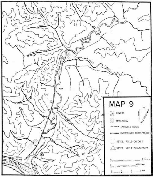
MAP 9. (click on image for a PDF version) |
#39 COAL TRANSPORTATION ROAD
LOCATION:
The road is 1/4 mile from the Yukon on the left bank
of Nation River crossing a horseshoe portion of land to the Yukon
River.
SIGNIFICANCE:
Local significance.
PLACE IN HISTORY:
This is part of the road used to carry the coal from
the Nation River mine to the Yukon River.
CONDITION:
Tall spruce trees frame the road that has since
become overgrown with willow, alder, and rose bushes. The road is
approximately 15-20 feet wide and is a short cut to the Yukon by cutting
off last small horseshoe of the Nation River, about 75 yards long. There
are no signs of coal along the Yukon River bank, but river floods and
channel changes could have wiped out any traces.
TREATMENT:
Recognition of the road and interpretation of the
logistical problems involved in mining coal and other non-precious
minerals is all that is needed.
SOURCE:
George Beck.
#40 NATION RIVER COAL MINE
LOCATION:
The mine is 1 mile from the Yukon River on the left
bank of the Nation River.
SIGNIFICANCE:
Local significance.
PLACE IN HISTORY:
In 1897 the Alaska Commercial Company attempted to
open a coal mine on the left bank of the Nation River 1 mile from the
Yukon. About 2,000 tons of coal were mined, sledded to the Yukon and
burned on river steamers or transported to the Dawson market. Owing to
the irregularity of the coal deposit, the consequent uncertainty of the
supply, and the expense of mining, the mine was abandoned before 1902.
Several features around the Nation River relate directly to this
mine—roads, stockpiles of coal, even a cabin.
CONDITION:
The mine workings had caved in by 1903. Since the
face of the bluff on which they are located is subject to local slides,
the exact location of the mine cannot be determined.
TREATMENT:
The mine and its influence on other developments on
the Yukon River should be recognized and interpreted. It can be tied
into the problems of fuel for the steamboats and the resourcefulness of
commercial companies.
SOURCE:
Arthur Collier.
#41 CHRISTOPHER 'PHONOGRAPH' NELSON CABIN
LOCATION:
The cabin is near the mouth of Hard Luck Creek, on
the right bank of the Nation River, 7 miles from the Yukon.
SIGNIFICANCE:
Local significance.
PLACE IN HISTORY:
The cabins on the Nation River at Hard Luck Creek,
Tindir, and Jungle were referred to by Nelson as 7 mile, 22 mile, and 35
mile trapping cabins. He considered the 35 mile cabin (near Jungle) as
his home base. There are many stories in the local lore about
'Phonograph' Nelson. He was a trapper whose early and illegal trapping
caused problems with Fish and Wildlife. These cabins are associated with
him and the Bluff cabin at the mouth of Nation River. All have his
characteristic style for triangular dog houses.
CONDITION:
None of these sites were visited. The condition of
the cabins, therefore, is also unknown.
TREATMENT:
These sites should be documented and evaluated for
preservation purposes and the Park record. This cabin is not within the
proposed boundaries.
SOURCE:
George Beck; Horace Biederman, Jr.
|
|
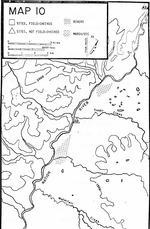
MAP 10. (click on image for a PDF version) |
#42 CHRISTOPHER 'PHONOGRAPH' NELSON CABIN
LOCATION:
The cabin is near the mouth of Tindir Creek, 22 miles
from the Yukon River on Nation River.
SIGNIFICANCE:
Local significance.
PLACE IN HISTORY:
The cabins on the Nation River at Hard Luck Creek,
Tindir, and Jungle were referred to by Nelson as 7 mile, 22 mile, and 35
mile trapping cabins. He considered the 35 mile cabin (near Jungle) as
his home base. There are many stories in the local lore about
'Phonograph Nelson. He was a trapper whose early and illegal trapping
caused problems with Fish and Wildlife. These cabins are associated with
him and the Bluff cabin at the mouth of Nation River. All have his
characteristic style for triangular dog houses.
CONDITION:
None of these sites were visited. The condition of
the cabins, therefore, is also unknown.
TREATMENT:
These sites should be documented and evaluated for
preservation purposes and the Park record. This cabin is not within the
proposed boundaries.
SOURCE:
George Beck; Horace Biederman, Jr.
#43 CHRISTOPHER 'PHONOGRAPH' NELSON CABIN
LOCATION:
The cabin is near the junction of Jungle Creek with
the Nation River, 35 miles from the Yukon River.
SIGNIFICANCE:
Local significance.
PLACE IN HISTORY:
The cabins on the Nation River at Hard Luck Creek,
Tindir, and Jungle were referred to by Nelson as 7 mile, 22 mile, and 35
mile trapping cabins. He considered the 35 mile cabin (near Jungle) as
his home base. There are many stories in the local lore about
'Phonograph' Nelson. He was a trapper whose early and illegal trapping
caused problems with Fish and Wildlife. These cabins are associated with
him and the Bluff cabin at the mouth of Nation River. All have his
characteristic style for triangular dog houses.
CONDITION:
None of these sites were visited. The condition of
the cabins, therefore, is also unknown.
TREATMENT:
These sites should be documented and evaluated for
preservation purposes and the Park record. This cabin is not within the
proposed boundaries.
SOURCE:
George Beck; Horace Biederman, Jr.
#44 LOG CAPSTANS
LOCATION:
The capstans are 20 yards upriver from the Nation
Bluff Cabin (Christopher Nelson's Cabin). One is just below the cabin
depression; the other is near the Yukon River bank separated by 20
yards.
SIGNIFICANCE:
Local significance.
PLACE IN HISTORY:
These capstans may have been built and used by
Christopher Nelson to help pull his big inboard motorboat up onto the
bank, or these may have been built by the coal company and used by
Nelson. More information is needed to determine their role.
CONDITION:
Two capstans stand 20 yards apart. One is in
excellent shape with the wire cable still intact. The other looks as if
it had been flooded and now stands in disrepair. There are 4 poles, 3
feet high which support 2 large poles which in turn support the center
wood capstan. There is one long turning pole 12-15 feet long. Between
the 2 capstans are 2 large logs 3 feet apart that might have served as
rails.
TREATMENT:
Preservation and protection is strongly recommended.
These are unique and fascinating even if their use is uncertain.
SOURCE:
George Beck; Jim Layman.
Photographs.
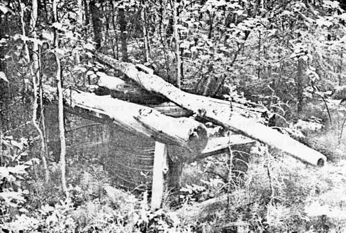
|
| PLATE 6. #44 Log capstan, view to the south. |
#45 CABIN DEPRESSION AT NATION BLUFF
LOCATION:
The depression is 20 yards upriver from Nation Bluff
Cabin (Christopher Nelson's Cabin), approximately 50 yards away from the
Yukon River.
SIGNIFICANCE:
Local significance.
PLACE IN HISTORY:
This may be a larger cabin than the current cabin
standing 20 yards downriver. This may have been built during the coal
mining period. There is no documentary evidence, thus, its role in
history is unknown.
CONDITION:
A deep depression 10 by 12 feet large could have been
a root cellar for a much larger house. There are logs remaining that
suggest cribbing while others suggest floor supports. It is surrounded
by new growth of willow and small aspen.
TREATMENT:
Archeology or more oral history may determine what
the depression is. If it were a bunkhouse for the mine, the story of the
coal mine could be well interpreted at this site. Preservation is
recommended until its value is known.
SOURCE:
George Beck.
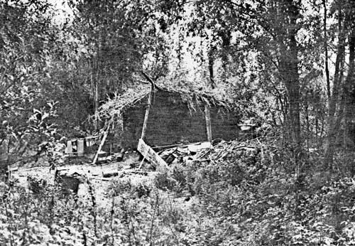
#46 NATION BLUFF CABIN OR CHRISTOPHER NELSON'S CABIN
LOCATION:
The cabin is 1 mile upriver from Nation City, on the
right bank of the Yukon River, shown on Charley River Quadrangle, scale
1:250,000 and Charley River (A-2), scale 1:63,360.
SIGNIFICANCE:
Local significance.
PLACE IN HISTORY:
Christopher 'Phonograph' Nelson built the current
cabin in 1934. He took the tent frame left from the coal mine operation
and built it into the cabin. There are a number of stories in the local
lore about 'Phonograph'. He got his name because he was a non-stop
talker. If a pause came in the conversation, he filled it with
"and-ah-and-ah" until he could think of something more to say. He
was a trapper whose early and illegal trapping caused problems with Fish
and Wildlife. Although he died of a heart attack, there are stories that
he died from drinking turpentine.
CONDITION:
The cabin is in excellent shape. There is the
original cabin made from square-cut-peeled logs measuring 12 by 12 feet
and a frame addition that serves as an entrance and workroom that is 8
by 12 feet. The cabin has been covered with flattened cardboard boxes on
the outside and paper on the inside. Tar paper covers the new roof on
the frame entrance but flattened tin kerosene cans cover the sod roof of
the original cabin. There are several triangle shaped dog houses, a
standing cache and a fallen cache. There are remains of 4-6 boats in the
area all in great disrepair.
TREATMENT:
The area has been badly abused by campers and
hunters. It is strongly recommended that the whole area be placed on the
National Register although at least two different periods and probably
three are represented.
SOURCE:
George Beck; Charlie Biederman; Jim Layman; Eagle
City Records; Horace Biederman, Jr.
Photographs.
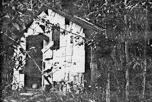
|
| PLATE 7. #46 Christopher Nelson's Cabin, view to the north. |
| PHOTO NOT AVAILABLE AT PRESS TIME. |
| PLATE 8. #46 Christopher Nelson's triangled-shaped dog house, view to the south. |
#47 STOCKPILE OF COAL NEAR NATION BLUFF
LOCATION:
The coal is 30 yards downriver from the Bluff Cabin
(Christopher Nelson's Cabin) and about 50 yards away from the Yukon
River.
SIGNIFICANCE:
Local significance.
PLACE IN HISTORY:
The stockpile of coal is explicit evidence of the
Nation River coal mine. In 1903 there were over 100 tons stockpiled from
mining done in 1898 (Collier; 1903, p.35).
CONDITION:
The stockpile is very evident 30 yards downriver from
the Bluff Cabin and on the same level as the cabin. The pile is
approximately 15 by 20 feet large. A small road in the back of the cabin
leads to the site.
TREATMENT:
Protection from any major disturbance and recognition
of what coal represented to business, mining, and individuals is all
that is recommended.
SOURCE:
George Beck.
Photograph.
|
| PLATE 9. #47 Stockpile of coal near Nation Bluff, view to the north. |
#48 TRAPPERS' CUBBY SETS
LOCATION:
The cubby sets are in the vicinity of Nation Bluff
Cabin (Christopher Nelson's Cabin).
SIGNIFICANCE:
Local significance.
PLACE IN HISTORY:
Cubby sets are a technique used by some trappers to
trap lynx. They are built to attract the curiosity of the lynx.
Oftentimes the cubbies were baited with fish during the summer, so that
the lynx would associate the cubby with food. Then in winter when fur
was prime, the cubby would be baited with a trap. A large number of
cubby sets in the area show the great diversification of sets. Most
trappers in the area now put traps where lynx travel rather than
training lynx to come to the cubby sets. These cubby sets are no longer
used and represent changing patterns in trapping.
CONDITION:
The cubby sets appear to be in good condition. Some
of those built with branches have deteriorated but on the whole they all
are recognizable as cubby sets.
TREATMENT:
Preservation and interpretation is recommended.
Several are unusual cubby sets - the one made from the bow of a boat and
the one made from scrounged-up wood.
SOURCE:
David Evans.
|
| PLATE 10. #48 Trappers' cubby set typically made from cut branches. |
|
|
| PLATE 11. $48 Trappers' cubby set made from spruce boughs. |
|
| PLATE 12. #48 Trappers' cubby set made from salvaged logs. |
|
| PLATE 13. #48 Trappers' cubby set made from the bow of a boat. |
#49 TRAPPERS' TRAIL
LOCATION:
The trails radiate out from Nation Bluff cabin
(Christopher Nelson's Cabin) primarily following the Nation and Yukon
Rivers.
SIGNIFICANCE:
Local significance.
PLACE IN HISTORY:
Trappers' trails allow transportation by dog teams or
on snow shoes. These trails are used primarily for setting out traps,
but they are also used as a means of transporting supplies and
travelling in the winter. The Yukon and its tributary streams and rivers
have been trapped since the 1870's by white men and earlier by
Indians.
CONDITION:
There are several trails from the Nation Bluff cabin
up the Nation River. These are primarily marked by blazed on the trees.
Winter travel along rivers is generally hard because overflow and wind
cause drifting of snow. Thus, trails usually are cleared out in the
woods.
TREATMENT:
Recognition and possible interpretation is all that
is suggested. If trapping is allowed, trappers will maintain the
trail.
SOURCE:
David Evans.
|
|
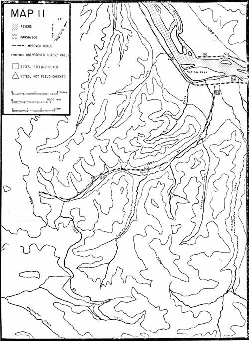
MAP 11. (click on image for a PDF version) |
#50 TRAPPERS' TRAIL
LOCATION:
The trail follows the right bank of the Yukon River
from the Nation Bluff cabin (Christopher Nelson's Cabin) to Rock
Creek.
SIGNIFICANCE:
Local significance.
PLACE IN HISTORY:
An important trail that runs along the north bank of
the Yukon. It is not part of the mail trail which runs along the south
bank. It was and is used as a trail along which traps are set.
CONDITION:
The trail is visible and well maintained by current
trappers.
TREATMENT:
No recommendations. Trappers' trails are not
advisable for hiking trails. They are primarily winter trails and often
cross knee-deep muskeg and tussocks.
SOURCE:
David Evans.
#51 JAMES TAYLOR PLACE
LOCATION:
The Taylor Place lies directly opposite from Nation
City, on the right bank of the Yukon River, just 1-1/2 miles from
the Nation Bluff Cabin (Christopher Nelson's Cabin).
SIGNIFICANCE:
Local significance.
PLACE IN HISTORY:
Jim Taylor mined Fourth of July Creek before the
Fairbanks stampede. After 1902 the miners happily sold their claims to
Taylor and went on to Fairbanks. Taylor tried to develop the mines
himself, importing a donkey engine that walked itself from Nation City
to the mines. Taylor eventually sold the consolidated claims to a
Sedro-Woolley, Washington, mining companies which attempted hydraulic
mining methods. Taylor also worked at the Washington Creek Coal Mine
until they went bankrupt, owing him $2,400 in back wages. In disgust
with mining he turned to trapping. He is associated with Nation City as
well as his own well-built home. He died of cancer in 1933 willing most
of his possessions to Ed Biederman.
CONDITION:
The main house burned to the ground several years ago
caused either by lightening or by careless hunters. Two cabins remain
with roof and walls intact. One has been turned into a recreation hall,
25 by 13 feet large, with a barrel stove, bar, and dresser drawers. The
shop is smaller, 13 by 13 feet large, with a sod roof and a stove that
once served as a forge. A summer dog-run for 4 separate dogs, built with
evenly spaced spruce logs, goes down to the running brook. The dog houses are
carefully made of peeled and squared-off logs. The winter dogbarn, 10 by
10 feet, is divided into 6 dog stalls, and a picket-like fence provides
a 30-foot run.
TREATMENT:
The complex should be preserved to distinguish
between temporary trappers or miners' cabins, and those built by
settlers planning to stay indefinitely. The workmanship is some of the
best on the river rivaled only by Miller's Camp, Woodchopper Roadhouse,
and Slaven Cabin.
SOURCE:
Barney Hansen; Wyman Fritsch; Charlie Biederman.
Photograph.
#52 NATION CITY
LOCATION:
Nation City is located by name on U.S.G.S. Charley
River Quadrangle, scale 1:250,000 and on Charley River (A-2), scale
1:63,360.
SIGNIFICANCE:
Regional significance.
PLACE IN HISTORY:
One of four mining camps or supply bases in Yukon -
Charley area. It was the largest and lived the longest. The townsite and
early mining claims are recorded in records that are part of Eagle City
Records. This town served as a steamboat stop and supply center for
Fourth of July Creek mining area. William E. Noyes who owned the
roadhouse, also served as Postmaster from 1908-1919. Later Frank M.
Young was appointed from 1917-1924. Nation is typical of small abandoned
mining communities along the Yukon that suffered when new gold strikes
were discovered.
CONDITION:
Two cabins have been built or rebuilt using logs from
other old buildings around Nation. Many of the logs from other buildings
were used for firewood, thus, the "City" itself consists of just a few
foundations. The roadhouse, 30 by 33 feet large, has only a few logs
plus a depression. A two-room cabin or store has walls 2 logs high.
Counting the 2 rebuilt cabins, there are 11 buildings, a sled, a cache,
some machinery and a few dog houses. Forty acres around this site is
patented.
TREATMENT:
Preservation is recommended. The "Nation Post Office"
is a three-foot mail box that resembles a rural mailbox. It is presently
at the Taylor Place but is likely to be stolen and made into a dog
house. The site, despite the rebuilt cabins, has kept its integrity. The
boat landing is still visible. A National Register nomination can be
completed. It should be protected from further destruction.
SOURCE:
Eagle City Records; Barney Hansen; Roger L. Tremble's
Antiquities Site Survey for BLM; U.S.G.S. Bulletins; Donald J. Orth;
Melvin Ricks; James T. Gray.
Photographs.
|
| PLATE 14. #52 Rebuilt trapper cabin at Nation City, view to the east. |
|
| PLATE 15. #52 Rebuilt smokehouse at Nation, view to the east. |

|
| PLATE 16. #52 Possible foundation of Nation's Roadhouse, view to the north. |
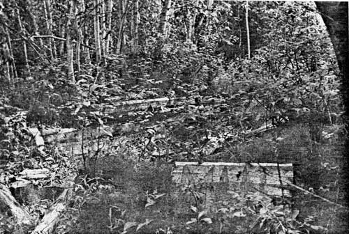
|
| PLATE 17. #52 A typical cabin remains at Nation, view to the southeast. |
#53 FRED KRAGER HOMESTEAD
LOCATION:
The Krager homestead is 1 mile from Nation City along
the Fourth of July Creek road. The cabins are indicated on U.S.G.S.
Charley River Quadrangle, scale 1:250,000 and Charley River (A-2),
scale 1:63,360.
SIGNIFICANCE:
Local significance.
PLACE IN HISTORY:
Very few areas have been homesteaded and patented in
the Yukon - Charley area. This homestead, although burned in the 1969
fire, was obviously cleared and farmed. The produce could have been sold
to the Fourth of July mines or to the steamboats. George Matlock,
Alaska's own brand of mountain man, had the farm first and built the
first buildings. Fred Krager patented about 40-80 acres. At one time the
Alaska Road Commission had built an airstrip nearby. This homestead
figures strongly in a number of local stories.
CONDITION:
The homestead has returned to rosebushes and alders
and the forest fire destroyed all buildings. The cabin remains still can
be plainly seen as the Fourth of July road passes near them. One cabin
was either a dug-out or had an 8-foot-deep
root-cellar or meat-tunnel and extended into 2 rooms. Stoves,
barrel drums, and pieces of metal can be found in the area.
TREATMENT:
Not much remains to be preserved but the area can
easily interpret another facet of Yukon River life—that of
homesteading and farming.
SOURCE:
George Beck; Horace Biederman, Jr.; Wyman
Fritsch.
Photograph.
| PHOTO NOT AVAILABLE AT PRESS TIME. |
| PLATE 18. #53 Fred Krager's burned homestead cabin, view to the south. |
#54 FOURTH OF JULY CREEK ROAD
LOCATION:
The road begins at Nation City on the left bank of
the Yukon River and follows the Fourth of July Creek 8 miles to the
Fourth of July Creek mine, located by name on Charley River Quadrangle,
scale 1:250,000 and Charley River (A-2), scale 1:63,360.
SIGNIFICANCE:
Local significance.
PLACE IN HISTORY:
The road began as a trail in 1898-99. When the Fourth
of July area consolidated, a wider trail was put in to facilitate
getting supplies and equipment from the Yukon riverboats. A donkey
engine literally walked its way up the trail. After World War II, Yukon
Placers built the road that now exists. The greatest development in
hydraulic mining occurred at this time.
CONDITION:
The road is clearly marked although it has been
overgrown with alders and rose bushes. Once the road leaves the
low-creek land, near the bluffs, the road forks into a high road and a
low one plus a walking trail. The high road is above the muskeg and has
been improved considerably. It is at least 30 feet wide.
TREATMENT:
The road is easy walking unlike mining and trapping
trails. The road represents the amount of work necessary to successfully
mine an area. This road is one of two road systems in the Yukon -
Charley area historically constructed. Trappers have also used the road.
Most of the road resides inside the proposal.
SOURCE:
Barney Hansen; U.S.G.S. Bulletins.
#55 FOURTH OF JULY MINE
LOCATION:
The mine is 8 miles from the left bank of the Yukon
River along the Fourth of July road that leaves the Yukon River at
Nation City, located by name on U.S.G.S. Charley River Quadrangle, scale
1:250,000 and Charley River (A-2), scale 1:63,360.
SIGNIFICANCE:
Regional significance.
PLACE IN HISTORY:
This hydraulic mine was the largest producer in the
Yukon - Charley area until 1936 when dredges began operating on Coal and
Woodchopper Creeks. Before the 1902 Fairbanks stampede over 50 people
worked claims here. At this time most of the miners sold their claims to
James Taylor who attempted to develop the mine himself. With a large
donkey engine he started a sawmill. Taylor later sold the consolidated
claims to a Sedro-Woolley mining company who in turn hired George
Matlock to manage the mine. Matlock, Alaska's own brand of mountain man,
built a 9-mile ditch to bring water from Washington Creek for the
hydraulic plant. Richard Bauer bought the mine about 1926. It then went
to Casper Ellingen who in turn leased it to Central Mining Company.
Finally after the war, Yukon Placers put in the road and made the most
money from it. The mine, however, is most closely associated with
Richard Bauer. He hired a number of local miners who worked long enough
for their own grubstake. There are many tales about Dick Bauer from how
he froze his feet to how he spent his money in Las Vegas each year. A
number of artifacts remain to interpret placer mining.
CONDITION:
There remains only 3 standing buildings and 1 cache.
Most of the buildings have been used for firewood because of the dearth
of trees in close vicinity. One serves as a shop with a blacksmith
forge, another is the living quarters for the current caretaker the
third is a house with a painted yellow interior, hot water heater, and a
root cellar. Scattered around the area are metal wheels, pipes,
machinery, and other mining apparatus. Once there were stables, machine
shop, bunkhouse, and a sawmill whose boiler (part of Taylor's original
donkey engine) still remains. The house has logs numbered—the
house had been moved log by log from another location on the creek.
TREATMENT:
Preservation is recommended as is National Register
nomination but the mine is currently private property. This site is
outside Yukon - Charley proposed area.
SOURCE:
Barney Hansen; U.S.G.S. Bulletins; Wyman Fritsch;
George Beck; Charlie Biederman.
Photograph available.

|
| PLATE 19. #55 Fourth of July Creek mine - boiler used in sawmill. |
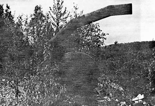
|
| PLATE 20. #55 Fourth of July Creek mine - pump used in hydraulic mining. |
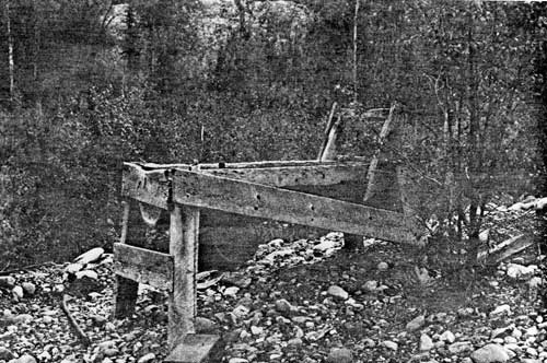
|
| PLATE 21. #55 Fourth of July Creek mine - rocker box used in simple placer mining. |

|
| PLATE 22. #55 Panning for gold on Fourth of July Creek, David Evans and Jack Wheeler. |
#56 CROWLEY CREEK CABIN
LOCATION:
The cabin lies 6-1/4 miles from Nation City,
along the Fourth of July Creek road, near the mouth of Crowley
Creek.
SIGNIFICANCE:
Local significance.
PLACE IN HISTORY:
Yukon-Charlie, Charlie Loapkey, built the cabin in
the early 1940's. He was grubstaked for a number of years by Herman
Joshlin, a bush pilot who flew the area. Yukon-Charlie mostly prospected
and did the necessary assessment work but no real mining. He was also
known as "Yukon Wind" because he would rather lie and tell long-winded
stories than tell the truth, simply because it took longer. This cabin
is illustrative of a well-built and maintained mining cabin.
CONDITION:
The cabin, 18 by 24 feet, is in good shape although
the roof has caved in on one end. The ridgepole is held up by 3 inside
support poles. The walls are squared off and may have been wallpapered
at one time. A stove, table, 2 bunks, and plank floor show touches of a
more permanent nature than most cabins in the area.
TREATMENT:
Preservation ought to be considered because of the
quality of the cabin. Since the Fourth of July mine is out of the
borders of the proposed park, this cabin could interpret the mining done
on the creek.
SOURCE:
Charlie Biederman; Jack Wheeler.
Photograph.

|
| PLATE 23. #56 Crowley Creek Cabin, view to the north. |
#57 FOURTH OF JULY CREEK DITCH
LOCATION:
The 9-mile ditch joins Washington Creek and Ruby
Creek that in turn runs into Fourth of July Creek. The ditch is
indicated as such on Charlie River (A-2) scale 1:63,360. The ditch is
outside Yukon - Charley proposed boundaries.
SIGNIFICANCE:
Local significance.
PLACE IN HISTORY:
Before the 1902 Fairbanks Stampede, there were around
50 people working claims on Fourth of July Creek. Most of the miners sold
their claims to James Taylor. Taylor began by bringing in a large donkey
engine which pulled itself from Nation to the mines under its own power.
The steam engine powered the sawmill. Taylor then sold out to a
Sedro-Woolley mining company in Washington. The Sedro-Woolley outfit
hired George Matlock to manage the mine. To increase the water for
hydraulic mining, Matlock constructed a 9-mile ditch to bring water from
Washington Creek over a pass to Fourth of July Creek. Unfortunately
because of the porous rock base, the only time water flowed in the ditch
was during a heavy rain when the mine did not really need it. The mine
was then sold to Richard Bauer about 1926 and it changed hands a few
more times. The ditch never functioned as the developers had
envisioned.
CONDITION:
The ditch was not visited. Reports state it looks
like a dry stream bed.
TREATMENT:
The ditch should be visited and its value determined
before preservation measures can be adopted. Even though the ditch is
outside the proposal's boundaries, it's history has a direct impact on
the proposed park's history.
SOURCE:
Barney Hansen; Jack Wheeler.
#58 IVY CITY
LOCATION:
The remnants of Ivy City lie about 3 miles from
Nation City, at the mouth of Schley Creek, which is right across from a
big rock known as Near Rock.
SIGNIFICANCE:
Local significance.
PLACE IN HISTORY:
One of 4 mining communities that began with the Yukon
boom of 1898-1900. It competed with Nation City to supply the miners of
Fourth of July Creek and eventually lost out. It also served as a
steamboat stop—drawn on Captain James Gray's track chart of 1899.
Some years later, Alvin Arp built a cabin near the abandoned city and
used the old buildings for fire wood.
CONDITION:
The exact location was not found. The forest fire of
1969, however, devastated the land. Only by actually walking over the
foundations could the town be found. It is doubtful that much remains to
even mark out a towns ite.
TREATMENT:
It would be good to search out the upriver side of
Schley Creek for the remaining foundations so that the townsite can be
properly interpreted and documented.
SOURCE:
George Beck; U.S.G.S. Survey Bulletins; Donald J.
Orth; J.C. Cantwell; James T. Gray.
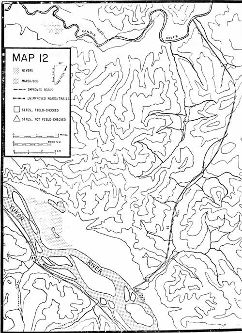
|
|
MAP 12. (click on image for a PDF version) |
#59 ROCK CREEK TENT FRAME
LOCATION:
The Rock Creek Tent Frame is 7-1/2 miles below
Nation City, on the right bank of the Yukon River, at the mouth of Rock
Creek.
SIGNIFICANCE:
Local significance.
PLACE IN HISTORY:
A modern tent frame 20 by 15 feet is set up only 15
feet from Rock Creek Cabin. It is unknown who built it, probably
hunters.
CONDITION:
Since the frame is only a few years old, its
condition is excellent. Lots of modern garbage and trash lie about.
TREATMENT:
If modern day use and hunting methods are to be
interpreted then the tent frame should be preserved. Otherwise it has
little local significance.
#60 ROCK CREEK CABIN
LOCATION:
The Rock Creek Cabin is 7-1/2 miles below Nation
City, on the right bank of the Yukon River, at the mouth of Rock
Creek.
SIGNIFICANCE:
Local significance.
PLACE IN HISTORY:
Harry Parker claimed Rock Creek Cabin. He was a mechanic, not a trapper,
from Rampart and Fairbanks. One day near Rock Creek, Parker's partner
heard a shot and a shout. He ran toward the shot to find a cow moose
dead, but before dying she had trampled Parker to death.
Chris Peterson, a Canadian, and Larry Dennis, an American, also used Rock Creek mainly as a thoroughfare to the Kandik, but they may have trapped the creek and used the cabins as well.
CONDITION:
A 15-by-13-foot cabin with 3/4 of its
sod roof fallen in stands 8-9 logs high with a small root cellar and
pole bunks. Household utensils, stove, and bob sled are scattered about
the yard. Its cache had a log foundation but only a tent frame for
sides. The cache was built without nails, instead, wire was used.
TREATMENT:
More documentation is required before a full
evaluation can be made however, the cabin should be preserved if
significance warrants it.
SOURCE:
George Beck; Barney Hansen.
| PHOTO NOT AVAILABLE AT PRESS TIME. |
| PLATE 24. #60 Rock Creek cabin, view to the north. |
#61 OLDER ROCK CREEK CABIN AND TREE CACHE
LOCATION:
The older cabin lies 100 yards back from the right
bank of the Yukon River 7-1/2 miles below Nation City.
SIGNIFICANCE:
Local significance.
PLACE IN HISTORY:
The cabin may be an old trapping cabin of Peter
Summerville's. He trapped Rock Creek during the early 1920's. He
trapped up Rock Creek to the Kandik. Each summer he would take his
supplies up the Kandik in a poling boat and cache them for winter
trapping.
CONDITION:
Only 3 logs on one wall plus foundation logs remain
of the old cabin. It is approximately 13 by 11 feet large, built of
unpeeled logs, 10 feet from the creek. The tree cache is 20 feet high
with 4 poles stretching across to 2 trees. The ladder still remains.
TREATMENT:
Little remains of the cabin or cache to preserve.
They should be documented for Park record.
SOURCE:
George Beck; Charlie Biederman.
Photographs.

|
| PLATE 25. #61 Older Rock Creek cabin, view to the west. |
#62 ROCK CREEK TRAPPING TRAIL
LOCATION:
The trail begins at the mouth of Rock Creek, on the
right bank of the Yukon River, 7-1/2 miles below Nation City. The trail
follows Rock Creek for 7-1/2 miles then joins one of the Kandik
tributaries.
SIGNIFICANCE:
Local significance.
PLACE IN HISTORY:
Supposedly Chris Peterson, a Canadian, and Larry
Dennis, an American, trapped together in the upper Kandik—one
trapped the American side, the other the Canadian. They used Rock Creek
as the most direct route to the upper Kandik but it is uncertain if they
trapped it. The trail is an excellent example of a trapper's trail
following the transition zone—that area between the flat muskeg and
black spruce and the birch and white spruce. It also follows the creek
so that animals must cross the trail, maybe even follow it, if they want
water. In certain places the trail skirts around rock outcroppings just
as animals would do. The trail may have been part of the aboriginal
trail system that went up Rock Creek to the Kandik above Johnson's
Gorge. Pete Summerville trapped along this trail in the early
1920's.
CONDITION:
The trail is easy to follow and well blazed.
TREATMENT:
If the trail is used by current trappers it will be
preserved.
SOURCE:
George Beck; Barney Hansen; Wyman Fritsch; Charlie
Biederman.
#63 ROCK CREEK TRAPPER'S DEADFALL
LOCATION:
The deadfall is 3/4 of a mile up Rock Creek Trail,
which is 7-1/2 miles below Nation City, on the right bank of the
Yukon River.
SIGNIFICANCE:
Local significance.
PLACE IN HISTORY:
Deadfalls were once the major method of trapping
before the introduction of the metal trap and the metal snare. Now
deadfalls are seldom made. They involve a great deal of work and aren't
always successful. Only 2 deadfalls were found in the Yukon - Charley
area. This was the largest and best constructed.
CONDITION:
It is a small 3 sided cabin with a roof and walls six
logs high. The fourth side consists of a heavy door made of heavy logs.
When the animal enters, he triggers the door that falls and crushes him.
The deadfall, 5-feet-square, is in excellent shape.
TREATMENT:
It is recommended that the deadfall be preserved as a
remnant of another period and for its uniqueness in the Yukon -
Charley area.
SOURCE:
David Evans.
Photographs.
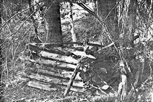
|
| PLATE 26. #63 Trapper's deadfall on Rock Creek Trail, view to the north. |
#64 GLENN CREEK CABIN
LOCATION:
The cabin is at the mouth of Glenn Creek, on the left
bank of the Yukon River, 12 miles below Nation City.
SIGNIFICANCE:
Local significance.
PLACE IN HISTORY:
During the 1950's Dr. LeFevre of Fairbanks built the
cabin as a hunting cabin. When the doctor died as a result of wounds
obtained in an airplane crash, the cabin fell into disrepair. Apparently
Frank Warren of Circle repaired it and uses it as a hunting cabin. The
cabin is easily seen from the river—the house 'log' shows many
visitors.
CONDITION:
The 14-by-14-foot cabin is in excellent shape
with a tin roof, rain gutters, fiberglass insulation, and plywood
paneling. Inside is a wood-burning cook-stove, 3 cots, chairs,
stools, and houseware. A frame storage shed with cans piled along side,
an old rotting boat, and a new boat complete the site.
TREATMENT:
Preservation is recommended. It is one of the most
habitable buildings on the river. Adaptive use is suggested.
SOURCE:
George Beck; Barney Hansen.
Photographs.

|
| PLATE 27. #64 Glenn Creek Cabin, view to the northwest. |
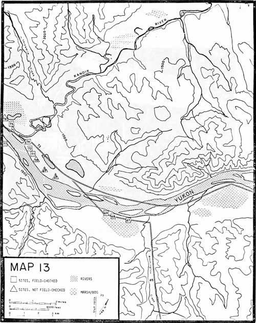
|
|
MAP 13. (click on image for a PDF version) |
#65 WASHINGTON CREEK COAL MINING ROAD
LOCATION:
The coal-mining road departs from the mail trail at
the Washington Creek Roadhouse, goes up the Yukon River, crosses
Washington Creek and follows the right bank of the Creek for 5 miles,
then crosses to the left until the mines are reached.
SIGNIFICANCE:
Local significance.
PLACE IN HISTORY:
There are very few roads that have been built in
Yukon - Charley. This road was one of the first and was built with the
future possibility of a railroad in mind. The small one-man placer mines
of the area never developed the land to the extent that larger companies
often did. The Nation coal mine, Fourth of July gold placer mine,
Woodchopper and Coal Creek dredge mines, and Ben Creek placer mine were
the only other enterprises to invest in expensive road building.
CONDITION:
The road parallel to the Yukon River has been
recently cleared by a bull dozer attempting to pull the steam tractor
out from the muck. The road parallel to Washington Creek, however, is
overgrown. Only tall spruce trees frame the 20-foot-wide road that scrub
spruce and alder have overgrown.
TREATMENT:
No preservation treatment is recommended but
recognition and interpretation of the road is advised.
SOURCE:
Arthur Collier; Hudson Stuck.
Photographs.
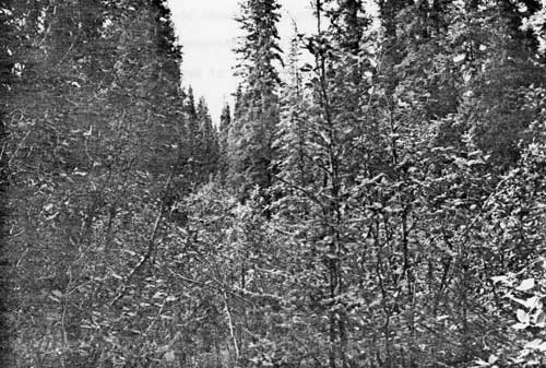
|
| PLATE 28. #65 Washington Creek coal mining road parallel to Washington Creek. |
#66 WASHINGTON CREEK COAL MINES
LOCATION:
The 3 coal mines are reported between 10-12 miles
from the Yukon River along the mining road that follows Washington
Creek. Two mines are on the right bank and one is on the left bank of
Washington Creek.
SIGNIFICANCE:
Regional significance.
PLACE IN HISTORY:
Coal was discovered on Washington Creek in 1897 by
N.B. LaBrie who turned the location over to Alaska Coal and Coke
Company. Five tons of coal were mined, and horses and dog teams sledded
the coal to the Yukon River during the winter. The mines, now caved in,
lay 12 miles from the Yukon. Casper Ellingin of Alaska Coal and Coke
Company had a shootout on the San Francisco courthouse steps over the
mine. Although the coal tested satisfactorily, the coal seams lay below
water level, thus, development would necessitate expensive pumping and
hoisting plants in addition to expensive transportation. Many of the
historic remains along this creek are relics from this period.
CONDITION:
The mines had caved in by 1903 and the exact location
would be difficult to determine, yet their presence can be interpreted
by the steam tractor and the mining road.
TREATMENT:
No preservation treatment is recommended.
SOURCE:
Arthur Collier; Hudson Stuck; George Beck.
#66A SURPRISE CREEK CABIN
LOCATION:
The cabin is approximately 10 miles from the Yukon at
the junction of Surprise Creek and Washington Creek.
SIGNIFICANCE:
Local significance.
PLACE IN HISTORY:
The cabin originally served as a winter sled for the
Washington Creek coal mine. The steam tractor pulled these large sleds
filled with coal from the mines to the Yukon approximately 10-12 miles
away. The sleds had runners made of 3-inch fur planking and
5/8-inch sled shoes that were 6 feet long. One prospector took the
abandoned sled and made it into a cabin near the mouth of Surprise
Creek. If the cabin remains it would illustrate the size of the
operation at Washington Creek and would show the adaptive use typical to
bush life
CONDITION:
The cabin has not been specifically located, thus its
condition cannot be evaluated.
TREATMENT:
The cabin, if it still remains, should be located and
its condition evaluated. It would be a unique cabin for the area. Not
only could it interpret the Washington Creek coal mine and the
logistical problems in transporting the coal, but it could depict the
prospector's life style. This cabin is outside the proposal area.
SOURCE:
Charlie Biederman.
#67 GEORGE BECK'S WASHINGTON CREEK CABIN
LOCATION:
The cabin is 22 miles downriver from Nation City on
the left bank of the Yukon River, 1 mile downriver from the mouth of
Washington Creek.
SIGNIFICANCE:
Local significance.
PLACE IN HISTORY:
George Beck built the cabin in 1947-1948 to be used
only as an overnight cabin when he was carrying supplies from the Yukon
to his mining cabin up Washington Creek. The cabin is characteristic of
small one-man cabins or of line cabins along trap lines. Trails lead up
Washington Creek and along the Yukon River. George Beck never trapped
from the cabin but it was used by Dr. LeFevre.
CONDITION:
The cabin is in excellent shape though George says it
brings in water. It measures 10 by 11 feet. Built of unpeeled logs, the
roof still stands. The door is still hinged, but the stove is in the
yard rusted away. The cache has fallen down. Four dog houses still
remain formed by logs with spruce piled high to serve as a roof. Lumber
is still carefully stacked on a rack beside the house.
TREATMENT:
The cabin should be protected. It has not yet
suffered the fate of vandalism. Life along the river from 1920-1950
could be easily interpreted here. Adaptive use is suggested.
SOURCE:
George Beck; Horace Biederman, Jr.
Photographs.
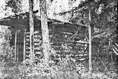
|
| PLATE 29. #67 George Beck's Washington Creek Cabin, view to the southeast. |
#68 WASHINGTON CREEK ROADHOUSE
LOCATION:
The roadhouse is 23 miles downriver from Nation City
on the left bank of the Yukon River, 1-3/4 miles downriver from the
mouth of Washington Creek.
SIGNIFICANCE:
Local significance.
PLACE IN HISTORY:
The roadhouse built by David Koontz was a frequent
stopping place especially during winter travel along the mail trail.
James Wickersham, C.A. Bryant, and Hudson Stuck all mention the
hospitality of the roadhouse. Stuck tells about one of the lady owners
taking rifle shots at those people who did not stop at her roadhouse. He
remembered well the intimidating and cajoling placards she posted along
the trail. The roadhouse, like others along the mail trail, captured
certain aspects of warmth, companionship, and hospitality of a by-gone
era.
CONDITION:
The roadhouse was two rooms or 36 feet long and 17
feet wide. The inside squared-off-wall was papered with 1906 newspapers.
Only 1/8 of the sod roof still remains and the wall facing the Yukon has
buckled, weakened by the door and window. The back wall, 8 logs high,
stands intact. The house is well built, using wooden dowels for strength
and endurance. A second house, possibly the bunkhouse, is less preserved
It measures 18-1/2 feet by 17-1/2 feet. Only 3-5 logs on each
side remain. It is also made of unpeeled logs outside and chinked with
moss. The name, Nord and Olson, was written on the shuttered windows. A dog
barn with 5-6 stalls completes the setting.
TREATMENT:
The buildings should be protected and interpreted.
They were important during the turn of the century and probably played a
role in the development of the abortive Washington Creek coal mine. A
National Register nomination could be completed but other roadhouses,
Woodchopper Creek for instance, are better preserved and more
illustrative but also not as old.
SOURCE:
Arthur Collier; Hudson Stuck; James Wickersham; C.A.
Bryant.
Photographs.
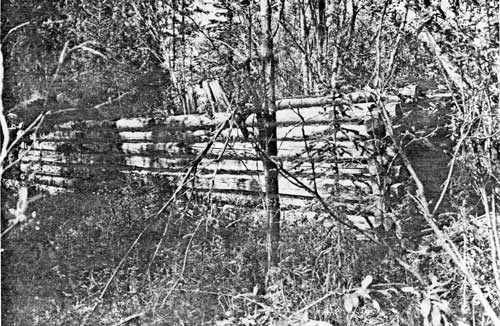
|
| PLATE 30. #68 Washington Creek Roadhouse, view to the northwest. |
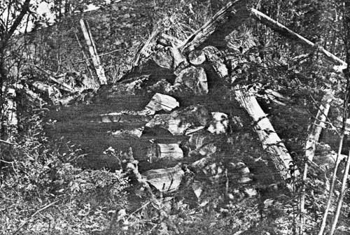
|
| PLATE 31. #68 Second cabin at Washington Creek Roadhouse, view to the northwest. |
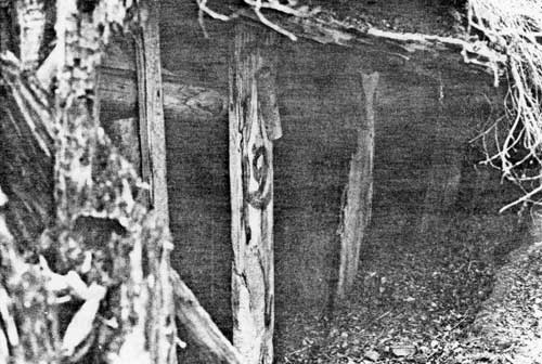
|
| PLATE 32. #68 Dogbarn at Washington Creek Roadhouse. |
#69 STEAM TRACTOR
LOCATION:
The tractor is located 23 miles downriver from Nation
City on the left bank of the Yukon River, 2 miles downriver from the
mouth of Washington Creek.
SIGNIFICANCE:
Local significance.
PLACE IN HISTORY:
The tractor was bought by Dr. Ryan, a San Francisco
physician, for use in transporting supplies to the Washington Creek coal
mine. The tractor pulled boxcar-like sleds filled with coal from the
mines to the Yukon. One of the sleds was used as a cabin at the mouth of
Surprise Creek. Unfortunately the coal did not prove of high enough quality for
steamboats and the company went bankrupt. The tractor is one of the most
dynamic relics of the Yukon-Charley area.
CONDITION:
The tractor stands 13 feet high and 26 feet long. The
wheels alone are 8 feet high. The valves, gages, and gears are missing.
George Beck took the boiler on 2 dog sleds to serve as a rain barrel at
Biederman's Camp. The bolts in the Biederman fishwheel likewise came
from the tractor's spokes. George also took the lumber from the cab to
serve as doors and windows for his mining cabin up Washington Creek.
Thus, parts of the tractor have been adapted by another era for other
uses as is characteristic of the subculture of bush life.
TREATMENT:
The tractor is now visible from the river because
within the last 2 years someone bulldozed the area and tried to remove
the tractor. The tractor should be protected from further vandalism or
destruction. National Register nomination is recommended especially if
more details could be found or if its uniqueness in Alaska could be
verified.
SOURCE:
Hudson Stuck; George Beck; Charlie Biederman.
Photographs.
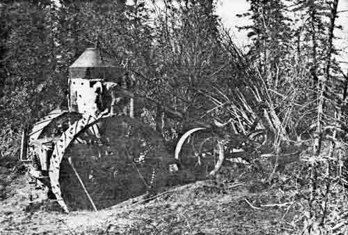
|
| PLATE 33. #69 Washington Creek steam tractor, view to the northwest. |
#69A FRANK FISH'S CABIN
LOCATION:
The cabin ruins are 3-1/2 miles upriver from the
mouth of the Kandik River and on the right bank of the Yukon just across
from the mouth of Westrinarin Creek.
SIGNIFICANCE:
Local significance.
PLACE IN HISTORY:
Frank Fish built the cabin probably in the 1930's as
a trapping cabin. Unfortunately the cabin burned down. Subsequent floods
following spring break-up have probably removed any trace. Frank Fish
and his brother trapped the Kandik River. They obtained their supplies
from the steamboat and then cached their winter supplies along the river
in line cabins.
CONDITION:
The cabin was not specifically located. Since it was
burned down, it is unlikely that much remains.
TREATMENT:
Aside from an attempt to document the exact location
of the cabin, no treatment is recommended.
SOURCE:
Charlie Biederman.
#69B INGESS SOLOMON'S CABIN
LOCATION:
The cabin is approximately 3 miles upriver from the
mouth of the Kandik River, on the right bank of the Yukon, across from
the mouth of Westrinarin Creek, about 1/2 mile downriver from Frank
Fish's Cabin.
SIGNIFICANCE:
Local significance.
PLACE IN HISTORY:
Ingess Solomon built the cabin. He probably used it
as a supply base. Obtaining his supplies from either the steamboats or
Eagle, he would store them in the cabin until he could cache them in his
line-cabins. He may have trapped from the cabin.
CONDITION:
The cabin was not specifically located. The condition
of the cabin is unknown.
TREATMENT:
The cabin or its remains should be located and
evaluated. Additional history of the cabin is also needed.
SOURCE:
Charlie Biederman.
#70 CHARLEY'S VILLAGE
LOCATION:
The village is 1-1/2 miles from the mouth of the
Kandik River, on the right bank of the Yukon River between the upriver
end of the S-shaped lake and the Yukon River.
SIGNIFICANCE:
Regional significance.
PLACE IN HISTORY:
This is the only historic Indian village that resided
within the boundaries of Yukon - Charley. Frederick Schwatka first
recorded the village followed by Billie Moore, and James Wickersham.
Finally Hudson Stuck tells that in 1914 the village was washed away and
the Natives moved to Circle. James Wickersham also tells several stories
about Chief Charley. Henry Apell of Hudson Bay Company recognized the
head of a musk ox that Charley had killed at the headwater of the
Kandik. Reportedly, Chief Charley helped with the boundary survey.
Travellers along the mail trail often stayed overnight at the
village.
CONDITION:
The village was washed away. Nothing remains but a
grassy bank. Archeology might yield something. Across the S-shaped lake
on a bench covered with birch is the grave yard for Charley's Village. A
picket fence encloses 3-4 graves.
TREATMENT:
The cemetery should be located and protected.
Archeologists could find the boundaries of the village. Since very little
is known about the Han Indians, historically as well as prehistorically,
this site is significant. A National Register nomination should be
considered following the archeologists' report.
SOURCE:
George Beck; Hudson Stuck; Fredrick Schwatka; Captain
Billie Moore; Cornelius Osgood; Leroy N. McQuesten; Charlie
Biederman.
#71 S-SHAPED-LAKE CABIN (KANDIK-YUKON)
LOCATION:
The cabin is 1-1/2 miles upriver from the mouth
of the Kandik, on the right bank of the Yukon, near the downriver end of
the S-shaped lake.
SIGNIFICANCE:
Local significance.
PLACE IN HISTORY:
The small cabin whose origin is unknown is unique for
Yukon - Charley. It may be a trapper's line cabin, a way station for the
mail trail, or a dog house.
CONDITION:
It measures only 7 feet by 10 feet with a
26-inch-tall door. It stands only 3 feet high or 7 logs high. Some of
the logs are even split in half lengthwise. It would not be a warm
cabin. One pole remains that may be part of a cache.
TREATMENT:
Preservation is recommended until its origin and use
are known. In any event it is unique for the area.
Photographs.
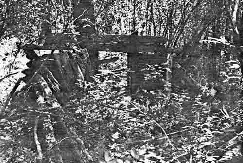
|
| PLATE 34. #71 S-Shaped-Lake Cabin, view to the southeast. |
#72 KANDIK-YUKON CACHE
LOCATION:
The cache is 1-1/2 miles upriver from the mouth
of the Kandik on the right bank of the Yukon, near the downriver end of
the S-shaped lake.
SIGNIFICANCE:
Local significance.
PLACE IN HISTORY:
Whose cache is unknown, thus its place in history
cannot be determined.
CONDITION:
Only 1 cache pole still stands but 3 others have
fallen down. No remains of a cabin were found.
TREATMENT:
No treatment recommended unless further documentation
merits preservation.
Photograph.
#73 MAIL TRAIL (NEAR KANDIK)
LOCATION:
The trail begins 1 mile from the mouth of the Kandik
River, the right bank of the Yukon River, near the upriver end of Kandik
Slough and runs parallel to the Yukon 200 yards off the river.
SIGNIFICANCE:
Regional significance.
PLACE IN HISTORY:
The mail trail is very visible along the Yukon at
this point. It is currently used as a trapper's trail but also as the
best way for winter travel.
CONDITION:
The trail is wide, about 6 feet, and well-traveled
and marked.
TREATMENT:
The trail should be preserved and used as it was
historically—for winter transportation.
SOURCE:
Local trappers.
#74 FRANK FISH'S KANDIK CABIN SITE
LOCATION:
The cabin site is 28 miles downriver from Nation
City, on the right bank of the Yukon River, near the upriver end of the
Kandik Slough, and 100 yards off the Yukon.
SIGNIFICANCE:
Local significance.
PLACE IN HISTORY:
Frank Fish built a cabin and a cache near the Yukon
where he could meet steamboats bringing his supplies. He would cache his
supplies at this cabin while he carried as much as possible to his base
cabin at the mouth of Three Mile Creek and the Kandik.
CONDITION:
Only 3 poles with metal around them that belonged to
the fallen cache are easily discerned. A few notched logs are found
randomly about with no apparent design.
TREATMENT:
No treatment recommended but documentation and
possibly interpretation is strongly suggested.
SOURCE:
George Beck.
Photograph.
#75 KANDIK MOUTH CABIN
LOCATION:
The cabin is at the mouth of the Kandik River on the
right bank of the Yukon River.
SIGNIFICANCE:
Local significance.
PLACE IN HISTORY:
Gordon Bertison from Circle built the cabin. Other
details are not known.
CONDITION:
The cabin is in excellent shape. It measures
12-1/2 feet by 15 feet. It has its roof and a barrel stove. Only a
few cabins have dirt floors; this is one. A tent frame covered with
canvas stands 15 feet high and served as the cabin's cache. A lot of
trash remains around the yard.
TREATMENT:
Since the cabin is in good shape, it should be
preserved and used accordingly.
SOURCE:
George Beck.
Photograph.
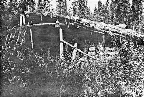
|
| PLATE 35. #75 Kandik Mouth Cabin, view to the north. |
#76 TOM KING ROADHOUSE NEAR KANDIK MOUTH
LOCATION:
The roadhouse once stood 3/4 mile from the mouth of
the Kandik River, on the right bank of the Yukon River, directly across
from Biederman Camp.
SIGNIFICANCE:
Local significance.
PLACE IN HISTORY:
Tom King built the roadhouse around the turn of the
century and suffered through many break-up floods. This roadhouse
rivaled the Washington Creek Roadhouse, which prompted the rather
extreme measures of threatening or shooting travellers who by-passed the
Washington Creek Roadhouse. At the same time, Tom King chopped and sold
wood for the steamboats. He also had some of the few horses in the
area.
CONDITION:
The roadhouse burned in 1918. Later Ed Biederman tore
down what remained and moved it across the river to Biederman Camp where
it stands solidly today.
TREATMENT:
The site should be located, documented, and evaluated
as to proper preservation treatment.
SOURCE:
George Beck; Horace Biederman, Jr.; Hudson Stuck;
Charlie Biederman.
#77 BIEDERMAN CAMP
LOCATION:
The camp is 3/4 mile from the mouth of the Kandik
River, on the left side of the Yukon and is indicated on the Charley
River Quadrangle, scale 1:250,000 and Charley River (B-4), scale
1:63,360.
SIGNIFICANCE:
Regional significance.
PLACE IN HISTORY:
This site is probably the most significant site in
Yukon - Charley in fabric remaining and in historical significance
throughout the region. Ed Biederman came from Bohemia at the age of 13.
His father, who was in the export business, helped him get to America.
In Philadelphia he became a baker's apprentice. Eventually he made it to
San Francisco where he heard of the Klondike strike. In 1899 he headed
north but diverted to Nome when he learned of the new stampede. Once in
Nome, he discovered all the good ground had been staked so he went to
St. Michael. He was working for the Northern Commercial Company when
they got the bids for the mail contract. Initially he carried the mail
from Rampart to Tanana and back, however, in 1912 when Northern
Commercial Company changed their policy to subcontract with their
drivers, Ed took the route between Eagle and Circle. During the summer
he boarded dogs for trappers and gold miners who did not want the
problems of caring for dogs in the off season. In 1918 he bought logs
for $50 from the Fish brothers, trappers along the Kandik, and tore down
Tom King's Roadhouse for his bunkhouse. Biederman Camp is approximately
halfway between Eagle and Circle. Ed and his sons, Horace and Charlie,
ran the mail by dog team from Eagle to Circle and return from
1912-1938, except for eight years when he lost the
contract—four when he froze his feet and four others when horses
and airplanes were used experimentally. After 1938, airplane pilots had
the mail contract. The Biederman's stayed in Eagle during the winter,
but during the summer they smoked and canned great quantities of salmon
for dog food as well as for the dining room table. As high as 60 dogs a
summer were boarded and as many as 3 tons of fish were caught annually.
Biederman's also served as an informal roadhouse for travellers along
the mail trail. A few trappers and gold miners used Biederman's as a
base camp. Ed Biederman died in 1945 and the family moved into Eagle to
remain year around.
CONDITION:
In July of 1976 the camp reflected a nostalgic return
to the Yukon River of the 1930's. By August, however, the flavor was
lost as the new owner of the Native allotment had removed much of the
furnishings that had helped to transcend four decades of "progress". The
house, 39 by 17 feet; the shed or bunkhouse, 14 by 16 feet; the cache,
12 by 15 feet; the steam house, 10 by 8 feet; and the meat tunnel are in
excellent shape with roofs and walls intact. Only the dog barn has lost
its roof and 2 of its walls. There are 8-10 boats in various stages of
disrepair. The fish baskets, 8 by 10 feet, and the fish-drying racks, 71
by 16 feet, remain to depict very graphically the size of the operation.
Numerous dog houses and various paraphernalia characteristic of the
lifestyle add other dimensions.
TREATMENT:
Preservation is strongly recommended. National
Register nomination is advised. The cooperation and enlightenment of the
current owner would prevent unnecessary destruction of one of the most
important historic sites in Yukon - Charley.
SOURCE:
Lois Kitchener; George Beck; Horace Biederman, Jr.;
Charlie Biederman.
Photographs.

|
| PLATE 36. #77 Biederman's House, view to the northwest. |
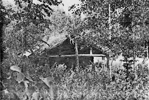
|
| PLATE 37. #77 Biederman's shed, view to the west. |
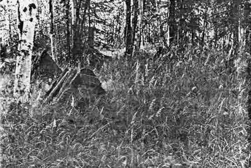
|
| PLATE 38. #77 Doghouses at Biederman's, view to the southwest. |
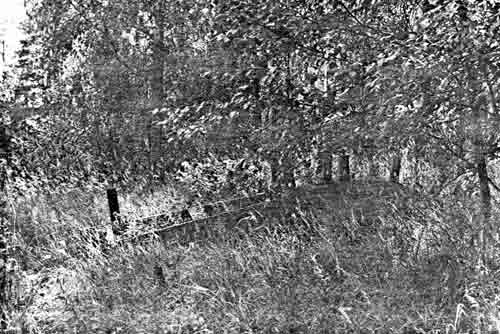
|
| PLATE 39. #77 Form for dogsled runners at Biederman's. |
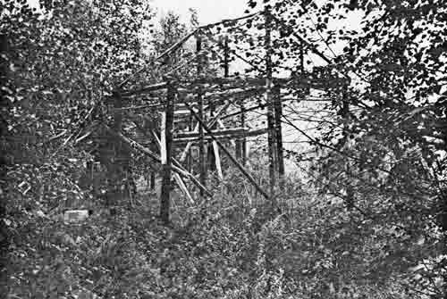
|
| PLATE 40. #77 Fishracks at Biederman's, view to the northwest. |

|
| PLATE 41. #77 Fishwhell baskets at Biederman's, view to the northwest. |
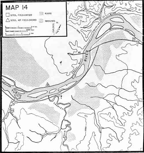
|
|
MAP 14. (click on image for a PDF version) |
#78 GEORGE BECK CABIN
LOCATION:
The cabin is 100 yards downriver from Biederman Camp
on the left side of the Yukon River.
SIGNIFICANCE:
Local significance.
PLACE IN HISTORY:
George Beck arrived in the Yukon - Charley area in
1934. He worked for Dr. Patty at Coal Creek gold mining dredge until he
met and married Nellie Biederman. For the next 10 years he lived in his
own house near the Biedermans trapping, hunting, and fishing. For 2
winters he prospected for gold on Washington Creek. Because George
Beck's lifestyle is characteristic of all whom have lived in Yukon -
Charley and because he is one of very few oldtimers who not only knows
the area's history and its people but actually lived it himself, the
cabin is significant. George Beck is almost a culture hero to the people
currently trapping on the Yukon River.
CONDITION:
The cabin is only 150 yards downriver from
Biederman's Camp. It is in good repair with an aluminum roof covering
the original sod roof. The root cellar and plank floor are in good
shape. The cache, however, has fallen down.
TREATMENT:
The cabin should be preserved. If George Beck's
approval and cooperation could be obtained, a National Register nomination
should be processed.
SOURCE:
George Beck; Horace Biederman, Jr.
Photographs.
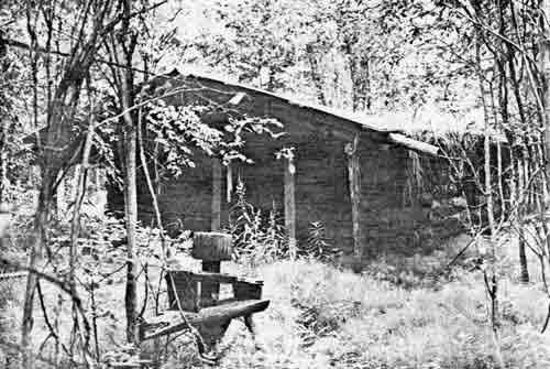
|
| PLATE 42. #78 George Beck's Cabin below Biederman's, view to the south. |
#79 MAIL TRAIL WAY-STATION
LOCATION:
The way station is 3/4 mile from Biederman Camp, near
the upriver end of the slough, on the left bank of the Yukon River.
SIGNIFICANCE:
Local significance.
PLACE IN HISTORY:
After Ed Biederman froze his feet in 1925, the mail
contract went to John Palm for four years. During those years the Alaska
Road Commission contracted with Sandy Johnson—a trapper, gold
miner, and carpenter—to build a cabin downriver from Biederman's
Camp. The cabin would provide a stopping place for those carrying the
mail contract who did not want to use Biederman's Camp. This is one of
very few cabins in the Yukon - Charley area built solely for the purpose
of providing a way-station for mail carriers. The Biederman's built at
least 2 cabins between Biederman's and Circle as way-stations, but these
cabins were not located.
CONDITION:
The cabin measures 12 by 12 feet but has lost its
roof and 2 of its walls. Its glass windows have fallen out, but a table
and bunk still remain inside the house.
TREATMENT:
If the cabin were in better repair, preservation
would be recommended. As it is, protection from further vandalism or
destruction is advised.
SOURCE:
George Beck; Charlie Biederman.
Photograph.
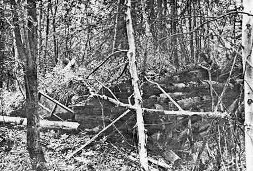
|
| PLATE 43. #79 Mail Trail Way-station, view to the west. |
#80 TRAPPING TRAIL BETWEEN BIEDERMAN BLUFF AND
CHESTER BLUFF
LOCATION:
The trail follows a creek between Biederman Bluff and
Chester Bluff 6-1/2 miles from Biederman Camp on the right bank of
the Yukon.
SIGNIFICANCE:
Local significance.
PLACE IN HISTORY:
This is a typical trapping trail. Like many trapping
trails it follows the creek that allows a natural highway for animals
and trappers. Blazes on the trees often located a trapper's set.
Although the 1951 topographic map shows the mail trail going along this
trail, mail carriers say that the mail trail was across the river. This
may have been one of Sandy Johnson's trapping trails.
CONDITION:
The trail is well marked and visible. Trappers' signs
are recognizable such as blazes on trees and occasional traps.
TREATMENT:
No treatment is recommended unless the trail is used
for hiking, then interpretation of trapping could be done.
SOURCE:
1951 U.S.G.S. topographic map; Charlie Biederman.
Photograph.
#80A SANDY JOHNSON'S TRAPPING CABIN
LOCATION:
The cabin is directly across from the mouth of the
Charley River on the right bank of the Yukon River.
SIGNIFICANCE:
Local significance.
PLACE IN HISTORY:
Sandy Johnson arrived in the Yukon - Charley area
about 1900. He prospected Sam Creek and Ben Creek. Although he mined
during the winter, he also trapped. This cabin was across the river from
Al Ames cabin. A cabin here allowed him to trap Andrew Flats. He may
have made the trapping trail between Biederman Bluff and Chester Bluff.
This cabin served as a line cabin. His base cabin was most likely the
Sam Creek cabin. Sandy Johnson built a large number of the cabins in
Yukon - Charley, and they usually remain in better shape for a longer
period of time than their contemporaries.
CONDITION:
The cabin was not specifically located, thus its
condition could not be assessed.
TREATMENT:
Since Sandy Johnson is a major figure in the
twentieth century Yukon - Charley area, the cabin should be located and
evaluated to supplement the existing knowledge of this fascinating
person.
SOURCE:
Charlie Biederman.
#81 CHARLEY RIVER MOUTH CABIN
LOCATION:
The cabin is 1-1/4 miles from the mouth of
Charley River, on the right bank of the Charley River, but on the left
bank of the Yukon.
SIGNIFICANCE:
Local significance.
PLACE IN HISTORY:
Al Ames built the cabin in the summer of 1941. He
also built a cabin on Bonanza Creek. Presumably these cabins were built
for trapping purposes.
CONDITION:
The cabin is in good condition. The roof is intact as
are the walls and floor. There are 2 rooms; the back room is a more
recent addition. The house measures 30 by 15 feet. Glass windows and
doors are uncracked. Stove, tables, benches, and beds complete the
furnishings. This site is a patented homesite.
TREATMENT:
The cabin should be preserved and maintained, at
least, at its present condition. If more information dictates that it
should be on the National Register, an application should be
completed.
SOURCE:
George Beck; Horace Biederman, Jr.; Wyman Fritsch;
Charlie Biederman.
Photographs.
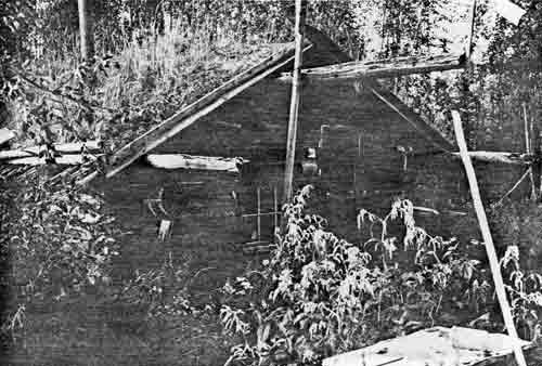
|
| PLATE 44. #81 Charley River mouth cabin, view to the northwest. |
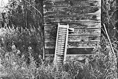
|
| PLATE 45. #81 Sluice box at Charley River mouth cabin, view to northeast. |
|
|
MAP 15. (click on image for a PDF version) |
#82 BONANZA CREEK CABIN
LOCATION:
The cabin is 9 miles up the Charley River from the
Yukon, on the left bank of the Charley River, near the mouth of Bonanza
Creek.
SIGNIFICANCE:
Local significance.
PLACE IN HISTORY:
Al Ames built the cabin presumably as part of his
trap line. The bomber pilot who crashed in the upper Charley River area
during World War II used this cabin on his heroic trip to
civilization.
CONDITION:
The cabin is in good shape even livable. It measures
18 by 15 feet with a wood floor, root cellar, stove, table, and beds.
Adjacent to the cabin are a fallen cache and an outhouse with an
attached steam bath.
TREATMENT:
The cabin should be maintained and preserved as it
currently exists. If additional research provides sufficient data, a
National Register nomination should be prepared.
SOURCE:
George Beck.
Photographs.
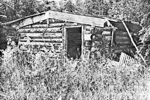
|
| PLATE 46. #82 Bonanza Creek Cabin, view to the southeast. |
#83 TOWN AT BONANZA CREEK
LOCATION:
The town is approximately 6 miles along Bonanza Creek
from its mouth to where it makes a big bend.
SIGNIFICANCE:
Local significance.
PLACE IN HISTORY:
The Charley River was prospected thoroughly. Only on
Bonanza Creek, however, did a small town evolve. George Beck reports
that the town was large enough to merit its own recorder and recording
district for mining claims. He states that the town lay at the bend in
Bonanza Creek. The existence of this town makes the Charley River appear
less pristine and untouched than it had initially seemed when compared
to the gold mining of the surrounding area. Also, Dr. Ernest Patty sent
teams into the Bonanza Creek region to test drill for possible gold
dredging lands.
CONDITION:
Condition unknown.
TREATMENT:
It is strongly recommended that this town be located
and evaluated for a clearer picture of the history of the Charley
River.
SOURCE:
George Beck.
#84 SILVIA CREEK CABINS
LOCATION:
The cabins are 23 miles up the Charley River from the
mouth of the Charley, on the left bank of the river near the mouth of
Silvia Creek.
SIGNIFICANCE:
Local significance.
PLACE IN HISTORY:
The 2 cabins appear older than any cabins surveyed.
Their style is also different from the later cabins built by trappers.
The windows are small, only 12 by 10 inches big. The roofs of both have
fallen in. The hand-hewn door has the word SILVIE written at the bottom.
Two shovels are propped up in front of one of the cabins.
CONDITION:
The cabins stand between 4-6 logs high, but the loss
of the roofs has caused substantial damage to the cabins' walls.
Apparently very little lumber could be found to use for framing the door
and windows. A bed and workbench remain but very little else.
TREATMENT:
Since the cabins may well be prospectors' cabins from
the turn of the century, their preservation may be important. More
information is needed before a complete evaluation can be made.
Photographs.
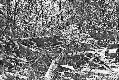
|
| PLATE 47. #84 Silvia Creek Cabin A, view to the northwest. |
#85 MARTEN DEADFALL ON THE CHARLEY RIVER
LOCATION:
The deadfall is 29 miles up the Charley River from
its mouth, on the left bank of the river nearly a 1/2 mile
downriver from the mouth of Drayham Creek.
SIGNIFICANCE:
Local significance.
PLACE IN HISTORY:
Deadfalls were once the primary method of trapping
but have since been replaced by metal traps and snares. Since deadfalls
require no metal, trappers who had more time than money used them. In
recent times the craft is seldom employed, thus, this site is almost an
antique artifact. This deadfall has 11 upright poles that provide a
"cubby", which is baited. As the animal enters the cubby to get the
bait, he triggers the killing log that falls and kills him. Some
trappers during the 1920's and 1930's used this method of trapping but
no one in the area today does.
CONDITION:
The deadfall is completely intact. The upright poles
are 18 inches high and 3 inches in diameter, whereas the killing log is
5-1/2 feet long and 6 inches in diameter. The deadfall is in a small
saddle of a steep cliff that drops off 150 feet below to the Charley
River, but on the other side it gently slopes into a wide flat valley. It
characterizes not only the technique used in building deadfalls but the
psychology and thought behind their placement.
TREATMENT:
Preservation is strongly advised, maybe even a
National Register nomination if no other deadfalls are found that are as
representative of the trapping theme in Yukon - Charley history, that
are as well preserved, or that depict such craftsmanship.
SOURCE:
David Evans.
Photograph.
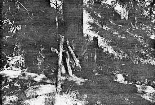
|
| PLATE 48. #85 Marten deadfall on the Charley River, view to the northwest. |
#86-#89 CABINS NOT SPECIFICALLY LOCATED ON CHARLEY
RIVER
LOCATION:
A cabin is at the mouth of Drayham Creek (#86), a
cabin is near the mouth of Highland Creek (#88), 2 cabins are near the
mouth of Essie Creek (#89), and a couple of graves are on an island off
Hanna Creek (#87).
SIGNIFICANCE:
Local significance.
PLACE IN HISTORY:
There are supposedly cabins at the mouth of nearly
every creek on the Charley River. Sam McCourtney built a cabin at the
mouth of Drayham. The Drayham Creek valley proved so steep that in order
to set up his sluice box he had to set poles across the creek to bridge
the two sloping hills. There are also reported 2 cabins near the mouth
of Essie Creek, a cabin near the mouth of Highland Creek that Earl Stout
built while prospecting, and a couple of graves on a small island off of
Hanna Creek. Al Brown and Phil Berail trapped the upper Charley River
and consequently must have left trapping cabins.
CONDITION:
Condition unknown.
TREATMENT:
Location of these sites should be found, documented,
and evaluated.
SOURCE:
George Beck; C.A. Bryant; Charlie Biederman.
#90-#103 COPPER CREEK ARCHEOLOGICAL SITES
LOCATION:
These sites are on Copper Creek, which is
approximately 56 miles from the junction of the Charley and the Yukon
Rivers. Copper Creek is approximately 27 miles long and is on the right
side of the Charley River.
SIGNIFICANCE:
Regional significance.
PLACE IN HISTORY:
Eleven prehistoric and one historic cabin were found
in a 1976 archeological survey. Two historic cabins indicated on the map
were not found. All prehistoric sites were located on prominent vantage
points, had similar soil profiles, had easy access to water resources,
were in strategic locations for game, and served as artifact manufacture
and game lookout sites. This survey concludes that there has probably
been intense aboriginal use of the Upper Charley River area over an
extended period of time. The area may prove to be of prime importance in
early-man studies.
CONDITION:
All the sites were undisturbed by man. Several are
referred to as blow-outs—natural erosion has exposed artifacts. The
historic cabin was without a roof, and had walls that are only 5 logs
high. Numerous historic artifacts—shovel, buckets,
stovepipe—lie about the cabin.
TREATMENT:
The high concentration of sites at the headwaters of
Copper Creek should be investigated further for possible inclusion in
National Register. The area, in any event, should be protected until it
has been thoroughly surveyed. The artifacts that are subject to vandals
or pot-hunters should be collected and accessioned.
SOURCE:
Peter Bowers and Dave Hoch, Copper Creek
Archeological Survey.
#104 BOMBER CRASH
LOCATION:
The crash site is on the left bank of the Upper
Charley River approximately 4 miles upriver from the mouth of Copper
Creek. The site is on the slope of a 5,510 foot mountain.
SIGNIFICANCE:
Regional significance.
PLACE IN HISTORY:
During a winter in World War II a bomber on a
training mission malfunctioned and crashed in the mountains of the Upper
Charley River. Before crashing, however, the crew were able to parachute
out. Only the pilot survived the long ordeal to safety. He found Phil
Berail's food cache but failed to recognize dried food or snowshoes.
Miraculously he stumbled into Al Ames' cabin (on Bonanza Creek?) who
took him by dog team to Woodchopper Creek Camp and safety. The story is
one of the most dramatic and exciting stories told of the Yukon -
Charley area in a national magazine, The New Yorker.
CONDITION:
The site of the bomber crash was not visited
therefore, its condition cannot be evaluated.
TREATMENT:
Exact details of the story need to be researched and
interpreted. The airplane itself may qualify for preservation but is
probably in poor condition. In any event the site should be protected
from vandals.
SOURCE:
George Beck; Jim Layman; John McPhee.
#105 UPPER CHARLEY RIVER TRAPPING CABINS
LOCATION:
The cabin on the tributary of the east fork of the
Charley River is 27 miles from the mouth of Copper Creek. The other
cabins are outside the proposal.
SIGNIFICANCE:
Local significance.
PLACE IN HISTORY:
Only cabin #105 lies within the proposal but cabins
#106-#110 are adjacent to the area. Elmer Nelson trapped this area from
1946-1949. He used the upper Charley River even though the bulk of his
cabins resided outside the proposed boundaries. The Pittsburg side of
the divide, he felt, had better fur—mostly marten and wolf. He
built cabin #109 on Pittsburg Creek, which measured 12 by 10 feet inside
dimensions. The Charley River cabin #105 measured 15-foot-square. He
air-dropped his supplies near his base cabin then landed at nearby Gold
Run airstrip (for Pittsburg Cabins) or on frozen lakes near Charley
River cabin. These cabins and associated trapping trails could be
compared and contrasted with trapping cabins and trails elsewhere in
the Yukon - Charley proposal. The history of trapping from 1920's to
1950's has never been thoroughly done.
CONDITION:
These cabins have not been visited, thus, their
condition cannot be evaluated.
TREATMENT:
At least the Charley River Cabin should be visited,
documented, and evaluated for preservation recommendations. The other
cabins should be part of the state survey and considered for
protection.
SOURCE:
Elmer Nelson.
#106-#110 UPPER CHARLEY RIVER TRAPPING CABINS
LOCATION:
The cabin on the tributary of the east fork of the
Charley River is 27 miles from the mouth of Copper Creek. The other
cabins (#106-#110) are outside the proposal.
SIGNIFICANCE:
Local significance.
PLACE IN HISTORY:
Only cabin #105 lies within the proposal but cabins
#106-#110 are adjacent to the area. Elmer Nelson trapped this area from
1946-1949. He used the upper Charley River even though the bulk of his
cabins resided outside the proposed boundaries. The Pittsburg side of
the divide, he felt, had better fur—mostly marten and wolf. He
built cabin #109 on Pittsburg Creek, which measured 12 by 10 feet inside
dimensions. The Charley River cabin #105 measured 15-foot-square. He
air-dropped his supplies near his base cabin then landed at nearby Gold
Run airstrip (for Pittsburg Cabins) or on frozen lakes near Charley
River Cabin. These cabins and associated trapping trails could be
compared and contrasted with trapping cabins and trails elsewhere in
the Yukon - Charley proposal. The history of trapping from 1920's to
1950's has never been thoroughly done.
CONDITION:
These cabins have not been visited, thus, their
condition cannot be evaluated.
TREATMENT:
At least the Charley River Cabin should be visited,
documented, and evaluated for preservation recommendations. The other
cabins should be part of the state survey and considered for
protection.
SOURCE:
Elmer Nelson.
#111 SAM CREEK CABIN
LOCATION:
The cabin is 1/4 mile up Sam Creek from the Yukon, on
the left bank of Sam Creek, and on the left bank of the Yukon. It is
indicated on the Charley River Quadrangle, scale 1:250,000 and Charley
River (B-4), scale 1:63,360.
SIGNIFICANCE:
Local significance.
PLACE IN HISTORY:
Sandy Johnson built the cabin as part of his mining
and prospecting lifestyle and also as his supply base from which he met
steamboats. Johnson also built a number of cabins in Yukon - Charley,
all maintain his distinct building style and, as merit to his craft, are
still standing. The bottom of each log is curved to overlap and tightly
fit over the log immediately beneath it. Johnson came to the Yukon in
the early 1900's, prospecting, trapping, and building cabins and trails
until 1946. He built the Slaven Cabin as well as the mail trail cabin
near Biederman Camp, and the Ben Creek Cabin.
CONDITION:
The cabin has recently been repaired. The roof and
walls remain standing. A well-made cache 10-1/2 by 10-1/2 feet
is almost as large as the cabin, 11 by 13 feet. A mining shaft and
several trails are also in the vicinity.
TREATMENT:
Protection from vandals is recommended. The Ben Creek
Cabin or Slaven Cabin are better examples of Sandy Johnson's work.
The cabin however, should be preserved and used adaptively rather than
constructing new buildings.
SOURCE:
Barney Hansen; Jim Layman.
Photograph.
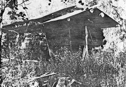
|
| PLATE 49. #111 Sam Creek Cabin, view to the northwest. |
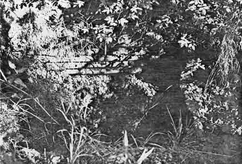
|
| PLATE 50. #111 Sam Creek mining shaft, view to the east. |
#112 BEN CREEK TRAIL
LOCATION:
The trail begins at the junction of Sam Creek and the
Yukon River, passes the Sam Creek Cabin between the cabin and the cache,
follows Sam Creek to Ben Creek, then up Ben Creek, over the hills to
Boulder Creek and on to Coal Creek.
SIGNIFICANCE:
Local significance.
PLACE IN HISTORY:
The trail leaves the Yukon and follows Sam Creek to
Ben Creek. It was the major supply trail to Ben Creek before the Coal
Creek Road and the subsequent Ben Creek Road were constructed in the
1930's. The trail is currently used as a trapping trail as it may well
have been used during the winters in the 1910-1920's. In fact when river
conditions prevented the mail trail from following the Yukon, the mail
drivers used Sandy's trail up Sam Creek over to Ben Creek and down Coal
Creek. Being sheltered by the trees and being usually maintained,
allowed this trail as a possible alternative to the more direct mail
route.
CONDITION:
The trail is still well marked and reasonably well
maintained. It is wide and skirts most of the muskeg. Since it is used
as a trapping trail, it is kept in good repair.
TREATMENT:
Preservation is recommended. The trail is one of the
very few existing trails in Yukon - Charley that allows good hiking.
Its historical significance does not merit National Register nomination
unless more information details greater import.
SOURCE:
Barney Hansen, Jim Layman.
#113 BIG SMOKEY CREEK CABIN
LOCATION:
The cabin is about 2-1/2 miles upriver from the
mouth of Sam Creek, on the right bank of Sam Creek just above the
junction with Big Smokey (a locally known and named creek).
SIGNIFICANCE:
Local significance.
PLACE IN HISTORY:
It is uncertain who built the cabin or when. It is
believed that the cabin may have been used by the Brown brothers. Al
Brown died of scurvey on Copper Creek in the upper Charley River
country.
CONDITION:
Only 6 logs of each wall remain; the roof has
collapsed. Wooden pegs were used to hold the logs together and to hold
the door frame onto the logs. The 12-foot-square cabin has logs of 12
inches in diameter. The cache has fallen to the ground.
TREATMENT:
Protection from vandals is the minimum treatment
advised. The site needs more documentation before a full evaluation can
be made.
SOURCE:
Barney Hansen.
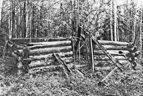
|
| PLATE 51. #113 Big Smokey Cabin, view to the north. |
#114 ALFRED JOHNSON'S CABIN
LOCATION:
The cabin is reported at the mouth of Ben Creek where
it joins Sam Creek approximately 4 miles along the Ben Creek trail from
the Yukon River.
SIGNIFICANCE:
Local significance.
PLACE IN HISTORY:
In 1898 Alfred Johnson came to the Yukon River from
Dawson with Sandy Johnson. While Sandy staked Upper Ben Creek area,
Alfred "sniped" at its mouth. He built a cabin where he stayed for a
while. The cabin burned down in October of 1928 with all Johnson's
savings and contents. It is uncertain if the cabin was ever rebuilt.
Alfred and Sandy Johnson, Martin Ademic, and Max Drews were the main
gold miners and trappers of the Sam Creek-Ben Creek area prior to World
War II. They lived a characteristic lifestyle of combining mining,
trapping, and wage labor. Sandy Johnson is the best known of the 4
men.
CONDITION:
Neither the cabin or the cabin site was found, thus,
its condition is unknown.
TREATMENT:
The cabin site should be found, documented, and
evaluated for preservation treatment.
SOURCE:
Barney Hansen; The Alaska Weekly.
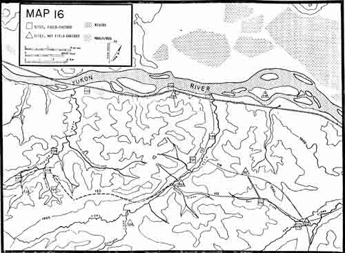
|
|
MAP 16. (click on image for a PDF version) |
#115 ARTHUR 'CAP' REYNOLDS CABIN
LOCATION:
The cabin is 4-1/2 miles along Sam Creek from its
junction with the Yukon and is on the left side of Sam Creek. The creek
that adjoins Sam Creek is known locally as "Little Rosie Creek".
SIGNIFICANCE:
Local significance.
PLACE IN HISTORY:
Sandy Johnson built the cabin that Arthur 'Cap'
Reynolds used. 'Cap' Reynolds had mined Fourth of July Creek before Jim
Taylor consolidated the area. He even once had a small steamboat from
which he acquired the nickname, 'Cap'. In the late 1940's Phil Berail, a
local trapper, found him dead in the trail bringing in a load of
freight. Later speculation arose when a freeloader who had stayed with
'Cap' was arrested for murdering a man for his money in the Juneau area.
Sandy Johnson and Barney Hanson felt the freeloader not only took Cap's
belongings but murdered him to do so.
CONDITION:
The sod roof of the cabin has fallen, but the walls
are still standing. The house measured 18 by 12 feet with a small
entranceway of 12 by 8 feet. The cabin's cache has also fallen down.
There are a large number of historic artifacts—2 sleds, a toboggan,
a trunk, several wooden barrels, saws, old bottles, radio, a sluice box,
even old clothes.
TREATMENT:
The site should be protected and the surface
artifacts collected and accessioned before they are lost. The cabin is
associated with a colorful character of the Yukon - Charley area. It
might qualify for the National Register, but in order to be properly
maintained, the roof would have to be restored. Since it is 6 miles from
the Yukon, the expense might be prohibitive or at least of lower
priority.
SOURCE:
Jim Layman; Barney Hansen; George Beck; Jess and
Cathryne Knight.
Photograph.
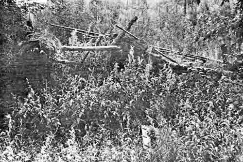
|
| PLATE 52. #115 'Cap' Reynolds' Cabin, view to the west. |
#116 BEN CREEK MINING DISTRICT
LOCATION:
The camp is 4-1/2 miles along Ben Creek Road from
the center of the Coal Creek airstrip or 7 miles via road to the Yukon.
The cabin is on the right bank of Ben Creek approximately 3 miles from
its junction with Sam Creek.
SIGNIFICANCE:
Local significance.
PLACE IN HISTORY:
In 1898 Sandy Johnson and his partner, Alfred
Johnson, built a raft at Lake Bennett and came down the Yukon. They
stopped at Sam Creek and prospected up to Ben Creek where they found
some gold. Between 1898-1917 Sandy built the large cabin currently
existing at Ben Creek as well as the cabin at the mouth of Sam Creek,
the Alaska Road Commission wayside station near Biederman, the Slaven
Cabin, and 'Cap' Reynolds cabin on Sam Creek. He prospected six claims
along Ben Creek almost to the junction of Sam Creek. During the winter
he ran a trap line as well as drift-mined Ben Creek. During the summer
he would sluice the stockpile of frozen paydirt. Barney Hansen bought
the claim in 1945 but only worked it for a year or two. In 1961 he sold
the mine to Jim Layman who currently spends each summer mining the
claim.
CONDITION:
The mining district looks like a gold mine. There is
a portable drill, a portable steam boiler, which was once used for
thawing frozen ground, a "Giant" for hydraulic mining, an automatic dam,
and two sizes of sluice boxes. The cabin, next to the Slaven Cabin, is one of
Sandy's best built cabins. It measures 20 by 20 feet and is currently
lived in each summer. A porch has been added as well as a small
shed—each modified by using the thin metal from which the
Daily-News Miner is printed.
TREATMENT:
The site is the epitome of what a gold mine should
look like. Since there remains all the fabric that represents a
small-scale mining outfit, I would recommend the site for the National
Register. Sandy Johnson is closely associated with the site as is Barney
Hansen, an oldtime miner currently living in Eagle. The mining equipment
from the steam boiler to the bulldozers to the sluice boxes should be
preserved and protected as essential to the meaning of the site.
Cooperation with the claim's owner is strongly advised. Jim Layman would
most likely be interested in any preservation ideas.
SOURCE:
Barney Hansen; Jim Layman.
Photographs.

|
| PLATE 53. #116 Sandy Johnson's Cabin at Ben Creek, view to the east. |

|
| PLATE 54. #116 Ben Creek Mining District, left to right, portable drill, cache, sharpening wheel. |
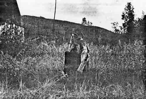
|
| PLATE 55. #116 Portable steam boiler at Ben Creek. |
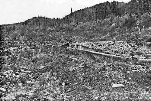
|
| PLATE 56. #116 Ben Creek Mining District, 'Giant' hydraulic piping. |

|
| PLATE 57. #116 'Automatic mining dam' on Ben Creek. |

|
| PLATE 58. #116 Cross-cut for sluice and hydraulic mining at Ben Creek. |
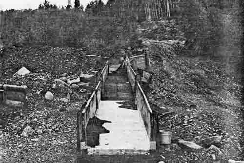
|
| PLATE 59. #116 Sluice box on Ben Creek. |

|
| PLATE 60. #116 'Clean-up' sluice box at Ben Creek Mining District. |
#117 BEN CREEK AIRSTRIP
LOCATION:
The airstrip is approximately 2 miles along Ben Creek
Road from the center of Coal Creek airstrip or 5-1/2 miles from the
Yukon River by road. Charley River (B-5) has the airstrip misplaced.
SIGNIFICANCE:
Local significance.
PLACE IN HISTORY:
Barney and Jim Hansen built the airstrip in the late
forties. They shipped in supplies both by barge and by constructing a
raft of twelve 55-gallon drums then freighted them by cat to the top of
the ridge. When completed the airstrip was 3200 feet long and could
handle a DC-3. The airstrip continues to be used in expediting the
transport of food, supplies, and equipment for use in the Ben Creek
mining district.
CONDITION:
Since the airstrip is used routinely, it is in
excellent shape. It is still at least 2500 feet long. A small overnight
cabin, 10 by 6 feet, on skids rests at the end of the runway. The cabin
is equipped with a propane stove, bed, and a few groceries.
TREATMENT:
The airstrip is the twentieth century's modification
to old-time mining by applying current technology to the transportation
of supplies and equipment. The airstrip is associated with Barney
Hansen, a warm, friendly old-time miner. Its historic value in other
areas appears minimal. As long as the Ben Creek area is mined, it is
expected that the airstrip will be maintained.
SOURCE:
Barney Hansen.
#118 ROAD TO BEN CREEK MINING DISTRICT
LOCATION:
Ben Creek Road departs from the Coal Creek Road 3
miles from the Yukon or approximately half-way down the airstrip. It
crosses Coal Creek, climbs the ridge, traverses to Ben Creek airstrip,
then drops off the ridge into Ben Creek mining district.
SIGNIFICANCE:
Local significance.
PLACE IN HISTORY:
Before World War II, Ernest Patty built the road from
Coal Creek up over the ridge to Ben Creek. The road was built to
expedite exploration of the Ben Creek mining district, which had been
mined since 1898. Although Patty drilled the area, no further
large-scale development followed. The road, nonetheless, allowed easier
transportation of supplies than the trail from the mouth of Sam Creek.
It also allowed the introduction of large machinery to construct an
airstrip and to mine larger areas of land.
CONDITION:
The road is in excellent shape. The grade is quite
steep so four wheel-drive vehicles are recommended. The road makes a
nice hiking trail. It leads directly to the airstrip, but then
forks—one going to Ben Creek and the other to 'Cap' Reynolds Cabin
on Sam Creek.
TREATMENT:
The road will be maintained as long as it is needed
for the current mining operations on Ben Creek. Its historic
significance does not merit large sums of money to preserve it
indefinitely. It makes a pleasant hiking trail.
SOURCE:
Barney Hansen.
Photograph.
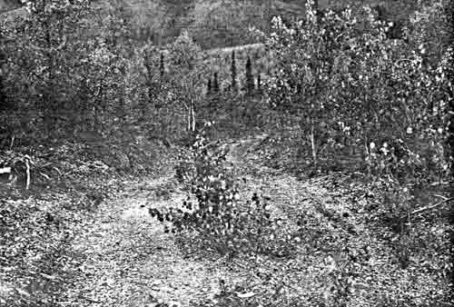
|
| PLATE 61. #118 Road to Ben Creek Mining District, view to the west. |
#118A WOODCHOPPERS' CABINS
LOCATION:
The cabins are located 4-1/2 miles downriver from
the mouth of Sam Creek on an island in the Yukon called Dalphus
Island.
SIGNIFICANCE:
Local significance.
PLACE IN HISTORY:
These cabins belonged to a group of Natives who
chopped wood for the steamboats. Among them were Woodchopper Joe Henry,
an Indian from Circle, and Captain Dalphus, an Indian from the Kandik
River area. Captain Dalphus also spent some time at Charley's Village.
Later Woodchopper Joe returned to Circle, and Captain Dalphus helped
board dogs at Biederman's. The cabins were common sites along the Yukon.
Steamboats, moving upstream, burned an average of 40 cords of wood a
day, consequently great quantities of wood were needed to supply the 30
to 40 steamboats that plied the Yukon. Natives often used the occupation
as a means of getting the white man's supplies. Sometimes they trapped
at the same time.
CONDITION:
These cabins were not specifically located. Since
they were built on an island in the Yukon, it is highly possible that
the spring floods have washed them away.
TREATMENT:
These cabins should be located and evaluated. If
these cabins exist, they would supplement the woodchoppers' story that
is represented only by the Wood Island cabin.
SOURCE:
Charlie Biederman.
#119 SLAVEN CABIN ON COAL CREEK
LOCATION:
The Slaven Cabin is on the left bank of the Yukon
just downriver from the mouth of Coal Creek. It is indicated by name on
the Charley River Quadrangle, scale 1:250,000 and Charley River (B-5),
scale 1:63,360.
SIGNIFICANCE:
Local significance.
PLACE IN HISTORY:
In 1917 Sandy Johnson built the large cabin that
became associated with Frank Slaven who had been a prize fighter and
Klondike gold miner. The cabin also served as a roadhouse and post
office for river travellers and residents. About 1936 Gold Placers, Inc.
built a road joining the Yukon River with the Coal Creek camp. At this
time, the Post Office moved from Woodchopper to Coal Creek. Even after
the dredge shut down, the Slaven Cabin served for the caretaker of the
mine and as a contact point along the Yukon.
CONDITION:
The cabin remains in excellent condition. It is two
stories high with some recent additions and several out-buildings.
All windows, doors, roofs and walls are intact.
TREATMENT:
The cabin should be preserved for its role in the
Coal Creek gold mine, its association with Frank Slaven, and the
craftsmanship of Sandy Johnson. The site might qualify for the National
Register. Additional field work would be required. The existing occupants
were very paranoid about NPS visitors, thus, little site documentation
was obtained.
SOURCE:
George Beck; Alaska Weekly; Ernest Patty;
James Wickersham.
#120 COAL CREEK DREDGE
LOCATION:
The dredge lies about 2-1/2 miles from the
junction of Coal Creek and the Yukon River. It can be reached by road or
by following the Creek. It rests 1/2 way between the road and the
Creek at the end of the tailings pile on the left side of Coal
Creek.
SIGNIFICANCE:
Regional significance.
PLACE IN HISTORY:
Gold Placers, Inc. bought the consolidated gold
mining claims on the creek in 1934 and test-drilled extensively
across the valley. The test results encouraged the construction of the
first dredge in Yukon - Charley in 1935. By the summer of 1936 the
dredge was operating. After the first two weeks the dredge produced
$27,000. The steel dredge had a pontoon hull which was a relatively new
departure at the time. Purchased from San Francisco, the dredge had to
be broken down and transported by steamboat and railroad to Coal Creek.
Ernest Patty, who developed the mine, served as resident manager and
part owner. He is a significant person in Alaskan history being one of
the University of Alaska's presidents as well as a well-known mining
engineer. The dredge operated until the early 1960's when it was closed
down.
CONDITION:
The dredge operated in the summer of 1975, but gold
prices did not encourage operation during 1976. Although this is the
original dredge, it is in good repair. The digging ladder consists of 62
buckets of 4 cubic feet capacity. Its power plant consists of diesel
engines.
TREATMENT:
Preservation is strongly advised. A National Register
nomination might be justified on three merits: 1) the first gold dredge
in the proposal area; 2) a new design for dredges; and 3) the
recognition of an important Alaskan figure—Ernest Patty.
SOURCE:
Ernest Patty; Ernest Wolff; Dan Colben; U.S.G.S.
Bulletins.
Photographs.
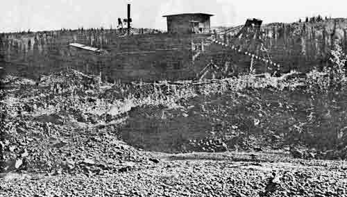
|
| PLATE 62. #120 Coal Creek dredge, view to the north. |
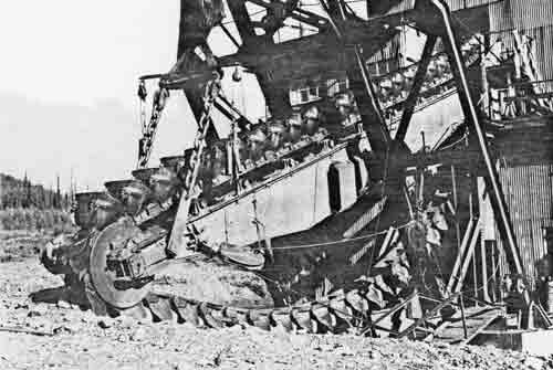
|
| PLATE 63. #120 Coal Creek dredge's ladder, view to the northwest. |
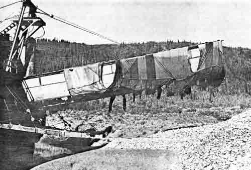
|
| PLATE 64. #120 Coal Creek dredge's stacker, view to the west. |
#121 COAL CREEK MINING CAMP
LOCATION:
The mining camp is 3-1/2 miles up the Coal Creek
mining road from the Yukon. It is indicated by name on Charley River
Quadrangle, scale 1:250,000, and Charley River (B-5), scale
1:63,360.
SIGNIFICANCE:
State significance.
PLACE IN HISTORY:
Between 1900-1925 Coal Creek had been mined by
one-man outfits. By 1925 the claims had been consolidated into two major
claims, one headed by Frank Slaven. In 1934 when Gold Placers, Inc. took
over, the valley was drilled extensively proving the feasibility of
dredge work. By 1936 the dredge was put into operation. First the ground
was stripped of trees, washed with hydraulic nozzles, and then the
dredge could begin work. The gravels yielded between $.60-$1.00 in gold
per cubic yard. World War II slowed down production and forced rising
costs still higher. After the death of Patty's oldest son, Patty pulled
back from the actual operation to become President of the University of
Alaska. With the increased costs of mining, in labor, supplies, and
transportation and the price of gold at $35 an ounce, the management
decided to shut down the dredge until costs were lower or gold prices
increased. Ernest Wolff and Dan Colbin bought Coal Creek in 1972. The
dredge operated once again in the summer of 1975, but with the declining
price of gold in 1976, the dredge did not operate. At its peak the
operation employed 30-40 men.
CONDITION:
The camp itself is spread out. All buildings were
built from the salvaged Fort Egbert gymnasium and were built on skids to
be readily moved along with the dredge as necessary. Thus, there are
small frame structures throughout the valley. The main camp has 10
individual cabins serving as office, gold room, power plant, mess hall,
tool shed, pool hall, and bunk houses. All appear reasonably well
maintained although a few windows are broken.
TREATMENT:
The camp is a functioning gold mine, thus, the
structures will at least be minimally maintained. The tailing piles and
the dredge could be interpreted as examples of larger placer-mining
operations. Too often, placer mining connotes only the gold pan or the
rocker, whereas dredges, hydraulic mining, and large sluice boxes
produce the greatest quantity of placer gold. Coal Creek can easily be
used to interpret the whole evolution of placer-mining history.
Preservation is recommended. A cooperative agreement with the owners
might ensure some interpretive program. As an example of a gold-mining
camp, however, Woodchopper is more compact and altogether.
SOURCE:
Ernest Patty; U.S.G.S. Bulletins; Ernest Wolff; Dan
Colben; George Beck.
Photographs.
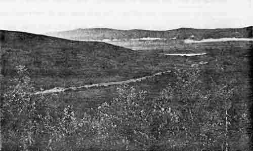
|
| PLATE 65. #121 Coal Creek Camp, overview showing tailings, view to the northwest. |
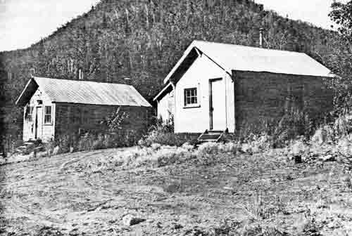
|
| PLATE 66. #121 Coal Creek Camp, view to the west, left to right, office, goldroom, Post Office. |
#122 COAL CREEK - WOODCHOPPER ROAD
LOCATION:
The road begins at Slaven Cabin on the left bank of
the Yukon. It parallels Coal Creek for 6-1/2 miles then crosses the
ridge to Woodchopper Creek Camp for a total of 14 miles.
SIGNIFICANCE:
Local significance.
PLACE IN HISTORY:
In 1936 Gold Placers, Inc. constructed an automobile
road from the mouth of Coal Creek upstream for six miles to the site of
the dredging operations, and thence westward across the ridge into the
valley of Woodchopper Creek. The road served all the principal mining
plants on Coal and Woodchopper Creeks. Along the road a telegraph line
connected the two camps. The road facilitated communication and
transportation of supplies between the two camps owned and managed by
General A.D. McRae and Ernest Patty. The road was the best constructed
and longest enduring road in the Yukon - Charley area.
CONDITION:
The road is still in good enough condition to be
driven. It makes a good and easy hiking trail. There is very little
muskeg to cross. From the mouth of Coal Creek to Woodchopper Camp is
approximately 15 miles.
TREATMENT:
The road should be preserved at least as a hiking
trail. The telegraph wire can still be seen along the road. Since the two
mining camps are no longer owned by the same company, the road may
easily fall into disrepair. The road is currently being used as a winter
trapping trail.
SOURCE:
Ernest Wolff; Ernest Patty; Joe Vogler; U.S.G.S.
Bulletins.
#123 BOULDER CREEK MINE
LOCATION:
Boulder Creek mine is 1/4 mile up Boulder Creek
from its junction with Coal Creek and is on the right side of the
Creek.
SIGNIFICANCE:
Local significance.
PLACE IN HISTORY:
Mines at Boulder Creek and Colorado Creek,
tributaries of Coal Creek, remained independent from the large dredging
operations of the 1930's and 1940's. These mines continued the
small-scale mining operations common throughout the region. Thus, even
today the evolution of placer mining can be traced from these single-man
drift mines to the large-scale mining operations of the dredge and
cross-cut sluice mining.
CONDITION:
These two mines were not visited. Some assessment work was done this
summer on the Boulder Creek Mine. The condition of the cabins is
unknown.
TREATMENT:
Documentation of these sites is recommended and then
recommendations regarding preservation should be made. If the
cooperation of all mining operations could be obtained, this area could
become a "living" history of placer-gold mining. The Coal Creek district
could be easily interpreted and easily walked unlike the rest of the
area where muskeg, swamp, and thick underbrush hampers comfortable
walking.
SOURCE:
Dan Colben; U.S.G.S. Bulletins.
#124 COLORADO CREEK MINE
LOCATION:
Colorado Creek mine is 3/4-1 mile up Colorado Creek
from its junction with Coal Creek and is on the right side of the
Creek.
SIGNIFICANCE:
Local significance.
PLACE IN HISTORY:
Mines at Boulder Creek and Colorado Creek,
tributaries of Coal Creek, remained independent from the large dredging
operations of the 1930's and 1940's. These mines continued the
small-scale mining operations common throughout the region. Thus, even
today the evolution of placer mining can be traced from these single-man
drift mines to the large-scale mining operations of the dredge and
cross-cut sluice mining.
CONDITION:
These two mines were not visited. Some assessment
work was done this summer on the Boulder Creek mine. The condition of
the cabins is unknown.
TREATMENT:
Documentation of these sites is recommended, and then
recommendations regarding preservation should be made. If the
cooperation of all mining operations could be obtained, this area could
become a "living" history of placer-gold mining. The Coal Creek district
could be easily interpreted and easily walked unlike the rest of the
area where muskeg, swamp, and thick underbrush hampers comfortable
walking.
SOURCE:
Dan Colben; U.S.G.S. Bulletins.
#125 MINERAL CREEK CABINS
LOCATION:
The cabins are 1 mile up Mineral Creek from its
junction with Woodchopper Creek on the right bank of the creek. The
cabins are indicated on Charley River Quadrangle, scale 1:250,000 and
Charley River (B-5), scale 1:63,360.
SIGNIFICANCE:
Local significance.
PLACE IN HISTORY:
The gold discoveries on Mineral Creek predate any
discoveries in the Coal - Woodchopper Creek. The first deposits that
proved to be of paying quality were discovered on this Creek. The creek
was initially staked in 1898 but not seriously mined until the 1920's.
The gold obtained was a higher grade ore than that obtained elsewhere in
the region. One of the well-known old timers, George McGregor, last
owned the cabins but eventually sold out to General McRae's and Ernest
Patty's Alluvial Gold, Inc.
CONDITION:
There are two cabins remaining, but the mining
operations are not visible. One cabin still has its roof and walls and
measures 14 by 16 feet. The sod roof has been covered with boards. The
other cabin, 12 by 16 feet, has fallen down. A good number of historic
artifacts, from an axe to a gold pan, lie around the cabins. National
Geographic Magazines from the 1930's are stacked in the fallen
cabin.
TREATMENT:
Preservation of the one solid cabin and accession of
the surface artifacts is recommended. These cabins probably predate the
dredge mining and thus are illustrative of the small-scale mining
operations.
SOURCE:
George Beck; Barney Hansen; U.S.G.S. Bulletins;
Charlie Biederman.
Photographs.
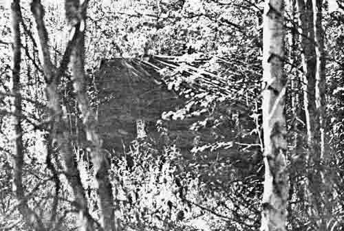
|
| PLATE 67. #125 Mineral Creek Cabin A, view to the west. |
#126 IRON CREEK MINING CAMP
LOCATION:
The cabin is 1/2 mile up Iron Creek from its
juncture with Woodchopper Creek on the right bank or about 6 miles from
the Yukon River.
SIGNIFICANCE:
Local significance.
PLACE IN HISTORY:
The first serious dredging activity began at the
mouth of Iron Creek where it joins Woodchopper Creek. Small-scale mining
had been carried on intermittently for many years prior to the
consolidation by General McRae and Ernest Patty in the 1930's. As with
Boulder Creek, if enough fabric remains, Iron Creek can be used to
interpret the evolution of placer mining from one-man outfits to dredge
construction.
CONDITION:
According to the 1956 U.S.G.S. map, a cabin remains
at Iron Creek. This cabin was not visited or documented, thus its
condition cannot be ascertained.
TREATMENT:
The site should be documented and an evaluation of
its value and treatment completed. Ideally it could be a contrast with
the larger Woodchopper Camp only 1/4 mile away—depicting two
different approaches to placer mining.
SOURCE:
U.S.G.S. Bulletins.
#127 WOODCHOPPER CREEK MINING CAMP
LOCATION:
Woodchopper Creek Camp is the terminus for the Coal
Creek - Woodchopper Creek Road at 15 miles from Slaven Cabin or 5-1/2
miles from the junction of Woodchopper Creek and the Yukon River. The camp is
indicated by name on Charley River Quadrangle, scale 1:250,000 and Charley
River (B-5), scale 1:63,360.
SIGNIFICANCE:
State significance.
PLACE IN HISTORY:
Ernest Patty began this camp in 1936 to support
dredging activities. The earlier and smaller mines were consolidated by
Frank Bennett and later bought by Alluvial Gold, Inc., owned by General
McRae and Ernest Patty. The dredge began operation in 1937. The initial
drillings showed that the gold of Woodchopper Creek was somewhat higher
grade than Coal Creek's. A ditch, built for hydraulic operations,
brought water 3 miles with adequate pressure for hydraulic nozzles. Over
30 men were employed during Patty's management. After Patty withdrew
from the operation and returned to the University of Alaska, Ted
Matthews, during the early 1960's, leased both creeks. Joe Vogler bought
Woodchopper from Ernest Patty in 1970-71.
CONDITION:
The camp is built on both sides of the airstrip,
which in turn has been constructed from the dredge's tailings. A large
18 by 14 foot shop still houses parts for the dredge and associated
vehicles. There are also 2 log cabins but most are built of frame construction. The
alders and willows have encrouched on most of the cabins. The messhall
must have also served as the movie house—a projector screen still
hangs above the door. A laundry room is adjacent to the messhall. There
is a pool table in one cabin and several locked cabins whose functions
could not be discerned. Across the airstrip was the manager's 2-bedroom
house. Curtains, sofa, even children's toys remain. Although the camp
has not been maintained or used in years, the flavor of its past is more
prevalant than at Coal Creek.
TREATMENT:
The camp should be protected and preserved. Although
the camp is on private property, a National Register nomination as a
historic district should be encouraged. Coal Creek and Woodchopper Creek
have the most fabric remaining of the largest mining operations in the
Yukon - Charley area.
SOURCE:
Ernest Patty; Ernest Wolff; Joe Vogler; U.S.G.S.
Bulletins.
Photographs.
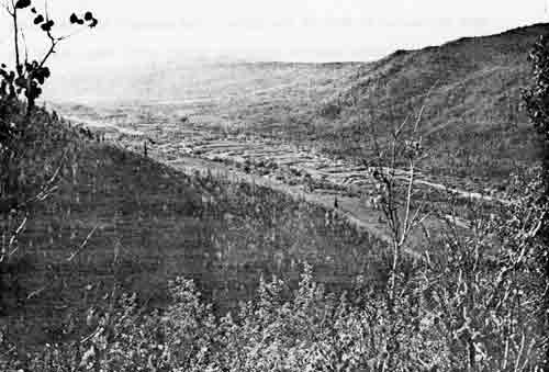
|
| PLATE 68. #127 Overview of Woodchopper Creek Camp showing tailings and airstrip, view to the west. |
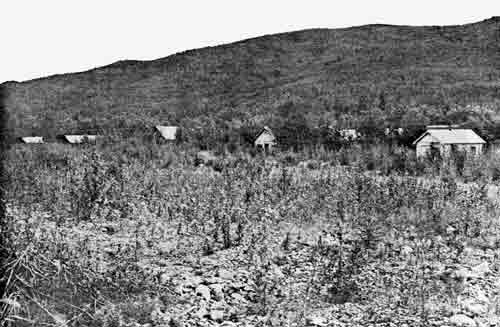
|
| PLATE 69. #127 View to the east across airstrip to main row of cabins at Woodchopper Creek Camp, Cabins B-G. |

|
| PLATE 70. #127 Manager's House (Cabin H) at Woodchopper Creek Camp, view to the west. |
#128 MINERAL CREEK MOUTH CABINS
LOCATION:
The cabins are located 4-1/2 miles up Woodchopper
Creek, at the mouth of Mineral Creek, on the left bank of Mineral Creek,
but on the right bank of Woodchopper Creek.
SIGNIFICANCE:
Local significance.
PLACE IN HISTORY:
These 4 cabins have been moved from Woodchopper Camp
to the mouth of Mineral Creek to serve as a base for the work of the
current owner, Joe Vogler. The one-room-frame cabins are all on skids.
Ernest Patty built the frame structures from Fort Egbert's gymnasium
about 1936-37. These cabins serve as living quarters for Vogler and his
wife, a bunkhouse, shop, and office. There are a number of large trucks,
bulldozers, and equipment in the vicinity. The cabins had been built to
move downstream with the dredge.
CONDITION:
The 4 cabins still retain their tin roofs and most of
their windows. Since the cabins are used each summer, they are kept in
good repair by Joe Vogler.
TREATMENT:
These cabins are maintained to some extent, but
protection from vandals is still a problem. Since these cabins represent
the Ernest Patty years and are currently being used for associated
mining work, they can illustrate the lifestyles of mining personnel.
Since the cabins are on patented land, the cooperation of Joe Vogler is
strongly recommended.
SOURCE:
Joe Vogler.
Photographs.
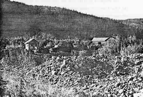
|
| PLATE 71. #128 Mineral Creek mouth cabins, view to the west, left to right, shop, living quarters, bunkhouse. |
#129 WOODCHOPPER CREEK DREDGE
LOCATION:
The dredge is 3-1/2 miles from the confluence of
Woodchopper Creek and the Yukon River. It rests near the northeast end
of the tailings pile and near the mouth of Slate Creek.
SIGNIFICANCE:
Regional significance.
PLACE IN HISTORY:
Only a few dredges remain that once mined gold
deposits of the Yukon River basin. Two of these dredges lie in Yukon -
Charley proposal area. Ernest Patty built the Woodchopper dredge in
1936. The new automobile road allowed the freighting of supplies and
equipment from the steamboat stop at Coal Creek. The dredge was
completed and operating in 1937. Although the gold proved to be of
higher grade than Coal Creek, the concentration of gold on the bedrock
was spotty. Patty eventually sold the claims and the dredge to Joe
Vogler in 1970.
CONDITION:
The dredge has not been operated for a number of
years, thus, it is not as well-maintained as the Coal Creek dredge. All
major parts appear to be in order.
TREATMENT:
Preservation should be encouraged. Vandals have
caused some damage. Since the dredge is privately owned, cooperation
with the owner is encouraged. The dredge would make an excellent vehicle for
interpretation of large-scale-placer-mining.
SOURCE:
Ernest Patty; Joe Vogler; U.S.G.S. Bulletins.
#130 McGREGOR CABIN
LOCATION:
The cabin is 1-3/4 miles below Slaven Cabin on the
left bank of the Yukon River. The cabin is indicated by name on the
Charley River Quadrangle, scale 1:250,000 and Charley River (B-5), scale
1:63,360.
SIGNIFICANCE:
Local significance.
PLACE IN HISTORY:
George McGregor arrived in the Yukon - Charley area
about 1915. He worked in the Circle-Central mining district then bought
the Mineral Creek claims. From here he lived the typical lifestyle of
miner-trapper. His trapline ran up the Woodchopper and into the upper
Charley. Later he built this cabin in 1939, known locally as "McGregor's
Fishcamp". He fished during the summer and trapped in winter. As life
slowed down on the Yukon and the Welchs left Woodchopper, McGregor got
lonely and moved to Eagle in the 1950's. McGregor, like Sandy Johnson, is
an old-timer with many associated stories.
CONDITION:
These are two cabins one is chinked with moss to
insulate against the winter cold, the other is not chinked and probably
functioned only in the summer. The roof, walls, and glass windows are
still intact. Each cabin's cache has fallen down. There are various
artifacts lying around from a barrel stove to a trunk to several
boats.
TREATMENT:
This site, like Mineral Creek, is associated with
George McGregor. There is more fabric remaining here, but less
information as to how he used the area. Since the two cabins are in
reasonably good condition, they should at least be preserved for
adaptive use. A National Register nomination might also be in order.
SOURCE:
Joe Vogler; Dale Ruck; Barney Hansen; George Beck;
Charlie Biederman.
Photographs.
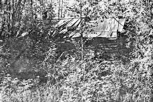
|
| PLATE 72. #130 McGregor's main cabin, view to the northwest. |
#131 WOODCHOPPER JOE'S CABINS
LOCATION:
The cabins are 1-3/4 miles below Slaven Cabin on the
left bank of the Yukon River behind McGregor's Fishcamp near the base of
the hill.
SIGNIFICANCE:
Local significance.
PLACE IN HISTORY:
Woodchopper Joe, an Indian from Circle, trapped the
Yukon - Charley area especially the Kandik River. He built a string of
cabins directly in back of George McGregor's Fishcamp. Woodchopper Joe
and fellow wood-choppers moved here from Dalphus Island above Coal
Creek. Dalphus Island is named after 'Cap Dalphus'. The woodchoppers
built cabins while they chopped cordwood for steamers during the 1920's
and 1930's.
CONDITION:
The cabins were not visited. It is unknown how many
cabins still exist or in what condition they are.
TREATMENT:
The cabins need to be exactly located and further
documented before any evaluation can be made.
SOURCE:
George Beck; Charlie Biederman.
#132 WOODCHOPPER ROADHOUSE
LOCATION:
The roadhouse is 3-1/2 miles below McGregor's Cabin
on the left bank of the Yukon. The roadhouse is indicated by name on
Charley River Quadrangle, scale 1:250,000 and Charley River (B-5), scale
1:63,360.
SIGNIFICANCE:
Regional significance.
PLACE IN HISTORY:
Roadhouses largely served winter travellers along the
mail trail. Here was room and board, offering hospitality and a chance
to learn the news. Generally several outbuildings supported the main
house—including bunkhouses and dog houses. Woodchopper, prior to
the development of Coal Creek, served as the Post Office. A safe still
remains on the site. Although Fred Brentlinger, a well-known prospector,
had the roadhouse in 1927, it is most closely associated with Jack
Welch. Jack Welch never had the mail contract as stated by Ernest Patty
but earned his living from the roadhouse he bought from Fred Brentlinger
who, in turn, had bought it from Woodchopper Smith. In the late 1930's
when airplanes replaced dog teams for carrying the mail, Jack Welch
turned to trapping, fishing, and boating. During the war, the flood at
break-up scarred the Welches. Mrs. Welch became bedfast, and Jack
attempted suicide. When his wife died, Jack got into his boat and
floated out to the Bering Sea. No one else acquired the roadhouse.
CONDITION:
The roadhouse is a large, 24 by 36 feet, two-story
log house. On the walls are remnants of fabric wallpaper. It stands
about 20 feet high with roof and windows intact. The first floor has been
flooded so often that the floor is unsafe, but the second floor is
solid. The second floor is divided into 4 individual rooms with bed
frames and wardrobes still standing. There is only one other cabin with
the roof intact. It is tightly built and is 18 by 16 feet large. Two
other cabins have lost their roofs. One was 20 by 20 feet large; the
other was 18 by 16 feet large. There are several dog houses and a
wheeled vehicle that might be a portable drill with large fly wheels.
Artifacts such as a safe, cook stove, rocking chair, tables, lie about
the vicinity.
TREATMENT:
Since this is the largest structure with its roof in
the proposal area, it is recommended that it be restored if a lodge is
ever needed for the park. A National Register nomination would give
added protection. Its association with Jack Welch, its value as a
roadhouse, post office, and fish camp, and its local architectural style
qualify for nomination. The artifacts ought to be collected and
accessioned before all are lost. Jack Welch's trapper's sled, built by
Charlie Mayo in 1934, currently rests in the University of Alaska
Museum.
SOURCE:
Ernest Patty; George Beck; Charlie Biederman;
U.S.G.S. Bulletins; Alaska Weekly.
Photographs.

|
| PLATE 73. #132 Woodchopper Roadhouse, view to the northwest. |
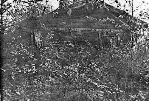
|
| PLATE 74. #132 Cabin #5 at Woodchopper Roadhouse, view to the southwest. |
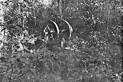
|
| PLATE 75. #132 Portable drill (?) at Woodchopper Roadhouse, view to the southwest. |
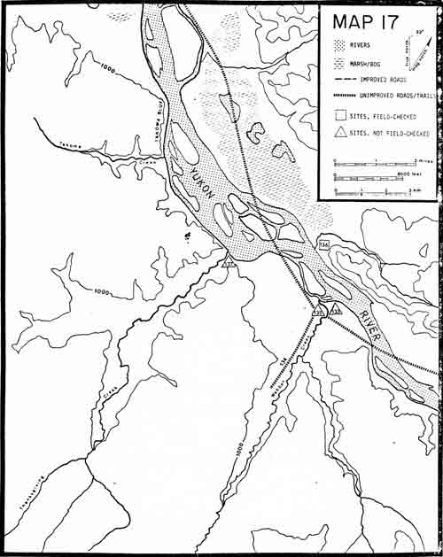
|
|
MAP 17. (click on image for a PDF version) |
#133 WEBBER CREEK ROADHOUSE
LOCATION:
The roadhouse is reported approximately 9 miles from
Woodchopper Roadhouse on the left bank of the Yukon near the mouth of
Webber Creek.
SIGNIFICANCE:
Local significance.
PLACE IN HISTORY:
James Wickersham, Eagle district judge from
1899-1903, reported staying at the Webber Creek Roadhouse in 1901. He
described Webber as a crank and a nuisance. The 1951 U.S.G.S. Charley
River Quadrangle shows a cabin on Webber Creek.
CONDITION:
The location of the roadhouse was not found.
Old-timers are not sure where it is. Ray Bell has trapped the area for
10 years but never found the roadhouse.
TREATMENT:
The roadhouse should be found and documented. If
there is any fabric remaining, it should be evaluated regarding its
preservation.
SOURCE:
James Wickersham; U.S.G.S. 1951 Charley River Quadrangle; Ray Bell.
#134 WEBBER CREEK TRAPPING TRAIL
LOCATION:
The trapping trail follows Webber Creek from its
mouth on the Yukon on up the Creek for several miles. The first couple
of miles the trail is on the left bank.
SIGNIFICANCE:
Local significance.
PLACE IN HISTORY:
Trappers have utilized Yukon - Charley since the
early trading days of the 1870's. It is still being used. The Webber
Creek trail has been used in recent years by a trapper in the area.
These trails are generally winter trails and, thus, often cross
snow-covered muskeg that makes difficult summer walking. This trail is
typical of trapping trails in the Yukon - Charley area.
CONDITION:
The trail is well marked by tree blazes and worn
vegetation. It is about 5 feet wide and fairly brushed out.
TREATMENT:
Aside from being used for interpretation of trapping
activities, the trail has little historical value.
SOURCE:
Ray Bell.
#135 WEBBER CREEK CABIN
LOCATION:
The cabin is behind an island 150 yards down the
Yukon from the mouth of Webber Creek on the left bank of the Yukon.
SIGNIFICANCE:
Local significance.
PLACE IN HISTORY:
The cabin was built in 1975 by 2 men who were later
apprehended by the State Troopers. They were charged with larceny and
other charges. They attempted to mine Webber Creek and cut a bulldozer
road to the creek. Local accounts imply that they had very little gold
mining experience or knowledge.
CONDITION:
The cabin was built of peeled logs. The roof is
unfinished. Two pickups without tires were also abandoned. Inside the
shell campers were various personal items.
TREATMENT:
The story behind this cabin is an interesting one, but
the overall historical importance and impact has yet to be evaluated.
Protection from vandals is the minimal protection advised. Greater
documentation from local inhabitants and from the State Troopers is
recommended.
#136 FORTYMILE CABIN
LOCATION:
The cabin is 9-1/2 miles down the Yukon River from
Woodchopper Roadhouse on the right bank of the Yukon. The cabin is
1-1/2 miles upriver from the mouth of Eureka Creek. The cabin is
indicated on Charley River Quadrangle, scale 1:250,000.
SIGNIFICANCE:
Local significance.
PLACE IN HISTORY:
The cabin was probably built by Charlie Moon in the
late 1920's or early 1930's. Charlie had a claim on Woodchopper Creek
that he sold to Ernest Patty. Hank Connette took it over when Moon left.
Connette did a little trapping but lived simply on less than $100 a
year. The cabin is associated with Hank Connette who died of a stroke.
Phil Berail, Ernest Patty's hydraulic foreman, also lived at the cabin.
Patty regarded him as one of the toughest men he knew. He trapped
primarily the upper Charley River. Ray Bell has occupied the cabin most
recently. From this cabin he has trapped and fished commercially.
CONDITION:
The condition of the cabin was not evaluated. There
are several outbuildings and a large garden.
TREATMENT:
The cabin was not visited. Further documentation is
needed before evaluation can be made.
SOURCE:
George Beck; Ray Bell; Ernest Patty; Charlie
Biederman.
#137 THANKSGIVING CREEK ROADHOUSE
LOCATION:
The roadhouse may be near the mouth of Thanksgiving
Creek on the Yukon River.
SIGNIFICANCE:
Local significance.
PLACE IN HISTORY:
Little documentation exists on Thanksgiving Creek
Roadhouse. George Beck, a trapper-miner from 1934-1946, reports that one
existed.
CONDITION:
The exact location and its condition is unknown.
TREATMENT:
The exact location should be found and further
documentation researched before any evaluation of its significance is
made.
SOURCE:
George Beck.
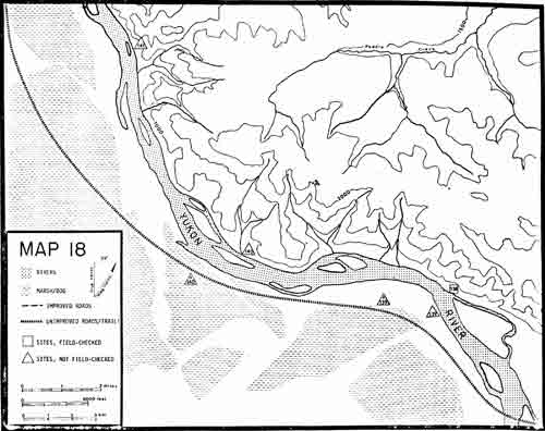
|
|
MAP 18. (click on image for a PDF version) |
#138 TWENTY-EIGHT MILE CABIN
(Paul Connell's Cabin)
LOCATION:
The cabin is approximately 28 miles from Circle or 22
miles from Woodchopper Roadhouse, on the right bank of the Yukon, at the
downriver end of a slough. It is indicated on the Charley River
Quadrangle, scale 1:250,000 and Charley River (C-6), scale 1:63,360.
SIGNIFICANCE:
Local significance.
PLACE IN HISTORY:
During the Klondike Stampede, Albert Hughes stopped
to make tea as he floated down the Yukon. He took some samples from an
outcropping and went on to Nome. Years later he had the samples assayed
and they were supposedly tellurite, a very rare mineral that
occasionally combines with gold. In the early 1920's Albert Hughes found
what he remembered to be the site except that the hill had slid down and
buried the outcropping. Along with his partner, Joe Gove, who was a
hard-rock miner, Hughes decided to tunnel into the hill. Since it was a
slide area, the shafts had to be timbered. They put a lot of work into
the mine. A promoter, Marian Edmundson, tried to put a pump in and wash
the hillside out. Although several people put up money for the project,
no gold was found. They mined until 1942, and World War II closed all
gold mines as non-essential. Shortly therefore Gove and Hughes got sick
and died. Later Paul Connell, who worked in the summer in Central, moved
into the cabin during the winter and read. He did a little trapping, but
he became a solitary reader. Gove and Hughes probably designed the
handmade tools. The site is fascinating for its "lost mine" story and for the quality of life
that the artifacts and fabric impart.
CONDITION:
The cabin is in excellent shape with roof and walls
intact. The sod roof has been covered with flattened kerosene cans, the
walls are chinked with moss and covered with a sandlike cement, and
there are double-pane windows. In the area is a shed, a cache, an Indian
hunting canoe, and 5 dog houses. This site contains more artifacts than
any site except Biederman Camp. There are old dishes, Charm
magazines, a handmade wheelbarrow, toboggan, drill, boiler, old clothes
and shoes, stove, and other fascinating objects.
TREATMENT:
The cabin lies behind an island just off a slough
that gets very little water so it is difficult to reach even though it
is marked on the U.S.G.S. map. The cabin should be protected, and the
artifacts accessioned. Since the cabin is habitable, adaptive use would
be in order. More research might determine that the site qualifies for
the National Register.
SOURCE:
George Beck; Jess and Cathryne Knight; Charlie
Biederman.
Photographs.
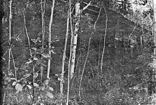
|
| PLATE 76. #138 Rear of Paul Connell's Cabin, view to the east. |
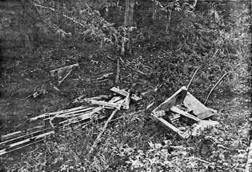
|
| PLATE 77. #138 Paul Connell's Cabin showing handmade sled, toboggan, and wheelbarrow. |
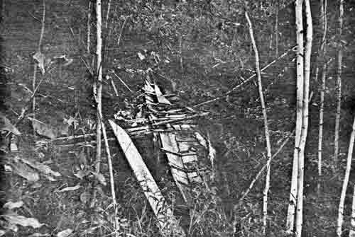
|
| PLATE 78. #138 Paul Connell's Cabin showing Indian hunting canoe. |
#139 TWENTY-SIX MILE VILLAGE
LOCATION:
The village is reported 26 miles upriver from Circle
on the left bank of the Yukon near Takoma Bluffs.
SIGNIFICANCE:
Local significance.
PLACE IN HISTORY:
Native informants from Fort Yukon reported this
Native village to archeologist F. Hadleigh-West in 1965. The site is
connected by trail to the important Medicine Lake across the hills. The
age and extent of the site are unknown.
CONDITION:
The site has been reported in two different
places—at Twenty-six mile or near Takoma Bluffs. It needs to be
exactly located, surveyed, and evaluated for its significance.
TREATMENT:
The site should be located, surveyed, and evaluated.
If evaluation determines that it qualifies for the National Register, an
application should be completed.
SOURCE:
Elizabeth Andrews' 14(h)(1) survey; F. Hadleigh-West;
Ed Hall.
#139A TWENTY-SIX MILE "BIEDERMAN'S ICE BOX"
LOCATION:
The cabin is approximately 26 miles from Circle on
the mail trail on the left bank of the Yukon River.
SIGNIFICANCE:
Local significance.
PLACE IN HISTORY:
Mail carriers needed way-stations to stop, rest, and
have hot tea. Sometimes these way-stations served as overnight cabins
when no roadhouse existed or weather conditions slowed the carrier and
prevented him from reaching them. During the late 1930's Horace and
Charlie Biederman built this cabin as a stop-over between Circle and
Coal Creek. Unfortunately, they built the cabin in the late fall from
green logs. These logs promptly froze solid and provided very little
insulation from the sub-zero temperatures. Thus, they called it
"Biederman's Ice Box". The mail trail at this point cut across a bend in
the river so the cabin is back off the river. This is only one of three
known way-stations whose sole purpose was to provide the mail carriers
with shelter.
CONDITION:
The cabin was not found nor its fabric assessed. It
is uncertain what condition the cabin is in. Since the cabin is off the
river, it is unlikely that it has been flooded. The roof has probably
collapsed.
TREATMENT:
The cabin should be specifically located and
evaluated. The mail carrier's story is one of the primary themes of the
Yukon - Charley area. Throughout contemporary sources, the mail carrier is
Alaska's unsung hero. Since Charlie Biederman was the last dog team mail
carrier, he could provide greater detail to this theme as well as to
this particular cabin.
SOURCE:
Charlie Biederman.
#140A TWENTY-MILE CABIN
LOCATION:
The cabin is approximately 20 miles from Circle, on
the mail trail, on the left bank of the Yukon River.
SIGNIFICANCE:
Local significance.
PLACE IN HISTORY:
During the late 1930's Horace and Charlie Biederman
constructed this cabin as a mail carrier's way-station between Circle
and Coal Creek. If weather or trail conditions prevented them from
reaching a cabin or road house, the carrier had to bivouac. In
temperatures of forty below zero or greater, bivouacking was
uncomfortable. Therefore, the Biedermans, who generally carried the mail
from 1918-1938, built a few way-stations between Eagle and Circle.
CONDITION:
The cabin was not specifically located. Since the
cabin is about 1 mile off the river, it is unlikely that it has been
flooded. Yet forty years have passed since the cabin was built so it may
not be in very good condition unless a trapper has used it as a line
cabin.
TREATMENT:
The cabin should be located and its condition
evaluated. Since the mail trail was the major route for winter
travelling, many historic themes tie into its story—roadhouses,
freighting, dog teams, and even trapping and mining.
SOURCE:
Charlie Biederman.
#140 TWENTY-TWO MILE CABIN
LOCATION:
The cabin is approximately 22 miles from Circle or 26
miles from Woodchopper Roadhouse, on the right bank of the Yukon, behind
a sand bar. It is indicated on the Charley River Quadrangle, scale
1:250,000 and Charley River (C-6), scale 1:63,360.
SIGNIFICANCE:
Local significance.
PLACE IN HISTORY:
James Wickersham, judge of the third judicial division from 1898-1903,
tells of staying in the Johnson's roadhouse in 1901, which was 22 miles
from Circle. Later in the 1930's Henry Appele, who once worked with
Hudson Bay Company at Fort Reliance, acquired the cabin. Reports state
that the mail carriers occasionally stopped here on their way to and
from Eagle. Appele quit trapping in 1940.
CONDITION:
The cabin roof and most of the walls have fallen
down. A tree has fallen over most of the house. The cabin, which
measures 14 by 16 feet, has between 4-7 logs of each wall remaining. A
log bunk bed, table, and 5 dog houses remain.
TREATMENT:
The cabin should be protected from further vandalism.
Alder and willow regrowth prevent the cabin form being seen from the
river despite being exactly located on the U.S.G.S. map.
SOURCE:
George Beck; Horace Biederman, Jr.; Charlie
Biederman.
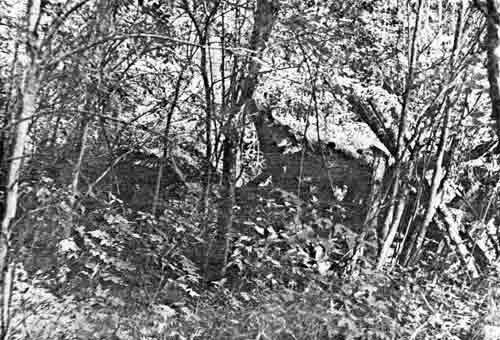
|
| PLATE 79. #140 Twenty-two Mile Cabin, view to the northeast. |
#141 SHAHNYAATI' GRAVE
LOCATION:
The gravesite is approximately 14 miles upriver from
Circle on the right bank of the river.
SIGNIFICANCE:
Regional significance.
PLACE IN HISTORY:
This is the gravesite of the famed Yukon Flats
Trading Chief, Shahnyaati'. It is reported that he died in 1892. As
Kutchin tradition dictated he was placed on a platform cache when he
died. One Native informant reported that from there a rainbow appeared
and showed where he was to be buried, hence the historic gravesite.
Shahnyaati' was so well known among the Natives and whites alike that
following his death Yukon River steamboats would sound their whistle
when passing his grave.
CONDITION:
The site has been reported in oral history surveys
but has not been specifically visited. Thus, the condition of the
gravesite cannot be evaluated.
TREATMENT:
The site should be definitely located and evaluated
as to its place in history and its qualifications for the National
Register.
SOURCE:
Elizabeth Andrews' 14(h)(1) survey; Richard
Mathews.
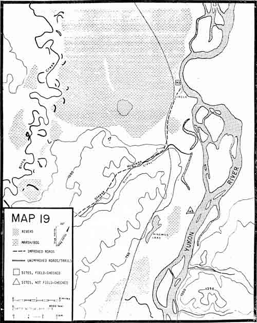
|
|
MAP 19. (click on image for a PDF version) |
#142 SIX AND A QUARTER MILE BLUFF
LOCATION:
The village site is 9 miles upriver from Circle on
the left bank of the Yukon.
SIGNIFICANCE:
Local significance.
PLACE IN HISTORY:
This was a Native summer settlement important in the
history and culture of the Native people of this area. A trail connects
the village to Medicine Lake where considerable subsistence activity
such as duck and geese hunting in the spring and fall and possibly moose
and caribou hunting in the later fall were carried on.
CONDITION:
Although archeologist F. Hadleigh-West located the
site in 1965, no survey was undertaken to determine the extent and age
of the site. Only a hearth and a few fire-cracked rocks were found.
TREATMENT:
The site should be definitely located and evaluated
as to its place in history and its qualifications for the National
Register. In the meantime the site should be protected from vandals.
SOURCE:
F. Hadleigh-West; Elizabeth Andrews' 14(h)(1) survey.
#143 CIRCLE
LOCATION:
Circle is indicated by name on the Circle Quadrangle,
scale 1:250,000.
SIGNIFICANCE:
Regional significance.
PLACE IN HISTORY:
Circle was founded in 1893 as a result of a gold
strike on nearby Birch Creek. Jack McQuesten grubstaked two
Russian-Native Creoles, Pitka and Cherosky. Miners from the Fortymile
stampeded to the new strike. McQuesten moved his store to the town named
Circle believing it to be above the Arctic Circle. The miners built log
cabins in Circle and used the town as a supply base and winter home.
Saloons abounded and became known as "Paris of the North". The Klondike
gold rush of 1897 drained the town of its population, however, a few
stayed on, joined by disappointed Klondikers Wickersham held court
occasionally during his years in Eagle. During the stampede a small
military camp remained to help keep law and order. Circle eventually
settled down to a small, stable population that supplied persevering
miners on the nearby Mastodon, Mammoth, Deadwood, and Birch Creeks.
Circle is best known for perfecting the pre-Klondike social institution
of Miners' Meetings.
CONDITION:
Most of historic Circle has been replaced by frame
structures. For instance, McQuesten's two-story log store is gone. A
historic survey by a historian and/or architectural historian is needed
to evaluate the fabric that remains and its significance.
TREATMENT:
An appropriate survey to evaluate the historic
district of Circle is recommended. There may be buildings remaining that
can interpret the story of early Circle. The town's past is
significant.
SOURCE:
David Wharton; William Hunt; Hudson Stuck; James Wickersham; Tappan
Adney; Josiah Spurr; Arthur Walden.
| <<< Previous | <<< Contents>>> | Next >>> |
yuch/grauman/sites.htm
Last Updated: 29-Feb-2012