|
NATIONAL PARK SERVICE
Research Report GRTE-N-1 The Elk of Grand Teton and Southern Yellowstone National Parks |

|
THE STUDY AREA
The study area includes most of the land used by Grand Teton and southern Yellowstone elk (Figure 1). It extends about 55 miles north of the south boundary of the National Elk Refuge near Jackson, Wyoming, through Grand Teton Park, and Teton National Forest lands into Yellowstone Park. Most of the area is on the west side of the Continental Divide in the headwaters system of the Snake River. A comprehensive account of the area's geology is given by Fryxell (1930), Love and Reed (1968). Physiographic features and soils show the effects of glacial action. Glaciers extended onto Grand Teton valley floor as recently as 9,000 years ago.
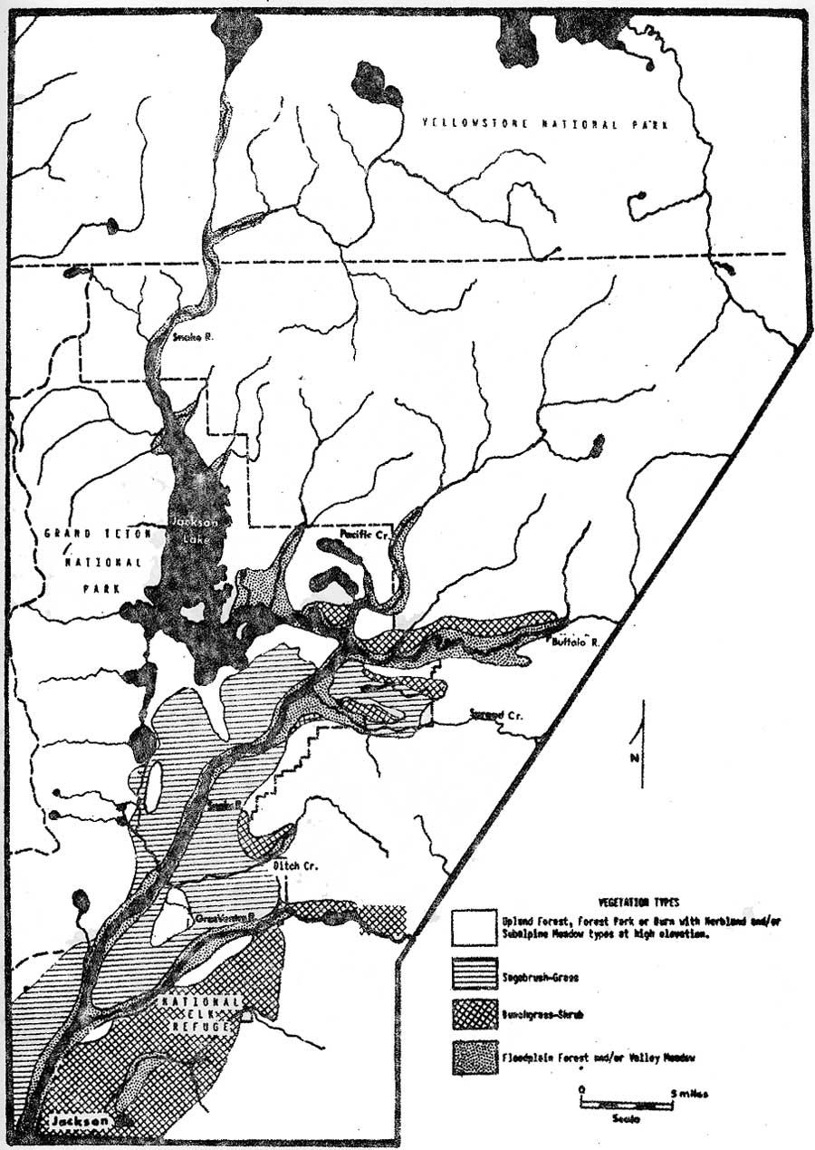 |
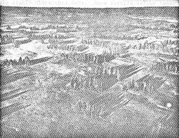
| Fig. 1. Map showing major vegetation types on the study area. (click on image for an enlargement in a new window) |
Physiography
The main physiographic features on the study area and adjoining lands are shown on Figure 2. The map regions shown as Jackson Hole, the Mount Leidy and Pinyon Peak highlands, the Snake River drainage slopes of the Teton Mountain, Gros Ventre, and Hoback Ranges, and the east slope of the Snake River Range are called "the Jackson Hole area." The portion of the valley south of the Snake River outlet from Jackson Lake is called "the Jackson Hole valley."
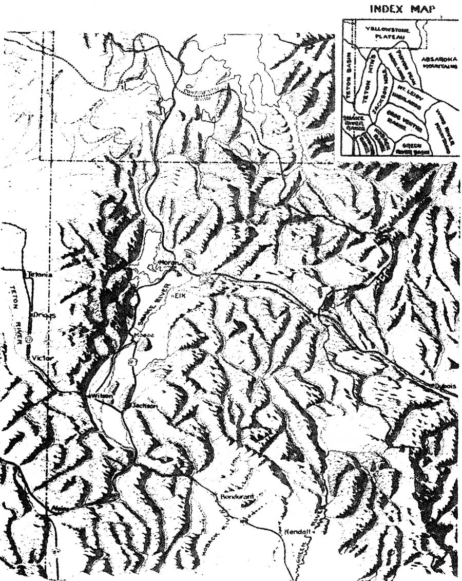 |
| Fig. 2. Physiographic map of the study area and adjoining lands (by permission of Dr. S. H. Knight from 1956 Jackson Hole Field Conference Guidebook, Wyoming Geological Assn., p. 7). (click on image for an enlargement in a new window) |
A comparatively flat glacial outwash plain forms the floor of the Jackson Hole valley. Other features on the plain are glaciated ridges that project through the surrounding outwash deposits, terrace benches along the sides of past and present water courses, potholes formed from melting ice blocks, alluvial fans, and braided stream bottoms. Foothill ridges and slopes border the valley on the east. Glacial moraine deposits border the valley on the north and west and extend as projections onto the outwash plain.
A series of high ridges, mountains, and plateaus occur from the north end of the valley into southern Yellowstone Park. Elevations range from a minimum of about 6,200 feet on the refuge to maximums of over 13,700 feet on the Teton Range, and slightly above 10,000 feet for the highest mountain and plateau tops within southern Yellowstone Park.
The outwash plain soils on the valley floor are poorly developed and contain a high proportion of rounded cobblestones. Glacial moraine and alluvial fan soils contain relatively greater proportions of fine textured material in variable mixtures with angular rock and cobble. Ridge and foothill slopes have mostly fine textured residual soils, but coarse textures occur where resistant rock formations are exposed or overlying glacial deposits are present. Soils along water courses range from layer cobble with gravel and sand in interspaces to developed sand, silt, and clay loams. Mountain and plateau soils are extremely variable, ranging from deep residual loams to very coarse textures developed from rock talus or volcanic rhyolite.
Climate
The area has short, cool summers and cold winters. U. S. Department of Commerce records for Moran at the northern limits of the Jackson Hole valley show a 30-year (1936-1965) mean annual temperature of 34.8° F. (Houston, 1967). The mean temperature for July as the warmest month is 60° F. January as the coldest, 10.3° F. About three-fourths of annual precipitation of 22.2 inches for the period fell as snow.
West to east and north to south gradients in lessened snow depths were apparent. Midwinter snow depths on the west side and north of the Jackson Hole valley commonly ranged from 6 to 3 feet, as compared to 3 to less than 1 foot depths on the east side or in the southern portions of the valley.
Moran was at the northern limit of the area used by any appreciable numbers of wintering elk. December through March snow measurements at this station were used to reflect the relative magnitude of this environmental influence between 1961 and 1967 (Table 1).
The period from November 16 through April 15 was considered the winter season. April 16 through June 15 in valley areas, and May 16 through June 30 in the mountain areas, was spring. June 15 or 30 to September 15 was summer. Fall extended from September 16 through November 15.
| Years | December-March mean monthly snow depths (inches) | Relative snow depths1 |
| 1961-62 | 40 | High |
| 1962-63 | 19 | Low |
| 1963-64 | 34 | Average |
| 1964-65 | 43 | High |
| 1965-66 | 30 | Average |
| 1966-67 | 32 | Average |
| 1951-1967 Mean | 32 | |
1 ±4 inches from the mean was considered average. | ||
Vegetation
Scientific and common names for plants mentioned in this bulletin listed in Appendix I. These generally follow Davis (1952) or Booth and Wright (1959). Vegetation was classified during field inspections and by analyzing measurements of taxa in representative stands. Measurements were by the author (Appendix II, III, IV) and other workers on the area (Martinka, 1965; Oswald, 1966; Houston, 1967), following Daubenmire (1959), Parker (1951), and Cottam and Curtis (1949).
Figure 1 shows the major vegetation types on the area. Table 2 lists information on their general distribution and the characteristic well as important associated plants for the more representative stands each type. Various mixtures of characteristic and important associated plants occurred in transitional or intermediate successional stages.
Characteristic plants occurred consistently and usually made up the greater portion of the plant crown cover in representative or successionally related stands. Important associated plants for other than forest stands had a crown cover that was slightly less, equal to, greater than characteristic plants. Important associated plants under forest canopies made up one-fourth or more of the ground level crown cover in distinct stands, or had a consistent high frequency of occurrence in successionally related stands.
| Vegetation Type | General Distribution | Characteristic Plants | Associated Plants |
| Bunchgrass—Shrub | Residual and glacial till soils on ridgetops and south, east, and west slopes in valley areas | Bluebunch Wheatgrass—Douglas Rabbitbrush Climax Big Sagebrush—Bitterbrush Stage Needle and Thread—Sandberg Bluegrass Disclimax |
Ricegrass Rubber Rabbitbrush Serviceberry Threetip Sagebrush Idaho Fescue |
| Sagebrush | Glacial outwash plain, stream—cut terraces and alluvial fans | Big Sagebrush Stage Big Sagebrush—Bitterbrush Stage |
Bluebunch Wheatgrass Idaho fescue Balsamroot Lupine Buckwheat Low Sagebrush |
| Valley Meadow | Alluvial soils along water courses below 7500 feet. | Willow—Sedge Stage Tufted Hairgrass—Sedge Stage Sedge—Bluegrass Stage |
Rush Shrubby Cinquefoil Silver Sagebrush Dandelion |
| Floodplain Forest | Stream alluvium up to about 7000 feet. | Narrowleaf Cottonwood Stage Blue Spruce Climax |
Russet Buffaloberry Red Dogwood Willow Thinleaf Alder Balsam Poplar |
| Upland Forest | Glacial till, north and west slopes within the valley and on a variety of substrates and exposures in mountain areas up to 10,000 feet. | Lodgepole Pine Stage Aspen Stage Douglas—Fir Climax Whitebark Pine Climax Englemann Spruce—Subalpine Fir Climax |
Geyer's Sedge Fine grass Arnica Large Huckleberry Dwarf Huckleberry Pachystima Menziesia Spirea |
| Burn | Upland forest stands burned since 1930. | Geyer's Sedge—Lodgepole Pine Disclimax Geyer's Sedge—Subalpine Fir Disclimax | (as in Upland Forest) |
Exceptions to this classification system were the herbland type, where the crown cover of various forbs was usually greater than the two characterizing grasses, and the bunchgrass-shrub type, where big sagebrush/or other shrubs had a greater crown cover than bluebunch wheatgrass on rocky or more mesic sites. Plant species that characterized successionally advanced stands which appeared capable of persisting under the present climate are given a "climax" suffix. Plants characterizing seral vegetation that could ultimately be replaced by climax stands are called a "stage." Plants characterizing stands modified by recent fires or animal use are called a "disclimax." The classification system represents a modification of criteria used by Weaver and Clements (1938) and Daubenmire (1953).
Figures 3 and 4 show what appeared to be the general successional patterns for vegetation in valley and mountain areas. The four types of climax vegetation below 8,500 feet appeared to develop from a variety of seral stands on different sites, exposures, and soils. Successional patterns for subalpine vegetation above 8,500 feet appeared to be comparatively simple. The dual role of mountain brome, slender wheatgrass, and tufted hairgrass in climax stands at high elevations and seral stands at low elevations was evident. Some of associated forbs for the herbland type probably had similar roles. Dual successional roles for tree species have been reported by Daubenmire (1953).
 |
| Fig. 3. Plant succession relationships at elevations from 6200-7500 ft. within valley areas. (click on image for an enlargement in a new window) |
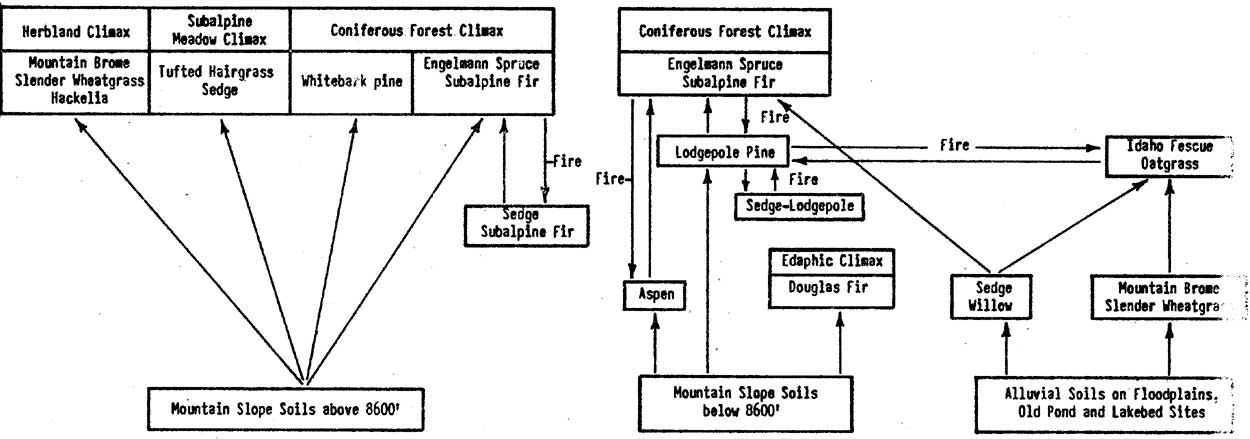 |
| Fig. 4. Plant succession relationships at elevations from about 7000-10,000 ft. within northern mountain areas. (click on image for an enlargement in a new window) |
Host Douglas-fir and whitebark pine stands on the study area were considered edaphic climaxes, but on some more mesic sites they were probably seral to Engelmann spruce and subalpine fir. Ellison (1954) concluded that scattered stands of Engelmann spruce and subalpine fir rocky outcrops in the herbland type were seral to herbland. This was on the Wasatch Plateau in Utah. In this study such stands occurred on rocky sites in both the herbland and subalpine meadow types and frequently contained whitebark pine. They were considered to be edaphic climaxes rather than a seral stage. All lodgepole pine stands were considered seral, but it is recognized that some stands could be considered "fire climaxes" as proposed by Daubenmire (1968). Fire and the biotic influences of wild ungulates in antler rubbing and foraging contributed to maintaining the forest park type.
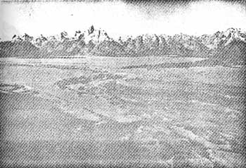
The classifications of vegetation and judgments of successional patterns made during this study should be considered tentative. Revisions and refinements from more detailed studies are expected. The general appearance of the major vegetation types is shown on Figure 5.
 |
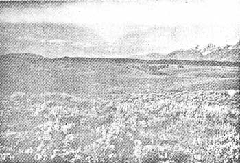
| Fig. 5a. Approximate center of Grand Teton Park showing extensive sagebrush type on the outwash plain, the valley meadow, and bottomland forest types along the Snake River flood plain, and the upland forest type on glacial moraine sites. |
 |
| Fig. 5b. The sagebrush type in a pothole area. |
 |
| Fig. 5c. Valley meadow and bottomland forest types on Snake River flood plain. |
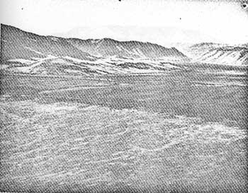 |
| Fig. 5d. Valley meadow type on National Elk Refuge bottomlands and the bunchgrass-shrub type on adjoining slopes. |
 |
| Fig. 5e. Bunchgrass-shrub type on south slopes with bottomland developed as a hayfield. |
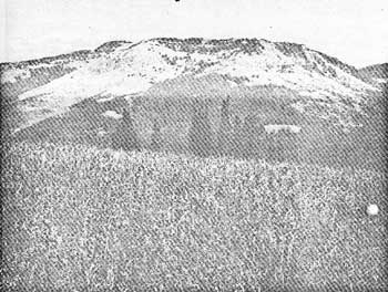 |
| Fig. 5f. Herbland type on upper portions of Chicken Ridge and in the foreground. |
 |
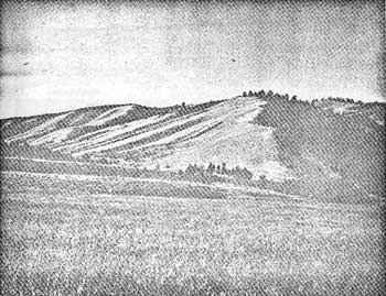
| Fig. 5g. Interspersed forest park, burn, and upland forest types with herbland above the upper half of Red Creek Ridge. |
 |
| Fig. 5h. Extensive subalpine meadow type with scattered Englemman spruce-subalpine fir stands on Pitchstone Plateau. |
History
Yellowstone National Park was established in 1872. The main east face of the Teton Mountain Range became Grand Teton National Park in Northern Jackson Hole valley lands and adjoining mountain areas were given national monument status in 1943. These were incorporated into the present boundaries of Grand Teton in 1950. The Forest Service assumed jurisdiction over its lands in 1897.
The following summary of Jackson Hole history is largely from Hayden (1956). The region was originally a summer hunting ground for Bannock, Shoshone, and Crow Indians. Organized fur trapping occurred from about 1811 to 1840. After the collapse of the fur trade only occasional expedition parties, trappers, gold prospectors, and hunters visited the region. First permanent settlement occurred in 1884 and the human population reached 65 persons in 1889. Settlers increased and cattle raising became the chief industry. Cattle numbers increased from about 3,000 head in 1910 to about 15,000 by 1935 and have remained relatively stable since this date. More fertile valley lands were developed as hayfields.
Wyoming became a state in 1890. It established a 10-month closed season on elk in 1895. A 570,000-acre area north of the Jackson Hole valley to the south boundary of Yellowstone was established as a game preserve in 1905. A brief period of illegal "tusk hunting" prompted local vigilante action. A hunting guide and outfitting industry was operative in 1895. This and a later developing dude ranch industry continue to the present.
Publicized elk dieoffs during severe winters and conflicts between elk and livestock-raising operations led to the establishment of the National Elk Refuge in 1913. The refuge did not reach its present size of about 22,700 acres until 1950. The Forest Service started to exclude cattle and horse grazing from important elk wintering areas on public lands in 1919. Many of the smaller ranchers unsuccessfully petitioned Congress to make the Jackson Hole valley a recreational area in 1925. The Wyoming Legislature passed a game damage law in 1939 which allowed claims for elk damage.
Yellowstone Superintendents reported that highly organized market hunting, poaching, and extremely liberal legal hunting occurred inside the the park before 1894. The more remote southern portions of the park, like the Jackson Hole area, probably escaped this exploitive era. The Lacey Act of 1894 established laws and fines to protect Yellowstone wildlife. Comparatively few tourists visited the parks until after World War II. Visits greatly increased after 1946 and tourism became the major industry in the general region bordering Grand Teton and Yellowstone Parks (Rajender et al., 1967)
| <<< Previous | <<< Contents>>> | Next >>> |
fauna/8/chap1.htm
Last Updated: 01-Feb-2016