|
ICE AGE
Geology of Ice Age National Scientific Reserve of Wisconsin NPS Scientific Monograph No. 2 |

|
CHAPTER 7:
Devils Lake Park
Introduction
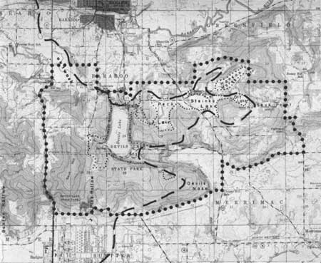
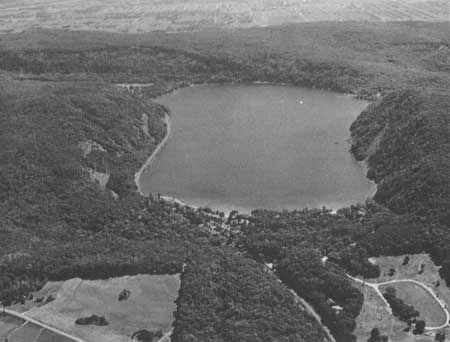
Devils Lake Park in the Baraboo Range, Sauk County, presently contains about 5 mile2 of scenic cliffs, wooded hills, and Devils Lake itself (Figs. 1, 2, 3, 46, 59). Topographically the park is mostly a rolling upland, near 1400 ft above sea level, cut by a steep-walled, L-shaped gorge whose floor is generally 500 ft below the summit (Fig. 59). The north-trending part of the gorge is occupied by Devils Lake (Fig. 60). Ancient rocks of Cambrian and Precambrian age in the eastern part of the park (Fig. 3) largely are covered by glacial deposits and Recent wind-blown silt. The record in the rocks and in glacial and periglacial features is especially rich. To preserve unique and representative glacial features in the area the park must be tripled in size following approximately the boundaries shown in Fig. 59.
|
| Fig. 59. Parts of U.S. Geological Survey Topographic maps—Baraboo and North Freedom, showing the position of the prominent Cary end moraine with heavy dashed line, the outlines of former glacial lakes with small dots, and the outlines of the minimal recommended area with large dots. |
As a field laboratory in earth history, the Baraboo Range is one of the most valuable and fascinating in the Upper Mississippi Valley region. Besides being the most popular park in Wisconsin, the Devils Lake area has been the locus of field trips for thousands of students each year. In spite of the great amount of study given the area by scientists over the decades, new information continues to appear. Hopefully, there will be renewed interest for study of the park by this recommendation for its inclusion in the Ice Age National Scientific Reserve.
To understand the deployment of ice in the park and the origin of many periglacial features it is necessary to understand the bedrock geology and geomorphology of the area. This note first summarizes the geomorphic development of Devils Lake Park and then comments on certain unusual or striking features in and adjoining it. Emphasis is given to description of the glacial and periglacial features. I have attempted to bring together the new information available since the last major summaries (Salisbury and Atwood 1900; Trowbridge 1917; Alden 1918). It is hoped that the features illustrated here can be seen and appreciated, but not destroyed, by the thousands of visitors each year who come to Devils Lake. In their zeal, geology students particularly have contributed importantly to the natural attrition of certain exposures in the park. This must cease. Pressure of man's use has increased to the point where even the durable rocks now need protection.
|
| Fig. 60. Air view looking southward of Devils Lake, its morainal plug in the foreground, the quartzite bluffs surrounding the lake but breached in the southeast corner, and the distant broad flat of the Wisconsin River. |
Geomorphology
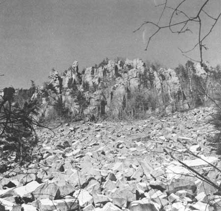
The story of Devils Lake Park must begin about a billion years ago, in latter Precambrian time, with the deposition in shallow seas of many hundreds of feet of very clean, well-winnowed quartz sand of medium-grain size. Subsequent burial in the earth's outermost crust and accompanying alteration during late Precambrian time lithified the rounded to subangular sand grains into the brittle Baraboo quartzite in which the gap containing Devils Lake has been cut. The lithification involved little or no crushing of the sand grains—only deposition of secondary silica cement in interstices. This makes the total rock very hard yet brittle so it breaks across grains. Large joint blocks are commonplace and lead to the formation of extensive talus and jagged cliffs (Fig. 61). The characteristic pink, red, and lavender hues are attributed to finely disseminated iron oxides in very small amounts. Ripple marks, mud cracks, and cross-cutting stratification typical of the former marine environment are widespread in the park. The individual grains of sand and some pebbly and bouldery zones are still easily distinguished today.
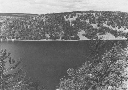
Perhaps in part during metamorphism of the sand to quartzite and certainly afterwards the area was folded into a large basin by a mechanism not fully understood. Perhaps more than one episode of regional stress made itself felt in minor structures now visible in the Baraboo Range. Devils Lake lies in the center of the south limb of the syncline or basin (Fig. 3 shows the outcrop pattern of the south limb and of the east nose), where the gentle north dips and local gentle undulations of the quartzite are readily discerned in the cliffs of the West and East bluffs overlooking the lake (Fig. 62). Local, very gentle south dips of the quartzite are found in the cliffs 2-3 miles east of Devils Lake.
|
| Fig. 61. Talus surmounted by castellated cliffs of Baraboo quartzite on the south face of East Bluff of Devils Lake. |
|
| Fig. 62. View westward of West Bluff of Devils Lake, showing talus and jointed beds of the Baraboo quartzite dipping 10° northward. |
Fracture cleavage—a parallel splitting of the quartzite easily confused with bedding—at Devils Lake dips at angles greater than the bedding planes of the quartzite (Weidman 1904; Hendrix and Schaiowitz 1964). It too aids in the formation of joint blocks, talus, and jagged cliffs. Such fractures are considered "normal" in their orientation with respect to the stresses that are inferred to have produced the syncline (Hendrix and Schaiowitz 1964). So are minor drag folds in thin argillites (clayey zones) at Devils Lake, but other minor structures including small folds, slip cleavage, and shears are considered "reverse" by Hendrix and Schaiowitz (1964). The normal minor features are confined to thin silty argillite layers interbedded with quartzite, whereas the reverse minor features are in thick argillite beds. Extensive exposures of the reverse structures are in Skillet Creek, about 1 mile northwest of Devils Lake; a small outcrop is just inside the present northwest entrance to the park (Hendrix and Schaiowitz 1964). (Both exposures are rapidly being destroyed by the promiscuous hammering of geology students who do not realize that more can be seen on a weathered surface than on a fresh one.)
The details of the folding mechanism of the quartzite are interesting but not especially germane to the problem of the present day surface features of the park even though their results are. As pointed out, the fracturing of the rock has made frost work especially effective in the formation of pinnacles, talus slopes, and bizarre forms (Figs. 61-64).
The younger Seeley Slate Formation and the Freedom Formation of iron-bearing slate, chert, and dolomite of Precambrian age (Fig. 3) are on the Baraboo quartzite southwest of North Freedom but have not been recognized in the park. They were the object of a flourishing iron ore exploration program in the late 1800s (Weidman 1904), but no mines are operating today. They do not produce any striking surface features.
Some time after the folding and uplift of the Baraboo Range, sub-aerial erosion (Trowbridge 1917) and probably marine shore erosion also (Thwaites 1958) developed relief of a thousand feet between the top of the range and the surrounding beveled Precambrian igneous and metamorphic rocks. Such relief was due almost entirely to the great resistance to weathering and erosion of the quartzite. Small bodies of igneous rocks crop out in Baxter Hollow, southwest of Devils Lake, and in isolated bodies farther west and on the north and east parts of the range. However, in most of the area surrounding the range, the igneous rocks are buried beneath thick accumulations of sand of Upper Cambrian age (500-550 million years old) (Fig. 3).
During the development of the relief, beveling of the upland quartzite obliquely across the bedding produced surfaces which look smooth to the eye and have long been called peneplains (Trowbridge 1917). The interpretation that the region was in the end-stage of one or more cycles of erosion is now discredited (Thwaites 1958, 1960). Nonetheless the mode of beveling of the resistant quartzite at such marked elevations above the surrounding plains is not truly understood. Certainly toward the close of the erosion cycle marine waters again inundated the quartzite.
Thick accumulations of sand were piled around the range which for a time stood as islands in the shallow seas, shedding their characteristic pinkish rocks into the surf zone to be transported downwind and along shore to inevitable burial (Raasch 1958). Thus we find pebbles and boulders of rounded quartzite to the south but only a short distance north. Quartzite pebbles are found locally from the Cambrian basal conglomerate up to the Platteville Formation of Ordovician age. The Cambrian sands not only lapped onto the flanks and filled the center of the syncline, but they also filled channels cut into the quartzite by supposedly ancient streams. The angular unconformity of the sands with respect to the beveled quartzite is striking in many places as is also the abrupt textural and compositional change to the basal conglomerate. A possible wave-cut terrace lies on the northeast part of Happy Hill, 6 miles west of Devils Lake (Thwaites 1958).
|
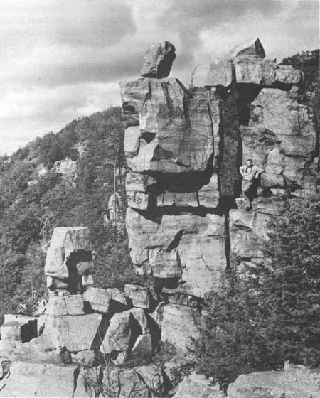
| Fig. 63. Devils Doorway on the south-facing slope of East Bluff of Devils Lake, formed by frost action from the well-jointed Baraboo quartzite. See Fig. 65. |
|
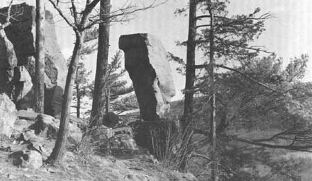
| Fig. 64. Balanced Rock, a joint block of Baraboo quartzite, isolated by frost action and rock falls of adjacent material, on the west-facing slope of East Bluff of Devils Lake. See Fig. 65. |
Gaps cut entirely through the range are common on the narrow, steeply dipping north flank (too narrow to show in Fig. 3). Only one is known, that with Devils Lake, on the broad south flank (Trowbridge 1917; Alden 1918:105-107). Some, such as at least part of Devils Lake Gap, are definitely Precambrian in age for they contain Cambrian sandstone; others probably are post-Paleozoic and still others were modified by streams as young as Pleistocene to Recent age. Hanging valleys in the quartzite of the south flank are anomalous also. They are broad and gently dipping in their upper reaches and plunge precipitously to the buried Precambrian surface hundreds of feet below. Some are filled partly with Cambrian sandstone, so date from the Precambrian erosion cycle; some also have narrow notches cut into them that may postdate the Paleozoic. The distribution of the hanging valleys in the Baraboo Range is not known nor is their origin. Pine Hollow in the southwest corner of the park, southwest of Devils Lake, is typical (Thwaites 1958).
Cambrian sandstone crops out near the northeast and northwest corners of Devils Lake, in the gorge east of Devils Lake and continuing eastward to Parfreys Glen, near Koshawago Springs and along Messenger Creek southwest of the Lake to the headwaters of Pine Hollow, and in a considerable area in Skillet Creek. It has not been found in the deep valley under Devils Lake itself which is filled with glacial sediments. Cambrian sandstone also is common along Highway 12 where it crosses the south limb, and continues westward to Baxter Hollow where it produces striking cliffs.
Paleozoic sediments continued to be deposited around and over the Baraboo Range probably until Silurian or possibly Devonian time (Fig. 3), with erosional intervals such as that below the St. Peter Formation (Wanenmacher et al. 1934: Thwaites 1961). However, in the park only the Upper Cambrian sandstone lies on the quartzite. The oldest unit exposed is the Galesville Member of the Dresbach Group. It is thickbedded and mostly white or very pale yellow. It is the unit that develops striking cliffs and steep slopes in Baxter Hollow west of the park. The next younger formation is the dolomitic, fine-grained Franconia sandstone that forms local benches, cliffs, and crags that are greenish grey in contrast to the Dresbach. Still younger rocks are more distant from the park today although they may have been present in the geologic past. Chert nodules and clay on top of the quartzite west of Devils Lake are thought to have been "let down" during weathering of the dolomitic formations of Ordovician age (Thwaites 1958).
Peneplaination of the upper quartzite surface also has been attributed to the erosion cycles that removed the Paleozoic strata from the top of the range. Thwaites (1958, 1960) discards those hypotheses in the same way as he discards that for the Precambrian.
Between the time of deposition of the post-Cambrian strata and their removal in post-Paleozoic time and then continuing to the Pleistocene, or Great Ice Age, geologic events in Devils Lake Park are obscured. The latter part of that interval, encompassing at least 300 million years, must have been largely a time for erosion as no rocks are left behind. If the interpretation is correct that the upland surface of quartzite is only the recently exhumed Precambrian surface protected during much of the time by a cover of Paleozoic sediments, then the topography of Devils Lake Park has changed considerably during the last 550 million years even though present day topography in the park may be essentially the same as it was 550 million years B.P. The remaining Cambrian sandstone in the present park does not make striking features as it does farther west, especially in Baxter Hollow, even though Parfreys Glen in the northeast corner of the recommended area is reasonably typical.
Although it seems clear that at least part of the Devils Lake gorge was cut in Precambrian times by an ancient stream, otherwise we would not see the Cambrian sandstone infilling it, perhaps not all was. Some writers attribute the north part of the gorge to the Paleozoic cycles of erosion (Thwaites 1958), and I do not believe that an early Pleistocene time for cutting part of the gorge can yet be ruled out.
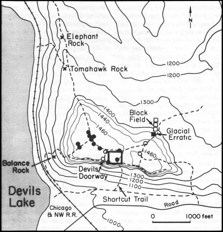
Potholes on the East Bluff (Figs. 65, 66) are attributed by different people to the stream work associated with the cutting of the gorge during the Precambrian, the Paleozoic, the Cretaceous, or the Tertiary, yet they too may only be Pleistocene (Black 1964c). However, at the east end of the Baraboo Range one pothole in a group of about 25 in the quartzite has Cambrian sandstone firmly adhering to the inside walls so it was cut indisputedly in late Precambrian or Early Cambrian time. Different kinds of potholes are present at that site, and all may not be of the same age nor are they necessarily the same age as those at Devils Lake. Several are altered by glacial ice of Cary age, but if all were, the evidence is obscured by post-glacial weathering. Potholes in bedrock are thought to have formed under glacial ice in Norway (Gjessing 1965-66).
|
| Fig. 65. Topographic map of East Bluff area of Devils Lake, showing location of various named features and area covered in Fig. 66. Solid black circles show locations of drill holes where the Windrow Formation was encountered below a broken rubble of Baraboo quartzite; open circles area locations of drill holes where the Windrow Formation was not encountered to bedrock. |
|
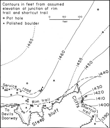
| Fig. 66. Topographic map located by rectangle on Fig. 65, showing locations of potholes and water polished boulders on East Bluff of Devils Lake. |
The pebbly loam with much expandable clay on top of East Bluff must be the source for the Windrow gravel (Fig. 65) (Andrews 1958) which is considered Cretaceous by him, but again an early Pleistocene deposit cannot yet be ruled out (Black 1964c). The gravel has been found in and around the potholes. No way has yet been found to date the deposits or cutting of potholes satisfactorily. Their place in the history of events must await new evidence. Regardless of their age, however, loose blocks with potholes have been moved about on the upland, and angular quartzite blocks lie on top of the pebbly clay. Glacial ice must have accomplished this, for blocks up to 85 tons seem to have moved upslope (Black 1964c). The area lies immediately west of the prominent Cary end moraine on the upland. This is correlative with the moraines that plug the southeast and north parts of the Devils Lake gorge (Fig. 59). These features are perhaps only 13,000-16,000 years old (Black et al. 1965:56-81). They do not prove that earlier ice went no farther into the Driftless area, and much evidence has now been amassed to indicate ice did go further west (Black 1960; Black et al. 1965:56-81; Frye et al. 1965:43-61).
Much of the talus and the pinnacled cliffs around Devils Lake (Fig. 61) are associated with the late Wisconsinan Stage of glaciation (Smith 1949; Black 1964c; Black et al. 1965:56-81). Whether the area was glaciated more than once is not proved but is suggested (Weidman 1904; Alden 1918:177-178; Thwaites 1958; Black 1964c; Black et al. 1965:56-81). For example, organic matter from a depth of 130 ft in glacial deposits at Baraboo was submitted by Thwaites to Wilson (1936:43) for identification; he found leaves of several dicotyledonous plants, some probably Vaccinium, and one species of moss, identified by Cheney as Campylium stellatum. Thus the story of the geomorphic development of Devils Lake Park jumps quickly from the Paleozoic to the Pleistocene or even late Pleistocene.
Since glaciation, gravity and frost action have moved many large blocks of quartzite down slope although the present rate is very slow. Railroad and other construction and abortive attempts at farming in the last century have left their mark. Some pits for aggregates have been opened in glacial materials and in bedrock. Increasing pressure from tourists and students is showing, but relatively little gross modification of surface features has occurred since the last glacial ice disappeared from the area.
Description of Specific Features
Moraines
The most important glacial feature in Devils Lake Park is the end moraine of Cary age (late Woodfordian) depicted in Fig. 59. This end moraine can be traced with only minor breaks from the southwest boundary of the recommended area in an irregular looping course through the park to the northwest corner. It is part of the Johnstown Moraine traceable along the entire front of the Green Bay Lobe (Alden 1918). The detailed description of the moraine in the park, initially given by Salisbury and Atwood (1900:93, 94, 105-111), has stood the test of time. Because of its length, it will not be quoted here. The moraine marks the still stand of the outer edge of the ice sheet in part synchronous with the more massive moraines and outwash plugging the valley and enclosing Devils Lake.
Terminal moraine plugs such as occupy the gorge north and southeast of Devils Lake are unusual individually but together comprise a unique situation. Having such a prominent well-defined end moraine extending for so many miles from those plugs makes the situation even more astounding. The moraine outlined in Fig. 59, in the recommended area, if not the best, is certainly one of the few best such features to be found anywhere in the world. Having it so readily accessible to centers of population with so many other features nearby makes it especially attractive. As recognized by Salisbury and Atwood (1900), the striking loops show clearly the inability of the ice to surmount topographic obstacles of negligible relief because of restricted flow over and around buttresses up ice. Nowhere are similar features so well displayed amongst so many other phenomena of intriguing historical connotation.
The uniformity of height (15-50 ft) and width (100-200 ft) of the moraine on flat surfaces and the asymmetry of the moraine on hill sides (only 10- to 15-ft abrupt faces on the uphill side and 50- to 100-ft faces on the downslope side) are in themselves very unusual over such broad distances. Furthermore the position of the moraine from its high point on Devils Nose southwestward to the level of the plain records precisely the distal slope of the ice front during at least the latter part of the deposition of the moraine. Recording of such gradients is a rare occurrence almost anywhere because of concurrent or post-glacial destruction by flowing water and mass movements. Thus, in the recommended area of Devils Lake Park are textbook examples of glacial features hardly rivaled anywhere else in the world.
The moraine in the recommended area is but a small part, but unquestionably the best part, of the end moraine of essentially similar age that has been traced throughout Wisconsin, from the Minnesota border near Hudson to the Illinois border south of Lake Geneva, and also from the Great Plains to the Atlantic Ocean (Chamberlin 1883a). This moraine was designated as the Terminal Moraine of the Second Glacial Epoch (Chamberlin 1878, 1883a). It was considered by him to be the boundary between older and younger drift and as such to be the most important time break in the Pleistocene in the state. Recent field work has not supported this viewpoint (Frye et al. 1965:43-61). Unfortunately we do not have a single date recording the advance of ice to this end moraine in Wisconsin, but from evidence from Minnesota and Illinois, it probably was formed 13,000-16,000 years B.P. In many places outside of the recommended park area, the moraine appears more massive than it is within the park. Yet its massiveness commonly may be attributed to bedrock elevations on which it is found or to the overriding and pushing up of material from below (Alden 1918).
In the park the end moraine outside of the two plugs containing Devils Lake is generally only 15-20 ft high. Locally, as at the easternmost loop at Sauk Point on the very crest of the Baraboo Range, near the WWCF radio tower, the front is fully 80 ft high. It is accentuated there because of the high level of the Baraboo quartzite on which it is built and the low plain stretching to the west which was occupied by outwash and a former glacial lake (Ott Lake, Fig. 59). The more massive moraines containing Devils Lake rise 90-130 ft above Devils Lake and even higher above the valley floors north and east. Their massiveness is due mostly to outwash and deltaic deposits (Thwaites 1958:150) deposited in front of the advancing ice. Only a thin local veneer of till was deposited directly on these deposits by the ice. The deepest well in the gorge, 383 ft, did not reach bedrock.
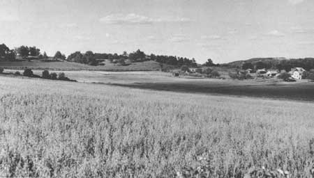
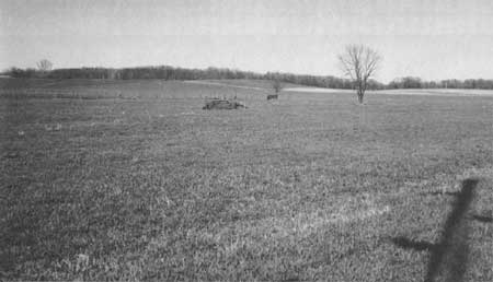
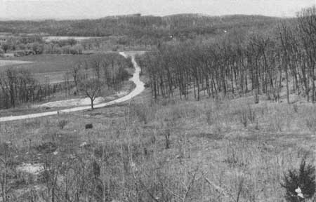
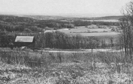
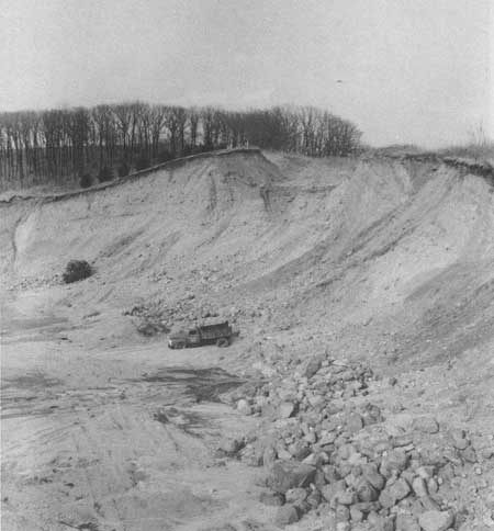
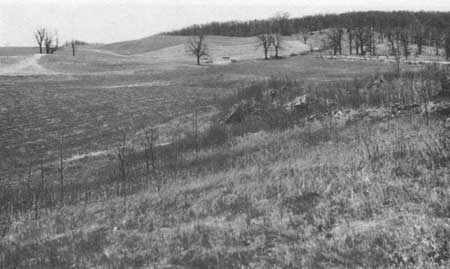
From a car, views of the end moraine are particularly good along County Highway DL northeast of Devils Lake (Fig. 67) and at the extreme northwest corner of the park where Highway 159 crosses the moraine (Fig. 68). There especially, with the abrupt steep slope to the northeast formerly occupied by ice and the small moraine ridge with its smooth outwash plain to the west or front of the moraine, we have a classic example of the relationship of the ice sheet to its proglacial fluvial deposits. At the easternmost loop, by Sauk Point, the moraine and its relationship to the quartzite and proglacial lakes are accessible and readily discernible (Figs. 69-72). Stratification and texture of outwash, unassorted sandy till, and shear planes inclined steeply up ice are especially well displayed in the gravel pit shown in Fig. 71. Immediately below the pit is Ott Lake basin, a former proglacial lake, and weathered outcrops of the Baraboo quartzite. Retreatal moraines are also common behind the outer moraine south of the gravel pit (Fig. 72). The abrupt interlobate junction of ice from the north and south sides of the south flank of the Baraboo Range is clearly portrayed in the moraines northeast of the pit.
|
| Fig. 67. The end moraine of Cary age is the topographic rise with trees forming the skyline. View northeastward from County Highway DL, about 1 mile east of Devils Lake. |
|
| Fig. 68. Outwash plain in the foreground from the Cary front in background as viewed northeastward from State Highway 159, about 0.5 mile east of State Highway 12. |
|
| Fig. 69. Moraine, outwash, and Ott Lake basin looking northwestward from the gravel pit at the eastern loop at Sauk Point. The north loop of the Cary moraine forms the skyline in the center of the photograph. |
|
| Fig. 70. View westward of Ott Lake basin from the gravel pit at the eastern loop of end moraine at Sauk Point. |
|
| Fig. 71. Gravel pit at the eastern loop of the end moraine at Sauk Point, looking northeastward. Stratified outwash dips gently to the left; till and drift partly bedded are inclined steeply to the right, reflecting ice push and possible shear planes as the ice attempted to override its moraine. Copper nuggets from Keewenaw Peninsula of Upper Michigan, Lake Superior sandstone, and many igneous and metamorphic rocks reflect the northern source areas. |
|
| Fig. 72. Retreatal moraines of Cary age, looking southward from the gravel pit in the outermost moraine in the eastern loop at Sauk Point. |
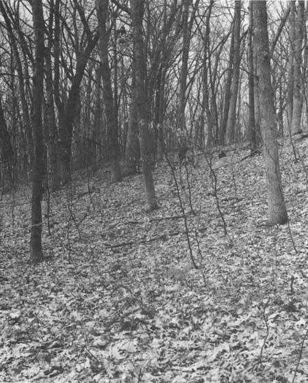
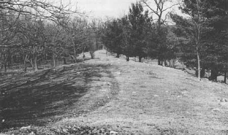
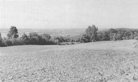
For hikers the views of the moraine are particularly good near the Devils Nose on the South Bluff southeast of Devils Lake (Fig. 73), on the southern part of East Bluff (Fig. 74), extending eastward to the extreme east loop of the moraine at Sauk Point, and also at the north tip of the north loop (Figs. 75, 76). There is one of the most striking views to be had anywhere of the Baraboo Valley, the city of Baraboo, and the Lower Narrows gap of the Baraboo River through the North Range. On the south rim of the East Bluff views to the Wisconsin River Valley from the moraine above the quarry and farther east to the vicinity of Parfreys Glen are superb (Fig. 77). Excellent views of the plugs containing Devils Lake may be had from all of the bluffs rising above them.
|
| Fig. 73. Outside or front of the end moraine on the north side of Devils Nose looking northwestward. |
|
| Fig. 74. Top of the end moraine on the East Bluff on Devils Lake, about 0.25 mile southwest of State Highway 113, looking northeastward. |
|
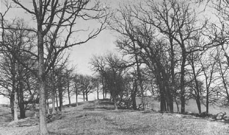
| Fig. 75. Apex of the end moraine in the north loop, showing the inside or supposedly unglaciated area on the right and a retreatal moraine on the left. View eastward. |

|
| Fig. 76. View southwestward from the apex of the inside of the north loop of the end moraine of Cary age. The line of trees is on the end moraine. |
Concentric moraines arc around the extreme north end of the north loop of the end moraine (Fig. 75), in sec. 9, north of Hanson Marsh. These show beautifully the building of ridges at the edge of the ice as it struggled to maintain its position around that high point. Probably at the initial advance the ice went over the inside of the loop, for erratics are to be found on it (Fig. 76). However, their presence can also be attributed to water transportation and even gravity movement from the steep face of the ice that must have developed there. As the terrain inside the loop is precipitous (Fig. 76), boulders could have bounced and rolled practically across the loop on a vegetation-free surface or on an ice-covered surface. At any rate the successive arcs are each slightly lower than their predecessor. The first two are separated by a gap only 60-100 ft across and 10-20 ft deep. The later ones are lower and less regular. The features at the nose of the arc are among the best developed anywhere. When coupled with the beautiful views of the Baraboo Valley to north and west and of the drained lakes and other features to the south, this can be considered truly one of the grand overlooks of the Reserve.
For additional details on the moraine, the reader is referred to the original works of Salisbury and Atwood (1900), Trowbridge (1917), and Alden (1918). All emphasize its uniqueness.
|
| Fig. 77. The Wisconsin River Valley, looking southwestward past Devils Nose on the right. |
Drained lakes
Proglacial lakes were formed immediately in front of the moraine in several places in the recommended park area (Fig. 59). All of these former lakes have been drained, but the sediments remain behind as mute testimony of their former existence. One unnamed lake formerly existed 1.3 miles southeast of Devils Lake on the north side of Devils Nose. Cary ice butted against the ridge leaving its end moraine which may be traced around and across the nose (Fig. 73). Where the moraine crosses the gully in the east half of sec. 30, it is a symmetrical ridge about 45 ft high and 100 ft wide, breached at the gully with a smooth plain to the southwest. That plain is underlain with 10-30 ft of silty sands and some clay and gravel. From the moraine down the gully to the north one sees numerous very large foreign erratics, but from the moraine up the gully to the west and southwest only the Baraboo quartzite blocks and small amounts of fine pea-sized foreign gravel are seen.
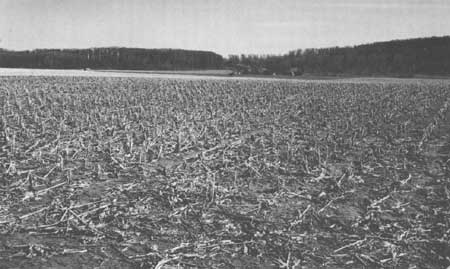
Similar but larger lakes were common in secs. 16, 17, and 18 in the northeastern part of the recommended area (Fig. 59). Peck and Steinke (Fig. 78) glacial lakes were named early (Salisbury and Atwood 1900; Trowbridge 1917). The name Glacial Ott Lake is assigned for convenience to the easternmost and smallest basin in the Sauk Point Loop. At one time those basins probably were merged into one lake which would have drained into Glacial Devils Lake. As the ice border retreated somewhat from the end moraine shown in Fig. 59, the lakes would have become separated from each other. Ott Lake in the southeastern part of sec. 16 was the first to be drained or to fill with outwash. Peck and Steinke lakes, farther west at lower levels, remained longer. Just how long they were able to survive is not known. However, in secs. 9 and 16, in the northeastern part of the recommended area, is the low swampy area known today as Hanson Marsh. It was a lake that survived for many centuries (Bachhuber 1966). Ice at its furthest extent at the position shown in Fig. 59, covered the area of the marsh but withdrew almost immediately thereafter to build an end moraine on the ridge to the west and another to the north, surrounding Hanson Marsh and forming a lake. While surrounding it, rhythmically-banded lacustrine sediments at least 25 ft thick were laid down in the lake along the ice margin. Bachhuber (1966) has counted representative samples of the supposed varves which represent at least 600 years of time. These are only part of that lacustrine sequence.
|
| Fig. 78. Steinke Lake basin, looking southward to the end moraine where it crosses State Highway 113. |
While the ice stood around the old lake, spruce forests to the west of the area were contributing pollen to the lake sediments. The pollen sequence throughout the deposits shows clearly the post-glacial climatic changes as reflected in the local vegetation. In brief they are mainly a transition from spruce to pine to mixed hardwoods and other deciduous trees (Bachhuber 1966).
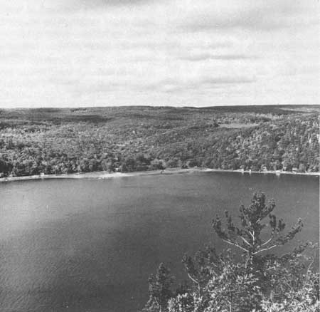
At its maximum, expanded Devils Lake may have reached an elevation of 1155 ft, enough to drain the lake to the northwest down Skillet Creek (Trowbridge 1917). (Elevations cited by Trowbridge differ from those cited here because of availability of more accurate maps today). Thwaites (1960) does not accept any available evidence that the lake actually overflowed through Skillet Creek even though Trowbridge (1917) found erratics in Messenger Creek on the lake side within 16 ft of the Skillet Creek divide (Fig. 79). The edge of the Cary moraine at the north end of West Bluff has left its mark up to 1060 ft in elevation only. How much higher the late Woodfordian ice went is not known although I have found large igneous and dolomite boulders up to 1160 ft on the northwest side of that nose (SW1/4SE1/4NE1/4 sec. 14, T. 11 N., R. 6 E.). Thus, I would agree with Trowbridge (1917) that Devils Lake overflowed into Skillet Creek. Furthermore, the cutting of lower Skillet Creek valley in quartzite must have been accomplished by far more discharge than is available from the present drainage area. In the lower part of the gorge, removal of the large blocks of quartzite from the gorge proper required torrential discharges. The monuments and jagged spurs now present in the gorge reflect post-glacial frost processes as do the bluffs around Devils Lake itself.
|
| Fig. 79. View westward of Messenger Creek valley, across Devils Lake, with the divide into Skillet Creek drainage at the cleared field on the upland surface in the right of the photograph. |
At its maximum advance, over 11 miles of the Cary ice front were contributing water to the lakes in the Devils Lake area (Trowbridge 1917:364). His argument is that ice was brought to the terminus at a rate of 6 inches a week or 26 ft a year. Assuming ice was melted along that entire front in a zone 100 ft wide by 26 ft deep we get a measure of the minimum amount of water that could reach the lakes. Surely melt waters farther back from the front would also in part reach the area. Trowbridge concludes that the annual discharge to the lakes would be at least on the order of 1.5 billion ft3. The Devils Lake basin itself has a capacity, to the discharge level at Skillet Creek, of about 7.5 billion ft3 Thus the main lake basin should have been filled to overflowing in only 5 years. The upper lakes would have held a relatively small amount before draining into Devils Lake. With the ice standing in the area more than 600 years, surely Devils Lake overflowed for considerable time through Skillet Creek and later possibly past the north end of West Bluff, at the margin of the ice, even though no features or deposits there prove this unequivocally.
Trowbridge has supported these rough estimates of water volume by a check on the amount of material deposited from the glacial waters. Trowbridge calculated that 6 miles of the ice front drained into Steinke Lake, depositing over 2.5 billion ft3 of debris. In Peck Basin its 0.5 mile of ice front contributed at least 142 million ft3 of debris. The Devils Lake gap between the two morainal dams contains over 2 billion ft3 of debris. Thus, it would seem clear that these lakes must have had more than enough water to drain through the headwaters of Skillet Creek, the lowest divide available if the late Woodfordian ice stood higher than 1155 ft against the north end of West Bluff. Unfortunately dating of the large foreign boulders buried in the soil up to at least 1160 ft elevation of the northwest side of that nose is not yet possible. Dolomite erratics are very little etched; gabbro and other coarse-textured boulders are not desegregated so it is assumed they were left by ice immediately preceding the building of the prominent end moraine.
A large fresh gravel kame (SE1/4 SE1/4 sec. 25, T. 12 N., R. 5 E.) 3.5 miles west of the same front at Baraboo and a deep kettle hole just off the southwest corner of Fig. 59 also attest to advance of the ice beyond the prominent end moraine.
In the Steinke Lake sediments Salisbury and Atwood (1900:120, Pl. 28, p. 108) noticed laminated silts and clays in which marked deformation of certain horizons were present. Locally more than 60 ft of these deposits were excavated. Salisbury and Atwood (1900:134) outline the history of that lake briefly. Because the basin is enclosed to the south, east, and west by quartzite, the basin was in a logical position to receive and hold water. The first lake thus formed against the ice to the north had no outlet and the water rose to the level of the lowest divide on the southwest side of Peck Lake where it overflowed to the west and northwest to Devils Lake via Hells Canyon. Sediments home into the basin by the glacial drainage were deposited as deltas and outwash in the lake. The coarser particles were left near the ice; the finer ones were carried farther away. Continued melt water from the ice front brought more and more sediment into the lake until its delta front extended completely across the lake, filling it to the level of the outlet. Later drainage followed the retreating edge of the ice westward into Devils Lake.
Accompanying the lakes and following their destruction were other drainage modifications in the area. An example is that of Skillet Creek, the small tributary to the Baraboo River which flows northwesterly from the southwest divide of Devils Lake. Before glaciation of the district, Skillet Creek probably flowed in a general northeasterly direction to the Baraboo River (Salisbury and Atwood 1900:138). The Woodfordian ice blocked the stream forcing it to seek a new course. The only course open was to the north and west in front of the advancing ice. Drainage from the ice, depositing glacial fluvial and then glacial lacustrine materials, forced the stream farther westward, until finally it reached its position across the sandstone plain well to the north and west of its former route. In that position ancestral Skillet Creek began to downcut after deglaciation and drainage of Glacial Lake Baraboo that inundated the lowland up to 980 ft elevation where Baraboo is now located. The creek superimposed itself on the bedrock in a new gorge. Such superposition would have occurred after the cessation of overflow of water into Skillet Creek from the glacial lake occupying the gorge of Devils Lake. To drain Lake Baraboo it was necessary to clear the ice from the east nose of the Baraboo Range proper, near Portage (Bretz 1950). The position of the lower part of Skillet Creek well on the westward flank of the out-wash apron of Cary age can be attributed to the initial topographic elevation left behind during the draining of Lake Baraboo.
Stagnant ice features
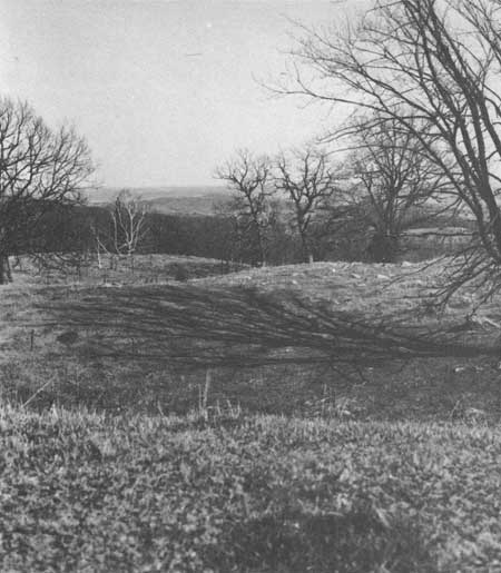
The retreat of the ice from Sauk Point at the crest of the Baraboo Range was by melting in situ, for it left behind typical ice-stagnation features with knob and swale topography (Fig. 80). Many knobs are small kames of poorly sorted but water worked sand and gravel; the depressions are almost invariably kettles produced by the melting out of buried ice blocks in the debris. The stagnant buried ice area formed at the junction of the advancing lobe from the north and another from the south, a kettle interlobate moraine of very small size when compared to the Kettle Interlobate Moraine of eastern Wisconsin. Yet its origin would have been similar. Section 15 contains the better features of this ice stagnation interlobate area. Relief is generally only 10-30 ft between the knobs and adjacent kettles. They are readily viewed from the east-west highway extension of County Highway DL.
Behind the end moraine as mapped through the recommended area (Fig. 59), numerous ice-stagnation features may be seen. These are particularly well-developed on the flanks of the Baraboo Range to the north toward the city of Baraboo and also to the south and east toward the Wisconsin River. Many knobs are kames in the sense that they were ice contact, water worked debris. Many of the swales are true kettles. Such ice-stagnation features of the steeper slopes of the Baraboo Range are generally nowhere as well developed or as large as those of the lowlands. It is in the lowlands that the larger ice blocks were buried more readily.
Potholes
Black (1964c) has described potholes on the East Bluff of Devils Lake overlooking the late Woodfordian moraine which plugs the southeast gorge (Figs. 65, 66). The potholes are carved in bedding plane surfaces of the Baraboo quartzite in situ and also in loose blocks of the quartzite that are scattered irregularly on the beveled upland surface. Polished chert-rich gravel of the Windrow Formation is associated with some potholes and has been found in them (Salisbury 1895:657). More than a dozen well-developed single potholes are known. They range from circular, polished depressions a few inches in diameter and only 1 or 2 inches deep to those more than a foot in diameter and twice as deep. Some are so beautifully symmetrical that they resemble artificially drilled holes with perfectly parallel smooth sides. Potholes above the sod are concentrated in an area 50 yards along the bluff and 30 yards northwest from the rim. They also occur in a narrow cascade zone for 75 ft vertically below the rim, along the Short Cut Trail. Others are scattered in the woods to the north of the Short Cut Trail. Buried potholes may be more widespread (Salisbury 1895:655).
|
| Fig. 80. Knob and swale topography in the east-central part of sec. 15, about 0.5 mile east of Sauk Point. |
Through the years most writers have attributed the potholes and associated gravels to preglacial streams of Cretaceous or Tertiary age that flowed across a continuous upland surface at and above the level of the rim. No one seriously had considered them to be glacial yet Black (1964c) has suggested such an origin seems at least as plausible as others.
However, we know now that at least one of the potholes at the extreme east nose of the Baraboo Range, which contains Cambrian sandstone firmly adhering to its walls, must have been produced by water in late Precambrian or earliest Cambrian times. Not all of the other potholes of that locality can be ascribed necessarily to the same time of formation though several clearly were modified by the Cary ice that overrode them.
By analogy it would be logical to suspect that the potholes on the East Bluff of Devils Lake were produced at the same time, but this does not prove it. Regardless of when they might have been formed, it is clear that the loose blocks in which we do find potholes have been moved subsequent to the pothole drilling. Some blocks have been split and one side or bottom of its pothole is now gone. Others are turned on their sides or are upside down. These are scattered along with other loose blocks of the Baraboo quartzite over the pebble-rich, clay nearby. I have confirmed this relationship by drilling 12 holes through the quartzite rubble and into the clay below.
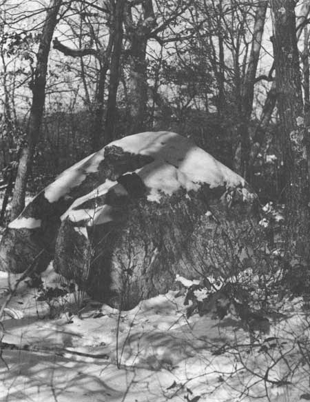
The splitting of the blocks and movement of the loose blocks to their present location is most easily explained on the basis of movement by glacial ice or possibly in part by melt waters associated with ice. The hundreds of blocks of Baraboo quartzite on top of the Windrow Formation cannot be explained by simply weathering down in place, as no quartzite nearby is higher. Such blocks of the quartzite on top of the Windrow must be considered true glacial erratics. The large erratic to the north of the pothole area (Fig. 66) is so described by Black (1964c). It weighs 85 tons and must have been moved upslope to its present resting place. This surely could only be accomplished by ice. Other smaller but impressive quartzite erratics may be seen on the South and West bluffs of Devils Lake as well (Fig. 81). No mechanism of erosion of the smoothly beveled upland surface that I know of can leave behind such large loose blocks to rise above the general level.
These various phenomena would imply that glaciation of the Devils Lake area had occurred some time prior to the Cary advance. This I am certain has occurred from a variety of evidence that cannot be detailed here. Dolomite and igneous rock erratics are found well above the Cary moraine at the north end of West Bluff. Moreover, a kame deposit 3.5 miles west of the front near Baraboo has 40,000 yard3 of gravel, and a deep kettle with till lies 1 mile west of the front at the Badger Ordinance Works south of the park. They attest to extensions of glacier ice beyond the end moraine of the Cary as recorded in Fig. 59. The freshness of dolomite and igneous erratics, the lack of erosion and filling of the kettle, the freshness of igneous outcrops to the west of Devils Lake, the youthfulness of the loess, and other criteria would suggest that the time of such glaciation did not long precede that of the Cary. In the Driftless Area, farther west of those phenomena, thin loess deposits in an area of a few square miles have buried soil profiles indicative of Altonian and Sangamonian age. Dating of the various deposits is a very perplexing problem, for which, unfortunately we have relatively little information and it cannot be discussed further here.
Erratics
For convenience, erratics within the recommended area of Devils Lake Park may be classified into two groups. One contains those rocks, such as igneous and highly metamorphosed materials, that could have originated only from a point far to the north, and the other those rocks of local derivation which are in anomalous situations. This section is concerned largely with the second group. The large mass of debris brought in by the Woodfordian ice and dumped inside the end moraine is clearly of glacial erratic origin. Within Devils Lake gap erratics have been washed out from the terminal areas of the ice that blocked the north and southeast ends. Erratics have been carried by drifting ice at least 90 ft above the present lake level (Salisbury and Atwood 1900:133), and Trowbridge (1917:366) in 1 hour found 103 erratic boulders in the valley of the north fork of Messenger Creek and one diabase cobble on the west slope of the divide in the drainage of Skillet Creek. He found igneous rock erratics 164 ft (202 ft in his paper reflects use of now outdated topographic maps) above the present level of Devils Lake and only 28 ft below the divide. Other glacial cobbles occurred within 16 vertical ft of the divide. Thus the origin of erratics behind the end moraine and those carried out from the terminus by outwash waters and floating icebergs in the proglacial lakes are readily explained. These are recognized easily because of their obvious foreign source.
In the second group of rocks, however, we find various local materials which are distributed in the area in such a way that it is far more difficult to prove that they are true erratics and even more difficult to prove that they obtained their present locations on the basis of glacial ice directly. In this group are placed the large Baraboo quartzite erratic blocks and fragments which occur on East Bluff on top of the Windrow Formation and also those which occur on the South and West bluffs on the Baraboo quartzite itself. To this group is added the Paleozoic cherts which lie outside the end moraine. These two categories require additional comment.
It is difficult not to accept as glacial erratics the angular rubble on top of the Windrow Formation on East Bluff. If one accepts the 85-ton Baraboo quartzite block near the block fields north of the pothole area (Fig. 66) on the East Bluff as a glacial erratic, then it would seem to me that we must also accept similar large angular blocks of the Baraboo quartzite on the South (Fig. 81) and West bluffs as well. On the rounded, relatively smooth upland surfaces of West Bluff, South Bluff, and also Sauk Hill to the west, isolated blocks of the Baraboo quartzite protrude through the loess cap which is a few inches to 2 or 3 ft thick locally. These blocks are loose and rest directly on the quartzite. Hence, they have not attracted the attention of previous workers in the area. However, no process of planation by sea or streams could leave such large angular fresh blocks behind to rise above the smoothly plained surfaces that are supposed to be exhumed from beneath hundreds of feet of Paleozoic sandstones and dolomites. These are the highest surfaces in the area. Obviously the material is related to that underlying it, and it cannot have been let down from a higher cover. How then can a dipping Baraboo quartzite be smoothly truncated with such loose blocks left behind to rise above the general surface by many feet? To me, it is far easier to explain such loose blocks as being brought in some time after the exhumation of the upper surfaces. The logical time is during the Pleistocene, by glacial action. Many blocks are angular with very sharp corners; relatively little pitting has taken place, and frost riving is minimal. No great antiquity can be given such indicators. A late Wisconsinan age for them would seem most logical, yet an earlier Pleistocene age is possible.
|
| Fig. 81. "Erratic" of Baraboo quartzite on the highest part of the South Bluff of Devils Lake. |
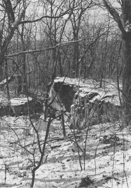
Associated with the erratic blocks of Baraboo quartzite on the South Bluff are distinct channels in the upland surface which are peculiar. One due south of the lake crosses through the crest of the range and has steep overhanging banks 10-15 ft high (Fig. 82). Corners of the blocks are very sharp. A few blocks, presumably derived by frost action, lie at the foot of the bank but hundreds of cubic yards of material have been removed from the largest channel. No accumulation of such debris is seen either to the north or to the south. Where has it gone? Are such features related to the Paleozoic or Mesozoic erosion cycles that have affected the area, or is this again something that may be attributable to a pre-Cary glacial event? We have really no basis for saying one way or the other except for the relative freshness of the edges and faces of the Baraboo quartzite exposed in these peculiar features. We have inherited at least one late Pre-cambrian or Early Cambrian pot hole, but it is a very small feature obviously protected by the Cambrian sandstone. No sandstone was seen anywhere in association with the loose angular blocks of the Baraboo quartzite on the upland or with the sharp channels. Hopefully, more detailed field work will provide additional clues to the perplexing origin of these features.
|
| Fig. 82. Overhanging bank of Baraboo quartzite on top of the South Bluff of Devils Lake, looking northward. |
The chert erratics present another puzzling situation. Chert behind the end moraine of Cary age clearly can be explained on the basis of its having been brought in by ice. However, it has been customary to explain chert that is locally identifiable as Ordovician-Silurian in age to the west of the Cary terminus as having been let down during the weathering and removal of the Paleozoic formations that once overlay the Baraboo quartzite (Thwaites 1958, 1960). The abundance of such chert of Silurian age is puzzling. One would expect that the younger formations which would be removed first in the Paleozoic-Mesozoic-Tertiary weathering cycles would be essentially absent from the upland in comparison with chert of the older formations, all things but time being equal. No detailed studies have been attempted, yet we find considerable Silurian chert. This seems incongruous because there is no difference in size or weather-ability. Is it possible that the chert has not been let down but has actually been brought in by ice of an earlier glaciation that did not have abundant igneous materials in it? Again we have no basis for discussion of such a problem, because the evidence is still too meager to constrain our thinking.
Periglacial features
Within the Baraboo area Smith (1949) lists three groups of features attributable to periglacial processes: 1) stabilized talus, 2) block concentrations and block-strewn slopes, and 3) choked valleys and block cascades. Within the recommended park area Smith (1949) discussed the talus deposits in the vicinity of Devils Lake and block concentrations and talus slopes northwest of Devils Lake and also on the south flank of the Baraboo Range south of the lake. To this list of features should be added the pinnacles and monuments on the cliffs of Devils Lake and wind-polished surfaces.
The talus accumulations around Devils Lake are among the most striking features of the park (Figs. 61, 62). They are better displayed there than anywhere else in the Baraboo Range. Other locations are in the gorge north of North Freedom (formerly Ableman's) (Salisbury and Atwood 1900: 67), and also along the bluffs of the Lower Narrows northeast of Baraboo. Talus is best developed on the East, West, and South bluffs of the lake. Where the Cary ice stood in the southeast gap it presumably removed much of the talus that apparently was there before. On the bluffs above the lake the talus is almost continuous laterally, being interrupted locally by dipping ledges of the quartzite. It is partly covered by irregular discontinuous forest. The talus on the south-facing slope of East Bluff attains maximum height and continuity of exposure. On the north-facing slope of the South Bluff the talus is covered largely by trees, and the slope is slightly less steep.
The talus is composed of heterogenous, angular, irregular blocks of quartzite more or less firmly wedged together. The blocks commonly are more than 6 ft on a side. No marked vertical zoning of large blocks is apparent. Occasional igneous erratic boulders may be found in the talus up to 90 ft above the lake level (Salisbury and Atwood 1900:133). Especially around the trails built during the 1930s by the Civilian Conservation Corps, foreign material was brought in for surfacing. Erratic blocks of foreign debris should be found in talus up to the level of the divide between Messenger and Skillet creeks, if the interpretation of that divide as the outlet of Glacial Devils Lake is correct (Trowbridge 1917). The maximum height of talus is about 300 ft; the maximum inclination of the slope is about 36° The hydrographic map of Devils Lake (Juday 1914, Map 8) suggests that the talus extends 30 ft out from shore below water level. According to data of Thwaites, the talus may extend to depths of as much as 285 ft below lake level.
Many of the talus blocks as well as the rock surfaces and ledges above them are partly covered with lichens and show some weathering stains. No clear indications of movement are available. The vegetation seems stabilized on the slopes. Few blocks are seen on snow surfaces in winter, and isolated loose blocks out from the foot of the bluffs in the forests are also relatively uncommon. The frost-rived bluffs and ledges above the talus show many loose blocks and pinnacles (Figs. 63, 64) apparently in unstable situations, yet few seem to collapse. The angularity and weight of the blocks permit them to stand in relatively permanent features. Other signs of inactivity recorded by Smith (1949) indicate that the formation of talus blocks now is an exceedingly slow process.
How much of the talus originated prior to the advance of the Woodfordian ice into the north and southeast gorges is not known. If the talus does extend many tens of feet below the surface of the lake, it seems likely that it has been covered by outwash from the ice fronts. In the abandoned quarry on the northeast side of Devils Lake a thin veneer of talus is separated from the bedrock by about 5 ft of stony soil containing small blocks and rock fragments scattered through an earthy matrix (Smith 1949:202). The contrast between the talus and underlying material is striking and points, according to Smith, to a marked change in conditions of weathering when talus accumulation began.
Smith (1949) did not discuss the effects that the high lake level might have had on the formation of talus in the gorge. If Trowbridge (1917) is correct in that Devils Lake was up to the level of the divide between Messenger and Skillet creeks, then the bulk of the talus in the area would have been covered by the glacial lake waters, and the lake level would have been near the base of the present cliff in many places. Would frost action which is commonly more severe at the water level of a lake have been instrumental in the formation of some of the talus? This is a question that we cannot yet answer. However, the lack of erratics of obvious foreign sources among the talus blocks where they surely were covered by lake waters is difficult to explain unless the talus has come down on top of such material to hide it. The small particles could have been flushed through the coarse openings of the large talus blocks. Pinnacled slopes and jagged angular blocks are almost as common along the Baraboo bluffs to the east where the Cary ice definitely overrode them and also in the lower narrows to the northeast of Baraboo.
In the St. Croix Dalles area Cary ice clearly went through the gorge, and the pinnacled cliffs have developed subsequently. Time of formation can be brief. No unequivocable facts are available for dating the talus and pinnacles in Devils Lake Park. Some of the material may have been derived in pre-Cary times, some of the monuments such as Devils Doorway (Fig. 63), Elephant Rock and Balanced Rock (Fig. 64) possibly were produced after Cary glaciation.
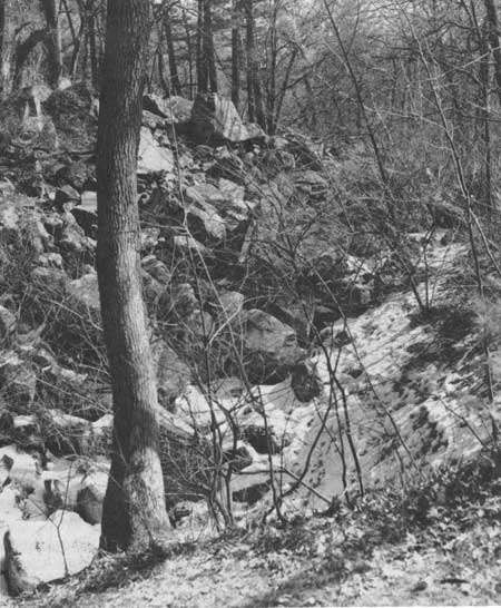
The narrow depressions (Fig. 83) along the base of many talus slopes are peculiar. They are elongate, discontinuous and channel-like—15-25 ft wide and 5-15 ft deep. Thwaites (1935:395-404) attributed them to settling of the finer sediment into interstices of the talus, but their origin is conjectural.
|
| Fig. 83. Elongate depression at the base of talus along the south-facing slope of East Bluff, Devils Lake. |
The smaller block concentrations and block strewn slopes on the south-facing flank of the Baraboo Range south of Devils Lake are quite similar to those of the talus slopes of Devils Lake except for their elongated dimension. Locally many are covered with forests and interstices of the large blocks are filled with soil.
The locality less than a mile northwest of Devils Lake (NE1/4 sec. 14) (Smith 1949:204) presents a problem. Smith records shattered blocks and boulders of quartzite, sandstone, and conglomerates occurring along a shallow valley and adjoining gentle slopes. Some of the blocks are almost buried in the soil, while others appear to be largely above the ground surface. Locally the blocks are jumbled together. This area is very close to the Cary ice front where it butted against the northeast corner of West Bluff. Some drainage went around the end of the bluff and may have affected this particular area. Smith concluded that this material was produced in the same way as that of the talus on the south flank of the Baraboo Range south of Devils Lake. However, the sandstone and conglomerate in this deposit call for different source rocks and the relative histories of the two locations are distinct. Some concentration by water working seems evident though surely not much rubble could have been produced in this way or the angular blocks would have been rounded.
In the extreme southeast corner of sec. 23, southwest of Devils Lake, a small ridge of Baraboo quartzite juts up above the level of the south fork of Messenger Creek. The relatively flat top of the ridge reaches an elevation of about 1100 ft but a large isolated pinnacle rises fully 20-30 ft above the level of the ridge and isolated rocks and smaller pinnacles are also present to the north. Removal of the upper part of the quartzite to leave the isolated monuments and pinnacles could have been accomplished possibly in Glacial Devils Lake if it had reached this general level, but the origin of some of these features obviously is conjectural.
Windwork is not common in the recommended park area. A thin accumulation of loess has been brought in by wind and deposited over the upland surface. This loess probably is latest Wisconsinan to Recent in age according to immaturity of weathering. Such deposition is common on uplands adjacent to abandoned lakes or glacial outwash such as have been so much in evidence around the Baraboo area. The sources of the loess could well have been Glacial Lake Baraboo to the northwest and the outwash apron in the Wisconsin River Valley to the south. That wind has been strong in the area is attested to by wind polished and fluted surfaces that may be seen outside the recommended park area south of Baraboo on quartzite knobs that rise above the early Paleozoic formations. There ventifacted, furrowed surfaces suggest strong winds from the west-northwest. Some polishing of the corners and faces of some of the upland cliffs of the Baraboo area have been attributed to windwork, but we cannot exclude waterwork and chemical action from such alteration.
Conclusion
The present boundaries of Devils Lake Park are too restricted to include a representative sample of the intricately looped moraine of the late Woodfordian or Cary ice advance and its associated glacial phenomena. To preserve a representative portion of this moraine and its associated phenomena, the park boundaries need to be expanded about three times. Particularly to the northeast, the recommended boundary barely includes the terminal moraine and very few of the retreatal moraines which were formed shortly after the farthest point was reached. Every geologist who has written extensively on the park has emphasized the uniqueness of the glacial and periglacial phenomena in the Baraboo Range. No other situation known to me has such a rich variety of unique features in so small an area near major centers of population. As a tourist area and scientists' field laboratory, it is unrivaled in the upper Midwest region.
Every effort should be made to achieve a park with boundaries at least out to those recommended. To do less would be tragic because the unconsolidated moraine is easily destroyed. No better moraine or combination of moraine and other features exists along this front from the Great Plains to the Atlantic Ocean. It is truly a unique area that should be dedicated to future generations of students and laymen alike. The story the Devils Lake area can tell should not be preserved only in print.
| <<< Previous | <<< Contents >>> | Next >>> |
chap7.htm
Last Updated: 1-Apr-2005