ICE AGE
Geology of Ice Age National Scientific Reserve of Wisconsin
NPS Scientific Monograph No. 2
|

|
CHAPTER 9:
Bloomer Moraine
Introduction
The Bloomer Moraine, as used here, refers to that
portion of the "dead-ice moraine" or ice-stagnation area of late
Woodfordian or Cary age in the vicinity of the town of Bloomer, Chippewa
County (Figs. 1, 2, 95, 96). This is part of the terminal moraine that
Chamberlin (1883a:381) referred to as the Moraine of the Chippewa Valley
Glacier of the Second Glacial Epoch. This usage was with reference to
the lobate nature of the ice sheet in northwestern Wisconsin rather than
to a distinctly separate glacier apart from the continuous ice sheet.
His map covering that part of the moraine (Chamberlin 1883a:35) showed
the generalized flow pattern of the ice and the general distribution of
the moraine. His verbal description of the characteristic features of
the moraine of the Second Glacial Epoch is quoted in Chapter 4 and need
not be repeated. Leverett (1929, Pl. 1) shows the position of the outer
edge of the moraine at a somewhat larger scale, but includes no verbal
description of the moraine in the Bloomer area. Reference of the Cary
and older moraines to the north and west is made by Mathiesen (1940)
whose map includes about 2 mile2 of the front in the area of
Fig. 96. Published data are singularly lacking in the area, and I made
only brief trips to certain portions. It is obvious that we know less of
the details of this area than of any of the others being recommended for
inclusion in the Reserve.
|
|
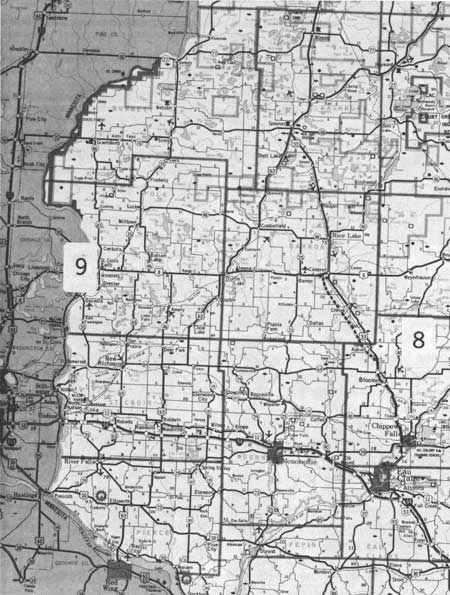
Fig. 95. Part of Wisconsin State Highway map, showing locations 8 and 9.
|
|
|
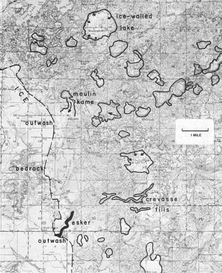
Fig. 96. Part of U.S. Geological Survey Topographic
Quandrangle—Bloomer, showing by heavy, ticked line the prominent
front of the dead-ice moraine, by solid line the outlines of former
ice-walled lakes and other named features, and by arrows the direction
of former water flow.
|
However, just because we know less about the area is
not reason to downgrade its importance for inclusion in the Reserve.
Actually I consider it one of the four major areas that will receive
most use—on a par with the Northern Kettle Interlobate
Moraine—particularly if sufficient area and variety of features can
be included. Because the Chippewa County Park must for practical reasons
provide the nucleus, attention has been focused on it and its immediate
surroundings. This cannot be helped, but is regrettable because a number
of superb features are several miles removed from it. Consequently, even
though funds will not permit a larger area to be recommended at this
time, I am in effect ignoring that recommendation in order to illustrate
and present a case for representative features outside the recommended
area. Therefore, Fig. 96 includes the recommended boundary and some of
the more unusual features in it, but also many which will be illustrated
or described near it so the reader too may judge their importance for
inclusion in the Reserve.
Description of Glacial Phenomena
Figure 96 contains a representative area of the
dead-ice moraine of the Chippewa Lobe of Cary age, its associated
outwash, and a representative area of Cambrian sandstone-supported,
subdued hills with thin drift cover whose age seems only slightly more
than that of the dead-ice moraine. Bedrock outcrops within the dead-ice
moraine are rare, but they are common in the hills westward outside
it.
The dead-ice moraine is one of the best developed in
the state even though its features are smaller and more compact than in
most other dead-ice moraines in the northwestern or northern part of the
state. Because most knobs and swales are smaller, they are more readily
seen and appreciated.
This part of the Bloomer Moraine is characterized by
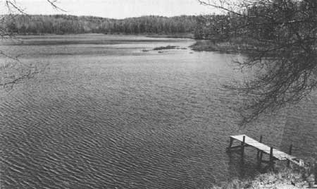
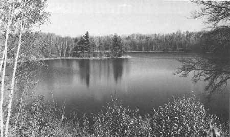
small kettle lakes—commonly less than 0.25 mile
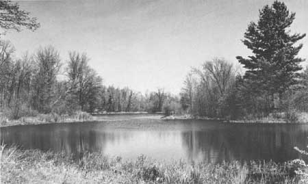
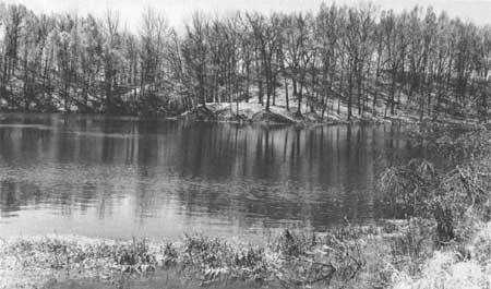
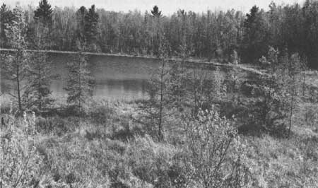
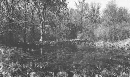
across—although a few larger ones are present (Figs. 97-102), by
kettle swamps (Fig. 103), or by dry kettles (Fig. 104). Most of the
lakes are shallow with very soft to soft water (Sather and Threinen
1963). Generally, relief is only 20-60 ft in the knob and swale
topography in till. The till is mostly dark red, sandy, and stony.
However, knobs and irregular hills of washed drift with relief of more
than 200 ft are present. These are part of an interesting family of
features genetically related but markedly different in size and
appearance. All are due to the stagnation of the ice and the consequent
melting and cracking through to the base of moulins and crevasses. Some
such openings were favorably located to receive vast floods of melt
water and great quantities of debris. In Fig. 96 they are located
especially on two lines—one trending southwesterly and another at
right angles or northeasterly—parallel and perpendicular to former
ice-flow directions. The flood of water enlarged the openings and
deposits grew from simple conical moulin kames or small crevasse fills
to large and more irregular lake beds and complexes bounded by ice on
all sides. Into those lakes vast quantities of debris were carried to
build ice-walled lake deposits as much as 1 mile across and more than
200 ft high. The deposits now resemble small rounded buttes and
mesas.
|
|
Fig. 97. View southward of kettle lake in the south-center, sec. 15, T.
31 N., R. 8 W.
|
|
|
Fig. 98. View eastward of kettle lake in the west-center, sec. 27, T. 32
N., R. 8 W.
|
|
|
Fig 99. View north-northeastward of kettle lake in the NE1/4 NW1/4 sec.
8., T. 31 N., R. 8 W.
|
|
|
Fig. 100. View southwestward of kettle lake in the NW1/4 SW1/4 sec. 5
and the NE1/4 SE1/4 sec. 6, T. 31 N., R. 8 W.
|
|
|
Fig. 101. View southward of kettle lake in the NW1/4 NW1/4 sec. 26, T.
32. N., R. 8 W.
|
|
|
Fig. 102. View southwestward of kettle pond in the NW1/4 SE1/4 sec. 6,
T. 31 N., R. 8 W.
|

|
|
Fig. 103. Kettle swamp in the SW1/4 NW1/4 sec. 32, T. 32. N., R. 8 W.
|
|
|
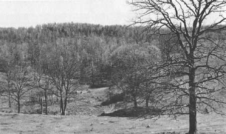
Fig. 104. View southeastward of large dry kettle from ice-walled lake
deposit in the SE1/4 NW1/4 sec. 32, T. 32 N., R. 7 W.
|
Characteristically the melt waters of glaciers varies
drastically in volume depending on diurnal and seasonal temperature
cycles and other factors. Mere trickles of water with little debris
undoubtedly changed literally overnight to great torrents of water
capable of transporting almost any rock fragment the glacier provided.
Debris slides and slumps off the ice banks would have been commonplace;
undercut ice masses would fall in the lake or be planed off on top. Ice
masses loaded with debris would be unable to float and would be buried
in the lake sediments to later produce kettles. Deltas around the
margins were especially common. The coarser material would tend to
remain at the periphery; the fines would be carried to the lower
centers. The large ice-walled lake deposit in secs. 21 and 28 is a
beautiful and very representative example (Fig. 96).
These ice-walled lake deposits are far too large to
have been simple cavities under the ice—they were unquestionably
open to the sky, they are relatively simple in concept, but exceedingly
complicated in the details of their construction. The surface shows only
the partial recording of the last events. The buried deltas, slumps,
slides, flows, and layers of sediments have little direct manifestation
at the surface except through artificial exposures. However, the former
buried ice blocks, also characteristic of such complexes, leave their
telltale depressions on melting. The larger deposits probably started as
moulin kames or crevasse fills. They now rise well above the general
level of their surroundings in reverse relief. They stand today as mute
testimony of their former history in a wide range of sizes and shapes
(Figs. 105-109) of which only some of the larger or higher ones are
shown in Fig. 96. The smaller ones cannot always be distinguished by
surface inspection from normal till knobs. Little subsurface
exploration has been done on them. Yellow brown, brown, and red silty
sand and local thin layers of gravel were seen most commonly in natural
or artificial exposures. In many places the flat-lying undisturbed
stratification of relatively quiet waters was seen. The poorly sorted
silty sand is particularly subject to slump and flow in road cuts, and
exposures do not remain open long.
|
|
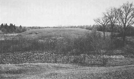
Fig. 105. View southward of mound and kettle in the SE1/4 SE1/4 sec. 23,
R. 32 N., R. 8 W.
|
|
|
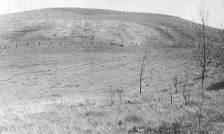
Fig. 106. View southward of large conical ice-walled lake deposit with
elevation of 1289 ft, in the NW corner, sec. 5, and the SW corner, sec.
32, T. 31 and 32 N., R. 7 W.
|
|
|
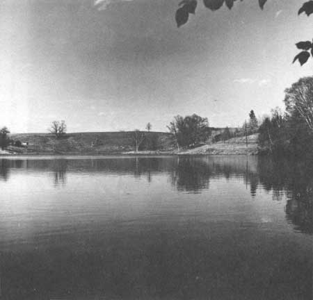
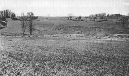
Fig. 107. View eastward of the outer wall of the ice-walled lake deposit
in sec. 27, from the NE corner, sec. 33, T. 32 N., R. 8 W.
|
|
|
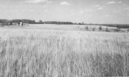
Fig. 108. View west-northwestward of the outer wall of the ice-walled
lake deposit in sec. 27, from the SE corner, sec. 27, T. 32 N., R. 8 W.
|
|
|
Fig. 109. View eastward of the top of the ice-walled lake deposit in
sec. 28 from the NE1/4 NW1/4 sec. 28, T. 32 N., R. 8 W.
|
In the recommended area, secs. 27-30 contain all or
parts of five characteristic ice-walled lake deposits. Pikes Peak in
sec. 29 has been named although it is neither the highest nor sharpest
of these features. It probably started as a simple moulin kame which
opened to a circular lake. The elongate irregular mound in the southern
part of sec. 30 may have been two separate moulin kames which in later
life merged into a single lake. The elongate mound north of it seems to
have been a single moulin that later grew westward as an elongate lake.
The largest deposit in secs. 28 and 21 shows beautifully the higher rim
of debris, generally coarser than the center, that was washed in from
all sides. The mound in sec. 27 is favorably situated to show its abrupt
outer walls (Figs. 107, 108) with lake sediments exposed in the road
cuts.
The most striking of these features is the conical
peak with elevation of 1289 ft in the SW corner sec. 32 and the NW
corner sec. 5, T. 32 and 31 N., R. 7 W. (Fig. 106). It is 4 miles east
of the recommended area and immediately west of County Highway E which
exposes lacustrine sediments in the lowermost flank of the mound. County
Highway E to the north and east rises across a large complex area from
which striking views of the adjacent kettles can be had (Fig. 104).
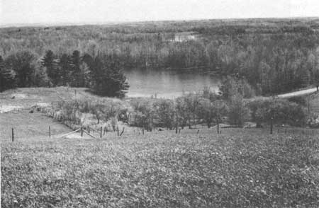
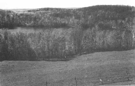
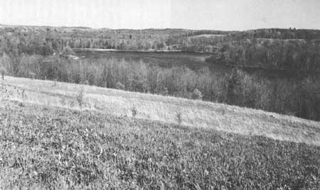
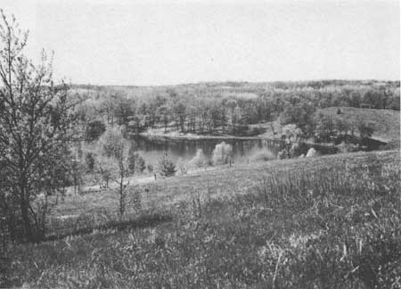
Views from the tops of the ice-walled lake deposits
are especially attractive where slopes are steep and overlooks to
present kettles are available (Figs. 110-113). Unquestionably the best
one for a view is the sharp conical peak with elevation of 1289 ft
(Figs. 106, 110, 111). The view from Pikes Peak is disappointing because
the peak is too broad and lacking in lakes immediately at its base.
However, views from those features east and west of it, in secs. 27 and
30 are good (Figs. 112, 113).
|
|
Fig. 110. View eastward from top of the ice-walled lake deposit at 1289
ft, in Fig. 106.
|
|
|
Fig. 111. View westward from top of the ice-walled lake deposit at 1289
ft, in Fig. 106.
|
|
|
Fig. 112. View southeastward from Plummer Lake from southeast corner of
the ice-walled lake deposit, sec. 34, T. 32. N., R. 8 W.
|
|
|
Fig. 113 View southwestward from the ice-walled lake deposit in the
south-center, sec. 30, T. 32 N., R. 8 W.
|
In secs. 5 and 8 west of Rock Lake and in secs. 9 and
10 east of Rock Lake are two interesting areas of washed drift. From an
inspection of aerial photographs their surficial form and surface
material suggests that they are moulin kames with associated drift laid
down as outwash or eskers. No detailed investigation has been made, so
the hypothetical reconstruction of their history is subject to
modification. Nonetheless, the feature west of Rock Lake, which I
visited briefly, shows washed sand and gravel in the southern part whose
surface form and near surface structure demonstrate that it came from
the conical hill to the north. Moulin kames during formation must have
an outlet for the water that drops into the moulin. If water coming in
exceeds outflow, a ponded water body forms. The outflow under the ice is
commonly in the form of a subglacial stream in addition to ground-water
flow through the porous material underlying the ice. Such streams leave
eskers most commonly recognized as long sinuous ridges. However, if
occupied long enough for the subglacial stream to meander or cut
laterally, the deposit is broadened accordingly and often not
recognized as an esker even though genetically it was formed in the same
way. As the subglacial stream migrates laterally, the ice above being
weak collapses behind it. No broad tunnel exists at any one time even
though the stream deposits may be very broad. The two areas cited appear
to be of this type wherein the subglacial streams originating at the
base of the two moulins fanned out or migrated laterally to leave broad
deposits of fluvial-glacial material. It is not known how much of the
sand and gravel so laid down was actually deposited under the ice in a
small stream or how much was deposited (particularly as in the case of
the feature west of Rock Lake) subsequently in an area open to the sky
between ice walls as the ice sheet thinned, broke up into blocks, and
melted away. This moulin and associated outwash is especially close to
the front. During the later part of its life it seems logical to have it
go from a subglacial situation to one at least partly exposed. Kettles
and ridges from the stagnant ice surround this moulin and esker on all
sides.
Other ice-stagnation features well displayed to the
south of the recommended area include crevasse fills and true eskers.
They are difficult to distinguish from each other on aerial photographs.
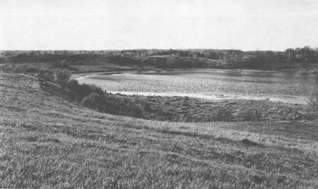
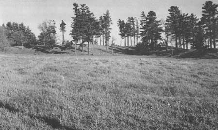
The long sinuous ridge in secs. 26 and 27, T. 31 N., R. 8 W. (Fig. 114)
is composed of red sandy till according to one cross section seen along
the road in sec. 26. Its right-angle bends show beautifully the control
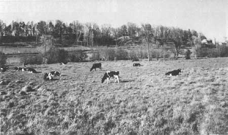
by fracture patterns in the ice. Another higher line of ridges and knobs
(Fig. 115) in sec. 35, T. 31 N., R. 8 W. borders an ice-walled lake area
northeast of Cornell Lake; its composition is not known. A true esker
(Fig. 116), part of which is in the southwest corner of Fig. 96, is
being used as a source for sand and gravel and is exposed in pits along
Highway 64. Many other interesting features may be seen throughout the
area but are not described here.
|
|
Fig. 114. View northwestward of kettle pond and crevasse fill in the
SW1/4 NE1/4 sec. 26, T. 31 N., R. 8 W.
|
|
|
Fig. 115. Crevasse fills or line of kames in the north-center, sec. 35,
T. 31. N., R. 8 W.
|
|
|
Fig. 116. Esker, looking southeastward, in the NW1/4 NE1/4 sec. 6, T. 30
N., R. 8 W.
|
One of the best places to see the front of the
dead-ice moraine, its associated outwash, and relation to the subdued
bedrock hills to the west is 0.25 mile east of the Tillinghast School
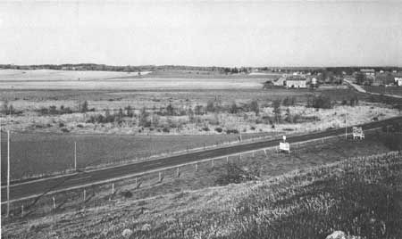
in sec. 35, T. 32, N., R. 9 W. From the moraine bordering the outwash
there is an excellent view southwestward (Fig. 117). The moraine itself
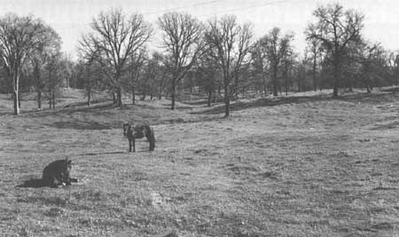
is dark red, sandy, stony till. Knob and swale topography in the till
along the front is shown in Fig. 118. Good views of the front across its
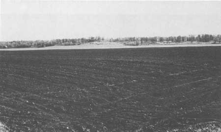
outwash plain can be had from County Highway AA, east of Highway 40
(Fig. 119).
|
|
Fig. 117. View southwestward from the Cary front in the NW1/4 SE1/4 sec.
35, T. 32 N, R. 8 W. This drift mantles Cambrian sandstone hills.
|
|
|
Fig. 118. Knob and swale topography in the Cary end moraine, County
Highway AA, 0.9 mile east of State Highway 40.
|
|
|
Fig. 119. View northeastward across outwash to the Cary front, from
County Highway AA, 0.4 mile east of State Highway 40.
|
The outwash plain locally is pitted showing that ice
formerly went beyond the front as indicated in Fig. 96. The high
concentration of igneous and metamorphic rocks from the Precambrian
shield areas is well displayed in a borrow pit at the front on County
Highway AA. Lake Superior sandstone is common but no dolomite was seen.
The local Upper Cambrian sandstone is too weak to survive long in
glacial streams and is recorded in the outwash mainly as sand.
The age relationships of the dead-ice moraine, its
outwash, and the thin drift cover or sparse erratics on the bedrock
hills westward are interesting. Leverett (1929, Pl. 1) and Mathiesen
(1940:262) in turn advanced the front of the younger drift beyond that
of the earlier workers, reducing considerably the actual area of
pre-Cary drift in the reentrant between the Superior and Chippewa Lobes
(Fig. 2). Based on soils, weathering of erratics, appearance and filling
of kettles, and erosional phenomena, I would agree that little time
difference seems to exist between the Cary and pre-Cary areas. One
single ice pulsation in Woodfordian time may account for the younger
drift in both lobes. Nonetheless the precise front of the Bloomer
Moraine does have out-wash from it showing that a time difference
existed at least during deglaciation. Insufficient data are available to
pursue this problem here, and further speculation seems unwarranted at
this time.
Conclusion and Recommendation
In conclusion I wish to emphasize the marked
difference between the large ice-walled lake features of the Bloomer
Moraine and the sharply conical moulin kames of the Northern Kettle
Interlobate Moraine. Although related in origin, the lake deposits
clearly demonstrate the effects of large ponded areas open to the sky.
The knob and swale topography and associated lakes and swamps of the
Bloomer Moraine are representative small features more readily
appreciated than larger features of similar origin to the north and
northeast—farther removed from centers of population. This area is
less disturbed by men than many comparable-size areas in the state.
Hundreds of small lakes, ponds, and swamps offer a maximum variety of
conditions for eutrophication studies of lake history. Unless controlled
in a Reserve they probably will be lost because pressure from summer
tourists and cottage owners is increasing rapidly.
The Bloomer Moraine presumably is approximately
equivalent in age to the end moraine of Devils Lake, Cross Plains, and
Kettle Interlobate areas. A range in time of many centuries may exist,
but no quantitative data are available. Although little in detail is
known of the area, it is a vital and different part of the Ice Age
phenomena of Wisconsin. If sufficient area and variety of features can be
incorporated, such as illustrated or pointed out here, this area would
become one of major importance rivaling the Northern Kettle Interlobate
Moraine. It is hoped that the initially recommended area, expanding the
Chippewa County Park, can be extended outward and southward to include
many of the features shown in Fig. 96.
chap9.htm
Last Updated: 1-Apr-2005
|


