|
HAWAI`I VOLCANOES
Invasion and Recovery of Vegetation after a Volcanic Eruption in Hawaii NPS Scientific Monograph No. 5 |

|
CHAPTER 5:
Plant Invasion Patterns
Kilauea Iki Lava Lake (Habitat 1)
Progress of invasion
A clearly directional progression of plant life was observed on the Kilauea Iki crater floor. Here plants invaded the new lava habitat from the margin toward the center in a pattern shown in Table 1A.
The species within each life form are listed in Appendix I. The term plant life form is used in a general sense in this book for designating such broad taxonomic groups as algae, mosses, lichens, ferns, and seed plants as shown in Table 1A. The term is also used for subdivisions of these groups, such as woody and herbaceous plants within seed plants. More detailed subdivisions of morphological forms as given by Raunkiaer (1918) or Ellenberg and Mueller-Dombois (1967) are likewise referred to as life forms.
In year 1, after the eruption, i.e., 6 months after formation of habitat 1, plant life was found only along transect a (NE side of crater floor, Fig. 2). A fern (Nephrolepis exaltata) and an alga (Stigonema panniforme) had progressed 11 m of the 325-m stretch toward the center. Two mosses (Campylopus densifolius and C. exasperatus) followed closely up to 5 m inward.
In year 2, no further progress beyond the 11-m point occurred along transect a, but plant life was found along the SE transect d to the 3-m point. The same species occurred there. In addition, one more alga was found, Scytonema myochrous. Also, a second fern species (Sadleria cyatheoides) occurred on transect a.
In year 3, invasion began along the two remaining transects (b and c) from the W side where the source of the lava outpour had occurred. Here, the same two algae (Stigonema and Scytonema) were found as the plants that had progressed farthest away from the edge, to 10 and 15 m, and two additional algae, Anacystis montana and Hapalosiphon, had joined the group. The same fern (Nephrolepis exaltata) and the same two Campylopus mosses appeared at the beginning of both transects. In addition, a third moss (Rhacomitrium lanuginosum var. pruinosum) appeared. A new cryptogamic life form occurred in the third year, the lichen Stereocaulon volcani. It appeared simultaneously on all transects, but advanced farther inward on the two southern transects (c and d). Here it occurred closest to the center together with the algae, the mosses, and the fern. On transect c (SW), Stereocaulon occurred even ahead of the other life forms, at 30 m toward the center by being present on every square meter. Thus, four pioneer algae were found in the third year, and these were generally closer to the center than the fern and moss species.
TABLE 1. Number of 10 x 10-m plots by habitats and transects as used for the plant records (transects and habitat outlines in Fig. 2).
| Habitat | Transect | No. of plots | |
| 2 Cinder cone | AA' BB' |
50 ) 35 ) | 85 |
| 3 Spatter area with tree snags | BB' EE' |
6 ) 15 ) | 21 |
| 4 Pumice area with tree snags | AA' BB' CC' DD' |
2 ) 12 ) 32 ) 26 ) | 72 |
| 5 Pumice area with surviving trees | AA' BB' CC' DD' |
9 ) 6 ) 14 ) 3 ) | 32 |
| 6 Thin fall-out area, upper Kau Desert | AA' | 5 | |
| Total | 215 | ||
In year 4, the algae progressed to 22 m on transect a, while they advanced to 40 m, together with the Stereocaulon lichen, on transect c and to 30 m on transect b. A moss, Campylopus densifolius, progressed to 48 m on transect d. A second lichen, Cladonia skottsbergii, appeared along the first few meters on all four transects. Transect a did not continue to show the farthest center-ward progression as it did the first 2 years. The farthest center-ward progression (48 m) was found on transect d (SE). However, the two eastern transects (a and d) exhibited the first seed plants in the fourth year. There were four selerophyllous (hard-leaved) woody plants (Metrosideros polymorpha, a potential tree, Vaccinium reticulatum, Dubautia scabra, both potential shrubs, and Hedyotis centranthoides, a semi-woody herb). These four are endemic species. A fifth seed plant species, Lythrum maritimum (a creeping herb and introduced species) made its appearance from the NW on transect b. After the fourth year, records were not taken until the seventh year (1966) following the eruption.
In year 7, plant life had progressed farthest on transect a to 150 m. This was almost half the distance to the center of the crater floor. The other transect on the east side, transect d, showed the second most forward advance (90 m inward), and the two west-side transects showed plant life to 80 m (on b) and 60 m (on c), respectively. The number of seed plant species had increased to eight, but Lythrum maritimum had disappeared. The other life forms showed increases of one species each, except the lichens.
TABLE 1A. Progression of plant life from crater floor edge towards center in habitat 1.
| Direction on crater floor |
Year after eruption |
1 1960 | 2 1961 | 3 1962 |
4 1963 | 7 1966 | 9 1968 |
Total distance to center |
| NE | Transect a | 11 m | 11 m | 31 m | 22 m | 150 m | 250 m | 325 m |
| NW | Transect b | -- | -- | 10 m | 30 m | 80 m | 120 m | 385 m |
| SW | Transect c | -- | -- | 30 m | 40 m | 60 m | 120 m | 340 m |
| SE | Transect d | -- | 3 m | 40 m | 48 m | 90 m | 120 m | 400 m |
| No. species | 4 | 6 | 10 | 17 | 23 | 30 | ||
| Life forms: | ||||||||
| algae | 1 | 2 | 4 | 4 | 5 | 5 | ||
| mosses | 2 | 2 | 3 | 3 | 4 | 5 | ||
| ferns | 1 | 2 | 2 | 3 | 4 | 5 | ||
| lichens | -- | -- | 1 | 2 | 2 | ? | ||
| seed plants | -- | -- | -- | 5 | 8 | 13 | ||
Community formation
In year 9 (1968), two distribution groups among the seed plants became evident, one appearing all around the crater, and one entering from one side only.
Group 1 contained the four native species that were recorded already in the fourth year, Metrosideros polymorpha, Vaccinium reticulatum, Dubautia scabra, and Hedyotis centranthoides. Except for Hedyotis, they occurred around the crater on all four transects. These species had advanced most on the east side (transects a and d). On transect a they were found from 72 m (Dubautia) to 114 m (Vaccinium) inward; on transect d they were found between 34 m (Dubautia) and 51 m (Vaccinium) inward. Metrosideros on each of these transects occurred between these two species.
Group 2, which started to enter the crater floor on the east side along transect a, contained four species in 1966 (a potential tree Buddleja asiatica, a shrub Cyrtandra sp., a grass Paspalum conjugatum, and a forb Anemone japonica). In 1968 the group increased to nine species. Seven of these were exotics and two were natives. The two native species were the shrubs Cyrtandra sp. and Coprosma ochracea. The remaining five species were the weed-tree Buddleja asiatica; the forbs Cuphea carthaginensis (semi-woody), Anemone japonica, Fragaria vesca var. alba; and three grasses Paspalum dilatatum, Andropogon virginicus, and Setaria geniculata. Paspalum conjugatum had disappeared. The progress of these species was found within the first 7 m on transect a only, but a single Andropogon was at 110 m on transect b. Group 1 also persisted together with Group 2 as well as with the 15 species of cryptogams (algae, mosses, and ferns) that were found already in the third year on all four transects. This shows that a more complex community was now beginning to form at the east side of the crater floor.
Three communities had become evident:
1. A cryptogamic pioneer community consisting of algae, mosses, ferns, and lichens. This community occurred all around the crater and had advanced furthest toward the center.
2. A phanerogamic pioneer community consisting of the above life forms plus four native seed plants. This community also occurred all around the crater, but had not yet advanced as far to the center as the pure cryptogamic community.
3. A more complex phanerogamic pioneer community, which consisted of several exotic seed plants plus the above four native seed plants and the cryptogams. The additional plants were all daphnous (= soft-leaved) perennials including two native species in this group (Cyrtandra sp. and Coprosma ochracea). Their life forms are thus different from the selerophyllous seed plants in the first phanerogamic community. This third community was more complex, because it now included a larger complement of life forms, potential shrubs, perennial herbs, and grasses. However, in the ninth year (1968), the final year of recording, this community had only entered the first few meters of one transect (a) on the east side of the crater floor.
In all, plant life had progressed to 250 m on transect a and to 120 m on the other three transects. In terms of overall distance to the center, this was approximately one-third.
Densification of colonization
In spite of the considerable progression of plant life toward the center of the crater floor, the vegetation cover was as yet so small in year 9 (1968) that, on superficial view, the surface looked practically barren.
Two parameters were recorded that convey the process of densification of plant life on the lava surface. One was frequency of the species in the square-meter quadrats along the four transects, the other was cover as estimated by the Braun-Blanquet scale in each contiguous square-meter plot. Density, in terms of number of individuals, was not recorded because of complications in recognizing individuals.
Frequency gives an idea of the uniformity of distribution along the transects. It is summarized for each of the five major life forms (algae, mosses, lichens, ferns, and seed plants) in Table 2. Here, their frequency is stated in relation to the cumulative transect area occupied by plant life per year of recording. The cumulative transect area was obtained from summing (Table 1A) the distances for each transect to which plant life had progressed from the crater-floor edge. The cumulative transect area shows the plant invasion zones as they enlarged during the six observational periods. The frequency values for each life form (Table 2) are derived from the maximum number of quadrats occupied by that life form at the time of observation. The number of quadrats occupied are expressed as percent of cumulative transect area occupied by all life forms. For example, in year 1, ferns occupied 3 quadrats out of 11 that were occupied by plant life (in this case algae). The fern frequency for 1960 thus was 27%.
Algae were uniformly distributed, showing from 87 to 100% frequency with any enlargement of the invasion zones, except in year 3. The reduction in algal presence in the third year (1962) is related to an exceptionally low rainfall. A rain gauge was not installed on the crater floor in 1962, but the record from the nearby park headquarters station showed a mean rainfall of only 1550 mm for that year, which was 1000 mm less than the amount recorded during the other years of observation. Because of abnormally low rainfall, vapor steaming from lava flow fissures must have been low also during 1962. This may explain the low frequency of algae in that year.
TABLE 2. Frequency (%) of plant life on crater floor area occupied.
| Year after eruption | 1 1960 | 2 1961 |
3 1962 | 4 1963 |
7 1966 | 9 1968 |
| Cumulative transect area occupied (meters) |
11 | 14 | 111 | 140 | 380 | 610 |
| Algae | 100 | 93 | 43 | 87 | 97 | 97 |
| Mosses | 0.9 | 29 | 22 | 22 | 21 | 20 |
| Lichens | — | — | 26 | 51 | 92 | 77 |
| Ferns | 27 | 50 | 11 | 16 | 20 | 18 |
| Seed plants | — | — | — | 0.4 | 0.6 | 0.6 |
While the uniformity of algal distribution proved to be high throughout the study period (except for the drop in 1962), in terms of cover, the algae occupied very little surface. The Braun-Blanquet values for algae were never greater than +. This means that algae were present in the square-meter quadrats with insignificant cover, but usually with more than one colony of algal growth. Insignificant cover was arbitrarily defined as 0.1%, which implies a mean of 10 cm2/m2. This seemed to represent a realistic estimate.
The record of algae as presented in study does not include microscopic plant life. Algae were recorded only if they formed macroscopically visible patches or colonies. This may have introduced a source of error in the observations recorded.
The mosses filled the expanding plant invasion zone suddenly in year 2, reaching a maximum frequency of 29% (Table 2). From then on their frequency remained relatively stable, near 20%, within the rapidly expanding invasion zone.
As in the algae, the surface cover of the mosses was minimal, not exceeding 0.1% for any one species. When the + values (translated into 0.1% mean cover) are added for the individual species, their combined cover reaches only 0.2%, in spite of five moss species being present on the crater floor in the final year of observation.
The lichens made their appearance in the third year with 26% frequency, a value closely similar to that of the mosses. But from then on, their presence increased rapidly across the expanding invasion zone of the crater floor. In the seventh year their uniformity of distribution was almost complete, with 92% frequency which is comparable to that of the algae. A slight drop to 77% frequency occurred in the final year, when the plant-life zone transect area nearly doubled from 380 to 610 m2. This slight drop may be explained by the presence of still unfavorable microhabitats for lichens in the algae-expanded invasion zone. In contrast to the algae and mosses, the lichens were never found near steaming lava cracks.
In terms of surface cover, the lichens occupied an insignificant part of the lava surface until the final year of observation, when their mean cover rose to an estimated 2.5% (Stereocaulon volcani).
The ferns showed a relatively high frequency of 50% in the second year (Table 2). Thereafter, their frequency dropped sharply to 11% in the third year. This correlates with the reduction of algal frequency and was probably also caused by the exceptionally low rainfall in 1962. In the fourth, seventh, and ninth year, fern frequency appeared to stabilize between 15-20%.
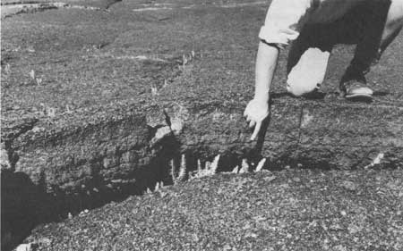
In contrast to the algae, mosses, and lichens, the ferns grew only in lava cracks (Fig. 5). Their frequency, therefore, is a function of the lava crack frequency per sampling quadrat. On the average, cracks or crevices ran through every fourth or fifth quadrat. On this basis, ferns occurred with a high frequency (from 60 to 100%) in these microhabitats, although their frequency, in terms of the whole lava flow surface in the invasion zones, was only between 11 to 20% as shown in Table 2. The initial high frequency of 27 and 50% was related to the greater abundance of cracks near the crater floor edge when the invasion zone had not yet extended much toward the center.
|
| Fig. 5. Floor of Kilauea Iki, habitat 1, 1967. (Ferns (Nephrolepis exaltata) established in joint cracks and crevices. |
In terms of surface cover, the ferns were as insignificant as the algae and mosses throughout the 9-year observation period.
The seed plants, which appeared only in year 4 (1963), exhibited a very low frequency value of 0.4%, which increased to only 0.6% at the last two observations (1966, 1968). This reveals that they were either widely scattered and sparse or locally clumped. The selerophyllous native seed plants (Metrosideros, Vaccinium, Dubautia, and Hedyotis) recognized by their progression onto the crater floor as group 1, fit more or less the first distributional pattern. The soft-leaved, more complex life form group (trees, shrubs, herbs, and grasses) described before as group 2, fits more or less the second distributional pattern. The latter became established only at the beginning of transect a, where they were locally clumped. In terms of cover, the seed plants were still as insignificant as the other life forms in the final year of observation.
Cinder Cone (Habitat 2)
Here, and in the other four habitats on pyroclastic materials, the quadrat size was 10 x 10-m, because of the expected wide scatter of plant arrival. The frequency records on the pyroclastic habitats (2 through 6) are thus comparable among each other, but not with the frequency record on the Kilauea crater floor (habitat 1), which was taken in square-meter quadrats. However, the qualitative records, such as species arrival, number, and diversity, are comparable.
Appendix II shows the sequence of life form and species arrival patterns as well as the quantitative spread or distribution of species over the 9-year observation period.
Arrival pattern in comparison to habitat 1
In contrast to the lava lake (habitat 1) on which four species of cryptogams became established in year 1, plant life on the cinder cone became established only in year 3 (1962). Appendix II shows that the life form arrival sequence on the cinder cone was:
year 3 algae (one species, Scytonema myochrous)
year 4 algae plus mosses, lichens, and ferns
year 7 the same plus woody seed plants
year 9 additional arrival of a herbaceous seed plant, a grass (Agrostis avenacea)
Apart from the 3-year delay period, the life-form arrival sequence was very similar on habitats 1 and 2. The simultaneous arrival on the lava lake of algae, mosses, and ferns in year 1, as shown in Appendix I, is somewhat generalized. The more detailed analysis of progression of plant life toward the center of the lava lake (as discussed under progress of invasion, habitat 1) revealed the algae to be in most cases somewhat ahead of the ferns and mosses. This coincides with the pioneer sequence on habitat 2. Also, on both habitats lichens appeared after the algae. In habitat 1, they arrived after the mosses and ferns had become established; in habitat 2, lichens appeared together with the mosses and ferns. Woody seed plants arrived as the fifth major life-form group, distinctly after the cryptogams on both habitats. On the Kilauea Iki lava floor, they arrived in year 4; on the cinder cone, they arrived in year 7. Thus, the delay period of 3 years on the cinder cone was similar to that of the cryptogam arrival. Grasses became established in year 7 on the lava floor and in year 9 on the cinder cone.
Therefore, on the two habitats (1 and 2) that had no organic residues, the similarity in life-form arrival sequence can be summarized. Algae were the first, these were followed by ferns and mosses that arrived simultaneously, lichens arrived as the third group. These were followed by woody seed plants and these, in turn, by herbaceous seed plants.
The difference in arrival pattern was primarily the delay on the cinder cone and the lower number of species. The probable reasons for the arrival delay will be discussed later.
Number and kind of species in comparison to habitat 1
Comparison of Appendices I and II shows that the number of species was greater on the Kilauea Iki lava floor (habitat 1 = 32) than on the cinder cone (habitat 2 = 18) in year 9. This is not surprising if one considers that the colonization started later on the cinder cone. The number of species in year 4 on the crater floor = 17 compares closely to that in year 9 on the cinder cone. It is interesting that these are also almost the same kinds of species.
Using the Sørenson (1948) index of similarity for the crater floor and cinder cone flora for these comparable years of pioneer plant invasion shows the following similarity percent.
| IS = | 2c a + B |
X 100(%) = | 28 17 + 18 | X 100 = 80% |
where IS = index of similarity
c = number of common species = (3 algae + 3 mosses + 2 lichens + 3 ferns + 3 woody seed plants) = 14
a = total number of species on site A, here crater floor = 17
B = total number of species on site B, here cinder cone = 18
The floristic similarity between the two habitats decreased in year 9 to 67%. The greater difference is caused primarily by the exotic grasses and forbs that entered the crater floor habitat in 1968. These species had not yet arrived on the cinder cone. Since the exotic grasses and forbs fill a niche that is not occupied by native pioneer plants, it is likely that the same trend of exotic invasion of herbaceous plants will also occur on the cinder cone at some future date.
Quantitative spread of species
A comparison of the two transects on the cinder cone revealed no difference in the direction of spread with respect to the prevailing winds. Therefore, the transect quadrats could be treated as one group of 85 as in Appendix II.
The rate of spread across the cinder cone habitat is shown for selected species in each life-form group on Fig. 6. The rate of spread refers to the occurrence of individual plants or colonies in the 10 x 10-m quadrats along the transects going through habitat 2.

|
| Fig. 6. Rate of spread across the cinder-cone habitat (2) for selected species in five life-form groups. |
Figure 6 shows that the lichen Stereocaulon volcani, though being a slower starter than the alga Scytonema myochrous, was the fastest invader in terms of quantitative occupation of the habitat. In year 9 the lichen occupied over 80% of the habitat surface. The next most rapid invader in terms of habitat occupation was the alga Scytonema myochrous. The other two algae (Stigonema panniforme and Anacystis montana) invaded with an equally fast rate (Appendix II), so that the algae occupied about 60% of the habitat terrain in year 9. The third fastest spreader was the fern Nephrolepis exaltata, which occupied 40% of the habitat surface in year 9. This was followed by the moss Rhacomitrium lanuginosum var. pruinosum, which had invaded about 20% of the surface area. The rate of spread was the same for the moss Campylopus exasperatus (Appendix II). The woody seed plants were the slowest invaders because they entered the habitat as the last of the five life-form groups. Therefore, in year 9 they had not yet occupied 20% of the surface. Their rate of spread, however, compares closely to that of the mosses. None of the species, shown as representatives of the five life-form groups in Fig. 6, indicated any slowdown in rate of spread in year 9. Therefore, the curves may be extrapolated to 100% frequency, and the time of total occupation on the cinder cone can be estimated for the lichen to occur at approximately year 10; for the algae, near year 12; for the fern Nephrolepis near year 18; for the mosses and woody seed plants, near year 24. This trend can be predicted, provided that the rainfall pattern remains relatively the same as during the year of observation. However, it must be understood that the spread of plant life across the habitat has little to do with cover of the species. Cover, defined as the vertical projection of shoot mass per species or colony size, was still quite insignificant for all invading species in year 9. As on the crater floor, the cinder cone surface looked practically barren in 1968.
| <<< Previous | <<< Contents >>> | Next >>> |
chap5.htm
Last Updated: 1-Apr-2005