|
BADLANDS National Park |
 |
Formation of the Landscape
The deposition of the badlands rock scarcely had been completed before the process of erosion of the same area began. At this stage, the broad valleys had been filled with sediments to depths of several thousand feet. We can surmise that the rise of the earth's crust caused the streams to increase their speed slightly and thus to start cutting downward. By this process definite channels became established. Of course, the rivers meandered and, by cutting their valley sides, widened their flood plains to some extent. However, the flowing waters were not following identifiable courses and were not wandering all over the landscape as they had during the time the badlands rockbeds were being deposited.
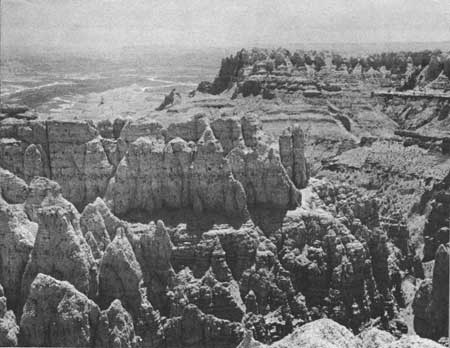
 Sheep Mountain |
We should remember that the Oligocene sediments were mostly clays and shales, with a few thin beds and lenses of sandstone and some layers of volcanic ash. These rocks are comparatively soft and easily washed away by rain or stream action. Such rapid erosion prevents most plants from getting established; so there are few roots in the soil to bind it and resist erosion. In this locality the White River cut downward quite rapidly, and its banks were steep. The smaller tributary streams also deepened their channels to keep pace with the downward cutting of the White River. Thus, along the stream courses steep-faced gullies were developed, and the stage was set for the formation of the spires and pinnacles. The canyons today have steeply dipping streambeds and very steep walls. An aerial view would give the impression of a giant tree, with the White River forming the trunk and the tributaries forming the branches and twigs.
 Tributary streams have cut deeply into the rocks |
Rainfall in this section of South Dakota often occurs as a sudden, heavy downpour (cloudburst) accompanied by thunder. Such heavy rains of short duration, with long dry periods between, are essential factors in the formation of badlands topography. The soft rocks and loose soil are rapidly sculptured during the brief heavy rains, but they dry quickly and harden between storms to preserve the intricate turreted ridges and sharp gullies. The rapid erosion and fast drying prevent the development of a plant cover which would otherwise retard erosion.
During cold weather a further modifying force is in effect. Water, from either rain or melting snow, seeps into cracks and crevices and fills them. As you know, when water freezes it expands about 1/10 of its volume and thus exerts considerable pressure. The repeated freezing and thawing process eventually loosens the rock, and it tumbles to the bottom of the gully, later to be washed away. During the dry summer, winds sweep over the badlands and fine dust particles are carried to distant places. The amount of material moved at any one time is slight, but the cumulative effect of centuries of wind erosion is astonishing.
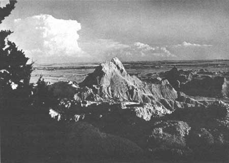
 Cedar Pass, looking south to Vampire Peak and the White River |
In a few localities there are spires with wide, flat caps, looking like huge nails or long-stemmed mushrooms. They developed because the cap rock was harder than the underlying rock, which wore away much faster. Eventually, any such cap tumbles to the base of the weakening spire which has been supporting it.

|

|
|
|
|
Last Modified: Sat, Nov 4 2006 10:00:00 pm PST |


