|
NATIONAL PARK SERVICE
Atlantic and Gulf Coasts Recreation Area Survey |

|
UNDEVELOPED SEASHORE AREAS IN NORTH CAROLINA

|
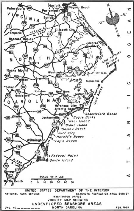
| Undeveloped Seashore Areas of North Carolina (Vicinity Map) (click on image for an enlargement in a new window) |
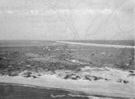
Core Banks
North Carolina
| Location: | Barrier reef running from Ocracoke Inlet to Cape Lookout. |
| Accessibility: | By boat and plane only. |
| Description of Area: | Core Banks, 33 miles in length, along with Portsmouth Island, 9 miles long, are low, marshy barrier beaches almost devoid of tree or shrub vegetation. The scattered dunes are low and unstable; the beaches are wide, clean and gently sloping. Inaccessibility and the low, barren nature of these islands have prevented development. |
| Present Use: | A fishing village exists on Portsmouth Island and about 30 to 40 fishing cottages have been built on Core Banks. |
| Analysis: | If the Core Banks could be restored by an adequate sand fixation program, they would possess first-rate potentialities as public beaches. |
 
|
| Core Banks |
Shackleford Banks
North Carolina
| Location: | Barrier reef running between Barden Inlet and Beaufort Inlet. |
| Accessibility: | By boat only. |
| Description of Area: | The island contains well-elevated land and expands to widths of one-half to three-quarters of a mile. Dunes rise to a height of 20 to 25 feet. The 8-mile ocean beach is clean and attractive but not as wide as that of Core Banks. The biotic communities of the western portion, if allowed to develop naturally for a period of years, could become of considerable scientific importance. |
| Present Use: | About 10 fishing cottages are located on the island. |
| Analysis: | This is a potentially valuable public beach of a type that might well render greatest service if acquired for that purpose and kept in natural condition. |

|
| Shackleford Banks |
Bogue Banks
North Carolina
| Location: | West of Salter Path, 3-1/2 miles. |
| Accessibility: | By road. |
| Description of Area: | A typical barrier reef some 9 miles in length with an average width of 1/2 mile. Its beach is smooth, uniform and gentle in slope. Roughly two-thirds of the island is covered with dense, windswept woodland, dominated by live oak in association with hornbeam, holly, red mulberry, laurel oak and devil's-walking-stick. The dunes are up to 25 feet in height and generally stabilized. The area contains approximately 2,800 acres of land. |
| Present Use: | Eight persons have combined to develop, promote and sell lots in a subdivision called Emerald Isle by the Sea. |
| Analysis: | The area is easily accessible and adaptable for public recreational use. It possesses the features necessary for this purpose. Acquisition of this area may be difficult and expensive. |

|
| Bogue Banks |
Onslow Beach
North Carolina
| Location: | A segment of seashore lying between Browns and New River Inlets, southwest of Swansboro, North Carolina. |
| Accessibility: | By road. |
| Description of Area: | There are about 7 miles of good beach with numerous stabilized dunes (not as spectacular as those immediately to the north of Onslow Beach) and a generous cover of tree and shrub vegetation that is comparatively natural. |
| Present Use: | Used by U. S. Marine Corps for training in amphibious landings and other related activities. |
| Analysis: | This area possesses excellent seashore values and should be retained in public ownership for recreation and conservation of natural values, when it becomes surplus to military requirements. |
Federal Point
North Carolina
| Location: | South of Kure Beach and north of Corncake Inlet. |
| Accessibility: | By road. |
| Description of Area: | A triangular point bordered by the Atlantic Ocean and Cape Fear River, which contains a fair stand of trees and shrubs. The beach shows severe signs of erosion and is low and marshy at intervals. The dunes are insignificant. Most of the site of old Fort Fisher is now under water. The area is easily accessible and contains approximately 1,000 acres of beach property suitable for recreation. |
| Present Use: | Used as a fishing base, and is advertised for residential resort development. |
| Analysis: | Could be considered for public recreation use if other more desirable areas, such as Smith Island, are not acquired for this purpose. The Civil War history of Fort Fisher should be more fully interpreted. |
Smith Island
North Carolina
| Location: | Northwest of Southport about 2-1/2 miles. |
| Accessibility: | By boat. |
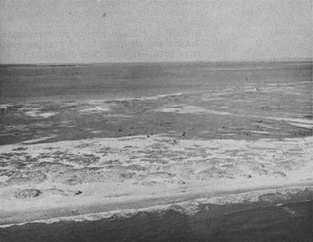
| Description of Area: | Considered to be among the five most outstanding undeveloped areas for recreation purposes along the Atlantic coast, the island has excellent vegetative cover and outstanding biological values. About 6 miles long with an average width of 2-1/4 miles, it contains about 11,900 acres of land, marsh, and fresh-water lakes. The two beaches, about 5 miles long, are wide, with clean white sand. The dunes are stable. Because of the well-developed forest and salt marsh, birds are more plentiful than on many Atlantic coast sea islands. It has outstanding historical values. |
| Present Use: | Privately owned and used by Mr. Frank O. Sherrill of Charlotte, North Carolina. |
| Analysis: | This is an outstanding area with excellent qualifications for public seashore recreation purposes. It does not appear that it would be difficult to acquire or unusually expensive. |

|
| Smith Island |
North Carolina
Bear Island
An island, off the mainland between Bogue and Bear Inlets, south of Swansboro, North Carolina, which is about 3 miles in length. It possesses dunes that approach the spectacular and contains a fair cover of trees and shrubs. The beach is wide and clean. The island is inaccessible by road but is sufficiently tied to the mainland by marshes so that road connections should not be prohibitively expensive. It possesses the natural, resources desired for a public seashore recreation area and should be considered in planning for the future needs of the public. The superiority of both Smith Island and Bogue Banks precludes its consideration at this time.
Brown Island
This island lies directly south of Bear Island, and is similar in character, desirability and length but with more vegetative cover and dunes a little less impressive in height. The island is inaccessible by road at the present time. Its consideration, like Bear Island, is secondary to that of Smith Island and Bogue Banks at this time.
Surf City (Northern part)
The undeveloped portion of this barrier reef, north of Surf City, has excellent dunes, a wide, firm, clean beach and a gently sloping foreshore. The vegetation is fair and the reef very narrow. The road extends some 14 miles north of the city but almost half of this area is now occupied by summer cottages. Although it possesses the resources necessary for a public sea shore recreation area, it is secondary in importance to Bogue Banks and Smith Island.
Hutaff's Beach
Between New Topsail Inlet and Rich Inlet is a 1-mile segment of barrier beach called Hutaff's Beach. It is not accessible by road. The character of the area is similar to that found at Surf City and it is desirable for public recreation purposes. It is secondary in importance, however, to Bogue Banks and Smith Island.
Foy's Beach
South of Hutaff's Beach lies Foy's Beach, a 2-mile stretch of barrier reef with interesting tree cover, sizable dunes, and a wide firm, clean beach. It is inaccessible by road. Although superior to the islands immediately to the north it does not equal the quality of Bogue Banks and Smith Island.
| <<< Previous | <<< Contents>>> | Next >>> |
rec_area_survey/ag/nc.htm
Last Updated: 25-Jun-2007