|
Senate Document 84 Message from the President of the United States Transmitting A Report of the Secretary of Agriculture in Relation to the Forests, Rivers, and Mountains of the Southern Appalachian Region |
|
REPORT
ON THE
FORESTS AND FOREST CONDITIONS OF THE SOUTHERN APPALACHIAN MOUNTAIN REGION.
(continued)
|
Method and results of the examination. |
It is the forest covering of these great mountain slopes— a covering that should never be removed—about which interest centers in the present investigation. The results of this examination during the past two years are given at length in a paper published as Appendix A (p. 41). They are stated separately for each of the larger river basins, following a somewhat general discussion of the forest conditions in the region as they exist to-day and of how the forests may be economically protected and improved under Government control. | ||||||
|
Forest maps. |
These forests have been carefully studied and classified, and over much the larger portion of the area their density and distribution have been indicated on the excellent topographic maps furnished for this purpose by the Department of the Interior. The length of time required for engraving these detailed forest maps makes it impossible to issue them as a part of the present report, but copies of them in manuscript forum are meanwhile available for examination at the Department of Agriculture and the Geological Survey. The distribution of these forests and the approximate relative proportion of the forest-covered and the cleared lands are indicated by the generalized map (Pl. XII). The scattered cleared fields on the mountain slopes are so small that it is impossible to indicate them on a map of this scale, and hence only the larger clearings, mainly those along the valleys, are shown. Considering the forests of the region as a whole, there is a striking uniformity about their general features, especially in the valleys and along the lower slopes, and yet everywhere there is variety. This fact is well illustrated by the list (on p. 93) of 137 species of trees and a still longer list of shrubs growing in this mountain region. PLATE XII. MAP OF THE SOUTHERN APPALACHIAN REGION. | ||||||
|
Variations in forests on southern and northern slopes. |
The forests on the southeasterly slopes are usually less striking, both in size of trees and density of growth, than those on the northwest, and they are usually more damaged by forest fires, because the slopes are steeper and are kept drier by their more direct exposure to the sun. The neighboring forests on the northern and western slopes and in the westerly facing coves exhibit a greater variety of vegetation, a denser growth, and finer specimens of individual trees, because they have not only greater moisture, but greater depth and fertility of soil. Both are protected by the humus which covers the surface and which contributes directly to the luxuriance of this growth. It is in such situations that we find the best examples of the superb hard-wood forests which abound in this region—the finest on the continent. (See Pl. XIII.) | ||||||
| |||||||
|
Variations in forests due to elevation. |
But the greatest variations in these mountain forests are observed in connection with the differences in elevation. Thus along the southern foothills of the Appalachians in Georgia one finds occasionally scattered colonies of the loblolly and long-leaf pines, trees which are characteristic of the South Atlantic and Gulf coast region, intermingling with the typical hard-wood forests of the Piedmont Plateau and of the lower mountain slopes. (See Pl. XIV.) At the eastern foot of the Blue Ridge, in North Carolina, the typical flora of the Piedmont Plateau abounds, and follows up the river gorges into the mountain valleys, where it associates with more characteristically Appalachian species. Thence up to the tops of the higher peaks there is a constant succession of changes—an intermingling and overlapping of the lower species with those which belong to greater elevations or more northern latitudes. | ||||||
| |||||||
|
Forests on Mount Mitchell. |
Thus in ascending any of the higher mountains, as Mount Mitchell, which, with its elevation of 6,711 feet, is the loftiest of them all, one may penetrate, in the rich and fertile coves about its base, a forest of oaks, hickories, maples, chestnuts, and tulip poplars, some of them large enough to be suggestive of the giant trees on the Pacific coast. (See Pl. XLIV.) Higher up one rides through forests of great hemlocks, chestnut oaks, beeches, and birches, and higher yet through groves of spruce and balsam. Covering the soil between these trees is a spongy mass of humus sometimes a foot and more in thickness, and over this in turn a luxuriant growth of shrubs and flowers and ferns. At last, as the top is reached, even the balsams become dwarfed, and there give place largely to clusters of rhododendron and patches of grass fringed with flowers, many of them such as are commonly seen about the hills and valleys of New England and southern Canada. | ||||||
|
Seasons vary with elevation. |
In such an ascent one passes through, as it were, the changing of the seasons. Halfway up the slopes one may see, with fruit just ripening, the shrubs and plants the matured fruit of which was seen two or three weeks before on the Piedmont Plateau, 3,000 feet below; while 3,000 feet higher up the same species have now just opened wide their flowers. Fully a month divides the seasons above and below, separated by this nearly 6,000 feet of altitude. | ||||||
|
General forest conditions. |
Remote from the railroads the forest on these mountains is generally unbroken from the tops of ridge and peak down to the brook in the valley below, and to-day it is in much the same condition as for centuries past. (See Pl. XVII.) In the more settled portions of the region, however, a different picture presents itself. Along the narrow mountain valleys are the cultivated fields about the settlements, where they ought to be. When the valleys were practically all cleared the increasing demands for lands to cultivate led to clearings successively higher and higher up the mountain slopes, with a pitch of 20 and 30 and even 40 degrees. From some of the peaks one may count these cleared mountain-side patches by the score. They have multiplied the more rapidly because their fertility is short lived, limited to two, three, or five crops at most. They are cleared, cultivated, and abandoned in rapid succession. Out of twenty such cleared fields, perhaps two or three are in corn, planted between the recently girdled trees; one or two may be in grain; two or four in grass, and the remainder—more than half of them—in various stages of abandonment and ruin, perhaps even before the deadened trees have fallen to the ground. (See Pl. XVIII.) | ||||||
| |||||||
|
Lumbering operations. |
The lumberman attacked this forest several decades ago when he began to penetrate it in search of the rarer and more valuable trees, such as the walnut and cherry. Later, as the railroads entered the region to some extent, he added to his list of trees for cutting the mountain birch, locust, and tulip poplar, and successively other valuable species. During the past few years he has cut everything merchantable. He is now beginning to extend his operations to considerable distances beyond the main lines of transportation by the construction of tramways and even cheap, short railways. Meanwhile his search for the more valuable trees has extended in advance to most of the more remote mountain coves. | ||||||
|
Damages from lumbering operations. |
In these operations there has naturally been no thought for the future. Trees have been cut so as to fall along the line of least resistance regardless of what they crush. Their tops and branches, instead of being piled in such way and burned at such time as would do the least harm, are left scattered among the adjacent growth to burn when driest, and thus destroy or injure everything within reach. The home and permanent interests of the lumberman are generally in another State or region, and his interest in these mountains begins and ends with the hope of profit. There is, however, no evidence that the native lumberman has in the past exhibited any different spirit. | ||||||
|
Destructive work of forest fires. |
Forest fires have been one of the great curses of this country. From the days of Indian occupation down to the present time these Appalachian Mountain forests have been swept through by fires. Some of these have preceded the lumberman, others have accompanied him, and still others have followed in his wake, and the last have been far more destructive because of the tops and other rubbish which he has left behind him scattered among the remaining growth. (See Pl. L b). The aggregate damage from these fires is great. Over some limited areas they have entirely destroyed the forests. Everywhere on the southward slopes the damages have exceeded those on slopes toward the north or west. Trees have been burned near the roots, making their bases defective (see Pl. XLVII); the young growth has been burned down (see Pl. XLVI); the grasses and other wild forage plants have been temporarily exterminated, so that instead of pasturage being improved, as some have believed it would be, in the end it has been seriously damaged. This destruction of the humus has always resulted seriously both to the forests and to the soils. In some cases, where the forests covering the steep, rocky slopes were thin, the loss of the humus has resulted in the washing and leaching away of the soils to such an extent as to destroy the forests entirely; and in all cases where the humus is thus removed the work of land erosion among the trees goes on as surely as though the forest itself were gone, though of course the process is far less rapid. Furthermore, the storage of water (in soils from which this humus has been removed) is far less perfect than in the original perfect forest. | ||||||
|
Imperative need of new forest policy. |
The rapid rate at which these lumbering operations have extended during the past few years and the still more rapid rate at which they are being extended at the present time, considered in connection with the destructive work of the fires and the clearing for agriculture, indicates that within less than a decade every mountain cove will have been invaded and robbed of its finest timber, and the last of the remnants of these grand primeval Appalachian forests will have been destroyed. Hence the very possibility of securing a forest reserve such as now contemplated is a possibility of the present, not of the future. This great activity indicates, furthermore, in the most striking way possible, the growing anxiety as to the future supply of hard-wood timber. And indeed the time is now at hand when the great interests involved make it imperative that the Government take hold of this problem and inaugurate here in these great broadleaved forests of the East a new conservative forest policy, as it is already doing for the pine forests of the West. | ||||||
| |||||||
|
Ordinary farming on these mountain slopes can not exist permanently and should never exist at all. As stated above, not more than 10 per cent of the land of this region has a surface slope of less than 10 degrees (approximately 2 feet in 10), while 24 per cent (see Pl. XII) of it has been cleared. In this region land with slopes exceeding this can not be successfully cultivated for any considerable time, because its surface is rapidly washed into the rivers below by the heavy rains, and the same agency rapidly leaches out and carries to the sea its more soluble and fertile ingredients. The valley lands have already been largely cleared, and the farmers arc now following up the mountain slopes. In many cases their cleared patches have well nigh reached the mountain summits. This process is going on with greater rapidity, because each short-lived hillside field must soon be abandoned. The underbrush is destroyed, the trees are girdled, and for one, two, or three years such a field is planted in corn, then a year in grain, then one or two years in grass; then the grass gives place to weeds, and the weeds to gullies. (See Pls. XX and XXI.) | |||||||
| |||||||
|
Agriculture on mountain slopes short lived in its benefits; permanent in the resulting injuries. |
Such a field has usually passed through its cycle in five to ten years and another must be cleared to take its place. A forest which is the growth of several centuries perishes in less than a decade; a soil which is the accummulation of a thousand years has been cleared, cultivated, abandoned, and is on the downward road to the sea within less than a decade. Such is the brief life history of many thousands of small mountain fields in this Southern Appalachian region. But even the native farmer is beginning to realize that the clearing of these mountain slopes is producing floods that wash away the valley farms, and that the time must come when he will have successively cleared and destroyed all his available mountain land. (See Pl. XXXIV). | ||||||
|
Some serious results from this forest clearing. |
Fortunately the intelligence of the country is awakening to other and larger results that are following this policy. The soil thus removed may stop long enough on its way to the sea to silt up the streams as they cross the low lands or may fill up the harbors as the streams reach the coast. Every acre of mountain slope thus cleared is a step in the more rapid destruction of the forests, of the soils, of the rivers, and of the "eternal mountains" themselves—the destruction of conditions which the combined wealth, intelligence, and time of man can not restore in a region which now possesses infinite possibilities for the benefit of the whole nation. | ||||||
|
Grass does not hold the soil on the mountain slopes. |
In the cool climate of New England the native grasses form a dense sod which holds the hillside surfaces in place, so that even where the forests have been removed there is little erosion. In the Southern Appalachians, however, neither the grass, the legumes, nor the other forage plants have been able to prevent this land erosion, and their only safeguard for the future is the protection of the forests. Hundreds of these steep mountain fields where selected grasses were sown have been observed during the past few years, and the results, as indicating a means of permanently holding these soils, have been generally unsatisfactory. (See Pl. XXII.) | ||||||
| |||||||
|
Washing of mountain lands. |
This washing away of the cleared mountain fields does not always manifest itself in the formation of deep gullies. The majority of these fields have slopes so steep that the water in its downward course can not always move laterally to a sufficient degree for its concentration and the washing out of such gullies. Each drop of rain does its own work in battering and loosening the surface; and as it carries downward the particles of soil it has captured it is joined by only its closer neighbors. Hence frequently after a heavy rain the surface of such a field looks as though it might have been harrowed or even raked downward rather than plowed in larger furrows. From one of these cleared fields more soil is sometimes removed by a single heavy rain than during the preceding centuries while it was densely forest covered. | ||||||
|
Washing away of valley lands. |
But while the rains are removing the soils of the cleared mountain slopes the floods are removing the soils of the valley farms. This is notably the case in the valleys, where the bordering forests have been cleared to the largest extent. Year by year the channels of the streams are widening and encroaching upon the adjacent farms, and as the magnitude of the floods increases, these mountain streams, transformed into swollen torrents, leave their course and plow new channels across the fields. During the floods of the present year thousands of acres of the most productive valley lands in this mountain region have been damaged or destroyed by one or both of these processes. (See Pls. XXIII and XXIV.) | ||||||
| |||||||
|
Result of present policy. |
It is, then, exactly true that the making of farms on mountain slopes is destroying the farms in the valleys, and that unless stopped by some external influence this process will proceed more rapidly as the population of the region increases. It is therefore only a question of time, to be measured not in centuries but in years, when, unless this policy is changed, there will be no forests in this region except on the small remnants—say 10 per cent of the whole—where the mountain slopes are too precipitous and rocky to make the cultivation of the lands possible, even by an Appalachian mountaineer and his hoe. | ||||||
|
Policy under proposed Government management. |
If, on the other hand, the policy now advocated is adopted, and all these steeper mountain slopes are incorporated into a forest reserve, owned and controlled by the Government, the valley lands will be protected from floods, and to the cultivation of these areas can be added that of the gentler slopes, the whole to be terraced and kept in a high state of cultivation by the native farmer, who will retain ownership then as now. (See Pls. IX b and XXIII a.) | ||||||
|
Guiding principle in Government management. |
The guiding principle of the Government in the creation of this forest reserve should be to protect the farmer in his occupation and to insure the use of agricultural lands for agricultural purposes; but also, and primarily, to maintain forever the forest cover of these great and beautiful mountains, which can be perpetuated in no other way. Under such a system the agriculture of this region will be maintained on a permanently satisfactory basis. Under the present policy it is advancing to certain ruin.
| ||||||
|
This region is the source of many rivers. |
Probably no region in the United States is better watered or better drained than this; nor is there any other region which can boast of being the source of so many streams. (See Pl. XII.) From about its northern end the New River (Kanawha) flows northward and westward and becomes a prominent tributary of the Ohio; along its southeastern front the James, the Roanoke, the Yadkin, the Catawba, the Broad, and the Savannah reach the Atlantic; near its southern end the Chattahoochee and the Alabama flow directly into the Gulf of Mexico; along its western the Hiwassee, the Tuckaseegee, the French Broad, the Nolichucky, the Watauga, and the Holston drain westward through the Tennessee into the Mississippi. | ||||||
|
Value of these mountain rivers crossing the lowlands for water power. |
Each of these greater rivers as it crosses the Coastal Plain region toward the sea is navigable for light-draft vessels. Each throughout its lower course is bordered by fertile agricultural lands, which in the past contributed largely to the nation's supply of corn, but during recent decades have begun to suffer seriously from river floods. Each one of these streams along its course through the mountains and across the hill country beyond by its water is already a contributor to the manufacturing interests of the country (Pl. XXV), and with improvement in the electrical transmission of power the possibilities of manufacturing developments in this direction are increasing rapidly every year. The measurements and estimates recently made by the Government hydrographer show the aggregate available undeveloped water power on the streams rising in this region to be more than a million horsepower. On these streams water-power developments are constantly in progress, but their value in the future will diminish as the forests disappear. | ||||||
| |||||||
|
Beauty of the mountain streams. |
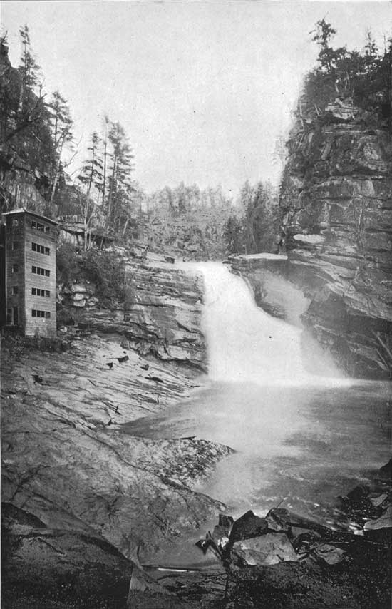
In the mountains themselves these streams have their sources at elevations from 3,000 to 6,000 feet, and before reaching a level of 2,000 feet many of them have reached considerable proportions. They subsequently flow across the mountain region for distances of from 20 to 50 miles before breaking through the border ranges onto the surrounding lowlands at elevations ranging from 1,000 to 1,200 feet. Along their courses stretches of smooth water are never long, and the descent is often accomplished by numerous rapids, cascades, and falls. (See Pl. XXVII; also Pls. LXX and LXXI.) Such cascades, with descent in short distances of from 10 to 50 feet, are abundant, while in some of the smaller tributaries beautiful falls of from 100 to 300 feet are to be found. | ||||||
| |||||||
|
I can not adequately describe the beauty and infinite variety of these mountain brooks and larger streams. Always clear, except immediately after the harder rains for the forests hold back the soil—fed regularly from perpetual springs, they are among the important assets of the South. | |||||||
|
The river gorges of the region. |
No gorges in eastern America can equal in depth and wildness those carved across the Blue Ridge and the Unakas by these streams in making their way through the marginal ranges of the Southern Appalachians. About the headwaters of the Catawba, the Linville River, after flowing for some miles parallel with the Blue Ridge, at an elevation of 3,800 feet, rushes down its eastern slope with a fall of 1,000 feet in less than 3 miles, through a gorge 1,500 to 2,000 feet in depth, a dozen miles in length, and with wall so steep and bottom so narrow and rugged that few persons have succeeded in following its course. (See Pl. LXXII.) Almost the same language might be used in describing the gorge cut by the Pigeon River across the Unaka Mountains southwest of Asheville; and there are a number of others cutting the Blue Ridge and Unakas at different points that are worthy of comparison with these. The same may be said of the gorges of the Tallulah and other streams in northern Georgia. But notwithstanding the steepness of the slopes of these gorges, even where the descent is almost precipitous, they are forest-covered except where the trees and shrubs have been destroyed by fire and the soil has been removed by the storms. (See Pls. XXIX and XLII.) | ||||||
| |||||||
|
Irregularity of streams in regions largely cleared. |
The perpetuation of the streams and the maintenance of their regular flow, so as to prevent floods and maintain their water powers, are among the prime objects of forest preservation in the Southern Appalachians. Nothing illustrates the need of this more fully than the fact that on the neighboring streams, lying wholly within the Piedmont plateau, where the forests have been cleared from areas aggregating from 60 to 80 per cent of the whole, floods are frequent and excessive. During the seasons of protracted drought source of the smaller streams almost disappear, and the use of water power along their course is either abandoned or largely supplemented by steam power. | ||||||
|
Forests regulate the flow of streams. |
To-day the larger valuable water powers in the South Atlantic region are mainly limited to the streams which have their sources among the Southern Appalachian Mountains; and the waters of these streams show a striking uniformity of flow as compared with the streams lying wholly within the adjacent lowland country, where forest clearing has been excessive. While the rainfall is somewhat greater in the mountain region, it is a question of the regularity rather than the volume of flow, and this depends upon the water storage. The soil in the one region is as deep as in the other, and the slopes being gentler in the low country, other things being equal, the water would soak into it the more easily. In the mountain region itself the flow of the streams along which proportionately large clearings have been made has become decidedly more irregular, and the flood damages have greatly exceeded those along other streams where the forests have not been disturbed. The problem resolves itself into one of a forest cover for the soil. This is just what one would expect who has been, during a rainy season, in the heart of a mountain region where the lands have not been cleared nor have forest fires destroyed the humus cover from their surface. The rain drops are battered to pieces and their force broken by the leaves and twigs of the trees, and when their spray reaches the ferns, the grass, and the flowers below, instead of running away down the surface slope it passes into the spongy humus, and thence into the soil and the crevices among the rocks below. As much of this supply as is not subsequently used by the growing plants emerges from this storehouse weeks or months later in numberless springs. (See Pl. XXXI.) The rain must be extremely abundant or long protracted to produce any excessive increase in the flow of the adjacent brooks. | ||||||
| |||||||
|
Heavy rainfall renders forest cover necessary. |
The rainfall in this Southern Appalachian region, as shown in Appendix D (p. 143), ranges from 60 inches for the year in Georgia to 71 inches in North Carolina. Heavy rainfalls during short periods are common. Even in an arid or semiarid region, where the rainfall for the year may be 10 inches or less, the absence of the forest cover results in a slow but sure removal of the soil from the mountain slopes. Much more in a region of heavy rainfall, like that of these southern mountains, when the forest cover has been destroyed will the soil removal be certainly and rapidly accomplished. | ||||||
|
Soil protection and water storage here are both forest problems. |
In studying the streams of the more northern States it is seen that the numerous lakes and the deposits of sand and gravel spread over the hills and valleys of that region by the glaciers serve to store the water and to preserve the uniformity in the flow of the streams, and would accomplish much in this direction even were the forests in that region entirely removed. In this southern region the preservation of the soil and the streams is a task which the forests alone must accomplish, and to that end they must be effectively protected. | ||||||
|
Proportion of cleared land in Appalachian region increasing. |
The proportion of cleared and forest-covered land in each of the great river drainage basins of the region is given on page 69, and as will be seen there, this proportion, though generally small, varies considerably in the different basins. Taking the region as a whole, at the present time about 24 per cent of the area has been cleared. (See Pl. XII.) This proportion is an ever-increasing one—increasing the more swiftly for the reason that new fields are constantly being cleared and the abandoned fields are being eroded so rapidly that they are seldom reforested. (See Pl. XXI.) | ||||||
|
Landslides indicating heavy rains in past and necessity of forest cover. |
Here and there among the Southern Appalachians a landslide extending over an acre, or several acres, has started, bearing on its surface a section of the forest, but the larger trees below have blocked its course within a few feet or a few yards of its original position. (See Pl. XXXII.) The trees on its surface were tilted, but the subsequent upward bending of their tops shows that the slip took place ten, fifty or more than one hundred years ago. The abundance of such evidence shows that these rain storms among the primeval forests have been both frequent and heavy, but during the centuries these densely forest-covered slopes have not lost their soils nor the soils their fertility, nor has a furrow been washed. Trees of four centuries stand to-day in the very bottom of shallow ravines and minor depressions (see Pl. XXXIII), eroded before these forests covered the mountains. Had these forests been removed a few of these great rains that started these landslides would have cleaned the mountain slope of its recently formed soil, and would have swept the valley below. | ||||||
| |||||||
|
The future will have its storms. Forests alone can protect mountains. |
These mountains will continue to be the home of storms. Their heavy rains will continue to drench the slopes, if cleared of their forests, with increasing violence. Whether in the future these rains shall be caught by fern and grass and humus, and received by a deep, porous soil, to be given out as needed to the vegetation above and the perpetual springs below, or whether it shall rush down bare, rocky slopes to fill the gorges and carry destruction through the valleys beyond, depends upon whether or not these forests are preserved. | ||||||
|
Damages from recent floods in this region. |
The terribly destructive work of the heavy rains in washing away the farm lands on the mountain slopes and in the valleys of this region, especially where the clearings have been greatest, has already been described. It should be understood clearly, however, that the dangers from these floods are not limited to the region about the mountains. The floods from the May storm of the present year on the Blue Ridge, about the sources of the Catawba, swept the best of the farm lands along the course of that stream for upward of 200 miles, and cost the farmers more than a million and a half of dollars. Am August storm in the same region added a loss of half a million more by further destruction on the Catawba lowlands. (See Pl. XXXIV.) Similarly, the same May floods swept the valleys of the Yadkin in North Carolina, the New (Kanawha) in Virginia and West Virginia, and the upper tributaries of the Tennessee with resulting devastation, which, when added to that on the Catawba, sums up to more than $7,000,000 damage. Add to this the damages from floods on other streams rising in different parts of this region during the spring and summer, and the total this year approximates $10,000,000. (See Pls. XXXV and XXXVI.) Such has been the story, on a smaller scale, of other similar but less violent floods about the sources of these mountain-born rivers during the past few years. If we are to continue the destruction of these mountain forests, this story will have to be repeated in successively larger editions in the future. | ||||||
| |||||||


| <<< Previous | <<< Contents>>> | Next >>> |
sen_doc_84/report1.htm
Last Updated: 07-Apr-2008