|
Fort Union
Administrative History |

|
CHAPTER 5: NATURAL RESOURCE MANAGEMENT

|
|
Figure 13. In order to prevent grass fire hazard, the fort regularly
trains its employees in fire fighting. Two employees stand before a
fire cache in the 1982 fire drill. Courtesy of Fort Union National Monument. |
One of Fort Union National Monument's managerial objectives is to conserve the scenery, the natural resources, and the wildlife both at the monument and in the surrounding area. The National Park Service Organic Act of 1916 directed the Park Service to preserve these resources and to leave them unimpaired for the enjoyment of future generations. As a result of a number of factors, including the size of the park, a shortage of personnel available to study the environment, and the status of the monument as a historic site, the management of natural resources remained secondary to the rehabilitation of the ruins and the interpretive program. In the last two decades, however, the Park Service has been broadening its responsibilities at Fort Union. The conservation of the physical environment is becoming a priority at the monument.
For years, natural resource management was nonexistent at Fort Union. Established to preserve the remnants of an old military post, the monument, more like a history museum than a scenic park, concentrated its efforts on management of the cultural resources. Even if there was an interest in the park's environmental aspects, the small permanent staff --usually three to four persons--limited the park's ability to conduct any large-scale scientific research. In contrast to many other units in the park system, Fort Union occupies a small area encircled by vast private lands. In the beginning there was no immediate need to consider a natural resource management program. Accordingly, the Park Service simply reacted to most natural resource issues. It responded to them only when nature posed an impending threat to the ruins.
A passiveness and unsophistication characterized all of the park's early decisions and activities in dealing with natural resources. For a long time, natural resource management and protection had been synonymous, encompassing such actions as suppressing fires, controlling floods, stopping trespassers, and guarding the flora and fauna from damage. Although Superintendent Kittridge Wing lacked any experience whatsoever in natural resource management, his intuition told him to protect the integrity of the fort as much as possible. Intended to preserve the ruins, not the environment, some of the measures implemented by his administration nonetheless benefited the natural world of Fort Union.
To save the remains of the old fort, the monument lost no time in enclosing its newly acquired property. Since the last of the troops marched away from the post in 1891, the Union Land and Grazing Company had allowed its cattle to feed freely in the fort area. Gradually the land became overgrazed; certain plant species increased at the expense of others, leaving the land in poor condition. [1] After regaining control of the area, the National Park Service prohibited grazing. Wing decided to fence the monument's boundaries. In April 1956, he secured enough funds to fence the territory. Two months later, the regional office granted a $5,048 contract to Steve Franken of Las Vegas. Following the marking stakes set by Regional Engineer George Johnston, Franken fenced both sections (the Third Fort and the Ordnance Depot) within five weeks. [2] The final exclusion of stock assured the recovery of the vegetation.
It was much harder to exclude fire, particularly unpredictable wildfires, from the park. This destructive natural force often posed a threat to the ruins. As early as January 1956, a wildfire engulfed 100 acres of short-grass sheep pasture ten miles south of the park, along Highway 85. Greatly concerned, Superintendent Wing observed, "if such a burn can happen in January in short grass, the alarming possibilities of a warm-weather burn in the long grass at Fort Union are evident." [3] There was an urgency to prepare for fighting wildfire, which could occur at anytime and anywhere.
The following month Wing contacted the regional forester in regard to a fire fighting jeep for the monument. Although the regional office had promised to deliver a jeep, it ruled out any hope that the Park Service would furnish a tank and pump equipment. [4] Because of a previous agreement in which the Union Land and Grazing Company donated all of the needed fire-fighting equipment, the Park Service agreed only to maintain the property and personnel at the site. Thus, Wing's continuous appeal for help did not change his superior's mind. For quite a while, Fort Union had little fire equipment.
Despite little assistance from Santa Fe, Fort Union tried its best to cope with the problem. In August 1957, Wing, in cooperation with the Union Land and Grazing Company, made arrangements with the New Mexico State Highway Department to rent a grader to create firebreak lanes along the entrance road. In addition, the visitor area of the monument received firebreak lanes on three sides with Wolf Creek forming a natural defense on the western side. [5] The measure reduced the fire threat from outside. In 1958, a wildfire on the adjacent ranch property burned 200 acres. remaining calm, the park employees trusted to the utility of the firebreaks.
Nevertheless, the park was vulnerable to any fire hazard within the monument's boundaries. This situation did not change until 1959 when Fort Union got its first running water system. In January, the Star & Cummins Company of Albuquerque installed a 50,000-gallon water tank in the northwest corner and laid all the pipes to the main sections of the monument. The modern water system provided not only drinking water for the employees but fire protection for the previously unprotected ruins. Hose houses were erected at each fire hydrant. They increased the park's fire-fighting capabilities.
Meanwhile, the park administration continued to highlight weed control and personnel training. The accumulation of dry weeds in arroyos and along the fences became fire hazards and required constant removal. Superintendent Homer Hastings hired Margarito Lovato and his team to mow undesired plants. In the fall, the New Mexico Highway Department again helped clean the firebreaks along the entrance road and inside the eastern edge of the monument. Also, Hastings conducted a fire control inspection and instructed the employees on the proper use of the fire-fighting equipment. [6] By the end of the 1950s, the monument staff had acquired the basic skills and equipment for fire control.
In managing water resources, Fort Union encountered a different situation. The problem was one of scarcity rather than abundance. The operation of the monument entailed furnishing a supply of water adequate for the needs of both the employees and visitors. A small spring meandering in the gully just west of the Third Fort could not meet the demand of ten-gallon-per-minute. The Park Service had to find other sources. To determine the feasibility of obtaining a ground water supply, the Park Service requested that U.S. Geological Survey study and assess ground water conditions. In addition to the field survey in July 1956, samples of well and spring water were sent to the laboratory in Albuquerque for chemical analysis. After the study, the surveyors affirmed the quality and quantity of ground water in the area. Later they helped select a suitable location for the well. [7]
As the first scientific study of the monument's natural resources, the survey gave people a better understanding of the fort's environment. While they searched for water, geologists examined various aspects of the park's geography, geology, and topography. In December, geologist I. J. Winograd presented a final report on the survey and its conclusions. His thirteen-page document became a collection of information useful for future research. The essential motive of the survey, however, came from a need to acquire water, not from a desire for more knowledge. As soon as fresh, pure water gushed out of the well, the Park Service lost interest in learning more about the area's environment. Accordingly, the Regional Office failed to conduct another scientific study on the natural resources at the monument for another 14 years.
The pragmatic and utilitarian approach to natural resources also guided erosion control and landscaping. Although annual precipitation measured only 18 inches, occasional rainfalls could leave their distinct mark on the once overgrazed land, washing away topsoil and creating small ravines. As a by-product of the ruins stabilization work in 1957, Superintendent Wing initiated efforts at erosion control by dumping unwanted earth and broken bricks into a gully at the northeastern corner of the Third Fort. The work eased the erosion problem for a small section. [8] Except for this experiment, there is no record showing any other erosion control in this early period.
During the construction of support facilities, bulldozers made people realize the need for landscaping. In Wing's view, "a great amount of regrading and reseeding" in the residential and visitor center areas was "required to make the environs of the new homes presentable." [9] Paul Gensemer of Las Vegas received a contract to beautify the natural scenery of the park. Although the Park Service expected him to complete the work before the formal dedication of the monument in June 1959, he did not meet the deadline. By the end of August, with exception of four loads of manure scattered over designated places, no progress occurred. In the following month, the Park Service terminated the contract, and later awarded it to James Vander Sys, a nurseryman from Santa Fe. Securing a number of Apache plum trees, salt bushes, and sumacs in Watrous, he planted them around the new visitor center and the residences. On April 29, 1960, he fulfilled his contract. [10]
Leaking sewer water caused by the inconsistent construction activities was another problem. It remained difficult to get the newly completed sewer lagoons to hold water due to the porous soil in the area. No sooner did the water enter the lagoons than it soaked into the ground. In the spring of 1958, Acting Superintendent George Cattanach made arrangements with Fort Union Ranch to put a dozen horses, loosely roped together, into each lagoon for a few hours to help compact the loose soil on the bottom. This method proved effective, and the lagoons began holding water in a sufficient quantity to permit them to function properly. [11]
The park administration realized the impact of nature on cultural resources. Wind, rain, snow, hail, drought, and fire threatened the historic structures at Fort Union. To protect the ruins, the monument staff had to pay attention to the area's natural resources. Although none of them had any formal training in natural resource management, their daily actions, as mentioned above, benefited the environment. Meanwhile, the fort sought to collect weather information by recording daily temperatures, wind speeds, and precipitation. In May 1957, Fort Union began submitting monthly precipitation reports to the Albuquerque Office of the U.S. Weather Bureau, in the hope of encouraging a systematic study of the climate of the Mora Valley. [12]
The monument carried on its traditional trouble-shooting strategy for handling natural resources into the 1960s. In the new decade, this passive and reactionary attitude still dominated all the decision-making processes. As long as the ruins and other man-made structures were safe, there remained no clear agenda for natural resource management. This did not forestall the fort administration in improving its ability in certain fields such as fire control. For example, in 1960 an additional tank and slip-on pump arrived at the fort, supplementing the existing fire equipment. Six years later, a new fire attack unit consisting of a 110-gallon water container and a one-horsepower pump replaced all existing equipment, which had proved unreliable in cold weather. [13]
Meanwhile, weed control efforts continued. The maintenance crew constantly inspected and cleaned the fire-breaks. Sometimes they had to work extra hours due to excessive weeds and grass caused by unusually wet weather. In August 1963, about six inches of rain fell, damaging the fire-break and the service roads north and east of the Third Fort. The maintenance crew quickly repaired them but correcting the soil erosion was beyond the park's capabilities. Again in 1965, more than 22 inches of precipitation, 15 percent above normal, resulted in abundant plant growth, which became a fire hazard. After failing to control weed growth in the summer, the maintenance workers had to conduct a controlled burn inside the foundation outlines of the historic buildings. [14]
The growing interest in natural resource management at Fort Union resulted from the changing cultural climate in the United States. The passage of the Wilderness Act of 1964 announced the third natural preservation movement, following those of the Progressive and New Deal eras. This time, the noble cause attracted powerful grassroots support. Throughout the second half of the sixties, Americans, led by burgeoning environmental groups like the Sierra Club and the Wilderness Society, began to introduce environmental agendas into both local and national politics. The entire country articulated concerns about the state of America's physical environment. The "Keep America Beautiful" campaign that Lady Bird Johnson initiated during her husband's presidency educated the public on the issue. Environmental movements won a significant victory in 1970 when the federal government proclaimed "Earth Day." [15]
Americans cared about their land and the Park Service responded to the nation's call. The tone of the era made the agency reconsider its priorities and responsibilities. The MISSION 66 program was designed to provide visitors with high standard services that would encourage maximum enjoyment for those who used the parks. In 1966, the 80-million-dollar program ended successfully. However, an increase in visitation brought a need to protect the natural resources from the depredations of people. If the Park Service hoped to continue quality service in the future, the natural resources in its domain required more attention. After a decade in which the use of the nation's parks overwhelmed the system's capabilities to preserve its resources, Park Service policy began a dramatic shift in the opposite direction.
Astute officials in Santa Fe lost no time in implementing Washington's policy. Recruiting enthusiastic young preservationists armed with the latest scientific knowledge, the Southwest Region began to implement various environmental programs. As early as 1969, it launched a campaign for environmental awareness and education. Regional Environmental Education Coordinator William Brown arranged a field exercise, in which people contributed their ideas and suggestions about the program, at Bandelier National Monument on February 27 and 28. Representatives from the different park units in New Mexico, including Fort Union, attended the meeting, and the participants were "imaginative and positive in their commitment to the environmental management concept." [16] Each unit drew up its own plan.
In comparison with its counterparts, Fort Union's plan for environmental education appeared a little sketchy but practical. According to the plan, the staff was going to discuss the issue during daily coffee breaks and scheduled monthly meetings, with the hope that various themes for natural resource management could be developed before the end of 1969. In the following year, the monument would create an environmental study area for the use of Las Vegas schools. Thus, students would gain first-hand experience in the program. Also, Superintendent Hastings contacted the local agency of the Forest Service and Highlands University in order to obtain their advice. [17]
The environmental education program continued through the early 1970s. After Superintendent Hastings' retirement, park ranger Robert Arnberger carried on the unfinished mission, laying the groundwork for the establishment of an environmental study area at the First Fort. Like his predecessor, he solicited the local schools and college for support. With the help of professors Werner Muller and Bob Lessard, an introductory course on the environment became a part of the teachers' preparation program at Highlands University. [18] A group of public school teachers also showed an interest in taking an active role in the program.
Applying the same tactics used in the interpretive program to natural resource management, Fort Union sought to build close relations with the community. The park personnel frequently contacted preservation organizations such as the Sierra Club and the Adelante Conservation to recruit assistance. Arnberger was invited to speak to the local Sierra Club. [19] These contacts and meetings helped the park determine its agendas and goals. Meanwhile, environmental education materials were distributed at the visitor center. As a result, both the Park Service and society benefited from the environmental education program. It strengthened the public's belief in conservation. For the first time, the monument devoted much time to environmental issues. Indeed, a balance between cultural resource and natural resource management began to emerge.
As natural resource management formally occupied the fort's administrative calendar, a series of actions involving preservation and research occurred at the site. One of the priorities was soil conservation, because erosion threatened the safety of the historic structures. Every cloudburst washed away dirt and created unwanted ravines in the park. Although Fort Union occasionally conducted a few emergency measures to fight erosion, the problem was beyond the park's capabilities. It had neither the money nor sufficient knowledge to retain the soil. This situation lasted until 1970 when the National Park Service addressed the issue in a serious manner. In November, Assistant Park Service Director Edward Hummel sent to the regional headquarters guidelines for soil and moisture conservation at each unit. Washington also agreed to appropriate more funds for such purposes. [20]
Under the guidance of Washington and Santa Fe, Fort Union started planning soil erosion control. For the first time, the Park Service asked the experts to conduct a systematic study on both the conditions of, and the solutions to, soil erosion. In October 1973, U.S. Soil Conservation Officer Harold Dineen inspected the situation of arroyo erosion at the monument and outlined the necessary measures. [21] According to his suggestions, masonry check dams and ripraps should be placed in arroyos to stabilize the banks. In the following year, the maintenance crew experimented with his methods and filled some of the arroyo heads with rubble and debris. Their work proved effective against the severe summer storms. [22]
The preliminary research and experimentation led to a well-planned and funded project for soil erosion control. In 1975, Fort Union and the U.S. Soil Conservation Service Mora-Wagon Mound District reached a cooperative agreement. It required the district to prepare a land inventory map of Fort Union National Monument, showing the soil, water, and vegetation potentials and limitations. Also, the conservation officers were willing to supply available technical assistance and information on how to treat the land. In return, the monument followed the district's instructions and recorded data about its soil, water, and vegetation. The chief beneficiary of this agreement was Fort Union, which received a detailed proposal for soil erosion control. [23]
Designed by conservation specialist Gary Storch, the proposal detailed work that was to occur in two stages. During the first year it focused on diverting water. Sheer vertical arroyo banks would be sloped and cut to no greater than a 2:1 slope to limit damages from runoff to downstream areas. Several new waterways with erosion-resistant rock lining were to be constructed to help dispose of large quantities of runoff water more efficiently. For 1976, the second season, the main objectives were rack building and grass seeding. Certain spots would receive either wooden posts or metal bars to catch debris in the arroyos and reduce the speed of flux after a rain. But nothing was more effective than grass cover. Thus, the plan suggested that workers seed the disturbed sections with native grasses such as blue grama, little bluestem, and western wheat. Careful planning was the first step toward success. [24]
Meanwhile, the Park Service received funds for a number of projects from the Economic Development Administration as part of the Job Opportunity Program. Fortunately, Fort Union was a chief beneficiary, and got a lion's share of the funds with $71,000. The unexpected funds enabled the monument to hire twenty unemployed veterans from Mora County and to execute its elaborate scheme for erosion control immediately. Following the plan, the workers accomplished their assignments and went home before Christmas. In the spring of 1976, eleven returned for the second season. They labored through early December until both the Job Opportunity Program and the erosion control project were completed. [25]
As a result, the two-year program eased most of the troubles concerning soil erosion. Although it was impossible to solve all the problems at once, this intensive conservation program stopped the further depletion of the earth to a great degree. For the time being, park administration could shift its attention to other natural resource issues.
Certainly, water was another long-forgotten aspect, that required more study. Since the U.S. Geological Survey effort of 1956, the Park Service had shown little interest in water resource management at Fort Union. In the late sixties, the predominant national mood favoring environmental preservation influenced the attitudes of government bureaucrats at every level. Concerning the safety of visitors and the potential for future consumption, the Southwest Region decided to examine both the quality and the quantity of water in the fort area. In 1970, hydraulic engineers suggested that the fort keep records of water use, including domestic consumption and irrigation. The absence of meters, however, made it difficult for the monument to provide accurate data about water use. Without basic cooperation from the local unit, the regional office had no alternative but to postpone water resource research indefinitely. [26]
The 1970s witnessed no activity in hydraulic studies at the fort except for a brief test of the well. After the Red Top Drilling Company installed a new pump, the Park Service did a routine check of the new system. In April 1974, Hydraulic Engineer Garland Moore and his team arrived at the site. They inspected the well and the new pump. Surprisingly, they found that the water table had dropped from 85 feet in 1957 to 91.7 feet. Because the team could not decide why the underground reservoir had shrunk, the test remained inconclusive. To the monument, a comprehensive hydraulic study remained unavailable. [27]
Nevertheless, the quality of the groundwater at Fort Union remained unchanged throughout its history. Beginning in 1960, the park staff collected water samples twice a month for bacteriological tests by a state-approved laboratory. Thorough analyses were made every three years. The chemical quality of the groundwater always met the drinking water standards set by the Public Health Service in 1962. Also, the maintenance crew regularly cleaned the water tank to keep the artisan water pure. [28]
When Fort Union merged with Capulin Mountain National Monument, water resource management received new attention. Both Santa Fe and Capulin bosses requested an inventory of water resources in the fort area. With some assistance from natural specialists from Capulin, unit manager Carol Kruse prepared a detailed report entitled "Water Resources Management Profile for Fort Union National Monument." Based on previous information and recent studies, the document dealt with various aspects of water resources such as physical description, legal rights, problem identification, recommended strategies, and bibliographical references. For the first time, the Regional Office received an overview of the fort's water assets and problems. Despite its primitive nature, the profile reflected a new approach toward resource management, from trouble-shooting to systematic studies. [29]
Although the small number of personnel limited Fort Union ability to conduct any large-scale research, the monument sought to learn more about water resources. In 1984, Carol Kruse requested that Santa Fe do a new examination of the well. The Regional Office brought in Hydrologist William Werrell from Fort Collins, Colorado, who arranged another aquifer test. After his field trip, Werrell compiled a detailed report about his survey. It suggested that a new well be drilled even though the existing one might be productive for a few more decades. His study gave the Park Service a better understanding of the groundwater situation at Fort Union. [30] In addition, the monument employees themselves continued to inquire into water resources. Throughout the 1980s, each management plan or superintendent's annual report showed progress in the field.
Unlike water resource management, which could pause at any time as needed, fire control required constant attention such as personnel training and equipment improvement. Because of its location where water was scarce and grass was abundant, wildfire posed the most dangerous threat to the park. Thus, the park employees were constantly on fire alert. They regularly checked and repaired the old fire-fighting tools. Every few years, new equipment was purchased and fresh ideas surfaced. In 1972, the monument redesigned its four fire hose houses and made them fireproof. [31]
Five years later, all the equipment was upgraded again. In April 1977, workers completed a new fire-resistant fire cache building in the maintenance area. The 300-gallon pump trailer received a new pump, improved hose reels, and other gear. Also, the monument procured a portable, backup fire pump for forest fire control use. Later in the season, four sets of bunker gear, including helmets, gloves, boots, turnout coats and pants, and self-contained breathing units, came to Fort Union to arm its mini-fire department. By the late seventies, with sufficient modern equipment, the monument had greatly increased its fire-fighting capability. [32]
The development of training in fire control went even faster. Wildfires in the neighboring areas offered the park staff good opportunities to acquire real battlefield experiences. In the seventies, natural fires broke out more frequently in the region than they did in previous decades. For example, one fire in April 1974 engulfed 1,500 acres of grassland belonging to the Union Land and Grazing Company. Armed with modern weapons, the park employees responded to calls for help and fought the fire effectively. [33] The only rewards for their sweat and bravery was enhanced skills and experience.
The park's amateur fire fighters also participated in suppressing wildfires in other regions and states. In June 1977, the La Mesa fire at Bandelier National Monument destroyed large portions of the Upper Canyon and Frijoles Mesa areas. Answering an emergency call for assistance, Superintendent Hopkins and ranger Thomas Danton, with their recently acquired equipment, quickly drove to the burning area. Both spent six consecutive days in the blazing forest. No sooner did they put the equipment back into the cache building than a fire broke out at Sequoia National Forest in California in August. Chief Ranger Robert Hoff and battlefield-hardened Danton were assigned to the La Bonita fire. They flew there and stayed on the front line for a week. These airborne fire fighters performed excellently. At the end of the summer, Hopkins, Danton, and Hoff received interagency fire fighting qualification cards. These special occasions helped Fort Union to develop an exceptional fire fighting squad. [34]
Besides reliable equipment and proper training, cooperative activities within government, community, and citizenry were crucial for the suppression of large fires. In 1968, the Southwest Region of the National Park Service and the state of New Mexico reached agreement on mutual aid in the case of natural disasters. Although the agreement covered the Mora Valley, the management sought additional cooperation from the surrounding communities. In 1975, Superintendent Hopkins and Andrew Marshall, then treasurer of the Union Land and Grazing Company signed an agreement on a joint effort to deal with fire disasters. A revised version appeared three years later. During the same period Fort Union and the Watrous Volunteer Fire Department struck a similar deal. With these agreements, the monument bore more responsibilities, but in trade for better fire protection. [35]
The best protective measure was to prevent fires in the first place. After improving its fire control abilities, the monument exhibited a growing interest in scientific studies. In April 1983, Fort Union installed a fire weather station near the visitor center to collect data on wind, precipitation, temperature, and humidity trends. High winds often proved to be a major factor in determining fire hazards. Because the highest recorded winds usually occurred in August, that became the most dangerous month for wildfire threats. So the preparation began before each summer. [36]
Learning from other parks' experiences, Fort Union tried a new fire control method--"prescribed burn." It was an effective tool used to restore the historic scenery and reduce fire hazards by carefully burning small sections of the vegetated area under closely supervised conditions. On April 10, 1985, the maintenance crew burned off five acres at two sites. Minimal pre-burn information was available, but the revegetation was documented with photographs for the following six weeks. The prescribed burn slowed the growth of woody plants and in return, the prairie grass made a comeback. [37]
The monument continued to improve its fire management capabilities in every way. In 1990, the draft of the fire management plan for Fort Union arrived at Santa Fe for review. It showed the maturity of fire control. Recent decisions by the Park Service, however, prohibited any prescribed burn due to "safety" reasons. The maintenance workers returned to more traditional ways of limiting the growth of unwanted plants by regularly cleaning the firebreaks and mowing the overgrown areas. But in general, fire management at Fort Union was successful as no fire has ever damaged any park property since its establishment.
|
|
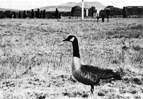
Figure 14. A Canada goose posed itself in front of the Officers'
Quarters and hissed at visitors through most of the spring of 1984. Courtesy of Fort Union National Monument. |
As a part of the cultural and natural resources of the monument, the Santa Fe Trail ruts raised a new issue for resource management. In the late seventies and the early eighties, the 800-mile Santa Fe Trail was developing a reputation in the public's eye as a significant historic resource in its own right. At Fort Union, the trail became a major attraction in addition to the ruins. A hundred years of revegetation, weathering, and erosion had changed the original appearance of the trail by either deepening the ruts into arroyos or filling them with earth. Sections of the trail, within the monument grounds, were lost through the construction of the visitor center, residential houses, and maintenance buildings. Although the park staff carefully photographed and mapped the ruts for further research, they could not decide how to preserve the trail. [38]
Beginning in 1985, a soil erosion control project helped care for the Santa Fe Trail ruts. Assisted by the U.S. Soil Conservation Service Mora District, Diane Jung and Keith Yarborough from the Southwest Region authored a plan for a two-year arroyo stabilization program at Fort Union. As soon as they finished the blueprint, the maintenance crew started constructing, mulching, and seeding earthen dikes. Banks of an arroyo at the northeast corner of the monument were sloped. In the summer of 1986, 45 Boy Scouts labored for 179 hours on the erosion control program. The project was completed in 1986 when the ruts of the Santa Fe Trail stood more firmly against the threat of erosion. [39]
But the problem was far from resolved. Since the visible ruts of the Santa Fe Trail stretched through the entire valley, their preservation as a whole seemed unrealistic. All wagon wheel ruts could eventually erode away. Even if the Park Service discovered a reliable way to preserve a small section of the ruts, it still could not restore the integrity of the historic trail. Realizing the situation, the fort administration pleaded with the regional office for further study on both the strategy and the tactics of preservation. In recent years, Superintendent Harry Myers made a few contacts with the Santa Fe Trail Association and the U.S. Soil Conservation Service to discuss possible measures. There was no quick answer. As are many interested citizens and government agencies, Fort Union is still searching for a solution. [40]
One of the best studies on the park's natural resources was Sandra Schackel's Historic Vegetation at Fort Union National Monument, 1851-1983. Then a history graduate student at the University of New Mexico, she accepted the Park Service's contract to produce an in-depth investigation of the fort's flora. Because the prairie environment affected Fort Union's physical condition regarding such things as soil erosion, fire hazards, animal habitats, and natural scenery, the Southwest Region decided to approach natural resource management at the "grassroots" level. Schackel pioneered the task. Working closely with the U.S. Soil Conservation Service, she investigated various species of plants and searched government documents to determine whether there was biological continuity or change through the park's history. In 1983, the first study on the history of the park's vegetation appeared.
According to Schackel's study, vegetation conditions at Fort Union in the early 1980s appeared similar to those documented in the historic records of the mid-nineteenth century. The valley possessed rich blue grama and other grasses interspersed with a great variety of beautiful wild flowers until the coming of U.S. troops in 1851. The construction of buildings, gardens, corrals, and the parade ground gradually turned the once luxuriant pasture into a barren, dusty area. In American frontier history, ranchers often followed soldiers. After the closing of this frontier post, the commercial grazing company replaced the military as the catalyst for environmental change. Cattle grazing continued to diminish the remaining vegetation cover for 65 years. However, the establishment of Fort Union National Monument brought new hope for environmental protection as the Park Service fenced the land and allowed the start of a recovering process. In the last 36 years, vegetation at the monument was gradually restored. Today the prairie is once again growing toward a potential climax. [41]
Simultaneously, several other research projects, not funded by the Park Service, were under way. In 1982 while Schackel was studying the park's vegetation, Lee Boyd of West Texas State University came to Fort Union to research the geological features of the nearby Turkey Mountains, which formerly were included in the military reservation. This year-long study resulted in a scholarly work, Geology and Joint Pattern Study of the Turkey Mountains. Park volunteers Charles and Peggy Matlock performed the first survey of birds at the monument and the surrounding areas. They lived at the fort in the fall of 1983. Incorporating data from personal observations and previous records, the Matlocks compiled a report about bird activities in the area. These research projects broadened the park's scope in fields from geology to flora and fauna. [42]
In accordance with the Endangered Species Act of 1973, the U.S. Fish and Wildlife Service defined and listed all endangered species of flora and fauna in the nation. Fort Union was home to none of them. The threatened creatures of Mora County, the black-footed ferret, the swift fox, and the spotted bat never visited the fort. Only bald and golden eagles occasionally stopped at the fort during their long flights.
Of all the fauna at the park, snakes received the most attention. A considerable snake population lives in the Third Fort and the Depot, with sightings recorded in all months except January and February. Unchecked activities by these reptiles, particularly rattlesnakes, threatened public safety. Rattler sightings in public use areas averaged 25 per year, about half of which involved confrontations with humans. Concerned with the safety of visitors, the Park Service, since the establishment of the monument, placed warning signs along the interpretive trail and asked people to stay out of the grass, where poisonous serpents were likely to linger. In past years, the warning sign helped reduce the chance of snake confrontations. [43]
Throughout the history of Fort Union National Monument, there was only one recorded incident of a snake bite. On August 18, 1983, a boy, Nathan Hagman, walked off the marked trail and into the grass. Suddenly, a rattlesnake bit his left leg about six inches above the ankle. It took only five minutes for his father to report the matter to the park staff. Under park ranger Carl Friery's advice, Dale Hagman properly kept his son still with his legs lower than his heart, and rushed the boy to the Northeast Regional Hospital in Las Vegas. [44]
Although only one rattler attack was recorded, the search for a proper way to handle potential confrontations between humans and snakes was needed for both public safety and resource management. Historically, neighboring ranchers killed rattlesnakes on sight. From 1958 to 1971, records indicated that Fort Union exercised the same extermination policy as its neighbors. The environmental preservation movement made the Park Service realize the importance of ecology and the coexistence of various species. Consequently, Fort Union shifted its policy from extermination to relocation. In the last two decades, the relocation philosophy remained the standard. Whenever a rattlesnake moved too close to the public use areas, trained park personnel quickly captured the errant reptile. Each captured snake was marked with brown paint on its tail and released on the northeastern boundary near the water tank. This method met the demands of public safety as well as environmental protection. [45]
In 1984, Fort Union issued its first written rattlesnake policy. Concise and perceptive, it gave an initial account of the park's experience in snake management, with thoughtful comments and practical goals. Approved by the Southwest Region, the rattlesnake policy became effective. In addition to the existing methods of warning and relocation, the park rangers began to encourage visitors to report rattler sightings. Public cooperation helped the Park Service gather more information for further research. The change of policy from extermination to relocation showed that the park administration supported "the native animal life of the parks for their essential role in the natural ecosystem." [46]
During the 1980s, natural resource management developed significantly. It became as important as preservation and interpretation. In 1976, personnel at Fort Union wrote a "Statement for Management," which gave natural resource management minor attention with only one short sentence that mentioned the desire to enhance the park's environmental quality. Soon, this attitude changed. Under pressure from the public and the Park Service, the monument began to prepare for a comprehensive management plan in 1979. It took about two years before unit manager Carol Kruse submitted the plan for approval. This time natural resources received significant attention; a natural-cultural resource balance in management began to arise. [47]
As the first plan of its kind, the "Resource Management Plan and Environmental Assessment" guided the fort's operations through the decade. Every three or four years the park administrators made efforts to revise and update it. The public was encouraged to provide input. In essence, by creating such a written document the administration saw the need for a natural resource management entity at the monument. [48]
In comparison with the ruins preservation and historical interpretation programs, natural resource management in the last two decades failed to cover the many problem spots that revealed themselves in management operations. Today, some areas are still waiting for research. For example, a pollen and soil study will augment Schackel's work and allow the mapping of soil as well as vegetation. A climatological study is needed to provide some insights into weather patterns and to predict their effects on ruins preservation. The animal population at Fort Union remains largely unstudied. Ground squirrels, whose burrows have severely weakened the trails and ruins, are not understood. The increased presence of rodent families raises additional concerns for human exposure to bubonic plague. Indeed, a careful appraisal of all these aspects of the environment is required before the park's natural resource management meets Park Service standards.
| <<< Previous | <<< Contents >>> | Next >>> |
foun/adhi/chap5.htm
Last Updated: 22-Jan-2001