FORT VANCOUVER
The History of Fort Vancouver and its Physical Structure
|

|
PLATES
|
|
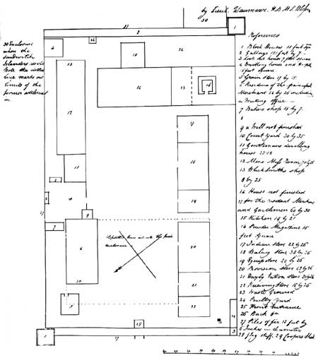
Plate I—Ground Plan of Fort George, 1818.
From Quarterly of the Oregon Historical Society, XIX (December, 1918),
opposite p. 271. (click on image for a PDF version)
|
|
|
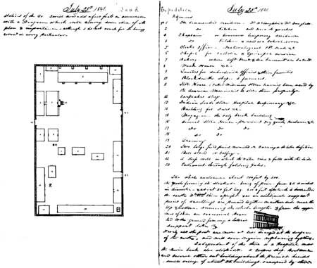
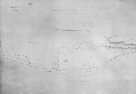
Plate II—Ground Plan of Fort Vancouver and
Sketch of Palisade, 1841, from Diary of George Foster Emmons. From George Foster
Emmons, Manuscript Journals, MSS, in the Yale University Library.
(click on image for a PDF version)
|
|
|
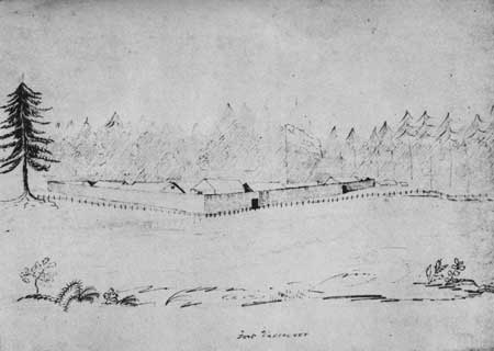
Plate III—View of Fort Vancouver from
the Southwest, 1841, Drawn by Henry Eld. From Henry Eld, Journal, Statistics,
&c., in Oregon and California, MSS, in Yale University Library.
|
|
|
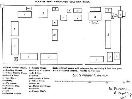
Plate IV—Ground Plan of Fort Vancouver,
1845, Based upon Map Drawn by M. Vavasour. From Quarterly of the Oregon
Historical Society, X (March 1909), opposite p. 100. (click on image for a PDF version)
|
|
|
Plate V—Map of Fort Vancouver and
Vicinity, Drawn by M. Vavasour. Original in British Foreign Office.
From photostat in possession of Howard J. Burnham. (click on image for a PDF version)
|
fova/hussey/plates1.htm
Last Updated: 18-Feb-2008
|