
|
Geological Survey Bulletin 1309
The Geologic Story of Isle Royale National Park |
WHAT HAPPENED WHEN?
(continued)
THE GLACIERS TAKE OVER
The concept of widespread glaciation during a so-called ice age evolved over a relatively short period of time during the first half of the 19th century. It was first clearly expounded by Louis Agassiz beginning in 1837 but met with considerable skepticism for many years. Interestingly enough, Agassiz himself visited the Lake Superior region in 1848 and remarked that nowhere had he seen evidence of glacial phenomena in greater clarity than on the shores of Lake Superior. He traversed the north shore of the lake as far west as the Hudson Bay Co. post at Fort William, opposite Isle Royale on the Canadian shore, but he was unable to visit the island because of stormy weather. The next year Edouard Desor, who had been Agassiz's secretary and coworker for the previous 10 years, became associated with Foster and Whitney in their studies of the Lake Superior region and was the first to describe glacial features on Isle Royale. Mount Desor, the highest summit on Isle Royale, and Lake Desor, the second largest lake on the island, bear his name.
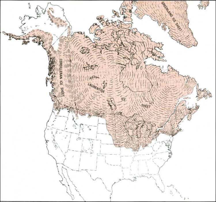
Beginning about 2 or 3 million years ago, the earth underwent a series of cyclic climatic changes, with at least four episodes cold or moist enough to permit the formation of extensive ice sheets. In North America, ice accumulated at several separate centers, spread out, and coalesced to cover a large part of the continent during each of these four episodes that together make up the glacial or Pleistocene Epoch (fig. 45).
|
| PLEISTOCENE ICE SHEETS showing the main centers of accumulation and the maximum extent of the Pleistocene ice sheets. (Fig. 45) (click on image for an enlargement in a new window) |
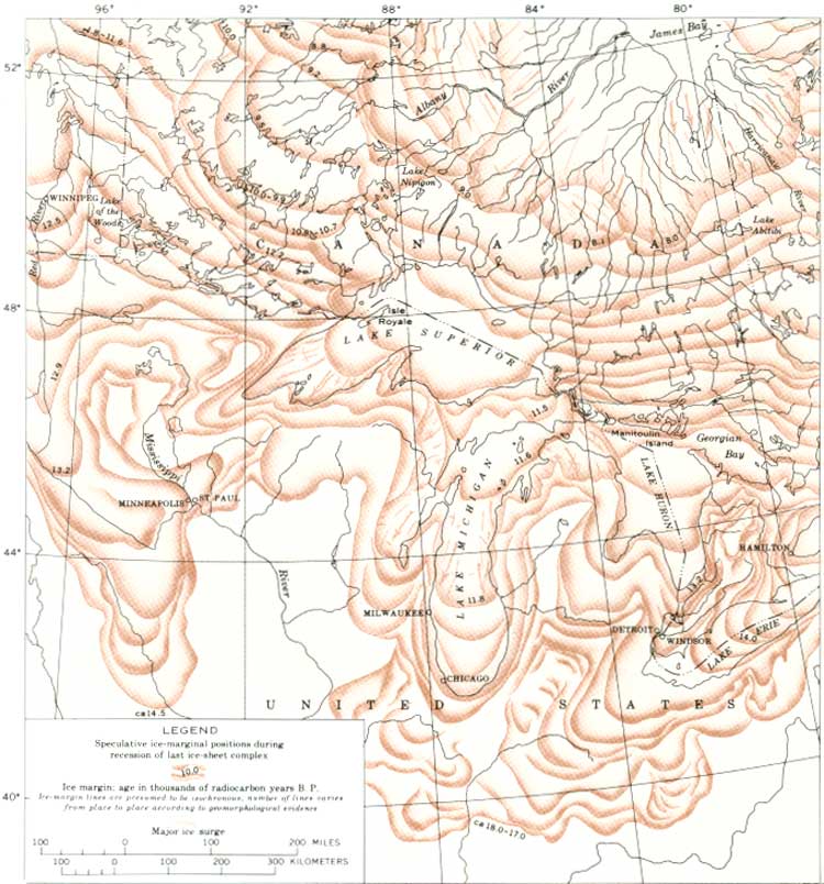
Isle Royale was overridden by glacial ice during each of the four major glaciations, and each successive glaciation virtually obliterated all direct evidence of the preceding glaciations on the island. In the waning phase of the last major glaciation, the Wisconsin Glaciation, the frontal ice margin retreated northward from at least the greater part of the Lake Superior basin, then readvanced into the basin about 12,000 years ago (fig. 46). We can attribute the final carving of the Isle Royale landforms to this last advance, although all the earlier glaciations played their part.
|
| WISCONSIN ICE RETREAT from central North America. Note major ice surge, or readvance, in the Lake Superior basin (from V. K. Prest, 1969, Geological Survey of Canada Map 1257A). (Fig. 46) (click on image for an enlargement in a new window) |
| <<< Previous | <<< Contents >>> | Next >>> |
bul/1309/sec5b.htm
Last Updated: 28-Mar-2006