
|
Geological Survey Bulletin 1508
The Geologic Story of Colorado National Monument |
TRIPS THROUGH AND AROUND THE MONUMENT(continued)
From Glade Park to Grand Junction Via the Little Park Road
| 38 GLADE PARK FAULT |
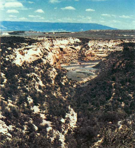
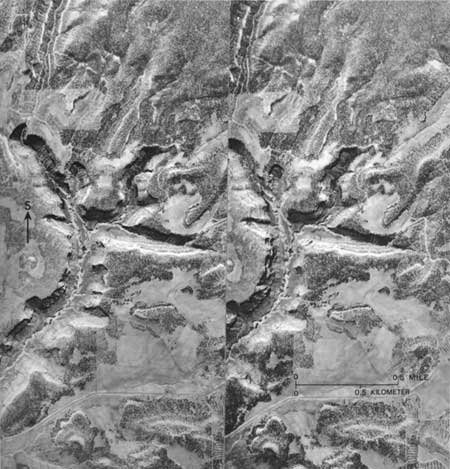
FROM THE INTERSECTION 1-1/2 miles east of the Glade Park Store—and Post Office, let us turn southeast on the recently improved and gravelled Little Park Road around the head of No Thoroughfare Canyon, which was added to the Monument in 1978 (fig. 3). From the intersection it is about 14 miles to Grand Junction by this route. In half a mile we reach the new boundary of the Monument at a minor drainage divide, and as we start down a steep hill beyond we may park on the right and look southeastward across No Thoroughfare Canyon along the Glade Park fault (fig. 58) which has produced the fishtail shape of the head of the canyon, as shown in figures 8 and 59. A different view of the fault and canyon head is shown by the stereoscopic pair of aerial photographs in figure 59.
The Little Park Road closely follows the new Monument boundary around the south end of No Thoroughfare Canyon, either on the Kayenta Formation or Entrada Sandstone, and affords good views into the canyon from several places. East of the southeast arm of the canyon, the road leaves the boundary and goes northeastward about 4 miles to the end of the improved part of the road, but the unimproved part is good, and the lower 5 miles is paved. On my geologic maps36 of the area, I called this road by its older name—the Jacobs Ladder Road.
| ||||
| 39 LADDER AND ROUGH CANYONS |
About a quarter of a mile from the end of the improved stretch, one may turn right on two tire tracks, travel about a quarter of a mile farther, and park near the junction of Rough and Ladder Canyons, where interesting geology is reachable by short walks up Ladder Canyon or down Rough Canyon. About a mile up Ladder Canyon is an interesting abandoned mica mine.37
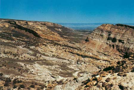
From the left side of the road, about 9 miles northeast of our starting point, we see the view shown in figure 60. About 2 miles farther north, Little Park Road is paved through a suburban housing development all the way to The Redlands; there, we may turn right, cross the Gunnison River, and reach U.S. Highway 50; or we may turn left through Rosevale and reach Colorado Highway 340.
|
| <<< Previous | <<< Contents >>> | Next >>> |
bul/1508/sec12f.htm
Last Updated: 8-Jan-2007