
|
Virginia Division of Mineral Resources Bulletin 86
Geology of the Shenandoah National Park, Virginia |
REGIONAL GEOLOGIC SETTING
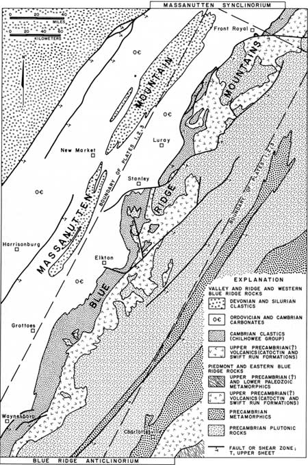
The Blue Ridge mountains in Shenandoah National Park lie entirely within the Blue Ridge physiographic province, the narrow mountainous area between the low-lying Piedmont province to the east and the Valley and Ridge physiographic province to the west. Geologically, the Blue Ridge is situated on the western flank of an extensive linear arch or upwarp extending from southern Pennsylvania into central Virginia or beyond and encompassing the Blue Ridge province and the western edge of the Piedmont. This complex upwarp, the Blue Ridge anticlinorium (Figures 5A, B), is an area of folding and faulting characterized by great uplift that is demonstrated by the presence of billion-year-old plutonic rocks that formed at great depth and which are now exposed along the axis of the anticlinorium. The flanks of the anticlinorium are delineated by a thick sequence of very resistant, metamorphosed volcanic and clastic sedimentary rocks of late Precambrian and early Cambrian age that form the Blue Ridge and a low parallel mountain range about 20 miles east of the Blue Ridge. This resistant layered rock sequence lies unconformably on the plutonic rocks and is the basal portion of the layered rock sequence that forms the Appalachian Mountains of which the Blue Ridge is only a small portion. Younger rocks, mostly of Paleozoic age, overlie the resistant sequence and are preserved in downfolded areas to the east and west of the anticlinorium. In the Piedmont to the east of the anticlinorium these rocks are a series of complexly folded and metamorphosed volcanic and sedimentary rocks intruded by granites and gabbros. To the west the younger rocks are mainly limestones, dolomites, shales, and sandstones of Cambrian through Devonian age and are only slightly metamorphosed and less complexly folded. Limestone and dolomite form the floor of the Shenandoah Valley and sandstone forms the crest of the Massanutten mountain range west of the park; shale underlies the lower slopes of the Massanuttens.
|
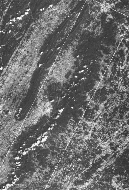
| Figure 5A. Shenandoah National Park and adjacent areas from 600 miles above the earth (LANSAT imagery). The park lies in the dark (forested) mountainous area within the outline of Plates 1, 2, and 3. (click on image for a PDF version) |
|
| Figure 5B. Generalized geologic map of area shown in figure 5A. The Blue Ridge lies between the Valley and Ridge physiographic province to the west and the Piedmont physiographic province to the east.(click on image for a PDF version) |
The trough or canoe-shaped downfold, now preserved as the Massanutten mountain range, is the Massanutten synclinorium (Figures 5A, B) that is the next regionally extensive fold system west of the Blue Ridge anticlinorium. The Blue Ridge anticlinorium and the Massanutten synclinorium are laterally continuous fold systems that share a common flank. Plutonic rocks in the Blue Ridge now occur at higher elevations than the Silurian rocks of the Massanutten mountain range due to vertical up-warping in the Blue Ridge of more than 4 miles (6 km) during Paleozoic time. The intensity of metamorphism and complexity of the folds decreases westward across the Blue Ridge from the Piedmont to the Valley and Ridge province. Faults and shear zones occur in and near the park and appear to be local features, but may be characteristic structures of the Blue Ridge anticlinorium and more extensive than shown on Plates 1-3 and Figures 5A and SB.
Few areas in the Blue Ridge can match Shenandoah National Park for the variety of well-exposed geologic features in the several rock units that are present. Also in few areas are the relationships between the several Precambrian and early Cambrian rock units so well displayed as in much of the park.
| <<< Previous | <<< Contents >>> | Next >>> |
state/va/vdmr-bul-86/sec1.htm
Last Updated: 28-Nov-2007