|
Hubbell Trading Post
Cultural Landscape Report |

|
SITE HISTORY
PHYSIOGRAPHIC CONTEXT
The state of Arizona covers 113,956 square miles and is comprised of three distinct physiographic areas. The northern area is made up of the plateau and canyon regions, the central area includes the high mountain ranges that run in a northwest - southeast direction, and the southern area has low level river plains in the eastern portion and the Great Desert traversed by the Gila River in the west. [3] The Navajo land is all part of the Colorado Plateau, an intensely dissected rocky region of elevations that range from 3,500 feet above sea level to more than 10,000 feet. According to Kluckholn and Leighton, "variations in climate are connected more with altitude than with northern or southern positions. Altitude is the principal determinant of temperature and length of growing season, of rainfall and the character of the growing season." [4] They continue by stating that "although most of the Navaho area lies between 5,000 and 7,000 feet — one must, from the standpoint of livelihood, distinguish four types of topography and 3 distinct climates. Topographically there are flat alluvial valleys, broad rolling upland plains, rugged tablelands, and mountains." [5] "In roughly one-half of the total acreage (at lower elevations) a warm, arid "desert" climate prevails; perhaps two-fifths must be assigned to an intermediate "steppe" climate characterizing the middle elevations, the remainder is mountainous, with a cold subhumid climate. None of these situations is really favorable to agricultural production save where irrigation water is available." [6]
|
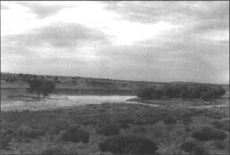
| Figure 4. Pueblo Colorado Wash just west of Hubbell Trading Post, 1993. |
Additional natural constraints associated with agricultural land use include high summer temperatures, sub-zero winter weather, high winds, frequent sand storms, and high evaporation rates. While the recorded annual rainfall may appear average for some years, the "precipitation may have come too early or too late or in the form of snow or sudden downpours." [7] There are also droughts, usually two periods each year (April through June and October through December). There have been extensive droughts for every three to eight years over the past fifty years.
The natural vegetation association for the Ganado area is described as the Colorado Plateau Desert Scrub and it is characterized by pinon pine in the higher moist areas grading downward into a pinon-juniper mix and finally into sagebrush alone. [8] According to Goodman, sagebrush is commonly associated with deep soils while short grasses occur in areas where the shallow soils are predominant and the lower drier elevations contain desert scrub vegetation and drought tolerant grasses including salt bush, greasewood, shade scale, alkali sacaton, and Indian rice grass. [9]
The Navajo lands contain numerous extractive resources including timber, coal, oil, helium, vanadium, uranium, and other minerals. The timber consists of four species which are Ponderosa Pine also known as Western Yellow (Pinus ponderosa), Douglas Fir (Pseudotsuga taxifolia), White Fir (Abies concolor), and Engelmann Spruce (Picea engelmanni). Ninety percent of the timber is Ponderosa Pine. [10] Although these resources have provided the Navajo Nation with a substantial source of income over the past several years, the consequences of extraction have often been highly destructive to and resulted in hazardous conditions within the local environment.
REGIONAL CONTEXT
Prehistoric and Proto-historic Periods
The cultural history of northeastern Arizona, including the Pueblo Colorado Valley, begins with the Paleoindian Period of 9,500-5,500 B.C. Evidence of these primarily big game hunters in northeastern Arizona occurs as limited finds of Clovis and Folsom style artifacts. The earlier Clovis stage is represented by a few isolated Clovis projectile point finds to the south near Sanders, [11] Houck, [12] and the St. Johns/Concho/Lyman Lake vicinity; [13] westward in the Winslow area; [14] and further to the northwest in the general vicinity of Page. [15] Combined, this evidence indicates a wide-spread but light scattering of these early artifacts across this portion of the Colorado Plateau. More numerous examples of the subsequent Folsom stage have also been recovered from the same general areas, including Concho, [16] Mishongovi [17] and Awatovi [18] at the Hopi Mesas, and in the Petrified Forest; [19] all west of Ganado. While Huckell [20] reports a late Paleoindian campsite in the more immediate vicinity of Ganado, no Paleoindian Period sites have been identified within the boundaries of the park.
|
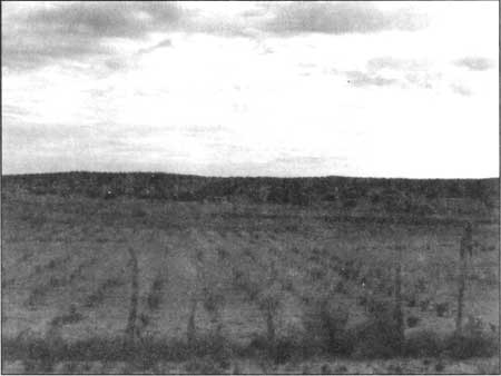
| Figure 5. Agriculture field in nearby community of Cornfields, Arizona, 1993. |
The Archaic Period (5,500 B.C.-A.D. 300) is characterized by a general shift from the earlier big game oriented subsistence to one with more emphasis on gathering and hunting of smaller animals, and, in the later stages, the beginning of maize agriculture. Archaic Period sites are more numerous than the earlier Paleoindian manifestations and have been found throughout the general area. Although no sites of this age occur within the upper Pueblo Colorado Valley, Archaic sites have been located to the south in the St. Johns/Concho region, [21] to the east in the Black Creek drainage near Window Rock, [22] and to the west in Petrified Forest National Park. [23]
The Basketmaker periods followed the Archaic Period with Basketmaker II occurring from A.D. 300-500 and Basketmaker III between A.D. 500-700. Both periods are characterized by a hunting and gathering subsistence combined with increased agricultural pursuits continued from the previous Archaic period. Basketmaker II is characterized by small, shallow pit structures and brush-and-mud surface dwellings. Basketmaker III is characterized by more formal pit houses with associated storage structures and the introduction of both plain and decorated ceramics. Several Basketmaker sites occur in the immediate vicinity of the park [24] and one Basketmaker III component occurs within its western boundary. [25]
As with the Basketmaker Period, the Pueblo Period consists of distinct sub-periods: Pueblo I-V. Pueblo I (A.D. 700-900) sites are characterized as upland sites for habitation with floodplain areas used for horticulture. As populations increased, multi-family villages were established. Site density during this period increased noticeably from the earlier Basketmaker periods and is reflected by the occurrence of three Pueblo I components within the boundaries of the park. [26]
Pueblo II (A.D. 900-1100) is characterized by a significant increase in site density across the region, by the creation of larger villages with kivas, and by more ceramic variability in styles and types. Although site density in general increased during this period, only one Pueblo II component has been identified within the park boundaries. [27]
Pueblo III (A.D. 1100-1300) sites are characterized by larger villages located near floodplains or in sheltered locations and appear more complex and communal in nature, as exemplified by Wide Reed Ruin. [28] Five Pueblo III site components, including Wide Reed Ruin, have been identified within the park boundaries, [29] Wide Reed Ruin appears to represent the terminal prehistoric occupation in the immediate Ganado area as no Pueblo IV or V sites have been identified. [30]
Athapaskan groups may have entered this portion of the Colorado Plateau prior to 1582. [31] and most certainly were west of the Continental Divide by 1620. [32] The descendants of these people include the Navajo and other Apaches. In response to the harsh natural environments they occupied, these people lived in dispersed extended family groups or bands. Although their new environment of the desert Southwest was not as harsh as the northern subarctic climates from whence they migrated, they retained this pattern of living and adapted to the sparse resources of the areas between the western pueblos of Acoma, Zuni and Hopi.
The Sand Dune Site is the earliest Navajo site identified within the park and dates ceramically to the eighteenth century. [33] This evidence supports Navajo traditional history for the age of the site. [34] Navajo occupation of the Ganado area has continued since that time and been an integral part of the history of what is now Hubbell Trading Post National Historic Site.
Spanish Exploration
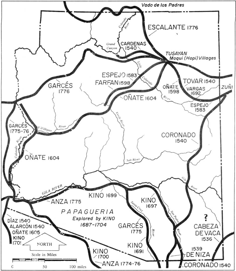
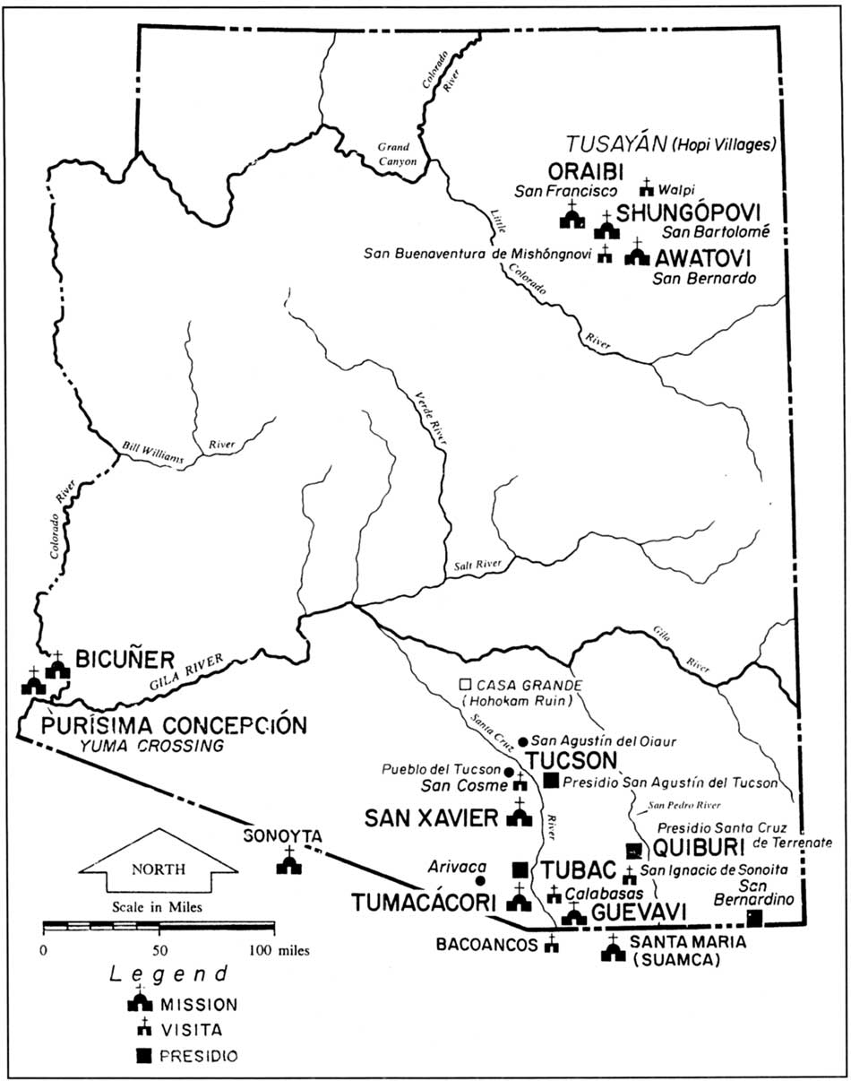
During the second quarter of the 16th century Spanish exploration began to penetrate northward from Mexico into Arizona. Tovar entered the area as early as 1540, Espejo in 1583, Onate in 1598 and later in 1604 and Vargas in 1692 (figure 6). A few Spanish missions and visitas were located within the Colorado Plateau area including San Francisco, San Bartolome, Walpi, San Bernardo, and San Buenaventura Mishongnovi (figure 7).
The first missions at Hopi were founded in 1629 by three Franciscan friars from New Mexico. According to Brugge, it was from New Mexico that most trade and cultural influences flowed into Navajo and Hopi territories. [35] The Mexican War of Independence (1811-1822) resulted in the neglect and decline of the missions along the northern frontier. By 1824 Mexico had established its independence from Spain and Americans from the East began heading westward to explore and expand their trade networks.
|
| Figure 6. Routes of Spanish explorers; adapted from Walker and Bufkin (1986). (click on image for an enlargement in a new window) |
|
| Figure 7. Spanish and Mexican missions and presidios in the Arizona area; adapted from Walker and Bufkin (1986). (click on image for an enlargement in a new window) |
American Military Frontier
By 1840 American hunters and trappers had ventured through the Southwest and were slowly extending the American Frontier to the Pacific Ocean and beginning around 1845 the "U.S. Government realized the need for protection of its citizens, although the country still belonged to Mexico." [36] The Mexican - American War started in May of 1846 and ended in February of 1848 with the Treaty of Guadalupe Hidalgo. The treaty ceded most of Arizona, a large part of New Mexico, and all of California to the United States. "During the period 1849-1886 the Army established no less than 46 camps and forts within the territory...and they were placed for strategic reasons in Mohave, Yuma, Navajo, and Apache country." [37]
As early as 1849 Camp Calhoun (later known as Camp Yuma) had been established on the Colorado River and in 1851 Fort Defiance was located on the northeastern edge of the present state of Arizona. The primary purpose of Fort Defiance was to serve as "a home base for expeditions against the Navajo Indians, but it was also located on the main wagon road from the east." [38] By 1853 the U.S. War Department had ordered surveys for the development of a transcontinental railroad route along the 35th parallel. The Atlantic and Pacific Railroad later followed this course.
As mentioned above, the late 1840's and early 1850's brought several American explorers and surveyors to the Colorado Plateau area with one of the first being Colonel John Washington and his military detachment in 1949 followed by Sitgreaves in 1851 and then Amiel Whipple in 1853. Whipple was surveying the area for a suitable route for the railroad. [39] In 1855 Captain Edward Beale led his expedition party through the area and Captain Joseph Ives of the Topographical Engineers passed through the area in 1858. The primary routes that were established through the area passed by the Zuni, Fort Defiance, and Hopi village areas (figure 8).
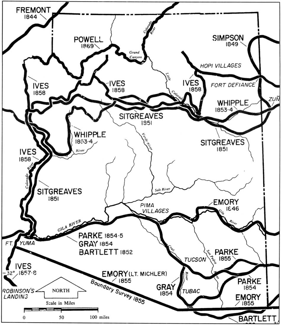
|
| Figure 8. Early exploration routes into the Arizona area; adapted from Walker and Bufkin (1986). (clik on image for an enlargement in a new window) |
By the late 1850's a number of stage lines began operation within the Arizona area. However, the majority of these were located in what is now the southern portion of the state. In 1866, the Santa Fe Stage Company established a route from Prescott to Denver and Kansas City. The route was located south of the Colorado Plateau area as it follows the lower portion of the Little Colorado River. This was the first commercialized transportation route in the vicinity of the Ganado area. By 1870 Peterson notes that "an express carrier had first built a shack at the crossing of the Little Colorado River which later became St. Johns". [40] Additional routes were established throughout Arizona and the Southwest during the last half of the nineteenth century (figure 9).
Arizona was first claimed as a territory of the Confederacy in February 1862 by President Jefferson Davis and Mesilla was selected to serve as the seat of government. One year later in February 1863 the U.S. Congress passed an Act to create the territory of Arizona with boundaries approximately following those of today with the addition of part of what is now lower Nevada. It was not until 1863 with the creation of the Arizona territory that Ganado was no longer under New Mexican administration, but Navajo affairs continued to be dealt with from Santa Fe. [41] The first territorial governor arrived in 1864 and established a temporary seat of government at Fort Whipple in the Little Chino Valley. The capitol was moved to Prescott and later to Tucson in 1867. The year 1877 resulted in the relocation of the capitol to Prescott where it remained until 1889 at which time Phoenix became the permanent seat of government.
Establishment of the Navajo Reservation and the Licensure of Traders
Numerous studies were reviewed regarding the Navajo trade network, the early establishment and growth of the Navajo reservation lands and the eventual licensure of traders located on the Navajo Reservation. This information has provided valuable insight into J.L. Hubbell's motivation, business acumen, and foresight into the commercial growth potential for a trader who carefully sites his trading post and cultivates his relationships with both the local community and the various bureaucracies of the U.S. government.
The earliest Navajo trade was with Spanish settlers and according to Brugge, these trade relations were documented in official reports at least as early as the 1700's. [42] William Adams notes that "extensive trading with neighboring peoples is a long-established feature of Navaho life Navaho trade with Anglo-Americans began, in the early 1800's. First contacts were sporadic and perhaps often accidental. Formal trading relations were first established with the newly colonized Mormon settlements north and west of the Colorado River in the middle of the 19th century. [43] "The development of this relationship was largely coincident with the rapid expansion of the Navahos occasioned by the Carson campaigns of 1862-63..." [44]
Adams goes on to state that it is uncertain as to how dependent the Navajo people became upon their early trade relations as "their subsistence agricultural and livestock economy flourished largely unchecked during much of the (early) 19th century, and it seems likely that the items for which they traded were chiefly in the class of luxuries, so that no functional interdependence at the subsistence level developed." [45] He then points out that a substantial turning point occurred with regard to commercial relations and the Navajo following their period of military exile at Bosque Redondo (1864-1868) and the 10 year treaty period that followed the return to their homeland. He describes the trading post system as having its roots in two distinct historical developments. "In the eastern area, beginning at Fort Defiance, it was a natural and perhaps inevitable outgrowth of the rations system; the first traders were, in fact, army "sutlers" (figure 10). They began by encouraging the Navahos to bring in their surplus wool to trade for extra rations at the ration depot, and ended by quitting Government service to make a full-time specialty of trading for Navaho wool." [46] J.L. Hubbell is noted to have started in the trading business while working at Fort Wingate as a clerk for a sutler, Mr. Coddington. [47]
"Farther to the west, trading posts were a direct outgrowth of the earlier, friendly trading relations between Navahos and Mormons beyond the Colorado River. For a longtime Navaho-Mormon trade was a sporadic affair, conducted by occasional trading expeditions sent out by both parties." [48] Early on many of the trading posts were transient enterprises, often nothing more than tents or wagons that frequently changed not only location but ownership as well. By the late 1860s fixed trading posts were becoming more common on the reservation lands and the process of licensure was clearly established and supervised by the Commissioner of Indian Affairs. According to Youngblood, "the supervision of Indian trading is one of the earliest forms of regulatory activity engaged in either by this Government, or its predecessors, the Colonial governments. The authority of the Federal Government to regulate Indian trading is amply provided for in our Constitution and laws." [49]
|
| Figure 10. The Navajo region; adapted from Bailey and Bailey (1986). (click on image for an enlargement in a new window) |
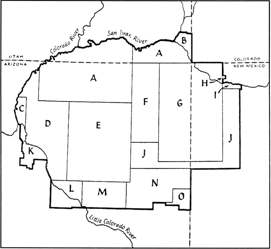
As early as 1796 Congress authorized the establishment of trading posts however the licensure of traders did not become a major feature of Indian policy or an institution of true importance until the Indian removals of 1820-1840. [50] Following the Kit Carson campaigns against the Navajo people and their subsequent removal to Ft. Sumner (Bosque Redondo) where they remained for four years, they were returned to their homelands and the Navajo Reservation was established in northwestern New Mexico and northeastern Arizona. As defined by the initial treaty "the Navajo reservation included only 3.5 million acres, a small fraction of their former domain." [51] The inadequacies of the newly established reservation boundaries were identified immediately (figure 11). The first trading post opened at Fort Defiance in 1868 soon after the establishment of the Navajo's first Indian Agency. It was also in 1868 that Indian tribes "won the right to approve or disapprove all applications for traderships and began to levy taxes on trading enterprises." [52]
Utley noted that "the physical plant and all improvements on it were considered government property by virtue of their location on an Indian reservation. The trader paid for them but did not own them." [53] In addition, when a trading post changed hands the plant was listed as good will equal to the seller's valuation of the plant. [54] The trader selected his stock to meet native demands and adjusted it accordingly over the years. During the early years the traders carried the basic staples including sugar, coffee, flour, and tobacco as well as fabrics, blankets, trinkets, and baubles. Utley states that the articles "demanded by the Indians during these early years were those that fitted conveniently into the aboriginal scheme of life., superior substitutes for articles already in use. They improved, without fundamentally changing, the old way of doing things." [55]
| |||
|
Figure 11. Navajo Reservation boundaries; adapted from Underhill (1956). (click on image for an enlargement in a new window) Dates various parts of the reservation were added:
|
By the 1880's the trader began influencing a noticeable change in the character of commodity demand as he convinced the Indians to purchase a new variety of items and instructed them in their use. "Many articles a few years ago were not called for at all, such as fancy soaps, articles of kitchen furniture, dried and canned fruits, and all kinds of groceries" as well as farm implements and new items of hardware. [56] "Although trade was sometimes conducted by direct barter or cash purchase, nearly every trader carried his Indians on credit for most of the year. In part, this resulted from the seasonal nature of the tribal economy, for the products of most tribes (eg. furs, grain, wool) had seasonal yield." [57]
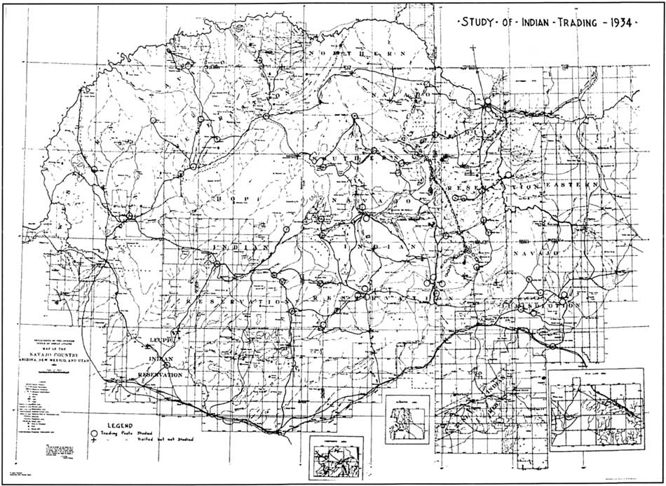
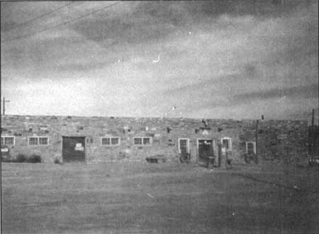
The importance of trading posts increased with time as did their numbers in and immediately adjacent to the Navajo reservation lands. In 1876 there were five trading posts in operation in and around the Navajo Reservation and by 1890 that number had increased to nearly 40 with the number increasing steadily until around 1930 (figure 12). [58] Utley notes that "unlike the business on other reservations, the Navajo trade continued to thrive and expand in the 20th century. By 1943, probably the peak of the trade there were 146 trading posts on or near the reservation of which 95 were licensed by the government. [59] It should be noted that only those trading posts operating on the reservation were licensed and that the federal government had very limited authority of those posts located outside the reservation boundaries.
|
| Figure 12. Navajo country, 1934; taken from Youngblood (1937). (click on image for an enlargement in a new window) |
Late 19th and Early 20th Century Development of Arizona Territory
By the early 1880's all of the principal towns within the new territory were connected by stage service. The introduction of transcontinental railroads was soon to follow with the Southern Pacific Company providing service in 1877 across the southern portion of the territory. The Atlantic and Pacific Railroad (now the Santa Fe) had pushed west from Albuquerque to Winslow by 1881 and was completed across the territory by 1883 thereby opening up the area to trade and commerce on both regional and national levels. [60]
"According to Underhill, it was the building of the transcontinental railroad (1881-82) which established the trading post as a permanent fixture on the Navaho Reservation. It assured the territory a steady and unlimited volume of American manufactured goods at moderate freight cost. At the same time Navaho wool and blankets could now be transported economically to Eastern markets. Gallup, railhead of the Santa Fe in 1882, became the great depot from which most of the Navaho country was supplied-as in fact it still is. Such a situation inevitably led to the development of a flourishing wholesale mercantile business specializing in trading-post supply." [61] Numerous secondary centers sprang up along the railroad as refueling and watering stations for the early trains and later developed into small depots and distribution points that served the more remote areas of Arizona. From east to west these depots/distribution points included Holbrook, Winslow, Flagstaff, and Williams. Improvements in transportation and the resulting effects on commercial and agricultural development led to a dramatic increase in the population of Arizona. During the 1870's the population increased from 9,658 to 40,440 and this number more than doubled following the completion of the railroad as the 1890 population had risen to 88,243. [62] The Navajo population was also on the increase during this period as it rose from a low 8,180 in the mid 1860's to 20,500 by 1897. [63]
By 1890 Arizona's agricultural and mining operations increased in importance and an internal transportation network gained new focus. Prior to the 1890's the driving force behind the development of transportation in the Arizona territory was the desire to establish satisfactory routes to California. By the 1900's the area was criss-crossed with rough unimproved wagon roads and trails connecting the various towns and trading centers with the railroad lines. By the 1940's the Roads Division of the Navajo Agency maintained "nearly 1,300 miles of primary roads, about the same mileage in secondary roads, and 700 miles of truck trails." [64] Of the 3,000 plus miles of existing roads the highway engineer noted that not over 150 miles could be kept open for traffic under extreme weather conditions. [65] Improvements to the roads on the reservation were initiated during the 1950's with approximately 371 miles improved between 1951 and 1958. This included improvements to Navajo Route 3, later named Highway 264 that passes through Ganado.
Comparative Summary of Other Hubbell Landscapes and Area Commerce
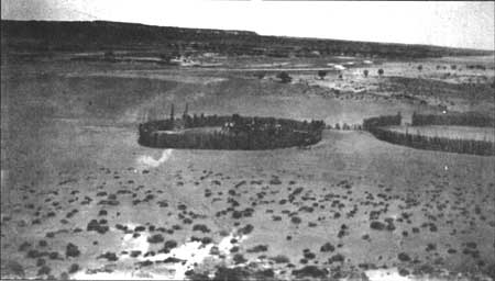
John Lorenzo Hubbell's business ventures within the Navajo lands started simply enough in the Fort Defiance area where he was employed as an interpreter, sutler's aid, and troubleshooter beginning in the early 1870's. [66] By 1876 Hubbell established his first trading post operation in the valley of the Pueblo Colorado Wash near the post built and operated by Charles Crary sometime around 1871. At this site, in the immediate vicinity of the present day Ganado Lake and Dam Hubbell built a new stone and log post. Sometime around 1878 or 1879, Hubbell acquired another trading post from William Leonard. Leonard had developed the post around 1874 or 1875 and it was located two miles downstream from the Hubbell and Crary posts in an area known as Pueblo Colorado or Red Town. This site was to become the best known of the Hubbell trading posts and would serve as the Hubbell family homestead and base of operations for the next eighty years.
Soon after establishing his post at Ganado Hubbell set about acquiring other trading operations on and adjacent to the Navajo Reservation. Hubbell's sons Lorenzo and Roman also acquired and established numerous posts and business ventures throughout the reservation. By 1912 Hubbell had started posts at Government Dam, Cornfields, Cedar Springs, Nazlini, Steamboat Canyon, Oraibi, Chinle, Black Mountain, Greasewood, and numerous other sites. During his late teens, Lorenzo was sent out by his father to operate and manage posts at Oraibi and Keams Canyon. Within a few years Lorenzo had started and managed posts at Pinyon, Big Mountain, Tinebito, and Na-ahtii Canyon. Around 1920 Hubbell and his partner C.N. Cotton closed their trading post at Chinle and Hubbell further diversified his operations as he turned over management of posts such as Cedar Springs to his son Lorenzo and set about acquiring farms at Pinyon Springs and Farmington, Sometime prior to 1920 Hubbell acquired 150 acres near Zuni at Pinyon Springs. According to Dorothy Hubbell they rented or leased the place, cultivated beans on the land and kept a small store. A few years later Hubbell purchased and operated two farms at Farmington. One was 80 acres and the other about 120 acres. On these farms Hubbell raised apples, grapes, and pears to supply the numerous trading posts. Hubbell also owned numerous sections of rangeland which he subsequently leased over the years.
From 1915 through 1918, while both J.L. and Lorenzo were busy operating and managing trading posts throughout the reservation, Roman was operating his father's large warehouse in Gallup. Roman later returned to Ganado to assist in the management of the farm operation and during the late 1930's he and his wife Dorothy took on a variety of business endeavors including a tour operation which they ran from 1937 to 1945. Lorenzo Hubbell Jr. died in 1942 and many of his trading post operations were taken over by his younger brother Roman and Roman's wife Dorothy Hubbell. These included the posts at Pinyon, Tinebito, Na-ahtii Canyon, Oraibi, Black Mountain, Marble Canyon, Big Mountain, as well as the wholesale/retail warehouse in Winslow. Other business operations owned and managed by Roman and Dorothy included a retail outlet on Route 66, a motel, cafe and store at Marble Canyon, and a service station and garage with a franchise from DeSoto and Plymouth. Outside of the Arizona area Dorothy and Roman owned and operated Curio Outlets in Santa Monica, Long Beach, and Hollywood, California. The majority of the Hubbell land and business holdings were sold by Roman and Dorothy during the early 1950's although they retained the Hubbell trading post and homestead at Ganado.
CULTURAL LANDSCAPE HISTORY OF THE HUBBELL TRADING POST AND HOMESTEAD
Early Settlement
Although the landscape associated with the Hubbell Trading Post has undoubtedly undergone some substantial changes over the last several thousand years with regard to climate and vegetation, the perennial flow of the waters in the Pueblo Colorado Wash has served to attract both man and beast and encourage human settlement. Within the boundaries of the Hubbell Trading Post National Historic Site, approximately twelve prehistoric archeological sites have been identified. At the present time there have been no Paleo-Indian period (ca. 9500 B.C. - 5500 B.C.) or Desert Culture period (5500 B.C. - 0 A.D.) sites located within the park boundary, however sites from both of these cultural periods have been located in the surrounding region.
Numerous Anasazi period (A.D. 0 - A.D. 1540) sites have been located within the boundaries of the park and range from Basketmaker II (A.D. 1 - A.D. 500) through Pueblo III (A.D. 1100 - A.D. 1300). For more information regarding these sites the reader is referred to the National Register of Historic Places Nomination Form — Hubbell Trading Post National Historic Site, Ganado, Arizona. The locations of identified prehistoric archeological sites are not included in this report due to the need for confidentiality.
Several early or historic period Navajo (A.D. 1540 - present) sites have also been located within the park boundaries. Through archeological excavations and testing projects the locations of two hogans (possibly dating from the mid-eighteenth century) and numerous associated features including corrals, pens, hearths, and ramadas have been identified. The possible site of an early twentieth century hogan was also located by the Chaco Center Remote Sensing Team. Locations for these early Navajo sites are included on the site base map included in this report.
Sometime around 1874 or 1875 a trader named William Leonard came down from Fort Defiance and established a trading post operation on the banks of the Pueblo Colorado Wash at the present site of the Hubbell Trading Post. The trading post and its associated Navajo community was known as Pueblo Colorado (Red Town). The name was taken from a nearby pueblo ruin called kin dah Lichi'i (Red House in the Distance). [67] While some early maps of the area refer to Pueblo Colorado (figure 13), the name was changed in the late nineteenth century about the time the first post office was established to avoid confusion with the town of Pueblo, Colorado. The community's name was changed to Ganado in honor of Ganado Mucho, the last peace chief of the Navajos. [68] Leonard apparently recognized the potential of the site with its perennial water flow, its close proximity to nearby Fort Defiance, and its location on one of the few east-west wagon routes through the area. No additional information has been located regarding this early period of site development.
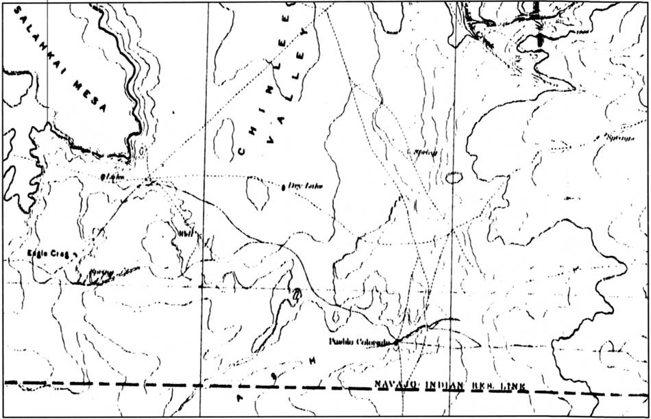
|
| Figure 13. United States Geological Survey topographic map, 1892 Ft. Defiance, 1:25,000 showing Pueblo Colorado, which was later renamed Ganado. (click on image for an enlargement in a new window) |
|
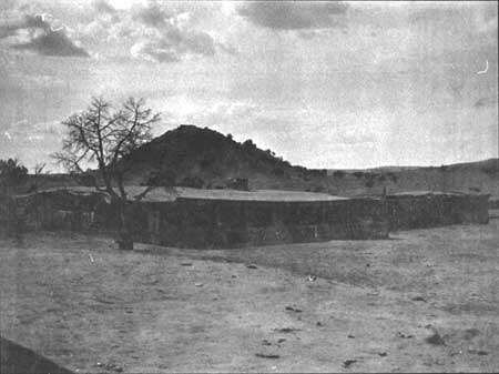
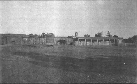
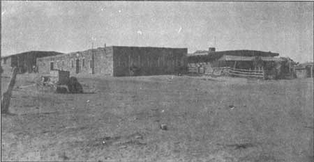
| Figure 14. Old Leonard Trading Post following Hubbell's acquisition of the property. (HUTR 2122). |
Expansion and Development of the Ganado Trading Post (1878-1894)
In 1876 John Lorenzo Hubbell relocated from Fort Defiance and built himself a small stone and log trading post in the immediate vicinity of what is now Ganado Lake. Hubbell had worked as a clerk in several trading posts throughout the Utah and Arizona territories and also served as an interpreter and sutler's clerk at nearby Fort Defiance. By 1878 John Lorenzo Hubbell purchased the William Leonard trading post and within a few years he had begun to expand and develop the trading post operation and its adjacent lands (figure 14). Hubbell originally utilized the roughly constructed Leonard buildings. In his "Homestead Proof — Testimony of Claimant" [69] Hubbell states:
My house was built on the land about July 1878; and established actual residence therein at the same time; improvements consist of dwelling house 12 rooms; store building, warehouse, stable, blacksmith shop, fencing, etc. value about $5000.
|
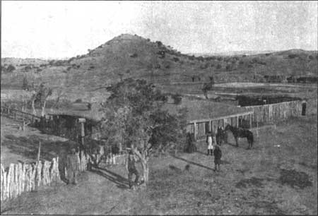
| Figure 15. The Leonard Buildings 1895. Photograph taken by Ben Wittick. (HUTR 8632). |
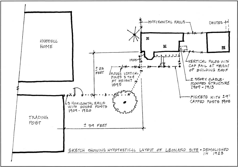
Early photographs of the trading post show quite an extensive complex of structures and enclosed spaces and based on the above reference it might be inferred that the majority of the development was constructed by J.L. Hubbell following his acquisition of the operation from Leonard (figure 15). While an 1869 map accompanying the Annual Report of the Commissioner of the General Land Office and a later 1879 map by the Rand McNally Co. identify Pueblo Colorado, Arizona and some nearby trails, mines, and springs neither includes structural developments or buildings. The same is true of an 1882 U.S. Geological Survey Topographic Quadrangle map that shows the community of Pueblo Colorado, Arizona and a few unimproved roads. However, it does not depict individual structures or areas of development (figure 16). It is historic photographs taken during the 1890s and early 1900s that provide us with glimpses of the original Leonard complex following Hubbell's occupation of the site (refer to figures 14 and 15). It has been hypothesized that the northernmost building within this complex was the original Leonard building and that the buildings to the south were constructed by J.L. Hubbell. However, any changes or modifications made to the original Leonard design and layout by J.L. Hubbell have not been confirmed through documentation. Archeological investigations of this significant area within the Hubbell landscape may provide valuable information regarding the building chronology of the original trading post complex. Using available archeological data and the available historic photographs a sketch of the potential layout or footprint of the Leonard/Hubbell trading post site has been prepared (figure 17).

|
| Figure 16. Early roads and trails in vicinity of Pueblo Colorado (Ganado); 1892 United States Geological Survey topographic map, Ft. Defiance, 1:25,000. (click on image for a enlargement in a new window) |
|
| Figure 17. Hypothetical schematic layout of early Trading Post buildings, Leonard/Hubbell Trading Post. (click on image for a enlargement in a new window) |
Available information regarding the development history of the site reveals that in addition to Hubbell's modifications to the old Leonard buildings he initiated construction of the office and rug room sections of the existing post as early as 1883. [70] One of the many depositions attached to Hubbell's Homestead Application states that E.S. Clark visited the Ganado tract in 1882 and improvements had been made "including dwelling house, store building, warehouse, stable, wells, enclosures and other improvements of a substantial nature..." [71] It is unclear as to whether the improvements mentioned are all in the immediate vicinity of the Leonard post or if the warehouse and enclosures mentioned might be new and separate developments.
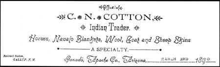
While J. L. Hubbell started his business at Pueblo Colorado, Arizona as the sole owner of the trading post operation, documentation reveals that in 1884 he brought in partners one of whom was a Mr. C.N. Cotton to assist with the trading post. By 1885 the entire business was under the sole ownership of Mr. Cotton as is evidenced by two letters written on June 22nd, 1885 by J.L. Hubbell that state "I have this day sold out my interest in the Pueblo Colorado store to C.N. Cotton..." [72] It seems that any improvements made to the property during the years 1885 to 1894 were undertaken by Cotton as he remained in residence at the Ganado store while Hubbell served as sheriff of nearby St. Johns (1882-1886) and the Hubbell family took up residence in a variety of towns including St. Johns, Arizona and Albuquerque and Gallup, New Mexico. Hubbell's involvement with the trading post operation at this time, if any, has not been determined.
During the period 1885 to about 1894 all correspondence from the Pueblo Colorado trading post operation in Ganado was prepared with Cotton's signature and many of the letters were prepared on Cotton's business letterhead (figure 18). A review of the trading post's correspondence files reveal that Cotton was not only struggling to retain the homestead before the lands were officially surveyed by the government but he also addressed the need to get irrigable waters to the site. Although Hubbell immediately began making improvements to the property following his acquisition of the post in 1878 and seemed intent on filing a land claim, the 1880 boundary expansion of the Navajo Reservation was drawn to include the 160 acre tract surrounding the trading post. According to Peterson, Hubbell and Cotton joined forces in August of 1890 and appealed to the Commissioner of Indian Affairs to have "Cotton's homestead excepted from the executive order of 1880, which had extended the reservation to include their trading post." [73] Cotton then wrote other letters to Washington and was notified that the "executive order was within legal rights and that it made no exception from the withdrawal from sale and settlement of tracts settled upon or occupied prior to 1880." [74] The response also noted that "since the land had been unsurveyed Cotton had acquired no vested right to it." [75] Little else was done until the end of the decade regarding actions to secure title to the land although Cotton expressed his frustrations in a letter he addressed to the Honorable C.E Vandever, U.S. Indian Agent, in which he states that he "had hopes that the Indian department would consider my case, and not compel me to take out a license as my ranch was taken up or located about the same time that Mr. Keams located at Keam's canon which at that time was not on the Navajo Reservation. But since that time the Reservation has been extended taking up both places." [76]
|
| Figure 18. Letterhead used by C.N. Cotton while operating the Trading Post. |
A separate letter was prepared by Cotton on April 5th, 1889 and mailed to the Honorable Commissioner of Indian Affairs. He references early letters that explain how he is situated at Pueblo Colorado and then "most respectfully" asks for a license to trade at Pueblo Colorado. [77] A letter written by Cotton a few days later includes one of the earliest known references to the proposed diversion of waters from Pueblo Colorado Creek. Cotton states:
perhaps Mr. Marshall considered I was meddling with your business when I suggested that the Pueblo Colorado Creek would be a good place for you to put up a dam. And I also remarked that Chin I lee (sic) was too sandy to make a permanent dam. I said this and don't deny it. And cannot see that I could possibly injure anyone by making such a statement. I do not know of any plot or scheme to your detriment. Nor would I consider such a thing. If I've got any complaint to make I'll come to you personally and make it. [78]
While historic photographs and documentation sources reveal that some improvements were made to the property during Cotton's ownership and management period, it appears that the major developmental period began after Hubbell regained ownership of the property. It appears that Cotton possibly undertook fencing of sections of the property, possibly to contain some of his livestock including cattle, horses, and sheep. In a letter dated October 1885 Cotton places an order for miscellaneous items that includes "1 wire stretcher for putting up wire fence". [79] About this same time there are several letters referencing his purchase of work cattle, Jersey cows, and other stock as well as orders for a variety of magazines and periodicals such as Country Gentleman, American Sheep Breeder, Harpers, and Arthurs Home Magazine.
Based on tree-ring information, the roof of the trading post's office and rug room originally constructed in 1883 was replaced in 1889 and "the store and wareroom were added...bringing the present structure to its existing floor plan." [80] Construction began on the core section of the barn sometime around 1893 and this single story block was probably completed in 1895. [81] No additional information has been located regarding the historic landscape and additional site improvements or developments for this early period. According to Hubbell's granddaughter LaCharles Eckel, J.L. Hubbell's partnership with C.N. Cotton was dissolved in 1894 and Cotton moved to Gallup to take over the wholesale business which had been established. [82]
Zenith Period of the Hubbell Trading Post and Farm (1895-1922)
Although some accounts such as the one above by LaCharles Eckel mention that Hubbell had regained full possession and management of the Ganado trading post by 1894 or 1895, Hubbell himself contradicts these statements. In his 1907 Homestead Application, J.L. Hubbell provided a deposition that described his trading business and ownership of the Ganado property as follows:
...affiant says that the store buildings upon said tract and referred to in said letter have been owned and occupied by himself and his employees exclusively for the last ten years, and that from the year 1885 until about the year 1897 there was associated with affiant in said business, one C.N. Cotton and that prior to the year 1885, to wit, from the year 1878, affiant owned and conducted said place exclusively and that during all of the time since the year 1878 affiant has been the exclusive owner of said tract of land and of the improvements thereon and has conducted the business of trading with the Navajo Indians thereon wholly and entirely in his own name and in his own right, save and except for the period between 1885 and 1897, when he was associated with C.N. Cotton as aforesaid; that the use made of the store buildings and warehouse is in the carrying on of an Indian trading business; that affiant buys wool, goat pelts and sheep pelts, silverware, blankets and other articles of Indian manufacture direct from the Navajo Indians and sell the same anywhere he can find a market. [83]
The year 1897 was definitely a year of improvements around the trading post. This also marked the beginning of an intensified period of trade with the Navajos, especially the weavers. [84] Wilkins also noted that the Hubbells began commissioning the rug paintings, buying greater quantities of rugs and heavily marketing Navajo textiles during this time. [85] Construction began on the first of Hubbell's bread ovens, several of the corrals and sheep pens located south of the barn were built using pole and beam construction techniques and an extension was added to the south side of the manager's residence sometime between 1897 and 1900. [86] Using tree-ring information it has been determined that several rooms now part of the primary Hubbell residence may have preceded the construction of the main house by two or three years. These early rooms might have included the dining room and the root cellar. [87]
Also visible in a series of photographs taken between 1895 and 1897 are several smaller structures including a well house and watering trough immediately east of the old trading post complex, a matanza to the west of the old trading post buildings, a continuous fence connecting the old complex to the new stone trading post building, and at least two unidentified shed type structures. These early photographs also reveal the sparse vegetation throughout the area immediately east and north of the development areas. While there are some sizeable trees to the southwest of the Leonard building, only a few scraggly junipers represent the limited vegetation immediately adjacent to the trading post (figure 19).
In December 1899, Agent Hayzlett provides a written reference describing Hubbell's property:
He (J.L. Hubbell) started and occupied the place expecting to make a permanent home, has improved and expended considerable money on it, I should think in the neighborhood of $10,000, and if an act can be passed that will secure to him a title he will put more Improvements on it and thereby give the Indians in the part of the country a daily object lesson, in the way of farming and stock raising. As it is he keeps some hogs, cows, and hundreds of chickens, and gives Employment to many Indians during the year. [88]
The following year Hubbell began work on the construction of his residence located immediately west of the new stone trading post building. Like the barn and trading post, the new house was constructed of locally available stone and timbers from the Defiance Plateau 15 miles east of Ganado, Tree-ring information reveals that the house was roofed in 1901 and this included the main hall and the 5 flanking rooms. [89] According to Stewart Culin, Hubbell moved into his new residence shortly thereafter. Culin's 1902 journal notes, "Mr. Hubbell had just completed a new house at Ganado, into which he had moved on the day of our arrival." [90] Following the construction of the new residence, the fence running from the new trading post building north to the old complex was changed from vertical juniper posts to a double post and rail fence (figure 20) and a wood plank boardwalk was constructed to connect the new residence to a privy located along the edge of the wash to the west (figure 21).
|
| Figure 19. The Leonard buildings around 1897. Photograph taken by Ben Wittick. |
Although Hubbell undoubtedly recognized that he was sitting on one of the best pieces of arable land in the Pueblo Colorado Valley, he hesitated to initiate further improvements to the property until he was able to obtain secure title. Actions continued in Washington to facilitate his eventual acquisition in title of the 160 acre homestead. Bill 4001 was introduced in the House of Representatives on December 13, 1899 for the purpose of excepting from the executive order of 1880 "all lands claimed by actual settlers or persons to whom valid rights attach." The bill was vetoed. In January 1902 it was reintroduced and was signed by the President on July 1 of the same year. At this point Hubbell was encouraged to file his homestead application, however he could actually do no more than file a letter of intent as the area had not been officially surveyed. [91]
|
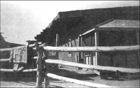
| Figure 20. Detail of fence construction between Hubbell home and Trading Post, around 1913. (HUTR 4502). |
|
| Figure 21. Plank boardwalk at Hubbell home, around 1903. (HUTR 4515). |
It seems that once Hubbell began to realize that clear ownership of the Ganado homestead was soon to become a reality he began to move forward with his plans for improving the land and developing his irrigation system. During his 1903 visit to the Ganado area Stewart Culin noted that "Hubbell's latest enterprise is the establishment of a steam pumping plant to raise the water of the Pueblo Colorado to the mesa above the creek adjacent to his house and irrigate a tract of some 160 acres." [92] A few months later in September 1903 Hubbell writes..."I have at last commenced my irrigation work and hope to have it concluded in about two months. I have changed my plans for the reason that I find that machinery would be to (sic) expensive to run. I am putting in an irrigating ditch and hope to have the water on the land at the latest in sixty days. I am going to be busy all winter and was in hopes of being able to visit Chicago this fall, but it is impossible." [93]
Almost three months later Hubbell again wrote..."I finished building my ditch which cost about double the amount that it was estimated. I hope to be able to finish the reservoir with less expense. But irrigating ditches and reservoirs seem to be a hard matter to estimate the cost with any degree of accuracy." [94] By January of 1904 Hubbell was making plans for clearing the land and preparing his fields for cultivation. On January 18, 1904 he writes to the John Deere Plow Company:
please ship the following goods advertised in your Catalog No. 28...2 timber land plows, 2 extra shares, page 6e of Cat.No.28; 1 Deere pipe lever bar harrow 15 ft. cut three
sections, page 189 of catalogue 28; 1 disc harrow 12 discs _?_ inch with seeder attachment as nearly like cut enclosed or your own selection; a 3 cultivator with solid shields, page 128 cat. No. 28 Walking Cultivator. All plows right handed. [95]
In the same letter, Hubbell describes additional equipment that he needs and mentions crops that he intends to plant and will need seeders for including alfalfa, wheat, barley, oats, rye, and sorghum. He also mentions that he has recently installed his irrigation ditch and plans future expansion of same. [96] Hubbell also provides us with a general description of the land that he has set forth in clearing when he writes another letter to the John Deere Plow Company dated February 8, 1904:
I note what you say about plows. Nevertheless I wish to have at least one of the timber land plows that you advertise on page 63. I have quiet (sic) a lot of land to break that has had quiet a lot of timber on it. You can send me two more plows of 14 inches of your selection for ordinary land, the strongest and best that you have in stock, that can be used with either two or three horses. Send an evener for four horses with the timber plow. Two eveners for the other two plows for three horses. [97]
The reference to the land that he plans to break having quite a lot of timber on it is supported by a statement provided by Friday Kinlichinee, a former Hubbell employee who was interviewed by park staff in 1970. Mr. Kinlichinee was born in March of 1895 and he states that at the time he was a little child "this fenced in area was full of juniper trees growing close together and I was present when they felled them." [98]
Additional information is provided by Stewart Culin regarding Hubbell's early progress in clearing and cultivating his fields and implementing his newly constructed irrigation system. Culin's journal entry made during his trip through Ganado in 1904 noted:
Mr. Hubbell took me over to see his reservoir. It covers some three acres and has an extreme depth of eight feet. With it he can irrigate his tract of 160 acres. The reservoir was probably two-thirds full, and later in the day it was reported entirely full, and the ditch still running.
Mr. Hubbell had the men and team at work preparing the beds for alfalfa. He had potatoes and corn in and doing fairly well. They promised a good crop with the present rain. Mr. Hubbell's irrigation scheme which involved bringing the water from the Pueblo Colorado to his dam in a ditch two miles long, cost him about $14,000. It is the most important improvement of its kind in northern Arizona, and suggests the possibility of a similar work along the Pueblo Colorado to Holbrook. [99]
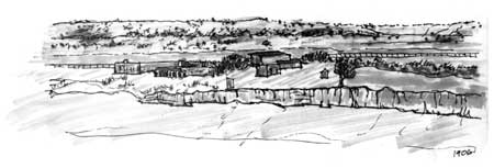
Stewart Culin again visits Ganado in 1905 and notes:
I had not visited Ganado since 1904. I found no particular changes, but everything looked prosperous. We drove past a large field of green alfalfa, which I was told later, had been frost-bitten, and saw the newly-planted fruit trees. [100]
A photograph dated 1913 reveals the expansiveness of Hubbells fields by that date as well as "Kentucky" style fences enclosing them (figure 22). The boardwalk running from the residence to the privy along the wash can no longer be discerned. A photograph taken in 1905 reveals the yard around the west side of the residence with the bread oven but again does not show any constructed walks or landscape treatments (figure 23). Hubbell's Homestead Application dated July 26, 1907 provides a great deal of information regarding his agricultural developments on the property, his business relationship with C.N. Cotton, and his occupation of the homestead. [101] An attached "Homestead Proof-Testimony of Witness" submitted by Jose Manuel Jaramillo as witness responds to the question "how much of the homestead has the settler cultivated and for how many seasons did he raise crops thereon?" by stating "settler has cultivated about 140 acres of the homestead and raised crops thereon four seasons." [102] According to this information, Hubbell began cultivating his fields in 1904. Additional descriptions are provided by Matthew Howell who states:
"Mr. Hubbell has established an irrigating system upon said land and has thereby brought under cultivation about one hundred and forty acres of land, upon which he has an orchard and vineyard and raises crops of rye and alfalfa; that said irrigating system consists of a main irrigating ditch about two and one-half miles in length, terminating in a reservoir, through which all of said land is irrigated by means of laterals. This irrigation system has been gradually developed during the last five years. [103]
J.L. Hubbell also includes a sworn deposition as part of his Homestead Application and in it he states the following regarding his use and development of the land:
...the said tract of land has been used and occupied by affiant as his home to the exclusion of every other place since the year 1878, except that he has been compelled, on account of the health of his wife and for the purpose of educating his children, to be absent temporarily at different times, and that affiant himself has never been absent from said place for over a month or six weeks at any time; that affiant has cleared and leveled about one hundred and forty acres of said land and prepared the same for cultivation at great expense, to wit, the sum of about ten thousand dollars, including the planting of an orchard and vineyard thereon; that he has constructed from what is known as Pueblo Colorado Creek an irrigating ditch which, when constructed, was five feet wide at the bottom and seven feet wide at the top for a distance of about two and one-half miles....; that at the terminal point of said ditch affiant has constructed a reservoir covering about five acres and so situated that by means of laterals running therefrom he can irrigate every part of the one hundred and forty acres so brought under cultivation by him, and that there are many laterals running from said reservoir to every part and parcel of said irrigated tract; and that upon said tract he has about twelve hundred trees about three years old, a vineyard, and that for four years last past he has raised large crops of rye, alfalfa and garden products generally.... [104]
Shortly after Hubbell completed the main irrigation canal system he began looking towards the government to take over its long term management and operation needs (Appendix 1). A letter from Hubbell to H.F. Robinson dated March 1909 refers to his earlier proposals made to the Commissioner of Indian Affairs and he states that:
I will turn over to the Gov. all my Ditches flumes and improvements on the ditch which runs to my farm. While you were doubtful as to whether the indians would use the water or not. I have faith in their doing it. Will also guarantee that the ditch will be cleaned to four miles from the reservoir by the indians them selves and kept in condition to run the water, except where flumes or head gates are destroyed by floods. [105]
Hubbell kept a carbon copy of both his business and personal correspondence files and while much of the information discussed in these letters pertains to the trading business some of them provide us with insight into the farm operation. For example Hubbell often refers to the fact that they have begun irrigating certain crops and based on existing weather conditions he estimates the outcome of the crop for the season. [106]
One letter in particular was helpful in that it was an order request for garden vegetable seed. This letter dated April 1909 was addressed to the Barteldes Seed Co., Los Angeles, California and requested that the following garden seeds be shipped by mail:
2 lb. Ox-Heart Carrot
2 lb. Giant Australian Carrot
1 oz. Cucumber Seeds (any you think will be early and prolific)
3 oz. Cuttings or Roots Horse Radish
2 oz. California Crea, Butter
1 lb. each of Beets; Detroit, Dark Red, Long Blood Red, Early Blood Turnip and Eclipse
1 lb. Glass Radish
1 lb. White Vienna Long Radish
1 lb. Long Brightest Scarlet
1 lb. California White Mammoth Winter
1 lb. Warty Hubbard Squash
1 lb. Mammoth Crooked Neck Squash
1 lb. Mammoth Tours
1 lb. earliest variety of watermelon you have
1 lb. Much (sic) Melon earliest variety you may have in stock.
|
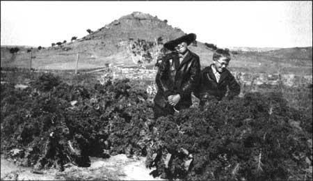
| Figure 22. Kentucky style fences around Hubbell fields, around 1913. Photograph taken by Simeon Schwemberger from Hubbell Hill (HUTR 2140). |
|
| Figure 23. West side of Hubbell home showing bread oven and surrounding yard, around 1905. (HUTR 4363). |
Hubbell also inquires "whether you will be fixed to ship me 8000 lbs of Winter Rye or more about June 20 or 25th at the latest..." [107] A later letter from Hubbell to his nephew Antonio Armijo who was at the Oraibe Trading Post mentions that he is mailing him some garden seeds but if he wants anything else he should "order a little of each by mail from the Barteldes Seed Co., Denver, Colorado. [108]
The years between 1906 and 1913 were a time of much building activity in and around the trading post. Around 1906 the chicken house later to become the generator house was first constructed and it originally included a stone fenced enclosure on the back or west side and was placed on stone foundation The stone enclosure is shown in later photographs Also during this time work continued on the corrals and pens, the wagon sheds to the west of the corrals were in place although not completed, additions were added to the barn on the west and south sides, and the second story was added to the northwest corner of the barn. The earlier 1897 addition to the manager's residence was removed around 1909 and a second bread oven was built south of the original oven west of the main residence. [109] Changes were also made to the main house around 1910 as the addition of the school room, bedroom, and present day kitchen were added to the earlier residence building that included five rooms and a large main hallway. This new addition served to connect the 1890's dining room and root cellar structure with the 1901 residence structure, create the small open patio between the two and result in a single structure for the Hubbell family residence. Also during this time a wooden vestibule area was added to the north entrance of the trading post.
As for the farm, Peterson provides information regarding the shipment and planting of a variety of fruit trees in and around 1905 and 1906. He notes that varieties planted included plums, apricots, pears, and apples including a "seedless apple" supplied by the Spencer Seedless Apple Company of Roswell, New Mexico. [110] Peterson also notes that there is "some hint that a large number of trees may have been planted east of the trading post, but it remains to be shown definitely whether or not orchards as such were ever planted." [111] There are numerous references to Hubbell having not only an orchard but also a vineyard, the possible location of the vineyard has not been established.
Hubbell continued to make application for his homestead grant in addition to working to convince the government of the need for the construction of a substantial reservoir facility along the Pueblo Colorado during this time. A patent was finally issued in 1908 however it was soon discovered that the Sam Day survey was flawed and a new survey was necessary In 1915 Frederick Miller completed a new survey that included Hubbell's lands and this information was filed with the General Land Office — Phoenix, Arizona In 1917 Hubbell was issued a new patent and the land was officially in his ownership. [112] Success had also been achieved with regard to the construction of the Ganado Reservoir as Hubbell wrote to his son in April 1912 that "the appropriation for the Ganado Reservoir has passed the House (Congress)..." and the reservoir appropriation was "sure to pass the Senate, so at last after many years, my dream has come true and under adverse circumstances and with an opposition that no one thought could be overcome." [113]
In 1913, Lina Rubi, Hubbell's wife died following a prolonged illness. She lived apart from Hubbell much of the time keeping residences in St. Johns and Albuquerque. Peterson notes that Lena spent summers and the final years of her life at the Ganado residence. However she did not maintain a high profile with regard to the daily operations and management of the property. She was buried on Hubbell Hill. Additional changes occurred around this time as the stone residence was constructed to serve as quarters for the freight and truck drivers and other post employees. Originally this structure included a 4 truck garage which extended east from the building. This structure later burned in 1931 and was repaired but then torn down sometime between 1935 and 1951.
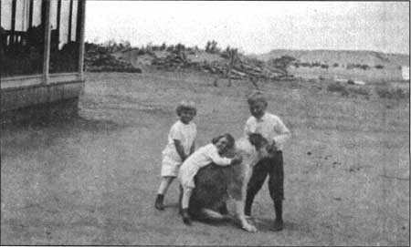
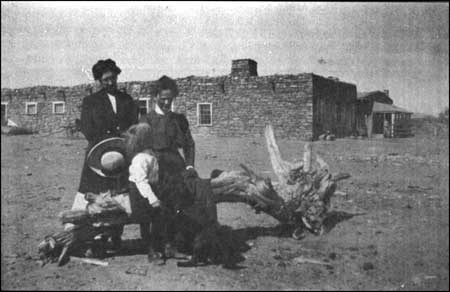
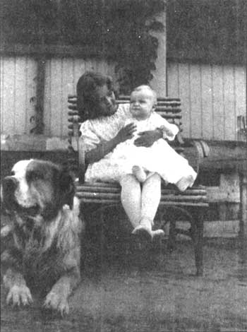
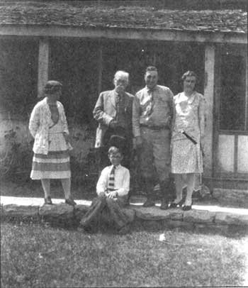
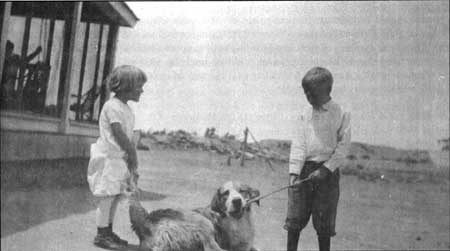
In 1911, two years before Lena Rubi's death her daughter Barbara Goodman moved home to Ganado to take care of her ailing mother and help keep the house. Barbara was a young widow as her husband Charles died in 1909 from a shooting accident prior to the birth of their daughter LaCharles, LaCharles was two years old when she and her mother moved to Ganado, There are numerous pictures of the young LaCharles playing in the yard surrounding the house and trading post (figures 24 and 25). Photographs dating from the period 1913-1915 show the landscape surrounding the residence remained compacted soil apparently devoid of either native or introduced vegetation (figures 26, 27 and 28). Adele Hubbell Parker and her son Miles were also living at Ganado at the time. A few years later Hubbell's son Roman returned to the Ganado farmstead and trading post, took up residence, and assisted his father in the management of the farm. Roman's wife died during the flu epidemic of 1918 leaving him with two small children to care for. During the late teen's and early 1920s Roman Hubbell assisted his father as co-manager of the farm while his sisters Barbara and Adele and the family's domestic employees assisted with the children. At the time of their mother's death Roman's children were quite young with Roman Jr. (Monnie) being 4 and John 8 months.
In addition to three of his children living at the Ganado home, Hubbell also had five grandchildren in and around the house. The Hubbell grandchildren as well as children of some of the workers at the trading post were tutored on site at the Ganado residence. The first tutor was Charlotte Chain and there are photographs of her with the Hubbell grandchildren dating as early as 1915. The second tutor, Ophelia McGraw was brought in around 1918. [114] In 1920 a young woman by the name of Dorothy Smith traveled to the trading post to serve as the family's third tutor and in 1921 she married Roman Hubbell. Mrs. Parker and J.L. Hubbell had both recently left Ganado prior to Dorothy's arrival in 1920. J.L. Hubbell had moved to Gallup where he resided in Roman's house. Those living in the Ganado house included Roman Hubbell and his sons Monnie and John, Barbara Goodman and her daughter LaCharles, and Miles Parker. Others living on the property included the storekeeper Epimenio Armijo and his two sons, Francisco Terrones the baker, Daisy and Elizabeth who helped with household chores, Loco the cook, Joe Borrego the blacksmith, and the gardener Don Eduardo. There were also freighters and the driver of the mail truck who were frequently here as well as temporary help for haying, irrigation, and such. [115] Several of the buildings on the property were utilized for living quarters. In addition to the family's main residence these buildings included the Leonard buildings, the stone bunkhouse (teamster's quarters), and the manager's residence. Both Dorothy and Hubbell's daughter Barbara who was also living at the post during part of this time following the accidental death of her husband had a strong influence on the daily operations of the post and farm, particularly on the visual quality of the landscape surrounding the residence.
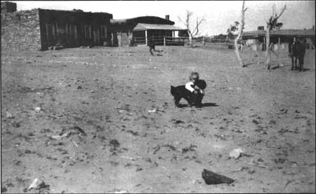
|
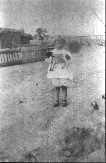
| Figure 24. Hubbell's granddaughter, LaCharles, near Leonard/Hubbell Trading Post buildings, around 1911. (HUTR 7076). |
|
| Figure 25. Hubbell's granddaughter, LaCharles, around 1910. (HUTR 7567). |
|
| Figure 26. Hubbell's granddaughter playing in front of Hubbell home, around 1915. (HUTR 4498). |
|
| Figure 27. Hubbell family members sitting east of Trading Post building, around 1909-1913. (HUTR 7564). |
|
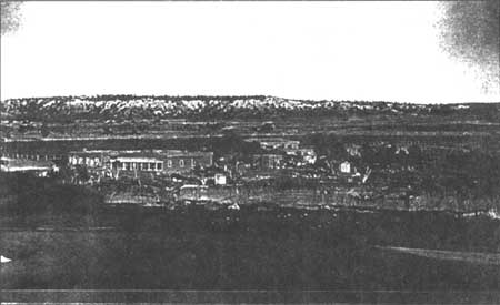
| Figure 28. Hubbell Trading Post with sheep herd in foreground, around 1913. Photograph taken by WA. Munk. (RP 58). |
According to Peterson, "they ran the house and served variously as governess, post mistress, accountant, trader, and spokespersons for the family." [116] By 1918 and 1920 historic photographs reveal the planting of ornamental vines along the front porch of the residence and a row of poplar trees along the eastern fence line which separates the yard of the residence from the trading post (figures 29 and 30). According to interviews with Dorothy Hubbell, the shade ramada or "summerhouse" that is in the front yard of the residence was there when she arrived in 1920 and was 'lust like it is now, with the silver lace vine..." [117] She also noted that the structure is built over an old well most likely associated with the early trading post.
|
| Figure 29. Hubbell's grandchildren, LaCharles and John (?), in front of Hubbell home, around 1918. (HUTR 4501). |
|
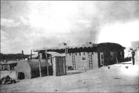
| Figure 30. Hubbell Trading Post and home, around 1920. (HUTR 8651). |
Decline of the Hubbell Trading Post and Farm (1923-1967)
The early 1920's seems to have been a time of change for the trading post, its operation, and the landscape around it. The deteriorated condition of the old Leonard trading post complex was seen as a potential hazard with the young Hubbell children playing in and around the structures so in 1923 the buildings were razed. The area was soon converted to flower gardens and the circular stone planter was constructed. Roman brought in numerous pieces of petrified wood which were used to define planting beds for the flowers. Also during this time the area to the northwest of the main residence was irrigated and cultivated for a variety of vegetables (figure 31).
Dorothy Hubbell mentioned that the stone wall that encloses the yard area and the raised flagstone walk were built in the years following her marriage which was in 1921. [118] It is hypothesized by this author that the wall was constructed following the removal of the Leonard buildings in 1923. Also about this time a small two room stone and adobe building was constructed to the northeast of the trading post. This structure housed the batteries for the Delco generator. The following year, 1924, Mr. Hubbell leased the small tract of land known as the "school tract" to the Bureau of Indian Affairs and a small stone school house building was constructed just a few feet north of the smaller Delco building (figure 32).
Other changes during the mid-1920's included the construction of two hogans just north of the enclosed yard of the main family residence. These hogans were constructed for overnight lodging and use by customers who traveled long distances to trade at the post. These hogans were later removed by the Hubbell family during the 1950's due to problems with gambling and bootlegging activities. This period also saw a few changes to the road system that ran by the trading post. The main road continued to run north-south just to the east of the post but the need to ford the Pueblo Colorado Wash was eliminated as the Bureau of Indian Affairs constructed a highway bridge across the wash. The historic road and this early bridge are no longer existing although the pylons are still evident today.
In 1926, J.L. Hubbell returned to live in Ganado as his health was deteriorating. According to LaCharles Eckel, Hubbell's granddaughter, it was around 1926 that the family constructed a large water tower just west of the kitchen immediately adjacent to the bread ovens (figure 33). The northern bread oven was demolished about this time and the southern oven was rebuilt to its modern appearance. Water was taken from the well located north of the trading post and carted in a barrel placed on a sled. The barn man and his white horse, Whitey hauled the barrels of water over to the tower location where it was pumped up into the tower using a gasoline pump. The water tower was removed during the mid to late 1930's. By 1929 the landscape, especially in the vicinity of the residence had begun to take on a new and more cultivated appearance as foundation plantings were added around the north side of the residence and the elevated berm measuring approximately 8' wide was planted and maintained in grass lawn (figure 34). A variety of both native and exotic flowers were planted in the front yard garden including calendulas, lilacs, roses, dahlias, yucca, sweet peas, Virginia creeper, lace vine, and honeysuckle (figure 35).
|
| Figure 31. Hubbell's grandchildren in garden area northwest of the Hubbell home. (HUTR 22824). |
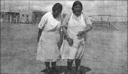
|
| Figure 32. Hubbell's household helpers, Daisy and Elizabeth in front of Delco building on schoolhouse tract, around 1920. (HUTR 7126). |
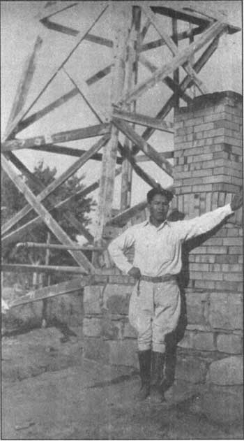
|
| Figure 33. Water tower support adjacent to bread oven, around 1926-1930. (HUTR 4436). |
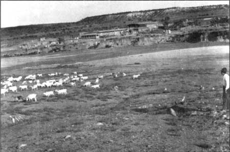
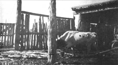
The late 1920's also saw a change in the operation of the farm as the family shifted from horse and mule drawn plows to the use of their first tractor. The alfalfa fields, fruit trees and vegetable gardens were cultivated and irrigated with regularity throughout this period. The family maintained over sixty mules and horses for hauling freight and a burro for the children to ride. They also kept some cattle, milk cows, goats, and a variety of pets for the children to play with (figures 36 and 37). According to Peterson, the Hubbells were very active in the sheep and goat trade during the 1920's. They purchased herds and collected them at Ganado for resale in whatever markets they could find. [119] In order to separate the sheep according to category a variety of pens were constructed and used by the family. The categories included aged and broken mouthed ewes, wethers of advanced age, yearling wethers and sheep, runt herds, and various goat categories. [120] The sheep were maintained and grazed on the property as they accumulated herds through their trading operations and held them until shipping time. They were then driven to railroad loading pens at either Chambers or Gallup. The family also maintained several hundred head of cattle up until the 1930's. Two large corrals were constructed across the wash from the trading post and west of Hubbell Hill (figure 38). Remnants of these structures may be found today.
|
| Figure 34. Hubbell family members in front of Hubbell home, around 1929; L-R, Barbara, John Lorenzo, Roman, Dorothy, and John [sitting]. (HUTR 4500). |

|
| Figure 35. Hubbell flower garden area, before 1930, with summer house, stone planter, and sundial. (HUTR 8722). |
|
| Figure 36. Hubbell corral and shed, around 1920-1930. (HUTR 4455). |
|
| Figure 37. Hubbell grandchildren in front of Hubbell home, around 1915. (HUTR 4492). |
|
| Figure 38. Hubbell horse and cattle corrals west of Hubbell Hill on north side of Pueblo Colorado Wash. (HUTR 4565). |
According to Cook and Brown, an extension to the wareroom of the trading post was built during the late 1920's but not immediately completed. [121] By 1931 photographs reveal that the structure was roofed although later photographs dating from the 1940's and 1950's and a watercolor dated 1953 show the building unroofed with ceiling vigas in various conditions. [122] This structure was later converted to a laundromat in 1964.
J.L. Hubbell died in November of 1930 and that same year Roman and Dorothy moved to Gallup and had their boys attend school in town. Following his death, Hubbell's children continued to play active roles in the management of the trading post and farm. For awhile, Roman and Lorenzo worked to expand their involvement in the livestock trade. Peterson attributes this as a response to the heavy debts that they were under as well as a response to the newly established policy of livestock reduction applied to the Navajo Reservation. [123] After the hard winter of 1932 some of this initiative was lost although they continued to purchase sheep part and parcel of their trading operations at Ganado. Barbara Goodman stayed on at the post and continued to serve as postmaster until the late 1930's at which time she moved to Gallup to live with Roman and Dorothy. About this same time the Parkers returned to Ganado and remained until Mrs. Parkers death in July of 1938. Even during the periods when members of the Hubbell family were not in residence at the Ganado home and trading post their influence over its operation and management was substantial.
Several changes occurred around the trading post during the early to mid-1930's including fire damage to the roof of the garage attached to the stone residence used by farm hands and freighters leading to its demolition a few years later. Also removed sometime between 1931 and 1944 was the southern wagon/cattle shed and the currently existing shed was built in its place. [124] According to both LaCharles Eckel and Dorothy Hubbell, the family switched from using the Delco plant in the 1930's and began using a Kohler for their energy needs. A few years later they converted to using a diesel generator which was housed in the utility building adjacent to the chicken house.
In 1934 construction began on the stone guest hogan as Roman wanted to build it as a standing memorial to his father. This structure was not fully completed until the early 1940's. Sometime around 1933 building modifications and additions were apparently made to the school house building complex, however it remains unclear as to the actual dates of construction for many of the structures. The earlier stone structure was likely incorporated into the new building design and the adjacent structures including a pump house and root cellar were constructed. [125] A frame residence was added to the site during the 1940's for use by the teachers and by the early 1950's the structures were converted for use as the area chapter house.
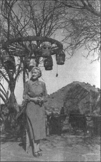
Around 1935 Pete Balcomb came out to Ganado with his family and began managing the trading post for the Hubbells. Dorothy Hubbell noted that while Pete Balcomb was running the post during the early 1940's, Bob and Betty Dillon operated the place as a guest lodge. This continued at least for two summers. It was during this time that the picnic area immediately to the north of the guest hogan was constructed and included a stone picnic table with stone benches, a brick lined barbecue pit, a flagstone paving area, and a wagon wheel light fixture (figure 39). In 1944 LaCharles Goodman Eckel, Hubbell's granddaughter and her family returned to Ganado and remained there until late 1945. Roman and Dorothy Hubbell continued to oversee the management of the Ganado operation from their home in nearby Winslow.
Although gasoline had been sold at the Ganado trading post for several years it was not until the early 1920's that a gas pump was added to the trading post landscape and by the early 1950's a modern-style gas pump was located immediately east of the trading post entrance (figure 40). By 1953 Dorothy and Roman had returned to live at the Ganado family residence and manage the property onsite. As Roman's health declined, the family strictly limited the number of overnight guests to the property and limited them to the guest hogan. Photographs from the mid 1950's and 1960's reveal the entrance sign board and bell and extensive flower gardens cultivated by Dorothy Hubbell (figures 41, 42, and 43). Roman Hubbell's health continued to deteriorate and he died in 1957. Farming activities were discontinued in the 1950's although Dorothy continued to manage and operate the trading post and residence until 1967 at which time the National Park Service acquired the property.
|
| Figure 39. Dorothy Hubbell in picnic area adjacent to guest hogan, 1954. (HUTR 8721). |
|
| Figure 40. East side of Hubbell Trading Post, around 1950; note gas, pump and Coca Cola sign. (HUTR 7114). |
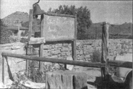
|
| Figure 41. Sign board and bell at entrance to Hubbell yard, around 1955. (HUTR 4587). |
|
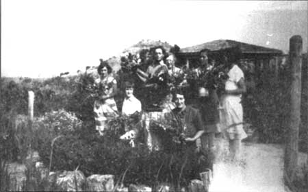
| Figure 42. Hubbell family members in flower garden area in front of Hubbell home; note silicified wood used to delineate flowerbeds. |
|
| Figure 43. LaCharles Eckel in Hubbell flower garden. (HUTR 7132). |
Hubbell Trading Post as Post Office for Community
The trading post served as an official U.S. Post Office beginning approximately 1883 with Charles Hubbell (J.L. Hubbell's brother) serving as Post Master for the Ganado office. During the early years the role of Post Master changed almost yearly. Clinton N. Cotton was listed as Post Master during October of 1884, followed by Robert Meekins in September of 1887. [126] In September of 1888 Cotton was reinstated as Post Master for Ganado, AZ and served in the position until replaced by J.L. Hubbell in January of 1895. [127] The post continued to serve as a post office until J.L. Hubbell's daughter Barbara H. Goodman retired her position on July 1, 1943. The table below lists references to the numerous individuals and the dates they were serving as Ganado's Post Master.
Table 1. Post Masters at Ganado
| GANADO POST OFFICE | CHARLES HUBBELL | FEB. 15,1883 |
| "" | CLINTON COTTON | OCT. 27, 1884 |
| "" | ROBERT MEEKINS | SEPT. 25, 1887 |
| "" | CLINTON N. COTTON | SEPT. 7, 1888 |
| "" | J.L. HUBBELL | JAN. 18, 1895 |
| "" | CHARLES BIERKEMPER | OCT. 10, 1908 |
| "" | KATHLEEN NEUBERT | JAN. 12, 1910 |
| "" | ELIAS H. ARMIJO | AUG. 28, 1912 |
| "" | WALTER CODINGTON | JAN. 22, 1914 |
| "" | DONALD SCHILLENBURG | MARCH 22, 1916 |
| "" | BARBARA GOODMAN | JAN. 2, 1919 |
| "" | MRS. BARBAR MYERS (name changed by marriage) |
OCT. 6,1926 |
| "" | BARBARA GOODMAN (name changed by divorce) |
JAN, 16, 1928...retired JULY 1, 1943 |
| <<< Previous | <<< Contents >>> | Next >>> |
hutr/clr/clr2.htm
Last Updated: 26-Apr-2004