|
John Day Fossil Beds
Rocks & Hard Places: Historic Resources Study |

|
Chapter Eight:
TOURISM AND RECREATION
While steamboats, railroads, stagecoaches, and sternwheelers fostered early-day tourism in many parts of the state, leisure-time travel into central and eastern Oregon was constrained by the lack of easy access. In the rugged John Day basin, overland travel remained challenging until World War One and beyond. Early recreational and social activities among the residents of Grant and Wheeler counties were simple, local in nature, and often outdoor-oriented. With the advent of improved roads and motorized travel, tourists first began to enter the basin to view and enjoy its unusual natural landscape. The development of state parks in the fossil beds area in the 1940s, and the subsequent establishment of John Day Fossil Beds National Monument introduced the unique attractions of the region to a wider world.
Early Recreation
On foot, horseback, or horse-drawn wagon, the early inhabitants of the John Day basin meandered slowly to their destinations, fording streams, including the John Day River itself, climbing ridges, and avoiding chasms. Few traveled solely for the pleasure of the trip. Sojourners were generally limited to local residents going to and from town and the courthouses at Canyon City or Fossil, peddlers, wool buyers, and freighters (Munro 1984: 7, 26). Traveler services were almost non-existent, limited to stage stops at local ranches and, by the turn of the century, modest commercial hotels in small towns.
Because isolation was a common aspect of life for settlers in the John Day basin, people were especially eager to congregate for recreational purposes. Picnics, holidays, and overnight dances occasionally brought families together from scattered ranches for camaraderie and social interaction (Campbell 1976: 37-39). For example, in 1899 — the year Wheeler County was established — long-time residents gathered at a Fourth of July celebration at Kelsay's Grove outside the town of Fossil and formed the Wheeler County Pioneer Association. Typical of the period, the day's events included patriotic speeches, entertainment by the Fossil Brass Band, and a grand dinner at the Donaldson Hotel. In 1901, the annual event was held in what is now the ghost town of Richmond and the following year at Mitchell. The organization evolved to become the Eastern Oregon Pioneer Association. In 1903, the group selected forty acres at a centrally located site on Sarvis Creek. From that time on, the traditional picnic was held at what is now known as Julia Henderson Pioneer Park on SR 19 between Fossil and Service Creek (Shaver et al., 1905: 647-648; Fussner 1975: 31, 53).
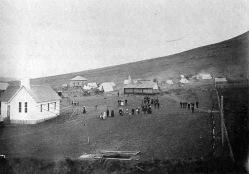
Fig. 61. Pioneer Picnic at Richmond, ca.
1901 (City of Fossil Museum).
In the year 1900, Scottish immigrants in the vicinity of Fossil organized the Caledonia Club. The group boasted 100 members, and met regularly at various locations — in 1903 they traveled all the way to the Lewis and Clark Exposition in Portland. Scottish sports and entertainment brought in from outside cities were enjoyed by all (Shaver et al., 1905: 651). Grant County ranchers gathered for Scot-American dances at Dayville and Canyon City. Bagpipes, fiddles, accordions, and a piano provided musical accompaniment. Couples danced; men went outside to drink Scotch and home brew, exchange lies, discuss the merits of a racehorse or a young woman, and throw a few punches. Long-time resident Rhys Humphreys recalled how important it was for people just to get together, "from dark until daylight, and then come home with a headache the next day." Non-drinkers and non-dancers went to church or attended "Skip-to-My-Lou" parties, chaste events where no one danced (they skipped) but gained an opportunity to socialize (Humphreys 1984a: 9,14, 18, 36-37; Humphreys 1984b: 9; Munro 1984: 9-11).
Community events in the upper John Day basin included the Chautauqua Circuit in the early 1920s. It brought speakers to audiences eager for continuing education and social contact. In 1928, traveling movie shows replaced the lecture programs and became an increasingly popular form of entertainment. Rodeos, especially when connected with county fairs, drew crowds who wanted to watch brave if reckless men risk their lives to ride bucking horses and Brahma bulls. In the twentieth century sports became an important magnet. Baseball and basketball games associated with schools or community teams attracted players and audiences. Sports events became a useful means for gathering socially and competing to enhance school or community pride. Personal pursuits filled rare spare hours for others. These included reading books, newspapers, and magazines, whittling, and chasing wild horses. "I knew one herder that built a thirty-foot log cabin, perfect," recalled Rhys Humphreys, "that he whittled with his pocket knife out of a stick of wood" (Cant and Cant 1984: 39-42; Humphreys 1984a: 9; Humphreys 1984b: 14).
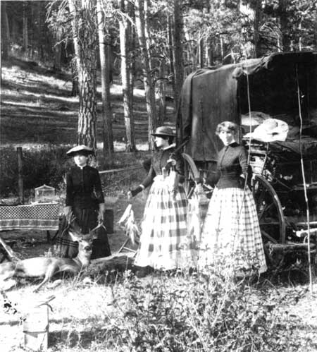
Fig. 62. Daughters of Martin Hazeltine
of Canyon City on a camping and hunting trip in the mountains of eastern
Oregon in the late 1880s (OrHi 3,509).
Outdoor recreation remained ever popular among the rural population. In winter, children had entertainment options of sledding and ice-skating. On occasion the residents of Dayville diverted the South Fork of the John Day River into a field and converted it into a large ice rink. In summer children and young people went swimming, hiking, camping and fishing (Cant and Cant 1984: 39-42; Humphreys 1984a: 9; Humphreys 1984b: 14).
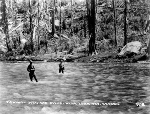
Fig. 63. Fishing on the John Day River
near the town of John Day, n.d. (OrHi 16011).
As early as 1902, Grant County was noted for its mineral and warm springs. These places became the first destination tourist sites in the region. Soda Springs, at the upper end of Bear Valley south of Canyon City was well-known. Blue Mountain Hot Springs was another:
In the mountains on the north side of the county are several hot springs, all possessing, to a greater or less degree, medicinal properties. The most noted warm springs are near Reynold creek, a tributary of the John Day, about twenty-five miles east of Canyon City The location has become the summer resort of the county. Bath houses have been constructed for the use of visitors. It is an ideal camping ground, the surroundings are picturesque, the streams afford good fishing and the mountains on the south abound in game (Anonymous 1902, 728).
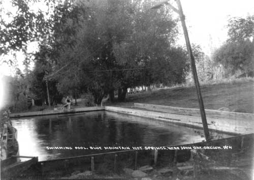
Fig. 64. Swimming pool at Blue Mountain
Hot Springs, near town of John Day, n.d. (OrHi 16003)
Another popular, and long-lived mineral springs resort took shape at Ritter on the Middle Fork of the John Day. The family resort developed intensively after 1896 when the existing ranch was purchased by the Charles Davis family. A cabin was built over the springs, and more of the 110-degree water was carried by trough to a bathhouse with three wooden tubs. A hotel, store, cabins, dancehall, and large stable for guests' horses went up in the early years of the century. Ritter Hot Springs stayed open year around, and guests came from Baker, Heppner, and Portland, some staying for weeks at a time. Hearty meals, served family style, gained fame. The Davis family kept cows, chickens, and pigs, supplying their own meat and dairy products. A large garden and an orchard irrigated with the warm mineral water are said to have grown luxuriantly, providing fresh fruit and vegetables (Secord 1973:133-136).
Large dances were held in the resort dance hall every two weeks or so. These events drew dancers from Monument and Heppner after automobiles made access into Ritter easier. In the 1920s, the owners added a swimming pool and dressing rooms at the upper hot springs, one mile up the river. Reportedly, many a moonlight swimming party took place at the pool during Prohibition. In 1956 the widow Davis retired and sold the resort to new owners. In the 1970s, the resort was still operational although much altered, with a new swimming pool, duplexes, and camper and trailer sites (Secord 1973: 133-136).
Tourism in the Motor Age
The construction of roads for motorized travel was key to bringing leisure-time travelers into central and eastern Oregon. After 1914, the automobile inspired rapid improvements to roads in the rugged John Day country, to an extent unimaginable even ten years prior. The John Day River Highway, in place as a gravel road through Big Basin, Butler Basin, and Picture Gorge by 1918, gave visitors access from Portland via the Columbia River. The Pendleton-John Day Highway, funded in 1917, opened a route in through the Blue Mountains from Pendleton and points north. In the 1920s, completion of the Ochoco Highway from Prineville to Mitchell and on to John Day, opened up the region to east-west travel (Mark 1996: 29-30, 36).
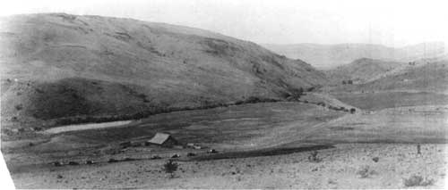
Fig. 65. Caravan of auto-tourists in the
John Day country, n.d. (OrHi 83670).
The tourism potential of Grant and Wheeler counties was not lost on its early-day citizens. From the turn of the century, local boosters were aware not only of the attraction of the hot springs resorts for outside visitors, but also of the growing fame of the fossil deposits. Turn-of-the-century descriptive writings do not fail to mention the geological and paleontological wonders of the area:
In 1890 the University of Princeton sent an exploring expedition into this region and many scientists have explored it besides and much is written concerning it. Surely Wheeler County is not only rich in possibilities at the present, but also is distinguished by the great wealth of lore that speaks like a book of the times that have been (Shaver et al., 1905: 658).
To improve both local and through access, Wheeler and Grant county residents participated in the Good Roads Movement. A photograph at the Fossil Museum shows a work party of local men improving an old wagon road for automobile use on a "Good Road Days" project. Adventuresome motorists did in fact make their way into the area as early as the 1910s, as soon as the condition of roads allowed. Another photograph of a caravan of auto-tourists in the John Day country depicts travel through a landscape of range land and cultivated field, on a graded and graveled road.
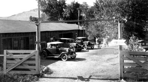
Fig. 66. Auto camp serving motorists at
John Day, ca. 1935 (OrHi 16001)
The motoring public required services at intervals along the way. Those communities situated along early routes — Mitchell, Fossil, Dayville, Prairie City and others — already boasted sizeable hotels and stage stop facilities. By the 1930s, roadside auto camps — municipal and private — offered a popular form of alternative lodging that was especially attractive to traveling families. Typically, local livery stables expanded their services to include auto repairs, and quickly converted exclusively to automotive servicing. Local mercantiles added curbside pumps, such as the one installed at the Fossil General Mercantile in 1914. Gas pumps also appeared at key rural crossroads, first as independents and often in conjunction with small grocery and traveler supply stores. For example, Scotty's Gas Station and Store at the mouth of Picture Gorge was operated by the Cant and Mascall families in the 1940s. Within a few short decades of the first graded roads, gas stations with modern corporate designs such as the Texaco station in Mitchell penetrated the area. For roadside dining, motorists increasingly preferred quick-stop lunch stands or cafes to hotel dining rooms (Stinchfield 1983: 32; Mascall/Kocis-Mascall n.d.: 1; Lentz 1995).
Three State Parks and a National Monument
In 1921, the Oregon legislature authorized the Highway Commission to acquire rights-of-way to 300 feet on either side of the centerline of Oregon roads. Under this authority the Commission began acquiring small parks and waysides. From this modest beginning, gifts of land and purchases of property led to a network of roadside parks. In 1925, the Oregon legislature expanded the authority of the Highway Commission to acquire larger areas for the preservation of trees and scenic places for "parks, parking places, camp sites, public squares and recreation grounds." The Commission was empowered to improve, maintain, and supervise these properties (Armstrong 1965: 13-14; Merriam and Talbot 1992:17-20).
Samuel H. Boardman became Superintendent of Oregon State Parks in 1929. Long impressed and inspired by lands in the John Day watershed, Boardman began the acquisition of scenic and paleontological areas there, but the project was slowed by the onset of the Depression. In 1942, the Oregon State Board of Higher Education, responding to the impetus of paleontologist John C. Merriam, created an Advisory Committee on State Parks. The aim of Merriam and the Advisory Committee was to secure key acreage in Grant and Wheeler counties. Although the committee did not endure, its purposes were attained when, in 1947, the State of Oregon had assembled sufficient lands to create the two new state parks — Painted Hills State Park, and Thomas Condon John Day Fossil Beds State Park (Merriam and Talbot 1992: 264).
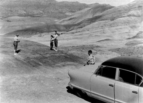
Fig. 67. Tourists in the Painted Hills
Unit, ca. 1955, John Day Fossil Beds National Monument (OrHi ODOT
5237).
The following table identifies initial tracts acquired by the Oregon Highway Commission as it built up acreage in the vicinity of the Fossil Beds. Acquisition was by both gifted deed and purchase. Boardman himself recommended a number of the properties. Some parcels were selected based upon scenic values; others were selected because of their geological or paleontological importance (Langille 1948a: 2). By 1965, the State opened for public use a third new park in the area — Clarno State Park.
Table 6. Some Lands Acquired for State Parks at John Day Fossil Beds
| Milepost | Acres | Location | Name | Date |
THOMAS CONDON-JOHN DAY FOSSIL BEDS STATE PARK: | ||||
| MP 106 | 3 | T9S, R26E, Sec. 31 | Griffin Tract | 6/18/1945 |
| MP 116 | 40 | T11S, R26E, Sec. 7 | The Cathedral | 6/20/1939 |
| MP 116.67 | .79 | T11S, R26E, Secs. 7,18 | Johnny Kirk Springs | 8/4/1928 |
| MP 118 | 200 | T22S, R26E, Secs. 28-29 | Turtle Cove | 1/5/1939 |
| MP 120 | 40 | T11S, R26E, Sec. 32 | Kennedy Tract | 7/17/1945 |
| MP 121 | 4.8 | T12S, R26E, Sec. 6 | Cant Wayside | 9/14/1935 |
| MP 122-123 | - | - | Sheep Rock | |
| MP 124 | - | - | Rock Creek Tract | |
| MP 125 | 1602 | T12S, R25E, Secs. 1, 2 T12S, R26E, Secs. 5, 8,18, 20 | Picture Gorge | 5/20/1931 |
| MP 126.7 | 3.8 | T12S, R26E, Sec. 29 | William Mascall Overlook | 9/14/1935 |
| MP 136 | 1.5 | T13S, R29E, Sec. 7 | Van Horn Ranch | 1/31/1931 |
PAINTED HILLS STATE PARK: | ||||
| - | 13.2 | T10S, R21E, Sec. 31, SE 1/4 | Allen Ranch | 6/23/1947 |
(Erigero 1995; Langille 1948b: 1-2). | ||||
Overall, the investments of Oregon Highway Commission in the John Day Fossil Beds parks were modest. They included a textboard, tables, benches, stoves, and an entrance road at Painted Hills State Park and at Thomas Condon John Day Fossil Beds State Park; an entrance road and parking area at Mascall Overlook; limited camping facilities at Turtle Cove; and a wayside with a textboard two miles north of the junction of Highways 26 and 19. Visitation was not carefully tracked. In 1962, Painted Hills State Park drew 5,703 visitors; no record was kept in 1963. For the Thomas Condon-John Day Fossil Beds State Park, no visitor count was made (Armstrong 1965:171, 206-207, 254, 257).

Fig. 68. Hikers on John Day River at
Sheep Rock, John Day Fossil Beds National Monument (OrHi
86137).
David G. Talbot, retired Superintendent of Oregon State Parks, recalled the sustained efforts of Gordon Glass, a resident of John Day, to lift up public attention and use of the fossil beds area: "Let's do something magnificent with the Painted Hills and Fossil Beds in the John Day River country because people come from miles around to see these scenic formations and it will help local business," he said. Talbot continued:
I could see right away that here was an opportunity to upgrade the presentation of those features. Because they are of national significance scientifically, maybe we could get the National Park Service to take them on. For a variety of reasons, we were not doing a very good job with the areas as a state park. We protected the holdings, but we didn't tell visitors much about them. We didn't interpret the park. I thought the Feds could invest more money, do a better job and attract enough people to help the local economy. And, that is exactly what happened" (Merriam and Talbot 1992: 138).
In 1967, the National Park Service, at the request of Oregon Congressman Al Ullman, conducted a regional study to evaluate the feasibility of including Oregon State Parks lands within the National Park System.
Table 7. Units Studied by National Park Service, 1967
| Unit | Acreage |
| Sheep Rock | 3,965 |
| Turtle cove | 240 |
| Foree | 80 |
| The Cathedral | 40 |
| William Mascall Overlook | 2 |
| Davis Dike | 20 |
| Clarno State Park | 120 |
| Painted Hills State Park | 13.2 |
(National Park Service 1967: 6-11) | |
The 1967 National Park Service assessment found colorful, scenic resources, limited recreation facilities, incomplete archaeological information, and historic resources "primarily of State or local significance." The Park Service determined that the areas examined were suitable for establishment as a national monument, but not for inclusion in the National Park System. The study concluded: "Of the natural, scientific, and recreational resources within the area of study, those of paramount importance are scientific." (National Park Service 1967: 24-28).
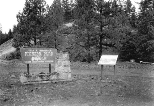
Fig. 69. Julia A. Henderson Pioneer
Park. F.K. Lentz, 1996 (National Park Service)
Cultural Resources Summary
Owing to late settlement and difficult travel, tourism and recreation in Grant and Wheeler counties was slow to begin and limited in scale. To date, recreation and tourism has left a far less visible imprint on the landscape of the area. Surviving cultural resources associated with this theme are less prevalent than those linked to ranching, mining, and lumbering, and for the most part are more recent in date. Buildings and structures related to traveler services especially tend to be clustered in towns.
Early residents and a small number of visitors from outlying parts of Oregon quietly enjoyed the handful of mineral and hot springs resorts tucked into high valleys. Some of these facilities continued in operation into the middle years of the century and may still retain extant features. State parks at the John Day Fossil Beds, and other small private camps, county parks, forest camps, and state park waysides took shape along stretches of improved roads from the 1930s through the 1970s. The earliest of these was Pioneer Park, established in 1903. The land for Shelton Wayside State Park on SR 19 was donated in the 1930s by Kinzua owner E.D. Wetmore in honor of his timber cruiser Shelton (Stinchfield 1983: 256).
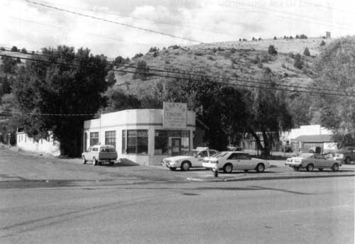
Fig. 70. Independent gas station in
Canyon City, c. 1925. F. K. Lentz, 1996 (National Park
Service)
In the early decades of auto tourism, gas, food, and lodging services sprang up at many small crossroads hamlets. In more recent decades, overnight facilities for travelers have concentrated in the incorporated communities of Fossil, Mitchell, and John Day, with limited gas and food available in the smaller towns like Dayville and Kimberly. Period gas stations and garages; hotels, motels and tourist cabins; cafes and restaurants dating from the 1920s through the 1960s can be found scattered along the main streets of most of the larger communities in the two-county area.
Today, tourist interest in and around the National Monument continues to depend on its paleontological and scenic values. Within a wider circle, however, outdoor recreation and cultural tourism are increasingly important draws as well. Grant County's promotion of its early gold mining and cattle ranching history has helped to elevate heritage tourism to an important element of the local economy. The federal designation of the John Day River as a National Wild and Scenic River in the late 1970s has spawned a local river rafting industry, and boosted Wheeler County's share of the recreational tourism dollar.
In 1997, local governments and chambers of commerce, funded by a USDA Rural Development Grant, pooled information and energies to develop an interpretive driving tour called Journey Through Time: Tour 50 Million Years of Oregon's Past, Points of Interest. The program is promoted as a 286-mile-long loop tour through the Oregon Department of Transportation's Scenic Byways Program. The tour route enters the Monument area at Fossil, and follows SR 19 and US 26 past Sheep Rock, the Cant Ranch, and Picture Gorge, and on to John Day. Distinctive interpretive signage along the route identifies some forty-four natural and cultural attractions, including the units and features of the Monument.
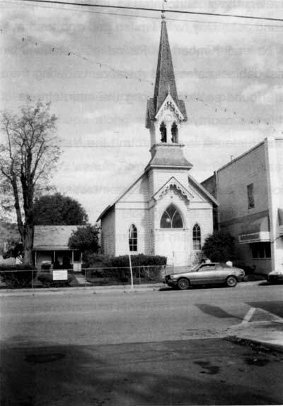
Fig. 71. Advent Christian Church, built
in 1898, now a tourist attraction in the town of John Day. F.K. Lentz,
1996 (National Park Service)
No cultural resources specifically associated with the history of tourism and recreation in Grant or Wheeler Counties are listed in the National Register of Historic Places.
No cultural resources associated with the history of tourism and recreation, other than several turn-of-the-century hotels presented in previous chapters, are listed in the Oregon State Inventory of Historic Places for Grant and Wheeler counties.
Area tourism literature for places associated with the history of recreation and tourism (in addition to scenic overlooks within the Monument, and various picnic and campgrounds of uncertain date) list only two sites:
Shelton Wayside State Park, dating from the 1930s
Julia Henderson Pioneer Park, established 1903
Two suggestions are made with regard to cultural resources associated with the context of Tourism and Recreation:
1. Consider working with the Grant County Historical Society to support research into the early mineral and hot spring resorts in Grant County. A field survey of known locations and a recording of extant features would be an important first step in this process. As a final product, a well-documented, pictorial booklet would add much to visitor understanding of early recreation in this remote setting.
2. Develop an inventory of any early State Parks era features such as landscaping, signage, camping and/or picnic structures in the units of the Monument. Over time, retaining such features whenever possible will help to preserve the tangible history of the human origins of John Day Fossil Beds National Monument.
| <<< Previous | <<< Contents>>> | Next >>> |
joda/hrs/chap8.htm
Last Updated: 25-Apr-2002