KLONDIKE GOLD RUSH
SKAGWAY, DISTRICT OF ALASKA — 1884-1912: Building the Gateway to the Klondike
Historical and Preservation Data
|

|
Part II
BUILDING THE DREAM
|
|
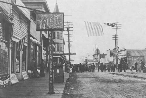
July 4 tug-of-war contest on Broadway Avenue about 1910.
|
Chapter 4
BROADWAY AVENUE, SKAGWAY
What was it like to walk
along Broadway Avenue in gold rush Skagway at its peak? A sourdough
standing at the corner of Fifth and Broadway would see a wall of
false-fronted, wooden buildings with bright signs, awnings, boardwalks,
crates and — most likely — mud. Two church
steeples towered to the northwest with the beginnings of a residential
district below them. To the southeast, down Fifth, squared-off lots
jutted out from the corner of Ben Moore's hard-held homestead. A fence
angled across Fifth Avenue marked the land claims boundary and the
official start of Moore's abandoned White Pass Trail. The fence still
stands.
The rest of town, however, appeared square and
orderly with buildings evenly lined up with their frontages on the
50-by-100-foot lots. A continuous, solid face of false fronts, two and
sometimes three stories high, lined Broadway from the depot to past
Seventh.
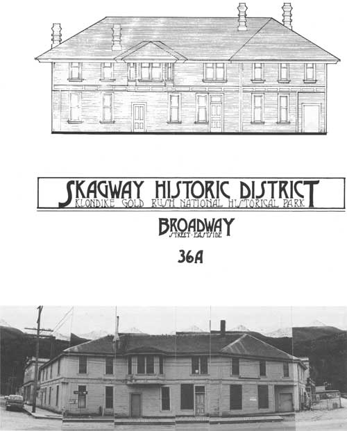
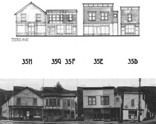
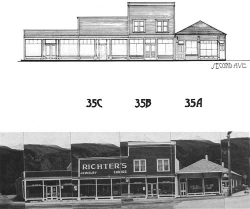
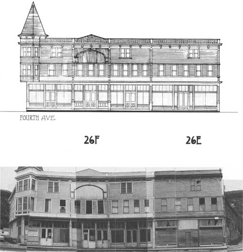
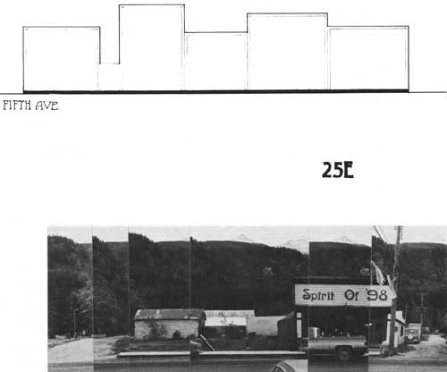
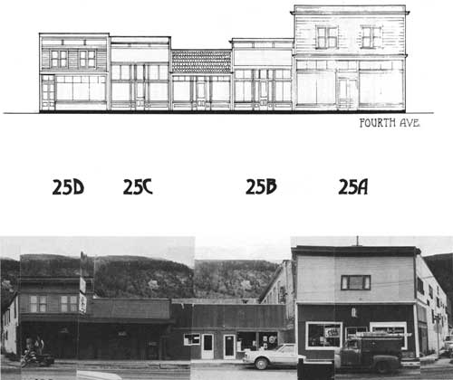
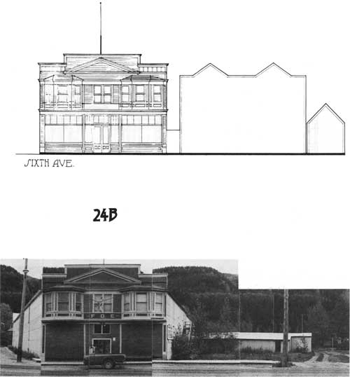
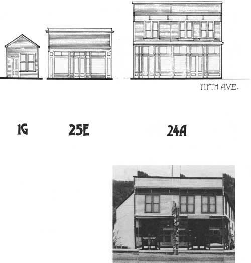
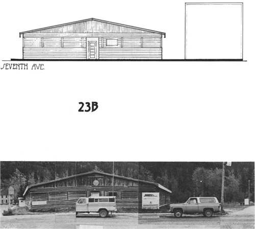
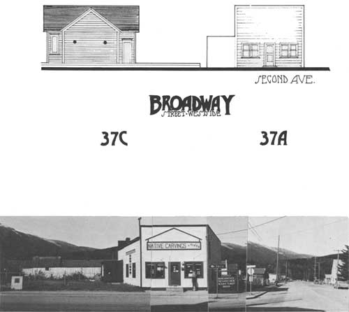
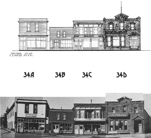
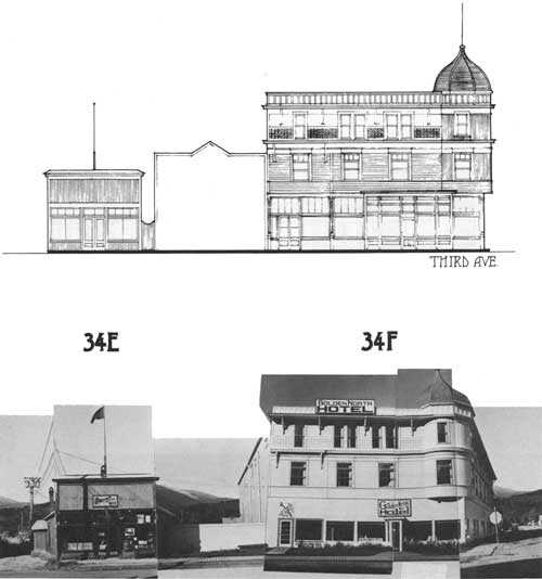
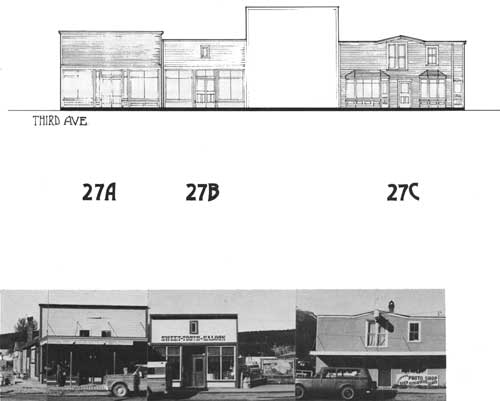
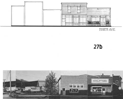
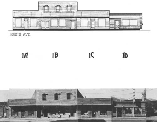
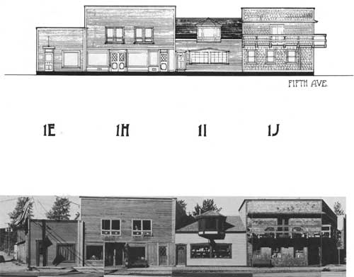
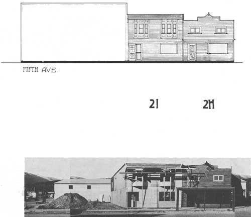
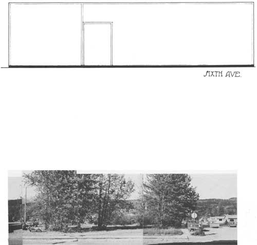
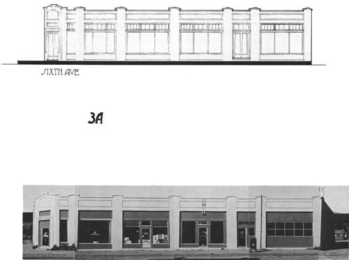
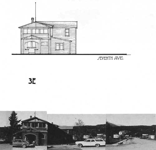
Broadway Avenue between Second and Seventh is the
core of Skagway's Historic District. The following streetscapes of this
area, which are drawn from historic and modern photographs and from the
structures still standing, show the early facades of the buildings
lining Broadway — many of the buildings seen by our
sourdough at the turn of the century. Contemporary visitors see Broadway
as it appears in the accompanying photographic composites pieced
together in 1977. (Note that the number beneath each building is keyed
to the Historic District maps and building histories in the
appendix.)
The architectural streetscapes represent the front of
each building at its earliest known appearance, unless this early
appearance does not include the major features known today. Rather than
draw Broadway at a set time period, say 1898 or 1900, which would have
omitted several key structures, each presently standing building was
recreated to look as it did at the time it was constructed. However,
since some of the early structures were mere shacks or very simple
gable-roofed sheds — which only later received their
distinctive false fronts and decorative trim, they are shown at their
earliest "distinctive" appearance. Thus, the Pack Train complex is
drawn with the ornate, towered facade added in 1908 and not as it
appeared earlier as the army barracks with a simple gable roof.
Non-historic, recent buildings are drawn to represent
their original 1960s or 1970s appearance; no attempt was made to add a
"historic" facade over a non-historic building. Outlines or "ghosts" of
structures which once stood on the now vacant lots on Broadway are
included to help fill in the solid wall of shops and stores that once
faced this street.
|
|
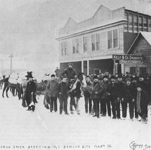
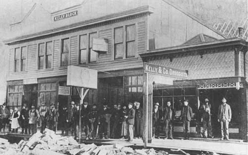
These two photos illustrate the facade changes along
Broadway. Note the new face added to the Kelly & Co. Druggist's
building in the spring of 1898; the construction debris in the
foreground was used as fill in the street. (Photos courtesy of Alaska
Historical Library, Juneau)
|
|
|
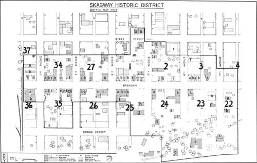
Skagway Historic District. (click
on image for a PDF version)
|
|
|
Skagway Historic District. Broadway
Street—Eastside. (click on image for a PDF version)
|
|
|
Skagway Historic District. Broadway
Street—Eastside. (click on image for a PDF version)
|
|
|
Skagway Historic District. Broadway
Street—Eastside. (click on image for a PDF version)
|
|
|
Skagway Historic District. Broadway
Street—Eastside. (click on image for a PDF version)
|

|
|
Skagway Historic District. Broadway
Street—Eastside. (click on image for a PDF version)
|
|
|
Skagway Historic District. Broadway
Street—Eastside. (click on image for a PDF version)
|
|
|
Skagway Historic District. Broadway
Street—Eastside. (click on image for a PDF version)
|
|
|
Skagway Historic District. Broadway
Street—Eastside. (click on image for a PDF version)
|
|
|
Skagway Historic District. Broadway
Street—Eastside. (click on image for a PDF version)
|
|
|
Skagway Historic District. Broadway
Street—Eastside. (click on image for a PDF version)
|

|
|
Skagway Historic District. Broadway
Street—Eastside. (click on image for a PDF version)
|
|
|
Skagway Historic District. Broadway
Street—Eastside. (click on image for a PDF version)
|
|
|
Skagway Historic District. Broadway
Street—Eastside. (click on image for a PDF version)
|
|
|
Skagway Historic District. Broadway
Street—Eastside. (click on image for a PDF version)
|
|
|
Skagway Historic District. Broadway
Street—Eastside. (click on image for a PDF version)
|
|
|
Skagway Historic District. Broadway
Street—Eastside. (click on image for a PDF version)
|
|
|
Skagway Historic District. Broadway
Street—Eastside. (click on image for a PDF version)
|
|
|
Skagway Historic District. Broadway
Street—Eastside. (click on image for a PDF version)
|
|
|
Skagway Historic District. Broadway
Street—Eastside. (click on image for a PDF version)
|
|
|
Skagway Historic District. Broadway
Street—Eastside. (click on image for a PDF version)
|
|
|
Skagway Historic District. Broadway
Street—Eastside. (click on image for a PDF version)
|
|
|
Skagway Historic District. Broadway
Street—Eastside. (click on image for a PDF version)
|
klgo/hpd-36/chap4.htm
Last Updated: 06-Aug-2009
| 


