|
NATIONAL PARK SERVICE
The Lewis and Clark Trail A Proposal for Development |

|
SUMMARY
FINDINGS
Altogether, the Lewis and Clark Expedition traveled some 7,500 miles from St. Louis, Missouri, to the Pacific Ocean and back. Of this total, about 5,500 miles were along the Missouri River and its tributaries, some 1,000 miles were overland, and about 1,000 miles followed the Columbia River system.
Along this route, the Expedition occupied approximately 393 separate campsites. Where the original scene has not yet been disturbed, historians, archeologists, and others have been able to identify their approximate location. However, many of the campsites and other physical traces of the Expedition have been flooded out by water control structures that have been built along the Missouri and Columbia Rivers and their tributaries. Along the overland route where the Expedition crossed and recrossed the Continental Divide, many of the campsite have been identified and most have been marked. The marking and designations, however, have been carried out by various Federal, State, and local agencies, private organizations, and individuals with little or no continuity or coordination among sponsors.
Provisions for conservation of natural resources and opportunities for outdoor recreation experiences along the Expedition route vary greatly. Even though some 1,700 miles of the Expedition route fall within the overall boundaries of National Forests, National Wildlife Refuges, Public Domain Lands, State and local parks, actual public control may exist over only about one-half that distance.
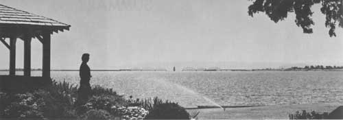
Of the entire route, only one substantial section remains as the primitive and majestic wilderness that Lewis and Clark found during their journey. This is the 180-mile section of the upper Missouri River from the Fort Peck Reservoir to Fort Benton, Montana, much of which still remains in the public domain.
Adjacent to the Lewis and Clark Expedition route, 896 sites, containing about 2 million acres, possess resources suitable for outdoor recreation and for the protection of wildlife. If acquired and developed for public benefit, such areas would contribute substantially to the creation of a "recreation ribbon" along the Expedition route.
A network of good first-class highways now parallels much of the route. If appropriately marked, these roads would make it possible for automobile travelers to visit the Expedition campsites and to follow the route rather closely as it winds across the plains, the mountains, and through the Pacific Northwest. Many of these roads, now under a combination of Federal, State, and local jurisdictions and financing arrangements, possess considerable scenic qualities which, with certain improvements, could provide continuity and access to the "recreation ribbon" of historic, wildlife, and other areas along the route.
RECOMMENDED PROGRAM
To establish a Lewis and Clark Trail and to provide a general framework for continuing action by the individual States and Federal agencies, the following actions are recommended:
1. A continuous, convenient, and attractive highway Trail for the public to use in retracing the whole or parts of the route of the Lewis and Clark Expedition should be provided. Initially, this Trail can be established by selecting and marking existing roads. Gradually, the roads can be improved by better surfaces, greater width, realignment, and, in some cases, new locations. Driving pleasure along this route can be enhanced further by securing scenic easements or establishing zoning regulations, establishing wayside parks at appropriate intervals, and providing ready access to the historic, wildlife, and other recreation resources along the way.
2. A common Lewis and Clark Trail sign should be adopted and used to mark the Trail throughout its length.
3. Facilities should be provided along the water route for the use of boaters following the Lewis and Clark Trail.
4. A hiking and horseback Trail should be constructed to follow as closely as possible the Expedition's water and overland route.
5. Public agencies should acquire and develop those major segments of the water and overland route that possess important historic, wildlife, scenic, and other recreation resources.
6. Each State should establish a Lewis and Clark Trail Committee to coordinate the development of the Lewis and Clark Trail Program.
7. Each State Trail Committee should develop an educational program to inform the public of the historic, wildlife, and other recreation resources available along the Trail.
8. Interpretation should be provided at appropriate points along the Trail to tell the story of the Expedition and to enhance public understanding of its contribution and importance to American history.
9. Control of sewage and industrial waste disposal should be accelerated, particularly to improve recreation opportunities along the lower reaches of the Missouri River.
10. Private enterprise should be encouraged to provide lodging, meal, and other services of good quality at moderate rates and at carefully planned intervals along the Trail.
The newly established Lewis and Clark Trail Commission, assisted by the Bureau of Outdoor Recreation, should assume the leadership in coordinating and supporting the activities of the participating Federal agencies, States, their political subdivisions, and private enterprise. The financing of the highway marking and improvement can be assisted through the Federal Aid Highway program. Much of the acquisition and development of the associated historic, wildlife, and other recreation resources can receive financial assistance from the Land and Water Conservation Fund.
| <<< Previous | <<< Contents>>> | Next >>> |
lecl/proposal-for-development/summary.htm
Last Updated: 11-Jun-2012