|
Mormon Pioneer
Historic Resource Study |

|
APPENDIX A:
MAPS
|
|
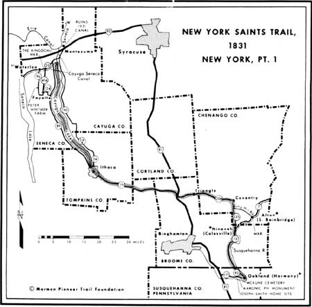
Map 1: New York Saints Trail, 1831, pt. 1. (Source: Stanley B. Kimball, Discovery Mormon Trails). |

|
|
Map 1a: New York Saints Trail, 1831, pt. 2. (Source: Stanley B. Kimball, Discovery Mormon Trails). |
|
|
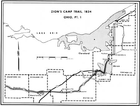
Map 2: Zion's Camp Trail, 1834, Ohio, pt. 1. (Source: Stanley B. Kimball, Discovery Mormon Trails). |

|
|
Map 2a: Zion's Camp Trail, 1834, Ohio, pt. 2. (Source: Stanley B. Kimball, Discovery Mormon Trails). |

|
|
Map 2b: Zion's Camp Trail, 1834, Indiana. (Source: Stanley B. Kimball, Discovery Mormon Trails). |

|
|
Map 2c: Zion's Camp Trail, 1834, Illinois, pts. 1 and 2. (Source: Stanley B. Kimball, Discovery Mormon Trails). |

|
|
Map 2d: Zion's Camp Trail, 1834, Missouri, pts. 1 and 2. (Source: Stanley B. Kimball, Discovery Mormon Trails). |
|
|
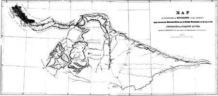
Map 3: The Fremont-Prues Map, 1843. (Source: John C. Fremont, Report of the Exploring Expedition Lying between the Missouri River and the Rocky Mountains... 1843). |
|
|
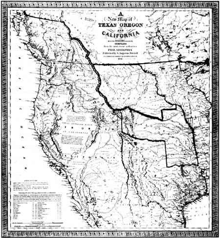
Map 4: S.A. Mitchell's New Map of Texas,
Oregon, and California, 1846. (Source: Facsimile copy. See also Wheat, Mapping the Transmississippi West, 1540-1861, vol. 3, 29 and 34-35). |
|
|
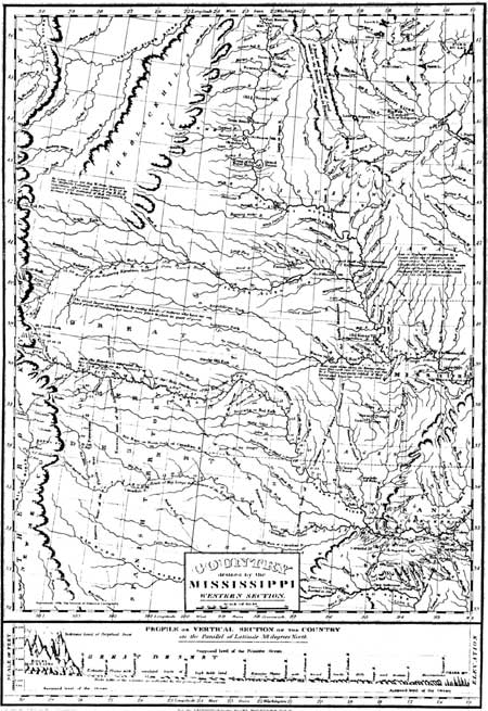
Map 5: Major S.H. Long's 1823 Map of
the Country Drained by The Mississippi. (Source: Edwin James, Account of An Expedition from Pittsburgh to the Rocky Mountains 1819-1820). |
|
|
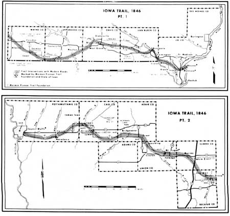
Map 6: The Mormon Trail Across Iowa, 1846. (Source: Stanley B. Kimball, Discovery Mormon Trails). |
|
|
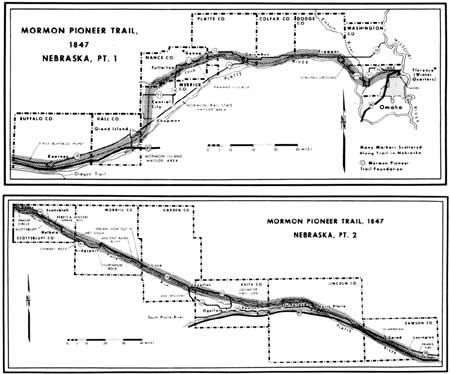
Map 7: Mormon Trail Across Nebraska, 1847. (Source: Stanley B. Kimball, Discovery Mormon Trails). |
|
|
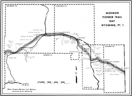
Map 8: Mormon Trail Across Wyoming, 1847, pt. 1. (Source: Stanley B. Kimball, Discovery Mormon Trails). |

|
|
Map 8a: Mormon Trail Across Wyoming, 1847, pt. 2. (Source: Stanley B. Kimball, Discovery Mormon Trails). |
|
|
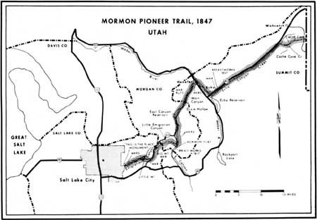
Map 9: Mormon Trail In Utah, 1847. (Source: Stanley B. Kimball, Discovery Mormon Trails). |
|
|
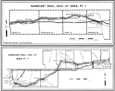
Map 10: The Handcart Trail Across Iowa, 1855-1857. (Source: Stanley B. Kimball, Discovery Mormon Trails). |
|
|
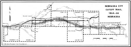
Map 11: The Nebraska City Cutoff Trail, 1864-66. (Source: Stanley B. Kimball, Discovery Mormon Trails). |
|
|
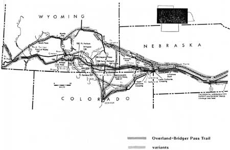
Map 12: The Overland-Bridger Pass Trail, 1862-1868. (Source: Stanley B. Kimball, Historic Sites and Marker). |
|
|
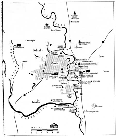
Map 13: Sketch of Council Bluffs-Winter Quarters Area, 1846-1853. (Source: Gail G. Holmes, "The LDS Legacy in Southwestern Iowa.") |
|
|
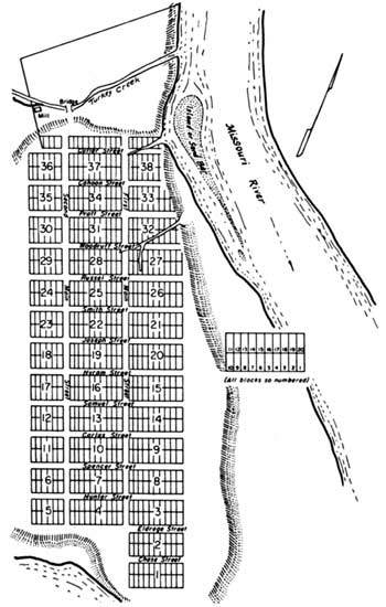
Map 14: Sketch Map of Winter Quarters, 1846-1847. (Source: Richard E. Bennett, Mormons at the Missouri 1846-52). |
|
|
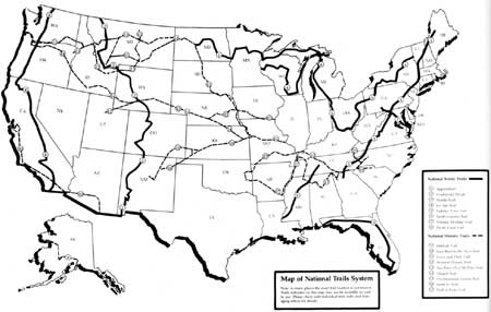
Map 15: National Trails System, 1990. (Source: Report on America's National Scenic, National Historic and National Recreation Trails, 1989-1990, January 1991, National Park Service, U.S. Department of the Interior). |
| <<< Previous | <<< Contents >>> | Next >>> |
mopi/hrs/appa.htm
Last Updated: 08-Oct-2003