|
Navajo
A Place and Its People An Administrative History |

|
CHAPTER III:
THE LIFE OF A REMOTE NATIONAL MONUMENT 1912-1938
In the first decade of the twentieth century, proclamation of a national monument had none of the connotations of the modern park system. A proclamation was an announcement to law-abiding citizens that an area was reserved. It contained no clauses concerning development or funding, staffing, or use. A reserved area meant exactly that: an area protected from land patents, mineral claims, and other forms of officially authorized settlement.
A kind of protection best described as "warning sign" preservation developed as a result of the proclamations of this era. [1] Despite the hullabaloo surrounding Navajo National Monument, the interest of scientists, the Smithsonian Institution, and the formal structure of government science, no formal system of protection arose. John Wetherill remained the nominal custodian, and while he took an active interest in the fate of the ruins of the Tsegi Plateau, he was also involved in numerous other activities. Like the vast majority of national monuments, Navajo remained subject to the wind and rain, the depredations of passers-by, and the intermittent interest of officialdom. Ignored by the federal bureaucracy, places like Navajo National Monument were best protected by their remote location.
In the middle of the western Navajo reservation, far from the railroads and roads that increasingly traversed the West, Navajo National Monument was out of the mainstream of the twentieth century. As yet poorly mapped and surveyed, it was inaccessible to the principal arteries of travel, the nearest of which was the railroad spur from Williams, Arizona, to the Grand Canyon, built at the beginning of the century. Yet from Flagstaff or the Grand Canyon to the Marsh Pass area was still a significant distance--more than one hundred miles. In addition, trails to the region were poorly marked. Most of the people that used them knew the way and had little reason to place signs for outsiders. Only the hardiest and most adventuresome of mainstream Americans endured the long trip from civilization to the ruins. Archeologists composed the majority of visitors, for they had more or less free run of the monument. Most other visitors who did make the trip had a pre-existing interest in archeology. Few people simply wandered up to the monument in this era.
This inaccessibility and lack of formal protection characterized Navajo National Monument for the subsequent quarter of a century. The federal agencies responsible for the monument, including the National Park Service, allocated few resources for Navajo. There was no live-in caretaker, nor were structures or quarters constructed. Formal interpretation did not exist, nor did the kind of infrastructure that brought people to a park area. As a result, Navajo remained among the least developed national monuments, an example of both the advantages and drawbacks of warning sign preservation.
In 1912, the General Land Office retained responsibility for Navajo National Monument and the other places in the monument category. Perennially understaffed and possessed of a reputation for corruption, the GLO had a vast range of management responsibilities in the West. Its special agents reported on conditions in the monuments as well as on land claims, homestead patents, the disposition of natural resources, and a range of other activities. [2] In the view of the bureau, individual national monuments were far from positions of primacy in the system.
As a result, much of the interest in Navajo emanated from the Smithsonian Institution, the Bureau of American Ethnology, and the archeologists interested in the region. Neil Judd, Byron Cummings' nephew and assistant, took a job at the U. S. National Museum in Washington, D. C., bringing him in contact with the leading people in federal science and building links between what had formerly been the western archeological community and the powers in Washington. [3] As the divergent viewpoints in archeology came closer together and younger scientists like Judd bridged remaining gaps, the distinctions drawn by people like William B. Douglass became less important. A decrease in competition and rivalry resulted.
GLO special agents in the West also paid closer attention to the resources in their care after 1910. Their job had evolved from pointing out the salient features of the western landscape to suggesting ways for its utilization. By 1916, two different special agents, Roy G. Mead in 1914 and W. J. Lewis in 1916, had visited the monument and filed reports on the conditions there.
The reports showed the situation and predicament of Navajo National Monument. Betatakin and Keet Seel showed signs of excavation, while Inscription House appeared to be in the poorest condition of the three. Mead recognized that the differences in construction materials and the open nature of the ruins there contributed to the situation at Inscription House. Both Keet Seel and Betatakin were protected from the elements by the natural overhangs above them.
Cummings appeared to be the person responsible for most of the excavations at Keet Seel and Betatakin. In 1914, Mead attributed work at both to Cummings, who held permits from the Department of the Interior, but also suggested that even the first-rate custodial care provided by John Wetherill was not enough to protect the ruins. Because he was not on the premises, Wetherill could only deter vandalism when he visited the area. At other times, anyone who happened by could do as they pleased.
Mead also articulated visitation as an objective. This followed from Fewkes' suggestion in 1910 that either Betatakin or Keet Seel be reserved as a type ruin. Mead suggested that ladders be installed at both Betatakin and Keet Seel and construction of a "goat-proof" fence for the base of the cliff below Inscription House. There was also need for guest registers to keep track of the people who visited the ruin. [4] In the eyes of federal agents charged with evaluating land, despite the remote location of the monument, it had potential.
When he visited Navajo late in June 1916, W. J. Lewis came to similar conclusions. The national monument was a "permanent institution," he declared, designed for educational purposes. The monument had to be accessible and useful for those purposes. This required better marking of trails to the ruins and a sign indicating that these ruins were within the boundaries of a federal reserve. The worsening condition of walls in the ruins led Lewis to suggest Cummings, who had served as his guide, as the logical man to supervise restoration at Navajo. He also recommended some trail work to make the Tsegi Canyon trails easier for visitors. [5]
Ironically, one of the issues that Lewis' report pointed out was how poorly the boundaries of the monument protected the wide range of cultural resources in the area. Other important sites were not reserved. Typical of these were Twin Caves ruin and Bat Woman cave, excavated by Cummings in 1912 and 1913. Cummings indicated to Lewis that the two areas were worthy of inclusion in the monument, and Lewis advocated the addition. The limits of the haphazard original proclamation were once again apparent.
Even in 1916, three non-contiguous ruins in one monument meant that any management of Navajo would be fraught with complications. Centralized administration and protection were difficult, for forty miles separated Inscription House from Betatakin and Keet Seel, eight miles apart. Despite the creation of one monument for the three ruins, their fate was linked mostly on paper. Each would require separate trails, approaches, and ultimately protection. Even John Wetherill could not effectively supervise all three at any one time. He informed Lewis that he was powerless to prevent vandalism to the ruins.
Lewis also clearly articulated visitation as an objective for the monument. He perceived a trip to the monument as a benefit for high school or college classes. He advocated printing descriptive fliers for each unit of the monument, an early form of interpretation, and leaving them by the register for visitors to take. "It would seem," Lewis concluded his report, "that a month spent in this vicinity by a class would be the finest kind of educational experience." [6]
The situation at Navajo was typical for national monuments during the 1910s. No agency had specific responsibility for such places, and administration remained piecemeal. Special agents visited when they could, but many other responsibilities fell their way. Once or twice a year was all they could manage. Recognizing this, Lewis recommended that John Wetherill be designated a U.S. Deputy Marshal as acknowledgement of the level of responsibility the famed Indian trader accepted. Without funding, staff, or protection, most of the early national monuments simply wallowed, vulnerable to natural and human depredation. [7]
The creation of the National Park Service in August 1916 seemed a remedy for the predicament. After four years of active lobbying, the new bureau came into existence to manage the existing national parks and the national monuments under the jurisdiction of the Department of the Interior. Stephen T. Mather, a graduate of the University of California and a Chicago public relations wizard who made a fortune in borax, became its first director. It seemed that the conditions for park areas such as Navajo National Monument would improve. [8]
The Park Service took on the personality of its new director and his alter ego, a young Californian named Horace M. Albright. As befitting an entity tied more to the emerging consumer culture than the receding Progressive era, the bureau was aggressive from the start. To survive, it had to carve a niche among the other agencies that administered natural resources. Foremost among these was the United States Forest Service in the Department of Agriculture. The Park Service and the Forest Service became instant rivals, for they shared elements of their missions and most of their constituencies. As a result, Park Service policy until the New Deal was shaped by the reality of its conflict with the Forest Service. [9]
The conflict prompted the NPS to become a dynamic, promotion-oriented agency. Mather recognized that national parks had strong symbolic connotations for Americans and he worked to bring the attributes of the system to the attention of the public. Almost instantly, the Park Service began to distribute pamphlets, photographs, and books about the national parks. Mather pressed for better campgrounds and more comprehensive railroad service, and the American public took notice. The preservation/use dichotomy was inherent at the founding of the Park Service, and Mather leaned heavily toward use. [10]
Mather's commitment to visitation meant that areas with considerable public appeal and tied into networks of transportation were the most likely candidates for development. The railroads were the primary means to bring visitors to parks, and Mather quickly began to develop a park-to-park highway that would include all of the major national parks in the West. The result was a dramatic fifteen-year period of growth that saw the acquisition of most of the major national parks in the Southwest. Grand Canyon, Zion, Bryce Canyon, and Carlsbad Caverns national parks were all established during Mather's tenure, as were numerous national monuments that furthered this strategy. [11]
Navajo National Monument was not among the parks promoted by the Park Service before the advent of the New Deal in 1933. Far from any of the passenger railroads in the Southwest and not fortuitously located between any of the major national parks, Navajo remained outside the scope of agency development. Despite a growing emphasis on development throughout the system in the 1920s, only the structure of the Park Service reached Navajo. Its resources did not. "Hosteen" John Wetherill learned to cope with what must have seemed a flood of paperwork to a man who chose to live far from the reach of bureaucracy. Beginning in the spring of 1917, the Park Service requested information on him for its personnel file, an annual report on conditions, and estimates for essential projects. [12]
To a man who not only lacked a budget or quarters and had never been paid even the dollar per month to which he was entitled, this new agency seemed impressive. Wetherill strove to respond, reporting that Cummings had done some excavating in the past year under his permit, as had a number of unauthorized Bureau of Indian Affairs employees from Tuba City, about fifty miles to the south. The conditions of the ruins remained "much the same," he laconically reported, adding that the only improvement he required was a register for visitors to sign. [13] Despite his savvy nature, Wetherill had yet to learn the importance of stating his case for the budget process.
Throughout the first decade of National Park Service administration, the only funds appropriated for Navajo National Monument came from the Smithsonian Institution and the Bureau of American Ethnology. W. J. Lewis' recommendations for further excavation received the attention of high level staff at the Department of the Interior, where officials referred it to the Smithsonian. A $3,000 appropriation that had to be expended by the end of fiscal 1916-17 resulted. Neil Judd had gone to work at the National Museum in 1911, and he became the leading candidate in place of Lewis's suggestion of Cummings. The anti-university bias that Douglass had helped to instill in Department of the Interior nearly a decade before remained strong. Smithsonian officials were not sure that they could allow anyone who was not directly affiliated with the federal government to head a government-financed expedition. As an employee of the National Museum, Judd had the appropriate credentials. Yet Charles D. Walcott, an internationally known geologist and Secretary of the Smithsonian, wanted Cummings to be involved in the project. [14]
Despite the efforts at compromise, Cummings avidly sought the position. He asked both Arizona senators, Marcus A. Smith and Henry Ashurst, to lobby on his behalf. Ashurst was particularly influential; he sat on the Senate Indian Affairs committee, through which the appropriation had come in 1916. As the pressure mounted, Smithsonian officials turned to Judd. He was both Cummings' former student and nephew, and he seemed a perfect selection. The choice of Judd would not offend Cummings or anyone else in western archeology. [15]
Smithsonian officials had to act quickly. The appropriation had to be spent before June 30, 1917, and Cummings clearly had influential backers. They had to choose quickly or risk losing the funding. By the end of February 1917, they were out of time. Walcott selected Judd, who later recounted that he was surprised to be selected. [16]
Judd had about two weeks notice to pack and head west. In early March 1917, he was informed by a bureau representative full of demands about reports and procedures that he was to head the expedition. Judd barked at the man, who "had never been west of the Alleghenies," to tell him that one report would have to suffice. It did. Judd left Washington, D.C., by train on March 16, arriving in Flagstaff three days later. He hired three laborers off the street, piled them into an automobile, and drove to Tuba City, about seventy-five miles from the railroad depot. John Wetherill and his teamster, Chischili-begay, met them there with a four-horse freight wagon. A two-day trip to Kayenta ensued, and from there the party rode to Betatakin on horseback with a pack team. They arrived at the ruin on March 27 to find two feet of snow.
Judd made the decision to limit the excavation to Betatakin. Although the appropriative legislation indicated work should be performed on all three ruins, Judd recognized that since he had to expend the funds by the end of the fiscal year on June 30, he could not do a credible job on all three. As a result, he chose Betatakin because he perceived it as the most accessible to visitors. [17]
Despite American entry into World War I, Judd and his crew continued to work until June. A few days after Woodrow Wilson's declaration of war, a Navajo agency policeman from Tuba City arrived in Betatakin with induction notices from the draft board. Judd and his crew were the only strangers in the county, and made excellent targets. Yet temporary work did not an address make, and after considerable explanation, the work continued. Food was in short supply that spring, and the weather was often bad. The temperature dropped well below freezing every night for the first three weeks, snow and hail storms occurred commonly until the start of June, and sandstorms followed them. Even Wetherill's trading post was low on provisions. Judd had to walk the twenty miles to Kayenta to scrounge food on three separate occasions. By early June, the work was completed, and the crew returned to Flagstaff. [18]
But that appropriation was the only allocation of federal money for Navajo for more than another decade. The monument remained far outside the mainstream of Park Service efforts. During the 1920s, the agency developed its focus on the "crown jewel" national parks, places such as Yellowstone and Yosemite. The agency spent the 1920s developing facilities for visitors at these flagship parks, and a two-tiered park system developed. The places with the most attractive and spectacular scenery also had roads, hotels, and amenities; the rest of the system lacked comfortable trappings and appropriations. [19] Generally national monuments were low on the list, and few places were lower than Navajo National Monument. Located in a remote and seemingly inhospitable corner of the Navajo reservation, it had few of the attributes that Americans sought when they looked at their park system.
Even the advent of a system of management for park areas in the Southwest did little to help Navajo. In 1924, Frank "Boss" Pinkley, the custodian of Casa Grande National Monument in south central Arizona, became the superintendent of the southwestern national monuments. Self-trained, aggressive, folksy, and an avid fan of archeology and archeologists, Pinkley shaped a domain by the force of his will. Between 1924 and the early 1930s, he developed a strategy to promote the national monuments under his jurisdiction, brought hundreds of thousands of visitors to the region, began the professionalization of park management in the Southwest, and brought a spirit of camaraderie to the volunteer custodians in his far-flung domain.
Pinkley was an archeology buff, and the monuments with prehistoric themes benefited most from his administration. He knew most of the first and second generations of southwestern archeologists, from Fewkes and Hewett to Kidder, and had great respect for their work. With so many prehistoric areas in his domain, Pinkley directed much of the attention of southwestern national monuments group toward them.
Among his many important programs, Pinkley focused on standardizing service for visitors and creating a permanent paid professional staff. From his headquarters at Casa Grande, Pinkley provided leadership and guidance, holding seminars, evaluating interpretation programs, and training his staff to work at other park areas. By the late 1920s, small amounts of money for custodians began to appear in the annual budget, and Pinkley slowly replaced "dollar-a-year" volunteers with people he had trained himself. Most of them administered small archeological areas such as Aztec Ruins National Monument in New Mexico. In line with Pinkley's philosophy, these areas were usually close to the main arteries of travel through the region. [20]
But at Navajo National Monument, little changed throughout the 1920s. John Wetherill remained as volunteer custodian. He lived in the tent he pitched there each spring and spent as much time as he could at the ruins, but found himself eternally distracted by the trading post and his guide business. While many of the southwestern monuments were developed and prepared for an onslaught of visitation, Navajo National Monument remained as it had always been: a far-away place that attracted mostly those already aware of its attributes.
Despite Frank Pinkley's desire to promote archeological areas, Navajo National Monument remained peripheral even to the southwestern monuments group. Long after development became common among the archeological areas of the Southwest, Navajo lacked any of the amenities Pinkley and the Park Service had elsewhere for visitors. Pinkley had little reason to invest his few resources in a plan without the infrastructure to attract visitors. As a result, it had no link to the modern world, a reality that was both an advantage and a disadvantage.
One factor that made Navajo unwieldy was that for administrative purposes, the monument was an artificial construct. There were three ruins at Navajo, and the long travel between the ruins crossed reservation land and made simultaneous care of the three impossible. No matter how effective the Navajo grapevine, John Wetherill could not be in all three places at once. Often he was not at any of them. Each of the three ruins was an attraction in its own right, and there was no individual primary feature at the monument. Travelers might focus on any of Betatakin, Keet Seel, or Inscription House. There were no resources to support administration, and a visitor might never realize that each ruin was part of a national monument.
Nor was the monument divorced from its surroundings either figuratively or literally. The area around the monument and Navajo Mountain was considered the most traditional part of the reservation. Conservative Navajo "long-hairs" dominated in the area, and their contact with the Anglo world was limited. As late as 1909, many had never met a white; into the 1910s there were still Indian "attacks" on trading posts and Indian agents. [21] Navajos avoided contact with the outside world, and as a result roads and maps of the area were limited. William B. Douglass had surveyed the area, but most of his markers were lost. As late as the end of the 1910s, there were no accurate cartographic descriptions. The tenor of the region in which it was located greatly influenced the growth of the monument. Its isolation prevented the kind of travel that usually generated dollars from Washington, D. C.
Access also remained a major problem. No roads had been built through the area, limiting travel to the existing trails. The trail through Marsh Pass was purported to be an old military wagon road from the 1850s; wags felt it was still in about the same condition seventy-five years later. The most commonly used way to arrive at Navajo National Monument was to follow the path from Marsh Pass that Richard Wetherill first took in the 1890s. This approach followed Laguna Creek to Tsegi Canyon, which wound its way toward Betatakin up one branch and to Keet Seel along another. Coming first from Oljato and later from nearby Kayenta, both north of the monument, John Wetherill institutionalized the path. He took Cummings, Judd, and others that way; in turn they showed others such as William B. Douglass, who Judd took to the area after the discovery of Rainbow Bridge. By 1910, this was the way nearly every Anglo-American arrived at Betatakin or Keet Seel. [2]
This principal access route was neither dependable nor easy. The trip along the main trail from Flagstaff could take as much as six days--under the best of circumstances--and any inclement weather made the ordeal even worse. Marsh Pass could be as much as a day from Kayenta alone, although Wetherill and Clyde Colville improved much of that stretch after 1910. As late as 1910, there was no road into the Tsegi at all. The Fewkes party had to build its own through one of the washes, then about fifteen or twenty feet deep. Fewkes had his men use a slip scraper to construct this trail to convey the buckboard wagon in which his wife rode. She was "not one to walk," Fred S. Garing, who worked as a laborer on the expedition, later recalled. The party went first to Betatakin, then to Keet Seel, and later made the forty-mile trip to Inscription House. [23]
Fewkes' trail cemented the main route to reach the ruins. It certainly suited John Wetherill. The trail led almost directly from his trading post at Kayenta, and as a result, he could keep a close watch on Betatakin and Keet Seel. It also helped his guide business, although his style of driving did not. Wetherill was known to stop his car at the bottom of every steep rise, put it in low gear, push the accelerator to the floor, and never slack off until he reached the top. Cummings also used this trail for his frequent trips to the area, and it became the favored way selected by archeologists. By 1914, it was clearly if roughly demarcated. Although in earlier accounts, the difficulty of the trip elicited comment, by 1914 it seemed no more difficult than any other part of the journey to a remote corner of the reservation.
|
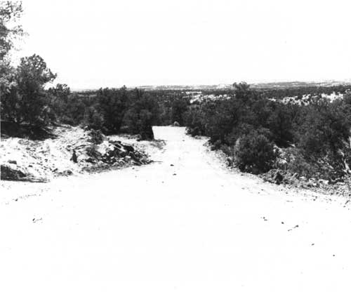
| The old entrance road could be difficult to traverse. |
Small developments in the area began to create new ways to reach the ruins. A closely regulated network of trading posts grew, some independent, others belonging to the Babbitt brothers of Flagstaff. One of these was at Shonto, about ten miles southwest of Betatakin. In the winter of 1929-30, Harry and Elizabeth Rorick took over the trading post. Unlike the previous inhabitants of the trading post, they were attracted to it in part because of the proximity to Betatakin. Friends of the Wetherills, they planned a future guide service to the ruins. The Roricks hired two local Navajos, Cap Wolf and Bob Black, who later worked at the park for many years, to build new guest hogans for visitors, entertained a number of important Park Service officials, and tried to attract people to their trading post.
But the trading post needed better access. The first step was some sort of road. The Roricks engineered a road to the west toward Begashibito, which was soon washed out by unusually bad flooding in the fall of 1930. Harry Rorick had some road surveying experience, and together with a crew of Navajos and some equipment from the Indian agent in Tuba City, he built a new road to the east that went near Betatakin and linked up with the main road to Flagstaff. Via Shonto, there was now a new way to reach Betatakin. [24]
The Roricks worked to promote Shonto as an alternative route to reach Betatakin. Elizabeth Rorick had ties to the National Park Service and Harry Rorick at one time worked for Fred Harvey's tourist service operation. In late April or early May 1931, Harry Rorick started his push to bring Shonto to the attention of the Fred Harvey Company. He took E. M. Ennis, second-in-charge of the Harvey operation at the Grand Canyon, and Ray Williams, the official photographer for the Harvey company, to Betatakin for a camping trip. Rorick was trying to sell them on the idea of a Shonto-based Indian Detour side trip from the Grand Canyon.
The trip was enjoyable, but it had serious consequences. After the party left, John Wetherill found the campsite covered with trash. Worse, Ennis had carved his name into a tree on the approach to Betatakin. Wetherill communicated this to Frank Pinkley at Casa Grande, who promptly exploded.
Pinkley had spent more than twenty years trying to teach the traveling public to behave, and wanton behavior like this from ostensibly responsible people was too much. In typical fashion, Pinkley fired off a missive to Rorick demanding an apology, threatening legal action, and generally assailing the character of anyone who would behave in this fashion. Pinkley often overreacted in such situations, for he had an evident proprietary feeling for each of the southwestern monuments, a lack of regard for those who had no respect for government property, and a quick temper. [25]
But Pinkley had not counted on Elizabeth C. Rorick's response. Before her marriage to Rorick, she had been married to Michael Harrison, who worked for the Park Service at the Grand Canyon. She knew a number of influential bureau people, including Horace Albright, who became director of the NPS in 1929. Elizabeth Rorick contacted Albright, explaining that Pinkley made a mistake attributing the mess in the canyon to Harry Rorick's party and acknowledging Ennis' name carving. She also stressed the Roricks' desire to work closely with the Park Service to promote the region, using the magic Harvey name. [26] The Park Service relented, and the new approach to Betatakin became acceptable to the agency.
Clearly the road from Shonto worried John Wetherill. It intruded on his dominance of hospitality in the region and made the level of protection he could offer the monument inadequate. The trading post at Kayenta would cease to be a necessary stop for visitors to Tsegi Canyon. The new road had the potential to threaten John Wetherill's livelihood, and his response showed how clearly he recognized the challenge. Wetherill suggested that the road would encourage more grazing of the canyon floor, and made it a point to alert the agency to every instance of vandalism that occurred when travelers came from Shonto. Park Service officials recognized Wetherill's position for what it was, and the road from Shonto grew in importance.
Ironically, the change in direction of approach provided Keet Seel with de facto protection that it never before enjoyed. Coming from the west to the closed end of Tsegi Canyon above Betatakin made Keet Seel a remote destination. Not only did visitors have to descend from the mesa, they had to ride another seven miles and successfully negotiate a change in canyon branch. Most of the travelers who reached Shonto were not equal to the task. In contrast the trip from Kayenta gave travelers a nearly equal chance to see Betatakin or Keet Seel. Coming from Marsh Pass, they faced two different forks of the same canyon and could visit either ruin with equal difficulty. The change in direction made Keet Seel more remote, and for some visitors, it was less impressive than Betatakin. In the 1920s, one remarked, it "was a let-down to me after Betatakin." [27] Less spectacular and more thoroughly excavated, Keet Seel began to recede from the primary position it occupied beginning in the 1890s.
Yet the emergence of the Shonto route as the primary approach to Betatakin was fraught with problems. The trail was poorly marked, and a number of visitors, including Agnes Morley Cleaveland, who later became a noted southwestern author, lost their way. The increase in visitation that John Wetherill did not supervise or know of led to instances of vandalism, and clearly more protection was essential. Stock also wandered into the Betatakin area, damaging the ruins and accelerating existing erosion. The Roricks wanted trail markers between Shonto and the ruins, and visitors such as Cleaveland echoed their sentiments. [28]
Frank Pinkley found himself in a difficult situation. The Roricks had created a new approach that bypassed John Wetherill, and in fact was a far more convenient to way to reach Betatakin. Pinkley felt he needed to carefully address this situation, for Wetherill and the Roricks were in economic competition. Pinkley did not want to create any appearance that the Park Service favored Wetherill because he served as custodian of the ruins. Pinkley also appreciated the hospitality that the Roricks offered visitors and felt that their activities helped promote the monument. Their service was far less expensive than Wetherill's and the trip was shorter as well. Pinkley opted to study the situation before committing NPS resources to fence trails. [29]
The situation was further complicated by the construction of a new road to the rim of Tsegi Canyon by the Forestry Service of the Bureau of Indian Affairs. The road stretched from the Shonto Trading Post to what is now called Tsegi Point, and Park Service engineers planned a trail to Betatakin. Its construction meant that visitors could bring their cars within a mile of the ruins. John Wetherill misunderstood the descriptions given him by BIA and the NPS engineers. He thought the road would end above Betatakin at the south end of the canyon and the trail would proceed to the ruin from there. Walter Atwell, one of the leading NPS field engineers, visited the region. He and Wetherill traversed the canyon and found the new road and stakes for the trail. The location posed fewer problems for Wetherill. It did not offer an easier way for stock to reach the ruins, nor did it favor the Roricks' enterprise over his own. [30]
But the new approach and the embryonic development program suggested the inauguration of major change in the patterns of visitation at the ruins of Tsegi Canyon. While accommodating visitors had been an objective for Navajo even during GLO administration of the ruins, the numbers had never seemed a threat. Despite the rugged conditions, the advent of tourism at Shonto required a response, particularly because the Park Service emphasized service in the 1920s and the New Deal made creating an infrastructure possible. Faced with growing numbers of visitors, the agency needed to take action.
Farther to the west at Inscription House, a similar process occurred. In 1926, Samuel I. Richardson left Rainbow Lodge to build a new trading post on Red Mesa. Called Inscription House Trading Post after the ruins in the canyon below, the new post replicated the advantages of Oljato, Kayenta, and Shonto before it. It was distant enough from the nearest posts to have an intrinsic local trade of its own and it held the added attraction of the ruin in the canyon. Richardson blasted out a four-foot wide trail through stone from the mesa to the ruins below and began to set up a cottage industry similar to that of Richard Wetherill in the late nineteenth century. Numerous parties of archeologists and buffs, some from respected museums, packed down the trail, and in the late 1920s, at least one hundred mule-loads of artifacts came out. Yucca sandals, pottery and baskets, turquoise, shellbeads, and bracelets, fabrics woven of human and dog hair, wooden fetishes, and many other artifacts were taken for public and private collections. [31]
Richardson's activities attracted the attention of Park Service personnel. Richardson was open about his actions, and visiting agency people heard rumors of numerous unauthorized collections. In early 1930, Ansel F. Hall, Chief Naturalist of the Park Service, brought the situation to Frank Pinkley's attention. According to Hall, who spent the summer of 1929 in the Navajo National Monument area, Richardson had been involved in pot-hunting since his days at Rainbow Lodge and had sold much of what he found to the Heard Museum in Phoenix. Hall acquired the information in confidence and had not been able to confirm it. Pinkley checked out the rumor with the Heard Museum, where officials unequivocally denied the charge. Pinkley was inclined to believe them, for he thought Richardson knew well the rules governing illegal pot-hunting. Tourists comprised a large percentage of his business at both Rainbow Lodge and Inscription House, and Pinkley thought that Richardson recognized that he depended on Park Service cooperation. Pinkley promised to remain vigilant, but found little to confirm Hall's suspicions. [32]
Again the disadvantages of a non-contiguous monument without full-time staffing were apparent. Richardson spent more time at Inscription House than did anybody in the Park Service, and even John Wetherill, with all his knowledge of the region, could do little to prevent Richardson's actions. To people like Richardson, the fruits of prehistory were theirs to harvest; their value system reflected the first-come, first-served ethos of the settlement of the West. Despite the existence of laws like the Antiquities Act, there was little that could be done without an investment of capital and workpower. But the agency still had far too few resources to adequately protect every park and monument, and there were many other park areas ahead of Navajo on the list of NPS priorities.
At this time, national park status was the prize that assured the survival of a park area, and during Horace Albright's administration, acquisition of new park lands was the critical feature of NPS policy. The best way to improve the chances of Navajo National Monument was to elevate it to park status, acquiring new land in the process. During the early years of the depression, Albright successfully made an efficient-management-by consolidation argument on a number of occasions. A number of new and enlarged park areas resulted. By the early 1930s, Navajoland, as the reservation area had been labeled, and the Navajo National Monument area looked like good candidates for such a proposal.
There were major problems to be surmounted in this process, the most significant of which was the presence of Navajo people in the area sought for a national park. Since its inception, the Park Service had focused on scenic parks. The acquisitions of the 1910s and 1920s, from Zion to Grand Teton national parks, all had spectacular natural features. Most were isolated, high mountain areas, where few people lived. But with the authorization of eastern parks areas in the mid-1920s, the NPS found itself displacing people in the Great Smoky Mountains and the Shenandoah region. In one instance at Cades Cove, Tennessee, park rangers and local people engaged in a pitched gun battle when the NPS tried to take over land it acquired through the power of eminent domain. The situation reflected poorly on the NPS, and influential people tried to persuade Albright to change policy. By 1930, Albright had adroitly switched his goals, considering the incorporation of people native to a region in new parks. [33]
The result was an attempt to create a national park in the vicinity of Navajo National Monument. Early in 1931, Roger Toll, the superintendent of Yellowstone National Park and the primary inspector of proposed park areas in the West, arrived to inspect the Navajo reservation. Toll spent a night at Shonto with the Roricks, visited numerous park areas, and produced a report recommending the establishment of Navajo National Park. His proposal suggested that the park should encompass Monument Valley, Canyon de Chelly, and a number of other features in the region. Navajo and Rainbow Bridge national monuments were to be included in a detached section of the proposed park. Toll believed the State of Arizona would support the idea and the Indian Service could be persuaded. Typical of the attitudes of the time, he made no mention of the desires of the Navajo people. [34]
The Park Service geared up for a push to create a new national park. Albright gave Toll's report to Charles Rhoads, the Commissioner of Indian Affairs, contacted Robert S. Yard, the driving force behind the National Parks Association, and made plans for a western swing. During the 1920s and early 1930s, this approach typified the acquisition efforts of the Park Service. [35]
Rhoads instantly decided against the project, but that did not thwart the NPS. Rhoads felt that the Navajos needed more, not less land, to offset the growing problem of overgrazing on the reservation. The reservation lands given them after Bosque Redondo did not encompass the traditional boundaries of Navajo inhabitation, and in the 1880s, Navajos began to live on public domain land. Initially this posed little problem, but by the 1930s, a number of changes had come together to create an untenable situation. Some of the best land around the reservation fell into the hands of Anglo and Mexican-American cattlemen and sheepmen. Simultaneously, the Navajo population increased, as did the quantity of their stock. By 1930, a larger number of Navajo and their animals had to subsist on a smaller, more thoroughly used area of land. From Rhoads' perspective, to give up some of that land base for a national park was folly. [36]
This failed to deter Albright, who persisted with the park plan. Albright intended to incorporate the Indians in the park, not expropriate their land, and the proposal was important enough to pursue. Conrad L. Wirth, who entered the Park Service through the New Deal and served as its director from 1951 to 1964, wrote a strong memo supporting Toll's proposal, and despite opposition from Harold C. Bryant, the head of the NPS Division of Education, and Washington B. Lewis, Albright continued. The proposal gathered momentum in the NPS after agency counsel George A. Moskey suggested an agreement with the Navajo similar to the one that helped establish Canyon de Chelly National Monument. In that instance, the Navajo Council sought to manage concessions at the monument. Albright contacted Rhoads again in December 1931, but Rhoads immediately asked him to forgo the project until the Navajo were in a better situation. Albright retreated, but only temporarily. In classic Park Service style, he waited for a better moment. [37]
The need for more land for the Navajo was acute, and Rhoads made a boundary extension of the reservation his priority. At the end of the Hoover administration in the midst of the depression, Congress voted to add the "Paiute Strip" in southern Utah to the reservation. The addition included Rainbow Bridge and much of the Navajo Mountain area. The bill itself was a compromise, passed after negotiation between the state of Utah and Bureau of Indian Affairs. It contained one clause important to the Park Service: "It is agreed that the scenic tracts [in the addition] are to be developed by the National Park Service with the cooperation of the Indian Service." [38]
Albright and the Park Service interpreted this clause as a signal to proceed. By early 1933, the proposal again had life as the NPS tried to capitalize on the activist role of government that was the hallmark of the New Deal. The ascension of Franklin D. Roosevelt to the presidency played a major role in the rebirth of the proposal. Albright was close to Harold L. Ickes, Roosevelt's crusty Secretary of the Interior, and was able to develop high-level support for his projects. Efficiency was the watchword in the federal government. The glib Albright easily convinced many people that consolidating a number of small monuments in one park would trim expenses. In addition, the success of nearby Grand Canyon and Zion national parks strengthened his argument. Navajo people could benefit economically and have their way of life protected simultaneously. Indian Service officials told Wirth that the Navajo would approve as long as the conditions under which the park was established were similar to those at Canyon de Chelly. [39]
During the summer of 1933, the park seemed a certainty. The Bureau of Indian Affairs supported the proposal, and its officials believed that the tribal council would pass the bill at its next meeting. But on July 8, the Navajo Council postponed consideration of the bill until the fall meeting. Park Service officials anxiously awaited the meeting. Minor R. Tillotson, superintendent at Grand Canyon, even volunteered to attend the meeting to present the proposal. [40]
At the meeting in Tuba City in October, the new Commissioner of Indian Affairs, noted reformer John Collier, put forward a comprehensive set of programs to change the basic nature of the Navajo economy. Under a program to protect rangelands from overgrazing, Collier mandated a stock reduction program for the Navajo. Despite opposition, Collier persuaded the Tribal Council to acquiesce. In return, he promised to deliver a boundary extension for the Navajos that would encompass at least part of the railroad checkerboard lands and other parts of the public domain where Navajos lived.
These programs were well-intentioned, but in the end they did vast damage to the Navajo economy. Collier's stock reduction program started as soon as the funds arrived. The number of livestock Navajos owned was dramatically reduced as the BIA sought to make policy that assured the long-range health of the Navajo economy by protecting grazing land for the future. Unfortunately, the program impoverished many Navajos in the short-term, putting many of them in desperate straits. Most were destitute, some starved, and many had to alter their lifestyle in response to the program.
The stock reduction was supposed to assure further expansion of the reservation, but in this effort, Collier failed. In 1933-34, he pushed for an extension of the reservation. The historic roots of the extension dated from the first decade of the twentieth century, when similar efforts to expand the boundaries had been initiated. But in the 1930s, vocal constituencies, generally local Anglo sheep and cattle interests, protested the proposal. The legislative delegations from New Mexico and Arizona fought the bills, and the extension was never granted.
The Navajos were confounded. No event since the exile to the Bosque Redondo in the 1860s was more demoralizing than the enforced stock reduction plan. Collier had been their advocate for more than a decade, but in one seemingly capricious and poorly communicated action, he destroyed all the good will he previously established. The Navajos became suspicious of any government program as the effects of the stock reduction and the failure to gain land in New Mexico loomed as a threat to the Navajo way of life.
The NPS tried to ride on the tails of increased federal involvement on the reservation to get the park established. The New Deal gave federal agencies greater power than they previously had and agencies such as the Park Service sought to convert that power into tangible gains. Navajo National Park was not designed to create a landscape without people as had earlier national parks; instead it proposed to incorporate the Navajo into a living, breathing national park that would use the largess of the modern world to protect the Navajo way of life.
This seemingly patronizing approach typified the paradox for Indians and other minorities contained within the New Deal. Federal programs proposed the use of science to restore degraded environments, but simultaneously insisted that Navajos and others use those environments in a limited way. Similar programs for Anglo-American farmers had no such requirement. Instead they promoted a wise technologically based use for the twin objectives of yield and profit. For Navajos, science was to allow a return to old ways. The park proposal would only add a formal structure that froze the Navajos in a moment in time.
The park project failed. Navajo suspicion of federal actions first stymied the proposal and finally squashed it. Collier's efforts to help the Navajo retain subsistence through federal programs aroused anti-park sentiment. When he could not deliver the promised boundary extension, the trust the Navajo had in him diminished. Nor could Collier himself support the park proposal. After failing to deliver on his promise, he could not be party to further restrictions on Navajo land. Without affirmation from either the Navajo people or Collier, the NPS had no chance of success. [41]
Although it failed to genuinely help the Navajo, the New Deal provided vast benefits for most of the park system. Under the aggressive Ickes, the Department of the Interior took the lead in the implementation of New Deal programs. The importance of the Park Service grew tremendously as it became a primary venue for labor-intensive programs. The agency nearly doubled its holdings as a result of Roosevelt's reorganization of the federal government in August 1933. All of the new areas and many of the old needed the investment of capital and labor that the New Deal made possible.
For the archeological monuments of the Southwest, the New Deal was the answer to Frank Pinkley's long-held dream. Finally the resources that had been lacking throughout the 1920s were available, and Pinkley put them to use. Across the Southwest, roads and trails, museums, administrative offices, ranger quarters, and an entire array of other kinds of facilities were constructed. At Bandelier National Monument in New Mexico, a mini-city built of indigenous materials arose as a result of the New Deal camp there, and nearly every other archeological area benefited in some way. [42]
But again, Navajo National Monument was overlooked. No Civilian Conservation Corps camp was located there, nor were extensive roads and trails constructed. The monument was too far from the principal avenues of visitor travel to merit a significant outlay of money and labor. Instead, Navajo received a minuscule portion of the available resources. A Civil Works Administration crew under the direction of Irwin Hayden was its primary benefit from the New Deal. In 1933-34, the crew stabilized rooms at Keet Seel, the extent of the reach of the New Deal to this remote corner of the Navajo reservation. [43]
For the Park Service, the New Deal was the pinnacle of its existence until that point. Nearly every park area with some visitation potential was developed under the auspices of the New Deal, as the agency was able to fulfill even the most far-fetched wish-lists. The nearly total absence of Navajo from the development of the New Deal shows how far down on the list of priorities the monument was located. In Frank Pinkley's previously neglected domain, Navajo was passed over in the greatest moment of government largess thus far.
But even in the heady days of the New Deal, it was a long way from using CWA money to stabilize ruins to hiring a full-time paid custodian. Ever prepared, Frank Pinkley developed a plan for Navajo similar to those he designed for other southwestern national monuments. Vandalism, growing numbers of unsupervised visitors, erosion, and fencing all required action. Pinkley's solution to all the problems was a full-time, on-site professional custodian. "We must have someone in charge to show these visitors around and protect these valuable ruins from them," Pinkley informed Arno B. Cammerer, who had succeeded Albright in 1933. Because the monument was divided into non-contiguous sections, Pinkley warned that one person would not be sufficient and a second to share the duties and provide relief was essential. So was a building at the head of the canyon above Betatakin.
But Navajo was unique. Besides the distance between its sections, the Park Service had little control over the lands in between. About twelve Navajos lived in the canyon, one of whom appeared to control land usage. Pinkley proposed to treat him as the leader and negotiate a deal. In exchange for removing their cattle and sheep from Tsegi Canyon, Pinkley wanted to offer the Indians the right to place a hogan above Betatakin and charge travelers a toll for crossing their land. This arrangement would preserve the special qualities of the place and treat Navajo people in the area in an equitable fashion. But it required personnel. [44]
The plan and budget that Pinkley had his staff put together for Navajo was impressive. It included the two full-time positions as well as equipment, animals, residences, and a water and sewer system. The $19,300 recommended for expenditure far exceeded the total the NPS spent at Navajo between 1916 and 1934. [45] The program was more evidence that the New Deal changed the scope of agency expectations. By the pre-1933 standards of the agency, it was extravagant. In the reality of expenditures authorized by New Deal programs, it was distinctly possible. Yet despite the cost, the program established only a skeletal protection structure.
In 1934, John Wetherill received a part-time seasonal ranger for the first time. His nephew, Milton Wetherill, was the choice, and for the following four summers, he served as ranger, ranger-historian, and laborer at the monument. Milton Wetherill proved more than satisfactory. Possessed of a seemingly hereditary interest in the ruins, he worked on projects ranging from the flora and fauna of Betatakin to stabilization and the study of prehistory in the region. As John Wetherill neared retirement, his nephew seemed a logical selection to succeed him.
By 1938, the end of his career as custodian was near for John Wetherill. The road from Shonto had supplanted his outfitting business for the canyon, making the trading post an ineffective place from which to guard the ruins. Wetherill was extremely busy during the summers of the 1930s, for he traveled extensively with the annual Rainbow Bridge-Monument Valley archeological expedition in each of the summers following 1933. He turned seventy in 1934, and in the changed climate, he recognized that he could not easily offer all the monument needed. When asked to take a physical examination to continue as custodian in 1938, he wrote Frank Pinkley: "turn my position over to someone who can draw a salary. There are plenty of men who need the work. . . . hoping you can get a good man in here for your best monument." [46]
Despite the symmetry of Milton Wetherill replacing his uncle, government regulations prevented the succession. Frank Pinkley desperately sought full-time status for the position at Navajo, and Milton Wetherill expected to take the Civil Service examination, pass it, and receive a permanent position. But Wetherill did not score well enough on the exam, and the position went to William F. V. Leicht. Both John and Milton Wetherill assisted Leicht, who arrived in the midst of bad weather, and within a month, he had established himself in the tent that served as his quarters. Frank Pinkley encouraged Milton Wetherill to continue as a temporary employee while preparing to retake the qualification exam. [47] Later in 1938, the first custodian trained by Frank Pinkley arrived at Navajo National Monument. Leicht came to Navajo from another government division and left for a position with the Bureau of Reclamation at Boulder Dam. James W. Brewer Jr., a permanent Park Service employee trained by Pinkley and posted for a probationary period to Aztec Ruins, followed him. Brewer was a product of the process Pinkley established for southwestern national monument service. He knew how to do things "the Boss's way." Brewer and his wife, Sallie, arrived in November 1938 and stayed the winter in one of the big stone hogans at the Roricks' trading post at Shonto. Brewer made frequent trips to the canyon when the road was passable. The change in administration and direction of approach was complete.
Between 1912 and 1938, Navajo National Monument was left out of most of the development of the park system. During the Mather-Albright years, the monument remained marginal except when it was part of a national park proposal. From the perspective of a visitor-oriented agency, Navajo had little potential. Its historic problems remained; it was too remote, too inaccessible, and without allocation of extensive resources and the development of the Navajo reservation for travelers, its potential remained too limited for the investment of scarce resources.
Even in Frank Pinkley's southwestern national monument group, set up to administer similar places, Navajo remained peripheral. Too many places with greater potential for visitors existed. The transportation networks in the Southwest determined much of the pattern of NPS development. Navajo was out of the main flow of traffic--by rail or road. The monument was also hampered by its dependence on the lands around it. In island-like sections, the fate of Navajo was more closely linked to that of the western Navajo reservation than to similar park areas. [48]
The arrival of Brewer inaugurated a phase characterized by professional management. Navajo was one of the last of Pinkley's park areas to receive a permanent, full-time, in-residence staff person. This late development foreshadowed future problems. In other areas of management, Navajo also lagged behind much of the park system. But after 1938, the forces that acted on it increased in intensity.
| <<< Previous | <<< Contents >>> | Next >>> |
nava/adhi/chap3.htm
Last Updated: 28-Aug-2006