.gif)
Parks for America
MENU
![]() Findings and Recommendations
Findings and Recommendations
|
Parks for America
|

|
|
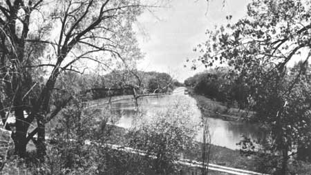
| The Illinois-Mississippi Canal west of Wyanett. (ILLINOIS DEPARTMENT OF CONSERVATION.) |
ILLINOIS
LYING between Lake Michigan and the Mississippi River, Illinois is level prairie land except for the wooded hills in the southern portion.
The population increased 15.7 percent in the 1950-60 decade to 10,081,158. Projections indicate a population of 12,894,000 by 1976. Average density is about 180 persons per square mile, ranging from 11 in Pope County in the south to 5,377 in Cook County, which includes Chicago. Over 77 percent of the State residents live in eight metropolitan areas.
Recreation expenditures within the State were, $858 million in 1959.
The generally flat to rolling prairie gives way to more interesting hill country in the south. Excepting Lake Michigan, the scarcity of large natural lakes increases the importance of rivers, streams, and reservoir impoundments. Pollution is a definite problem. The Mississippi flyway provides a source of recreation by bringing waterfowl over the State.
The hot, humid summers send many people out of the State for vacations. The Lake Michigan shore line and the Chain of Lakes area, both located in the heavily populated northern region, offer recreation resources not yet fully developed. Illinois is rich in historic sites associated with Lincoln and has many sites illustrating prehistoric cultures, French exploration and settlement, and later events. Nine sites possess exceptional value in commemorating the history of the United States.
EXISTING PUBLIC AREAS
NATIONAL: The Forest Service administers three developed recreation areas in one forest of 210,953 acres. The Bureau of Sport Fisheries and Wildlife administers several small recreation areas and one major development on Crab Orchard Lake in the eight national wildlife refuges of 91,038 acres.
STATE: The Department of Conservation administers 93 parks, recreation areas, and memorials totaling 80,000 acres. The 1960 attendance was 8,378,571. It also administers 36,085 acres in nine game management areas and 10,999 acres in four forests.
LOCAL: Counties and cities administer 10 major nonurban parks and 1 historic monument totaling 50,544 acres.
QUASI-PUBLIC AND PRIVATE: Two nature preserves (287 acres) and three historic monuments are provided by quasi-public or private interests.
PARK AND RELATED NEEDS
Protection of the few remaining natural recreation resources is of prime importance. Pollution of the streams needs to be corrected, especially since stream-sides offer an important source of recreation. Additional historical and archeological resources should be developed. The East St. Louis and Chicago areas and the population centers in the central farming region of the State are in need of more recreation areas. There is a need for additional county and metropolitan park enabling legislation.
Existing areas under State administration now provide 80,900 acres for 10,081,158 residents. Potential State areas identified in this plan total 96,762 acres. Acquisition and development of all of these potential areas would still leave much unsatisfied need, which will increase by 1976.
|
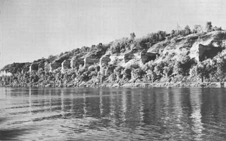
| Alton Bluffs would provide a rock-ribbed scenic backdrop for one Illinois section of the proposed Great River Road. |
RECOMMENDATIONS
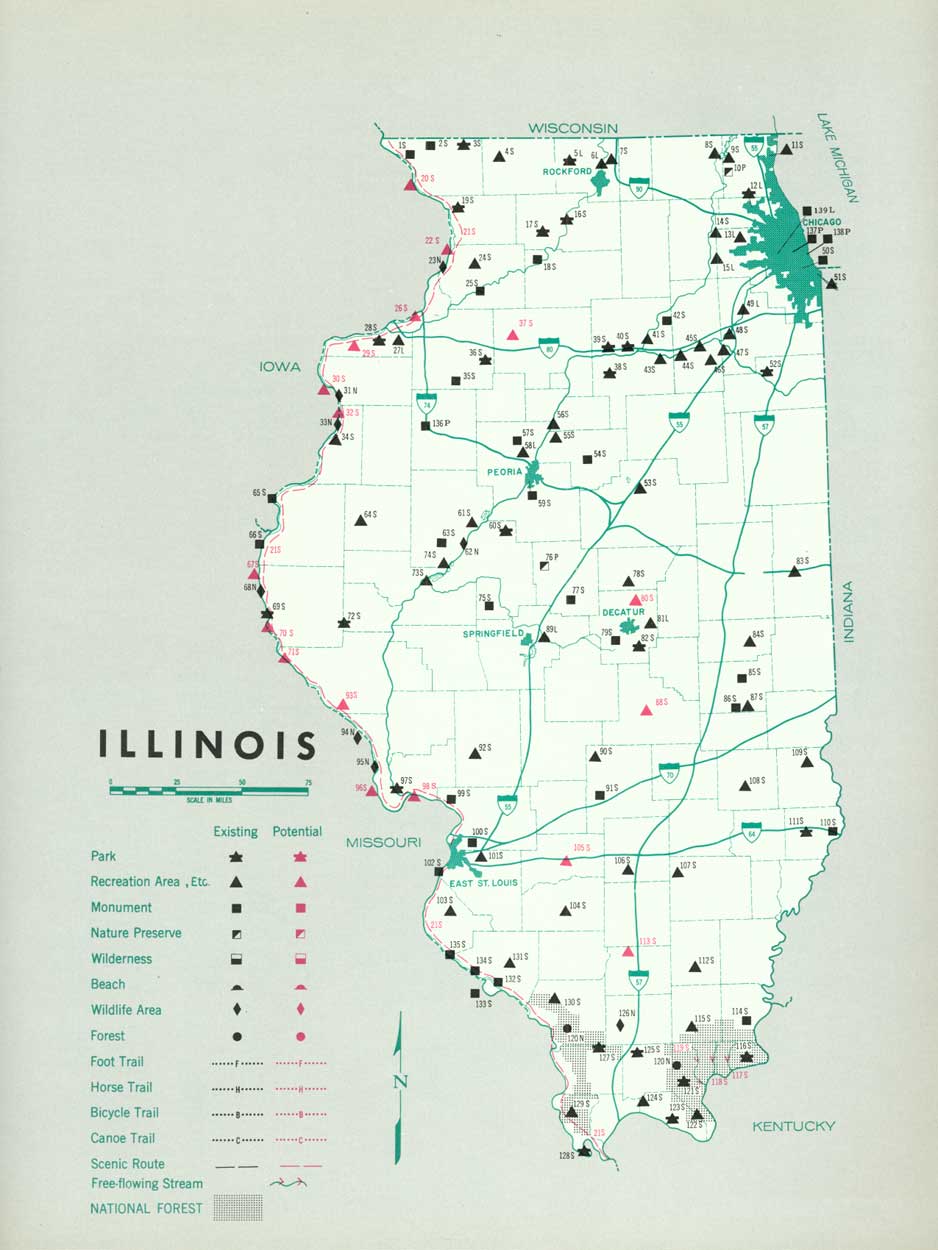
Existing recreation resources and many potential areas are shown on the accompanying tabulation and map. If the following recommendations are implemented by vigorous action by the agencies concerned, they may provide needed additional outdoor recreation opportunities.
STATE: Continuation of the State's present program of providing recreation facilities around manmade lakes. Three such areas are recommended, as well as major additions to seven existing areas. Fourteen other areas are suggested for further study.
Careful consideration of Corps of Engineers reservoirs in planning stages for their recreation potential. Scarcity of natural lakes except in the north emphasizes the importance of these reservoirs as a recreation resource.
Supporting recommendations include—
1. Expansion of the system of State parks to preserve the remaining areas worthy of such action.
2. A comprehensive survey of ecologic, archeologic, and historic sites looking toward adequate preservation and development of sites found to possess sound educational and inspirational values.
3. Additional county and metropolitan park enabling legislation, particularly in the areas of population concentration.
4. Development of the Great River Road, and studies of other potential scenic roads, parkways, foot trails, and canoe trails.
5. Consideration of Big Grand Pierre, Big, and Lusk Creeks for preservation as free-flowing streams; protection and proper development of other streams for recreation use, through either acquisition or flood-plain zoning.
6. Correction of the serious statewide stream pollution problem.
7. Development of a large-scale program of marina and boat-launching sites.
(Table omitted from online edition)
|
| (click on image for an enlargement in a new window) |
NEXT >>>
 Top
Top
|
|
Last Modified: Mon, Sep 6 2004 10:00:00 pm PDT
parks_america/illinois.htm