.gif)
Parks for America
MENU
![]() Findings and Recommendations
Findings and Recommendations
|
Parks for America
|

|
|
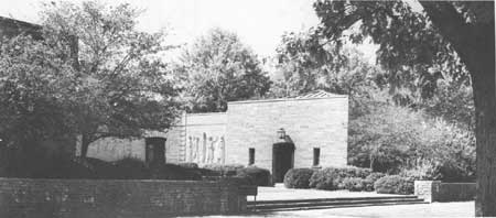
| The Nancy Hanks Memorial, part of the Lincoln Boyhood National Memorial recently established. |
INDIANA
INDIANA lies in the heart of the east-central section of the country between Lake Michigan and the Ohio River.
The State's 18.5-percent increase in population from 1950 to 4,662,498 in 1960 amounted to the same rate of growth as that of the United States. Sixty-two percent of the population was urban, and the density averaged 129 per square mile, ranging from 22 in Brown County in the south-central section to 1,735 in Marion County, which includes Indianapolis.
A 1958 survey estimated Indiana's income from recreation to be $273 million.
Rolling topography in the north and central portions, permitting intensive farming, gives way to rugged timber-clad terrain in the south. Lake Michigan and 600 inland lakes in the north, together with the Ohio River in the south, are important natural assets. The absence of natural lakes in the central and southern portions lends added importance to rivers, streams, and water impoundments, particularly those near urban centers. Climatically, there are wide temperature ranges between seasons. Indiana has a number of significant historic sites ranging from early development of the Old Northwest to the later political, cultural, and economic development of the State. Grouseland in Vincennes, the Nancy Hanks Lincoln State Memorial, and Tippecanoe Battlefield possess exceptional value in commemorating the history of the United States.
EXISTING PUBLIC AREAS
NATIONAL: The Forest Service administers one national forest of 125,000 acres in which there is one developed recreation area.
STATE: The Division of State Parks administers 21 parks and recreation areas totaling 52,703 acres and 13 memorials on 703 acres. The total 1960 attendance was 2,864,311. The Division of Fish and Game operates 10 game management areas on 39,268 acres, and 50 fishing access sites, of which 5 are developed recreation areas. The Division of Forestry administers 14 forests of approximately 120,000 acres, in which there are 13 developed recreation areas totaling 10,000 acres. The Highway Department operates 92 way side recreation areas, and 40 additional areas are planned.
LOCAL: Five nonurban metropolitan and county parks total 721 acres.
QUASI-PUBLIC AND PRIVATE: There are three historic monuments, and one nature preserve, of 592 acres.
PRIVATE ENTERPRISE: Privately owned hunting areas, campgrounds, and boat-storage areas are increasing in importance. Facilities and services such as cabins and boat rentals provided on many of the northern lakes are also privately owned.
PARK AND RELATED NEEDS
Protection of remaining natural features is of prime importance. A major problem is relating areas to the urban populations in the central and northern portions of the State, where the need is most urgent. Additional weekend and vacation opportunities are needed, and lands suitable for such development can be found in the southern part of the State. The attractive rural scenery along many existing highways should be protected and preserved through a system of recreation roads and scenic easements. Legislation should be enacted to prevent further despoliation of prehistoric sites.
Existing areas under State administration provide 64,018 acres, and local nonurban parks and recreation areas provide an additional 721 acres. Potential State areas identified in this plan total 62,819 acres. Even if all of these potential areas were acquired and developed, additional recreation areas would be needed by 1976.
|
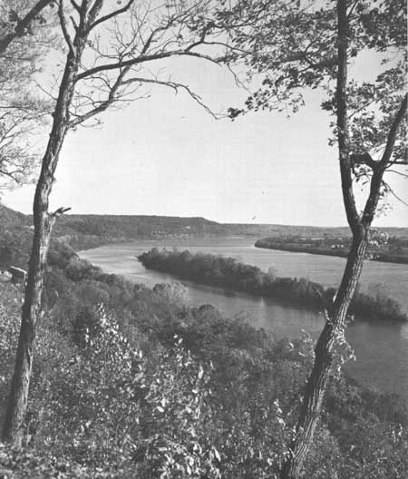
| An Ohio River Parkway is among suggested park and recreation projects for Indiana that merit further study. The scenic values of the river make it an important recreation resource. |
RECOMMENDATIONS
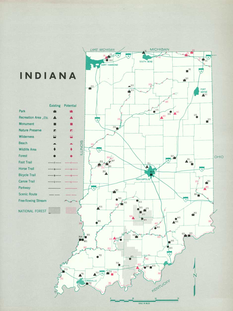
Existing recreation resources and many potential areas are shown on the accompanying tabulation and map. If the following recommendations are implemented by vigorous action on the part of the agencies concerned, they can help provide needed outdoor recreation opportunities for public enjoyment and use.
NATIONAL: Establishment of Indiana Dunes National Lakeshore.
STATE: Expansion of the State park system to preserve the remaining natural areas worthy of such action. Two parks are suggested for further study.
Designing of Corps of Engineers reservoirs, where feasible, to give the highest recreation potential and to provide additional recreation opportunities at the State level. Five such State recreation areas are recommended and one is suggested for further study.
Development of parkways and designation and protection of scenic roads. One parkway is recommended and another is suggested for further study.
Consideration of preserving portions of rivers as free-flowing streams. Segments of 10 rivers are suggested for initial study.
Supporting recommendations include—
1. Initiation of studies to locate potential artificial water impoundments and other recreation sites in the vicinity of urban areas.
2. Development of 130 roadside park sites.
3. Restudy of enabling legislation applicable to metropolitan and county park systems to encourage more adequate development of such systems.
4. A comprehensive survey of archeological and historic sites should be undertaken within the State with a view to preservation and development of those found to possess sound educational and inspirational values.
5. Inclusion of systems of canoe trails and hiking trails in a well-rounded park and recreation program.
(Table omitted from online edition)
|
| (click on image for an enlargement in a new window) |
NEXT >>>
 Top
Top
|
|
Last Modified: Mon, Sep 6 2004 10:00:00 pm PDT
parks_america/indiana.htm