.gif)
Parks for America
MENU
![]() Findings and Recommendations
Findings and Recommendations
|
Parks for America
|

|
|
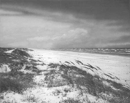
| Wild, sun-drenched solitudes of the Texas gulf coast will henceforth be protected for enjoyment in Padre Island National Seashore, recently authorized by Congress. |
TEXAS
TEXAS has a diversity in topography and climate that gives emphasis to outdoor recreation of almost every sort. Coastal plains, forested uplands, high plateaus, eroded canyons, desert mountains, and water impoundments are valuable recreation resources. Upland game abounds in the State. The State history covers four centuries under six flags. Of the many historic sites, 11 possess exceptional value in commemorating the history of the United States.
The State population was 9,579,677 in 1960. Projections indicate a growth to 13,281,000 by 1976. In 1960, 75 percent of the population was urban. The average density is 36 persons per square mile, ranging from 0.3 in Loving County to over 1,000 in Dallas County.
Tourist expenditures are currently estimated at $431 million.
|
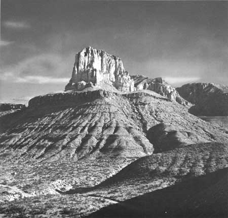
| El Capitan commands the spectacular Guadalupes, highest mountains in Texas. These peaks could compose a national park. |
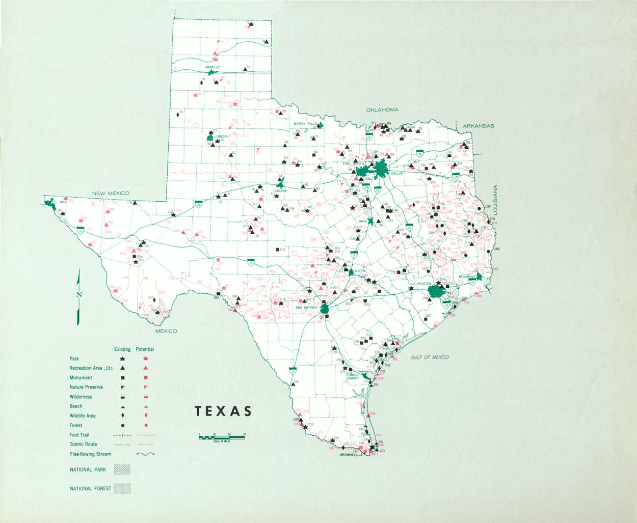
EXISTING PUBLIC AREAS
NATIONAL: One national park of 708,221 acres is administered by the National Park Service and had a 1960 attendance of 75,900.* The Bureau of Sport Fisheries and Wildlife manages six national wildlife refuges with 115,800 acres. There are four national forests with 658,004 acres and seven land-use areas totaling 117,268 acres, administered by the Forest Service. The Corps of Engineers, Bureau of Reclamation, and International Boundary Commission reservoir projects provide 15 major water areas totaling 442,095 water-acres.
*Fort Davis National Historic Site, 460 acres, was established July 4, 1963.
STATE: The State Parks Board administers 39 parks totaling 222,610 acres and 3 recreation areas. The 1960 attendance was 7,286,318. There are 22 historical monuments with 1,331 acres administered by the State Historical Society. The State Game and Fish Commission manages 16 refuges. The State Forestry Department has five forests totaling 6,423 acres. There are 840 roadside rest areas administered by the State Highway Department.
LOCAL: Major local areas identified in this plan include 7 parks with 5,263 acres, 28 recreation areas with 134,995 water-acres, and 3 beaches with 389 acres.
QUASI-PUBLIC AND PRIVATE: There are nine recreation areas and one historic monument.
PRIVATE ENTERPRISE: The substantial role played by private enterprise includes recreation areas, services, and accommodations.
|
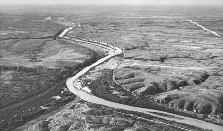
| Amistad Dam will provide water recreation on an 86,400-acre reservoir at this site on the Rio Grande. |
PARK AND RELATED NEEDS
The expanding urban population is in need of additional nonurban recreation facilities for day and weekend use. The State and local park systems need additional areas and enlargement of existing areas. Preservation of free-flowing streams, gulf coast areas, scenic roads, and trails are of utmost importance.
For the present population of 9,579,677 there exist 231,339 acres of State significance and 140,647 acres in local areas. This falls short of overall needs. The acquisition and development of potential areas identified in this plan will help to alleviate State recreation needs.
|
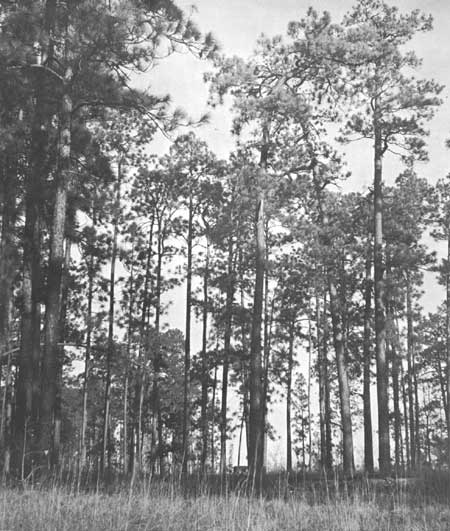
| One of the nature preserves recommended for Texas would preserve stands of virgin longleaf pine. (U.S. FISH AND WILDLIFE SERVICE.) |
RECOMMENDATIONS
Existing recreation resources and many potential areas are shown on the accompanying tabulation and map. The following recommendations are offered to help provide needed outdoor recreation opportunities for public enjoyment and use.
NATIONAL: Establishment of Padre Island as a national seashore as authorized by Congress. Study the desirability of national park status for the Guadalupe Mountains.
STATE: Major additions to 39 existing areas and expansion of the State park system by acquisition of 13 park areas, 11 recreation areas, 6 beaches, 9 historic sites, 4 scientific monuments, 1 wilderness area, and 18 nature preserves.
Designation and protection of scenic routes and unmodified portions of four free-flowing streams.
LOCAL: Establishment of four recreation areas and one beach and major additions to existing areas.
Supporting recommendations include—
1. Cooperative study to determine the desirability and feasibility of a State scenic parkway along the gulf coast of Texas.
2. Provision for additional waysides, particularly along scenic routes.
3. Further study of portions of the Colorado, Brazos, Neches, Guadalupe, San Antonio, and Trinity Rivers for status as free-flowing streams.
4. Special study proposed to determine ways of meeting nonurban recreation needs of the Midland-Odessa area.
5. Provision of adequate public access and additional recreational land at existing and proposed major reservoirs.
(Table omitted from online edition)
|
| (click on image for an enlargement in a new window) |
NEXT >>>
 Top
Top
|
|
Last Modified: Mon, Sep 6 2004 10:00:00 pm PDT
parks_america/texas.htm