|
NATIONAL PARK SERVICE
Great Lakes Shoreline Recreation Area Survey |

|
REMAINING OPPORTUNITIES ALONG THE MICHIGAN UPPER PENINSULA (Lake Michigan - Lake Huron Shorelines)
|
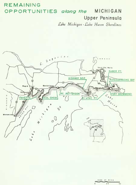
| Remaining Opportunities along the Michigan Upper Peninsula — Lake Michigan - Lake Huron Shorelines (Vicinity Map) (click on image for an enlargement in a new window) |
SUMMARY
While the north shore of Michigan's Upper Peninsula is outstanding for its scenic variety, the south shore abounds in active recreation potential. Void of rugged inland topography and precipitous shores, northern Lakes Michigan and Huron boast of wide sand beaches ideal for public use. Shallow bays with sandy bottoms are frequently associated with these beaches and add materially to their appeal for swimming. In contrast, flat limestone bedding planes are exposed along some water lines, adding a new and interesting aspect to the shoreline.
Highway access along this shore has been developed to a higher degree than along Lake Superior. In the 260 miles from Menominee to Detour, the highway routes follow or remain in close proximity to the shoreline, never straying more than 10 miles from the lakes. Lying this close to the shoreline, the highway has a profound influence on the shore environment. When given proper treatment--with a right of way of sufficient width to protect its vistas and retain the native roadside character--the highway becomes a pleasant scenic drive. Lacking certain controls, however, the landscape can be marred irreparably.
The portion of the Upper Peninsula stretching from Menominee, Michigan on Green Bay to the beginning of the St. Marys River near Sault Ste. Marie has a shoreline of approximately 700 miles. Along this shore the main communities are Escanaba, Manistique, St. Ignace and Sault Ste. Marie. On the west, Escanaba is a shipping point for ore from the Menominee iron range. St. Ignace is the northern anchor point for the Straits of Mackinac Bridge. Several limestone quarries, as well as a large dolomite operation on Drummond Island, are located along the south shore of the peninsula. The ship locks at Sault Ste. Marie are among the busiest in the world during the shipping season. At this time a never ending parade of Great Lakes freighters can be seen on the St. Marys River.
Though 15 percent of the southern and eastern shores of the Upper Peninsula is in public ownership, little of this is devoted to recreational land. Less than two percent of this shoreline is devoted to state parks, and they are mostly small areas, except the five miles around Mackinac Island. State forests comprise the principal public land holdings on this portion of the shoreline.
Fortunately, there are a number of undeveloped sites remaining that offer considerable potential for recreation areas. Paramount in this group is Seul Choix and its expanse of dunes and beach bound to a scenic limestone point. The iron-making village of Fayette, now a ghost town, has a significant history as well as a charm that would make it one of Michigan's finest lakeshore historic sites. Elsewhere, other beach sites and the historic ruins of a fort are recommended for public acquisition designed to preserve a segment of a region rich in scenic and recreation features.

| Upper Peninsula of MICHIGAN (Lake Michigan - Lake Huron Shorelines) |
RABER POINT
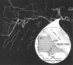
LOCATION Raber Point is located along the west shore of the St. Marys River, approximately 8 miles northwest of Detour, Michigan. Two miles northwest of the Point, the village of Raber is situated near a graveled county road that connects with State Route 48 north of Goetzville. The 5-mile shoreline embraces an inland area of 5,800 acres.
DESCRIPTION Raber Point has its primary value in the fossils that occur scattered over the tablelands lying above the St. Marys River. Limestone bluffs rise gently to the higher lands from a narrow flat along the rocks and marsh of the river's bank. From these bluffs, vistas open eastward to St. Joseph and Lime Islands, as well as island-studded Potagannissing Bay. The passage of Great Lakes freighters on the St. Marys River provides an interesting sidelight to these vistas.
Lying near these bluffs and farther inland are the limestone rocks that comprise the geologic core of the region. Locked within some rocks, exposed in others, are the fossils of marine life from ancient salt water seas. Through the years, large quantities of these fossils have been removed by collectors, but many still remain. These fossils provide in-place exhibits of considerable scientific interest, and the protection of the remaining fossils in their natural location is essential to the basic importance of the Raber Point region.
The terrain west of the bluffs is gently rolling, now and then marked by outcrops of limestone. Open stands of deciduous trees cover a major portion of this region, with birch and aspen particularly abundant. Spruce, white cedar and other conifers are not extensive. Bender Lake, a small body of water bordered by aquatic plants, provides a variety of vegetation of considerable interest as a contrast to the plant growth of the thin soils on the surrounding limestone country.
PRESENT USE Private holdings by lumbering interests exist, though extensive logging operations are not known to occur. The properties neighboring this region are primarily in farms where grazing is often a common use.
ANALYSIS The educational and scientific values of these fossil deposits impart significant importance to the desirability of preserving this area for public benefit, and indicate that immediate steps should be taken to protect these fossils from destruction.

|
| Raber Point |
| Upper Peninsula of MICHIGAN (Lake Michigan - Lake Huron Shorelines) |
POTAGANNISSING BAY
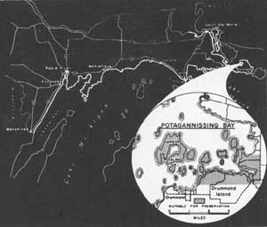
LOCATION Potagannissing Bay forms one of the most distinctive features of the Drummond Island shoreline. Lying offshore from the most easterly part of the Upper Peninsula, Drummond Island rests between Lake Huron, the St. Marys River and the Canadian North Channel. From Detour and the eastern terminus of State Route 134, an auto ferry crosses the St. Marys River to the island. Gravel roads connect the ferry landing with several shore points along Potagannissing Bay. Within the bay, a group of 21 islands constitutes a shoreline of 27 miles and a land area of 2,800 acres.
DESCRIPTION Potagannissing Bay's outstanding feature is its island complex, particularly the group east of Harbor Island. This group lies in the relative protection of Drummond Island, whose northern and southern shores reach toward the bay as protecting arms. Nine islands in the group are less than 10 acres in size, while 10 vary from 20 to 80 acres. Harbor Island, the largest, contains nearly 700 acres. The islands are forested with stands of second growth hardwoods and some conifers.
The highest elevations occur on Harbor Island where one lobe of the island rises 100 feet above the waters of the Bay. The island appears to be so named because of the natural, though shallow, harbor that is its most prominent feature.
Most of the beaches are composed of pebbles and cobbles. Sand beaches are nearly nonexistent. Marshes occur along the bay's east shore as well as a few places along the shores of smaller islands. The entire water area is characterized by shallow depths -- averaging about 18 feet.
PRESENT USE Along the south shore of Potagannissing Bay there are scattered private developments, but little has taken place on the islands. Most of the islands are in single ownerships. Considerable boating and fishing activity occurs in the bay region.
ANALYSIS This island complex, lying in relatively protected waters, possesses certain desirable qualities for small boat or canoe and wilderness camping uses. Fishing in the bay is now an attraction to many sportsmen. As a boating and wilderness camping park, this area would provide facilities for public use of several rapidly expanding recreational pursuits.

|
| Potagannassing Bay |
| Upper Peninsula of MICHIGAN (Lake Michigan - Lake Huron Shorelines) |
FORT DRUMMOND
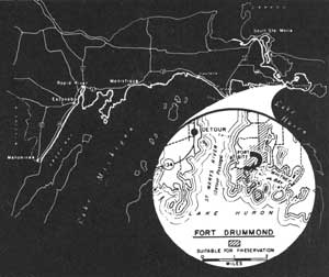
LOCATION The ruins of old Fort Drummond lie adjacent to the protected shores of Whitney Bay near Drummond Island's southwestern tip. The island may be reached by State Route 134 to Detour, Michigan, and thence by auto ferry across the St. Marys River. A gravel road connects the ferry landing with the area adjacent to the historic site. A 7-mile shoreline together with 550 acres involves the western shores of Whitney Bay and four offshore islands.
DESCRIPTION The War of 1812 cost the British their flourishing post on Mackinac Island, and in 1815 they established Fort Drummond (Fort Collyer) on Whitney Bay. However, the settlement of the international boundary's location in 1822 showed that the new fort was on American soil, and the British were again obliged to move. So it was that the Union Jack was replaced by the Stars and Stripes in 1828.
In the passing years the fort was abandoned, and the elements took their toll of stone, mortar and logs. Today, only the weathered masonry chimneys stand as prominent remains, though closer inspection reveals the faint traces of the attendant building foundations. Elsewhere, cedars have overgrown the parade ground as well as the small cemetery where a few weather-worn grave markers remain. These are the faint reminders of the military occupation of this fort over 125 years ago.
In terms of Drummond Island's physical characteristics, the presence of limestone is the principal influencing factor. The limestone that underlies this region slants slightly from the shore into the waters of Whitney Bay where occasional boulders lie awash in the shallow water. Beyond, vistas open up to Lake Huron, interrupted occasionally by the outer islands of the bay.
PRESENT USE Private properties control this historic site. In one instance, a cabin has been built near Whitney Bay incorporating one of the Fort's standing chimneys. Elsewhere, the northernmost chimneys known to occur in the fort are separated from dolomite mining pits by only the narrow width of a gravel road.
ANALYSIS Fort Drummond is recognized as an integral part of the Straits of Mackinac history, more specifically that period immediately following the War of 1812. Public acquisition of this site is desirable to provide protection for the fort ruins and to interpret its part in the Straits history.

|
| Fort Drummond |
| Upper Peninsula of MICHIGAN (Lake Michigan - Lake Huron Shorelines) |
ST. VITAL POINT
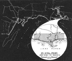
LOCATION Located on the north shore of Lake Huron, St. Vital Point protrudes from the southeastern tip of Michigan's Upper Peninsula. Passing near the Point, State Route 134 parallels the shoreline for better than 30 miles west of Detour. Five miles west of Detour, St. Vital Point lies near the mid-point of an 8-mile shoreline, stretching between Huron Point and Carlton Bay. This shore sets off an inland area of nearly 5,600 acres.
DESCRIPTION St. Vital Point is a prominent, though narrow, neck of limestone angling into Lake Huron's northern waters. On the Point's eastern shore are some of the finest sand beaches that remain undeveloped on northern Lake Huron. These wide sandy beaches are rimmed by a paralleling low barrier dune partially stabilized by beach grasses. A second low dune is crowded by the edge of the forest. In sharp contrast to the sand beaches are the cobblestone shores on the west side of the Point. Here, limestone cobbles and boulders not only comprise the shore but extend into the shallow offshore waters. These weathered rocks form the tip of St. Vital Point as well, and anchor the arcs of several sand beaches on the east side.
North of St. Vital Point stretches a broad, low plain. Covering this region are fine forests containing a considerable quantity of northern conifers, particularly spruce and balsam fir, though representative northern hardwoods are not uncommon.
Due to the proximity of State Route 134 to Lake Huron, a scenic lakeshore drive is, in essence, already in existence. The motorist's trip through this region is rewarded by the lake scenes that unfold before him. The boulders as well as the sand beaches offer contrasting foreground to the blue-green waters of Lake Huron that are often framed between birches and white cedars along the shore.
PRESENT USE A large portion of this area is already state-owned and is administered as part of Munuscong State Forest, but this state ownership involves only a small fraction of the shoreline. Relatively little development has taken place on the remaining private lands.
ANALYSIS Immediate steps should be taken to protect the scenic elements of the existing shore drive as well as the recreation values of the shore and inland environment surrounding St. Vital Point.

|
| St. Vital Point |
| Upper Peninsula of MICHIGAN (Lake Michigan - Lake Huron Shorelines) |
SCENIC SHORE DRIVES
(U.S. HIGHWAY NO. 2)
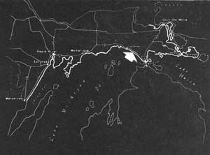
Within the shadow of the Straits of Mackinac Bridge begin some of the Great Lakes' finest shore drives. One of these, U.S. Highway 2, stretches northwesterly for nearly 45 miles, closely paralleling the northern Lake Michigan shore through a region rich in scenery and other recreation values.
Following the lake's contour, the shore drive nears the water's edge as it swings between the beach and the sand dunes north of Point aux Chenes. The short alignment that the drive follows here gives the motorist a new and different experience in his association with the Lake. In contrast, the drive mounts the Manitou Paymen Highbanks near the Cut River to produce wide panoramas over the lake and shore environment. These are the extremes the shore route follows, for elsewhere the drive stays in the vicinity of the low bluff that lies behind the beach. Often an open screening of trees faintly reminds the motorists of the Lake's nearness, while elsewhere he may stop at roadside parks to enjoy the unobstructed view and inhale the invigorating lake air.
Much has been done of commendable value to provide for the recreational needs of the user on this scenic drive. The U.S. Forest Service has an excellent recreation area along the shoreline near the west boundary of the Marquette National Forest. The State Highway Department has located roadside parks at the Cut River and on Hog Island Point. Within the Mackinac State Forest, the Michigan Department of Conservation controls much of the lake as well as highway frontage. These are the elements of a scenic recreation drive and they have been well developed. Only one threat is posed--unrestricted private and commercial development. By such spoilage of the natural scene, all that has been done to beautify and maintain a pleasing drive could be lost and the route relegated to the status of "just another highway."
It is not only the scenic values of U.S. Highway 2, but many other drives along Michigan's water shorelines, that face this situation. The goal for protection of the natural scene along these highways is for public control of sufficient highway right of ways. In many instances, scenic easements may satisfactorily provide the essential safeguards, but, in other cases, the goal can be achieved only through purchased right of way to the shore.

|
| Lake Michigan from Highway No. 2 |
| Upper Peninsula of MICHIGAN (Lake Michigan - Lake Huron Shorelines) |
POINT PATTERSON
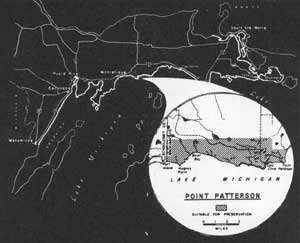
LOCATION Lying on the south shores of the Michigan Upper Peninsula, this region is impregnated with the atmosphere of freedom and isolation. The only road access to the shoreline is a county road connecting Cozy Cove with U.S. Route 2 at Gould City. Elsewhere, access into the region or its shore is restricted to foot or boat travel. A 12-1/2-mile shoreline stretches westward from near Point Patterson to the west Mackinac County Line, spanning an area of nearly 12,000 acres.
DESCRIPTION Accentuating the uneven shore west from Point Patterson are the resistive limestone slabs and boulders that jut into Lake Michigan. Between these points are wide sand beaches whose fine sands reach into the shallow bays. Bordering the sand beaches are low, partially stabilized barrier dunes; further inland, paralleling sand ridges mark the location of old beach lines. These lines are well defined and comprise one of the region's principal features. Marshlands lie in the narrow swales, and the vegetation of these wet sites contrasts sharply with the plants of the drier ridges. Occasionally, the barrier dunes near the shore are disturbed and the sands begin to shift into the twisted masses of low sand dunes.
Extensive forests of sugar maple, beech and birch, along with spruce, balsam fir and white cedar, cover the broad, low inland plain. The forest's remote location on Point Patterson makes this a haven for many forms of northern wildlife. White-tailed deer frequent the area, and, occasionally, bear tracks may be observed on the beaches.
PRESENT USE These 12-1/2 miles of shore correspond to the beach frontage of the Mackinac State Forest's west unit. Six miles of this shoreline and approximately 2,000 acres are in private ownership. Relatively no development has occurred in the region near Lake Michigan except for a small, informal picnic ground at Cozy Cove.
ANALYSIS Because of the high quality of the beaches here, this location has excellent qualifications for shoreline recreational uses. Consideration should be given to completing state ownership of the lands lying within this unit of the Mackinac State Forest and thereby protecting these shore features for future public benefit.

|
| Point Patterson |
| Upper Peninsula of MICHIGAN (Lake Michigan - Lake Huron Shorelines) |
SEUL CHOIX
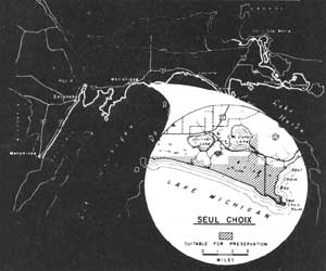
LOCATION The weather-battered limestone point at Seul Choix is the culmination of broad, sweeping beaches on this northern shore of Lake Michigan. At a point 13 miles east of Manistique, state and county routes lead south 8 miles to Seul Choix Point. Near Gulliver Lake, a graveled road terminates at the beaches west of the point. This study site includes a shoreline of 12 miles and an inland area of 5,500 acres.
DESCRIPTION The expansive sand beaches of Seul Choix are among the finest to be found on the Great Lakes. Varying from 100 to 150 feet in width, they stretch nearly eight miles along Lake Michigan's turquoise waters. Behind a low barrier dune towers a scenic backdrop of sand dunes.
Seul Choix Point is formed by the resistive limestone rocks that are characteristic of the south shore of the Upper Peninsula. Here, massive slabs of bedrock emerge from the bottom of Lake Michigan on a shallow slant, only to be broken in great blocks and channels by the unrelenting elements. Pounding waves in summer and grinding ice blocks in winter work ceaselessly to alter this shore. East of the point, the limestone strata lies nearly level, tilting only slightly into the lake. Inland, on the east side of McDonald Lake, the limestone reappears with fossil beds of considerable geologic interest.
Behind the shoreline, the telltale evidences of old beach lines exist as alternating sand ridges and marshes. This is the only break in the otherwise broad, flat plain lying north of Lake Michigan. A deciduous forest composed of second growth white birch and sugar maple covers much of the inland region, while dense stands of northern white cedar, balsam fir and spruce grow in almost impenetrable thickets behind the dunes.
PRESENT USE Some shore development has begun on the west side of Seul Choix Point, particularly in a subdivision located almost directly south of Gulliver Lake. Public lands include an active Coast Guard lighthouse on the Point and interior properties of the Manistique River State Forest.
ANALYSIS The superlative features of the region, particularly the excellent beaches and their scenic charm, identify Seul Choix as an exceptional public use area. Action should be instigated at an early date to insure protection of the area's primary values for public benefit.

|
| Seul Choix |
| Upper Peninsula of MICHIGAN (Lake Michigan - Lake Huron Shorelines) |
FAYETTE
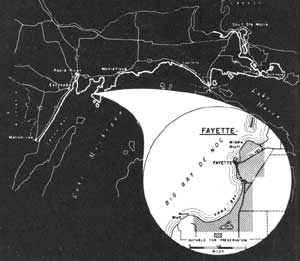
LOCATION The ghost town of Fayette is located on the west shore of Lake Michigan's Garden Peninsula in Delta County. County Route 483 winds southward along the east shore of Big Bay de Noc, nearly 18 miles from U.S. Route 2, before reaching the ruins of this old iron-furnace village. The study area's 1,900 acres have a shore frontage of 6 miles stretching south from Middle Bluff.
DESCRIPTION Fayette was the result of an attempt, during the early years of Michigan's iron-ore rush, to smelt the high grade ores near their source. Here was a site near the Marquette Range that also provided a ready supply of limestone and hardwood trees, plus a protected harbor for shipment of the finished product. Beginning in 1867 the operation prospered, but depletion of the hardwood supply necessary for charcoal spelled doom, and by 1892 the furnaces cooled and production finally ceased.
Today, though abandoned to the elements, striking evidences of furnaces, casting houses, bridge and charcoal houses, lime and charcoal kilns and attendant residences remain. The nearly 40-foot stacks of the furnaces symbolize this smelting site, and the stabilization of these excellent remains is a highly desirable objective.
Fayette's picturesque setting adds to the public use potential of the over-all area. The towering limestone cliffs of Middle and Burnt Bluffs rise 100 to 200 feet from the water's edge. White cedars occur atop these bluffs, while the remainder of the Garden Peninsula forest cover consists of second growth birch and maple. Sand Bay describes a broad arc of low dunes and narrow beaches fronting on shallow water that extends nearly 200 yards from shore. Snail Shell Harbor at Fayette offers deep water protection for small boats.
PRESENT USE Private holdings constitute the major properties, though steps have been taken by the State to secure the historic site around Fayette. A limited amount of cottage development has taken place on Sand Bay; and, inland, some cleared land is under cultivation.
ANALYSIS Because of the historic buildings and structures which remain, Fayette should be publicly acquired to insure the protection of these ruins as an outstanding interpretative center of Michigan's iron industry. In addition to its historical significance, Fayette possesses excellent recreation potential amid a scenic setting that marks it as an exceptional public area.

|
| Fayette |
| <<< Previous | <<< Contents>>> | Next >>> |
rec_area_survey/gl/mi2.htm
Last Updated: 27-Jun-2007