|
Managing Multiple Uses on National Forests, 1905-1995 A 90-year Learning Experience and It Isn't Finished Yet |
|
Chapter 3
Managing Multiple Uses in the Face of Unprecedented National Demands: 1945 to 1970
National Forest Planning and Performance: 1945 to 1970
Rapid economic and population growth after World War II created extraordinary demands on the goods and services of the Nation's natural resources. National forests quickly became a major source for expanding the supply to meet those demands. National forest managers were immediately challenged to rebuild and expand their workforces, access roads, facilities, and equipment. They also had to make up for the maintenance and management deferred through the war years and deal with the rapid growth in resource demands that outran and continually taxed their managerial capabilities and workforces.
In the 25 years from 1945 to 1970, national forest timber harvesting rose an average of more than 5 percent per year — twice the rate of the national economic growth and almost four times faster than total U.S. production of industrial wood products. During the 1950's and 1960's, national forest timber and the expansion of low-cost Canadian lumber imports offset a near 40 percent decline in the South's average annual softwood lumber production (Ulrich 1989). National forest timber stabilized log supplies for the large and highly productive timber industry of western Oregon and Washington and increased total log supplies for the rest of the West (Fedkiw 1964). The large and rapid increase in national forest timber harvests contributed to the economic stability and growth of many western communities and helped meet national housing goals and lumber demands. They also relieved pressures to harvest the stands of young, small-diameter timber. This gave the South's young and rapidly growing southern pine trees a 20-year opportunity to grow in size and increase the South's timber inventory.
Recreation visits to national forests grew more than 11 percent per year — more than 6 times faster than population growth — as the American family's income and leisure time increased and the Nation's highways and transportation facilities greatly expanded and improved. Hunting and fishing visits rose at an even faster rate. Water-storage facilities for power, irrigation, domestic consumption, mining, fisheries, and recreation use increased by about a million surface acres. Mineral exploration and development grew sporadically, but steadily.
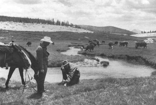
Beef consumption, nationally and per person, also increased steadily during this period. National forest cattle grazing rose from 1.2 million to 1.5 million AUM's — an increase of 25 percent. Forage productivity improvements and the acquisition of the national grasslands brought a 30-percent increase in grazing allotment carrying capacities. Animal husbandry improvements and improved range forage added significantly to cattle weights. However, there was a significant decline in sheep herding and grazing.
National forest area dedicated to wilderness use increased by 7.1 million acres, from less than 1.5 million acres to 9.1 million in 1964. The National Wilderness Preservation Act of 1964 included these wilderness acres as the initial components of the National Wilderness Preservation System. An additional 5.5 million acres were scheduled for evaluation and eventual wilderness designation over the next 10 years. Nearly a million of those acres were added to the National Wilderness Preservation System by 1970.
There was an evolution in planning and management for multiple uses on national forests during this period. The fitting of multiple uses into ecosystems on individual national forests became increasingly complex as demands for all national forest uses burgeoned. The fitting of adaptive management practices for overlapping and adjacent resource uses into the site-specific conditions within highly variable ecosystems became more challenging. Reconciling competing and overlapping user interests likewise became more demanding, especially as those interests broadened beyond local users to regional and national publics and special-interest groups. Conflicts between the timber industry and wilderness and recreation interests reached national proportions.
During the early years and into the 1950's, planning on national forests focused on individual resources such as timber, rangeland, recreation opportunities, wilderness areas, wildlife and fish, and watersheds. Planning called for inventories of resource conditions and trends on rangelands, forests, watersheds, recreation sites, and wildlife habitats. Planning determined sustainable timberland and rangeland use levels and assessed the need to modify use or adapt management in areas where there was a need to protect watersheds and other resources. The collection and evaluation of resource data for national forest planning grew throughout the 1945 to 1970 period. The data reflected both the use and the condition of natural resources.
|
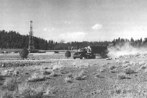
| Multiple use: timber growth and harvest and mineral development. Lakeview Logging Company truck hauls harvested logs, Fremont National Forest, Oregon, 1960. The derrick in the background is part of a Humble Oil Company wildcat operation searching for oil or natural gas. (Forest Service Photo Collection, National Agricultural Library. Taken by Paul R. Canutt.) |
Conflicts were largely avoided or easily mitigated as long as the level of use remained relatively low compared to the national forests' capacity to absorb it. Where conflicts did occur, a multifunctional consultation approach was used to coordinate the uses. Users and State and local wildlife and water resource officials often helped resolve these issues.
National forest efforts to coordinate land uses through management planning became more deliberate as resource uses accelerated during the 1950's. Local managers began to demarcate recreation and special management areas, waterways, roads and trails, and other use characteristics in their plans as resource inventories were completed. The content of these plans differed from forest to forest because the National Forest System had no uniform standards or direction for coordinating multiple uses. Despite this lack of consistency, more informed planning and management decisions were being made. However, the actual implementation of the decisions on the ground in many instances still depended on the district ranger's or forest supervisor's practical experience and intuitive judgment (Wilkinson and Anderson 1985).
The Multiple-Use Sustained-Yield Act (MUSY) in 1960 brought a more balanced consideration of all national forest uses and resources. MUSY mandated that national forests be managed for multiple uses and sustained yield of their products and services; that the various renewable surface resources be used in combinations that best met the needs of the American people; and that the relative values of the various resources be considered and that decisions not be limited to use combinations that gave the greatest dollar return or the greatest unit output.
The Forest Service proposed the MUSY Act when pressures were emerging from the timber industry and wilderness interests, respectively, to increase and to halt the harvesting of remaining old-growth stands. The wilderness interests largely perceived old-growth timber lands as "the" remaining wilderness. They saw the construction of national forest roads to access old-growth timber as rapidly reducing wilderness designation options. The Forest Service felt that legislative direction to manage national forests for multiple uses and sustained yields would provide the policy guidance to ensure a nationally balanced mix of uses in the face of the opposing pressures of "single-interest groups" and economic demands for possible "overuse" (USDA Forest Service 1961b).
|
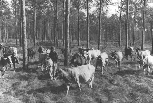
| Brahma hybrid cattle grazing under permit on wiregrass forage in a managed stand of longleaf pines, Apalachicola National Forest, Florida. (Forest Service Photo Collection, National Agricultural Library. Taken by Dan Todd.) |
Diversifying Staff and Skills in Managing Growing Multiple Uses
This period saw an improvement in natural resource science, knowledge, technology, and professional skills. For example, the number of degrees conferred annually in natural resource areas rose from an estimated 10,000 to 15,000 in 1940 to more than 60,000 around 1970, and for the first time around 1970 included a significant number of women. For the same period, the number of doctorates in natural resources subjects rose from 12 in 1940 to 122 in 1970. Membership in natural resource professional societies rose from 6,300 to 47,400 (Fedkiw 1993).
The Forest Service increased both the number of resource professionals in the national forest work-force and the diversity of their knowledge and skills as resource use and management became more complex and the supply of professionally trained resource specialists expanded. Although foresters continued to dominate the professional workforce, the diversity of skills and knowledge within the national forest workforce in the early 1970's grew (table 1) (Fedkiw 1981).
Table 1. Number of Forest Service employees by occupation and skill, 1972
| Occupation or Skill | Number |
| Forester | 5,021 |
| Civil Engineer | 1,081 |
| Range Conservationist | 262 |
| Contracting and Procurement | 239 |
| Landscape Architect | 181 |
| Soil Scientist | 151 |
| Wildlife Biologist | 108 |
| Hydrologist | 104 |
| Plant Pathologist | 94 |
| Computer Specialist | 92 |
| Geologist | 52 |
| Fisheries Biologist | 24 |
| Archaeologist | 4 |
| Geographer | 3 |
| Economist | 2 |
| Total | 7,418 |
Source: USDA Forest Service 1980. | |
Although these skills had been previously represented in the Forest Service, they were almost exclusively in Forest Service Research and in Washington and the regional offices. Now they were increasingly needed on national forests and ranger districts.
Depth of experience and seasoned judgment from working with a wide range of forest conditions, uses, and users on the ground were important supplements for managing natural resources effectively. Multidisciplinary consultation expanded and helped integrate the management of multiple uses. But the driving force of annually expanding use "targets" and management challenges in each individual resource area continued to influence the seeking of resource-specific solutions. Advanced planning and longer lead times became increasingly critical tools for the effective integration of multiple uses and their management.
|
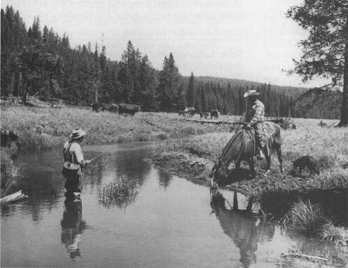
| Managing for multiple uses on the Dale Ranger District, Umatilla National Forest, Oregon, 1960. Range cattle grazing, timber production, water supply and fish habitat. (Forest Service Photo Collection, National Agricultural Library. Taken by C.M. Rector.) |
In this general setting, national forest managers met expanding output and use targets while advancing the art, practice, and effectiveness of managing multiple uses. Although there were shortfalls along the way, national forest outputs and uses rose to peak levels in the 1960's. Wildlife and fisheries habitats, particularly for game species and specifically targeted species, such as the condor, Kirkland's warbler, and osprey, were generally being maintained or improved. Eastern national forests were being rehabilitated. Rangeland conditions were being improved and forage production was increasing. Forest fires were being contained to lower acreages and other natural disasters were being ameliorated. There were more research natural area and wilderness designations. The quality of managing multiple uses improved incrementally, but slowly, responding to growing uses as well as improving science and management skills. National forest managers gave new attention to wetlands and increased their efforts to identify and take measures to protect endangered species and their habitats.
National forest management's incremental responses to the growing and changing mix of multiple uses were progressively building, extending, and modifying use systems throughout the National Forest System, and during this period incremental responses seemed sufficient. The National Forest System was progressively evolving into an integrated association of uses and management systems that were designed to sustain the uses and ensure the permanence of the resources and their productivity. The individual use systems became more integrated as they increasingly overlapped and adjoined each other in various combinations within the national forests. During the 1950's and 1960's, national forest managers modified and adapted the forest structures and their ecosystems as they provided Americans with increasing quantities of products, services, and benefits from water, timber, mineral, range, wildlife, fishery, watershed, recreation, landscape, and wilderness resources.
However, major events and uncertainties during the 1960's began to reveal serious management inadequacies and dissatisfactions among some national forest users and important groups of the American people.
Public concerns for wildlife management, for example, began to develop broader and deeper dimensions. Game biologists and some hunters questioned the knowledge and practices used to manage elk throughout the Rocky Mountains. Using timber harvest to improve food and forage supplies, controlling excess livestock and big game numbers, and protecting big game winter range did not always sustain desired deer and elk population levels or quality hunting experiences. This issue came into sharp focus when Montana Department of Fish, Wildlife, and Parks biologists challenged a proposed timber sale on the Lewis and Clark National Forest. National forest managers saw the sale as a necessary part of the Forest's timber management program. The biologists anticipated an adverse impact on elk that would shift game populations from State-owned lands to private lands. To resolve this dilemma, national forest managers joined several Federal and State wildlife agencies in a long-term study of elk habitat requirements (Lyon et al. 1985).
In the East, national forest users on West Virginia's Monongahela National Forest questioned the way even-aged management was being applied to hardwood forests. Such forests provided important turkey and squirrel habitats and long-established, highly valued hunting grounds. National forest users also questioned the visual impacts and quality impairments associated with clearcutting. After several years of challenges from the West Virginia Legislature and national forest users, the Monongahela prepared an environmental impact statement (EIS) on the forest's implementation of even-aged timber management. The Forest recognized the need for management changes and improvements and generally agreed with the findings of a study commission established by the State Legislature. The EIS recommendations, if they could be effectively implemented, indicated that the Monongahela's timber management questions could be resolved, but the issue actually broadened in the early 1970's.
During the 1960's, the public became aware that populations and habitats of some wildlife, fish, and plants were declining, including wetland habitats for waterfowl. National forest managers, responding to these emerging concerns, began to increase their efforts to protect and restore wetlands and to identify and address endangered species habitat needs jointly with various interest groups and public agencies.
In the West, national forest managers realized that forest fire prevention and control were leading to a new problem — forest fuel buildups. They began to address this concern through fuel inventories and fuel hazard management projects that used prescribed burning to reduce fuel buildups and strategically located firebreaks to slow and control fires that might break out in areas of heavy fuel and high risk.
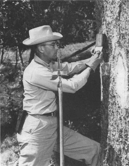
National forest managers, seeing a need for better soil inventories and soil management capabilities, initiated soil surveys and a related soils training program. The soil surveys were barely underway in 1964 when a massive landslide occurred in the watershed of the South Fork of Idaho's Salmon River. A combination of extraordinary rainstorm conditions and extremely wet soils on steep and unstable slopes, which for decades had been crisscrossed by logging roads, were seen as the cause. These conditions led to severe sedimentation of the river and its tributaries, with devastating damage to salmon fisheries and habitat — particularly spawning beds.
In Montana, local citizens were relentlessly challenging clearcutting and terracing on the Bitterroot National Forest's steeper, more visible mountain slopes. The issue became national in 1970's.
Internally, the Forest Service was using the traditional incremental management response to local demands, issues, and problems — a style that had worked well in addressing natural disasters and catastrophic forest fire conditions. National forest managers felt that shortfalls, failures, or new problems that involved management, as well as natural events, could be ameliorated or reversed using this same approach. Believing this, they took care to define and limit matters to their local dimensions. Implementation of System-wide initiatives such as fuel hazard management and soil surveys was largely left to the regions and forests according to what they perceived were their local priorities and preferred timeframes.
The Forest Service's hierarchical administrative structure and decentralized style of managing multiple uses continued to prevail during this period — even though national forest managers were becoming more aware of the public's growing concerns about the direction and quality of national forest management. No comprehensive effort emerged within the Forest Service or USDA to integrate these major events and concerns into an holistic evaluation of the National Forest System's performance. Although there were a few individual exceptions, the national forest management hierarchy did not generally perceive this traditional hierarchical and decentralized approach to managing multiple uses as a potential weakness or "Achilles heel" in managing national forest lands.
The next part of chapter 3 describes the development and growth of multiple uses on national forests and the efforts to improve resource protection, maintenance, and management in meeting the demands of the American people from 1945 to 1970. Each resource is described separately because that is the way use was managed and reported. The growing need for planning and coordinating the management of multiple uses is given special emphasis.
The Management of Multiple Uses: 1945 to 1970
Population, Economic, and Demand Trends
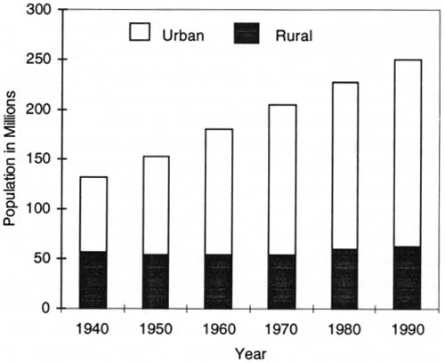
From 1945 to 1970, the American population grew by 45 percent, from 64 million to 205 million — an increase unmatched before or since. The economy rose almost twice as fast as population and led to substantially improved per capita incomes and family welfare. Leisure time and mobility likewise increased. There were also major shifts in regional demographics as Americans sought to share in the Nation's economic growth by relocating to areas of growing employment and higher wages. Urban populations rose from 60 percent to 74 percent of the Nation's population, while rural populations declined to 26 percent (fig. 5). Agricultural productivity per acre and per farmer rose rapidly and induced younger people to out-migrate from rural areas. Even though national growth became concentrated in urban and suburban communities, agriculture and natural resource development prospered.
|
| Figure 5. U.S. urban and rural population, 1940-1990. Source: Bureau of the Census, U.S. Department of Commerce. |
Between 1940 and 1970, the number of households nearly doubled, from 35 million to more than 63 million. Construction of new housing rose to an average of a million homes per year. The need for replacement housing rose from 100,000 units per year in the 1930's and early 1940's to 700,000 units per year in the 1960's. Lumber and plywood consumption rose from 32 bbf in 1945 to 44 bbf in 1950, an increase of 40 percent, and to 50 bbf by 1970, 57 percent more than in 1945. Beef consumption more than doubled to a peak level in 1976. Cattle numbers rose from 86 million head in 1945 to 132 million by 1976.
Outdoor recreation activities accelerated faster than the population growth. Recreation use on Federal lands soared. Manufacturing, construction, energy use, and urban development also expanded more rapidly and produced great increases in emissions, effluents, and wastes that increasingly impacted the Nation's air, water, and land for their dispersal and disposal. Rapid growth in every dimension of society brought unprecedented demands on the goods and services provided by the Nation's natural resources. National forests quickly became an expanding source of supply for meeting those demands.
|
| Forest supervisor and district ranger inspecting conditions in Big Whitney Meadows, Inyo National Forest, California, 1958. (Forest Service Photo Collection, National Agricultural Library. Taken by Daniel O. Todd.) |
Grazing Use and Management
In 1945, some 23,000 ranchers and farmers were grazing 1.2 million cattle and 4.3 million sheep and goats on national forests. This stocking level was 45 percent below the severe overstocking of ranges during World War I and closer to range carrying capacity. But seriously degraded vegetation, eroded soil, and other unsatisfactory range conditions remained (USDA Forest Service 1945; Rowley 1985). Although World War II production pressures had also slowed efforts to reduce livestock numbers, livestock producers after the war were prepared to resist renewed efforts to reduce the number of animals they could graze. Cattlemen and sheepowners were resolved to work together to achieve vested rights (established entitlements) to their allotments, clarify grazing objectives, and strengthen their role in managing their livestock on national forest allotments.
As the public became more aware of this issue, national forest managers became more sensitive about letting unsatisfactory range conditions continue. The general press and conservation groups strongly opposed any increased grazing on Federal lands and supported national forest initiatives for further livestock reductions and range betterment (Rowley 1985).
Despite stockowners' opposition, the Forest Service renewed its emphasis on reducing stock levels. Both stockowners and national forest field employees recognized the challenges in implementing such reductions. They did not agree on methods for estimating grazing carrying capacity or range conditions and trends. Some field employees complained that "We just do not have reliable records of conditions measured periodically from which trends can be determined" (Rowley 1985). Range rehabilitation was recognized as easier to implement and more acceptable to stockowners, but it was a slower process. Between 1933 and 1945, western national forests reseeded 85,000 acres of rangeland, while 45,000 acres of pastured lands were reseeded on eastern forests. This was a start, but 4.2 million acres needed reseeding. To accelerate range rehabilitation, Congress in 1949 authorized $3 million to develop nurseries to grow grass and shrub seed to reseed depleted rangelands and restore their forage and browse cover. The Forest Service also began to explore easily demonstrated ways to measure range vegetation conditions and trends (Rowley 1985).
The Granger-Thye Act of 1950 provided for the use of legally authorized 10-year grazing permits and local grazing advisory boards. It also authorized the use of grazing receipts when appropriated by Congress — 2 cents per AUM for sheep and goats and 10 cents per AUM for other stock — for reinvestment on the national forest rangelands for reseeding; constructing fences, stock watering places, bridges, corrals, driveways and other improvements; controlling range-destroying rodents; and eradicating poisonous plants and noxious weeds.
|
| District ranger with permittee inspecting range conditions and cattle grazing under permit on an allotment in the Tatoosh Mountain range, Gifford Pinchot National Forest, Washington, 1949. (Forest Service Photo Collection, National Agricultural Library. Taken by L.J. Prater.) |
Between 1945 and 1955, cattle numbers on national forest rangelands were reduced by 9 percent and sheep numbers by one-third. Range permittees declined by 10 percent to 21,000. The sharp decline in sheep grazing was strongly influenced by market factors such as the advent of synthetic fabrics and a one-third reduction in U.S. wool and mohair production. Wool imports declined even more, by 60 percent, reflecting a sharp drop in market demand. The cattle industry, however, grew as beef consumption steadily rose to a peak in the mid-1970's. Cattleowners, thus, continued to strongly oppose reductions in permitted livestock.
The Granger-Thye Act did not grant the vested rights sought by permittees. Permits remained contract privileges rather than absolute rights. The new legal status given local grazing advisory boards encouraged stockowners to participate more actively in negotiating the terms of their grazing contracts. Grazing advisory boards were made up of 3 to 12 stockowners who were also national forest grazing permittees — and could include a representative of wildlife interests appointed by the State game commission. When requested to do so by a permittee, the boards could provide national forest managers with advice and recommendations on grazing permit modifications, animal reductions, or denials for permit renewals. The boards also advised on establishing or modifying individual or community allotments. The Granger-Thye Act brought stockowners some relief from the policy for reducing permitted stock as national forest range management increased its emphasis on improving and expanding forage production to avoid future reductions (Rowley 1985).
In this environment, national forest rangeland management shifted away from aggressive reductions and emphasized range improvements to increase forage production. Stockowners strongly supported and cooperated with this shift. They increasingly participated in improvement projects with money, time, labor, and materials. The pace of reseeding, fencing, installing water developments, and building livestock driveways accelerated after 1955. In addition to increasing forage productivity and output, these range improvements also helped correct some of the longer term problems of deteriorating and depleted ranges. Cattle numbers in 1970, compared to 1955, were up about 31 percent to 1.5 million, and range carrying capacity was up by 30 percent. Half of the increase in capacity was due to the addition of the national grasslands in 1954. With this shift in management emphasis, the aggressive drive for livestock reductions faded. But national forest managers made it clear to stockowners and their political representatives that such reductions were still needed on the more critical lands. Sheep numbers declined to 1.7 million by 1970 and allotment permittees dropped below 18,000 by 1970. When allotments were no longer needed for sheep, some were converted to cattle allotments.
National forest grazing managers installed an allotment analysis system using improved methods and measures for assessing range conditions and trends developed by research in the mid-1950's. Permittees were encouraged to participate in allotment analyses and planning. They also began to hire range scientists to do independent range studies for their own interests. By 1960, allotment analyses had been completed on a third of the 11,000 national forest allotments. Some 1,900 — more than 17 percent — had plans based on these analyses. In 1965, grazing permittees became cosigners of their 10-year permits. By 1970, the first cycle of systematic range analysis and planning had been completed on all allotments. Range rodent and noxious weed control also advanced during this period (USDA Forest Service 1945-1970; Rowley 1985).
Stockowners introduced improved breeds and animal breeding during this period. These improvements, together with greater forage production and higher forage consumption per animal, increased the number of cows calving and overall stock weight, a performance difficult to quantify, but nevertheless an observed benefit of better animal husbandry and range betterment.
Grazing on southern national forests was free until 1965. Because the southern forests had been acquired through piecemeal purchases of farmland, their progress in range management had been slow and difficult. Long-established customs and free use of open range reinforced the reluctance of local stockowners to accept regulated grazing. Poor economic conditions in the more remote rural South also slowed progress. In 1965, however, when cattle grazing was expanding with growing beef demands, grazing fees were introduced on southern forests.
Stockowners Sensitive to 1960 Multiple-Use Sustained-Yield Act
The MUSY Act in 1960 specifically identified range as a resource use, along with outdoor recreation, timber, wildlife, watershed, and fish, among the national forest multiple-use purposes. Although the Act explicitly authorized range use in law for the first time, the livestock industry perceived a threat from this affirmation. The industry became particularly sensitive to recreation use, including wilderness, as a competitor to traditional grazing privileges. The emergence of the environmental movement during the 1960's and early 1970's similarly raised stock-owner and range manager concerns, as environmental groups began to perceive national forest range managers as being too closely allied with range users and livestock organizations. These unfolding sensitivities were indicative of changes to come in the 1970's and later.
The National Grasslands
In 1954, the administration of 3.8 million acres of rangeland land utilization projects (LUP's) was transferred from the Soil Conservation Service (SCS) to the Forest Service. The SCS had originally acquired these lands, primarily in the Great Plains Region, and managed them for domestic livestock grazing during the depth of the Depression under a New Deal program designed to purchase unprofitable, low-productivity farmlands for Federal administration. In 1960, the Secretary of Agriculture designated almost all of these lands as 19 national grasslands and formalized their management by national forest managers (Rowley 1985). NFMA formally incorporated the national grasslands into the National Forest System in 1976.
The national grasslands brought new challenges to national forest managers. The Bankhead-Jones Farm Tenant Act, as amended in 1963, required that their management promote grassland agriculture and sustained-yield management and demonstrate sound land use practices to adjacent public and private landholdings. During its 20 years of management, the SCS had established cooperative agreements with Great Plains grazing associations and districts to help integrate the management and use of LUP grasslands with the needs of the private operators who leased them. The SCS issued permits to the associations, which, in turn, redistributed grazing privileges among their members according to the overall grazing limits. The associations often participated in planning and design of LUP improvements. This participative and coordinated approach to rangeland husbandry was in stark contrast to the national forests' direct control of rangeland management. National forest managers, nevertheless, accepted the challenge and eventually acceded to much of the SCS approach and practice in grassland management. As grassland managers and technical assistants assigned to the national grasslands transferred to range positions elsewhere on the National Forest System, they helped spread the use of cooperative, integrative, and demonstration approaches to other national forest rangelands (West 1992; Rowley 1985).
|
| Blackbird mine operations on Blackbird Creek, Salmon National Forest, Idaho, location of the world's largest cobalt deposit, 1952. (Forest Service Photo Collection, National Agricultural Library. Taken by L.J. Farmer.) |
Managing Surface Resources on Mineral Leases and Claims
The exploration and extraction of leasable minerals (oil, gas, coal, oil shale, phosphate, potassium, and sulfur) on national forests grew steadily in the postwar years as national development and related demands for energy resources expanded rapidly. In the late 1940's, leases — mainly for gas and oil — numbered about 4,000 and covered less than 5 million acres. By 1970, their number had increased to 19,000 and covered 16 million acres — almost 10 percent of all national forest lands. Most of the growth occurred on the former public domain lands in the western national forests and on the acquired lands of the southern national forests. But leasing occurred in all regions.
The BLM had responsibility for administering both mining leases and hardrock mineral claims on national forests created from the public domain. In 1947, the BLM was also delegated the administration of mineral leases and claims on acquired national forest lands. The Department of the Interior's Geological Survey was responsible for technical administration of the leases. The role of national forest managers was to ensure that mineral exploration and development were compatible with national forest surface rights and resources. By interdepartmental agreement between Interior and USDA, this included reviewing applications, recommending approval actions, and stipulating conditions for the protection and use of surface resources.
In reviewing lease applications, national forest managers sought to further mineral development, under conditions that protected the surface resources for timber production, watershed protection, forest recreation, and wildlife and fisheries. In 1951, for example, California's Los Padres National Forest worked cooperatively with BLM, the Izaak Walton League, the Audubon Society, and the oil industry to agree upon a set of special stipulations for all oil and gas leases in the Sespe Condor Sanctuary (USDA Forest Service 1951-1952).
National forest managers reviewed each application to determine whether mineral development and use could be carried out in harmony with surface uses. Where harmonious use was impractical, they assessed the relative values. In the case of strip mining, for example, a determination could be made that the best public interest precluded strip mining altogether in valuable watershed or recreation areas, but could be permitted in other areas. Where such mining would seriously impair the surface resources, a stipulation would be made that, after mining, the operator would restore surface resources for productive use and otherwise prevent soil erosion.
|
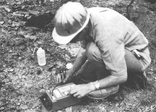
| Hydrologist checks pH content of strip mine, Shawnee National Forest, Illinois, 1967. (Forest Service Photo Collection, National Agricultural Library. Taken by Paul Steucke.) |
In 1960, wildlife groups challenged oil and gas interests when the latter applied for leases to explore and develop oil and gas resources on the North Kaibab section of Arizona's Kaibab National Forest. National forest managers worked cooperatively with BLM, the oil industry, the Geological Survey, the State of Arizona, sportsmen, and other conservationists to review lease applications and issue final permits. They jointly developed 35 stipulations to protect wildlife and wildlife user interests. The stipulations controlled the number of wells that could be drilled at any one time; the location, construction, and use of roads; pipeline locations; limits on tanks and other surface uses; disposition of equipment; revegetation measures; and measures to protect scenic, water, wildlife, and other resources. As it turned out, the exploration ended as a "dry hole" (USDA Forest Service 1963-1964). By the end of the 1960's, national forest managers were initiating coordination and protection actions on about 4,000 leases per year.
Mining Claims
Shortly after World War II, the number of people staking spurious claims on national forests under the 1872 Mining Act accelerated. Many claimants intended to use the staked claims for purposes other than mining. The 1872 Act did not provide that mining be done on a claim after it was patented, nor did it provide any checks against damage to soil, timber, water, or other resources. In many places, a finder could still stake a claim by filing a document with the county and marking the site with a note in an old Prince Albert tobacco can. In many counties, there were literally thousands of such questionable claims. The late 1940's and early 1950's became an era of the "weekend miner." Legitimate claims by miners who had actually discovered minerals and were working to develop them were mixed in with spurious claims — making the handling of mining claims a nuisance for national forest managers. Many national forest managers became skeptical and even hostile to mineral development (Peterson 1983).
In the big-timber country of California and the Pacific Northwest, where timber values often far exceeded estimated values of minerals on claims (some timber was valued up to $25,000 per acre), some claimants clearly used the mineral laws to obtain title to that timber. Other claims were used to control access to large bodies of merchantable national forest timber or to develop summer home sites. In many areas, the claimholder's pre-emptory right to surface resources often made effective natural resources management difficult or impossible.
|
| District ranger examining mining claim found in a can nailed to a tree during a forest boundary survey in the Clear Creek area, Boise National Forest, Idaho, 1955. (Forest Service Photo Collection, National Agricultural Library. Taken by Bluford Muir.) |
In the early postwar years, the national forest resource manager's role in mining claims and patents was largely reactive and limited to initiating protests against claims believed to be invalid and those where surface resources were being improperly used. Mining claimants, to hold their claims, had to do a small amount of work on them each year and had the right to use surface resources, but only as needed for such work.
Legitimate mining operations continued to be encouraged, and they increased on national forests. Claimants could obtain patents to bona fide claims under the mineral laws and title to 20 acres of timber as well as the minerals. But national forest managers increasingly saw a need for stronger guidelines and more deliberate efforts to protect the public's interest in proper land and resource management on frivolous claims.
In the early 1950's, the Forest Service proposed the separation of surface and subsurface (mineral) rights as one solution to the growing problem of managing surface resources on claims and adjacent lands. This did not jeopardize the interests of legitimate miners, but it could prevent abuse of mining laws from spurious claims and interference with managing other national forest uses and resources. The American Mining Congress, representing the mining industry, agreed that it was time to face the problem, and a new law, the Mining Claim Rights Restoration Act, was passed in 1955. It separated surface rights from subsurface rights while permitting legitimate mineral exploration and mine operations. The law also withdrew the staking of mining claims to extract common-variety materials: sand, stone, gravel, common pumice, and cinders. These became "salable" minerals subject to permits and sale under direct national forest supervision.
Uses unrelated to mining were no longer permitted on mining claims, nor could claimants remove timber except as needed to operate their claims. In addition, the 1955 Mining Act provided a procedure requiring the claimant, upon proper notice, to prove his or her claim was valid. The national forests promptly instituted a review process, guidelines, and a schedule to identify valid claims — a review that took 12 years to complete. Some 1.2 million claims were identified, covering 24 million acres. Tens of thousands of dormant and abandoned claims were eliminated. By 1967, national forest managers had validated 13,371 claims, less than 2 percent, on the basis of verified claimant statements.
National forest managers reviewed hundreds of occupancy applications on unpatented claims where claimants had become occupant-owner residents of valuable improvements. Qualified claim occupants — those entitled to surface rights — received relief through leases, special use permits, or purchase of the occupied site or an alternate site, but this type of relief required that all rights to the unpatented mining claim be reverted to the Government. Thus, the age of frivolous national forest mineral claims eventually came to an end (USDA Forest Service 1956-1968).
During the 1950's and 1960's, except for periodic spurts of uranium prospecting and a few high-value minerals, most national forests were not very active in hardrock mineral or energy development. The principal, and largely sufficient, sources of domestic ores and energy were being located on private and BLM lands. The more remote, topographically rough, and difficult to access national forests were largely ignored — with the notable exceptions of nickel, cobalt, and uranium (Peterson 1983).
During the cold war and missile-driven uranium boom, claimants filed about 5,000 claims per month. In the late 1960's, renewed interest in prospecting for uranium, silver, copper, molybdenum, and gold again prompted the staking of many hundreds of claims on national forests. The number of claims examined for compliance with mining laws rose to 4,000 per year, and surface rights were coordinated on 10,000 to 40,000 claims each year.
During the 1960's, as public interest in protecting natural resource conditions grew and the environmental cause emerged, some mining companies began to introduce resource protection measures into their national forest operations. For example, national forest managers and six major mining companies cooperated to ensure environmental protection in developing their leases on Missouri's Clark National Forest. By the terms of their leases, permits, and agreements, these companies took action to control erosion, prevent stream pollution, revegetate disturbed lands, and reduce harmful air emissions. In Colorado, the American Metal Claim Company (AMAX) cooperated with national forest managers; the Colorado Game, Fish, and Parks Department; and the Colorado Open Space Foundation to plan and operate mining projects near a well-known ski resort on the Arapaho National Forest. Environmental protection practices focused on maintaining water quality for established uses; providing both winter and summer recreational opportunities, including swimming, hiking, hunting, and camping; and creating a pleasing appearance (USDA Forest Service 1970). These actions were at the forefront of the mining industry's response to intensifying concerns about national forest environments.
But there also were more challenging situations. In 1969, the American Smelting and Refining Company (ASARCO) located a major molybdenum deposit in the highly scenic and game-rich White Cloud Peaks area on Idaho's Challis and Sawtooth National Forests. ASARCO applied for a special use permit to build an 8-mile access road to its claim. It worked closely with national forest managers to evaluate road access options for minimizing impacts on the area's sensitive scenery, ecology, and game resources. Nonetheless, ASARCO's proposed development became very controversial. Conservation interests opposed the road proposal and argued that the permit be denied due to threats to wildlife, water quality, and scenic values. They felt that protection of these resources outweighed the benefits from mining a relatively abundant mineral (Wilkinson and Anderson 1985).
In the public press, writers protested the rationale that gave mining top priority on a pristine 80-square-mile national forest area that included 54 scenic mountain lakes and one of Idaho's few glaciers. They urged that the White Cloud area be closed to mining. Under the mining laws, national forests had no regulations to control prospecting or to protect surface areas, water quality, fish, wildlife, timber, or soil resources; they also lacked authority to deny access. Their authority was limited to regulating the manner and route by which a road could be constructed. National forest managers held three public meetings on the White Cloud issue, which then became moot in 1970 when ASARCO, due to political sensitivity and a weak molybdenum market, withdrew its permit request and ceased further development (Wilkinson and Anderson 1985). In 1972, Congress added the White Cloud area to the Sawtooth National Recreation Area, where mining was permitted only under strict resource protection standards: the use of tracked vehicles and other moving equipment on this highly scenic area with fragile soils and frail ecology susceptible to aesthetic damage was prohibited or restricted. The White Cloud issue illustrated how national forest authority was limited to managing only surface resources on claims filed under U.S. mining laws. It also illustrated the influence of environmental interests.
|
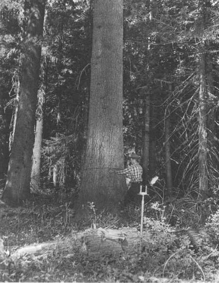
| Forester measuring a 46-inch d.b.h. western white pine on a timber-survey sample-tree measurement plot, Powell Ranger District, Clearwater National Forest, Idaho, 1951. (Forest Service Photo Collection, National Agricultural Library. Taken by L.J. Prater.) |
Using and Managing Timber Resources
The military's demand for timber products abated abruptly after 1945, but rising domestic housing demands quickly absorbed wartime timber supplies and more. Annual housing starts rose to 1.5 million per year by 1950 and remained at that average level until 1970. National forest timber supplies increased from 3.1 bbf in 1945 to 3.5 bbf in 1950. Between 1945 and 1950, even though demand for wood was strong and rising, expansion of the national forest timber harvest was dampened by the lack of adequate roads. Road construction budgets were scarcely enough to maintain wartime harvest levels. In 1946, the Federal Housing Expediter eased this situation by allocating funds "to build 1,443 miles of access roads, and reconstruct 656 additional miles to develop a maximum contribution from national forests toward providing more lumber for veteran's housing" (USDA Forest Service 1945-1950).
Congressional leaders, administration officials, and national forest managers saw expanding national forest softwood sawtimber harvests and producing high-quality wood products as performing a social service to the Nation. The softwood timber inventories of the Northeast and Lake States had been heavily depleted by the early 20th century. In the South, supplies of large trees and high-quality timber were declining rapidly and the smaller second-growth trees were producing low-quality wood products. Southern softwood inventories were also declining as timber harvests continued to exceed the growth of younger stands (USDA Forest Service 1945-1950). National forests, at this time, held half of the Nation's softwood timber inventory, primarily in mature and overmature stands in the West (Powell et al. 1992).
In the West, the national forest allowable cut was the calculated timber volume that could be sold and harvested in each year of the current decade and each decade thereafter on a long-term, sustainable basis. This calculation was based on the planned life (rotation age of the managed forest) of the existing old-growth timber inventory and the accretion from the estimated growth of any young timber in these stands and expressed on an annual basis.
During the postwar years, allowable cuts were separate determinations in the national forest timber management plans prepared each decade for some 400 working circles. Working circles basically represented the efficient national forest timber supply areas for the established local timber industry. Working circle allowable cuts were summed up to estimate the allowable cut for the whole forest.
Actual annual timber sale volumes generally lagged behind calculated allowable cuts because some timber markets were limited by industry's milling capacity or the available timber harvest included species for which markets were limited or nonexistent — a common situation in the Rocky Mountains. Lack of staff and funding to prepare timber sales and build access roads contributed to this lag. National forest managers viewed the allowable cut estimates as an upper limit to the average annual and decadal sales level while the western timber industry interpreted them as lower limits for timber sales and expected the full amount of the allowable cut estimate to be offered for sale throughout the 1945 to 1970 period. During the 1940's and 1950's, and into the 1960's, the industry widely held the view that national forest estimates of the full allowable cut were conservative compared to the sustainable harvest potential. They continually pressured national forest managers to raise allowable cut estimates. The allowable cut, or the allowable sale quantity (ASQ) as it came to be called in the 1980's, became a persistent and divisive issue between the timber industry and the Forest Service (Cliff, no date).
In 1950, the allowable cut level for all national forests was 6.0 bbf, but actual timber harvest volume, due to lack of access, was limited to 3.5 bbf. As staffing and funding improved, road construction and reconstruction accelerated from 2,000 miles per year in 1950 to 4,700 miles in 1960. Timber sales and harvests during the 1950's rose almost every year. Timber harvests reached 9.4 bbf in 1960 — 85 percent of the allowable cut of 11.0 bbf (fig. 6). The decadal updating of inventories and management plans with more accurate and detailed data permitted a steady rise in the calculated estimate of the sustainable allowable annual cut for the 400 national forest working circles. Such data included new information on growth, reproduction stocking, protection, reforestation and stand improvement practices, access, wood utilization standards, and inventory levels. Changing technologies and improved timber inventory methods were especially important. They made intensive timber utilization more economical and timber inventories more accurate. These improvements continued to influence yields and harvests through the 1960's as the total national forest allowable cut rose to 12.9 bbf in 1969. In that year, the harvest rose to 11.9 bbf — almost 8.4 bbf more than in 1950 — and to 92 percent of the allowable cut (USDA Forest Service 1945-1970, 1984, 1993).

|
| Figure 6. National forest timber sold and harvested, 1950-1969. Source: USDA Forest Service. |
Ninety percent of the increase in national forest timber harvests came from the western old-growth. The largest share came from Washington and Oregon with 41 percent, northern California with 20 percent, and Idaho and Montana with 15 percent. Small increases in the rest of the Rocky Mountain and Great Plains States forests added 9 percent, Alaska had 5 percent, and the remaining 10 percent came from the eastern and southern national forests (USDA Forest Service 1993).
|
| Clearcutting by staggered settings in old-growth on the Willamette National Forest, Oregon, 1953. (Forest Service Photo Collection, National Agricultural Library. Taken by Thomas C. Adams.) |
In the East, national forests focused on rehabilitating the heavily cutover, often burned-over acquired forests and reforesting abandoned farm croplands and fields. Planted forests were still too young to be harvested for saw-timber. To rebuild growing stocks and sawtimber inventories in the rehabilitating forests, only half of the growth was being harvested. Thus, average annual timber sales and harvests of the southern and eastern forests were limited to about half of their sustainable allowable cut levels.
During the late 1940's and 1950's, national forest timber supplies in the Douglas-fir areas of western Oregon and Washington offset the timber harvest decline on private lands. As a result, the total harvest in western Oregon and Washington during the 1950's remained relatively stable at an average annual level of 10.9 bbf, while the harvest share from Federal lands rose from 25 to 37 percent. Some lumber mills, however, went out of business for lack of logs, as the larger and higher quality logs were increasingly used for plywood by an expanding softwood plywood industry. Many lumber mills short of timber supplies shifted their operations to northern California, Idaho or Montana, and Canada, where available public timber supplies helped expand jobs and community growth (Fedkiw 1964; USDA Forest Service 1993).
Nationally, the rising western national forest harvest offset large declines in softwood sawtimber harvests and lumber production in the younger, much cutover, and declining private inventories in the East and South. Softwood lumber production in the South had dropped from 10 bbf in 1940 to less than 6 bbf in the early 1960's and 7 bbf in 1970. In the New England, Mid-Atlantic, and Lake States, softwood lumber production declined by 1 bbf in the same period. The huge old-growth reserves of the western national forests provided 20 years of reduced market pressure on the declining softwood sawtimber stocks on industrial and other private forest lands in the East and South. This respite in sawtimber harvests in the eastern United States helped to increase the rate of regrowth and buildup of softwood timber stocks, particularly in the Southeast and Northeast, which became important sources of increased sawtimber supplies during the 1970's (Ulrich 1989; Wheeler 1969; Row 1962).
Sustained-Yield Units and Long-term Timber Supply Contracts
Up through the 1940's, national forest managers used sustained-yield units and long-term timber supply contracts to advance community development and stability and to develop young, managed forests. The Sustained Yield Forest Management Act of 1944, passed largely through the efforts of the Western Forestry and Conservation Association and with the support of timber companies in need of new log supply sources, authorized the Secretary of Agriculture to establish cooperative and Federal sustained-yield units on national forests. The Act was designed to promote forest industry, employment, and community stability where sustained-yield units could ensure a stable and continuous timber supply. By 1945, national forests in seven regions had identified 64 potential opportunities for cooperative sustained-yield units and more than 61 opportunities for Federal sustained-yield units, and had applications for 60 cooperative units and 16 Federal units (Clary 1986).
Sustained-yield units could be established on national forests where community stability depended on Federal forest timber supplies and where such supplies could not be assured through the usual timber sale bidding procedure. The sustained-yield unit was designed to supply the timber needs of such communities on a sustainable basis without competitive bidding, but at prices not less than the appraised value of the timber. A cooperative unit was an agreement between an industrial or other private timber landowner and the national forest to establish and manage a unit made up of both private and national forest timberlands. A Federal unit contained only national forest timberlands.
Only one cooperative unit was ever established — the Shelton Cooperative Sustained-Yield Unit on the State of Washington's Olympic National Forest, established in 1947 through a 100-year agreement with the Simpson Logging Company. The unit included 110,000 acres of virgin national forest old-growth and 159,000 acres of Simpson's second-growth and regenerating forests. This cooperative arrangement provided the Simpson Company a sustainable timber supply of 90 million board feet per year. Without this cooperative arrangement, the Simpson harvest would have been 50 percent lower, mills would have closed, and 1,400 people in the local communities of Shelton and McCleary would have lost jobs (Clary 1986; Steen 1976). The Simpson unit was effectively phased out in the 1980's, as its dependence on national forest timber declined to zero. Simpson's timber needs are now being supplied by the regrowth on company lands, but the formal contractual dependency on national forest timber remains a valid agreement.
Just five Federal sustained-yield units were ever established. They reserved a total 1.7 million acres of national forest timber lands in Arizona, California, New Mexico, Oregon, and Washington. These units essentially guaranteed a sustained timber supply to local mills located in small communities dependent on the timber industry. Each, however, became a continual source of complaints and frustration to national forest managers (Clary 1986). All units are still in existence, except the one in Flagstaff, Arizona, which was developed in 1948 to support two sawmills. In 1980, the Coconino National Forest shut this unit down when the surviving mill had grown strong enough economically to operate without the preferential supply of a sustained-yield unit (Clary 1986).
In the face of strong opposition from many segments of the timber industry, conservation groups, organized labor, civic organizations, and communities, national forest efforts to advance community stability through sustained-yield units faded in the 1950's. One of the outgrowths of the retrenchment was the development of oral timber sale bidding in the Pacific Northwest. Oral bids gave local timber firms an opportunity to meet "outside" competition and thus support community stability (Leonard 1995).
National forests offered long-term timber sale contracts to encourage the development of the pulp and paper industry. In 1950, a public auction of 4.5 million cords of pulpwood on four Colorado forests culminated years of effort to develop a market for the Engelmann spruce timber that dominated the mountain slopes of the upper Colorado. The sale required erection of a pulp mill with a capacity of 200 to 250 tons daily and would keep that mill supplied for 30 years. Since two-thirds of the sale area timber was dead — killed by tiny spruce beetles — the sale also became a gigantic salvage project. In the high mountains, short summers and low humidity kept the beetle-killed timber in usable condition for pulpwood for many years.
|
| Winberry sale unit, Willamette National Forest, Oregon, clearcut in 1951, showing advanced regeneration and brush in 1957 after 1953 replanting. Brush provides wildlife habitat and forage until shaded out by new tree crop. (Forest Service Photo Collection, National Agricultural Library. Taken by L.J. Prater) |
In 1958, Alaska's Tongass National Forest awarded a long-term pulpwood sale of 1.5 billion cubic feet to the Ketchikan Pulp and Paper Company. This culminated three decades of effort to bring a pulp and paper industry to southeast Alaska. The sale required construction of a 300-ton capacity mill that would employ 800 people, and would supply that mill with 50 years of pulpwood. There were three additional long-term sale contracts; two have been canceled (the latest, Alaska Pulp Corporation in 1993), and a third, the Pacific Northern Sale, was modified to a 25-year contract when pulp mill construction became infeasible. The 25-year contract was completed in the 1980's by the Alaska Lumber and Pulp Company (now Alaska Pulp Corporation) (Leonard 1995). Only one long-term contract, Ketchikan Pulp's, remains operational — but under revised terms and reduced volume. These were among the last long-term timber sale contracts that national forests granted.
Timber Management Planning
Until the late 1970's, there were very few and only rudimentary national guidelines for overall national forest management planning. Official regulations, focused primarily on timber management, had only six specific requirements. They were to aid in providing a continuous supply of national forest timber; be based on the principle of sustained yield; provide an even flow of timber to help stabilize communities and local employment; help coordinate timber production and harvesting with other national forest lands and uses in accordance with principles for managing multiple uses; establish the allowable harvest rate at "the maximum amount of timber that may be cut from the national forest lands within the unit by years or other periods"; and be reviewed and approved by the Chief of the Forest Service (Wilkinson and Anderson 1985).
Central control and consistency for all timber management plans among the national forests was ensured by the Washington Office review and approval process (Leonard 1995). From Pinchot times, three basic procedural steps have been used in timber management planning: determining the land that was suitable for harvest (the commercial forest land); calculating the amount of timber that could be sold from the suitable land base on a sustained basis; and deciding the appropriate methods for harvesting and regenerating that timber (Wilkinson and Anderson 1985).
Commercial forest land (CFL) included all areas capable of growing at least 20 cubic feet of commercial wood per acre per year in soil conditions, terrain, and locations where logging would not be too costly. CFL excluded lands withdrawn for wilderness, administrative sites, or other purposes. In 1952, CFL made up 94.7 million acres — more than half of the National Forest System. By 1962, there were 96.8 million acres. CFL acres declined thereafter as new wilderness areas were designated by Congress.
|
| Winberry sale unit, Willamette National Forest, Oregon, in 1972, showing 20-year regrowth of Douglas-fir planting following clearcut in 1951. Planted trees are more than 20 feet tall and brush is suppressed. (Forest Service Photo Collection, National Agricultural Library.) |
National timber management guidelines gave national forest managers a great deal of flexibility and discretion and placed responsibility for planning and carrying out plans at the national forest and ranger district levels. Some latitude in national direction was desirable and necessary to enable district rangers to deal more effectively with local forest timber type variations and conditions and other national forest resources and uses (Wilkinson and Anderson 1985). The pressure to harvest timber in areas reserved for recreation, landscape aesthetics and watersheds led to more specific guidelines. For example, in rejecting a 1962 plan for "near natural" management in certain zones of California's Sequoia National Forest, the Chief of the Forest Service called for a certain amount of harvesting in some scenic areas. He felt that maintaining all parts of every scenic area in a near-natural condition — in this case, the establishment of virtually unmanaged areas of up to 100,000 acres — was impracticable (Clary 1986). The Forest Service issued new national direction that required allowable cut levels for landscape management areas to be determined separately and used only where there was assurance that the forest and industry could protect the desired features and attractions of landscape areas.
In the mid-1950's, during the planning for the Quilcene watershed on Washington's Olympic National Forest, the city of Port Townsend was concerned about timber harvesting and management in its municipal water supply source. National forest managers assured the city that the Forest would "propose nothing in the way of management that would adversely affect the amount and purity of the water supply." The watershed was part of the Quilcene working circle, and more than half of the watershed supported mature and merchantable timber. The Forest wanted to begin harvesting as soon as possible so that average annual harvest would be smaller (it would be spread out over a greater number of years). The harvest plan stipulated that the timber harvest would be limited to the watershed's sustainable yield of 9.5 million board feet per year; clearcuts would be limited to 30 acres or less (compared to a maximum of 80 acres); each clearcut patch would be reforested soon after slash disposal; and national forest managers would carefully select logging practices to protect watershed conditions (Clary 1986).
1961 National Development Program for National Forests
In 1961, President Kennedy, on behalf of the Forest Service, transmitted a long-term "Development Program for National Forests" to Congress, in which it was determined that the long-term sustainable harvest of national forests under intensive management would be 21.1 bbf by the year 2000. This included an intermediate goal of 13 bbf by 1972 (USDA Forest Service 1961a; Clary 1986). The goals, however, were never realized. Timber sales and harvests averaged less than 12 bbf through the 1960's, 1970's, and 1980's.
|
| Reforestation and clearcutting. A 15-year-old Douglas-fir plantation well-established following a 1950 clearcut, Gifford Pinchot National Forest, Washington, 1955. In the background, a more recent clearcut area with mature timber on either side. (Forest Service Photo Collection, National Agricultural Library. Taken by P. Freeman Heim.) |
Nevertheless, national forests were seen to play an important role in the Nation's timber supply and economy, particularly in the housing sector. The harvesting of old-growth timber, which was often decadent or deteriorating, was also viewed as a positive factor. Such harvests replaced mature and overmature western coniferous forests that had little or no net growth with fast-growing young timber stands (Clary 1986; USDA Forest Service 1945-1970).
Preparation of Timber Management Plans
Forest supervisors and their timber staffs, working with district rangers, prepared timber management plans, although in the major timber-producing regions a significant amount of technical work was centralized in the regional offices — from the taking of timber inventories to the calculation of allowable annual cuts. The Washington Office Timber Staff reviewed timber management plans throughout the 1945 to 1970 period. Often, allowable cuts were increased above pre-war levels to reflect updated inventory and regeneration data, improved harvest methods and equipment, shorter rotations, and higher utilization standards. National forest timber management plans "that did not calculate timber so as to permit the greatest annual allowable cut were returned to the regions for revision" (Clary 1986). The final approval for national forest timber management plans rested with the Chief of the Forest Service.
The Role of Road Development in Timber Resource Management
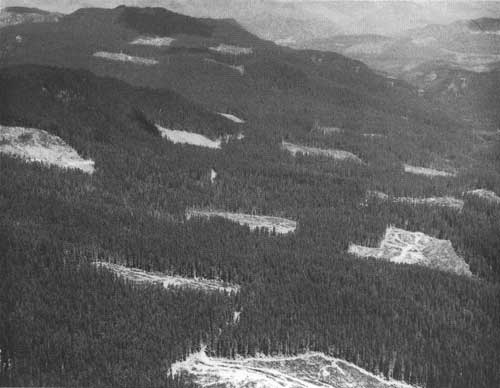
Developing and maintaining the national forest road system was a primary priority throughout the post-World War II period. Although road access to all parts of the National Forest System was needed to administer, protect, use, and manage the national forests efficiently, timber management to develop vigorous young forests and achieve the full allowable cut became a strong focus for the rapid development of the road system. Timber harvests became the principal basis for financing, justifying, and accelerating the construction of almost all local logging and collector roads, and many mainline access roads. Road system development also allowed the use and management of national forests for other purposes, especially outdoor recreation, wildlife, and fisheries.
An average of 22,000 timber sales per year took place during the 1950's; in the 1960's, the average was 24,000. More than 90 percent were very small sales to small local timber operators and other users, generally less than 100,000 board feet and under $1,000 or $2,000 per sale. About 1,000 sales per year involved 100,000 to 1 million board feet to somewhat larger operators. The bulk of the annual timber sale volume, however, was sold through another 1,000 or so sales of 1 million to 20 million board feet or more to medium- and large-size timber operators. These large sales were an important tool in developing the access road system; they required three types of roads: arterial (mainline) roads, the primary road system to major drainages or large land areas; collector (lateral) roads, to feed into the primary roads and reach smaller drainages and blocks of land; and local roads (logging spurs), temporary, lower standard roads to reach specific timber sales.
|
| Residual ponderosa and sugar pines left as seed source after logging, Umpqua National Forest, Oregon, 1953. Residual trees will be harvested later, after the unit has been restocked. (Forest Service Photo Collection, National Agricultural Library. Taken by E.L. Hayes) |
To extend the road system into previously undeveloped areas, timber sales scheduled many widely spaced timber harvest units. This approach encouraged smaller units that could be harvested and naturally seeded by surrounding timber, artificially seeded, or planted. Such units, with "no cut" areas between, limited the logging disturbance to a relatively small portion of the total timber sale area. The selection harvest system, often used for ponderosa pine, removed only a few trees per acre. Such sales covered larger harvest areas and likewise extended the road system to previously unroaded areas.
Although the national forest road system was initially developed to reach and extract national forest timber, it was seen as the key to opening up the national forests for hunters, anglers, hikers, other recreation interests, and other users. The total permanent road system in 1945 was about 100,000 miles. By 1970, it was nearly 200,000 miles.
Arterial and collector roads were engineered to Government standards and constructed by the Forest Service or the timber operator as a timber sale requirement. Temporary spurs were built by timber operators and treated as logging costs. However, many of these spurs were built on lines staked by national forest engineers where future permanent roads would be needed. Maintenance or reconstruction in later years would add these roads to the permanent road system. Between 1950 and 1970, timber operators built 70 to 90 percent of the annual road miles constructed or reconstructed. The annual mileage built by timber operators rose from 1,500 miles in the early 1950's to 3,800 miles in 1960 and over 6,000 miles by 1970. Roads built by the Forest Service increased from 500 miles in 1950 to 850 in 1960 and 1,100 miles by 1970.
Access To Respond to Natural Disasters
Between 1949 and 1951, repeated hurricane-force storms blew down timber over wide areas of western Oregon, northern Idaho, and western Montana — as much as 8 bbf in Oregon and a half-billion more in Idaho and Montana. National forest managers reoriented timber sales and road plans as soon as possible to salvage the heaviest concentrations of dead and damaged trees.
|
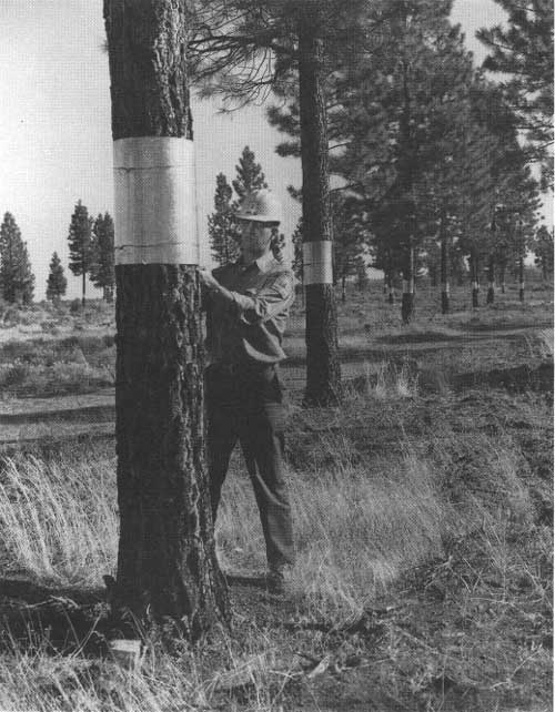
| Ponderosa pine seed orchards, Hackamore area, Modoc National Forest, California. Forest worker installing metal bands to prevent chipmunks from climbing trees to harvest pine cones and eat the seeds. (Forest Service Photo Collection, National Agricultural Library. Taken by John Wicker.) |
With major outbreaks of Engelmann spruce and Douglas-fir beetles in Idaho, Montana, and Oregon in 1952, the emergency efforts shifted to harvest the newly infested timber as soon as possible. A decade later, in 1962, the Columbus Day storm again caused similar widespread timber damage in Washington and Oregon. Redirected timber sales and road construction enabled salvage of 1.4 bbf of national forest blowdown timber by 1964 (USDA Forest Service 1949, 1953, 1964-1965).
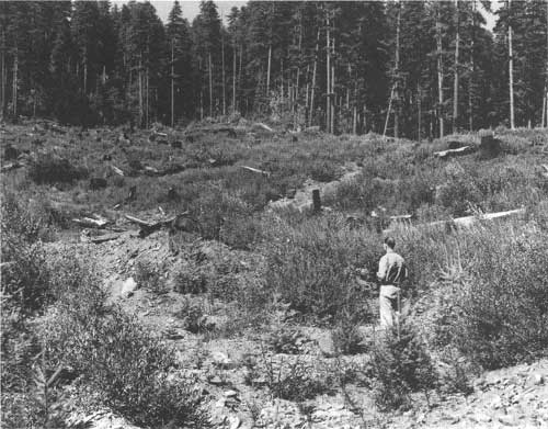
Reforestation and Stand Improvement
Before World War II, 1.2 million acres of deforested land had been planted or seeded, and an unknown amount had received timber-stand improvement cuts, weeding, thinning, or pruning. During World War II, these activities were largely suspended. By 1946, some 3.2 million acres of CFL needed reforestation and 3.8 million acres needed some type of timber-stand improvement.
Such work was reactivated in 1946, but it was limited to sale areas where timber operators paid for reforestation and post-harvest stand treatments. In that year, 27,600 acres were planted or seeded. Reforestation had doubled to 56,000 acres by 1955, accelerated to 200,000 acres in 1962, and stabilized at about 260,000 acres per year in the late 1960's. This trend reflected the rising national forest timber harvest level, primarily clearcutting, and a shift away from natural regeneration to planned reforestation. About 50,000 acres per year were being naturally regenerated in the 1960's. Success was improved by brush removal and scarifying the soil surface to expose mineral soil.
National forest tree nurseries were reactivated after the war. In 1950, 13 nurseries produced 45 million seedlings. This rose to 88 million in 1955 and 137 million in 1960, then stabilized at 100 million to 120 million seedlings per year. Superior seed production areas, seed orchards, and hybrid production were developed in the late 1950's. By 1963, national forests had 13 superior forest tree seed production areas on 10,069 acres, and 28 forest tree seed orchards were under development on 1,763 acres. The number of seed orchards and their area continued to expand seed production during the balance of the postwar period.
The quality of regeneration management improved throughout this period. In 1962, the Forest Service established the position of certified silviculturist on national forests and upgraded it to the level of senior timber sale positions. Forest Service research completed studies that improved regeneration methods, seed orchards, seed production, seed and tree quality, and nursery management and production.
Weeding, precommercial thinning, and sanitation cuts to remove both excess and poor-quality trees increased from about 250,000 acres per year in the early 1950's to more than 500,000 acres per year between 1955 and 1963. As thinning costs rose significantly, these activities declined to 300,000 acres in 1970. Other activities were animal damage control, mainly fencing to exclude deer, on about 200,000 acres per year, and rodent control on several hundred thousand acres. Prescribed burns were increasingly used, especially in the South, to protect longleaf pine from brown-spot disease, to reduce understory brush competition, and to prepare the ground for natural seeding (USDA Forest Service 1946-1970).
|
| Foresters on Pisgah National Forest, North Carolina, discussing multiple-use plan for the Pisgah Ranger District, 1963. (Forest Service Photo Collection, National Agricultural Library. Taken by B.W. Muir.) |
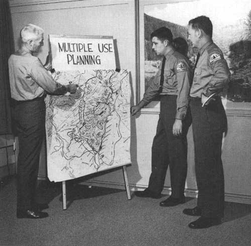
Planning for Multiple Uses Under the MUSY Act
The initial planning for managing multiple uses under the MUSY Act established a two-stage process for classifying national forests into land-use zones. Such zones were defined in the first-stage regional multiple-use planning guides. They gave broad direction for establishing, planning, and managing zones for recreation, travel influence, water influence, landscape, grassland, general forest, and formally dedicated areas such as research natural areas and wilderness. The zones varied somewhat among the regions. The general forest zone was usually CFL. Wildlife areas were not zoned because wildlife occupied all zones. All regions required the water influence, travel influence, and dedicated-area zones. Regional guides, however, did not give any direction on the use combination or pattern of uses that would best meet the public's needs within the regions nor how the use combinations or patterns should be determined. Multiple uses actually were coordinated incrementally on the ground through management decisions and practices within each land-use zone as the demand for uses emerged, site by site and year by year (Wilson 1967, 1978).
In the second stage, district rangers prepared district multiple-use plans that classified their entire district into land-use zones. These plans were used to decide where management activities should take place. District plans did not withdraw CFL from timber production; rather, they directed the protection of landscapes, water quality, recreation, and other resources within the land-use zones. Timber planners were required to ensure that timber harvest plans would protect other designated zone values. Sometimes this direction required reducing the allowable cut or modifying management practices. Resource planning for nontimber uses created other difficulties. For example, wildlife resource planners would often categorize CFL within a general forest zone as elk winter range, which called for adaptation of timber harvests and management. Thus, wildlife management under the multiple-use plans was essentially a matter of coordination with other uses rather than a matter of separate zoning. In time, it became apparent that neither the functional resource plans of the earlier years nor the multiple-use plans of the 1960's provided any clear or uniform guidelines for coordinating multiple uses (Wilkinson and Anderson 1985; Wilson 1967).
Insect and Disease Management
The Forest Pest Control Act of 1947 elevated the national priority of and strengthened the Federal Government's leadership and funding in pest control. Forest industry groups and the American Forestry Association, who often saw insects and diseases as generally more destructive to commercial timber stands than forest fires, strongly influenced this legislation. The new policy recognized that the key to cost-effective pest management was coordinated control of pest infestations on all land ownerships and authorized Federal technical and financial assistance to States and private landowners. The Act, which was initially administered by the Department of Agriculture's Bureau of Entomology, placed heavy emphasis on surveys and early detection of forest pest outbreaks. In 1953, the Secretary of Agriculture transferred the administration of the USDA forest insect and disease research and control programs to the Forest Service. Throughout the post-World War II period, following the 1947 policy direction, national forest managers coordinated insect and disease control with State and private landowners through technical and financial assistance for detection, evaluation, and control of insects and diseases on all ownerships. This multi-jurisdictional and multi-ownership approach approximated an ecosystem-wide approach and contributed significantly to the effectiveness of pest management (Worrall 1994).

|
| Ranger chopping bark of mature ponderosa pine to check for bark beetle infestation on Panguitch Lake District, Dixie National Forest, Utah, 1953. (Forest Service Photo Collection, National Agricultural Library. Taken by Jack Rottier.) |
The National Forest System's emphasis on insect and disease management and control accelerated rapidly after World War II — partly in response to more frequent spruce budworm and bark beetle attacks in the mature and overmature western national forests. It was also influenced by the low cost and high effectiveness of DDT and aerial spraying on spruce budworm in aging true fir, Douglas-fir, and spruce forests.
Insect Suppression
By 1960, national forest managers and pest control experts were conducting insect suppression projects on 80 national forests per year. Such projects involved 10 to 16 species of bark beetle, 6 to 8 defoliators, and a half a dozen or more other insects. Bark beetles continued to be the most destructive insects in the pine, Douglas-fir, and spruce forests of the West. Periodically, they were also very damaging to southern pines. Annually, four species of bark beetles — the mountain pine, western pine, Engelmann spruce, and southern pine beetles — caused the most damage. Bark beetle suppression projects were the largest and most costly insect control efforts.
From 1958 to 1969, some 700,000 to 1.2 million felled trees, stumps, and cull logs were debarked, burned, or treated with chemical emulsion bark sprays annually to control bark beetles. The strategy was to suppress initial outbreaks while they were small and less costly to control. However, epidemic outbreaks were frequent in the 25-year post-1945 period. Epidemics often followed major windstorms that damaged mature and aging timber. Commercial salvage operations quickly removed damaged and weakened trees that were highly susceptible to beetle attack, so they became an important tool in containing outbreaks and limiting the spread of beetles to healthy timber.
Spruce budworm was the most destructive defoliator. It attacked Douglas-fir, true firs, and spruce stands on western national forests and spruce and fir stands in the Lake States. Immediately after World War II, spruce budworm and other defoliators were sprayed with DDT. National forest managers learned that DDT was less toxic than compounds previously used to suppress defoliators and had a very low cost (less than $1.00 per acre after 1958). In 1963, the total area sprayed for defoliators reached a peak of 1.2 million acres and averaged 600,000 acres per year from 1957 to 1965.
National forests used DDT liberally in this period (USDA Forest Service 1945-1970). Although early studies indicated some environmental sensitivity to DDT, the Forest Service cooperated with the Federal Council on Insect Control and Federal and State wildlife agencies to reduce possible adverse effects (USDA Forest Service 1959).
In 1962, because of perceived damaging impacts of pesticides on some wildlife, Rachel Carson, in her book Silent Spring, raised serious challenges to the use of chemical pesticides, particularly DDT. Silent Spring, a subsequent report by President Kennedy's Science Advisory Committee, and reports from other information sources on pesticide hazards quickly contributed to grave public concerns about pesticide use. In 1963, more people observed aerial spray projects on national forests and other lands and participated in monitoring than ever before in the history of forest insect control. Despite this intense scrutiny, there were no reports of discernible pesticide damage to fish, wildlife, or other national forest resources.
Nevertheless, the use of DDT on national forests was greatly reduced in the latter 1960's, partly because of fewer defoliator outbreaks and partly because of restrictions on pesticide use. The national forest area treated with pesticides to suppress defoliators dropped from 1.7 million acres in 1963 to 800,000 acres in 1965, then fell sharply to 72,000 acres in 1966 and 14,000 acres in 1969 as use restrictions were tightened. At the same time, national forest managers mounted aggressive screening and testing activities to find nonpersistent pesticides that were acceptable alternatives to DDT. Biological control methods and silvicultural practices were also expanded and used to minimize insect outbreaks and damage.
Treatments for insects other than bark beetles and defoliators were limited to very small acreages. The total area annually treated for such insects varied from 200 acres in 1954 to 25,000 in 1964, and averaged 6,000 acres a year for the entire National Forest System.
Disease Control
After World War II, white pine blister rust control efforts were renewed. Although there were questions about the cost-effectiveness of the Ribes eradication, studies on previously completed eradications were reporting favorable results. White pine blister rust control continued to be the largest national forest disease control effort by far. Some 3.5 million acres of national forest white pine and sugar pine lands were designated for Ribes eradication. They involved 30 national forests in the West and the Lake States (now the Eastern Region) (Benedict 1981).
In 1949, Forest Service research experimented with applying the chemical Actidion on tree boles of infected trees to kill the blister rust fungus. By 1957, this experimental procedure was being applied to infected trees on national forests. An antibiotic foliar spray, Phytoactin, was tested in 1958 and sprayed from ground equipment and helicopters between 1959 and 1965. More than 500,000 acres were treated from the air and an additional 1.5 million acres from the ground. However, the use of these treatments was terminated in 1965 and 1966, as evaluations determined these antibiotics were not effective (Benedict 1981).
Genetic testing, begun in the 1940's produced a first generation of rust-resistant western white pine seedlings in 1957. By 1966, scientists were able to show that second-generation progenies had a 66-percent survival rate. Western white pine seed orchards to develop rust-resistant tree seeds and seedlings were eventually planted in Idaho in the early 1970's. A similar project to develop rust-resistant sugar pines was initiated in California in 1957 (Benedict 1981).

|
| Air tanker dropping borate slurry at the head of the Monrovia fire, Angeles National Forest, California, October 1958. (Forest Service Photo Collection, National Agricultural Library. Taken by Los Angeles County Fire Department.) |
During the mid-1960's, continuing evaluations of Ribes eradication in western white pine areas of Idaho, Montana, and Washington found that the rust was reinfecting young stands in protected areas at an average rate of 3 percent per year. It would not be economically feasible to bring such young stands to merchantable size. When compared to its benefits, the cost of eradicating Ribes was excessive. In the meantime, Douglas-fir, white-fir, western larch, and cedar had increased in relative value to western white pine in the northern Rocky Mountains and were finding good markets. Therefore, national forest managers decided to curtail Ribes eradication in Idaho, Washington, and Montana. Elsewhere, where Ribes eradication was still considered effective, it was continued on a cautious basis. By the late 1960's, only 15 forests were eradicating Ribes.
In 1959, four western national forest regions pilot tested silvicultural control of dwarf mistletoe, a parasitic disease of conifers, to evaluate control methods, costs, and operational problems in infected ponderosa pine, Douglas-fir, and lodgepole pine stands. During the 1960's, they implemented a control program that treated about 25,000 acres annually in those regions. Infected mature trees were harvested or otherwise removed, and the infected branches were pruned from younger trees.
Oak wilt, another introduced fungal disease, emerged as a new disease problem in the East in the 1950's. It was limited to five national forests in the Appalachian and Ozark Mountains. Because the disease posed an unknown threat, analogous to Dutch elm disease and chestnut blight, to the widespread, valuable oak species and forests, it was aggressively searched out in wide-reaching surveys. In the early 1960's, the infected trees removed from national forests numbered less than 200 per year; in 1968 and 1969 less than 100 were removed, and those were limited to the Monongahela National Forest in West Virginia (USDA Forest Service 1945-1970).
Protection From Forest Fires
After World War II, national forest managers responsible for forest fire control turned to more effective use of the growing technology and the expanding road network to reduce forest fire losses and damage. This included expanding smokejumper crews for rapid access to fires in remote mountain areas, using helicopters to move people and equipment to larger fires without using parachutes, and using aircraft to drop water and fire retardants on fires. The effectiveness and striking power of firefighting organizations was raised through increased use of new and improved mechanical firefighting equipment and expansion of the road system to reduce the need for large firefighting forces. Radio communications were improved and expanded. The effectiveness of logistics, communications, and coordination among firefighting forces of Federal and military agencies, States, and industry on large and highly destructive fires was increased. Technical knowledge of fire behavior for more effective firefighter training and generalship and strategies for coordinating new air-attack techniques with ground-attack methods were improved. A uniform national fire danger rating system was developed for more accurate prediction and comparison of fire situations. Clothing and protective equipment for firefighter safety were also improved.
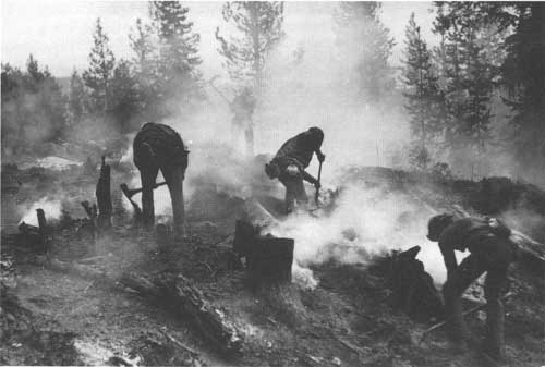
|
| Fighting wildfire with hand tools on the Hanover fire line, Nez Perce National Forest, Idaho, August 1967. The lightning-caused fire eventually burned 2,450 acres. (Forest Service Photo Collection, National Agricultural Library.) |
The average annual burn on national forests was reduced to 200,000 acres per year — barely one-tenth of one percent of the total national forest area. By 1951, the total strength of the short-term firefighting force was reduced to 6,000, compared to more than 13,000 in 1940, at the time of the CCC, and 9,300 in 1945, after the CCC.
The number of fires controlled annually on national forests varied from 7,000 to 13,000, and averaged 11,000 per year. Lightning caused a consistent 55 percent of the total fires — mostly in the West. Given the quadrupling of the timber harvest and even greater increases in the use of the national forests by recreationists, this performance was an extraordinary achievement. However, there were a few bad years. In 1951, more than 510,000 acres burned. Severe drought in the Southwest and California and the driest fire season since 1922 in western Washington and Oregon contributed to one of the worst national forest fire seasons, measured in terms of timber killed and other resources damaged, in many years. A billion board feet of sawtimber and 100,000 acres of young stands were damaged or destroyed. These fires also damaged watersheds in the Southwest and California. Heavy rainfall on some of the burned areas caused severe flash flooding.
The year 1967 was similar to 1951. Washington, Oregon, Montana, and Idaho had the warmest and driest summer since 1910, when 2.8 million acres burned in Montana and Idaho alone. Despite sustained critical forest fire conditions, fire damage was limited to 208,000 acres. Resource losses were similarly limited. This success was attributed to modernized fire control capability and strong interagency cooperation. Some 15,000 firefighters, including organized crews of American Indians, Hispanic-Americans, farmworkers, loggers, and BLM Alaska Native crews were mobilized. Foresters were drawn from every part of the Nation to supervise firefighting. Smokejumpers attacked a record number of fires with more than 4,000 jumps. The National Guard, the Army Reserve, and the U.S. Army and Air Force provided additional firefighters and equipment. The Forest Service employed hundreds of aircraft and bulldozers and massive amounts of support equipment and marshaled supplies, feeding facilities, and other support for firefighters. More effective fire attack and control plans were made possible by recently adopted airborne infrared fire mapping technology that could "see" the fires through smoke and darkness.
Fuel Management Activities
Fire control managers were also responsible for disposing fuels from timber harvests, road rights-of-way, and thinning. They burned fuels when moisture conditions minimized the risk of spread to green timber and atmospheric conditions dissipated smoke quickly. Firefighting equipment such as bulldozers, water tankers, and pumps were often kept on standby to minimize losses in case a burn escaped to green timber. Any such escapes were suppressed as forest fires. In the late 1960's, 300,000 acres or more were being burned annually, although by 1961 chipping, chopping, and other alternatives to burning were being used. The latter alternatives did not create smoke or impair visibility, which began to be seen as environmental concerns in some areas in the late 1960's.
Flammable vegetation was being removed from about 1,000 miles of roadside each year to minimize the threat of forest fires caused by passing motorists. Fire-hazardous snags were being felled on 500,000 acres per year to reduce the incidence and spread of lightning fires. Eventually, in the late 1970's, a number of selected snags per acre were being left to provide habitat for cavity-nesting birds and wildlife. Prescribed fires were being used in carefully selected situations to improve forage production, timber crops, and wildlife habitat on about 300,000 acres per year.
Initiation of Fuel Management
In the 1960's, national forest managers began to recognize that controlling forest fires to protect resources, regeneration investments, and other improvements, and to reduce risks to users, was leading to another problem — the buildup of woody forest debris, which created a potential for major fires in certain forests, particularly during drought years. In the past, periodic wildfires under natural conditions and fires started by Native Americans in presettlement times had been nature's way of avoiding woody debris accumulations. Prescribed fires — controlled burns set at times and under conditions that ensured slow, low-intensity burns that would consume the accumulated fuels with minimum damage to the forest itself — became one remedy. The earliest reference to prescribed burning as a forest fuel management tool on national forests appeared in the Quincy, California, Feather River Bulletin. it related to conditions on the Plumas National Forest in 1918:
. . . If the Forest Service were to adopt the policy of burning off the ridges in the early spring, this would eliminate in great measure the possibility of fire spreading over any great area, and would give the fire fighter unmeasurable advantage (McLean 1993).
In the late 1960's, western national forests began to apply prescribed burns to limited areas, up to 50,000 acres per year. About 1,000 miles of fuel and firebreaks were also being put in place. Progress was slow, but by 1969 it was evident that where fires had originated or burned into fuel-treated areas, both suppression costs and damage were significantly lower (USDA Forest Service 1968-1970).
Managing Recreation Uses and Resources
Postwar recreation visits to national forests — each single entry by a person equated to a visit — literally exploded when wartime gas rationing and other restrictions ended. Visits rose from 18 million in 1946 to 46 million in 1955 and 132 million in 1964 (fig. 7). In 1965, Federal agencies adopted a uniform unit for measuring recreation activity on Federal lands — the recreation visitor day (RVD), 12 hours of onsite use by one or more persons. Recreation use continued to rise, to 173 million RVD's in 1970 — an average increase of 2.7 percent per year compared with a population growth rate of 1.1 percent (fig. 8).

|
| Figure 7. Outdoor recreation visitor use of national forests, 1925-1964. Source: USDA Forest Service. |
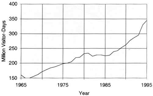
|
| Figure 8. Outdoor recreation visitor use of national forests, 1965-1994. Source: USDA Forest Service. |
Human populations shifting to the West and Southwest accelerated use pressures on western national forest lands and resources, particularly on forests near highly urbanizing areas and growing cities. Increasing affluence, leisure time, and high-tech equipment, and the use of offroad vehicles and boats, dramatically influenced the way Americans recreated. Although the CCC had effectively equipped many national forests with good-quality recreation facilities, the burgeoning use soon outgrew the 20-year-old public facilities and pressed into the less-developed lands and resources that were made accessible to recreation visitors by the expanding road system. The road system grew from 100,000 miles in 1945 to nearly 200,000 miles in 1970 and opened up access to new opportunities for recreation experiences.
The rapid rebound of recreation visits after World War I made recreation management a race to catch up and keep abreast of the growing use. Although recreation visits had declined by 50 per cent during the war, many areas near population centers had been used continuously. In the absence of maintenance during the war years, many facilities and areas had deteriorated and needed rehabilitation. Thus, restoring impacted recreation environments and upgrading, repairing, and rebuilding latrines, water systems, fireplaces, shelters, bathhouses, parking areas, and other facilities became an immediate priority after the war.
All national forests were planning new recreation areas or expanding existing facilities to relieve over use at many sites and to serve the rapid growth of recreation use. New recreation areas and sites were often planned and located where the buildup of recreation activities in accessible but unimproved and undeveloped areas threatened to impact resource conditions, recreationists' safety, or the quality of the site itself. A great increase in the popularity of winter sports created demand for more winter sports areas, skilifts, winter resorts, and more challenging skiing terrain. Ninety percent of the terrain available for public skiing was located on the western national forests, and it became a major source of winter sports expansion. From 1952 to 1959, the number of recreation visits to national forest winter sports facilities more than doubled, growing from 1.9 million to 4.2 million. The exploding participation in winter sports also required national forests to find ways to ensure the safety of large numbers of people in high-country winter conditions. Avalanche control to protect winter sports enthusiasts became an important need and difficult challenge on many forests.
A 5-year issue over developing a part of the San Gorgonio Primitive Area on Southern California's San Bernardino National Forest as a ski area illustrates the pressure for winter sports development on national forests. In 1947, following public hearings, national forest managers decided that the San Gorgonio watershed's values were best protected by keeping the proposed ski area in permanent wilderness, but it would be open for backcountry skiing (USDA Forest Service 1947-1948).
Recreation use in the 1950's continued to grow strongly on national forests and everywhere else in the United States. Congress established the Outdoor Recreation Resource Review Commission (ORRRC) in 1958 to focus national policy attention on long-term outdoor recreation needs. The Commission's task was to inventory and evaluate outdoor recreation resources and estimate the amount and type of recreation facilities that would be needed by 1976 and 2000. It completed its report in 1961.

|
| Winter sports on the Arapaho National Forest, Colorado. Jumping hill at Winter Park during NCAA tournament, March 1956. (Forest Service Photo Collection, National Agricultural Library. Taken by K.G. Brown.) |
|
| Cross-country skiers and snowmobiles on Trillium Lake Basin snow trail, Mt. Hood National Forest, Oregon, 1961. (Forest Service Photo Collection, National Agricultural Library.) |
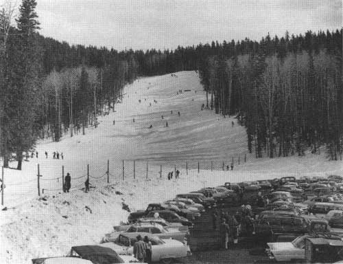
|
| Skiing on the Coconino National Forest, Arizona, 1957. This is the advanced slope at Snow Bowl. (Forest Service Photo Collection, National Agricultural Library. Taken by Dean M. Earl.) |
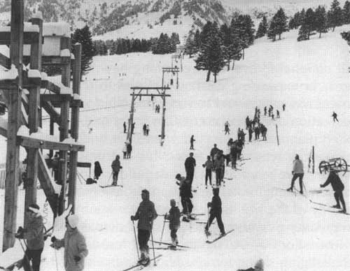
|
| Bridger Bowl Ski Area, Gallatin National Forest, Montana, 1961. Skiers waiting for ski tow to slopes in the background. (Forest Service Photo Collection, National Agricultural Library.) |
The Forest Service, anticipating participation in the ORRRC studies, initiated its own survey on national forests in 1957. In that, the forests launched a 5-year initiative called Operation Outdoors to improve the quality of existing facilities and add new recreation areas and facilities to relieve the continuing crowding and accommodate the 66 million visits projected for 1962. They employed professional landscape architects and recreation planners to review, update, and revise plans to modernize 4,700 campgrounds and picnic areas and prepare designs for new ones. By 1962, 22,000 family camps and picnic units were renovated and 17,000 new units were constructed. In addition, national forests developed or expanded 30 winter sports areas, 59 swimming sites, several boating sites, scenic outlooks, and other areas. Although this progress was significant, it achieved only about half of the targeted objectives, while recreation visits rose to 113 million in 1962 — twice the level projected by Operation Outdoors (USDA Forest Service 1945-1970).
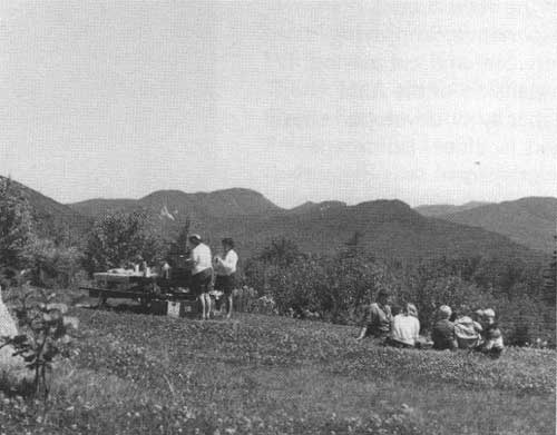
|
| Forest visitors enjoy lunch at the C.L. Graham Wangan picnic ground, White Mountain National Forest, New Hampshire, 1966. (Forest Service Photo Collection, National Agricultural Library. Taken by L.J. Prater.) |
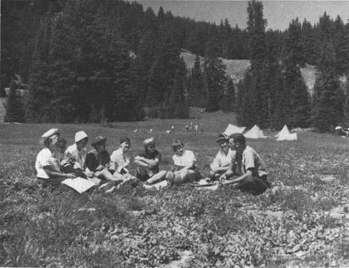
|
| Girl Scouts having lunch and visiting with forester during the 1960 Girl Scout All-State Encampment at Todd Lake, Deschutes National Forest, Oregon. (Forest Service Photo Collection, National Agricultural Library. Taken by L.J. Prater.) |
The national forests learned from the Operation Outdoors experience and the ORRRC studies that their 1957 growth projections greatly underestimated growth trends. Undismayed, the Forest Service incorporated higher targets for expanding recreation areas, facilities, and services to meet higher projections of recreation visits in its 10-Year Development Program, which President Kennedy transmitted to Congress in 1961 (USDA Forest Service 1961a). This program also included construction of more multiple-purpose roads and trails to serve the expected higher levels of recreation use in addition to increased timber harvests. Landscape, travel, and recreation zones were also being identified in management plans and on the ground to further integrate recreation use, management, and development with other national forest uses.
As visits to national forests rose from 27 million in 1950 to 113 million in 1962, the greatest increase came in the number of people just seeking general enjoyment of the forest environment. Automobile visits increased greatly (U.S. automobile registrations rose from 30 million in 1945 to 75 million in 1962). Driving for pleasure and picnicking were among the most popular onsite activities, growing from 14 million in 1950 to 61 million in 1962. Hunting and fishing visits increased from 7 million to 26 million. Visits for hiking and horseback riding rose from 600,000 to 2.5 million. All of these uses were helped by the expanding road system and existing trails (USDA Forest Service 1945-1970). Because the new roads often took the place of former trails built primarily for forest fire protection, the total miles of trails maintained by the national forests declined steadily, from 144,000 miles in 1945 to 105,000 in 1962 (Wells Associates, Inc., 1985).
Other, more site-specific activities also grew rapidly. Camping increased from 1.5 million visits in 1950 to 8.0 million in 1962, and winter sports from 1.5 million to 5.3 million. Swimming visits rose from 1 million to more than 3 million. Other visits, for boating, waterskiing, resort use, gathering forest products, summer home use, and nature study, rose from 1.3 million to 6.7 million (USDA Forest Service 1945-1970).
|
| Visitors at the "Cradle of Forestry in America" Visitor Information Center, Pisgah National Forest North Carolina, listening to recorded message about the "Things to Come" exhibit, 1967. (Forest Service Photo Collection, National Agricultural Library. Taken by L.J. Prater.) |
During the balance of the 1960's, recreation management focused increasingly on raising the quality of the recreational experience, improving services, and continuing expansion of the total capacity of developed sites and facilities. Landscape management was expanded as a new multiple-use discipline. Landscape areas and scenic vistas began to receive equal expert management consideration with other uses and values sought by national forest users. For example, the number of observation sites for enjoying scenic vistas increased from 242 in 1962 to 444 in 1970, and their capacity for people at one time (PAOT) grew from 12,000 to 26,000 — an increase of 117 percent.
The Visitor Information Service (VIS) was introduced in 1963 to help the public understand and interpret the national forests' historical and natural resources. The VIS provided road and trailside exhibits and signs, nature trails, personal contacts, and visitor centers at the most heavily visited attractions. In 1963, three centers were open to visitors: the Mendenhall Glacier Center on Alaska's Tongass National Forest near Juneau, the Missoula Smokejumper Center in Montana, and the Redfish Lake Center on Idaho's Sawtooth National Forest. By 1970, 36 such centers had a PAOT capacity of 7,305 visitors. The number of interpretive sites and trails, including those designed to serve persons with disabilities, reached 240 — and they could serve more than 20,000 visitors at one time. In 1970, the RVD's spent at information sites exceeded 2 million.
Between 1962 and 1970, the PAOT capacity at developed sites areas grew more than 52 percent, to 1.3 million. The greatest percentage increases in capacity occurred at boating, swimming, observation, and information sites. There also were huge increases in campsites, picnic sites, and winter sports areas. Total capacity at organization camps, hotels, lodges and resorts, and recreation residences remained about the same.
Concessionaire operation of developed sites was introduced in 1951 at well-improved areas where user charges could be readily justified. Sites operated by concessionaires rose to 148 by 1970, more than 10 percent of the publicly developed PAOT capacity at developed recreation sites. Concessionaire operation of recreation and visitor sites freed national forest managers to give more attention to the strategic and development aspects of national forest recreation management.
Almost 40 percent of all visitor use occurred at developed sites. The dispersed use of the national forest environment constituted 105 million RVD's — more than 60 percent of the total 173 million RVD's in 1970. Driving for pleasure over forest roads made up 38 million of the dispersed RVD use, and hunting, fishing, hiking, and horseback riding contributed another 38 million RVD's.
|
| Multiple use: wood is hauled out as recreationists drive into the Cherokee National Forest, Tennessee, over an attractive forest road to South Holston Reservoir, 1962. (Forest Service Photo Collection, National Agricultural Library.) |
National Recreation Areas
National Recreation Areas (NRA's) were an early Federal effort to improve and ensure the quality and supply of outdoor recreation opportunities close to areas of population concentration and growth centers. The establishment of NRA's was generally limited to areas with high recreation-carrying capacity (greater than 20,000 acres) and located where there were 30 million or more people within a 250-mile radius — a ubiquitous situation now. Each NRA is authorized by a separate individual act of Congress. The first national forest NRA was established in 1965 at Spruce Knob — Seneca Rocks on West Virginia's Monongahela National Forest. Spruce Knob was the State's highest mountain and the central attraction in 100,000 acres of a unique scenic and recreation area. Its development plan included facilities to accommodate a million recreation visitors per year by the 1970's and conservation of scenic, scientific, and historic sites. The plan permitted timber cutting, grazing, and mineral development with adaptations as needed to sustain the priority uses.
Two more NRA's were established in 1966: the Whiskeytown — Shasta-Trinity NRA on California's Shasta-Trinity National Forest and the Mount Rogers NRA on Virginia's Jefferson National Forest. Their total PAOT capacity at developed sites such as campsites, picnic areas, boating sites, motels, and lodges was 16,000. They could also accommodate tens of thousands of RVD's in dispersed-use activities such as hunting, fishing, driving, hiking, and scenic enjoyment. In 1967, visitor use at each of the initial three NRA's reached a million RVD's. The Flaming Gorge NRA, the fourth such area, was designated in October 1968 as a part of the Ashley National Forest in northeastern Utah and southwestern Wyoming. It included 200,000 acres of outstanding scenic country and the numerous recreation facilities surrounding the Flaming Gorge Reservoir constructed by the Department of the Interior's Bureau of Reclamation in 1964.
Designation of Wild and Scenic Rivers and National Trails
In October 1968, Congress extended its authority for designating Federal lands and resources to the preservation of wild, scenic, and recreational rivers — with the Wild and Scenic Rivers Act — and of national scenic, historic, and recreational trails — with the National Trails System Act — for the use and enjoyment of present and future generations. These Acts responded to ORRRC report recommendations. They reflected a growing concern that continuing national growth and development would encroach upon and preempt the recreation and aesthetic opportunities remaining in underdeveloped and newly developing areas on Federal lands and an urgency to ensure an adequate supply of such opportunities for future generations.
Congress initially designated eight wild and scenic rivers. Four of these rivers and a major part of a fifth, totaling almost 500 miles, were mainly on national forest lands and were to be managed by the Forest Service. The Act designated 27 other rivers for detailed study; the Forest Service was responsible for nine of these. The rivers and their immediate environments were to be evaluated for their outstanding scenic, recreation, geologic, fish and wildlife, historic, and cultural resources. Designated wild and scenic rivers were to be preserved in their free-flowing condition and their immediate environments protected for the benefit and enjoyment of present and future generations. Public listening sessions were scheduled as studies developed management plans and options that could be presented to the public.
Congress also designated two national scenic trails — the Appalachian Scenic Trail and the Pacific Crest Scenic Trail — and named 11 other scenic trails and 29 historic trails for study. In the West, the Pacific Crest Trail extended 1,599 miles through national forests in Washington, Oregon, and California and was to be administered by the Forest Service. The Appalachian Trail extended 2,000 miles from Maine to Georgia. The Forest Service would cooperate with the Department of the Interior to administer the 840 miles that passed through eight eastern national forests and participate in other studies where trails traversed national forest lands. Congress recognized the contributions that volunteers and private, non-profit trail groups had made to the development and maintenance of the Nation's trails and encouraged their continued participation in the planning, development, and management of national recreation trails.
Wilderness Preservation and Management
Wilderness use in the immediate postwar years represented less than 1 percent of the total visits to national forests. In 1947, wilderness areas — those areas classified as wilderness, wild, and primitive — were visited by 144,000 people who spent 406,000 days in them (USDA Forest Service 1947-1948). As the number of visits grew steadily, though slowly, the progress of national forest evaluation and classification of primitive areas as wilderness or wild also progressed. The 1947 decision to retain the San Gorgonio Primitive Area as permanent wilderness exemplifies an early post-World War II step in such evaluation.
In 1947, there were 77 wilderness, wild, and primitive area setasides on national forests, with a total area of more than 14 million acres. The National Forest System goal was to preserve, for all time, representative examples of the variety of American wilderness conditions. Areas selected for evaluation were kept in a substantially primitive, unmodified condition. Neither road construction nor commercial timbering was allowed. However, since most of the areas were in high country with little commercial timber, their withdrawal from timber cutting had little effect on the available timber inventory or allowable cuts. Access inside wilderness areas was limited to trails or waterways. Regulated livestock grazing was allowed in places where it had been long established. Many areas provided big game habitat. The national forest criteria for classification were very strict — pristine, primitive conditions and absence of any significant evidence of previous human activity such as logging, roads, residences, or other development. Wilderness areas were seen as the last remnants of pristine conditions in America. They were being selected to provide genuine wilderness recreation opportunities for those who wished to "rough it," as well as for those who yearned for solitude and a reflective, awe-inspiring experience (USDA Forest Service 1947-1948).
The pristine goals for wilderness gave national forest managers the policy direction to provide the finest wilderness conditions and experience to be found within the National Forest System, while balancing the lands and resources available to respond to the demands for more intensive uses. This approach worked well through the 1940's and into the 1950's and had the support of industry, conservation groups, wilderness interests, and communities. Conservation group interest in the preservation and management of wilderness areas grew during these years. All areas were located in the western national forests except the 7,610-acre Linville Gorge Wild Area established in 1953 on North Carolina's Pisgah National Forest. Another significant national forest reservation in the early 1950's was the closing of the airspace over the Superior National Forest roadless areas, which banned flying over the reserved area that eventually became the Boundary Waters Canoe Area.
|
| Field foresters checking watershed conditions on Hamilton mesa, Pecos Wilderness area, Santa Fe National Forest, New Mexico, 1954. (Forest Service Photo Collection, National Agricultural Library. Taken by W.L. Hansen.) |
The number of areas being considered for wilderness on national forests rose to 83 in 1961. As some lands, often those with commercial timber, were withdrawn from wilderness consideration as evaluation progressed, others were added, so the total area remained fairly close to 14 million acres. In 1961, 15 areas greater than 100,000 acres, including the Boundary Waters Canoe Area, were classified as wilderness and 30 areas of 5,000 to 100,000 acres were classified as wild areas. These represented 40 percent of the total national forest wilderness set aside of 14.7 million acres and included a second eastern wild area — the Great Gulf Area, with 5,400 rugged acres on the slopes of Mt. Washington on New Hampshire's White Mountain National Forest (USDA Forest Service 1945-1962).
By 1960, the number of wilderness visits rose to 765,000 — still less than 1 percent of all national forest recreation visits. Thus, it was apparent that wilderness was being valued more as a symbol and setting for human experiences than as a resource whose physical use would increase rapidly. The idea or mental image of wilderness and its symbolism captured America's imagination as the national movement for wilderness designation advanced (Roth 1984a; USDA Forest Service 1945-62).
As the 1950's unfolded, the steady extension of national forest roads and timbering into unroaded areas increasingly raised questions about the compatibility of logging with recreation and wilderness designation (Roth 1984a). Logging versus recreation came to be a source of friction. Some users began questioning the balance between commodity production and the aesthetic values of national forest. Uncertainty emerged among wilderness interest groups over the compatibility of the multiple-use management philosophy with wilderness preservation. Here and there, the withdrawal of commercial timberland from areas earlier classified as potentially suitable for wilderness designation aggravated these concerns. Wilderness leaders and advocates lost confidence in the Forest Service's administrative discretion to designate commercial timber lands as wilderness, where such areas were also valuable for wilderness. In 1956, they initiated a prolonged effort to develop and obtain passage of Federal legislation. They sought to provide statutory authority for wilderness designation; to withdraw Forest Service authority to declassify or reduce the size of wilderness-type areas; to protect wilderness against mining and water project developments; and to extend wilderness preservation to other Federal lands (Roth 1984b).
The Multiple-Use Sustained-Yield Act of 1960 was passed in this changing environment. Even though the Act implicitly recognized the compatibility of wilderness preservation with the multiple-use management philosophy, it mobilized wilderness advocates to seek passage of legislation that ultimately became the National Wilderness Preservation Act of 1964. Under this Act, Congress delegated to itself the power to designate areas of the National Forest System and other Federal lands as parts of a new National Wilderness Preservation System (NWPS), reducing the national forest managers' role from designating wilderness areas to identifying and evaluating candidate areas, recommending their classification, and managing the congressionally designated wilderness areas.
The Wilderness Act designated all of the Forest Service's previously classified wilderness or wild areas and the Boundary Waters Canoe Area as the initial components of the NWPS. These initial designations included 54 areas totaling 9.1 million acres that had been designated since 1924. The Act also directed that the remaining 5.5 million acres of national forest primitive areas be reviewed within 10 years to determine their suitability for wilderness. The findings were to be reported to the President, who would then recommend wilderness designation or other reclassification (Roth 1984a, 1984b; Steen 1976).
The Forest Service moved consciously to even more rigorous wilderness standards as it developed its procedures for classifying the remaining national forest primitive areas. The review was designed to ensure consistent national application of pristine standards for wilderness, even though the Wilderness Act provided only general definitions of wilderness and no guidelines on how to reconcile wilderness preservation with other national forest uses and resources. Under these circumstances, the classification process was quickly burdened by the ambiguities between the preferences of wilderness advocates and the Forest Service's rigorous criteria. Advocates participating in evaluation of primitive areas consistently pressed for inclusion of substantial acreages that did not meet the Forest Service's pristine standards. The Wilderness Act's broad guidelines left wide room for discretion. Thus, the participative process often led to compromise rather than consistent selection. The Wilderness Act similarly set no goals or guidelines for the ultimate size of the National Wilderness Preservation System. Stewart Brandborg, Executive Director of the Wilderness Society, argued on behalf of the advocates that the political process should be allowed to decide the ultimate size of the wilderness system (Roth 1984a).
During the 1960's, the Forest Service realized that Congress would likely include more than the classified primitive areas in the NWPS. In 1967, the Chief went beyond the Wilderness Act study requirements and directed regional foresters to complete an inventory and review of all remaining unclassified roadless areas larger than 5000 acres. In 1971, this initiative became the Roadless Area Review and Evaluation (RARE) — the second comprehensive national forest assessment of roadless lands for wilderness designation. The initial inventory had been undertaken in 1926 to identify primitive areas.
Between 1964, when the Wilderness Act was passed, and 1969, Congress designated seven new wilderness areas totaling 793,000 acres. Wilderness RVD's in 1969 exceeded 5 million and made up about 3 percent of the total recreation visitor use. These RVD numbers substantially exceeded the number of previously counted "visits" or single entries because wilderness recreation typically involved 4 to 5 days per visit.
Reservation of Research Natural Areas
National forests continued to reserve research natural areas (RNA's) after World War II and by 1970 had added 33 RNA's covering 41,288 acres, bringing their total to 72 and their area to 86,608 acres. The RNA's ranged from 18 acres to 9,102 acres, with a mean area of 1,202 acres — almost 2 square miles. RNA efforts continued to focus on establishing representative natural areas of major forest types and their scientific study and educational use to obtain and share information about natural system components and processes to distinguish differences between RNA development and that of representative managed ecosystems (USDA Forest Service 1992b).
In 1947, for example, on the Thornton M. Munger RNA at the Wind River Experimental Forest in Washington's Gifford Pinchot National Forest, a long-term study of old-growth Douglas-fir and western hemlock was initiated to evaluate growth and mortality, crown class development, and species succession. This study, 36 years later, provided dramatic data on the dynamics of stand structure and species composition in Douglas-fir and western hemlock old-growth and the static nature of old-growth total stand volumes as annual mortality offset annual growth.
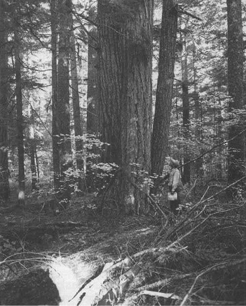
|
| Thornton T. Munger Research Natural Area, representing old growth Douglas-fir and western hemlock, 1952. Growth and mortality have been periodically measured in the stand since 1947. (RNA Research File, USDA Forest Service, Washington, DC.) |
In 1950, the G.A. Pearson RNA was established on Arizona's Coconino National Forest to maintain in its natural state a representative stand of pure ponderosa pine typical of the commercial old-growth stands on the Coconino Plateau. In the 1990's, the Pearson RNA would provide data on goshawk habitat preferences for less-dense stands and management guidelines to keep the goshawk off the endangered species list.
The Elk Knoll RNA was established in 1957 on Utah's Manti-LaSal National Forest to maintain an area of subalpine vegetation, trees, and shrubs in a protected condition free from domestic livestock grazing. It served as a baseline for evaluating ecological trends of subalpine vegetation under various grazing regimes, and in time helped to calibrate an evaluation scale to assess the Manti-LaSal's range conditions.
Protecting and Managing Watershed Condition
Maintaining favorable watershed conditions continued to be a prime national forest management concern as timber harvesting — including road building — and recreation increasingly became the most widespread national forest uses after 1945. Reliable flows of good-quality water were needed not only to sustain wildlife and fisheries habitats, provide quality recreation opportunities, and serve other national forest needs, but also to ensure water supplies for downstream communities, farms, and industries. National forest watersheds were the major water source for 1,800 cities and towns. Hundreds of smaller communities and thousands of rural residents received all or part of their water supply from the national forests.
National forest water yield was particularly important in the 11 contiguous Western States — Washington, Oregon, California, Nevada, Arizona, New Mexico, Utah, Colorado, Wyoming, Idaho, and Montana, where national forests made up 21 percent of the land area and yielded 53 percent of the total runoff. More than 600 hydroelectric power developments and thousands of industrial plants depended on water supplies from these forests. National forest watersheds were also the major water supply sources for agricultural irrigation in the West and the locale and sites for many reservoirs that provided water storage and regulated waterflows.
East of the Great Plains, national forests were fewer and more widely dispersed and did not loom large in the total water supply picture. But in the Ozarks and the Appalachians and some other critical eastern watershed areas, they often played an important role in local and regional water supplies and flood control.

|
| Young rangers at Rocky Mountain Region training camp receiving field instruction on analyzing watershed conditions, Pike National Forest, Colorado, 1952. (Forest Service Photo Collection, National Agricultural Library. Taken by F. Lee Kirby.) |
Following World War II, the national forests renewed their efforts to prepare management plans for important watersheds. These plans provided basic soil and water information for land use and management. In time, such watershed plans included quantified data on actual and potential water yields, conditions, and current and potential water requirements. This effort advanced slowly. Most watershed management concentrated on projects to rehabilitate watersheds already damaged by forest fires, overgrazing, and other causes of damage.
By the end of the 1950's, there were up to 90 active watershed rehabilitation and stabilization projects per year on damaged lands and waterways on about 80 national forests. Although the multiple uses were managed in ways that protected the soil and provided adequate vegetative cover, there were still some areas where cover was inadequate due to extreme past abuse and forest fires. In 1958, these areas constituted 3.5 million acres of eroding slopes, some 43,000 acres of slides and unstable dunes, 6,200 miles of impaired stream channels, and more than 20,000 miles of gullies (USDA Forest Service 1959).
Restoration of damaged watersheds and emergency treatment of newly burned areas continued through the 1960's. Rehabilitation projects treated about 40,000 acres of eroding land; stabilized several hundred miles of streambanks, shorelines, and gullies by planting trees and grasses; and controlled erosion on about 2,000 miles of abandoned, but eroding, old trails and roads each year.
The following case examples illustrate the range and performance of watershed management and protection activities. In 1947, California's Angeles National Forest, in cooperation with the Soil Conservation Service, strengthened its forest fire control capabilities and the protection of highly flammable mountain brush on steep, erosive slopes by installing water storage facilities. In areas with growing water needs, the protection of the "worthless" brush on areas with high watershed value was viewed as more important than a stand of choice timber on areas of low watershed use and benefit (USDA Forest Service 1947-1948). They also installed stream improvements in certain parts of steep mountain channels to better control streamflow, stabilize stream channels and banks, and reduce streamflow damage.

|
| Job Corps enrollees building gabions for stream improvement and watershed protection on the Middle Fork of the Red River, Daniel Boone National Forest, Kentucky. (Forest Service Photo Collection, National Agricultural Library. Taken by L.J. Prater.) |
In 1949, two extensively burned areas on California's Los Padres and Cleveland National Forests received emergency rehabilitation treatments. Fixed-wing aircraft quickly reseeded thousands of acres of denuded lands to grass. Where the terrain was too hazardous for fixed-wing aircraft, helicopters were used. In 1950, the entire North Fork of the Swift Creek watershed on Wyoming's Bridger National Forest was withdrawn from grazing with full cooperation from local ranchers. Heavy grazing in past years had so depleted the watershed's forage cover that runoff from rains was a source of critical flooding to the downstream town of Afton. Erosion and sediment were also causing widespread damage, especially to the town's water distribution system and even to plumbing fixtures in homes and to irrigation facilities in the surrounding area. This rehabilitation effort continued for a full decade. In 1958, the Siuslaw National Forest on the Oregon coast was engaged in stabilizing coastal sand dunes to protect roads, campgrounds, small lakes, and streams from dune encroachment. On New Hampshire's White Mountain National Forest, four municipal watersheds were being rehabilitated to stabilize soils in ways that would steadily improve the quality and yield for domestic water supplies.
Watershed foresters monitored the performance of their projects. For example, after the completion of a 3-year rehabilitation project on the Castle Creek watershed of Colorado's San Isabel National Forest, they reported that surface runoff had been slowed to a point where Castle Creek no longer carried silt. Meadow-type vegetation was returning to bottom-lands where the water table had been restored by gully stabilization and contour trenches. Castle Creek, which used to flow after each rain and then dry up, was slowly returning to a yearlong live stream supporting fish and wildlife.
Soil Surveys Initiated
In 1960, all national forest regions initiated systemtic soil surveys after they had pilot tested the most cost-effective way to carry them out (USDA Forest Service 1961b). Soils training schools were established and a soils handbook was prepared and published. National forest managers needed to know more about soil capabilities and limitations and how they related to national forest management activities and uses. By 1970, detailed soil surveys had been conducted on more than 20 million acres of National Forest System lands. With the advice of soil scientists, soil and water management problems were being minimized on more than 500 projects per year. Similarly, data from hydrologic and geologic surveys were used to improve national forest resource use and management.
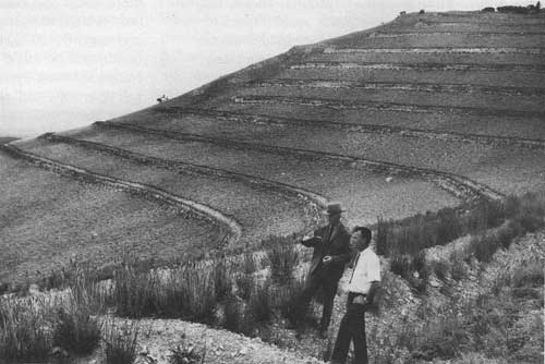
|
| District ranger and the mayor of Ely, Nevada, examining 1958-59 contour trenching and crested wheatgrass seeding project done at Ward Mountain, Humboldt National Forest, to stop erosion and the repeated flooding of the town of Ely. Photo taken in 1965. (Forest Service Photo Collection, National Agricultural Library. Taken by L.J. Prater.) |
Water Storage Development
National growth and development after World War II unleashed an unprecedented rate of dam construction in the United States. More than 35,000 dams were completed between 1945 and 1969. Many served multiple purposes such as irrigation, flood control, water supply, recreation, and hydroelectric power (Frederick 1991). Although some water storage facilities were built on eastern national forests, much of this construction spilled over to western national forest lands, where many sites had been identified as power sites available for public or private development. By 1951, large, multiple-purpose dam projects such as the Hungry Horse project on Montana's Flathead River and the Detroit Dam on Oregon's North Santiam River created huge reservoirs, often flooding national forest lands and being filled, in part, by runoff from nonflooded national forest lands. Often, national forests were given the responsibility for managing the recreation sites and uses around such large reservoirs.
Local communities were also reaching into national forests for additional water supplies. Private power companies were constructing large reservoirs and power-generating plants. Farmers and ranchers continued to build many small irrigation and stock watering reservoirs on national forests. In Alaska, also in the 1950's, the more accessible of the 200 available power sites were being studied as water and power sources for pulp mills.
Although other agencies were constructing these water developments and were responsible for managing them, national forest managers were faced with the impact of these developments. Some of the larger reservoirs were submerging thousands of timber-producing acres, which required national forest managers to conduct impact studies and surveys to coordinate the various other forest resource uses with the dam-building projects. Twenty-nine such surveys were completed on national forests in 1961, and work was advancing on an additional 35 more. This number doubled by 1962 and continued to increase to more than 400 by 1970. During this period, such studies were renamed impact surveys and expanded to include all water-development construction projects. The surveys provided information on adaptive measures to mitigate resource damage that occurred during dam construction (USDA Forest Service 1945-1970).
Barometer Watershed Projects To Increase Streamflow
In the late 1950's, research demonstrated that watershed streamflows could be increased by reducing or changing the density of forest cover. To determine whether watersheds could be managed in ways that would increase waterflows, the Forest Service in the early 1960's established a series of barometer (gauged) sample watersheds in areas where water supplies were scarce. Such projects were established on 50,000- to 100,000-acre watersheds on 40 national forests. Streamflow gauges determined baseline and altered waterflows before and after a variety of management practices were implemented. Such practices included snow fencing or timber cutting in patterns to increase snow depth and subsequent snowmelt runoff, conversion of brush cover to grass, identifying pollution sources and methods to reduce pollution, and developing rehabilitation plans for eroding areas. Twenty-one barometer watersheds had been designated by 1965. When they were fully instrumented, they would sample the effects of resource management and development practices on water quality and yield.
Throughout the 25-year postwar period, most soil and watershed activities were carried out in coordinating other uses. At the end of the 1960's, of the 360 soil and water FTE's, 310 were engaged in coordinating soil and water protection and management with other uses or in conducting inventories to provide basic information on soil and water resources and conditions. Only 50 FTE's were involved in implementing soil and watershed management practices directly on national forest land (USDA Forest Service 1992a).

|
| Santa Fe Canyon Reservoir, Santa Fe National Forest, New Mexico, 1947, with city of Santa Fe in the background. Watershed protection was the highest priority use for the land, and it was closed to all other uses. (Forest Service Photo Collection, National Agricultural Library. Taken by L.J. Prater.) |
Wildlife and Fish Management
The 1945 to 1960 Period
At the end of World War II, big game populations on national forests had generally risen to their highest levels in the 20th century — twice as great as those on other ownerships (USDA Forest Service 1947-1948). By 1945, their numbers exceeded 2 million, nearly quadruple the 1921 estimate when the first big game population survey was done on the National Forest System (Thomas et al. 1988). They included deer, elk, moose, antelope, bear, bighorn sheep, and mountain goats and constituted a third of the Nation's big game population (USDA Forest Service 1947-1948). Between 1945 and 1960, national forest deer populations increased by more than a million and elk rose from 160,000 to 296,000 in the nine Western States — Washington, Oregon, Idaho, Montana, Wyoming, Utah, Colorado, Arizona, and New Mexico. Increases in other big game populations were smaller. Bighorn sheep numbers had declined to a low of about 9,500 in 1940, but in 1960 they numbered 12,000 (Thomas et al. 1988).
National forests also supported a wide variety of small game and birds such as squirrels, ruffed grouse, and wild turkey. Furbearers were widespread. As a result of protection and restoration efforts, beaver were increasing rapidly in some locales. There were more than 80,000 miles of fishable streams — some of the best trout waters in the country. Game fish were common in the waters of 1.5 million acres of natural lakes or impoundments. Because national forests provided unrestricted access for hunting and fishing and were located in almost every State, the Forest Service predicted public demand for hunting and fishing on the national forests would grow rapidly after World War II (USDA Forest Service 1945).
The number of hunter and angler visits to national forests rose from 3 million in 1945 to more than 22 million by 1960 — an average growth of more than 13 percent per year (USDA Forest Service 1945-1970). Between 1945 and 1960, fishing visits outnumbered hunting visits by two to one. In 1950, big game hunters outnumbered small game hunters by about two to one. Hunting visits to national forests between 1947 and 1958 increased nationwide at 10 times the rate of State hunting license sales. Fishing visits increased at 3.5 times the rate of State fishing license sales nationwide (USDA Forest Service 1959). Thus, national forests were becoming the frequent and preferred hunting and fishing locales for an increasing number of American sportsmen and sportswomen. This trend was influenced not only by the quality of national forest hunting and fishing opportunities, but also by the spread of urbanization and industrial development and other changes in land use; by improved ease and speed of transportation; and by increased posting of private lands. The number of big game animals taken each year rose from less than 300,000 before 1950 to more than 650,000 in 1960. During the same years, big game populations nearly doubled from 2.2 million to 4.2 million. Turkeys also increased, and their harvest rose from negligible numbers in 1945 to 10,000 in 1960. By 1960, the acreage of lakes that supported sport fish rose to 2.5 million acres as national forest impoundments increased. Sport-fishing stream mileage remained more or less stable at about 80,000 miles (USDA Forest Service 1945-1970).
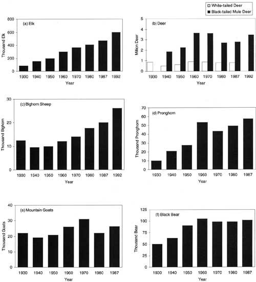
|
| Figure 9. Selected trends in national forest big game populations, 1930-1992. Source: Thomas et al. 1988. |
Several important factors during the preceding 40 years influenced the buildup in national forest game populations until 1945 (particularly deer and elk, but other species as well). The gradual strengthening of State game-protection laws was perhaps the most important. Game populations increased each year as the laws limiting the taking of game were effectively enforced. The management of game populations and regulations governing hunting and trapping on national forests and other lands were strictly the province of the individual State governments. Although these were zealously guarded State rights, States often deputized national forest officers as State game wardens to aid in the enforcing State game laws on national forests. National forest officers, on the other hand, often kept track of wildlife population trends, and State authorities often consulted them on proper hunting, fishing, and trapping seasons and bag limits. The national forest managers' role was limited to managing wildlife and fish habitats — including making habitat condition surveys. But because habitat management had clear implications for wildlife and fish populations, the province of the States, national forest managers purposefully sought working agreements with State fish and game commissions and agencies.
National forest managers restored and improved domestic livestock and wildlife forage in many places. Wildlife habitats were improved by timber cutting. The annual extension of timber harvests to more and more areas created large amounts of open spaces and forest "edge" where choice game browse plants grew. National forest managers cooperated with State wildlife managers to restock game and other animals, such as beaver and birds, where their populations had been seriously depleted or lost. Wildlife populations were also improved by States' establishment of management areas and refuges in cooperation with national forests.
The buildup in game populations to 1945 and thereafter brought full stocking to many western deer and elk ranges, and overstocking to others. Where big game ranges were overstocked, the natural food supplies were bound to be reduced and deer and elk numbers could be decimated by starvation and disease. Wildlife overstocking, much like livestock overstocking, damaged range and forest vegetation and sods. In some areas and situations, competition with livestock for forage became a serious problem, even though deer and elk tended to frequent the rougher country and more timbered range while the livestock favored the grasslands. Severe winter weather conditions caused competition for the food supply where both shared the same rangeland and their total numbers were out of balance with available forage. Deer and elk faced the threat of starvation and decimation while livestock weights were reduced. Where the number of permitted livestock needed to be reduced, the grazing industry was understandably dissatisfied.
During the war years, most national forest wildlife specialists either had entered the military or had been assigned to more urgent wartime duties, curtailing many wildlife maintenance projects and much of the management work. By 1945, there was an accumulated workload for stream and lake surveys, game inventories, and wildlife habitat studies. Escalating hunting and fishing use and accelerating timber harvests further magnified wildlife management demands. To address this growing workload, the recruiting and staffing of wildlife specialists in the regional offices and on many national forests became a prime priority.
National forest and State game managers saw controlling game numbers as a solution to excess game populations. Their principal control tools were planned hunting seasons and managed hunts to reduce wildlife numbers to the capacity of their habitats and compatibility with other uses. Public opinion was slow to accept such an approach after several decades of public support for building up game populations. State officials, on this account, frequently delayed applying such population-control measures. National forest managers, nevertheless, cooperated with State officials to reduce problem herd populations. In 1949, for example, the national forests of Utah, Nevada, southern Idaho, and western Wyoming cooperated with State wildlife authorities to plan and carry out 95 special hunts on overpopulated big game ranges. Reducing excess game populations continued to be a high priority through the 1945 to 1960 period. Where there was competition between big game and domestic livestock, stockowners became important participants in finding mutually acceptable solutions. In such situations, national forest managers generally worked with the stockmen and sportsmen as well as the States to find a mutually acceptable balance among such uses and users (USDA Forest Service 1945-1970).
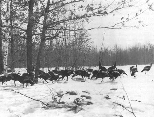
|
| Wild turkey feeding at a foodpatch in deep snow, Manistee National Forest, Michigan, 1959. Turkeys were introduced in 1957 by the Michigan Department of Conservation. (Forest Service Photo Collection, National Agricultural Library. Taken by Robert E. Radtke.) |
The number of new cooperative wildlife habitat management projects with States on national forests expanded between 1945 and 1960, while established cooperative projects such as protecting the nesting sites of the endangered California condor and the joint study and management of livestock and deer with the State of Arizona on the Grand Canyon National Game Preserve of the Kaibab National Forest continued. The cooperative beaver restocking efforts on West Virginia's Monongahela National Forest, begun in the 1920's, led to the first beaver trapping season in 1948. Earlier cooperative wild turkey restocking in Colorado national forests led to the first open hunting season in 1950.
In the 1950's, national forest and State cooperative wildlife and fish management areas in Florida, Georgia, Alabama, Tennessee, North Carolina, and Virginia provided good hunting and fishing where game and fish had previously been absent or very scarce. These areas received intensive management. The States usually collected fees from hunters and anglers and, in turn, shared those fees with the national forests to improve and maintain fish and game habitats. This form of cooperative supplemental State financing was first initiated in the West in 1950 on the Three Bar Quail Management Area of Arizona's Tonto National Forest, where management provided numerous small water developments for quail, fencing to exclude livestock, and access roads for hunters to reach previously inaccessible quail habitats.
In the 1950's, State fish and game departments and many other organizations stepped up their participation in direct habitat improvement work on national forests. By 1959, for example, States were helping with new fish and wildlife habitat improvement projects on 69,450 acres of national forest and assisting in constructing 199 small water developments on 92 miles of fishing streams. In addition, States and national forests were jointly maintaining existing fish and wildlife habitat improvements on about 160,000 acres of national forest land and 150 miles of fishing streams, nearly 900 established small water developments, about 1,000 acres of human-made lakes, and more than 300 study enclosures. Cooperative work included wildlife openings, food and cover plantings, water developments, browse regeneration, stream improvement structures, bank stabilization, new fishing lakes, and access roads and trails.
In the West, States cooperated with national forest managers on efforts and projects focused on timber harvest planning, assessing critical deer and elk winter habitat needs, and studying the relationship between logging and fish and game habitat in Colorado and Oregon. In the East, cooperative efforts focused on habitat improvements for deer and small game. On North Carolina's Pisgah National Forest, studies found that selection cutting or clearcutting of limited areas in hardwood forests produced abundant deer browse compatible with timber management. On Wisconsin and northern Michigan national forests, extensive openings were being left unplanted to provide sharptail grouse range. On Pennsylvania's Allegheny National Forest, cooperative projects provided openings in dense forests for small game such as rabbits and grouse.
Wildlife Habitat Management and Staffing: 1945-1959
Wildlife habitat management plans had been completed on two-thirds of the national forests by 1957, and the balance were scheduled for completion by the end of 1959. In response to the rising timber harvest levels, many national forests had developed or upgraded coordination guidelines and increased staffing to better integrate wildlife and timber management. In the Southeast, for example, prescriptions for timber stand improvement included wildlife habitat protection and improvement measures. By 1959, all regions had two or more full-time wildlife or fisheries management specialists, and some had assigned full- or part-time wildlife specialists to individual or groups of forests that had heavy wildlife and fisheries workloads. Such staffing improved technical direction of wildlife management projects and coordination of fish and wildlife objectives with other resource uses.
Strengthening of Wildlife Management in the 1960's
The MUSY Act in 1960 established legislatively, for the first time, that wildlife and fish habitat management were valid purposes for designating and administering national forests. In enacting this legislation, however, Congress made it clear that the established division of responsibilities between the States and the Federal Government for managing wildlife and fish populations and habitats on Federal lands, respectively, would remain unchanged.
The MUSY Act reinforced the traditional understanding that national forest wildlife priorities would continue to reflect State priorities, which placed heavy emphasis on game and sportfish management. Within the National Forest System, however, the MUSY Act recognized wildlife and fish resources as coequal with other renewable natural resources, but did not provide any guidelines for integrating wildlife and fish habitat management with the other resources, except for requiring sustained yields of these resources (Wilkinson and Anderson 1985). During the 1960's, this improved status strengthened the role of wildlife and fish management within the National Forest System and contributed to both funding and staffing improvements. Funding rose slowly, to more than $12 million (constant 1991 dollars) by 1969, and staffing rose to nearly 300 FTE's. Wildlife support and coordination activities with other resource management activities accounted for more than 70 percent of the funding and more than half of the staffing (USDA Forest Service 1992a).

|
| Wildlife guzzler furnishes a steady supply of water for wild birds and animals. Installed on the Rita Blanca National Grasslands, Texas, by the Texas Game and Fish Commission, 1963. (Forest Service Photo Collection, National Agricultural Library. Taken by L.J. Prater.) |
All national forest regions intensified wildlife and fish management training for staff specialists and district rangers. Its primary focus was on more effective integration of wildlife and fish habitat management with other resource uses and management, particularly with range and timber. Some range and wildlife management specialists received field training at interregional schools on coordinated game-livestock range analysis. Some timber management specialists similarly participated with wildlife management specialists in field training schools on timber-wildlife habitat management coordination techniques. These specialists, in turn, conducted on-the-ground training for resource management personnel on their own forests and districts.
During the 1960's, national forest managers and wildlife and fish specialists, in cooperation with State managers and experts, renewed their emphasis on developing and updating wildlife and fish habitat management plans. These plans provided intensified guidelines for on-the-ground management activities that coordinated wildlife and fishery requirements with timber management, grazing, and watershed improvement. By 1976, more than 1,200 such habitat management plans were providing continuity in managing wildlife and fish and their habitats.
Direct wildlife habitat improvement work increased steadily, from 69,000 acres per year in 1959 to 230,000 in 1970. During the late 1960's, State cooperation and support expanded accordingly and the States' share of financing rose to an average of 50 percent of project costs. Improvements included permanent openings for forage production, prescribed burns, seeding and planting of food and cover plants, releasing forage plants, and fencing key game areas. Nearly 2 million acres of direct habitat improvements were installed during the 1960's.
National forest wildlife and fishery managers and staff experts annually installed fishable stream habitat improvements where needed throughout the 1945 to 1970 period. These included installing channel structures, improving spawnbeds, removing stream barriers, fencing stream channels, and removing rough fish. Nearly 5,000 acres of new lakes were also constructed in this period — adding to the million or so acres of human-made reservoirs supporting cold and warm freshwater fisheries. Lake improvement activities included stabilizing water levels and banks, controlling aquatic plants, developing fish shelters, removing debris, and removing nongame fish that had little or no direct economic or recreational use value.
National forests also placed more attention on improving waterfowl habitats. Minnesota's Chippewa National Forest and Michigan's Hiawatha National Forest, in cooperation with State conservation agencies and national resource associations and the Department of the Interior's Bureau of Sports Fisheries and Wildlife, initiated special wetland improvement projects. Waterfowl habitat improvements on national forest wetlands rose from less than 200 acres in 1962 to 4,000 acres in 1969. During the 1960's, the cooperative effort improved more than 30,000 acres of wetland habitats (USDA Forest Service 1945-1970).
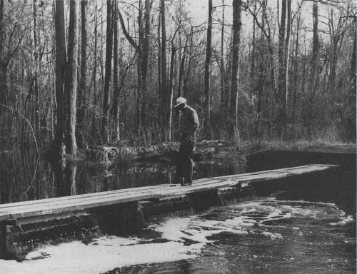
|
| District ranger checks dam and spillway at Nicholson Creek Green Tree Reserve, Witherbee Ranger District, Francis Marion National forest, South Carolina, where duck habitat has been improved for hunting. (Forest Service Photo Collection, National Agricultural Library. Taken by D.D. Devets.) |
National forest wildlife managers and biologists, likewise, gave growing management attention to nongame species, particularly rare, endangered, and unique species. In 1963, a special 4,010-acre Kirtland's warbler management area was set aside on northern Michigan's Huron National Forest to preserve this "bird of fire" (Radtke et al. 1983). Successful forest fire control had progressively reduced the Kirtland's warbler nesting habitat in young jack pine stands. After fires, jack pine (a pioneer species) reseeded readily on sandy soils. Although 500 pairs were counted in the 1951 and 1961 censuses, it was clear that the Kirtland's warbler nesting habitat was disappearing. In 1964, the Huron began a systematic schedule of prescribed burns, almost a full square mile (about 640 acres) in that year, to create and sustain future habitats. This joint effort with the Michigan Department of Natural Resources set aside 7,630 acres of State lands to manage as Kirtland's warbler habitat.
Throughout the 1960's, national forests cooperated with the Audubon Society to provide ways and means to protect dwindling populations of bald eagles and osprey. In 1969, central Oregon's Deschutes National Forest, cooperating with the Oregon State Game Commission, the Department of Fish and Wildlife, and the Department of the Interior's Bureau of Reclamation, established an osprey management area at the Crane Prairie Reservoir to develop habitat and nesting sites for osprey — probably the first of such osprey habitat management in the country (USDA Forest Service 1970). California's Los Padres National Forest continued to maintain the 53,000-acre Sespe Condor Sanctuary to protect the nesting areas of the 40 surviving California condors — the largest birds in North America.
By 1970, before the enactment of the Endangered Species Act, national forests had classified 47 wildlife and fish species as rare or endangered, and 68 others had been identified as unique to national forests. Endangered wildlife included the Puerto Rican parrot, gray wolf, red wolf, grizzly bear, black-footed ferret, and southern bald eagle. Fish species included the little Colorado spinedace and the Paiute, greenback, and Gila cutthroat trout. Among the rare species were the Kaibab squirrel, glacier bear, California bighorn, lesser prairie chicken, and Arctic grayling. Special management or management plans had been developed for 30 of these species, and plans were being considered for 56 others.
In Alaska on March 27, 1964, a catastrophic earthquake — the most powerful ever recorded on the North American continent — damaged coastal and some inland areas of the Chugach National Forest on Alaska's coast south and east of Anchorage. Some of the impacted areas sank up to 8 feet, drowning shoreline vegetation and trees and flooding seawater onto dry-land big game ranges and freshwater spawning areas at the mouths of streams. Other areas were raised several feet, causing some waterfowl habitat to become high and dry and destroying many nesting sites. Earth movements also caused sedimentation damage to salmon spawning gravels and blocked salmon access to their former spawning streams throughout Prince William Sound, jeopardizing commercial fisheries. National forest managers promptly evaluated the resource impacts of the earthquake. In cooperation with the Alaska Department of Fish and Game, management activities for the next few years rehabilitated spawning habitats in several damaged streams, including installation of fish ladders where land movements had caused stream obstructions. In the Copper River Delta, nesting sites lost to landlift were replaced with new waterfowl nesting sites on some of the land inundated by the seawater (USDA Forest Service 1964-1965; USDA Forest Service 1983).
The quality and diversity of national forest wildlife and fisheries habitat management grew in all dimensions in the 1960's. By the end of the decade, even though there was much room for further improvement, the Public Land Law Review Commission cited national forest wildlife management as the most active Federal effort in wildlife habitat improvement. (Public Land Law Review Commission 1969).
1960's Trends in Wildlife and Fisheries Use
Hunting and fishing visits continued to increase, to 30 million by 1965. In that year, however, the units of use changed to the 12-hours-on-site wildlife/fish user day (WFUD) to better measure the actual amount of use. The user-day equivalent of 30 million visits became 24 million WFUD's, which were about equally divided between hunting and fishing. A hunting visit was just about equal to a full WFUD, and a fishing visit to half a WFUD. In 1969, hunting use reached 14.9 million WFUD's. The estimated annual harvest of big game stabilized at around 660,000 animals. Given the continued increase in hunter use, this harvest rate represented a decline in hunter success per WFUD. Many small game species, upland game birds, and waterfowl were harvested in much greater numbers than big game. Fishery use rose to 14.1 million WFUD's. The total use of 29.0 million WFUD's by hunters and anglers represented a 3.5-percent annual growth rate since 1960, substantially more than the U.S. population growth rate (USDA Forest Service 1945-1970).
The nonconsumptive use of wildlife became increasingly important and began to be reported in the 1960's. Nonconsumptive uses included bird-watching, wildlife observation, photography, and related activities and were estimated at 10.1 million WFUD's by the end of the 1960's. The aesthetic appreciation of wildlife, though not included among the nonconsumptive uses, was assuming greater importance to the camper, the hiker, and the boater, who considered encounters with wildlife as valuable parts of their recreation experience. Total WFUD's, including nonconsumptive use, reached nearly 40 million in 1969, almost 25 percent of the total RVD use on national forests (USDA Forest Service 1970).
Emergence of a National Policy for the Environment
in 1970
The growing environmental movement of the 1960's culminated when President Nixon signed the National Environmental Policy Act (NEPA) into law on January 1, 1970. The new legislation opened the way for more formalized and widespread public participation in national forest planning and management and required preparation of fuller and more vigorous explanations of management alternatives as a way to avoid or reduce adverse effects of management activities on the environment. NEPA declared that it was national policy to encourage production and enjoyable harmony between people and their environment; to promote efforts to protect or eliminate damage to the environment and the ecological systems and to stimulate human health and welfare; and to enrich the understanding of ecological systems and natural resources. It also established the Council on Environmental Quality (CEQ).
The action-forcing part of NEPA was section 102(2)(c), which required responsible officials to prepare detailed environmental impact statements (EIS's) for every recommendation or report on proposals for legislation or other major Federal actions that significantly affected the quality of the human environment. Henceforth, responsible officials were to consult with and obtain the comments of any Federal agency with jurisdiction by law or expertise over any reported environmental impacts. Copies of such statements and the comments and views of the appropriate Federal, State, and local agencies authorized to develop and enforce environmental standards were to be made available to the CEQ and public.
Insofar as National Forest System activities were concerned, the Forest Service, at the time, saw NEPA as an extension of the MUSY Act of 1960 and the Organic Act of 1897 (USDA Forest Service 1972). NEPA made environmental considerations a full partner with economic and technical forest management matters. Even though economic and social factors were to be considered, they were not NEPA's main thrust. Its primary focus was on environmental considerations and informing the public about environmental effects. The Forest Service set about designing procedures to implement NEPA's requirements for full public disclosure of the environmental consequences of significant Federal actions. The NEPA document prepared on the Monongahela National Forest's clearcutting issue became one of the Forest Service's first EIS's.
The 1960's Open Major Issues for Timber and
Multiple-Use Management
Several major events in the 1960's, associated with both planned activities and natural phenomena, brought national forest management national and multiregional attention and opened major timber and multiple-use management issues. Four are reviewed here as a setting for national policy issues that emerged in the 1970's and are addressed in Chapter 4. Two of the events were resolved in the short run through adaptive management and research initiatives. Two others became the focal points of prolonged national debate and major policy changes.
Timber Management and Fish Habitat
In the winter of 1964 and 1965 on the Payette and Boise National Forests in west central Idaho, heavy rain on snow resulted in massive water-caused erosion from logged areas and from logging and access roads on steep, stream-cut sideslopes of the South Fork of the Salmon River drainage. The massive erosion washed prodigious amounts of sediment, estimated at 1.5 million cubic yards, into the South Fork and its tributaries. This sediment severely degraded prime spawning gravel and rearing habitats for one of the largest remaining and nationally important populations of Columbia River Basin summer Chinook salmon. Other species were also affected. The watershed area covered more than 1,000 square miles, an area slightly larger than the State of Rhode Island, with elevations ranging from 2,700 to 9,280 feet. The soils in the South Fork drainage were shallow and coarse textured and, therefore, highly erodible when disturbed, particularly on steep, stream-cut sideslopes.
The massive landslide was the culmination of several decades of accumulating degrading influences from a variety of land management activities. Before 1940, the same watershed had been damaged extensively by uncontrolled dredge, placer, and hydraulic mining and by domestic grazing activities. In the mid-1940's, 350 miles of road were built in the drainage, with little attention to the erosion hazard. From the mid-1940's to the mid-1960's, 800 additional miles of road had been built — many across the very steep and fragile slopes — to log some 325 million board feet of timber on about 7 percent of the drainage area. As roads rose to higher elevations, they undercut erosive slopes repeatedly, making them highly susceptible to severe slippage and slides when soils became oversaturated (Payette National Forest et al. 1989; Platts 1971).
As a result of the massive erosion, the Payette and Boise National Forests imposed a moratorium on logging and road construction in the upper South Fork drainage. Small-scale erosion control efforts began immediately. These efforts focused on reducing the massive road-failure potential, particularly of logging roads, on steep slopes. During the latter 1960's and early 1970's, more than 500 miles of logging roads, almost half the total road system, were closed and revegetated. Main access roads were also revegetated and their drainage systems were improved. These control measures, together with the stream's natural sediment flushing action and later management actions to control or mitigate any unexpected acceleration of erosion, were designed to significantly reduce, in time, the amount of sediment in the South Fork and its tributaries and, therefore, to reclaim fish habitat (Payette National Forest et al. 1989).
Clearcutting: Hardwoods and Wildlife on the Monongahela National Forest
In the eastern United States in 1964, local interests on West Virginia's Monongahela National Forest, primarily squirrel and turkey hunters, began to raise questions about the clearcutting of central hardwoods, primarily oak-hickory forests, as the Monongahela implemented its new timber management plan. The plan defined even-aged management as the "primary" system for managing all of the Forest's CFL — 750,000 out of 860,000 acres. The decision to favor even-aged management, and particularly clearcutting, emerged from a growing awareness among foresters that selection cutting, the favored silvicultural practice for managing hardwood stands in the eastern United States before 1964, was often not reproducing high-value, shade-intolerant species such as yellow poplar, cherry, red oak, and others. Research findings, documented in Timber Management Guide for Upland Central Hardwoods (Central States Forest Experiment Station and North Central Region, 1962) in the early 1960's, had also established scientifically that even-aged management, including clearcutting, regenerated shade-intolerant hardwoods more effectively than selection cutting. These convincing results received the strong support of the Forest Service's Washington Office timber management staff, who in turn directed national forest managers on the Monongahela and all other eastern national forests managing hardwood timber stands to study the research on the ground at the Vinton Furnace Experimental Forest in Ohio and to participate in even-aged management field training sessions. Later, national direction established even-aged management as the primary system of hardwood management across the eastern United States, even though some biologists raised questions about its implementation, though not its credibility as an effective system for timber-stand regeneration and timber production. In updating its timber management plan, the Monongahela National Forest aggressively endorsed this strong central direction and readily received approval for its plan from the Washington Office (Weitzman 1977).
The real user concerns were not so much with even-aged management as a silvicultural system or clearcutting as a regeneration practice, but how the clearcuts were being applied — their large size, the concentration of clearcut areas, their impact on squirrel and turkey high forest habitats, and their impairment of hunting opportunities and experience. There were also concerns about the visual effects and watershed impacts of large clearcut areas. Despite the complaints, the Monongahela National Forest continued to implement even-aged management as a technically sound and practical system for harvesting and regenerating hardwoods, including several large clearcut timber sales in close proximity to each other. These actions responded, in part, to continuing strong demands for timber sales and mounting pressures from Congress and the public to meet housing needs (Weitzman 1977). Such sales were also planned to take advantage of existing roads to avoid the costs and environmental effects of building more extensive road systems. Sale area sizes were often designed to increase the efficiency of the logging opportunity.
In 1964, the West Virginia House of Delegates assembled a committee of natural resource professionals from the West Virginia University College of Forestry and the State Department of Natural Resources and asked them to study the new even-aged management practices. After studying national forest management objectives and reviewing the selected cutover areas on the Monongahela, the committee concluded that "there appears to be no reason to be critical of the present practices" (Weitzman 1977). But this review had only included sales from an area where the clearcuts were small enough and their nature technically sufficient to be generally acceptable to forestry professionals. In 1967, the West Virginia Legislature called for a second committee, this time made up of legislators only, five each from the House and Senate, to evaluate the Monongahela's management practices. Their report was critical of national forest timber management practices and asked that the Forest "cease and desist from the clearcut practices" and "that the selection cutting practices be re-employed" (Weitzman 1977). Neither the Monongahela National Forest nor the 1968 West Virginia Legislature took any follow-up action on this report.
In early 1970, the West Virginia Legislature, responding to continuing citizen complaints, passed a third resolution, this time appointing a Forest Management Practices Commission to study the effects of clearcutting on national forest lands. The Commission included both legislators and citizen members knowledgeable in conservation and forestry. The Chief of the Forest Service, in turn, named a special in-service review committee to examine and report on the Commission's study of the Monongahela's timber harvesting practices. Because of the importance of even-aged management to National Forest System management and its controversial nature, the Forest Service prepared a draft EIS based on the review committee's assessment, filed it with the CEQ, and circulated it to other agencies and the public. The Forest, the Eastern Region, and the Washington Office carefully studied comments from the State Commission and other sources. The Final EIS, released in December 1970, suggested the need for several changes in current practices which the State Commission's report had also suggested. The Forest Service's EIS specifically concurred with the State Commission's recommendation that individual clearcuts normally be less than 25 acres and agreed to follow it. It further declared that high-quality forest culture required a variety of cutting methods, including clearcutting, to produce different timber stands for a variety of wildlife associated with different timber-stand structures and conditions. The Washington Office transmitted the report of the review committee and its recommendations to the Monongahela National Forest with direction to take corrective action. However, the Monongahela's managers could only make "limited progress because (as the report indicated) the limitations in staffing, funding, and policy were beyond local control" (Weitzman 1977; USDA Forest Service 1972).
Despite repeated efforts to reconcile the clearcutting question, the controversy continued and became polarized and highly controversial during the 1970's, resulting in a major Federal court suit and an appeal that eventually led to new legislation for the management of national forests in 1976 — the National Forest Management Act (NFMA).
Elk — Timber Management Conflicts
Before 1960, big elk managers in the Rocky Mountains perceived that elk populations were often too large for the carrying capacity of the available winter range and, therefore, a major problem. In such situations, hunting seasons were long and often allowed hunters to harvest more than one animal. Logging was usually seen as beneficial where new forage areas were created, and logging roads often provided hunters access to areas with low elk harvests and large elk populations. During the 1960's, however, hunters and wildlife biologists began to suspect possible adverse effects on elk related to logging, road access, and loss of tree cover. Little was known about elk response to timber harvests and roads, but strong views emerged in many parts of the West about the reductions in local deer and elk herds despite improved forage supplies in newly roaded areas. Some concerned observers suggested that elk moved to adjacent undisturbed areas. Others expressed concerns that increased access and elk hunting efficiency would lead to shorter seasons, a lower quality of hunting experience, and even herd reductions (Lyon et al. 1985).
In 1970, a proposed timber sale that would have modified elk summer habitat in the Little Belt Mountains on Montana's Lewis and Clark National Forest led to a meeting of concerned State, national forest, and private resource managers and biologists to discuss the potential impact of elk winter concentrations on State-owned and private lands. That meeting led directly to the design and initiation of a long-term Montana Cooperative Elk-Logging Study in 1970, with seven different study areas located throughout western Montana. Ultimately, the research was highly successful in analyzing elk behavior and habitat needs in managed timber areas and led to improved timber management and roading practices on a broad landscape management scale to favor elk habitat.
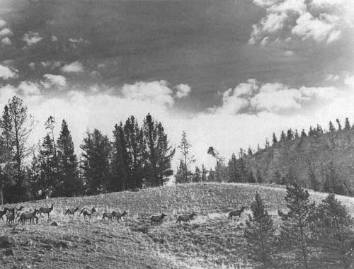
|
| Elk herd on spring range, Upper Gallatin River near the northern boundary of Yellowstone National Park, Gallatin National Forest, Montana. (Forest Service Photo Collection, National Agricultural Library. Taken by George Wolstad.) |
The Emergence of the Bitterroot Controversy
During the 1960's, the timber management practices on Montana's Bitterroot National Forest became the focus of unrelenting criticism from a growing number of Bitterroot Valley residents. Their concerns centered on the visual effects of an increasing number of clearcuts on the steep slopes surrounding the valley. Other concerns included soil erosion, water runoff, wildlife habitat damage, and reduced property values. Farmers feared for their irrigation water supplies. Real-estate people were troubled with the effect of highly visible clearcuts on scenic landscapes and property values. At the core of these concerns was a perception that the rate of timber harvest was too high and that the forest was being overcut (Bolle 1989; Popovich 1975).
In 1967, these concerns drew the attention of Montana's Senator Lee Metcalf, a Bitterroot Valley resident. He explored the problem with the University of Montana forestry faculty and, in 1968, in preference to a full congressional investigation, he encouraged the University to look into it at the local level. In the spring of 1969, the regional forester, acting jointly with the director of the Intermountain Forest and Range Experiment Station, responded to a written critique by a coalition of Bitterroot Valley conservationists and to criticisms in the local press by appointing a task force to assess the problem internally. It was a thorough, comprehensive examination addressing specific charges that clearcutting and terracing on steep mountain slopes were injurious to water quality, physically unappealing, and unnecessary; that roads were improperly constructed; that much of the Bitterroot Valley forest should not be logged; and that the allowable cut was higher than could be sustained.
About the same time, Senator Metcalf saw no reason for the University committee, chaired by Dean Arnold Bolle, to hold off on its independent investigation. The University committee, tentatively set up in 1968, had spent some time evaluating the problem and the information role it could perform. The Senator respected the Forest Service study and had encouraged it. However, he felt the preponderance of local criticism was a strong reason for the University committee to give another point of view and perhaps some corroboration to the work of the national forest task force. In December 1969, he formally requested the University committee to study "the long-range effects of clearcutting, and the dominant role of timber production in the Forest Service policy" (Bolle 1989; Wilkinson and Anderson 1985; Popovich 1975).
The Bitterroot National Forest report was released in April 1970, well before the "Bolle Report," as the University committee's report came to be known. The national forest report concluded that the Bitterroot Forest had exceeded its allowable cut and recommended greater control over timber management through land-use planning. Although there were some dissenters, the Bitterroot report was praised both by national forest supporters and critics. The Bitterroot report had addressed the concerns primarily as a specific resource management problem. The Bolle Report, issued 6 months later in November 1970, shaped its findings and recommendations from a policy viewpoint as Senator Metcalf's request suggested. This approach was instrumental in elevating clearcutting practices on national forests to a major national policy issue in 1971 and later years (Bolle 1989; Wilkinson and Anderson 1985; Popovich 1975). The national aspects of the Monongahela and Bitterroot National Forest clearcutting issues are discussed further in Chapter 4.
References
>Benedict, Warren B. 1981. History of White Pine Blister Rust Control — A Personal Account. FS-355. USDA Forest Service, Washington, DC. 47 pp.
Bolle, Arnold W. 1989. "The Bitterroot Revisited: A University Re-View of the Forest Service." The Public Land Law Review 10:1-18. University of Oregon, Eugene.
Central States Forest Experiment Station and North Central Region. 1962. Timber Management Guide for Upland Central Hardwoods. USDA Forest Service, Columbus, OH. 33 pp.
Clary, David A. 1986. Timber and the Forest Service. University Press of Kansas, Lawrence, KS. 252 pp.
Cliff, Edward R. No date. Oral history on file with Forest Service History Unit. USDA Forest Service, Washington DC.
Fedkiw, John 1964. Forest Industry Capacity, Production, and Available Log Supplies in the Douglas-fir Subregion. USDA For. Serv. Res. Paper PNW-11, Pacific Northwest Forest and Range Experiment Station, Portland; OR. 63 pp.
Fedkiw, John 1981. Memo dated November 1, 1981, to Douglas W. MacCleery, Deputy Assistant Secretary for Natural Resources and the Environment, USDA, Washington, D.C.
Fedkiw, John. 1993. Natural Resources: Federal Spending and Resource Performance. Office of Budget and Program Analysis, U.S. Department of Agriculture, Washington, DC. 32 pp.
Frederick, Kenneth D. 1991. "Water Resources: Increasing Demand and Scarce Supplies." In: America's Renewable Resources: Historical Trends and Challenges. Edited by Kenneth D. Frederick and R. A. Sedjo. Resources for the Future, Inc., Washington, DC. pp. 23-80.
Leonard, George W. 1995. Review notes to author dated September 14, 1995. Washington, D.C.
Lyon, L. Jack, T.N. Lonner, H.P. Weigand, C.L. Marcum, W.D. Edge, J.D. Jones, D.W. MacCleary, and L.L. Hicks. 1985. Coordinating Elk and Timber Management. USDA Forest Service Intermountain Forest and Range Experiment Station; Montana Department of Fish, Wildlife, and Parks; University of Montana Forestry School; USDI Bureau of Land Management; and Plum Creek Timber Company, Inc., Missoula, MT. 53 pp.
McLean, Herbert F. 1993. "The Wildfire Fiasco." American Forests 99:5-6:15 (May/June 1993).
Payette National Forest, Boise National Forest, and the Intermountain Forest Experiment Station. 1989. South Fork of the Salmon River Restoration Strategy. 43-0261-9-0265. Prepared for USDA Forest Service by Chinook Northwest, Inc., Eagle, D. 19 pp.
Peterson, R. Max. 1983. The Evolution of Minerals Management on the National Forest System: New Challenges, Recognitions, and Needs. Remarks to Advanced Minerals Management Course, Marana, AZ, December 9, 1983. USDA Forest Service, Washington DC. 17 pp. copy.
Platts, William S. 1971. "The Effects of Logging and Road Construction on the Aquatic Habitat of the South Fork Salmon River, Idaho." In: "Clear Cutting" Practices on National Timberlands. Hearing before the Subcommittee on Public Lands of the Committee on Interior and Insular Affairs, U.S. Senate. 92nd Congress, First Session. p. 113.
Popovich, Luke. 1975. "The Bitterroot — Remembrances of Things Past." Journal of Forestry 73:1 2:791-793.
Powell, Douglas S., J.L. Faulkner, D.R. Darr, Z. Zhu, and D.W. MacCleery. 1992. Forest Resources in the United States. Gen. Tech. Report RM-234. Rocky Mountain Forest and Range Experiment Station, USDA Forest Service, Fort Collins, CO. 132 pp.
Public Land Law Review Commission. 1969. "Fish and Wildlife Management Programs on Federal and State-owned Lands" Chapter XII (Vol. II). One Third of the Nation's Land: A Report to the President and the Congress. Public Land Law Review Commission, Washington DC. pp. 267-291.
Radtke, Robert E., J. Byelick, and G. Inoue. 1983. "Endangered Bird of Fire — the Kirtland's Warbler." Using Our Natural Resources: 1983 Yearbook of Agriculture. U.S. Department of Agriculture, Washington DC. pp. 174-181.
Roth, Dennis M. 1984a. The Wilderness Movement and the National Forests: 1964-1980. FS-391. USDA Forest Service, Washington, DC. 70 pp.
Roth, Dennis M. 1984b. "The National Forests and the Campaign for Wilderness Legislation." Journal of Forest History. 28:3. pp. 112-125.
Row, Clark. 1962. Regional Competition for Softwood Lumber. Southern Forest Experiment Station, USDA Forest Service, New Orleans, LA. 10 pp.
Rowley, William D. 1985. U.S. Forest Service Grazing and Rangelands: A History. Texas A&M University Press, College Station, TX. 270 pp.
Steen, Harold K. 1976. The U.S. Forest Service: A History. University of Washington Press, Seattle, WA. 356 pp.
Thomas, Jack Ward, J. Verner, L.R. Jahn, R.D. Sparrow, D.E. Toweill, M. Bender, and T. Quigley. 1988. Status and Trends of U.S. Renewable Resources: Wildlife. From tabulations of elk trends presented to the National Conference on Natural Resources for the 21 st Century, November 1988, under the sponsorship of the American Forestry Association, Washington, DC.
Ulrich, Alice H. 1989. U.S. Timber Production, Trade, Consumption and Price Statistics 1950-87. Misc. Pub. No. 1471. USDA Forest Service, Washington, DC. 77 pp.
USDA Forest Service. 1945. Report of the Chief of the Forest Service for Fiscal Year 1945. Washington, DC.
USDA Forest Service. 1945-1950. Report of the Chief of the Forest Service for Fiscal Years 1945-1950. Washington, DC.
USDA Forest Service. 1945-1962. Report of the Chief of the Forest Service for Fiscal Years 1945-1961. Washington, DC.
USDA Forest Service. 1945-1970. Report of the Chief of the Forest Service for Fiscal Years 1945-1969. Washington, DC.
USDA Forest Service. 1947-1948. Report of the Chief of the Forest Service for Fiscal Years 1947 and 1948. Washington, DC.
USDA Forest Service. 1949. Report of the Chief of the Forest Service for Fiscal Year 1949. Washington, DC.
USDA Forest Service. 1951-1952. Report of the Chief of the Forest Service for Fiscal Years 1951 and 1952. Washington, DC.
USDA Forest Service. 1953. Report of the Chief of the Forest Service for Fiscal Year 1953. Washington, DC.
USDA Forest Service. 1959. Report of the Chief of the Forest Service for Fiscal Year 1958. Washington, DC.
USDA Forest Service. 1956-1968. Report of the Chief of the Forest Service for Fiscal Years 1955-1967. Washington, DC.
USDA Forest Service. 1961a. Development Program for National Forests. Misc. Pub. 896. Washington, DC. 26 pp.
USDA Forest Service. 1961b. Report of the Chief of the Forest Service for Fiscal Year 1960. Washington, DC.
USDA Forest Service. 1963-1964. Report of the Chief of the Forest Service for Fiscal Years 1962-1963. Washington, DC.
USDA Forest Service. 1964-1965. Report of the Chief of the Forest Service for Fiscal Years 1963 and 1964. Washington, DC.
USDA Forest Service. 1968-1970. Report of the Chief of the Forest Service for Fiscal Years 1967-1969. Washington, DC.
USDA Forest Service. 1970. Report of the Chief of the Forest Service for Fiscal Year 1969. Washington, DC.
USDA Forest Service. 1972. Report of the Chief of the Forest Service for Fiscal Years 1970-1971. Washington, DC.
USDA Forest Service. 1980. Personnel Requirements of the Forest Service, Fiscal Year 1982. Program Development and Budget Division, Washington, DC. 5 pp.
USDA Forest Service. 1983. Chugach National Forest map and brochure. Anchorage, Alaska.
USDA Forest Service. 1984. Annual Allowable Harvest Potential Yield by Region and Fiscal Year, 1940-1984. Tabulation provided by Timber Management Staff, Washington, DC.
USDA Forest Service. 1992a. Historical Data Base for Forest Service Programs, 1963 to 1991. Washington, DC.
USDA Forest Service. 1992b. Preparing for the Future: Forest Service Research Natural Areas. FS-503. Produced in cooperation with The Nature Conservancy. Washington, DC. 10 pp.
USDA Forest Service 1993. Timber Sold/Harvested Report for 1950-1992. Timber Management Staff, Washington, DC.
Weitzman, Sidney. 1977. Lessons of the Monongahela Experience: An In-Service Analysis of the USDA Forest Service. Washington, DC. 62 pp.
Wells Associates, Inc. 1985. National Forest Trails: Neglected and Disappearing. Bainbridge Island, WA. 14 pp.
West, Terry. 1992. Mini-histories of the Forest Service Centennial. USDA Forest Service. Washington, DC. 72 pp.
Wheeler, Philip. 1969. The South's Third Forest. Southern Forest Experiment Station, USDA Forest Service, New Orleans, LA.
Wilkinson, Charles F., and H.M. Anderson. 1985. "Land and Resources Planning in the National Forests." Oregon Law Review 64:1-2. University of Oregon, Eugene. 373 pp.
Wilson, Carl N. 1967. Decision Making and Multiple Use Management in the United States Forest Service. Master's thesis. University of Montana, Missoula, MT. 90 pp.
Wilson, Carl N. 1978. "Land Management Planning Processes of the Forest Service." Environmental Law 8:461-477.
Worrall, Allison. 1994. "Pest Management: A Glimpse into the Past." History Line. Winter 1994. USDA Forest Service, Washington DC. pp. 7-9.
| <<< Previous | <<< Contents>>> | Next >>> |
|
FS-628/chap3.htm Last Updated: 20-May-2009 |