|
NATIONAL FORESTS OF COLORADO |
|
THE NATIONAL FORESTS OF COLORADO
Colorado contains 1 per cent of the Nation's people, and Colorado's national forests contain 1 per cent of the Nation's timber. These forests with their present stand are capable of growing every year more timber than is used annually by the people of the State. This can be said of very few States. Thus, Colorado's forest problem is not the discouraging one of building up new forests, but the happier one of husbanding and managing existing timber resources.
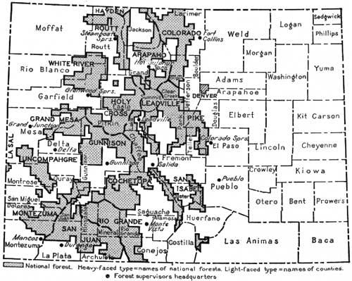
The national forests of Colorado, with a total area of 13,234,380 acres, lie in the high country along the Continental Divide which extends north and south across Colorado from New Mexico to Wyoming. (Fig. 6.) Some of them are natural units, and others are set off arbitrarily for convenience of administration. In all, there are 15 national forests lying entirely in Colorado and small portions of two others, the Hayden1 La Sal, while lie chiefly in the neighboring States of Wyoming and Utah, respectively. Table 1 gives some data concerning the national forests of Colorado.
1Described in detail in United States Department of Agriculture Circular 82, National Forests of Wyoming.
|
| FIG. 6.—The National Forests of Colorado |
TABLE 1.—Area, volume of standing timber, grazing authorization for cattle, horses, sheep, and goats, and supervisors' headquarters, Colorado National Forests1
| Forest | Area | Standing timber (all species) |
Grazing authorization |
Supervisor's headquarters | ||||||||||||||||||||||
| Cattle and horses |
Sheep and goats | |||||||||||||||||||||||||
| Acres | M. ft. b. m. | |||||||||||||||||||||||||
| Arapaho | 636,506 | 1,671,873 | 11,900 | 28,400 | Sulphur Springs, Colo. | |||||||||||||||||||||
| Cochetopa | 908,787 | 1,348,277 | 14,833 | 33,133 | Salida, Colo. | |||||||||||||||||||||
| Colorado | 828,744 | 1,314,070 | 21,900 | 21,800 | Fort Collins, Colo. | |||||||||||||||||||||
| Grand Mesa | 659,384 | 475,305 | 50,300 | 15,500 | Grand Junction, colo. | |||||||||||||||||||||
| Gunnison | 905,256 | 911,119 | 36,500 | 37,400 | Gunninson, Colo. | |||||||||||||||||||||
| Hayden2 | 65,769 | 385,930 | 350 | 12,500 | Encampment, Wyo | |||||||||||||||||||||
| Holy Cross | 1,125,174 | 1,532,978 | 23,000 | 91,500 | Glenwood Springs, Colo. | |||||||||||||||||||||
| La Sal3 | 26,631 | 46,555 | 1,448 | ----- | Moab, Utah | |||||||||||||||||||||
| Leadville | 927,413 | 798,565 | 12,000 | 100,000 | Leadville. Colo. | |||||||||||||||||||||
| Montezuma | 697,582 | 1,320,881 | 24,790 | 67,800 | Mancos, Colo. | |||||||||||||||||||||
| Pike | 1,087,115 | 520,654 | 14,500 | 31,800 | Colorado Springs, Colo. | |||||||||||||||||||||
| Rio Grande | 1,135,764 | 1,517,807 | 18,500 | 185,000 | Monte Vista, Colo. | |||||||||||||||||||||
| Routt | 750,254 | 1,675,201 | 16,715 | 114,495 | Steamboat Springs, Colo. | |||||||||||||||||||||
| San Isabel | 599,416 | 825,522 | 15,002 | 25,425 | Pueblo, Colo. | |||||||||||||||||||||
| San Juan | 1,241,720 | 5,779,530 | 26,200 | 167,100 | Durango, Colo. | |||||||||||||||||||||
| Uncompahgre | 754,291 | 397,576 | 30,030 | 49,450 | Delta, Colo. | |||||||||||||||||||||
| White River | 884,565 | 1,685,401 | 37,200 | 51,000 | Glenwood Springs, Colo. | |||||||||||||||||||||
| Total | 13,234,380 | 22,167,244 | 378,498 | 1,113,700 | ||||||||||||||||||||||
1The "grazing authorization" states for any given national forest the number and class of livestock which, based upon the estimated carrying capacity of the range, are authorized by the Secretary of Agriculture to graze under permit upon that unit. (These figures in effect 1928.) 2Lies mostly in Wyoming. 3Lies mostly in Utah. 4Over 12 inches in diameter. 525 per cent of annual receipts returned to counties in which national forests lie for roads and schools. 610 per cent of annual receipts spent by Forest Service on local roads and trails in addition to other appropriations. | ||||||||||||||||||||||||||
ORGANIZATION
The State of Colorado, with six others, falls within the Rocky Mountain district of the Forest Service. In charge of this district, comprising 27 national forests, is the district forester, with offices in Denver, who is responsible directly to the Forester in Washington. In every national forest is a supervisor with from three to eight rangers under him, each ranger in charge of a district of from 50,000 to 200,000 acres.
THE PIKE NATIONAL FOREST
About the year 1807, when the West was only an indefinite wilderness, Zebulon Pike, late of the Colonial Army, camped with his little band of explorers at the foot of a very imposing mountain and raised the first American flag ever flown in what is now the State of Colorado. Since that time Pikes Peak, to which the young lieutenant's name was given later, has been a landmark for trapper, trader, miner, settler, and tourist.
|
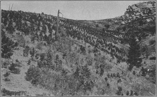
| FIG. 7.—Plantation on Pike National Forest, made for protection of the Colorado Springs, Manitou, and Cascade watersheds F-191564 |
When Pike first saw the mountain its slopes all the way to timber line were green with an almost continuous coniferous forest. About 50 years later repeated fires burned the slopes with a devastating fury and thoroughness which in places left little but barren rocks and which rendered nature and time helpless to replace the original growth.
Pikes Peak is no longer in the midst of an indefinite wilderness; in fact, the whole Pike National Forest, which extends northward for 70 miles, is very close to the centers of population along the foothills of the eastern slope of the divide. The early development of the region drew heavily upon the resources of the forest. Railroads, principally the Colorado & Southern, the Denver & Rio Grande, and the Colorado Midland, obtained a large portion of the ties for their original railroad construction from this forest, and they have drawn upon it for timber for maintenance ever since. Coal mines in the vicinity of the Pike National Forest which supply Denver, Colorado Springs, and Pueblo have always obtained mine props from the forest. It was not until the period 1880-1890 that improved transportation facilities began to bring in timber from more distant points. Even so, this forest has always supplied a large portion of the local demands.
The near-by mountains and their forests have been important to local communities as a source of water supply as well as timber. Early settlers, however, found that the water contained sediment washed from the barren slopes from which it drained and that it was irregular in its flow. One of the early tasks of the Forest Service in Colorado was to hasten the process of nature in replacing a soil binder by planting trees on the barren slopes of these drainages, and the Pike National Forest planting project is the result.
The Pike forest has become widely known as a reforestation area. Along a recently constructed automobile road which goes to the very summit of Pikes Peak the young trees of the man-made forest can be seen stretching from the highway in irregular rows. Planting was done every year here for 20 years, until in 1923 the work was transferred to Mount Herman, about 20 miles north, where it continues on the same scale. In all a total of 6,236 acres has been planted on Pikes Peak. The four species planted—western yellow pine, limber pine, Englemann spruce, and Douglas fir, all of which grew there before the fires—were chosen after early experimental plantings had indicated the trees best suited to local conditions.
Patience and hard work, as well as skill, were required for the success of the project. Early summers are often dry and hot on these exposed slopes, and it is necessary to begin operations every spring as early as bare, unfrozen ground can be found, just below the lingering snow banks, and, if possible, to follow the receding snow very closely, so that the little trees can have the benefit of the moisture produced by its melting while the newly transplanted roots are getting "set" in the loose soil.
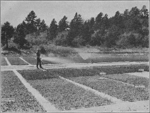
Near Monument, at the foot of Mount Herman, the Forest Service maintains a nursery which is an important part of the Pikes Peak planting. Here, on 10 acres of ground, are 3,000,000 baby trees getting a start under the expert care of an experienced nurseryman.
About one-third of these trees are dug up every year and shipped out for transplanting. They are so tiny even after three years growth that it seems hardly possible that they can get a start in the discouraging surroundings of a burned-over mountain slope. But, even though they may be lost, apparently, for several years after transplanting, the proof is on the ground in the earlier plantations that they are able to make their way better than might be expected and that the work of past years is already serving a highly useful purpose in retarding erosion.
There are many mature stands of timber on the Pike National Forest, valuable for the wood they are growing every year. Only a part of this annual growth is as yet harvested. Other tracts of timber, such as that in Jarre Canyon, southwest of Denver, because of the crowded condition in which they grow, show practically no annual increase in volume. Individual trees are small and from a timber production standpoint are practically valueless. Accessibility to the Denver market for Christmas trees, however has enabled officers on the Pike National Forest to practice an intensive type of forestry here, and enough trees are being removed to afford space for optimum growing conditions for those left. The sale of material for Christmas trees more than pays the cost of thinning. Permanent sample plots are maintained in connection with this work as guides regulating the degree of thinnings. As a rule stands of 3,000 or more trees per acre are reduced to about 700.
|
| FIG. 8.—Transplant beds, Monument Nursery, Pike National Forest F-200914 |
The grazing of livestock on the Pike National Forest is limited to the use of summer range by stock, usually in small herds from near-by ranches where stock raising is only one of many pursuits. It is not of such importance here as in the western part of the State, as may be seen by comparing the authorization figures for the Pike with those of some of the other forests. (See Table 1.)
The proximity of the forest to several good-sized towns and the many roads and railroads which cross it make it the goal of many summer travelers. Many residents of Denver and Colorado Springs have built summer homes on plots secured under permit from the Forest Service, tourists from far and near camp and fish along the streams, and picnickers are common anywhere within a half day's ride of the cities.
THE COLORADO NATIONAL FOREST
Clear Creek, descending precipitously from the mountains west of Denver, marks in a general way the northern limit of the Pike and the beginning of the Colorado National Forest which continues northward to the Wyoming line. The Colorado National Forest is about 84 miles long, north and south, and extends along the Front Range wholly on the eastern slope of the Continental Divide. Within the forest are the headwaters of some half-dozen rivers and creeks which irrigate the large sugar-beet section in the valley immediately to the east.
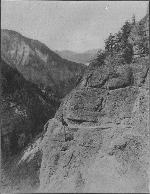
Fire protection is perhaps of more than ordinary importance on the Colorado and the Pike National Forests, because of recreational use and the intensive demands made for watershed protection by established towns and industries. Prompt location of fires on the Colorado National Forest is provided by five regularly employed fire lookout guards who have different parts of the forest under direct observation. The guards are stationed one on Medicine Bow Peak and one on Somber Hill in the Medicine Bow Forest, Wyo.; one (employed by the National Park Service) on Twin Sisters Peak, on the boundary between the Colorado Forest and the Rocky Mountain National Park; one on Squaw Peak; and one on Devils Head Peak. Map readings of any smoke sighted are reported immediately by the guards to the rangers and supervisors, who, by triangulation from two or more lookout points on a map, can locate the fire with a fair degree of accuracy and dispatch crews to handle it. Aside from the lookout system, which is more highly developed in this locality than in any other part of the State, fire organization and methods are not different from those used on other forests. (See p. 1.)
In the extreme northern end of the forest are extensive stands of lodgepole pine which are important for the production of railroad ties. This timber is being cut as a part of a large unit which includes the stands in the southern end of the Medicine Bow National Forest in Wyoming, immediately to the north. The tendency of lodgepole pine to grow tall and very trim, of small diameter, and with thin bark adapts it admirably to the hewing of ties. With two opposite sides slabbed and the other two "barked," an average trunk can be sawed into three or four standard-gauge railroad ties. This same form adapted it equally well to the Indians' needs in building tepees and lodges. Since the Indian used it first, he gave the tree its name—lodgepole pine to grow tall and very trim, of small diameter, and with be called the "crosstie pine." Other timber types on the Colorado are, in order of importance, western yellow pine, Engelmann spruce, Douglas fir, alpine fir, limber pine, and cedar.
The stands of lodgepole pine in the north end of the Colorado National Forest, like those in southern Wyoming, yielded the very foundation of the first railroad construction in this part of the West. It is the purpose of forest management here to provide for perpetually recurring crops of this product, even though new types of operation may be introduced from time to time to meet new needs.
Within this national forest, chiefly in the southern part, are some of the historic mining camps of the West. Although production has slumped in recent years, new developments in the mining industry are making some of these operations profitable on a conservative and substantial basis. The metals produced are gold, silver, tungsten, lead, and copper. This local activity has a direct bearing on the development of timber management on the Colorado National Forest, not only because of the demand on its resources, but also because of the opportunity to practice forestry on an economic scale.
|
| FIG. 9.—Building a trail on the Colorado National Forest F-22818-A |
The present grazing use on this national forest involves about 17,000 cattle and 13,500 sheep, the property of 209 local ranchmen. As on many other national forests, the correlation of game protection with the grazing of domestic livestock is very important on the Colorado. The demand for summer pasturage by stockmen in the vicinity makes the proper use of this resource imperative.
The Colorado National Forest is easily accessible. At least one good auto road leads into it from each of the many towns along the eastern border and an easy highway extends from Estes Park south to the boundary. Some of the roads, such as those in Boulder, Poudre, St. Vrain, and Thompson Canyon, are built through very spectacular scenery. Other roads connect with trails which lead back to the rough country along the range among the lakes and glaciers and to the Rocky Mountain National Park. This accessibility has led to extensive use of the forest during the summer, not only by the general public but by various organizations. Every summer the University of Colorado assembles large classes in biology and geology for field work at its summer camp near Nederland and the forest school of the agricultural college conducts field classes near its headquarters in Pingree Park.
THE ARAPAHO NATIONAL FOREST
West of the Colorado National Forest and extending along the main range of the Continental Divide, which at this point runs east and west, is the northern division of the Arapaho National Forest, separating North Park from Middle Park. South of Middle Park lies the southern division of the Arapaho.
North, Middle, and South Parks are large, high, open, level mountain valleys lying in a north and south series between the main divide and parallel lateral ranges. They have no forest growth and are suited to agriculture and stock raising. North and South Parks, both on the east side of the main range, drain, respectively, into the North and South Platte Rivers and, ultimately, into the Gulf of Mexico; Middle Park, caught in a loop of the Continental Divide, which bounds it in a general way on the north, east, and south, is drained by the headwaters of the Colorado River, flowing southwest into the Gulf of California. The actual headwaters of all these streams lie within the boundaries of the national forests.
Scattered through the timber surrounding these large parks are many other similar valleys, large and small. The boundaries of the national forests are drawn so as to leave the larger ones out entirely, among them the San Luis, Yampa, White, Gunnison, Uncompahgre, and San Juan River Valleys, and the valley of the Rio Grande. The smaller creek valleys are included within the exterior boundaries of the forest, but all agricultural land in them has been classified and listed as available for homestead entry. Many such "lists" have been homesteaded.
|
| FIG. 10.—Railroad ties decked for hauling in lodgepole pine timber, Colorado National Forest F-42519-A |
The southern division of the Arapaho is crossed by the Berthoud Pass highway, a main east and west artery through Colorado, and the northern division is similarly served by the Willow Pass road, a lesser highway connecting North and Middle Parks across the Continental Divide. Other roads, such as Williams Fork, lead well into the forest, giving access to the resources there and greatly facilitating fire protection.
The Colorado and Arapaho forests are now connected by the Moffatt Railroad tunnel extending for 6 miles through the Continental Divide between Tolland on the Colorado and West Portal on the Arapaho. As traffic is developed through this tunnel, the products on the west side of the divide will be brought much closer to their logical markets.

|
| FIG. 11.—A skidway and log chute in the Arapaho National Forest F-178829 |
Timber cutting on the Arapaho is done on a fairly large scale. The timber types are similar to those on the Colorado National Forest, except that there is more Engelmann spruce and no western yellow pine. The lodgepole pine and Engelmann spruce are here manufactured largely into lumber, the tops and smaller timber being used for mine props. While this timber is well adapted for the production of railroad ties, the industry has not been very well developed because of the demand for lumber. All trees which are mature, overmature, defective, or crowded, are cut. The thinning out of crowded stands of small trees, however, is limited by the markets for the products.
These operations in no way alter the essential forest conditions necessary to watershed protection, since they are regulated by forestry principles. Cutting is done by the selection system, which, in this kind of forest, removes 60 to 70 per cent of the volume in board feet in trees over 10 inches in diameter. According to present information on growth rate the largest trees left will be ready for the next cut in about 40 years. By rotating the cut over enough units a perpetual yield is obtained. Because of accessibility to the railroad, most of the demand for timber products on the Arapaho is in the southern division of the forest, in the vicinity of West Portal and Fraser. Many large bodies of timber are found, however, in other portions.
Grazing of livestock is of secondary importance on the Arapaho because the unusually dense and continuous timber and the rough topography result in less than average forage. (See Table 1.) The valley of the Williams Fork, however, is a ranching community, so that grazing bulks comparatively large in that vicinity.
Known for the activities in timber harvesting, grazing, and recreation carried on in it, the Arapaho has the distinction, also, of guarding the headwaters of the Colorado River, which as a source of water for power and irrigation is of the highest importance to seven Western States. So it is of more than ordinary moment to preserve the forest cover unimpaired for the prevention of erosion and for the retention of snow and water past the spring flood season.
THE ROUTT NATIONAL FOREST
That part of the Continental Divide which is west of North Park and is known as Park Range is within the Routt National Forest. Because of the steepness of this range on its east side, only a narrow strip of the Routt lies between the North Park and the crest pf the ridge, the remainder of the forest sloping somewhat more gradually westward toward the Yampa River Valley. Just south of the Wyoming State line the Routt turns west at right angles along a spur of the divide, giving the forest the general shape of a figure 7.
West of the Routt there are no more stands of timber in Colorado. The Routt, therefore, containing more than a billion and a half board feet with cordwood besides, provides an opportune supply for the industrial development which is expected among the mineral fields of Moffatt County and the western part of Routt County.
One very large stand of timber, chiefly lodgepole pine and Engelmann spruce, is located in the south end of the forest on high ground, near Buffalo Park. Other large bodies of timber are found on the upper slopes of the three branches of Elk River, in the vicinity of "Bears Ears" Mountain and around Black Mountain in the extreme western end of the forest. The timber is on both the Snake and Yampa River watersheds and a small area in the southern end of the ores sloping directly into the Colorado River watershed. Around the border of the forest, in the lower altitudes are extensive stands of aspen, which are characteristic of the national forests of Colorado.
Forest fires have left many open spots on the Routt National Forest. Some of these fires were set by the fugitive Utes in the late seventies and eighties. These openings in the timber are noticeable from the Rabbit Ears Pass road across the divide and extend intermittently from the Buffalo Park timber in the south to the South Fork of Elk River on the north. All of the west side of the North Fork drainage has also been burned over.
The Routt National Forest plays an important part in the livestock industry, providing as it does more than half a million acres of high summer range. Aspen, in contrast to coniferous timber, usually contains a luxuriant growth of forage. On this forest the combination of aspen, burns, and natural parks, both above and below timber line, affords extensive grazing areas.
This national forest yields irrigation water to North Park and the Yampa River Valley, both of which are important agricultural sections. Limited portions of the forest are drained also by the Snake River to the north and the Colorado River to the south.
The divide is crossed here by the Victory highway over Rabbit Ears Pass, so called from a huge rock shaped much like the ears of a rabbit. In addition to the Rabbit Ears Pass road, there is the Gore road which parallels it a few miles to the south, connecting Kremmling on the east with Toponas on the west. Also a road from Steamboat Springs north to Snake River crosses the forest between Hahns Peak and the Colorado-Wyoming line.
The many lakes and good fishing streams make the Routt National Forest attractive to summer visitors. Most of these waters are in the northeastern part of the forest and may for the most part, be reached on horseback. Here also are the rougher mountains which, with a limited amount of big game, make an ideal place for an outing of the more strenuous type.

|
| FIG. 12.—The canyon in Elk River, Routt National Forest F-179874 |
THE WHITE RIVER NATIONAL FOREST
South and west of the Routt is the White River National Forest, which is roughly rectangular in shape and covers a high, comparatively level plateau, bordered on the north, south, and east by river valleys, and on the west by the desert.
The Flat Tops, in the White River National Forest, reaching an elevation of 12,000 feet above sea level, are broad and rolling above timber line. Their sheer, limestone escarpments gradually dissolve into the thickly timbered slopes of the lower talus and high valley formations. In one of the high valleys lies Trappers Lake in a setting of wilderness solitude. Although an auto road from Meeker reaches to within three-fourths of a mile of the lake, only more primitive modes of travel lead directly to it from the end of the road. Trappers Lake is the source of Rio Blanco, more commonly called White River, which irrigates a very fertile and prosperous valley below. Locally the White River Forest fills an important place in ways very similar to the Routt.
Although many minor roads lead up into this forest, not a single highway crosses the main body of the forest. Comparative inaccessibility of timber stands has deferred cutting except in a few localities. Accordingly, the administration and proper regulation of grazing, the building of an extensive trail system, and fire protection fill most of the time of the supervisor and rangers. Horseback, with pack horses and outfits, is the accepted mode of travel.
|
| FIG. 13.—Colorado River in Glenwood Canyon, White River National Forest F-42953-A |
Summer visitors, campers, resorters, and home owners make up a large population on the forest during the open season, especially along the two forks of White River. The primitive character of the White River National Forest has been appropriately maintained in all of the recreational improvements.
Many famous men, including Theodore Roosevelt, have hunted among the big-game herds which were once numerous here. A large portion of this national forest is now within a State game refuge. (Fig. 4.) For further protection of the elk, deer, and mountain sheep especially, limited areas are closed to the grazing of livestock. One of the interesting observations made so far is that, although the domestic stock are successfully kept out of the restricted ranges, the deer and elk often prefer to graze outside also along with the cattle and sheep.
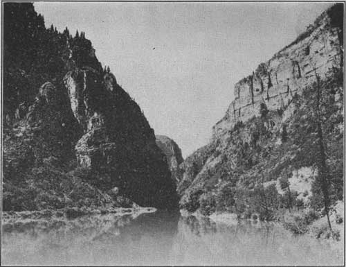
The extreme southeastern corner of the White River National Forest is crossed by the Colorado River, through Glenwood Canyon, a precipitous gorge about 16 miles long. Within this canyon is a hydroelectric power plant with an installed capacity of 18,000 horsepower, generating current for the use of many cities in eastern Colorado. The theaters on Curtis Street in Denver are lighted from this source. Many tributaries of the Colorado River rise in the eastern and southern portions of the forest and contribute their share toward this, the first plant along a river of water power and irrigation projects. Here, as on the Arapaho National Forest, watershed protection is of the highest importance.
The Arapaho, Routt, and White River Forests make up the northwestern group with many characteristics and uses in common. Although timber production, especially on the Fraser and Colorado River watersheds of the Arapaho, is important, with this exception the highest direct economic value of these forests at present is in their watershed protection and their summer-grazing grounds, which supplement the privately owned ranch property in the surrounding valleys.
THE LEADVILLE NATIONAL FOREST
South and west of the southern division of the Arapaho is the Leadville National Forest. The Leadville forest, the Holy Cross forest on the west, and the Cochetopa immediately south cover the highest portion of the Continental Divide in the State. This region has been important as a mining district since two German shoemakers, George Hook and August Rische, first discovered the famous blanket formation in California Gulch in 1878, near the location which later became Leadville. Before there were any national forests the surrounding timberlands were taxed far beyond their capacity by the development of this grand bonanza.
Accompanied by destructive fires, the demand for mine props, railroad ties, and construction material soon depleted many of the stands. Second growth is coming in in many places and, if protected from fire, will bring back the forests as they were. Forest management here has for its purpose the supplying on a perpetual-yield basis of enough products to satisfy the demands of the permanent industry in the region. Grazing is also an important use on these forests.
The Leadville National Forest is in a long, narrow strip north and south, covering the slopes of the Arkansas and Blue River watersheds to the crest of the very high surrounding ridges, which contain several of the highest peaks in the State. Near the city of Leadville is Mount Elbert, the highest peak in all the Rocky Mountain chain between Canada and Mexico and the second highest peak in the United States.
The Arkansas River flows south from Tennessee and Fremont Passes in the Continental Divide, and the Blue River flows north from Fremont and Hoosier Passes, the waters of the Arkansas flowing eventually into the Gulf of Mexico, and those of the Blue River into the Gulf of California. Most of the valley floor, in each case a very narrow strip through the middle of the forest, has been eliminated from the forest because it is agricultural land, leaving the forest spread out somewhat in the form of a long narrow H with a portion of the Continental Divide between the two river sources making the horizontal line.
Most of the mining activity has been concentrated between the southern arms of the forest near Leadville, and the demand for wood has considerably reduced the volume of surrounding timber. North of the divide, is a similar but somewhat lesser development. Timber for the support of this industry will be provided by the Dillon working circle which has been placed under a very definite management plan. This development, though less spectacular than that around the city of Leadville, is still of importance and promises an equal degree of stability.

|
| FIG. 14.—Twin Peaks and Lakes, Leadville National Forest F-156325 |
The main line of the Denver & Rio Grande Western Railroad and an important automobile highway in the southern portion of the forest parallel the Arkansas River and finally cross it in the vicinity of Tennessee Pass where both enter the Holy Cross National Forest. Other automobile roads cross at Fremont and Hoosier Passes to the Blue River watershed, where they join and lead on down this valley to the Colorado River. From Twin Lakes, south of Leadville, a road leads west through the forest over Independence Pass, the highest in the State, to Aspen. And from Buena Vista, near the south end, is another road along Trout Creek connecting this valley with South Park, Denver, and Colorado Springs. In spite of these and a number of shorter roads leading into the Leadville Forest at intervals, also a narrow-gauge branch of the Colorado & Southern Railroad from Denver, most of the area can be reached only on horseback or afoot.
THE COCHETOPA NATIONAL FOREST
The Cochetopa National Forest, lying south of the Leadville and north of the Rio Grande forests, embraces a region which once formed part of the summer hunting grounds of the warlike Utes. In the southern part of the forest is the site of an old Indian agency and a cabin home built by Chief Ouray. Cochetopa Pass, named by the Indians and meaning "Buffalo Gate," gave the forest its name.
The northern part of the Cochetopa is characteristically mountainous, but toward the south it becomes more rolling though the altitude is still high. In the early summer remnants of snow on Mount Shavano outline the figure of a woman known as the Angel of Shavano.
One railroad and two highways cross the forest over Marshall, Monarch, and Cochetopa Passes, respectively. This with administrative and development roads makes travel in the forest easy.
Grazing and recreational uses are about the same on the Cochetopa as on the other Colorado forests.

|
| FIG. 15.—Forest highway over Monarch Pass on the Cochetopa National Forest F-133009 |
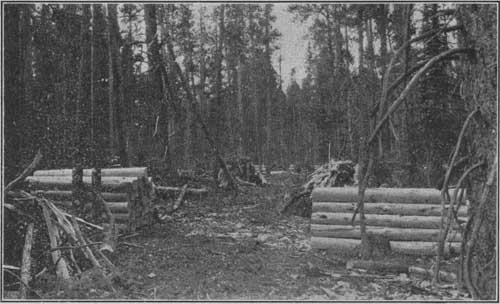
The cutting of telephone poles on the Cochetopa is a new activity but one which promises to develop a substantial industry. Lodgepole pine is used entirely and is treated against decay in a plant at Salida. The treatment adds durability to a long list of natural qualifications which experiments have shown lodgepole pine to have for this use. Production of lodgepole-pine poles is getting under way also on the Gunnison, Colorado, and Leadville National Forests.
There is one especially interesting timber sale here, which at first sight might seem to violate good forestry principles, for the cut is very heavy and takes only small trees. But the fact is that there are only small trees in this area, and their sparse crowns, dead tops, and general appearance indicate that they are old and beginning to die. The annual rings on any stump will be found to be very fine and close together. Careful study has established the fact that the slow growth is due to soil conditions and to too dense a stocking of trees. Since all trees of merchantable size are mature or overmature they are being removed in the present operation. However, a sufficient stand of reproduction and immature trees is coming on to insure future crops. The market for mine props and ties makes the present cutting a profitable one.
THE HOLY CROSS NATIONAL FOREST
The Holy Cross National Forest, separated from the Leadville by the Continental Divide, spreads out much like a fan over the watersheds of the Eagle, Frying Pan, Crystal, and Roaring Fork Rivers. Its name is derived from the Mount of the Holy Cross, which displays very clearly a huge cross of snow during several weeks of the early summer.
As on the Leadville National Forest, mining is important, especially around Gilman, where zinc ore is found in large quantities. Here also the timber is managed to support the demand of the local industries, a large amount of material being cut every year from the upper Eagle River working circle, the cut from which is regulated under a management plan which provides for a permanent, regulated yield of forest products.
Roads lead well into the forest along the Crystal, Roaring Fork, Eagle, and Frying Pan Rivers, and clear to the boundary and across the divide along the last two. These streams are all noted for their good fishing and are visited by many anglers every summer.
At the head of Crystal River, on Yule Creek, is a tremendous deposit of white marble which has supported large quarries intermittently for many years, although the industry has made little demand on the resources of the forest. Many well-known structures in the United States have been fashioned from Yule marble.
In the southern and western parts of the Holy Cross National Forest grazing is important, as it is related to the large ranching region in the lower country to the north. Also a large number of sheep from more distant points are grazed in the high range. Most of them are shipped by train to Tennessee Pass, where they are unloaded and trailed to the proper areas.
THE GUNNISON NATIONAL FOREST
South of the Holy Cross and adjoining the Leadville on the west along the crest of the Continental Divide, is the Gunnison National Forest. The forest lies crescent shaped around the upper slopes of a great half bowl drained toward the south by the upper branches of the Gunnison River. The rim of this crescent to the north and east is marked by very sharp, high ridges and peaks, the boundary between the Gunnison and adjoining national forests. On the west the Gunnison slopes off gradually into the fruit-growing region of the Uncompahgre, North Fork, and other valleys tributary to the lower Colorado River.
The summer range on the Gunnison is practically indispensable to the livestock industry, which has been the principal pursuit of the ranchers to the south and west ever since the valley was settled. In handling this national forest more than average expert attention has been given to range matters, not alone that the forest might serve the ranchers who use the range, but that the forest growth might not be damaged by excessive or poorly regulated grazing.
|
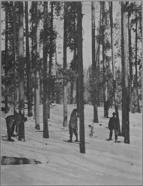
| FIG. 16.—Forest rangers on snowshoes marking lodgepole pine for sale. Each tree to be cut is blazed at breast and then stamped "U. S." The timber will be used for railroad ties in the West. Holy Cross National Forest F-26725-A |
Watershed protection, which is largely fire protection on the Gunnison, has a very practical connection with the Uncompahgre reclamation project which in 1925 covered 61,637 acres of land, with a crop production valued at $3,032,295. Without irrigation this land would be practically valueless for farming. The drainage of about 80 per cent of the Gunnison National Forest goes into this project and is diverted through a tunnel nearly 6 miles long, built at a cost of several million dollars. It is said to be the longest irrigation tunnel in the United States.
Timber production on the Gunnison has always been necessary to the mining activity of this region. Although precious metals were mined in the early days of settlement here, there is little left now except coal, which is found at Somerset, Crested Butte, Bowie, and Baldwin. These communities require large numbers of mine timbers annually, most of which are supplied from this forest.
The numerous resorts on the Gunnison River provide accommodations for those who have neither time nor facilities for trips to the higher, more remote fishing streams, and there is much travel over the Taylor Park road, which has recently been completed. Two other main roads cross the forest, one from the town of Gunnison across Black Mesa to Crawford and Hotchkiss and another via Crested Butte over Kebler Pass via Somerset to Paonia in the valley west of the forest.

|
| FIG. 17.—Open herding of sheep on the Gap allotment of the Anthracite district, Gunnison National Forest F-196294 |
THE GRAND MESA NATIONAL FOREST
The Grand Mesa, created by proclamation by President Benjamin Harrison in 1892, was the first national forest in Colorado. It lies west of the Holy Cross National Forest and northwest of the Gunnison.
The geological formation of Grand Mesa, as indicated by its name, is that of a great high table-land, a large part of it above timber line at an average elevation of 10,500 feet. The area of the mesa alone is nearly 35,000 acres. The rim is almost perpendicular, like that of the Flat Tops in the White River Forest, and the more gradual, lower slopes are well timbered.
A similar plateau, Battlement Mesa, makes up the northwest portion of the forest. Between these two mesas is the broad valley of Plateau Creek. The lower portion of the valley is eliminated from the national forest as agricultural land, but the upper slopes are good timber and grazing land, and are included within the forest. This valley, the only extensive one on the forest, is in decided contrast with the two mesas which overshadow it on both sides. Two smaller valleys, Divide Creek on the north and Muddy Creek on the south, indent the boundaries of the eastern portion of the forest. The waters of these two creeks drain ultimately, as do all the other waters of this forest, into the Colorado River.
|
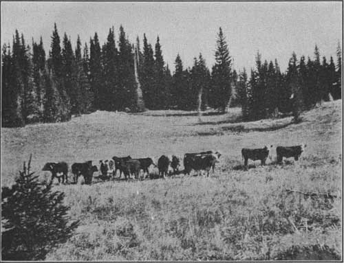
| FIG. 18.—Cattle grazing in open timber, Grand Mesa National Forest F-26985-A |
There are over 100 lakes on the Grand Mesa, many of them old craters and as yet unfathomed. The cool, invigorating weather good fishing, and attractive surroundings draw many summer visitors from the warm lowlands nearby, as well as from many distant places. Frost is likely to come at night any month of the year, and during the summer it is possible at midday to drive in two hours from a temperature of well above 90° F. to one of 50°. In addition to visitors who come to the forest for rest and recreation, many organizations maintain summer camps there. Public camp grounds are located where they will serve the public with the least possible fire hazard. Such camp grounds are often cleared of inflammable brush, surrounded by a trench which a ground fire can not cross, and equipped with stone fireplaces.
For the summer homes and lodges, permits are issued and a nominal charge is made. The buildings and other improvements are built and owned by the permittees and may be sold to new permittees in the case of a transfer. Permits may be renewed annually or issued for a term of 10 or 15 years.
The waters of the Grand Mesa have other uses besides fishing and camping which justify the careful protection they receive. They are the main source of irrigation for the surrounding orchards and fields. More than 101,000 acres of farm land are watered from the lakes and streams on the Grand Mesa, and more than 193,000 are susceptible of irrigation.
Timber cutting is limited here by lack of market. As the demand increases, however, larger quantities can be cut, to the extent of the annual growth, or about 5,000,000 board feet, without any detrimental effect on the water supply.
The Grand Mesa is an exceedingly important grazing forest. It supplies summer range to 43,500 cattle and horses and 14,000 sheep owned by 650 ranchers in the valleys, thus serving a greater number of stock owners than any other national forest in the State. The character of the range and the demand for its use for cattle make this primarily a cattle range.
Main automobile highways surround the Grand Mesa National Forest on all sides except the east, where the Grand Mesa joins the Holy Cross and Gunnison National Forests along a mountainous border. A forest highway serves the Plateau Valley from the main Colorado River, branching at the head of the valley and connecting on the north with the Colorado River again at Silt, via Divide Creek, and on the south with Gunnison River, via Muddy Creek, both roads crossing the forest. The Grand Mesa has been made very accessible to automobile travel. A State highway connects Collbran Valley with Cedaredge on the North Fork of the Gunnison, and the Grand Mesa "skyway," recently completed by the Forest Service, renders accessible the important lakes on the mesa and makes a direct connection between the Ocean to Ocean Highway and the Rainbow Route via the towns of Mesa and Delta.
THE UNCOMPAHGRE NATIONAL FOREST
The Uncompahgre National Forest is made up of two divisions: The Uncompahgre Plateau and the Ouray. The Uncompahgre Plateau is long, narrow, and well defined, and lies southwest of the Grand Mesa National Forest. Its broad stands of Engelmann spruce, western yellow pine, and aspen make it conspicuous in the semiarid lowlands which surround it completely. The forest is devoted chiefly to grazing and watershed protection at present, although timber sales are also an important activity. One road on the State highway system from Montrose to Naturita crosses this division, but it is in poor repair and not used for regular travel.
Southeast of the Grand Mesa are the headwaters of the Uncompahgre River, which drains the valley along the east and around the north side of the Uncompahgre Plateau. The Uncompahgre watershed descends very rapidly from the precipitous divide which rises to a sharp ridge between the mining towns of Ouray on the north, Telluride on the west, Silverton on the south, and Lake City to the east. This upper portion of the Uncompahgre watershed, once known as the Ouray National Forest, although separated entirely from the Plateau, is now administered as the Ouray division of the Uncompahgre. It extends from the main Uncompahgre River Valley up to the crest of the San Juan Mountains, south of which are, in order from west to east, the Montezuma, the San Juan, and the Rio Grande National Forests.
In the Ouray division, the utilitarian value of wood, water, and forage in the forest is supplemented by boldly sculptured mountain scenery which draws many summer visitors and nature lovers.
|
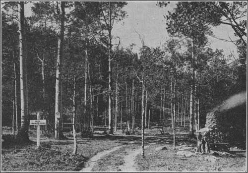
| FIG. 19.—Bear Creek trail (an old mining trail) on the Ouray division of the Uncompahgre National Forest F-30318-A |
THE SAN JUAN NATIONAL FOREST
Though somewhat less in altitude, the mountains in the San Juan country are even more rugged than those around Leadville. The Geological Folio for this region, published by the United States Geological Survey, describes them as
a range of extremely rugged mountains of granite and schist, from which rise sharp peaks, the summits of four of which are over 14,000 feet in elevation, while 6,000 feet below the Animas River rushes through a canyon which separates the West Needles from the main group. From Needle Creek on the south to Elk Creek on the north, and from the Vallecito to the Animas, they form a group of peaks almost unequalled in this country in altitude and in boldness of their forms.
Like the Leadville mountains they contain rich minerals, and very close to the top of the range have gown up such mining towns as Silverton, Ouray, and Telluride.
The San Juan, covering about 1,239,000 acres, is the largest national forest in Colorado. The Continental Divide bounds it on the east and separates it from the Rio Grande National Forest.
One main road, from Red Mountain on the Uncompahgre-San Juan boundary to Durango, crosses this forest from north to south. Other shorter roads enter the boundary at various points and lead a few miles toward the interior. The Wolf Creek Pass Highway crosses the forest east and west, and at the top of the pass enters the Rio Grande National Forest.
|
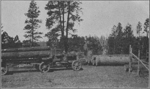
| FIG. 20.—Motor truck hauling logs. The large log on ground in front of truck contains 1,270 feet board measure western yellow pine. San Juan National Forest F-153022 |
The extensive timber stands on the San Juan are still in process of inventory, but they give promise of supporting a large industry in the future. Although there has been a consistent timber-sale activity on the more accessible areas of the San Juan some large bodies of timber were for many years considered inaccessible because of the rugged topography of the country, but improvements in local transportation facilities and the increasing price of timber products are making this large resource more available.
The livestock industry has always been important in the San Juan country, and the grazing resource of the forest is very valuable.
Seekers for gold, Spanish missionaries, and explorers came into this part of Colorado at a very early date. Extending the quest for gold from Mexico northward and beyond the Rio Grande, Vasquez Coronado, with an expedition of 350 Spaniards and 800 Indians, penetrated the San Juan Mountains in the year 1541. More than two centuries later, in 1776, Padre Francisco Silvestra Velez Escalente, in search of a route from Sante Fe to the missions of California, guided his companions in a westerly course, skirting the southern boundary of the present San Juan National Forest. To Escalente is ascribed credit for the musical Spanish names borne by such streams as the Rio San Juan, Rio de las Animas Perdidas, Rio de las Piedras, Rio de los Pinos, and the Rio Florida. Modern usage, however, has shortened these names, and our present-day maps merely indicate these rivers as the San Juan, Animas, Piedra, Pine, and Florida.
A treaty with the United States Government in 1868 secured southwestern Colorado to the southern Utes. It was not until 1873 that another treaty released the greater part of this area to settlement and mineral development. Several years previous, however, in 1860, a party of 200 men under the leadership of Charles Baker, thoroughly explored this region and paved the way for subsequent development. Baker's Park, the present site of the town of Silverton bears the name of this intrepid explorer. Here it was that in 1861 the expedition endured privation and starvation, and Baker himself narrowly escaped death at the hands of his mutinous band.
THE MONTEZUMA NATIONAL FOREST
Joining the San Juan on the west is the Montezuma National Forest. The northern and eastern sections of the forest have the rugged topography of the San Juan and the Ouray division of the Uncompahgre, while the southwestern part is of the mesa type. The forest is crossed north and south by two automobile roads, one from Norwood and the other from Placerville by way of Telluride to Dolores.
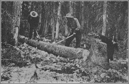
Most of the western yellow pine stands in and near the southwestern national forests were cut over in early logging operations before the forests were created. A few virgin stands remain, however. One of these on the Montezuma, containing 400,000,000 board feet of western yellow-pine timber, is the scene now of the largest logging operation under Government supervision in the history of Colorado. Because of the advanced age of this stand, an unusually heavy cut of about 80 per cent of the volume is being made. This operation consumes about 30,000,000 board feet of timber each year or over 130,000 feet daily. About one-third of it is on private land. The timber on other units is more thrifty and will not be cut so heavily.
Grazing on the Montezuma is very important to the ranching communities which join it on the south, west, and north. The entire forest has been covered by intensive reconnaissance of grazing resources. On this basis unit plans are being worked out which will guarantee the heaviest possible use of the forage without damage to forest growth. Although unit plans are common on all forests now, intensive reconnaissance is justified only in a few cases.
The water that flows from the forest is used for irrigating farm lands and operating large hydroelectric plants.
|
| FIG. 21. —Hewing a water trough out of a spruce tree for improvement of soft-water spring, Montezuma National Forest F-17303-A |
THE RIO GRANDE NATIONAL FOREST
The Rio Grande National Forest is a unit of over a million acres, and across it the granite back of the Continental Divide, seamed with canyons and jagged with numberless peaks, twists, and bends for 150 miles.
Long ago the Indians, the first to appreciate the natural advantages of the area for recreation and sports, came to this region on their annual hunting expeditions. Here they played their games and hunted, and left their records on the "Painted Rocks."
Historically, the country is rich. Fremont and his men forced a way through, only to be defeated by the elements. But he and other early travelers have left a wealth of tales of adventure.
In spite of the fact that this national forest is all potential timber-land and that some timber cutting is being done, there are large tracts which are ideally suited to grazing.
Range management receives the closest attention, as the forest takes care of over 300,000 cattle and sheep of all ages on its summer ranges every year. Intensive reconnaissance has been made and careful plans of utilization have been worked out, and, as on the Montezuma, this specialized work is aimed at forest protection as well as livestock production; for the primary purpose of the national forests is timber growing and the danger of substituting a secondary use, however important locally, must be guarded against.
|
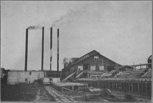
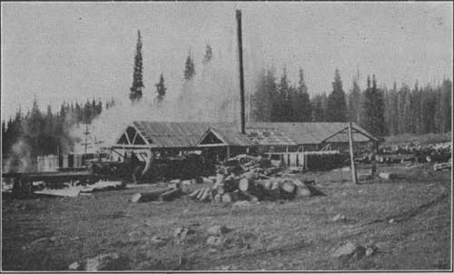
| FIG. 22.—A sawmill at McPhee, Colo. (operating capacity about 35,000,000 board feet annually). Montezuma National Forest F-202832 |
There is a limited recreational development appropriate to the character of the country. Within the forest is the Wheeler National Monument, named in honor of George Wheeler, United States engineer, who made geological explorations in this region. The monument with its grotesquely eroded geological features attracts many visitors.
Although two highways, in addition to the one over Wolf Creek, cross the forest east and west—one going over the divide at Cumbres Pass in New Mexico, and the other through Crede to the extreme north—the Wheeler National Monument and many other places within the Rio Grande can be reached only by horse or foot trails.
|
| FIG. 23.—A sawmill in the Rio Grande National Forest F-188181 |
THE SAN ISABEL NATIONAL FOREST
The three divisions of the San Isabel National Forest, with a combined area of about 598,000 acres, are grouped about the Wet Mountain Valley, each division being situated on a separate mountain range.
Across the San Luis Valley east of the Rio Grande Forest may be seen the glorious snow-capped Sangre de Cristo Range in the largest of the three divisions of the San Isabel Forest. The Sangre de Cristo Range extends continuously and in a well-defined line for 100 miles nearly due north and south, and there is many a jagged 14,000-foot peak in its picturesque skyline.
In the Wet Mountain division of the forest, lying east of the Sangre de Cristo Range, are the Wet Mountains, relatively low and thickly wooded. According to tradition, the Mormon pioneers, coming from the east across the dry, dust-laden plains, saw in the distance the wooded verdure of the mountain slopes and the heavy rain clouds hovering above, and rejoicingly gave them their name.
In the Las Animas division of the forest, south of the Wet Mountain Valley, is the Culebra Range. Detached from the Culebra Range, of which they are geologically a part, and rising precipitously from an almost level valley, their snow-capped peaks standing out like beacons, are the two Spanish peaks. These peaks were probably the first of the Rockies to be seen by white men.
|
| FIG. 24.—Ophir camp ground, San Isabel National Forest F-200986 |
All of the San Isabel, with the exception of the western slope of the Sangre de Cristo, which drains into the Rio Grande del Norte, lies within the watershed of the Arkansas River and its southwestern tributaries.
In addition to their 825,000,000 board feet of timber, their range for 40,000 head of livestock, and their guardianship of several important municipal watersheds, these three San Isabel units provide another public service which is very closely interwoven with the many other uses. Without in any way interfering with the primary purposes of the forest, people in near-by communities, in cooperation with the Forest Service, have developed this region as a very intensively used recreation area. Roads have been built to make it accessible. Community houses, improved camp grounds, resorts, and hotels have all helped to bring the public close to the beauties of these mountain forests. Boy Scouts, churches, business men, and the American Legion have built lodges there for their summer headquarters. Use of the forest in a variety of ways has aroused the interest of the public in preserving its resources and has resulted in very efficient cooperation in fire protection.
First-class automobile roads completely encircle the San Isabel, and a number of good highways, over which shorter trips may be made, pass through the forest. These roads not only bring visitors to the forest but serve the needs of ranchmen, farmers, and citizens interested in the home-building and wealth-producing activities of the region.
Likewise the numerous saddle-horse and foot trails function in the economic life of the community, as well as affording opportunities for recreation. The most spectacular trail follows the crest of the Sangre de Cristo Range and gives a marvelous panorama of the surrounding country for a distance of 200 miles, frequently from an elevation of 13,500 feet.
The San Isabel has a good supply of fish, big game, and game birds, but not enough to make it a mecca for hunters and fishermen. The keen sportsman, however, will have no difficulty in making a good catch. All fish and game are protected by law but may be taken during open seasons. The Las Animas division and the extreme northern end of the Wet Mountain division are State game refuges, in which hunting is prohibited at all times, but the streams may be fished freely. The Sangre de Cristo Range will appeal both to the angler and to the hunter. In that region the numerous lakes and streams are kept stocked and constitute ideal fishing grounds. Many of these waters are near timber line and can be reached only by climbing.
There is much of geological and scenic interest in the San Isabel. In the Culebra Range of the Las Animas division are the strange walls of Cucharas, a caprice of geology, displaying bizarre shapes and exquisite coloring. Amid such picturesque settings are many decaying buildings still diffusing the atmosphere of romance and courage of the early settlers who erected them.
The route over the Squirrel Creek Road in the Wet Mountains, winding its way to the top of the range against a background of timber-robed canyons, constitutes a rare combination of the wonders of human and natural engineering. On a rock near Wetmore is to be seen the signature of Kit Carson, carved many years ago by the famous scout and Indian fighter.
In the Sangre de Cristo Range are 40 lakes which have been formed in old craters. Twenty miles south of Westcliffe in a red sandstone bed are fossils of early sea life which indicate that this great range was formerly a sea bottom. Of special interest, too, are the Medano, or disappearing creek; the Marble Cave, an unexplored, bottomless pit; and the Great Sand Dunes, a desert of white shifting sand, covering 30 square miles, from which rise mountains of sand.
| <<< Previous | <<< Contents>>> | Next >>> |
|
colorado/sec2.htm Last Updated: 12-Sep-2011 |